Moderate Hikes in Colorado
The sweet spot for most hikers: enough elevation to feel earned, a real destination, and you're back at the car by mid-afternoon. Bring water, layers, and start early to beat the storms.
82 trails in our directory.
Emerald Lake Trail
A stunning alpine lake hike that passes Nymph Lake and Dream Lake before reaching the spectacular Emerald Lake. Perfect introduction to Rocky Mountain National Park's high country.
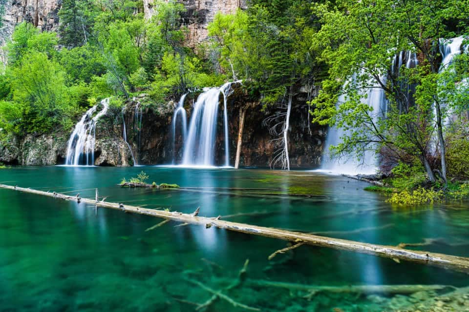
Hanging Lake Trail
Colorado's most photographed lake features turquoise waters and a spectacular waterfall. Reservations required year-round due to its popularity and fragile ecosystem.
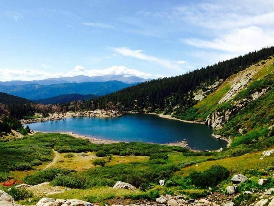
St. Mary's Glacier
A short but steep hike to Colorado's most accessible glacier. The trail leads to St. Mary's Lake and continues to the permanent snowfield above.

Royal Arch Trail
A popular Boulder hike from the Chautauqua Park trailhead leading to a natural sandstone arch with stunning views of the city and Flatirons. The upper half involves stair-steps and short Class 2 scrambling, so older kids handle it well; younger kids may find it tough.
Bridal Veil Falls
Colorado's tallest free-falling waterfall drops 365 feet from a hanging valley. The trail follows a historic mining road with spectacular mountain views.
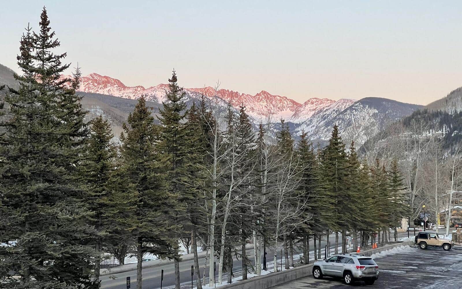
Booth Falls
A beautiful waterfall hike through aspen and conifer forests leading to a 60-foot cascade. Popular among Vail visitors for its accessibility and scenery.
Mohawk Lakes
A scenic hike through historic mining country to pristine alpine lakes surrounded by rugged peaks. The trail passes several mining ruins and artifacts.
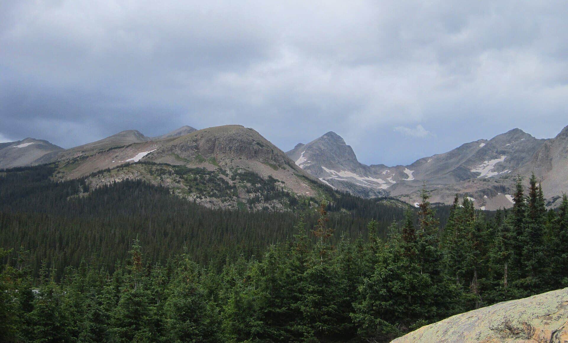
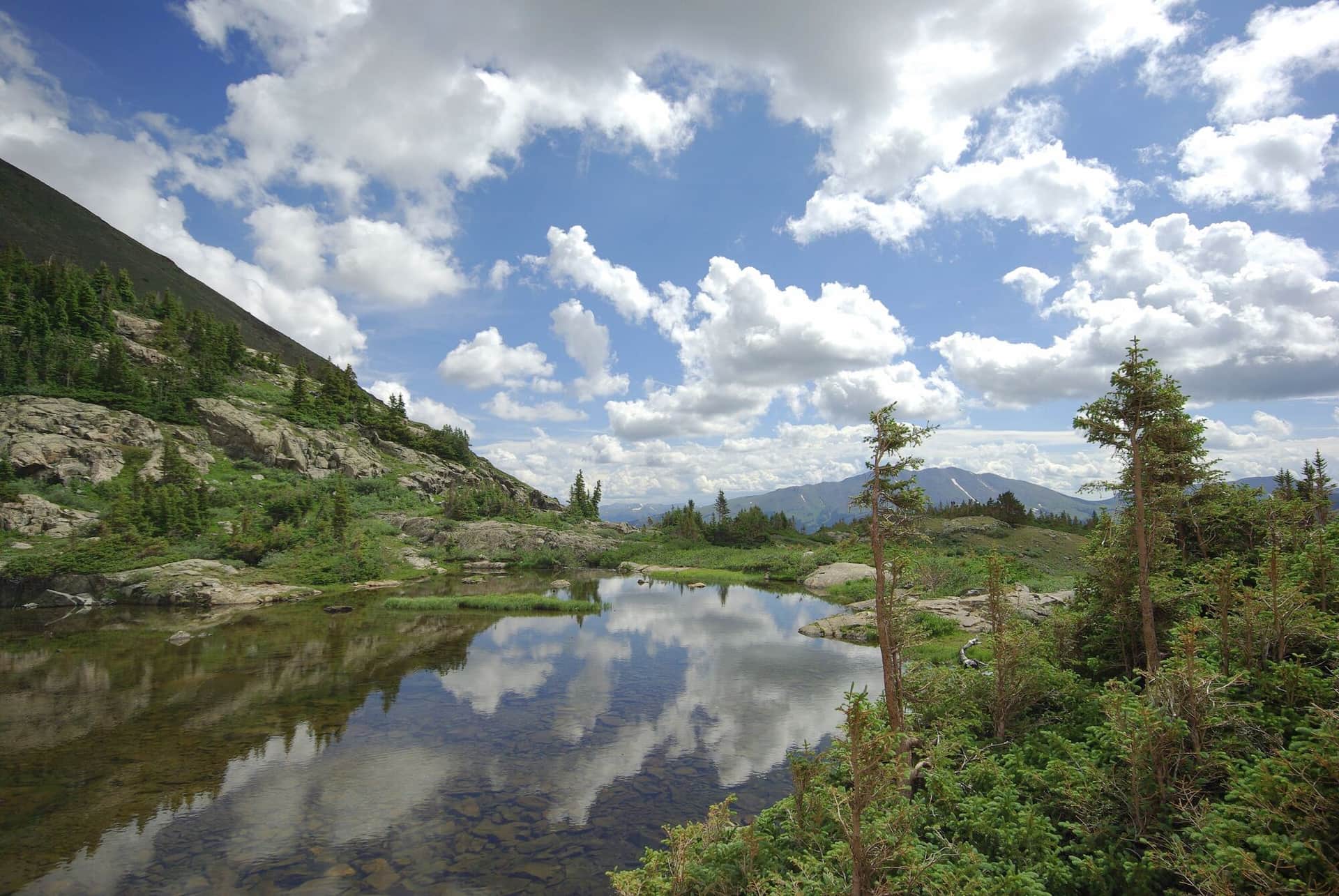
Indian Peaks Wilderness Loop
Classic Indian Peaks hike from Brainard Lake Recreation Area to Lake Isabelle, a stunning alpine lake set beneath the Continental Divide. Wildflowers explode in July, the lake water levels drop dramatically by late August, and aspens turn in late September.
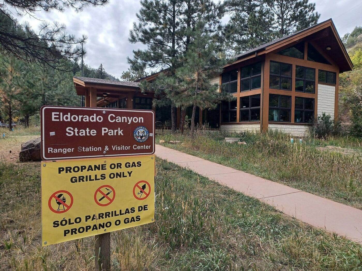
Eldorado Canyon Trail
A dramatic canyon hike through golden sandstone walls with South Boulder Creek flowing below. Popular for rock climbing access and scenic beauty.
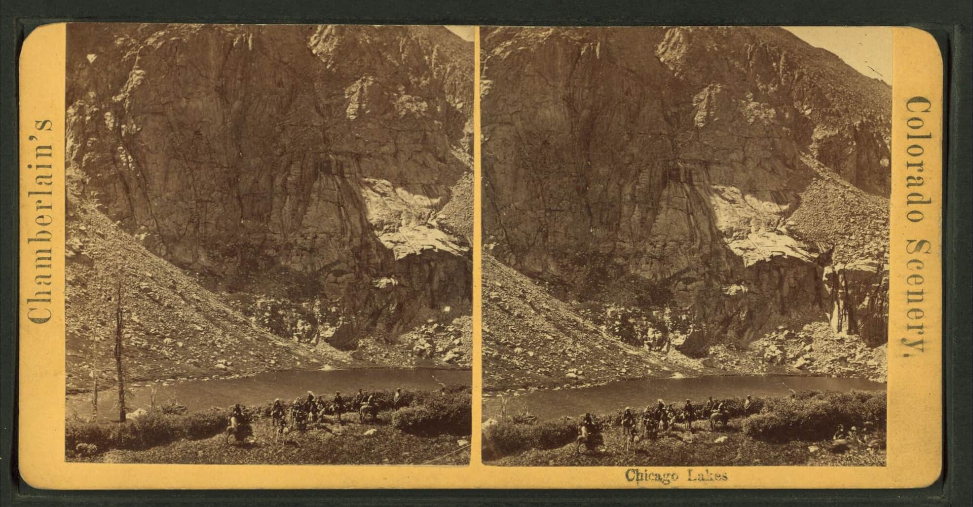
Chicago Lakes
A long but gentle hike to two pristine alpine lakes beneath Mount Evans. The trail follows an old mining road through beautiful subalpine forest.
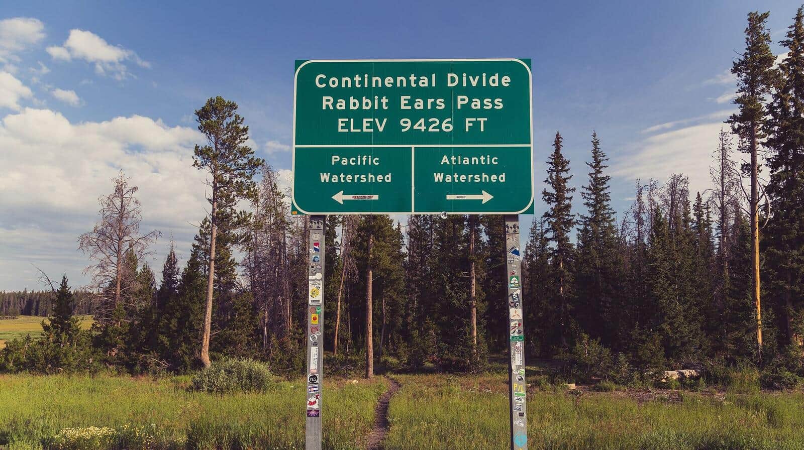
Rabbit Ears Pass Trail
Moderate hike from Dumont Lake to the distinctive rabbit-ear-shaped rock formations on the summit of Rabbit Ears Peak. Wildflower meadows in summer, aspen color in late September, and one of the most photographed peaks along the Continental Divide.
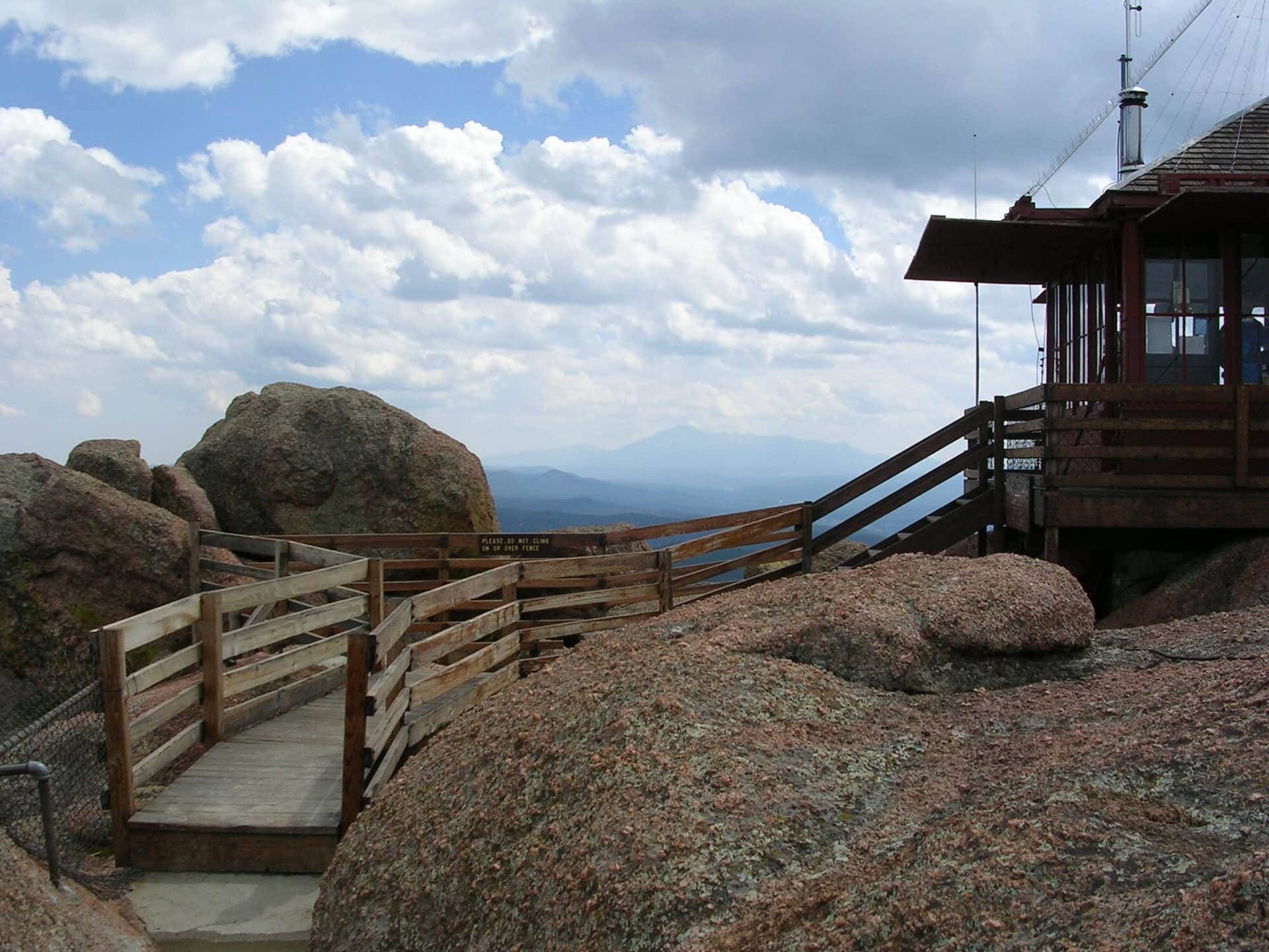
Devil's Head Lookout
A historic fire lookout tower hike through ponderosa pine forest with 360-degree views from the restored 1919 fire tower at the summit.
Ice Lake Basin
A spectacular hike to a pristine turquoise alpine lake surrounded by colorful peaks and abundant wildflowers. One of Colorado's most beautiful destinations.
Highland Mary Lakes
A scenic hike through historic mining territory to a series of alpine lakes with dramatic views of the surrounding San Juan peaks.
Fourmile Falls
A moderate hike through aspen and spruce forest to a dramatic 300-foot waterfall in the San Juan National Forest north of Pagosa Springs. The trail follows Fourmile Creek through wildflower meadows before the final approach to the falls.
Mount Evans Road Scenic Drive Trails
Short but tough alpine hike from the Summit Lake parking area to the top of Mount Spalding, a 13,842-foot peak on the ridge between Summit Lake and Mount Blue Sky (formerly Mount Evans). The whole hike sits above 12,800 feet, so altitude is the difficulty.
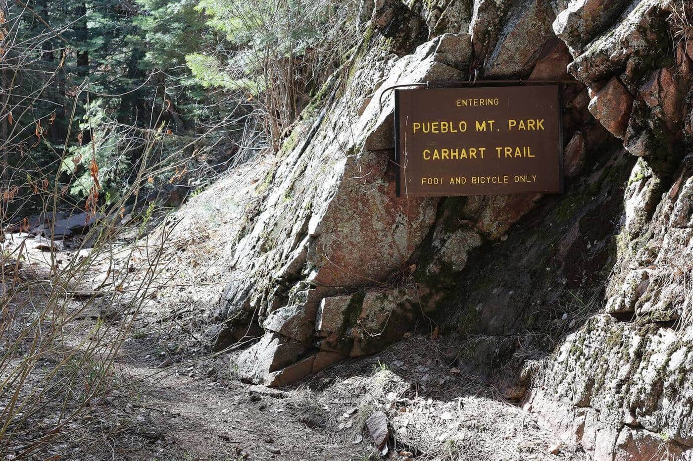
Pueblo Mountain Park Trail
A diverse mountain park trail through ponderosa pine forests and open meadows with views of the Sangre de Cristo Range and Arkansas River valley.
Upper Piney River Falls Trail
A scenic, family-friendly trail following the Piney River past Piney Lake through open wildflower meadows, aspen stands, and pine forests. The waterfall at the end is a refreshing reward with views of the Gore Range.
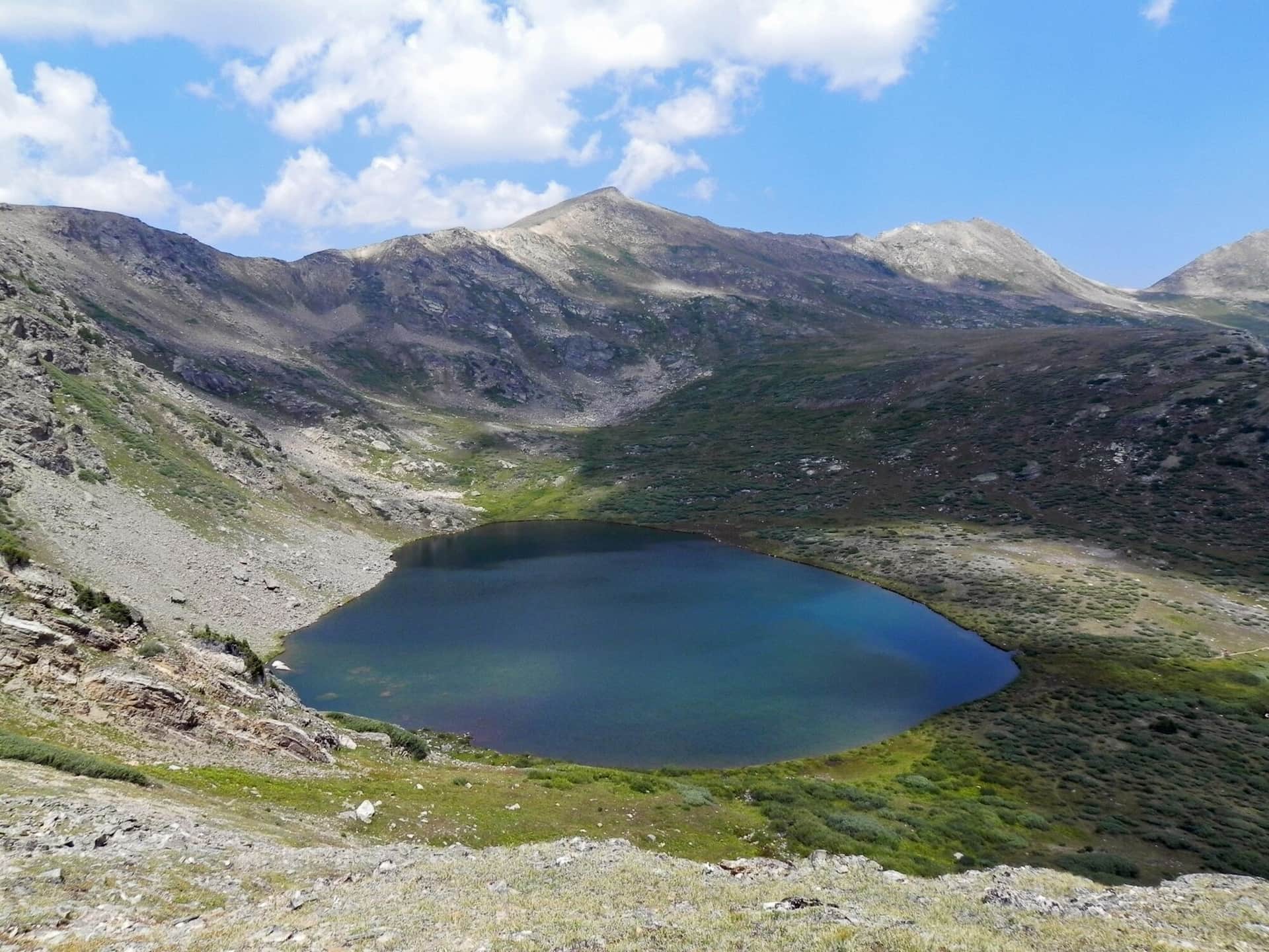
Savage Lakes Trail
A moderately steep climb east of Basalt to a pair of subalpine lakes surrounded by rugged peaks. The trail passes through aspen and conifer forests with good fishing opportunities at the lakes.
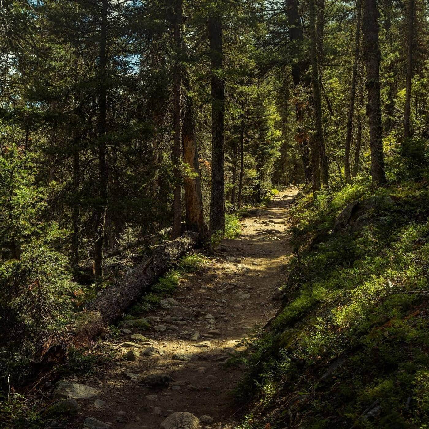
Acorn Creek Trail
A quiet trail offering solitude and wildlife viewing through aspen groves, sagebrush meadows, and spruce-fir forests. Reaches the Ptarmigan Peak Wilderness with spectacular Gore Range views. One of the first trails to clear of snow in spring.
Linkins Lake Trail
A short but high-altitude trail just below the summit of Independence Pass leading to a small alpine lake above treeline. The trail starts at nearly 12,000 feet, offering immediate alpine tundra scenery and wildflowers.
Fern Lake Trail
A longer alternative to the crowded Bear Lake corridor. The trail follows the Big Thompson River through Moraine Park, passes The Pool and Fern Falls, and climbs to subalpine Fern Lake. Quieter than Emerald Lake even in peak season.
Bierstadt Lake Trail
Short but steep switchbacks climb to Bierstadt Lake, a quiet forested lake with classic reflection views of Longs Peak and the Continental Divide. The lake is busier in winter for snowshoers than in summer.
Mills Lake Trail
Starts at Glacier Gorge Trailhead and climbs past Alberta Falls into the dramatic Glacier Gorge to Mills Lake, with direct views up to the Keyboard of the Winds and Longs Peak. The trailhead is also the start for Loch Vale and Sky Pond on longer days.
Mad Creek Trail
Climb from the Mad Creek Trailhead into the Mount Zirkel Wilderness along Mad Creek. Aspen, conifer, and meadow terrain with multiple side trails. Excellent fall colors in late September. Connects to longer trails into the Zirkel high country.
Hahns Peak Trail
Steep climb to the historic Hahns Peak fire lookout, a 10,839-foot summit north of Steamboat. The lookout structure is preserved at the top. Views span the Park Range, Mount Zirkel Wilderness, and into Wyoming.
Buffalo Pass Trail
Continental Divide pass east of Steamboat. The trail / road climbs through dense forest to the open pass with views back to town. Mountain bike popular; hike-friendly in shoulder seasons.
East Marvine Trail
From the Marvine Trailhead, follow East Marvine Trail through aspen and conifer forest into the Flat Tops Wilderness. Excellent fall colors in mid-September. Quiet backcountry experience with backpack camps along the trail.
Service Creek Trail
Lower-elevation Flat Tops trail through aspen forest along Service Creek. Excellent shoulder-season option when high country is still snowy. Wildlife viewing for deer and the occasional moose.
Lake Elbert Trail
Mt Zirkel Wilderness lake hike from the Slavonia area. Trail climbs through pine and conifer forest before opening into a high meadow with Lake Elbert. Quieter than the popular Gilpin/Mica Lake loop nearby.
Wheeler Lakes Trail
From Vail Pass, climb to a chain of alpine lakes in the Eagles Nest Wilderness. Wildflowers in July, fewer crowds than the Breckenridge-side trails. Lake reflections of the Tenmile Range from the upper lakes.
Boreas Pass Trail
Historic narrow-gauge railroad bed from Breckenridge to Boreas Pass at the Continental Divide. Wide, well-graded, accessible to a broader range of hikers. Aspen forest below treeline, alpine tundra at the top.
McCullough Gulch Trail
Climb past a waterfall into a high alpine basin in the Tenmile Range. The basin holds unnamed alpine lakes with Quandary Peak rising directly above. Short but scenic; popular with Breckenridge locals.
Spruce Creek Trail
Spruce Creek Trailhead is the main approach for Mohawk Lakes and Crystal Peak. The lower trail follows Spruce Creek through aspen and conifer forest before the trail splits. Standard access for multiple destinations.
Half Moon Trail
From the Half Moon Trailhead, climb to Half Moon Pass with views of Mount of the Holy Cross. The standard approach for the 14er summit attempt, or stop at the pass for the views. East Cross Creek camps are below for backpackers.
Surprise Lake Trail
From the Surprise Trailhead, climb through aspen and conifer forest to Surprise Lake in the Gore Range. Quieter than the Eagles Nest popular trails. Backpacker camps in the upper basin.
East Cross Creek Trail
From the Half Moon Pass area, descend into East Cross Creek valley with views back to Mount of the Holy Cross. The standard backpacker approach for Holy Cross attempts; East Cross Creek camp is at the base of the standard route.
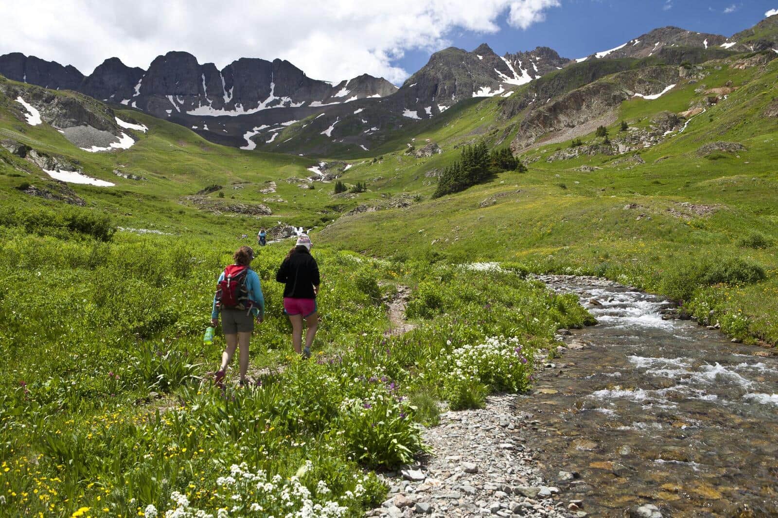
American Basin Trail
One of Colorado's most famous wildflower hikes. The basin explodes with color in mid-July through early August. Trailhead at the end of a rough 4WD road from Lake City. Also the standard start for Handies Peak (14er).
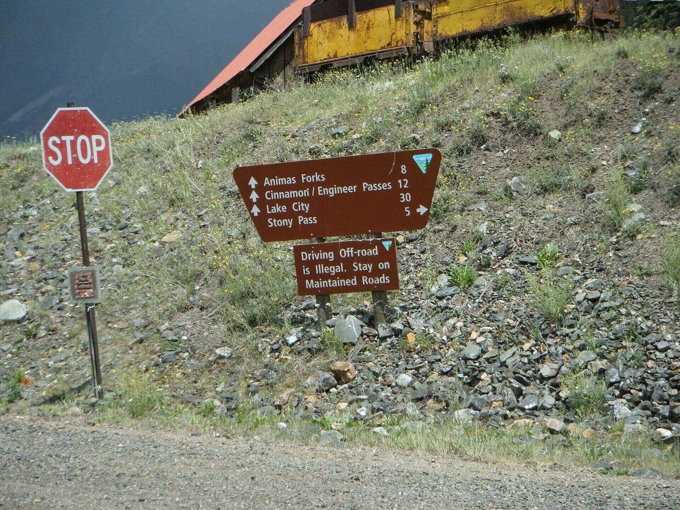
Cinnamon Pass Trail
Alpine pass between Lake City and Silverton, accessible as a 4WD route or a hike from the lower trailhead. The pass itself sits at 12,640 feet with views into both Animas Forks and Lake San Cristobal. Common access for Handies, Redcloud, and Sunshine 14ers.
Engineer Pass Trail
Alpine pass on the Alpine Loop Scenic Byway connecting Lake City and Ouray. Real hiking is possible from the lower trailhead; 4WD users can drive most of the way. Views span the entire upper San Juan headwaters.
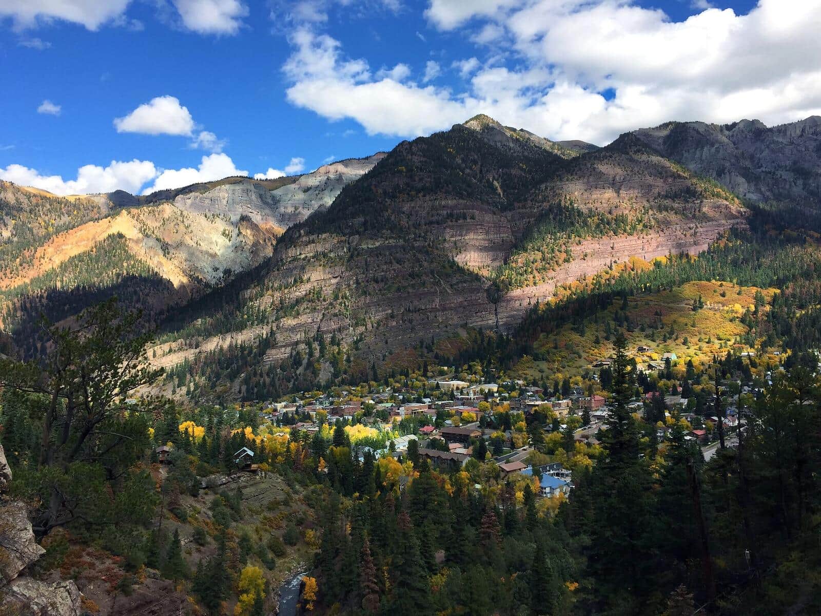
Ouray Perimeter Trail
Loop around the town of Ouray with views down to the streets and out to the surrounding peaks. Passes Cascade Falls, Box Canyon, and a series of viewpoints. The classic Ouray locals' hike.
Pine River Trail
Long Weminuche Wilderness valley trail starting at Vallecito Reservoir. Day-hikable to about mile 4 or used as a backpack approach for the upper Pine River basin. Excellent fall colors.
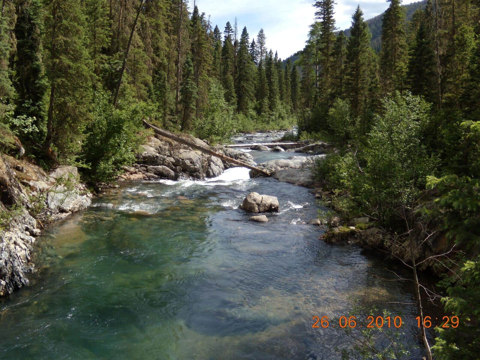
Vallecito Creek Trail
Day-hike or backpack approach into the southern Weminuche Wilderness following Vallecito Creek. Less crowded than the Pine River. Excellent for shorter day-hikes from the Vallecito Reservoir area.
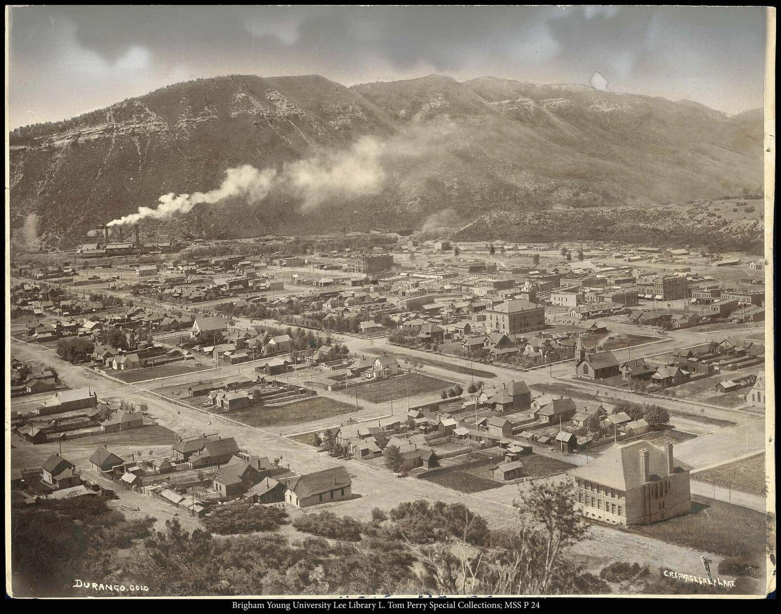
Cascade Creek Trail (Durango)
Wide aspen-and-meadow trail north of Durango along Cascade Creek. Excellent mountain biking and hiking shared use. September aspens are the highlight.
Lime Creek Trail
Easy hike from Old Lime Creek Road through the historic Lime Creek Burn area. Aspen regrowth in the burn zone, with bright fall colors. Lower difficulty than typical Silverton-area trails.
Stony Pass Trail
Alpine pass on the Continental Divide above Silverton. Access via 4WD road from Silverton or by hiking the lower section. The pass marks the divide between Rio Grande and Animas drainages.
Mount Sanitas Trail
The most popular Boulder trail. Steep climb up Mount Sanitas with city views the whole way, then a faster descent on the East Ridge Trail. Reliably crowded mornings and evenings.
Mount Galbraith Loop
Loop around a foothills peak above Golden with Front Range and Denver views from the upper sections. Wildflowers in spring, less crowded than the more famous JeffCo Open Space trails.
Apex Park Trail
JeffCo Open Space loop above Golden with multiple trail options. Mountain bikers share the trails (odd days for bikes, even days for hikers). Aspen groves on the upper switchbacks.
White Ranch Park Loop
Big JeffCo Open Space park north of Golden with extensive trail network. Open meadows, pine forest, and views into the foothills. Popular with horseback riders.
Maxwell Falls Trail
Forested hike to a small waterfall in the Pine Valley Ranch area. Best in May-June when snowmelt runs. The Cliff Loop adds 1.5 miles for a bigger day.
Mesa Trail
The classic Boulder Open Space trail running along the base of the Flatirons. Can be done as a point-to-point with shuttle or sections out-and-back. Multiple side trails branch up to Bear Peak, Green Mountain, and Royal Arch.
Lookout Mountain Trail
Trail from Beverly Heights up to Lookout Mountain summit near Buffalo Bill's grave. Forested switchbacks with city views from the top. Different from the easier Lookout Mountain Nature Center Loop.
Walker Ranch Loop
Boulder Mountain Parks loop on a historic ranch property with views of Eldorado Canyon and the Flatirons from above. Mountain bikers share the trails (odd-day hikers, even-day bikes).
Centennial Cone Loop
JeffCo Open Space loop on Centennial Cone with rolling foothills terrain. Mountain bikers share the trails with weekend-alternating days. Less crowded than Apex and White Ranch.
Heil Valley Ranch Loop
Boulder County Open Space loop in a quiet valley north of Lyons. Aspen groves and ponderosa pine, less crowded than the closer-in OSMP trails.
Picture Rock Trail
Connector trail between Heil Valley Ranch and Lyons. Open meadows, rolling terrain, mountain bike popular. Can be done as a point-to-point or shorter out-and-back.
Carpenter Peak Trail
Steep climb to the highest summit in Roxborough State Park. Sandstone red rock formations on the lower half, then a forested climb to a 7,205-foot summit with views back to Denver.
Lost Lake Trail
From the Hessie Trailhead, climb through aspen and pine to Lost Lake, a small alpine lake. No pass or permit is needed, but Hessie parking is tiny and fills before dawn in summer; Boulder County runs a free shuttle from Nederland on summer Fridays, weekends, and holidays, no reservation needed.
Bear Creek Loop (JeffCo)
JeffCo Open Space loop along Bear Creek with mixed pine and aspen forest. Quieter than the more famous Mount Falcon and White Ranch. Mountain bikers share parts of the trail.
The Crags Trail
An easier alternative to Barr Trail accessing the west side of Pikes Peak. Climbs through aspen and bristlecone pine to a granite outcrop with views of Pikes Peak's back side and the Lost Creek Wilderness. Often the family-friendly Pikes Peak experience.
Mount Muscoco Trail
Steeper, longer alternative to Mount Cutler from the same North Cheyenne Cañon trailhead area. Climbs to a granite summit with 360-degree views of Pikes Peak, Cheyenne Mountain, and the city.
Big South Trail
Long trail through the Cache la Poudre Wilderness following the Big South Fork. Aspen and conifer forest, granite slabs above the river, and excellent fall color in late September. Suitable as a day hike to about mile 4 or as an overnight backpack.
Berry Creek Trail
Local Vail Valley trail from Edwards climbing through pine and aspen forest along Berry Creek. Popular with mountain bikers in summer; quieter for hikers in shoulder seasons. Connector to the broader USFS trail system above Vail.
Geneva Lake Trail
Climb from the Lead King Basin area to Geneva Lake, an alpine lake beneath the West Maroon ridgeline. Wildflowers in July, golden aspens in late September, and far less crowded than the popular Maroon Lake area.
Lovell Gulch Trail
Forested loop in the hills above Woodland Park with views of the Pikes Peak massif from the upper ridges. Multiple trail intersections allow shorter or longer loop options. Popular with Colorado Springs locals avoiding the Manitou crowds.
Hunter Creek Trail
Hunter Creek Valley trail starting from the east end of Aspen. Climbs through aspen and conifer forest along Hunter Creek to a high meadow with views back to Aspen Mountain. Popular with locals for after-work jogs and dog walks.
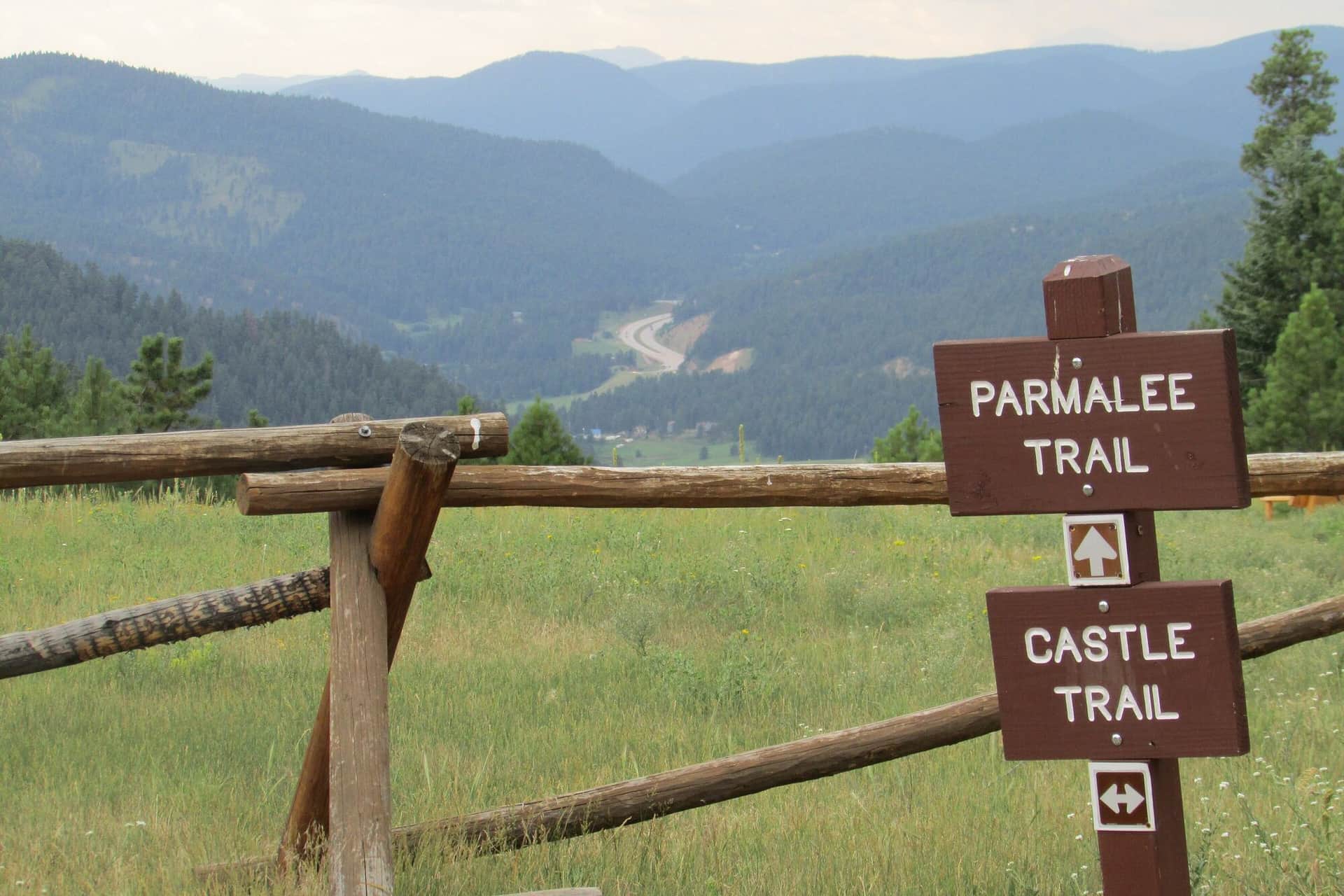
Mount Falcon Park Castle Trail
A loop hike through Denver Mountain Parks land with views of Red Rocks, the Front Range, and the Denver skyline. The ruins of John Brisben Walker's stone castle anchor the upper section.
North Table Mountain Loop
A flat-topped mesa hike with sweeping Front Range views, raptor sightings in spring, and one of the best Denver-area sunset viewpoints. Wide gravel roads make it stroller and bike friendly.
Horsetooth Mountain Loop
The iconic Fort Collins hike to the toothy rock formation visible from town. The loop climbs through ponderosa forest to the summit, with views of the Reservoir, the Mummy Range, and on clear days, Longs Peak.
Arthur's Rock via Lory State Park
Short steep climb to a granite outcrop overlooking Horsetooth Reservoir and the city. Good after-work hike for Fort Collins locals; one of the most consistent spring trails in the area.
Animas Mountain Trail
Loop up the mountain that frames Durango on the north side. Views down into the Animas Valley, west to Mesa Verde, and east toward the Weminuche Wilderness. The local after-work classic.
Hermosa Creek Trail
Long valley trail through the Hermosa Creek Wilderness, popular as a backpack or a mountain-bike shuttle. Hikers usually do a 6-10 mile out-and-back from either trailhead. Aspens turn early September.
Huron Peak (Northwest Slopes)
Often called the most scenic Sawatch 14er. Class 1-2 route from the Huron Peak Trailhead through alpine meadows. Views of the Three Apostles (13ers) from the summit are spectacular.
Mount Sherman (Southwest Ridge)
Shortest standard route on any 14er. Trailhead at 12,000 feet, summit at 14,036 feet. Mining history visible along the route. Excellent first 14er for fit hikers from a high starting altitude.
Independence Lake Trail
Short hike off Independence Pass to a high alpine lake at the head of the Roaring Fork. Easy access for the elevation, gorgeous wildflowers in July. Trailhead parking is small.
Music Pass and Sand Creek Lakes
Non-14er option in the Sangres. Music Pass leads to Lower and Upper Sand Creek Lakes, two pristine alpine lakes in the wilderness south of the Crestones. Quiet and scenic.
Red Mountain Trail (Manitou Springs)
Short, steep summit hike from downtown Manitou. Views over Manitou Springs and out to Pikes Peak. Less crowded alternative to the Incline.
Intemann Trail
Six-mile traverse along the bluffs above Manitou Springs and Colorado Springs. Connects multiple trailheads with mostly gentle grade and big city-edge views.
Grizzly Creek Trail
Follows Grizzly Creek up Glenwood Canyon. Wildflowers, beaver ponds, and a quiet alternative to Hanging Lake. The trail re-opened after the 2020 fires; check trail conditions.
Boy Scout Trail
Local favorite uphill grind that ends at a viewpoint over Glenwood Springs and the confluence of the Colorado and Roaring Fork. Steep but short.
P-S Loop at Philip S. Miller Park
Castle Rock's flagship trail system at Philip S. Miller Park. The full perimeter loop includes the famed 200-step Challenge Hill at the center of the park.