American Basin Trail
San Juan Mountains • Lake City, Colorado
Overview
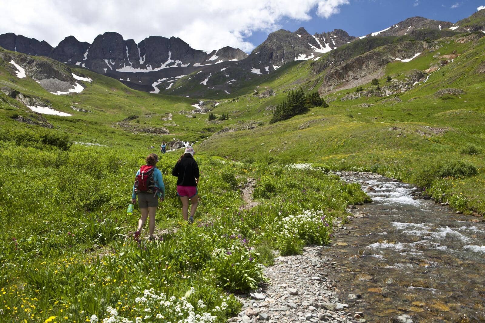
American Basin is the wildflower basin above Lake City, a bowl at 11,600 feet below Handies Peak where columbine, paintbrush, and larkspur grow waist-high in the second half of July. The trail is the first stretch of the Handies Peak route, climbing 1,500 feet in 2.5 miles to Sloan Lake in the upper basin, and it is the best short hike in the San Juans for people who want the flowers without the summit.
Trail Highlights
The Route
From the American Basin trailhead at the end of the road, the trail crosses the basin floor through the flower meadows, with the creek beside it and the walls of the basin closing in. After about a mile it begins to climb, switchbacking up a headwall of talus and tundra with a waterfall on the left, and the flowers give way to alpine cushion plants.
At about 2.5 miles the trail reaches Sloan Lake at roughly 12,900 feet, a cold tarn in a rock bowl below the ridge of Handies; the listing's 12,200-foot high point is the meadow bench below the lake where many people turn around. Handies Peak's trail continues past the lake to the saddle and the summit, another 1,100 feet and about 1.5 miles. Return the same way.
Getting to the Trailhead
From Lake City, take Cinnamon Pass Road (County Road 30) south past Lake San Cristobal about 20 miles, then turn left on the American Basin road for the last mile to the trailhead at about 11,300 feet. Passenger cars reach the American Basin turnoff when the road is dry; the last mile is rough and rocky and high-clearance vehicles do better, though careful drivers in cars manage it slowly. The lot holds about 30 vehicles and fills by 7 AM in wildflower season. No fee or permit.
Best Time to Hike
The road opens in June and the basin is under snow until early July. The flowers peak from about July 15 to August 5, which is also when the road and the lot are busiest. Storms build over Handies by early afternoon most July and August days and the basin is entirely above treeline; be off the headwall by noon. September is quiet, cold in the mornings, and the aspen along Cinnamon Pass Road turn in the last week of the month. Snow closes the road in October.
Good to Know
Dogs are allowed and should be leashed in the flower meadows; the trail is in the Handies Peak Wilderness Study Area. The distance and the altitude are why this is not marked kid-friendly, though the basin floor is an easy walk for any child. The trailhead is above 11,000 feet, so sleep in Lake City first. Stay on the trail through the meadows; the flowers are what everyone came for and they do not survive shortcuts. Dispersed camping is allowed along Cinnamon Pass Road, and Mill Creek campground is lower down. The Handies Peak guide covers the summit, and the Lake City hikes page lists the Alpine Loop trails.
Sources
Figures and access details on this page were checked against these pages on 2026-09-04. Conditions change; confirm with the managing agency before you go.
Who to call
Conditions, closures, permits, and anything left behind on American Basin Trail.
- Managed by
- Gunnison Field Office, Bureau of Land Management
(970) 642-4940 (Gunnison, Mon to Fri 8 to 4:30) · website - Lost and found, non-emergency
- Hinsdale County Sheriff's Office
(970) 944-2291 · websiteBusiness hours only; after hours call Gunnison regional dispatch, (970) 641-8200. - Emergency
- 911. Cell coverage is patchy on most of these trails; a text to 911 can get through where a call cannot.
Numbers checked 2026-10-04. Colorado United is an independent guide, not the land manager; wallets, keys, and dogs found on the trail go to the offices above.
What to Pack
Gear guides for this kind of hike:
Frequently Asked Questions
How long does the American Basin Trail take?
Most hikers finish the 5-mile route in about 4 hours, plus stops. Allow extra time at altitude and for photos.
How hard is the American Basin Trail?
It is rated moderate, with 1,500 feet of gain over 5 miles and a high point of 12,200 feet. Expect a real workout but no technical sections.
Is the American Basin Trail dog-friendly?
Yes, leashed dogs are allowed. Pack water for them and clean up after them.
When is the best time to hike the American Basin Trail?
The best seasons are summer. Start early to beat both the crowds and Colorado's afternoon thunderstorms.
Do I need a pass or permit for the American Basin Trail?
No pass or permit is required to park, though popular lots still fill early on summer weekends.
Planning a Colorado trip? Get our packing checklist.
Free PDF + a weekly note on the best trails for the current season.
We respect your inbox. Unsubscribe anytime.
Trail Information
Nearby Trails in San Juan Mountains
Connected pages
- Hikes near Lake City
All curated trails in the Lake City area.
- Hiking in the San Juan Mountains
Regional trail guide.
Discover More Trails
Browse our complete directory of Colorado hiking trails with detailed guides and filters.
View All Trails