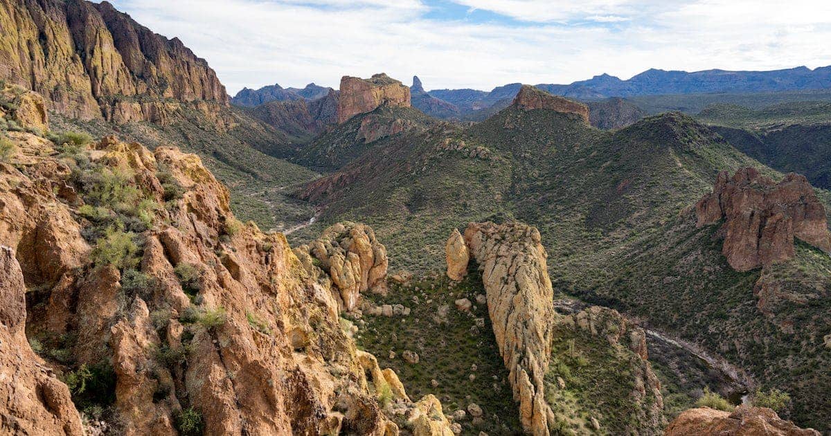
Royal Arch Trail
Front Range • Boulder, Colorado
Overview
Royal Arch is the natural sandstone arch below the Flatirons, 1.7 miles above Chautauqua Park, and the hike to it is Boulder's most popular: a steep climb on rock steps through the pines with a false top at Sentinel Pass, a short drop, and a final scramble to the arch, where the view runs east over the city and the plains. It is 3.4 miles round trip with 1,400 feet of gain.
Trail Highlights
The Route
From the Chautauqua trailhead, follow the Bluebell Road up through the meadow to the Bluebell Shelter, then take the Bluebell-Baird trail and the signed Royal Arch trail into the trees below the Third Flatiron. The trail climbs steadily on stone steps built into the slope, crossing Bluebell Canyon and passing under the rock.
Above the canyon the trail steepens to Sentinel Pass, a saddle at about 6,950 feet that looks like the top and is not. The trail drops about 100 feet from the pass and climbs the last stretch on rock steps and a few short scrambles to the arch. Walk under it for the view. Return the same way; the steps are hard on knees.
Getting to the Trailhead
Chautauqua Park is at the top of Baseline Road in Boulder. The lot and the surrounding streets charge for parking on weekends and holidays from late spring through early fall, and the lot is full by 7 AM year-round on weekends; Boulder runs a free park-to-park shuttle from downtown and the CU campus on those days. Weekdays are easier. No permit. Toilets and water at the Ranger Cottage.
Best Time to Hike
The trail is hiked year-round. Spring and fall are the best seasons; summer mornings are cool under the trees and the afternoon storm reaches the arch by 2 or 3 PM. From December into March the upper trail holds ice for weeks after each storm and the scrambles near the arch are the icy part; microspikes are standard. The city closes the trail when it is muddy.
Good to Know
Dogs are allowed and must be leashed the whole way; the Royal Arch trail is not a voice-and-sight trail. The rock steps and the scrambles near the arch are why the trail is listed for older kids; school-age children who climb do fine. Carry water; there is none above the Ranger Cottage. The arch itself is fragile and climbing on it is prohibited. Boulder is at the trailhead. The Boulder hikes page lists the Flatirons trails, and Green Mountain starts from the next trailhead up Flagstaff Road.
Sources
Figures and access details on this page were checked against these pages on 2026-09-04. Conditions change; confirm with the managing agency before you go.
Who to call
Conditions, closures, permits, and anything left behind on Royal Arch Trail.
- Managed by
- Open Space and Mountain Parks, City of Boulder
(303) 441-3440 (Boulder) · website - Lost and found, non-emergency
- Boulder County Sheriff's Office
(303) 441-3629 (lost and found), non-emergency (303) 441-4444 · websiteFound property goes through Property and Evidence. Items found inside Boulder city limits go to Boulder Police. - Emergency
- 911. Cell coverage is patchy on most of these trails; a text to 911 can get through where a call cannot.
Numbers checked 2026-10-04. Colorado United is an independent guide, not the land manager; wallets, keys, and dogs found on the trail go to the offices above.
What to Pack
Gear guides for this kind of hike:
Frequently Asked Questions
How long does the Royal Arch Trail take?
Most hikers finish the 3.4-mile route in about 3 hours, plus stops. Allow extra time at altitude and for photos.
How hard is the Royal Arch Trail?
It is rated moderate, with 1,400 feet of gain over 3.4 miles and a high point of 6,950 feet. Expect a real workout but no technical sections.
Is the Royal Arch Trail dog-friendly?
Yes, leashed dogs are allowed. Pack water for them and clean up after them.
When is the best time to hike the Royal Arch Trail?
The best seasons are spring, summer, and fall. Start early to beat both the crowds and Colorado's afternoon thunderstorms.
Do I need a pass or permit for the Royal Arch Trail?
No pass or permit is required to park, though popular lots still fill early on summer weekends.
Planning a Colorado trip? Get our packing checklist.
Free PDF + a weekly note on the best trails for the current season.
We respect your inbox. Unsubscribe anytime.
Trail Information
Nearby Trails in Front Range
Connected pages
- Hikes near Boulder
All curated trails in the Boulder area.
- Hiking in the Front Range
Regional trail guide.
Discover More Trails
Browse our complete directory of Colorado hiking trails with detailed guides and filters.
View All Trails