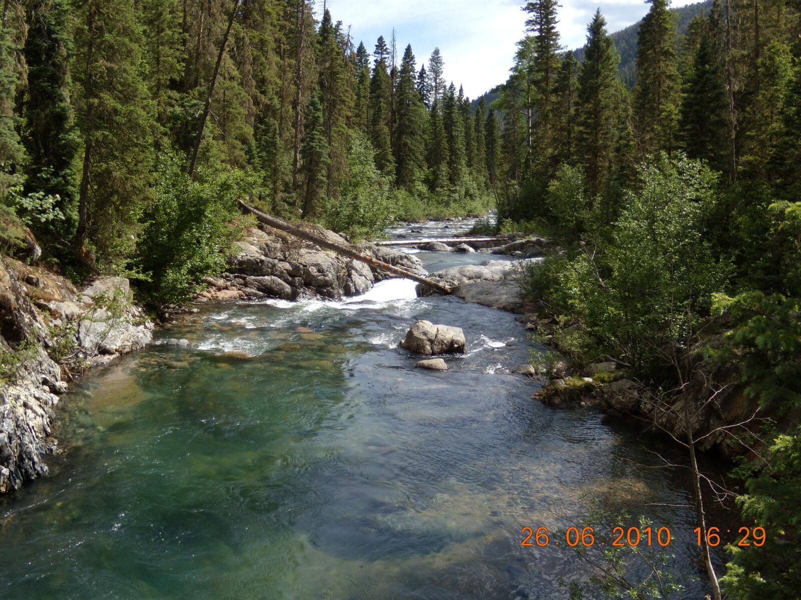
Vallecito Creek Trail
San Juan Mountains • Bayfield, Colorado
Overview
Vallecito Creek is the quiet back door into the Weminuche Wilderness: a valley trail that starts at a campground on Vallecito Reservoir and runs 20 miles north to the Continental Divide. The first 4 miles make a day hike through a granite canyon and creekside meadows, with the option to keep going as far as your legs and permit-free camping allow. It sees a fraction of the traffic of the Needle Creek side because there is no train and no fourteener at the end.
Trail Highlights
The Route
The trail leaves the north end of Vallecito Campground and follows the creek on the flat for about 0.6 mile, an easy stretch that families walk on its own. It then enters the wilderness and climbs the west wall of the canyon on switchbacks, gaining most of the day's elevation in a mile, with the creek loud in the granite gorge below and a couple of spots where the trail is cut into the cliff.
Above the gorge the valley opens. The trail drops back to creek level, crosses the first bridge, and rolls through meadows and stands of ponderosa and aspen with the creek beside it. The meadows around 4 miles, at roughly 8,800 feet, are the natural turnaround for the 8-mile day, with campsites for anyone staying. The October 2025 flood washed away the Middle Bridge about 5.5 miles up; the first bridge and the twin bridges survived, but the Forest Service says the creek is no longer passable there and does not expect a replacement soon, so trips beyond that point mean a ford or a turnaround. Beyond, the trail continues past the Johnson Creek junction at about 10 miles, the link to Columbine Pass and Chicago Basin, and on to Hunchback Pass and the Divide.
Getting to the Trailhead
From Durango, take Florida Road (County Road 240) 17 miles, turn left on County Road 501 for about 9.5 miles through the community of Vallecito, then left on County Road 500 for about 3 miles to the Vallecito Campground entrance at the north end of the reservoir; trailhead parking is on the left, about 45 minutes from town. The trailhead parking lot is just outside the campground entrance; day hikers should not park in the campground loops. There is no fee for the trail. The campground charges a fee and takes reservations, and it is the obvious place to sleep the night before.
Best Time to Hike
The trail starts below 8,000 feet, which makes it one of the earliest Weminuche trails to open, usually by early May, and one of the last to close. The creek runs high and loud through June. Summer is warm in the lower canyon. The aspen and cottonwoods turn in the third and fourth weeks of September, and fall is the best time here. Afternoon storms are the July and August pattern, but the day-hike section is below treeline. Snow closes the upper valley from November into May.
Good to Know
Dogs are allowed on leash in the wilderness. The flat first half mile is fine for any kid; the canyon-wall section above it is narrow with drop-offs and is the reason the trail is not marked kid-friendly here, though steady older children manage it. Bears are active around the campground and the lower valley; hang food or use a canister. The creek is not safe to ford in June. Backcountry camping needs no permit, but the usual wilderness rules apply: 100 feet from water, groups of 15 or fewer. Bayfield, 30 minutes south, has a grocery and gas; Durango has everything else. The Chicago Basin guide covers the fourteener side of the same wilderness.
Sources
Figures and access details on this page were checked against these pages on 2026-09-04. Conditions change; confirm with the managing agency before you go.
Who to call
Conditions, closures, permits, and anything left behind on Vallecito Creek Trail.
- Managed by
- Columbine Ranger District, San Juan National Forest
(970) 884-2512 (Bayfield, Fri only, 10 to 4:30) · websiteOn other weekdays call the San Juan National Forest office in Durango, (970) 247-4874, Mon, Tue, Thu and Fri 9 to 3. - Lost and found, non-emergency
- La Plata County Sheriff's Office
(970) 385-2900 · websiteItems found inside Durango go to Durango Police. - Emergency
- 911. Cell coverage is patchy on most of these trails; a text to 911 can get through where a call cannot.
Numbers checked 2026-10-04. Colorado United is an independent guide, not the land manager; wallets, keys, and dogs found on the trail go to the offices above.
What to Pack
Gear guides for this kind of hike:
Frequently Asked Questions
How long does the Vallecito Creek Trail take?
Most hikers finish the 8-mile route in about 5 hours, plus stops. Allow extra time at altitude and for photos.
How hard is the Vallecito Creek Trail?
It is rated moderate, with 1,200 feet of gain over 8 miles and a high point of 8,800 feet. Expect a real workout but no technical sections.
Is the Vallecito Creek Trail dog-friendly?
Yes, leashed dogs are allowed. Pack water for them and clean up after them.
When is the best time to hike the Vallecito Creek Trail?
The best seasons are summer and fall. Start early to beat both the crowds and Colorado's afternoon thunderstorms.
Do I need a pass or permit for the Vallecito Creek Trail?
No pass or permit is required to park, though popular lots still fill early on summer weekends.
Planning a Colorado trip? Get our packing checklist.
Free PDF + a weekly note on the best trails for the current season.
We respect your inbox. Unsubscribe anytime.
Trail Information
Nearby Trails in San Juan Mountains
Connected pages
- Hikes near Durango
All curated trails in the Durango area.
- Hiking in the San Juan Mountains
Regional trail guide.
Discover More Trails
Browse our complete directory of Colorado hiking trails with detailed guides and filters.
View All Trails