Linkins Lake Trail
White River National Forest • Aspen, Colorado
Overview
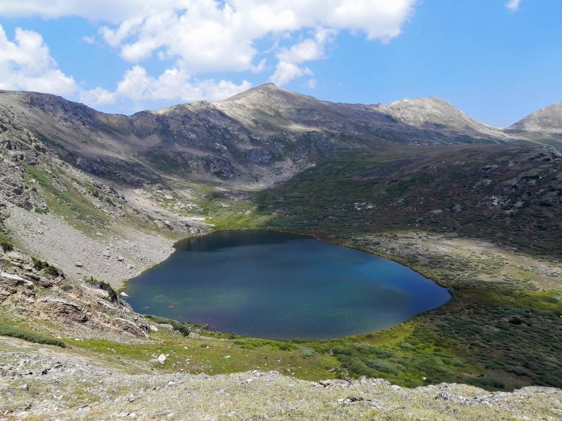
Linkins Lake is the highest short hike on this site: a 0.7-mile climb from a trailhead at 11,500 feet, just below the summit of Independence Pass, to a lake above treeline at about 12,000 feet, in tundra that is thick with wildflowers in July. It is a 45-minute outing on the way over the pass, and it is the easiest place near Aspen to stand in alpine country.
Trail Highlights
The Route
From the Lost Man trailhead, the trail heads north with the Lost Man trail for a few hundred yards, then the Linkins Lake spur leaves left and climbs at once. The trail switchbacks up a tundra slope with the headwaters of the Roaring Fork below and the peaks of the pass around, gaining 500 feet in under a mile.
The lake sits in a bowl of tundra and rock at about 12,000 feet, with Geissler Mountain above and the willows at the outlet full of birds. A path circles it. Return the same way for 1.4 miles, or continue on the Lost Man trail from the junction for a longer day to Independence Lake and Lost Man Pass.
Getting to the Trailhead
From Aspen, drive east on Highway 82 about 18.5 miles to the upper Lost Man trailhead, on the left (north) side of the road at the last switchback below the summit of Independence Pass. The lot is a gravel pullout with room for a dozen cars and no toilet. No fee or permit. Highway 82 over the pass is closed from early November until late May.
Best Time to Hike
The trail melts out in late June and the lake is ice-free by early July; July through September is the season, with the tundra flowers peaking in the second half of July. The whole route is above treeline, so the July and August storm pattern means a morning visit. September is cold and clear and the willows turn gold. The trailhead closes with the pass in winter.
Good to Know
Dogs must be on a leash; the trail is inside the Hunter-Fryingpan Wilderness, and the Forest Service also asks people not to camp at the lake because the tundra is fragile. The trail is short enough for any kid who walks, but the trailhead is at 11,500 feet and visitors who drove up from Aspen that morning feel the first switchback. Stay on the trail across the tundra; the plants take decades to recover. No water at the trailhead; the lake needs a filter. The Grottos, 9 miles down the pass, is the other short stop, and the Aspen hikes page lists the rest.
Sources
Figures and access details on this page were checked against these pages on 2026-09-04. Conditions change; confirm with the managing agency before you go.
Who to call
Conditions, closures, permits, and anything left behind on Linkins Lake Trail.
- Managed by
- Aspen-Sopris Ranger District, White River National Forest
(970) 963-2266 (Carbondale, Mon to Fri 8 to noon and 1 to 4:30) · website - Lost and found, non-emergency
- Pitkin County Sheriff's Office
(970) 920-5300 · websiteKeeps the county lost-and-found database (Mon to Fri 8 to 5). Items found inside Aspen city limits go to Aspen Police, (970) 920-5400. - Emergency
- 911. Cell coverage is patchy on most of these trails; a text to 911 can get through where a call cannot.
Numbers checked 2026-10-04. Colorado United is an independent guide, not the land manager; wallets, keys, and dogs found on the trail go to the offices above.
What to Pack
Gear guides for this kind of hike:
Frequently Asked Questions
How long does the Linkins Lake Trail take?
Most hikers finish the 1.4-mile route in about 1.5 hours, plus stops. Allow extra time at altitude and for photos.
How hard is the Linkins Lake Trail?
It is rated moderate, with 505 feet of gain over 1.4 miles and a high point of 12,010 feet. Expect a real workout but no technical sections.
Is the Linkins Lake Trail dog-friendly?
Yes, leashed dogs are allowed. Pack water for them and clean up after them.
When is the best time to hike the Linkins Lake Trail?
The best seasons are summer. Start early to beat both the crowds and Colorado's afternoon thunderstorms.
Do I need a pass or permit for the Linkins Lake Trail?
No pass or permit is required to park, though popular lots still fill early on summer weekends.
Planning a Colorado trip? Get our packing checklist.
Free PDF + a weekly note on the best trails for the current season.
We respect your inbox. Unsubscribe anytime.
Trail Information
Nearby Trails in White River National Forest
Connected pages
- Hikes near Aspen
All curated trails in the Aspen area.
- Hiking in the White River National Forest
Regional trail guide.
Discover More Trails
Browse our complete directory of Colorado hiking trails with detailed guides and filters.
View All Trails