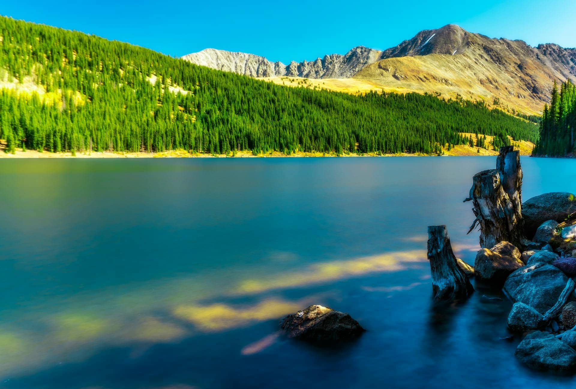
Lost Lake Trail
Indian Peaks Wilderness • Eldora, Colorado
Overview
Lost Lake is the shortest alpine-lake hike in the Indian Peaks and the one most people do first: about 2 miles from the Hessie trailhead to a small lake tucked under Bryan Mountain, with an old cascade on the way and campsites around the shore. It is the hike to take a first-time visitor or a kid who has never been above 9,000 feet.
The catch is Hessie itself. The trailhead has a handful of parking spots at the end of a road that floods every spring, and Boulder County runs a shuttle because there is no other way to get several hundred people a day up there.
Trail Highlights
The Route
From the Hessie townsite, the trail follows the old wagon road up the North Fork of Middle Boulder Creek. In half a mile you cross the creek on a bridge and reach a junction: the Devils Thumb and Woodland Lake trails go right, the King Lake trail goes left. Take the left fork.
The King Lake trail climbs steadily along the creek past a series of cascades that run hard through June. At about 1.1 miles a signed spur leaves left for Lost Lake. The spur climbs a few hundred feet through spruce and reaches the lake at about 9,800 feet, with Bryan Mountain across the water and the Continental Divide behind it. A path circles the lake; the far side has the campsites and the best view back east. Return the same way. Strong hikers continue on the King Lake trail toward King Lake and the Divide, a much longer day.
Getting to the Trailhead
Hessie is 1 mile west of Eldora at the end of Fourth of July Road. The last half mile past the winter closure gate is a rough, often flooded dirt track that most drivers should not attempt; park at the gate if there is room and walk it. The Hessie lot holds about a dozen cars and is full before dawn on summer weekends, and the county tickets and tows cars parked along the road.
On summer Fridays, weekends, and holidays, Boulder County runs a free shuttle from the Nederland High School park-and-ride to the Hessie gate, no reservation needed, and leashed dogs ride too. Parking along Fourth of July Road is allowed only between the signs; the county fines or tows the rest. It is the sane way in from June through September. No fee or permit is needed for day hiking.
Best Time to Hike
The trail is clear of snow by mid-June in most years and the lake is at its best from July through September. Mosquitoes are thick around the water in July. The aspen along the lower trail and up the Eldora valley turn in the last two weeks of September, and Hessie is a popular fall-color walk. In winter the road is closed at the Eldora townsite and Lost Lake becomes a snowshoe trip of about 6 miles round trip from the plowed lot.
Afternoon storms are the July and August pattern, though this trail stays in the trees and turns around below treeline, so it is a reasonable choice on a day when the high routes are not.
Good to Know
Dogs are allowed and should be leashed on this busy trail. Lost Lake sits just outside the Indian Peaks Wilderness, whose boundary lies farther up the Devils Thumb trail, so wilderness rules do not apply here. Kids handle the distance easily; the cascades and the lake give them targets. Camping at Lost Lake is at eight designated sites around the lake, first come, first served, with no permit required; the Forest Service asks campers to use a bear canister and keep it 200 feet from the tent. The lake is shallow and warmer than most alpine lakes, but it is a drinking-water watershed, so keep dogs and soap out of it. There is a vault toilet at the Hessie gate and nothing above it. The Indian Peaks region page covers the other trailheads.
Sources
Figures and access details on this page were checked against these pages on 2026-09-04. Conditions change; confirm with the managing agency before you go.
Who to call
Conditions, closures, permits, and anything left behind on Lost Lake Trail.
- Managed by
- Boulder Ranger District, Arapaho and Roosevelt National Forests
(970) 295-6600 (Boulder, by appointment, Mon to Fri) · websiteOne phone line serves every Arapaho and Roosevelt district. - Lost and found, non-emergency
- Boulder County Sheriff's Office
(303) 441-3629 (lost and found), non-emergency (303) 441-4444 · websiteFound property goes through Property and Evidence. Items found inside Boulder city limits go to Boulder Police. - Emergency
- 911. Cell coverage is patchy on most of these trails; a text to 911 can get through where a call cannot.
Numbers checked 2026-10-04. Colorado United is an independent guide, not the land manager; wallets, keys, and dogs found on the trail go to the offices above.
What to Pack
Gear guides for this kind of hike:
Frequently Asked Questions
How long does the Lost Lake Trail take?
Most hikers finish the 4-mile route in about 3 hours, plus stops. Allow extra time at altitude and for photos.
How hard is the Lost Lake Trail?
It is rated moderate, with 800 feet of gain over 4 miles and a high point of 9,786 feet. Expect a real workout but no technical sections.
Is the Lost Lake Trail dog-friendly?
Yes, leashed dogs are allowed. Pack water for them and clean up after them.
When is the best time to hike the Lost Lake Trail?
The best seasons are summer and fall. Start early to beat both the crowds and Colorado's afternoon thunderstorms.
Do I need a pass or permit for the Lost Lake Trail?
No pass or permit is required to park, though popular lots still fill early on summer weekends.
Planning a Colorado trip? Get our packing checklist.
Free PDF + a weekly note on the best trails for the current season.
We respect your inbox. Unsubscribe anytime.
Trail Information
Nearby Trails in Indian Peaks Wilderness
Connected pages
- Hikes near Nederland
All curated trails in the Nederland area.
- Hiking in the Indian Peaks Wilderness
Regional trail guide.
Discover More Trails
Browse our complete directory of Colorado hiking trails with detailed guides and filters.
View All Trails