Bierstadt Lake Trail
Rocky Mountain National Park • Estes Park, Colorado
Overview
Bierstadt Lake sits on top of a glacial moraine above Bear Lake Road, a flat lake in a lodgepole forest with a view across the water to Longs Peak and the Continental Divide, and the switchbacks up to it from the Bierstadt Lake trailhead are the whole hike: 1.4 miles and 566 feet, then a level loop around the shore. It is quieter than Bear Lake in summer and busier in winter, when it is one of the park's favorite snowshoe trips.
Trail Highlights
The Route
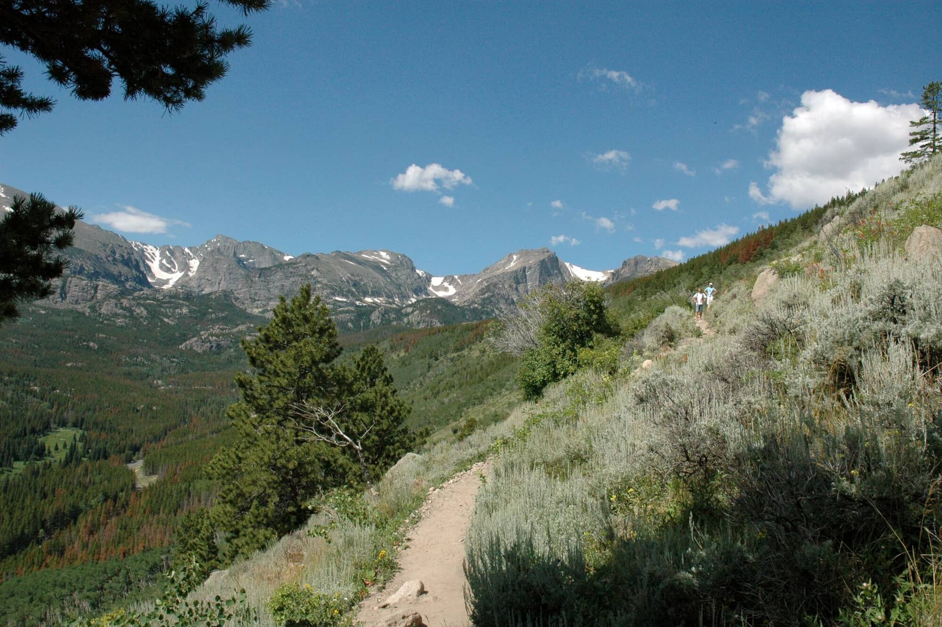
From the Bierstadt Lake trailhead, the trail climbs the south face of the moraine on long switchbacks through aspen and open slope, with Longs Peak and the Divide filling the view behind you at every turn. The grade is steady and the footing is good. At the top the trail levels into the lodgepole and reaches the lake in a few hundred yards.
A loop trail circles the lake, about a mile, with the best view of the Divide from the north shore. The trail continues past the lake down to Bear Lake, 1.6 miles, or to the Park and Ride, which makes a one-way hike with the shuttle back. Return the same way for the 2.8-mile version.
Getting to the Trailhead
The Bierstadt Lake trailhead is on Bear Lake Road, 6.5 miles from the Beaver Meadows entrance, and is a stop on the Bear Lake shuttle. The lot is small and fills by 8 AM in summer; the shuttle from the Park and Ride is the reliable way in. The Bear Lake corridor timed-entry permit and the park entrance fee apply. There is a vault toilet at the trailhead, replaced in fall 2024.
Best Time to Hike
The switchbacks melt out by May and the lake is at its best from June through October, with the aspen on the moraine turning in the last week of September. Afternoon storms in July and August catch people on the open switchbacks; the lake is in the trees. In winter the trailhead lot is plowed and the trail is a packed snowshoe route with the Divide white behind it, which is when it is busiest.
Good to Know
No dogs anywhere on park trails. The switchbacks are steady rather than steep and kids who walk manage them; the loop around the lake is flat. Carry water; the lake is not drinkable without a filter. The moraine faces south and is hot at midday in summer. Estes Park is 20 minutes away. Bear Lake is the flat loop at the far end of the connecting trail, and the Bear Lake trailhead guide covers the shuttle.
Sources
Figures and access details on this page were checked against these pages on 2026-09-04. Conditions change; confirm with the managing agency before you go.
Who to call
Conditions, closures, permits, and anything left behind on Bierstadt Lake Trail.
- Managed by
- Rocky Mountain National Park Information Office, National Park Service
(970) 586-1206 (Estes Park, daily 8 to 4 in summer; Mon to Fri 8 to 4 and weekends 8 to noon in winter) · website - Lost and found, non-emergency
- Larimer County Sheriff's Office
(970) 498-5198 (lost and found), non-emergency (970) 416-1985 · websiteFound property goes through the Property and Evidence Unit. - Emergency
- 911. Cell coverage is patchy on most of these trails; a text to 911 can get through where a call cannot.
Numbers checked 2026-10-04. Colorado United is an independent guide, not the land manager; wallets, keys, and dogs found on the trail go to the offices above.
What to Pack
Gear guides for this kind of hike:
Frequently Asked Questions
How long does the Bierstadt Lake Trail take?
Most hikers finish the 2.8-mile route in about 2 hours, plus stops. Allow extra time at altitude and for photos.
How hard is the Bierstadt Lake Trail?
It is rated moderate, with 566 feet of gain over 2.8 miles and a high point of 9,416 feet. Expect a real workout but no technical sections.
Is the Bierstadt Lake Trail dog-friendly?
No, dogs are not permitted on this trail.
When is the best time to hike the Bierstadt Lake Trail?
The best seasons are summer, fall, and winter. Start early to beat both the crowds and Colorado's afternoon thunderstorms.
Do I need a pass or permit for the Bierstadt Lake Trail?
You need a National Park entrance pass, and many park trailheads also require a timed-entry reservation in peak season. Check the park website before you drive out.
Planning a Colorado trip? Get our packing checklist.
Free PDF + a weekly note on the best trails for the current season.
We respect your inbox. Unsubscribe anytime.
Trail Information
Nearby Trails in Rocky Mountain National Park
Connected pages
- Hikes near Estes Park
All curated trails in the Estes Park area.
- Hiking in the Rocky Mountain National Park
Regional trail guide.
Discover More Trails
Browse our complete directory of Colorado hiking trails with detailed guides and filters.
View All Trails