Mount Sopris, Colorado: Hiking the Twin Summits Above Carbondale (2026)
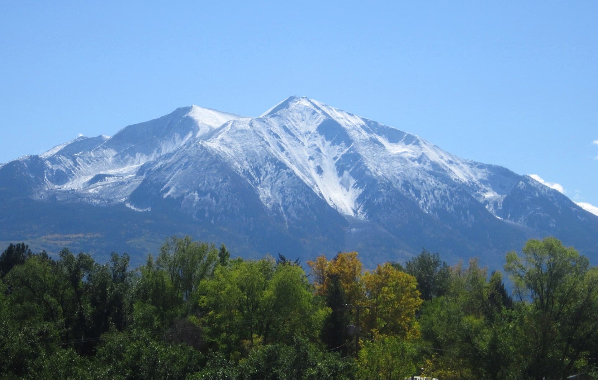
Mount Sopris is the mountain that makes people pull over on Highway 82 and ask what it is. It tops out at 12,965 feet, which means it isn't a 14er and never shows up on the peak-bagging lists. It also rises more than 6,000 feet straight out of the Roaring Fork Valley floor, so it looks and climbs bigger than plenty of peaks that outrank it on paper.
The summit hike runs roughly 12 to 14 miles round trip with about 4,300 to 4,800 feet of gain, which is more climbing than most Colorado 14ers ask of you. The shorter version, a hike to the Thomas Lakes at the base of the east ridge, is around 7 to 8 miles round trip and about 1,600 feet of gain. Both start from the same trailhead near Dinkle Lake, south of Carbondale.
This guide covers the drive, both hikes, the twin-summit question that confuses first-timers, the overnight permit rules that catch backpackers off guard, and when to go.
What you'll learn
- Quick stats for the lakes hike and the full summit
- Why Sopris hikes harder than its elevation suggests
- Getting to the trailhead from Carbondale
- The hike to Thomas Lakes, the moderate option
- Thomas Lakes to the summit, where it gets real
- East Sopris or West Sopris, and which one counts
- Making it an overnight and the permit rules
- Best time to hike
- What to pack
- Wilderness rules
- FAQs
Quick stats {#quick-stats}
| Thomas Lakes | East Sopris summit | |
|---|---|---|
| Distance (round trip) | ~7.2 to 8.2 miles | ~12 to 13.8 miles |
| Elevation gain | ~1,500 to 1,650 feet | ~4,300 to 4,800 feet |
| Typical time | 3 to 4.5 hours | 8 to 12 hours |
| Difficulty | Moderate | Strenuous, Class 2 near the top |
| High point | ~10,200 feet | 12,965 feet |
| Trailhead | Thomas Lakes / Dinkle Lake | same |
| Dogs | Leashed | Leashed |
| Fee | None | None |
Published figures vary by a mile or so depending on where people start their GPS and whether they touch both summits. Treat these as ranges, not gospel.
Why Sopris hikes harder than its elevation suggests {#prominence}
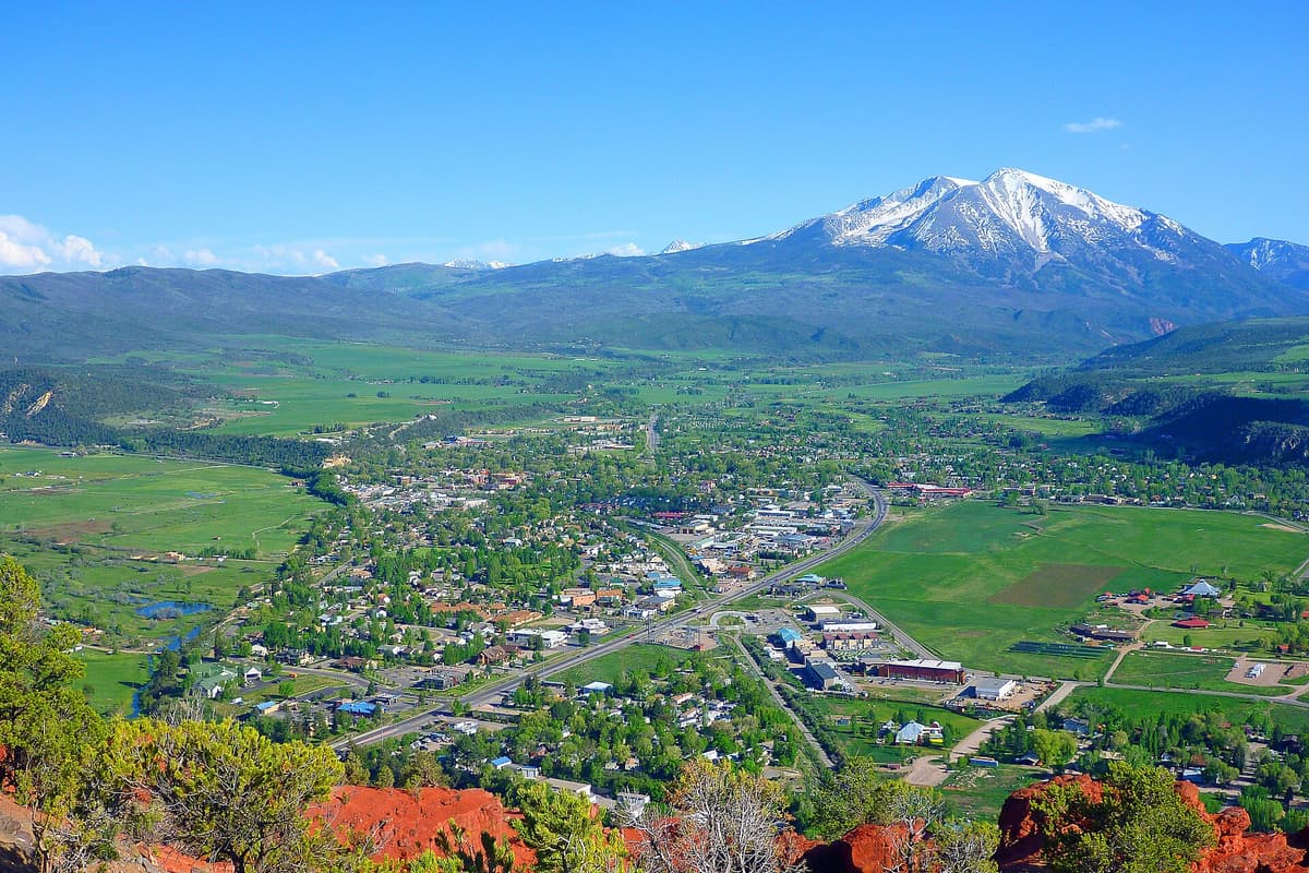
Colorado hikers are trained to sort peaks by elevation, and by that measure a 12,965-foot mountain is a warm-up. Sopris breaks the rule because of where it sits. It stands at the northwest end of the Elk Mountains with no neighbors to prop it up, so the whole mountain is exposed from base to summit. West Sopris rises about 6,400 feet above the valley to its west in only 2.7 horizontal miles.
Compare that to a peak like Grays or Quandary, where you drive to a trailhead above 10,000 or even 11,000 feet and only climb the top 3,000. On Sopris you start in the mid-8,000s and climb the whole thing. That's why the summit day is longer and steeper than most of the 14ers people use it to train for.
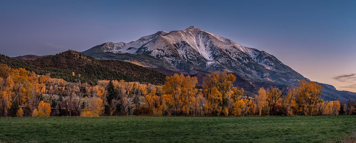
The mountain got its name in 1860. Richard Sopris left Denver on July 1 with fourteen other prospectors, headed west of the Continental Divide looking for gold. When the party dropped into the Roaring Fork Valley and saw the peak, they named it for their expedition leader. Sopris went on to serve in the Civil War, sat as a delegate to Colorado's first constitutional convention, served as mayor of Denver from 1878 to 1881, and pushed through the creation of Denver's City Park.
Getting to the trailhead {#getting-there}
From Carbondale, head south on CO-133 for about two miles, then turn left onto Prince Creek Road. Follow it several miles and stay on it as it turns to dirt, then bear onto Dinkle Lake Road and follow signs for the Thomas Lakes trailhead. The parking area sits about a quarter mile before Dinkle Lake itself.
The last stretch is dirt and gets rutted and washboarded, especially after storms. Most passenger cars make it in dry conditions if you take it slow, but clearance helps and a wet spring can change the answer. Check current road conditions with the White River National Forest before you commit, and read our notes on trailhead parking in Colorado if you're driving up on a weekend.
There's no fee and no timed-entry reservation to park here, which is a real advantage over the Maroon Bells corridor an hour up the road. The lot is small, though. Summer weekends fill early, and the overflow situation is limited, so plan on an early start regardless of which hike you're doing.
The hike to Thomas Lakes {#thomas-lakes}
This is the version most people do, and it's a good day on its own. The trail climbs steadily through aspen and evergreen, opens up for valley views behind you, and reaches the two Thomas Lakes in about 3.5 to 4 miles. Prepared hikers and leashed dogs get there in two to three hours.
The lakes sit in a shallow basin right under the east ridge, and the view up at the summit mass from the shoreline is the payoff. It's a good picnic turnaround, a solid conditioning hike, and the standard first night for anyone splitting the summit into two days. If alpine water is your thing, it fits neatly alongside the other alpine lakes worth hiking to in Colorado.
Turning around here is not a consolation prize. It's about 1,600 feet of gain in a pretty basin with no permit hassle, and it's the right call if the weather looks unsettled or anyone in the group is still adjusting to elevation.
Thomas Lakes to the summit {#summit}
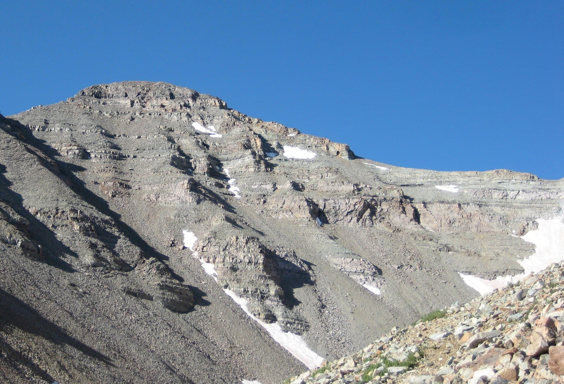
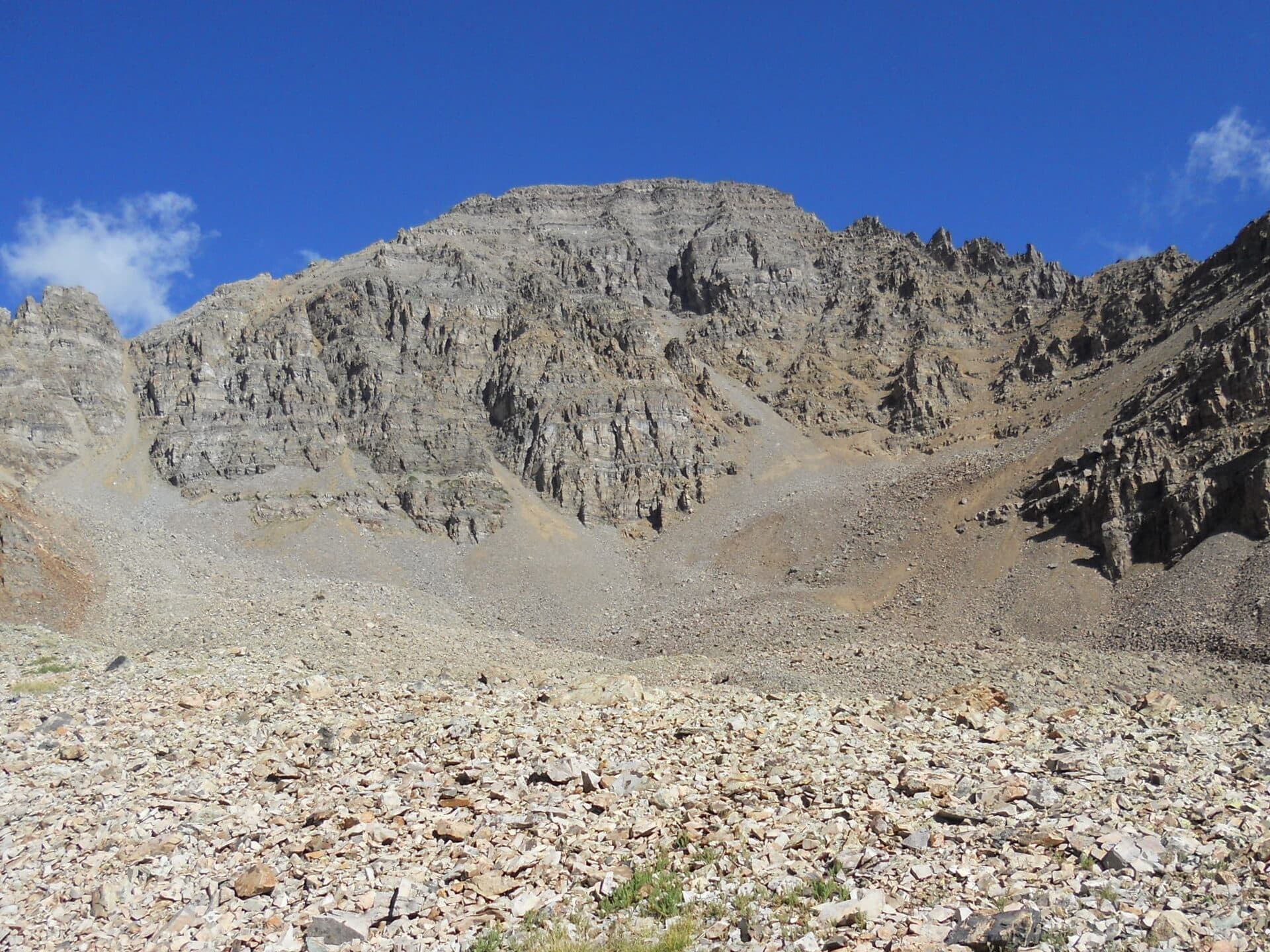
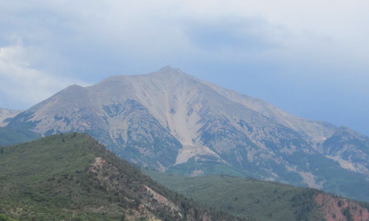
Past the lakes the trail gets serious. You gain roughly 2,800 to 3,300 feet from the lakes to East Sopris, and you do it on the east ridge with very little shade once you clear timberline. The upper mountain is loose rock and talus, and the final stretch is Class 2 scrambling where you'll use your hands for balance on the bigger blocks.
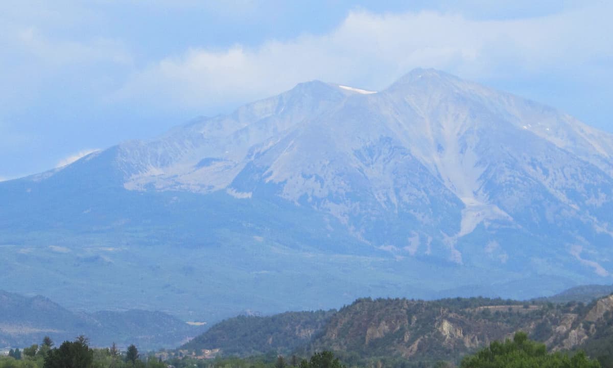
Two things make this section harder than the numbers suggest. The ridge is long, so the summit stays visible and stubbornly distant for a couple of hours. And the rock is genuinely loose in places, which slows the descent more than people budget for. Plenty of parties reach the top in good time and then take just as long coming down.
Start early. Above treeline on a summer afternoon you're the tallest thing on a very exposed ridge, and Colorado thunderstorms build fast. The same discipline that applies on Longs Peak and Pikes Peak applies here: be off the ridge by early afternoon, and turn around when the sky tells you to.
East Sopris or West Sopris {#twin-summits}
Sopris has two summits half a mile apart, and here's the part that trips people up: they're the same height. Both East Sopris and West Sopris measure 12,965 feet. The saddle between them drops to about 12,660, so each rises roughly 300 feet above the connector, which puts them right on the borderline of Colorado's usual 300-foot rule for counting a summit as its own peak.
The standard trail from Dinkle Lake tops out on East Sopris, so that's the one most hikers mean when they say they climbed Sopris. Traversing over to West Sopris adds about a mile round trip and a few hundred feet of regain on more loose rock. It's a reasonable add-on if you're feeling strong and the weather is holding, and pointless if either of those isn't true.
You'll also see the elevation listed as 12,953 feet in older sources and on some signs. Modern surveys settled on 12,965. Both numbers refer to the same mountain, so don't let it worry you.
Making it an overnight {#overnight}
Splitting the climb into two days is the popular move: hike the 3.5 to 4 miles to Thomas Lakes with a pack, camp, then go for the summit at first light with a light daypack. It turns a brutal single push into two pleasant halves.
The rules matter here. Mount Sopris sits inside the Maroon Bells-Snowmass Wilderness, which runs an overnight permit system. Advance reservations are required for overnight stays in the wilderness permit zones, and you get them through Recreation.gov before you go, not at the trailhead. Bear canisters are required for all backpackers in this wilderness, and camping is limited to designated sites. Confirm the current zone boundaries, dates, and fees at Recreation.gov or with the White River National Forest, since these rules have tightened over the past few seasons.
If you're new to hauling a pack overnight at elevation, our guides to backpacking tents for Colorado and sleeping bags cover the gear that actually matters at 10,000 feet.
Best time to hike {#when-to-go}
Mid-July through September is the reliable window for the summit. Snow lingers on the upper east ridge well into July some years, and postholing up loose talus under a wet snowpack is miserable and slow.
Late September into early October is the best-looking window. The aspens on the lower trail turn hard, and the light on the mountain at dusk is why every photo of Carbondale has Sopris in it. Days are shorter, so start earlier than you think.
June usually works for Thomas Lakes but not the summit. Expect mud low down and snow up high.
Winter turns this into a serious mountaineering objective, not a hike. Avalanche terrain, a long approach, and a road that isn't plowed to the trailhead. If you want snow travel at a reasonable risk level, start with our winter hiking guide instead.
What to pack {#what-to-bring}
The summit day is a long one with real exposure, so pack like it. A few things earn their weight here specifically.
Sturdy boots. The upper ridge is loose talus and the descent is where ankles roll. Stiffer soles help more than they do on a groomed trail. See our picks for hiking boots that hold up in Colorado, or shop hiking boots directly.
Trekking poles. Not optional on a 4,500-foot descent over loose rock. Our trekking pole guide breaks down the options, or grab a set of trekking poles.
Water and a filter. There's water at Thomas Lakes and almost none above them. Carry three liters minimum for the summit push and top off at the lakes. Compare water filters or pick up a backpacking water filter.
Sun protection. Hours above treeline at 12,000 feet with no shade. Sunscreen, a brimmed hat, and real sunglasses. A wide brim sun hat is worth the pack space.
A rain shell. Afternoon storms are the rule, not the exception. Our rain jacket picks cover the range, or browse lightweight rain jackets.
A headlamp. Alpine starts and long descents both run into the dark. Carry a headlamp even on a day hike here.
If you're coming from sea level, read up on altitude sickness before you commit to a 12,965-foot day. Sleeping a night or two in the valley first makes a real difference.
Wilderness rules {#rules}
Maroon Bells-Snowmass Wilderness rules apply from the trailhead:
- Dogs must be leashed
- Group size is capped for both day use and overnight trips
- Camping is in designated sites only, with an advance permit in the overnight zones
- Bear canisters are required for backpackers
- No motorized or mechanized travel, which includes bikes and drones
- Pack out everything, including food scraps and toilet paper
Rangers do check permits at the lakes during busy weekends, and the fines are not small.
FAQs {#faqs}
How hard is the Mount Sopris hike?
It's strenuous. The full summit runs 12 to 14 miles round trip with 4,300 to 4,800 feet of gain and finishes with Class 2 scrambling on loose talus. Most people take 8 to 12 hours. The hike to Thomas Lakes only is moderate, about 7 to 8 miles with 1,600 feet of gain.
Is Mount Sopris a 14er?
No. Mount Sopris is 12,965 feet, so it falls short of the 14,000-foot mark. It rises more than 6,000 feet above the Roaring Fork Valley, though, which gives it more vertical relief than many 14ers and makes the hike longer and steeper than most of them.
Do you need a permit to hike Mount Sopris?
Not for a day hike, and there's no parking fee or timed entry. Overnight trips are different: the Maroon Bells-Snowmass Wilderness requires an advance permit for its overnight zones, reserved through Recreation.gov, plus a bear canister and camping in designated sites only.
How long does it take to hike to Thomas Lakes?
Two to three hours each way for most prepared hikers, covering about 3.5 to 4 miles and 1,600 feet of gain. It's a common turnaround for a half-day trip and the standard overnight camp for people summiting the next morning.
Why does Mount Sopris have two summits?
East Sopris and West Sopris sit half a mile apart and are both 12,965 feet, connected by a saddle around 12,660 feet. That leaves each with roughly 300 feet of prominence over the connector, right at the threshold Colorado uses to count summits separately. The standard trail reaches East Sopris.
Can you hike Mount Sopris in one day?
Yes, and plenty of people do. Start before dawn, be off the summit ridge by early afternoon, and expect the descent to take nearly as long as the climb. Splitting it with a night at Thomas Lakes is the more pleasant option if you can get the permit.
Final word
Sopris rewards hikers who ignore the elevation number and read the profile instead. It's a bigger day than its 12,965 feet suggests, with a longer ridge and looser rock than most 14ers, and it comes without the permit lottery and shuttle logistics of the Maroon Bells one valley over. Go for the lakes if you want a good moderate day, go for the summit if you want a long one, and either way get an early start.
Planning a longer trip through the area? Our Aspen hiking itinerary and the seven-day Colorado hiking road trip both pass right through the Roaring Fork Valley.
Get the Colorado 14er Packing Checklist (free PDF)
Plus a weekly note on the best Colorado trails, gear deals, and seasonal hike picks. No spam, unsubscribe anytime.
We respect your inbox. Unsubscribe anytime.