Wetterhorn Peak: A Complete Guide to the Class 3 San Juan 14er
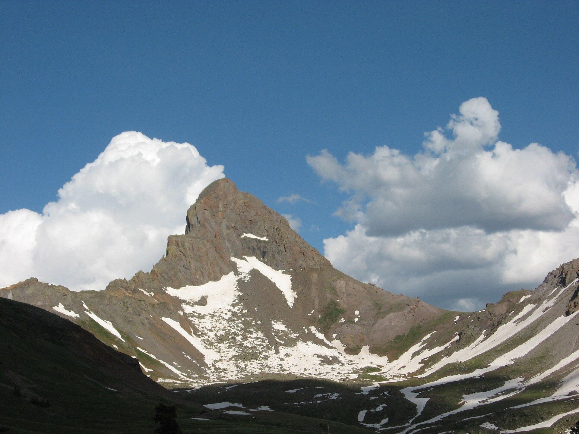
Wetterhorn Peak is the horn-shaped summit west of Lake City, 14,015 feet, and one of the most photographed mountains in the San Juans. From the valley it looks like a tilted fin of rock standing alone, and that profile is honest about what the climb asks of you. Nearly the whole route is a walk on trail and talus. The last 150 feet to the summit is a steep Class 3 pitch of good rock with real exposure, and that short section is the whole personality of the day.
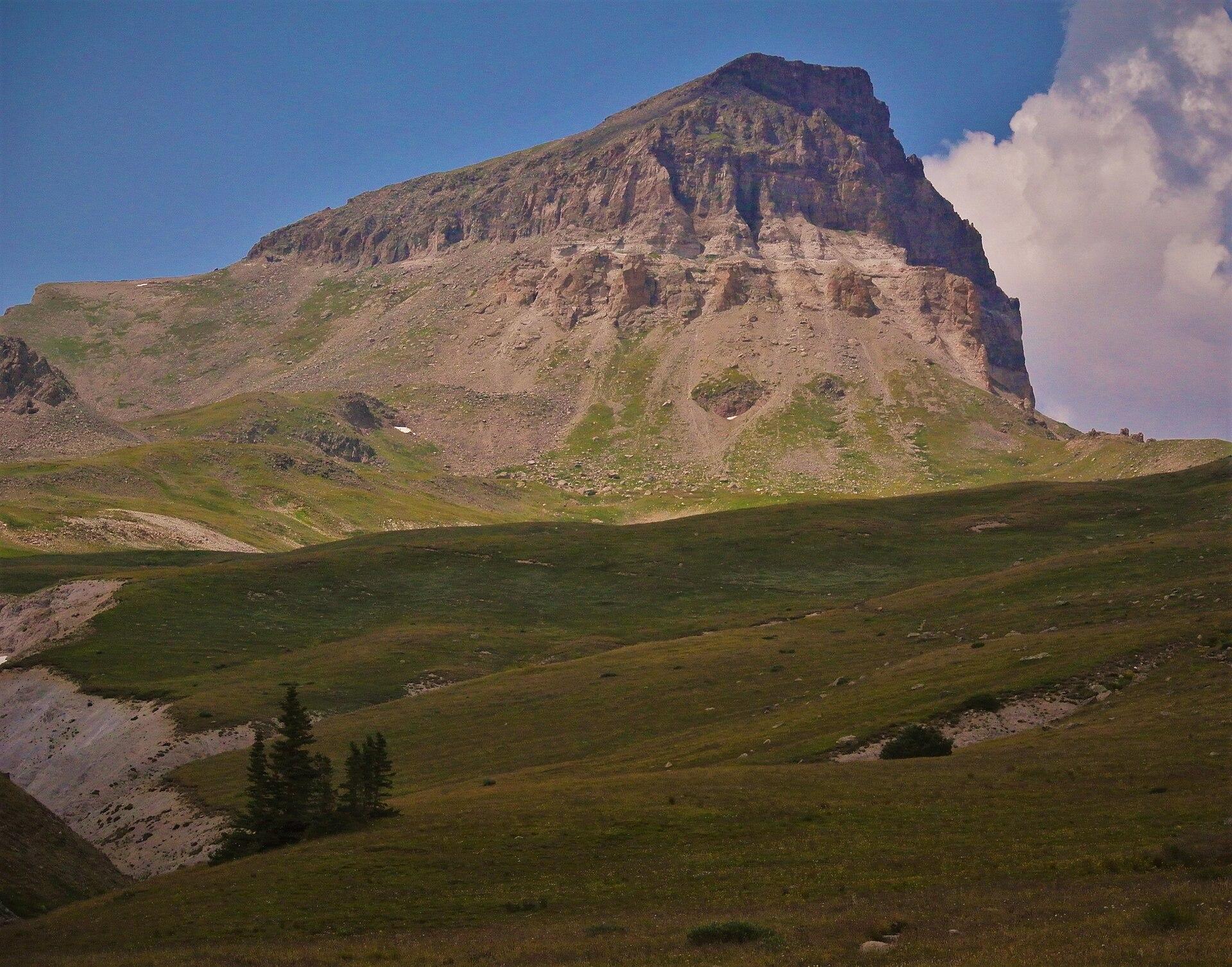
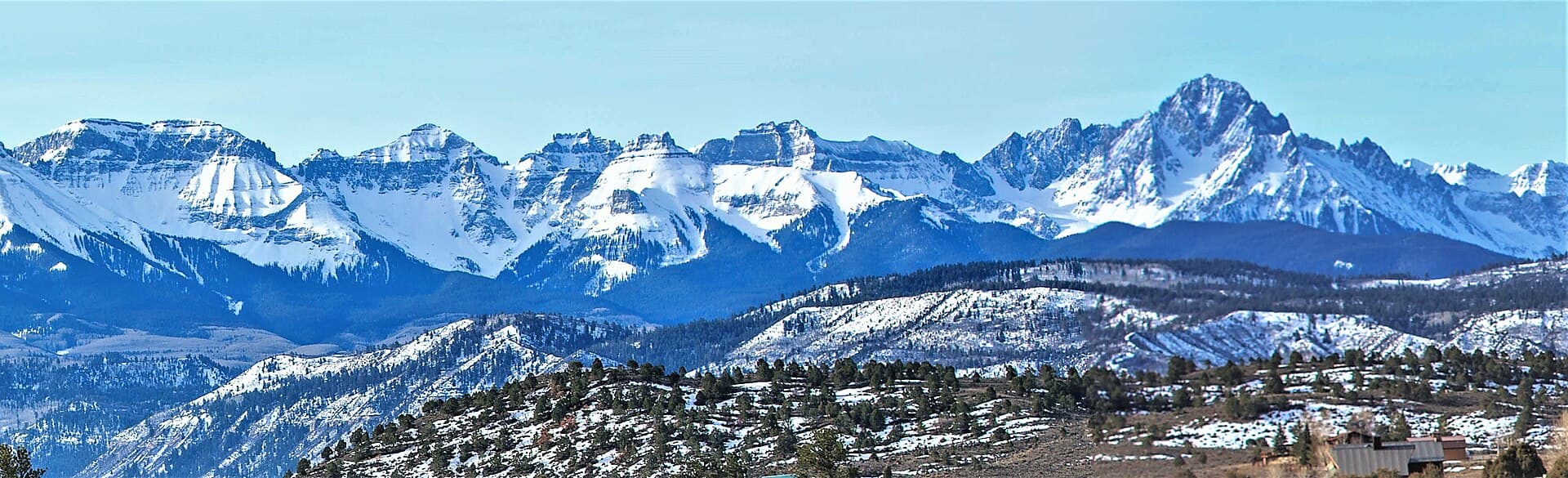
If you've already stood on nearby Uncompahgre Peak, treat this as the step up. Where our Uncompahgre Peak guide covers a Class 2 walk-up with one loose gully, Wetterhorn adds exposed scrambling you have to be comfortable reversing. This page walks through the Southeast Ridge, the Ship's Prow, the final pitch, and how to time the climb around San Juan weather. For the wider trip, our San Juan Mountains guide and our Colorado 14ers guide set the scene.
What You'll Learn
- Quick Stats
- Getting to the Trailhead
- The Standard Route: Southeast Ridge
- The Ship's Prow and the Notch
- The Final 150-Foot Pitch
- How Hard Is Wetterhorn Peak?
- Pairing It with Uncompahgre and Matterhorn
- Timing and Weather
- What to Pack
- Common Mistakes
- Frequently Asked Questions
Quick Stats
- Elevation: 14,015 ft (ranked 50th in Colorado)
- Route: Southeast Ridge from the Matterhorn Creek trailhead
- Distance: about 7 miles round trip
- Elevation gain: roughly 3,300 ft
- Difficulty: Class 3, with a 150-foot exposed summit pitch
- Trailhead: lower Matterhorn Creek trailhead, about 10,400 ft (2WD when dry); upper trailhead 0.7 mile farther (high-clearance)
- Time: about 6 to 9 hours car to car
- Nearest town: Lake City (Hinsdale County), around 8,700 ft
- Permit or fee: none; first come, first served
- Range: San Juan Mountains, Uncompahgre Wilderness
Getting to the Trailhead
The road to Wetterhorn is easier than the one to Uncompahgre next door, which is a nice change in these mountains. From Lake City, drive Henson Creek Road toward Engineer Pass for about 9 miles, then turn right onto North Henson Road and follow it 2 miles to the lower Matterhorn Creek trailhead at about 10,400 feet. A regular passenger car manages this stretch when it's dry, so you don't need a built rig to start the hike.
A high-clearance vehicle can continue roughly 0.7 mile past the lower lot to an upper trailhead, which trims a little distance and climbing off the day. It isn't a big difference, and plenty of people park at the lower lot and walk the short connector without regretting it. There's no fee and no permit for either trailhead; both are first come, first served, and small, so an early arrival helps on summer weekends. Henson Creek Road is part of the Alpine Loop, so expect jeep and side-by-side traffic sharing the road with you on the drive in.
The Standard Route: Southeast Ridge
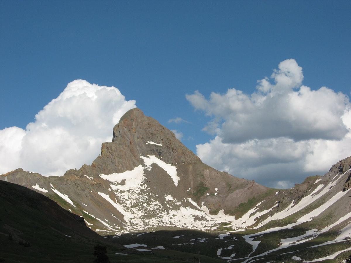
From the trailhead, the trail climbs about 2 miles through forest and meadow into the Uncompahgre Wilderness, following Matterhorn Creek up a pretty basin with the peak's fin growing ahead of you. This lower half is straightforward hiking, and it's where you cover most of the distance. Top off your water in the basin, because the higher you go the less reliable the creek becomes.
The trail then works up to a saddle below the peak's southeast ridge and turns toward the summit block. From the saddle you're on talus, climbing the ridge on a bootpack that stays obvious as long as you keep the fin in front of you. The grade stiffens and the walking gets rockier, but none of this is scrambling yet. You're moving toward the base of the summit tower, where the real climbing starts and the day gets interesting.
Everything to this point is a hike. If the weather is turning or someone in your group is having a bad day with the altitude, the ridge below the summit block is a clean place to turn around with the hard part still ahead of you. There's no shame in it, and it beats bailing off the crux in a hurry.
The Ship's Prow and the Notch
Near 13,900 feet the route reaches the Ship's Prow, a blunt fin of rock that juts from the ridge and gives the upper mountain its distinctive look. You don't climb the Prow itself. The trail passes beneath it and drops a few feet into a notch on the ridge, a small gap that sits right at the base of the final pitch.
This notch is the decision point. From here you can look straight up the last 150 feet to the summit and get an honest read on whether you want it. Some people reach the notch, size up the exposure above, and call it a good day right there. That's a reasonable choice, not a failure, and it's far better than starting up the pitch and freezing halfway. Take a few minutes in the notch to eat, drink, put on your helmet, and watch any party already on the pitch before you commit.
The Final 150-Foot Pitch
The last 150 feet is the climb everyone comes for and the reason Wetterhorn is Class 3 rather than a walk-up. It's a pitch of solid rock with good holds, which in the San Juans is a gift, since the range is famous for rotten rock and this route has some of the best stone around. The holds are there and the line is reasonable. What makes it serious is the exposure: the drop beside you is real, and the summit is small.
Two things matter more than the difficulty of the moves. First, the pitch is harder than the photos suggest, and a lot of people are surprised by how steep and airy it feels once they're on it. Second, and this is the part that catches climbers out, you have to downclimb everything you climb up. That is the way home. Going up on good holds with the summit as a reward is one thing; reversing the same moves while looking down into the exposure is another. Be honest at the notch about whether you can climb down what you're about to climb up, because committing to the top without that answer is how people get stuck.
A climbing helmet belongs on your head from the notch up, both for your own falls and for anything a party above kicks loose. Move one climber at a time on the pitch, keep your group tight so you're not sending rock down onto each other, and test holds before you weight them even though the rock is good. If you're climbing with a partner who's nervous on exposure, a short rope for the pitch is a reasonable call; it won't make the summit easier, but it changes the mood of the downclimb.
How Hard Is Wetterhorn Peak?
By the numbers, 7 miles round trip and 3,300 feet of gain is a moderate 14er day, and the hiking that gets you there is easy. The difficulty is concentrated in that final 150 feet, and it's genuine Class 3 with exposure, not a token scramble. On most difficulty lists Wetterhorn sits a clear notch above the easy walk-up peaks and a step below the Class 4 terror of the Elk Range. Our 14ers by difficulty breakdown shows where it lands and what else lives at that grade.
Be realistic about your scrambling background before you drive out here. If you've only done Class 2 walk-ups and the idea of downclimbing exposed rock makes your stomach drop, Wetterhorn is a mountain to build toward, not your next weekend. Mount Sneffels, another Class 3 San Juan peak with its own airy crux, is a fair comparison for the kind of ground you're signing up for. If you want to stay in the Lake City area at an easier grade, Uncompahgre and Handies Peak are both friendlier climbs. And since this is a remote mountain with no cell service and a long way from help, the margin for a mistake is thinner than on a popular Front Range 14er. Read our notes on altitude sickness prevention and sleep high in Lake City the night before if you can.
Pairing It with Uncompahgre and Matterhorn
Wetterhorn and Uncompahgre both start from Henson Creek Road, so a lot of climbers base out of Lake City for a weekend and take one peak per day. It's a natural pair, but the two climbs aren't the same animal. Uncompahgre is a Class 2 walk-up from the Nellie Creek trailhead with one loose gully, and we cover that rough four-wheel-drive road in the Nellie Creek trailhead guide. Wetterhorn is the harder summit of the two, so if you're doing both, climbing Uncompahgre first as a warm-up is the sensible order. The programmatic peak pages for Wetterhorn and Uncompahgre put the quick stats side by side.
There's also a shorter add-on right there in the basin. Matterhorn Peak, the 13er across from Wetterhorn, is an easy Class 2 walk from the same trail, and strong parties tag it on the way out for a two-summit day. It adds distance and climbing, not difficulty, so it's a question of how much gas you have left after the main event rather than whether you can handle the terrain.
Timing and Weather
The Southeast Ridge is usually dry and in condition by early July and stays that way through September. Earlier than that, the final pitch and the talus below it can hold snow and ice, which turns a good scramble into something much more serious; if you're going before the rock clears, you need the skills and the gear for a snow climb, not a summer hike.
July and August are monsoon months in the San Juans, and storms build over these peaks by early afternoon almost every day. The summit pitch is the worst possible place to be caught: wet rock on an exposed downclimb, with lightning a real possibility up high. The good news is that the route is short. A dawn start from the trailhead puts most people on the summit by nine in the morning and back at the car before the weather turns, which is exactly how you should plan it. Watch the sky from the notch, and if clouds are already stacking up, the summit will be there another day.
September is the best month on this peak, as it is on most San Juan 14ers. The monsoon eases, mornings turn stable, and the aspens along Henson Creek start to go gold. You trade some daylight and colder starts for the most reliable weather of the year and thinner crowds. Once the first heavy snows arrive in October, the road and the route both close down for the season.
What to Pack
Standard 14er kit, plus a couple of items the scramble calls for:
- A climbing helmet, worn from the notch up
- Hiking boots or approach shoes with sticky, grippy soles for the rock
- Trekking poles for the talus and the long descent (stow them for the pitch)
- Layers for the ridge wind, which blows cold even on warm mornings
- Two to three liters of water, since the basin creek is the last reliable source
- Sun protection, because the upper route has no shade at all
- A paper San Juan Trails Illustrated map and a phone with offline maps, since there's no cell signal
- A short rope with a sling or two if a partner wants a backup on the pitch
- Early season only: microspikes or an axe for snow on the upper mountain
Common Mistakes
A few errors come up again and again on this peak:
- Committing to the pitch without a plan for the downclimb. You have to reverse every move you make to the summit. Decide at the notch whether you can, not halfway up.
- Treating it like a walk-up because the hike in is easy. The first 6 miles fool people. The last 150 feet is genuine exposed Class 3, and it deserves respect.
- Starting too late. The summit pitch in an afternoon storm is one of the worst spots on any Colorado 14er. Leave at dawn and be heading down by mid-morning.
- Going too early in the season without snow skills. Ice on the pitch changes the climb completely. If the rock isn't dry, you need different gear and different experience.
- Skipping the helmet. The pitch funnels loose rock, and parties stack up on it in summer. Falling stone from above is the real hazard, not the moves.
If you're newer to this kind of terrain, our guide to the easiest 14ers points you toward better first mountains, and our Colorado trailhead parking guide covers the etiquette for small lots like this one. For sleeping high the night before, our dispersed camping in Colorado guide explains the free sites along Henson Creek, and anyone thinking about a cold-season attempt should start with our winter hiking guide for beginners; off-season, this becomes a mountaineering objective, not a hike.
Frequently Asked Questions
How hard is it to climb Wetterhorn Peak?
Wetterhorn is Class 3. The hike to the summit block is easy walking on trail and talus, but the final 150 feet to the top is a steep, exposed scramble on good rock that you have to downclimb on the way back. It's a clear step up from walk-up 14ers and best saved for after you're comfortable on exposed terrain.
How long is the Wetterhorn Peak hike?
The standard Southeast Ridge route is about 7 miles round trip with roughly 3,300 feet of gain, which most people cover in 6 to 9 hours car to car. The distance is moderate for a 14er; the time depends mostly on how long you spend on the summit pitch and any line waiting to use it.
Do you need technical climbing gear for Wetterhorn?
No ropes or hardware are required for the standard route, and most parties climb it with hands and feet alone. A helmet is strongly recommended for the summit pitch because of loose rock and other climbers. A short rope is a reasonable backup if a partner is uneasy on the exposed downclimb, and early in the season you may need traction for snow.
Can you drive to the Wetterhorn Peak trailhead?
Yes. A regular passenger car reaches the lower Matterhorn Creek trailhead at about 10,400 feet when the road is dry, following Henson Creek Road and then North Henson Road from Lake City. High-clearance vehicles can continue about 0.7 mile to an upper trailhead, but the difference is small and the lower lot is fine for most people.
Should I climb Uncompahgre or Wetterhorn first?
If you're doing both over a weekend from Lake City, climb Uncompahgre first. It's a Class 2 walk-up that lets you acclimate and feel out the altitude, while Wetterhorn's exposed Class 3 pitch is the harder summit. Saving the tougher climb for day two is the sensible order.
Final Thoughts
Wetterhorn packs its whole challenge into the last 150 feet, and the rest of the day is a pleasant walk into a beautiful basin. Drive the easy road, hike to the notch, read the weather and your own nerve honestly, and only start up the pitch if you know you can climb back down it. Do that and you'll stand on one of the finest summits in the San Juans. When you're ready to turn it into a Lake City weekend, our Uncompahgre Peak guide and Nellie Creek trailhead guide cover the other half of the trip, and our San Juan Mountains guide ties the range together.
Get the Colorado 14er Packing Checklist (free PDF)
Plus a weekly note on the best Colorado trails, gear deals, and seasonal hike picks. No spam, unsubscribe anytime.
We respect your inbox. Unsubscribe anytime.