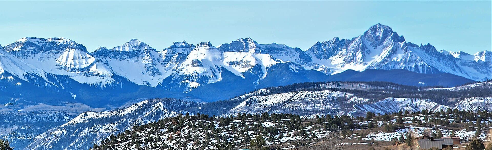
Uncompahgre Peak: A Complete Guide to Colorado's Sixth-Highest 14er
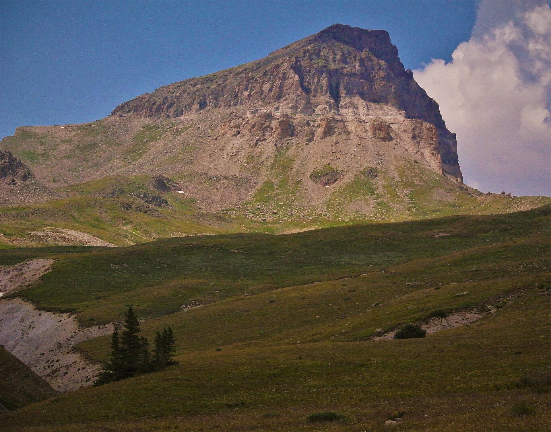
Uncompahgre Peak is the sixth-highest mountain in Colorado at 14,309 feet, the high point of the entire San Juan range, and the most-climbed 14er in these mountains. From a distance it reads like a tilted mesa with a sheer cliff on one side, a shape that stands alone above the town of Lake City and looks far more intimidating than the hike turns out to be. The summit is a walk almost the whole way, with one short, loose gully near the top that keeps it honest.
The catch isn't the climbing. It's the drive. Nellie Creek Road, the four-wheel-drive track to the trailhead, decides how long your day is, and we cover that road in detail in our Nellie Creek trailhead guide. This page is about the mountain itself: the standard route, the one spot where you'll touch rock, the enormous plateau summit, and how to time the whole thing around San Juan weather. If you're pulling together a San Juan trip, our San Juan Mountains guide and our Colorado 14ers guide give you the wider picture.
What You'll Learn
- Quick Stats
- Getting to the Trailhead
- The Standard Route: South Ridge
- The Class 2 Gully
- The Summit Plateau
- Pairing It with Wetterhorn
- Timing and Weather
- How Hard Is Uncompahgre Peak?
- What to Pack
- Common Mistakes
- Frequently Asked Questions
Quick Stats
- Elevation: 14,309 ft (sixth-highest in Colorado, highest in the San Juans)
- Route: South Ridge from the upper Nellie Creek trailhead
- Distance: about 7.5 miles round trip from the upper trailhead
- Elevation gain: roughly 3,000 ft
- Difficulty: Class 2, with one steeper, looser gully near the summit
- Trailhead: upper Nellie Creek trailhead, about 11,400 ft (high-clearance 4WD road)
- Time: about 5 to 8 hours car to car from the upper trailhead
- Nearest town: Lake City (Hinsdale County), around 8,700 ft
- Permit or fee: none; first come, first served
- Range: San Juan Mountains, Uncompahgre Wilderness
Getting to the Trailhead
Almost everything hard about Uncompahgre happens before you start walking. From Lake City you drive about 5 miles up Henson Creek Road, the start of the Alpine Loop toward Engineer Pass, then turn onto Nellie Creek Road (Forest Road 877). That last stretch is roughly 4 miles of narrow, rocky four-wheel-drive road that climbs 2,000 feet to the upper trailhead near 11,400 feet, and it fords Nellie Creek twice along the way.
Whether you drive that road or walk it changes the trip completely. A high-clearance 4WD vehicle gets you to the upper trailhead and the 7.5-mile hike. A low passenger car stops at the junction near 9,300 feet, which adds about 8 miles round trip and 2,000 feet of climbing, turning the day into a 15- to 16-mile outing. We break down the road, the creek crossings, and where each kind of vehicle gives out in the Nellie Creek trailhead guide, so read that before you decide how early to set an alarm. For now, assume you may be walking from wherever your car honestly stops.
The Standard Route: South Ridge
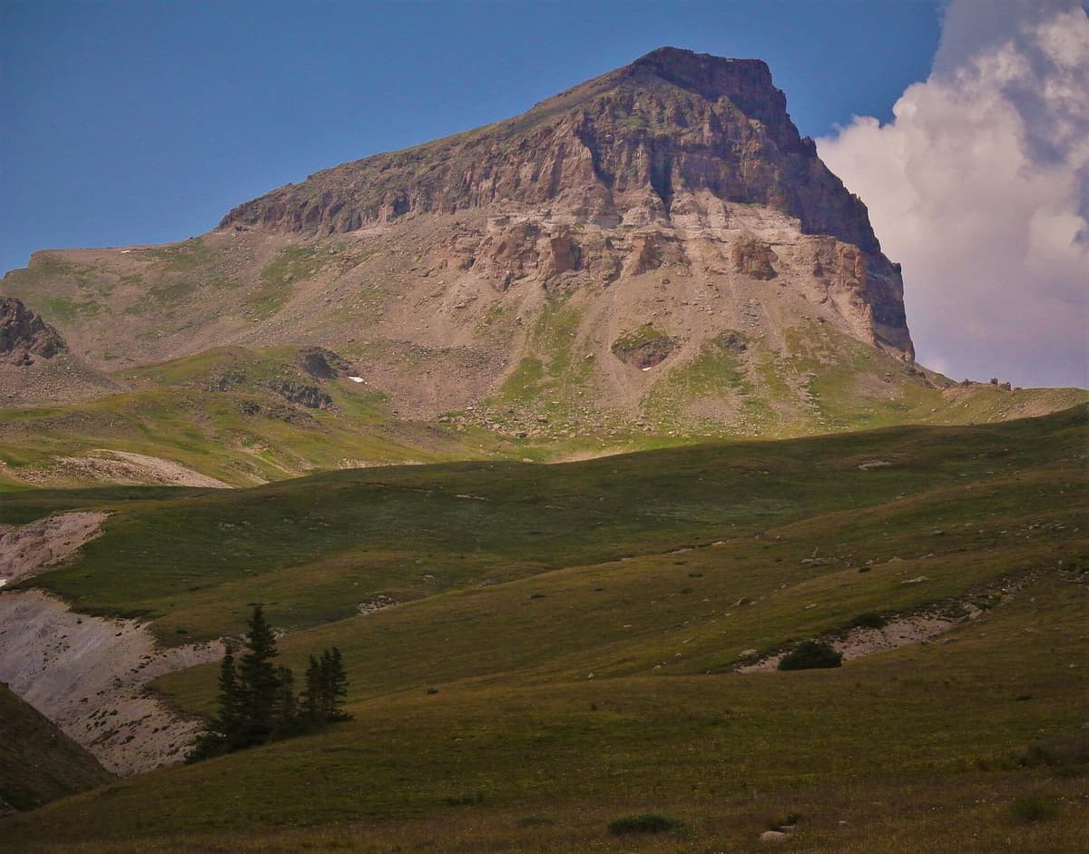
From the upper trailhead at about 11,400 feet, the trail follows Nellie Creek into a wide, open basin inside the Uncompahgre Wilderness. This lower stretch is pleasant walking through willow and tundra with the peak growing ahead of you. Fill your bottles here if you need to, because the creek in this basin is the last reliable water on the route.
Past the basin, the trail bends toward the peak's south ridge and crosses more than a mile of open tundra at around 12,500 feet. This flat middle section lulls people. It's easy ground, but it's high, exposed, and farther along than it looks, and it's where hikers who came up too fast start to feel the altitude. Take it steadily and keep drinking.
The trail then climbs the south ridge in a set of switchbacks, gaining steadily toward a band of rock below the summit plateau. The grade stiffens here, but the footing stays good and the trail stays obvious. You're aiming for the base of the cliffs that ring the top of the mountain, where the one real obstacle waits.
The Class 2 Gully
The summit plateau is guarded by a rock band, and the route climbs through it in a short gully on the southwest side. This is the only place on the whole mountain where you'll put hands on rock, and it's brief, a scramble of a few minutes rather than a pitch. It earns its Class 2 rating for one reason: it's loose. Small rocks and gravel sit on the ledges, and everything you dislodge rolls down onto whoever is below you.
Because of that loose rock, a climbing helmet is worth wearing through the gully whenever other parties are above or below you, which on a summer weekend is most of the time. Move one person at a time through the tightest spots, keep your group close so you're not showering strangers with debris, and test holds before you trust them. Early in the season the gully can hold snow, which adds a different hazard; if you're climbing before the snow clears, carry traction and know how to use it.
The Summit Plateau
Top out of the gully and the mountain changes character entirely. The summit is an enormous, nearly flat plateau, and the trail simply walks the last quarter mile across it to the high point. After the work of the ridge, strolling across the roof of the San Juans feels almost unreal. The view runs the length of the range, from the Wilson group above Telluride in the west to the Sangre de Cristos far to the east, with Wetterhorn's horn standing up close by.
One serious caution comes with all that flat ground. The peak's north face is a sheer cliff, the same drop that gives Uncompahgre its dramatic profile from the highway. On a clear day the edge is obvious and you keep well back without thinking about it. In cloud or blowing snow, that edge is invisible until you're on it, so stay toward the middle of the plateau and know where the drop is before the weather closes in. This is not a place to wander looking at your phone.
Pairing It with Wetterhorn
Uncompahgre's neighbor, Wetterhorn Peak (14,015 ft), is the pointed, horn-shaped summit to the west and one of the most photographed mountains in the range. It starts from the Matterhorn Creek trailhead off the same Henson Creek Road, so a lot of people base out of Lake City for a weekend and climb both, one per day. The two are a natural pair, but they are not the same kind of climb.
Wetterhorn is a Class 3 route with a short, steep, exposed final pitch of about 150 feet, a real step up from Uncompahgre's loose gully. If Uncompahgre is your first San Juan 14er, treat it as the warm-up and be honest with yourself about whether you want the harder summit the next morning. Our 14ers by difficulty breakdown lays out where each sits, and the programmatic peak pages for Uncompahgre and Wetterhorn carry the quick stats side by side. If you'd rather keep the whole weekend at Class 2 or easier, Handies Peak is the gentlest 14er in the area, reached from the Cinnamon Pass side of town.
Timing and Weather
Nellie Creek Road usually opens by late June, once the snowmelt settles and the creek crossings calm down, and the route stays dry through September. The upper basin holds patches of snow into early July, so the earliest climbers often meet lingering drifts on the tundra and in the gully.
July and August are monsoon months in the San Juans. Storms build over the high peaks by early afternoon almost every day, and the summit plateau has no shelter of any kind. The standard advice for Colorado 14ers goes double here: start at dawn, aim to be on top by mid-morning, and be heading down off the exposed upper mountain well before noon. A plateau at 14,300 feet with lightning overhead is one of the worst places you can be, and there is nowhere to hide.
September is the best month on this peak. The monsoon eases, the mornings turn stable, and the aspens along Henson Creek start to turn gold. You trade a little daylight and some overnight cold for the most reliable weather of the year, and the crowds thin once summer ends. Before the first heavy snows close the road in October, it's the quietest and most pleasant time to be up here.
How Hard Is Uncompahgre Peak?
By the numbers, Uncompahgre is one of the friendlier 14ers in the state. It's Class 2, the summit is a walk-up apart from the gully, the trail is obvious nearly the whole way, and 7.5 miles with 3,000 feet of gain is a moderate day by 14er standards. That's why it's the most-climbed peak in the San Juans and why it lands on most lists of reasonable first 14ers once you're acclimated. Our guide to the easiest 14ers in Colorado explains where it fits.
The honest asterisks are altitude and remoteness. Because the route is gentle, it draws people who are not ready for how high it is, and that long tundra crossing at 12,500 feet is where the headaches and nausea show up. Read our notes on altitude sickness prevention and sleep a night at Lake City elevation first if you can. This is also a long way from help, with no cell service on the mountain, so the usual 14er margin for error is thinner out here. Treat the easy summit with the same respect you'd give a hard one.
What to Pack
Nothing exotic, but don't skimp:
- Sturdy hiking boots with good tread for the loose gully
- Trekking poles, which help on the long tundra and the descent
- A climbing helmet for the gully when other parties are around
- Layers for the plateau wind, which blows cold even on warm days
- At least three liters of water, since the basin creek is the last source
- Sun protection, because the tundra and plateau offer zero shade
- A paper San Juan Trails Illustrated map and a charged phone with offline maps, since there's no signal
- Early-season only: traction such as microspikes for snow in the gully
Common Mistakes
A handful of errors come up over and over on this peak:
- Planning for 7.5 miles and walking 15. The Nellie Creek road decides your mileage. If your vehicle can't do the full road, you're adding 8 miles and 2,000 feet, so know that before you start.
- Starting too late. The plateau is the most exposed summit in the area. A late start puts you up top when the afternoon storms arrive, with no shelter anywhere.
- Underestimating the altitude. The route's gentleness fools people into charging the tundra crossing. Pace yourself, hydrate, and acclimate first.
- Wandering near the north edge in cloud. The summit's north face is a cliff. In poor visibility, stay toward the middle of the plateau.
- Skipping a helmet in the gully. The one scramble is loose and usually busy. Falling rock from the party above is the real hazard, not the difficulty of the moves.
If you're newer to high-country travel, our Colorado trailhead parking guide covers the etiquette for small lots like this one, and our dispersed camping in Colorado guide explains the free sites along Henson Creek if you want to sleep high the night before. For anyone eyeing a cold-season attempt, start with our winter hiking guide for beginners; the road closes and the peak becomes a serious snow climb.
Frequently Asked Questions
How hard is it to climb Uncompahgre Peak?
It's Class 2 and one of the easier 14ers to summit, a walk almost the whole way with one short, loose gully near the top. The real difficulties are the altitude (it's 14,309 feet, the highest in the San Juans) and the rough Nellie Creek road to the trailhead, not the climbing itself.
How long is the hike up Uncompahgre Peak?
From the upper Nellie Creek trailhead at about 11,400 feet, the standard South Ridge route is roughly 7.5 miles round trip with about 3,000 feet of gain, which most people cover in 5 to 8 hours. If you park at the lower lot and walk the 4-mile road, the day stretches to about 15 to 16 miles.
Do you need technical gear to climb Uncompahgre?
No ropes or climbing equipment are needed for the standard route. A climbing helmet is strongly recommended for the loose summit gully when other parties are nearby, and early in the season you may want traction for snow. Otherwise it's standard 14er gear: boots, poles, layers, and plenty of water.
Can you drive to the Uncompahgre Peak trailhead?
Only with a high-clearance four-wheel-drive vehicle. Nellie Creek Road is about 4 miles of rough, rocky track with two creek crossings, climbing to the upper trailhead near 11,400 feet. Low passenger cars stop at the junction around 9,300 feet and walk the road. See our Nellie Creek trailhead guide for the full breakdown.
Is Uncompahgre a good first 14er?
It's a reasonable first 14er once you're acclimated, thanks to the gentle Class 2 route and obvious trail. The honest caveats are the high trailhead, the exposed summit, the long and remote drive, and no cell service, so build up to it and sleep high the night before rather than making it your very first mountain day.
Final Thoughts
Uncompahgre rewards an early start, an honest read of your vehicle, and respect for how high and exposed the top really is. Drive or walk the road, pace the tundra, mind the one loose gully, and you'll stand on the highest summit in the San Juans with a view that runs the whole range. When you're ready to plan the drive, our Nellie Creek trailhead guide gets you up the road, and our San Juan Mountains guide ties the rest of the range together.
Get the Colorado 14er Packing Checklist (free PDF)
Plus a weekly note on the best Colorado trails, gear deals, and seasonal hike picks. No spam, unsubscribe anytime.
We respect your inbox. Unsubscribe anytime.