Nellie Creek Trailhead: The 4WD Road to Uncompahgre Peak
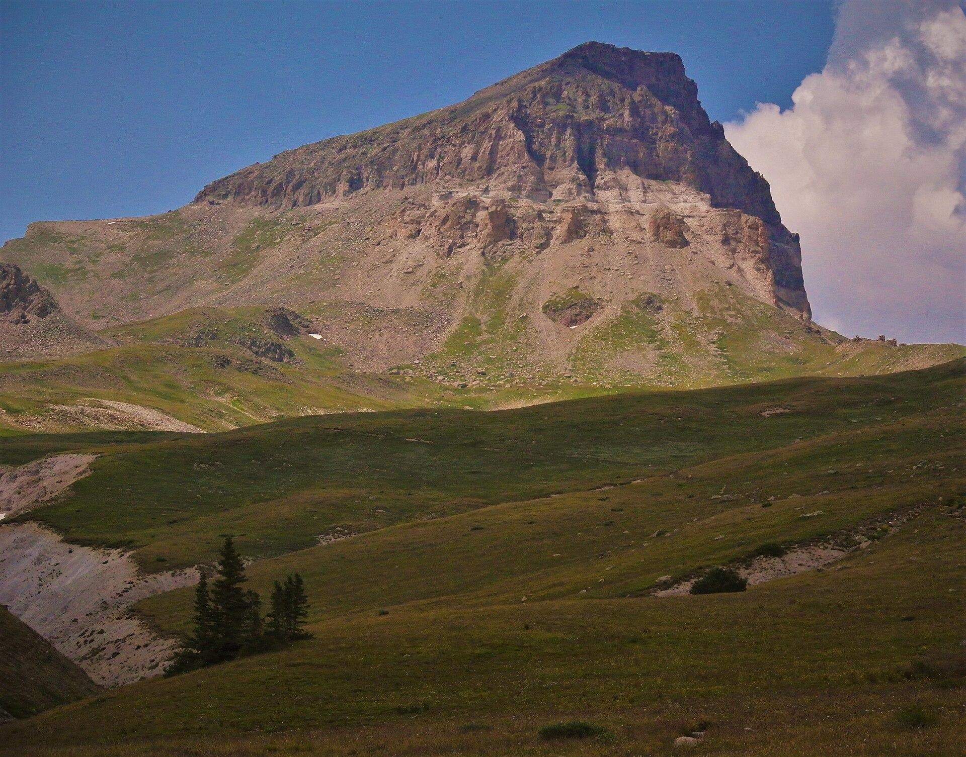
Uncompahgre Peak is the sixth-highest mountain in Colorado and one of the easiest 14,000-foot summits to actually stand on, a Class 2 walk with one steeper gully near the top. The hard part isn't the hike. It's the Nellie Creek Road, four miles of rough, rocky four-wheel-drive track with two creek crossings that climb to the trailhead. Where your vehicle gives up on that road decides whether Uncompahgre is a 7.5-mile tundra walk or a 15-mile day with four miles of road walking tacked on each way.
This page is about the drive and the parking, not the climb itself. If you want the standard San Juan trip planning, the range overview, and how Uncompahgre fits with its neighbors, start with our San Juan Mountains guide and our Colorado 14ers guide. Here we're getting you off the highway in Lake City, up Nellie Creek Road as far as your car can honestly go, and parked in a legal spot with a realistic idea of the day ahead.
What You'll Learn
- Quick Trailhead Facts
- Where Is the Nellie Creek Trailhead?
- Driving Nellie Creek Road
- The Creek Crossings
- Can You Make It in a Regular Car?
- Parking and the Lower Lot
- Do You Need a Permit or Reservation?
- Facilities, Dogs, and Cell Service
- When the Road Is Open
- Where People Go Wrong
- Who to Call
- Frequently Asked Questions
Quick Trailhead Facts
- Upper trailhead: about 11,400 ft, high-clearance 4WD only
- Lower 2WD parking: around 9,300 ft, near where Nellie Creek Road leaves Henson Creek Road
- Access road: Henson Creek Road (County Road 20) west from Lake City about 5 miles, then Nellie Creek Road (Forest Road 877) for roughly 4 miles
- Vehicle: the last 4 miles need real clearance and 4WD, with two fords of Nellie Creek
- Permit or fee: none; first come, first served
- Facilities: none at the trailhead, no water, pack everything out
- Cell service: none on the road or the mountain
- Peak: Uncompahgre Peak (14,309 ft), Class 2 with one steep gully
- Hike from the upper trailhead: about 7.5 miles round trip, roughly 3,000 ft of gain
- Managing office: Gunnison Ranger District, Grand Mesa, Uncompahgre and Gunnison National Forests, (970) 641-0471
- Season: road usually drivable late June into October; buried in snow and unplowed the rest of the year
Where Is the Nellie Creek Trailhead?
The trailhead sits above Lake City, a small old mining town in Hinsdale County on the east side of the San Juan Mountains. Lake City is your last real stop: fuel, water, a market, and a bathroom. From Denver it's a long drive, close to six hours, so this is a peak you sleep near rather than one you day-trip from the Front Range. Sleeping a night at Lake City elevation, around 8,700 feet, also helps you start the hike already part-way acclimated.
From town, you follow Henson Creek Road, which is County Road 20 and the start of the Alpine Loop Backcountry Byway toward Engineer Pass. The pavement ends quickly and the road turns to graded dirt that most cars handle in dry weather. About 5 miles up Henson Creek Road, a sign marks Nellie Creek Road, Forest Road 877, branching off to the right. That turn is where the real four-wheel-drive road begins, and it's the part that decides your day. The Forest Service describes the Nellie Creek access as about 6 miles west of Lake City, which lines up with that mileage once you add the turn.
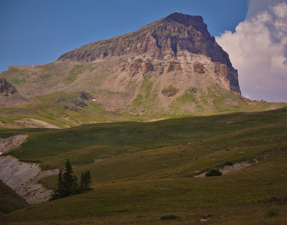
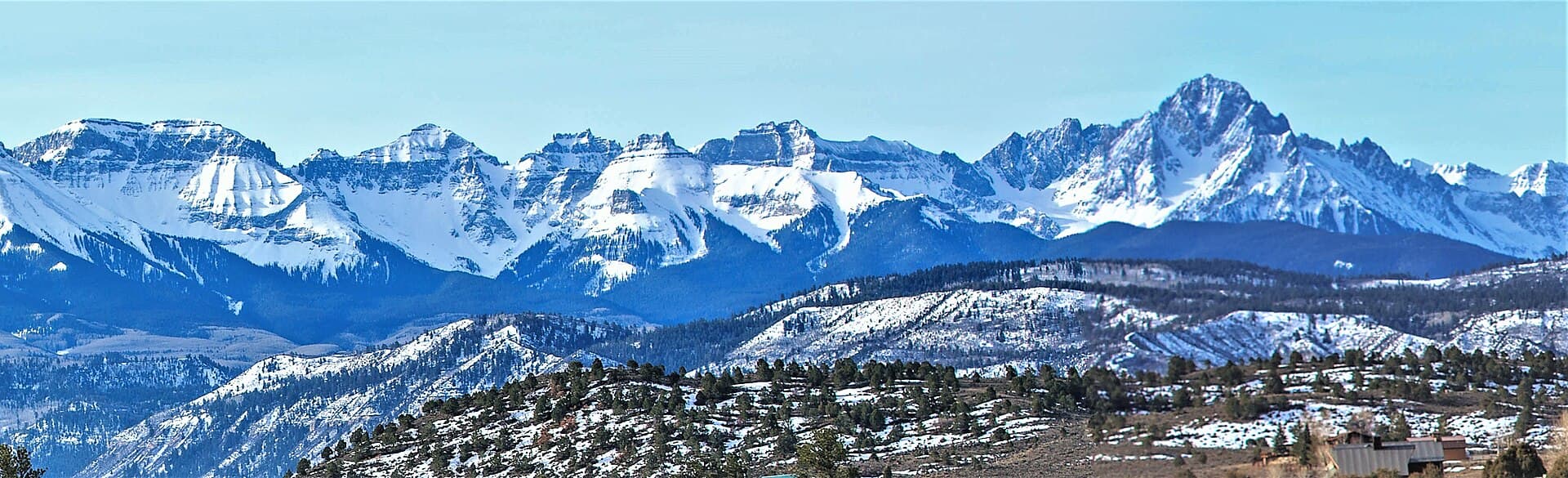
The peak you're aiming for is the big tilted block in the distance. Uncompahgre is the high point of the entire San Juan range and the most-climbed 14er in these mountains, mostly because the summit itself is forgiving. Getting a vehicle to the start of the trail is the whole challenge, so that's next.
Driving Nellie Creek Road
Once you turn onto Forest Road 877, the easy part is over. Nellie Creek Road is about 4 miles long and climbs roughly 2,000 feet to the upper trailhead near 11,400 feet. It's narrow, rocky, and rutted, with embedded rock, tight sections, and spots where you'll crawl in low range. Trip reports routinely describe drivers bottoming out even in capable rigs, and times of 45 minutes or more to cover those 4 miles are normal, not slow.
This is a true high-clearance four-wheel-drive road, not a graded gravel road like you find at some Front Range trailheads. A stock SUV with good clearance and all-terrain tires can usually make it in dry conditions with a patient driver. A low passenger car cannot, and shouldn't try. The road is narrow enough that a stuck vehicle blocks everyone behind it, and people wreck oil pans and tires up here every summer by pushing a car past what it can handle.
Because the road changes with every spring runoff and every storm, treat any single report as a snapshot. A 2026 trailhead note mentioned a gate and a "do not enter" sign roughly a mile below the lower trailhead, which may be temporary or may reflect a washout or repair. Road status up here genuinely shifts, so call the Gunnison Ranger District at (970) 641-0471 or check recent reports on 14ers.com before you commit to the drive.
The Creek Crossings
The feature that catches people off guard is water. Nellie Creek Road fords Nellie Creek twice on the way up, and the depth is a moving target. In late summer and early fall, the crossings are usually shallow rock-bottom splashes that a high-clearance vehicle rolls through without drama. During peak snowmelt, from late May into June, the same crossings run higher and faster, and they're the reason the road isn't reliably open until the runoff settles down.
If you arrive early in the season and the water looks pushy, don't force it. Walk the crossing first and read the depth and the bottom. A ford that's knee-deep and moving can float a light vehicle or stall an engine, and recovery up here is slow and expensive. When in doubt, park below the water and walk the rest of the road. It adds distance, but it beats a drowned rig miles from help with no cell signal.
Can You Make It in a Regular Car?
Short answer: a regular car gets you to the start of Nellie Creek Road and no farther. The honest planning rule for Uncompahgre is to assume you're walking from wherever your vehicle stops, then be pleasantly surprised if you drive higher.
Here's how it breaks down by vehicle:
- Low passenger car: park near the Nellie Creek Road turnoff on Henson Creek Road, around 9,300 feet. You'll walk the full 4 miles of jeep road, which adds about 8 miles round trip and 2,000 feet of climbing to your day.
- High-clearance SUV or truck, 4WD: you can usually reach the upper trailhead at about 11,400 feet in dry conditions, slowly, with careful lines through the rocks and the fords.
- Crossover or AWD wagon: this is the gray zone. Some drivers nurse a Subaru to the top in dry conditions, and plenty of others stop short and walk. Clearance and tires matter more than the badge on the tailgate, and your comfort on a narrow shelf road matters most of all.
Starting from the lower parking area turns Uncompahgre into a roughly 15- to 16-mile day. That's a big outing at this elevation, so if you're walking the road, start in the dark and treat it like the full-length hike it becomes.
Parking and the Lower Lot
There are two places people park. The lower option is on Henson Creek Road at or near the Nellie Creek Road junction, around 9,300 feet. It's informal roadside and small-pullout parking, so arrive early on summer weekends and don't block the road or private property. The upper trailhead, at about 11,400 feet, has room for a handful of vehicles and a few primitive campsites nearby. On a busy July Saturday the upper area fills early, which is one more reason to start before dawn.
Because the summit route is popular and the road is slow, the parking math rewards early arrival at both ends. A dawn start gets you a spot, gets you up and down before afternoon storms, and keeps you off the narrow road when oncoming traffic is heaviest.
Do You Need a Permit or Reservation?
No. There's no fee, no permit, and no timed-entry reservation to hike Uncompahgre Peak or to drive Nellie Creek Road. The trailhead is first come, first served. You're entering the Uncompahgre Wilderness partway up the trail, so standard wilderness rules apply: no bikes or motorized travel past the trailhead, keep groups small, camp away from water and the trail, and pack out everything you bring in.
That no-permit simplicity is a real contrast with Colorado's busiest peaks. Longs Peak and the Bear Lake corridor in Rocky Mountain National Park run on reservations and fees. Out here the only gatekeeper is the road.
Facilities, Dogs, and Cell Service
Plan on nothing. There's no reliable toilet, no water, and no services at either parking area, so handle bathrooms and fill your bottles in Lake City. Carry a way to treat water if you plan to refill from the creek, and read up on altitude sickness prevention before you go, because Uncompahgre is remote and thin on quick help.
Dogs are allowed in the wilderness under control, which is a nice difference from the national park peaks that ban them outright. Keep your dog close on the exposed upper slopes and carry extra water for it, since there's none above the creek.
Cell service is nonexistent at the trailhead and on the mountain. Download your maps before you leave town, tell someone your plan, and don't count on calling for help from up high. A paper San Juan Trails Illustrated map is cheap insurance when the phone is a brick.
When the Road Is Open
Nellie Creek Road is a summer-and-early-fall road. It's typically drivable from late June, once the snowmelt and the creek crossings calm down, into October, when the first serious snows arrive. The exact dates move every year with the snowpack, so don't treat late June as a guarantee.
The road isn't plowed in winter. From roughly November through May it's buried, and reaching Uncompahgre becomes a long ski or snowshoe approach followed by a snow climb, which is a completely different and more serious trip. If you're newer to cold-season travel, our winter hiking guide for beginners is the place to start before you consider anything at this elevation in the snow.
Where People Go Wrong
A few mistakes come up again and again on this peak:
- Underestimating the road and running out of day. People plan for a 7.5-mile hike, stop short on the road, and suddenly face 15 miles. Plan for the long version and enjoy the short one if you get it.
- Forcing a car that doesn't belong up there. A stuck or broken vehicle blocks the narrow road for everyone and leaves you stranded with no signal. Park lower and walk rather than gamble your oil pan.
- Showing up during peak runoff. Early-season fords run deep and fast. If the water looks pushy, walk it first or park below it.
- Treating an easy summit as a casual day. The whole upper route is above treeline with no shelter. Afternoon storms build fast over the San Juans, so start early and be heading down by early afternoon. Trekking poles help on the loose gully near the top, so a set of collapsible trekking poles earns its space in the pack.
- Skipping traction early in the season. Snow lingers in the summit gully into early summer. Carry hiking microspikes if you're climbing before the snow clears, and know how to use them.
If this is your first San Juan 14er, Uncompahgre is a reasonable choice once you're acclimated. It sits alongside the other Lake City peaks, and our guide to the easiest 14ers in Colorado and our 14ers by difficulty breakdown can help you line up a warm-up first. If you'd rather climb something with a friendlier road from the same area, Handies Peak is the gentler option out of Lake City.
Who to Call
For official road and trail status, call the Gunnison Ranger District of the Grand Mesa, Uncompahgre and Gunnison National Forests at (970) 641-0471. The Uncompahgre Wilderness spans two ranger districts and some BLM land, but the Nellie Creek and Lake City side falls under the Gunnison district. For a lost item, an overdue hiker, or a non-emergency problem, the Hinsdale County Sheriff's Office non-emergency line is (970) 944-2291, with after-hours calls routed to Gunnison regional dispatch at (970) 641-8200. In a true emergency, call 911. For current camping rules and dispersed sites in the area, our dispersed camping in Colorado guide covers the basics, and our trailhead parking guide covers the etiquette for small, crowded lots like this one.
Frequently Asked Questions
How rough is Nellie Creek Road?
It's a genuine high-clearance four-wheel-drive road: about 4 miles of narrow, rocky, rutted shelf road climbing 2,000 feet, with two crossings of Nellie Creek. Drivers in capable rigs still bottom out and take 45 minutes or more to reach the top. A low passenger car can't make it and shouldn't try.
Can a 2WD car reach the Uncompahgre Peak trailhead?
No. A 2WD or low-clearance car gets you to the start of Nellie Creek Road on Henson Creek Road, around 9,300 feet. From there you walk the 4-mile jeep road, which adds about 8 miles round trip and 2,000 feet of gain. High-clearance 4WD is needed to reach the upper trailhead.
How long is the hike up Uncompahgre Peak?
From the upper trailhead at about 11,400 feet, the standard route is roughly 7.5 miles round trip with about 3,000 feet of gain. It's Class 2, mostly a walk with one steeper, looser gully near the summit. If you park at the lower lot and walk the road, the day stretches to about 15 to 16 miles.
Do you need a permit to hike Uncompahgre Peak?
No. There's no fee, permit, or reservation for the trailhead or the hike. It's first come, first served. You are entering the Uncompahgre Wilderness, so standard wilderness rules apply, including no motorized or mechanized travel past the trailhead and packing out everything you carry in.
When is Nellie Creek Road open?
The road is usually drivable from late June, after the snow and the creek crossings settle, into October. It isn't plowed, so it's snowbound from roughly November through May. Dates shift every year with the snowpack, so check with the Gunnison Ranger District or recent trip reports before you drive.
Uncompahgre rewards an early start and an honest read of your vehicle. Plan for the long version of the day, respect the creek crossings, and you'll stand on the highest summit in the San Juans with plenty of afternoon to spare. For the bigger picture on these peaks, our San Juan Mountains guide ties the range together.
Get the Colorado 14er Packing Checklist (free PDF)
Plus a weekly note on the best Colorado trails, gear deals, and seasonal hike picks. No spam, unsubscribe anytime.
We respect your inbox. Unsubscribe anytime.