Mount Sneffels Trailhead: Yankee Boy Basin Road, 2WD vs 4WD, and Parking
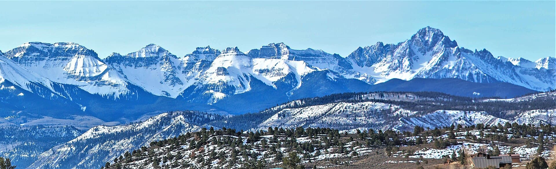
The Mount Sneffels trailhead isn't one spot, it's a decision about how far up a rough mountain road your vehicle can go. The climb starts in Yankee Boy Basin, southwest of Ouray in the San Juan Mountains, and the road into that basin is the part people underestimate. A careful passenger car can reach a lower parking area in dry weather. Getting to the upper trailhead at roughly 12,450 feet takes high-clearance four-wheel drive, a short wheelbase, and a driver who's comfortable crawling over embedded rock. Where you park decides whether Sneffels is a short morning scramble or a long day with miles of road walking tacked on.
This page is about the drive and the parking, not the climb. If you want the route beta for the Class 3 scramble, the V-notch, and the gear, that's in our complete Mount Sneffels guide. Here we're getting you up the Yankee Boy Basin road, parked in a legal spot, and pointed at the trail with a realistic idea of what your car can and can't do.
What You'll Learn
- Quick Trailhead Facts
- Where Is the Mount Sneffels Trailhead?
- Driving Camp Bird Road and Yankee Boy Basin
- Can You Make It in a Regular Car?
- The Two Trailheads: Lower and Upper
- Parking, Crowds, and Wildflower Season
- Do You Need a Permit or Reservation?
- Facilities and Cell Service
- The Blue Lakes Alternative
- When the Road Is Open
- Where People Go Wrong
- Frequently Asked Questions
Quick Trailhead Facts
- Lower parking area: around 11,300 to 11,400 ft, reachable by careful 2WD in dry conditions (vault toilet here)
- Upper 4WD trailhead: about 12,450 ft, high-clearance 4WD only
- Access road: Camp Bird Road / County Road 361, leaving US 550 about a quarter mile south of Ouray
- Vehicle: graded dirt to the lower area; the final stretch to the upper trailhead needs real clearance and 4WD
- Permit or fee: none; first come, first served
- Facilities: vault toilets at the lower parking area, no water
- Cell service: none on the road or the mountain
- Peak: Mount Sneffels (14,150 ft), Class 3 scramble
- Managing office: Ouray Ranger District, Grand Mesa, Uncompahgre and Gunnison National Forests, (970) 240-5300
- Drive time: about 6 hours from Denver to Ouray, then 45 to 90 minutes on the basin road
- Season: road usually drivable late June into October; buried in snow the rest of the year
Where Is the Mount Sneffels Trailhead?
Sneffels sits above Yankee Boy Basin, southwest of Ouray. To get there you drive US 550, the Million Dollar Highway, to the south edge of town, then turn west onto Camp Bird Road. On county maps it's County Road 361, and it leaves the highway about a quarter mile south of Ouray. That turn is your mileage zero; start your odometer there, because the trailheads up the basin are described by distance from the highway, not by any sign you can trust in the dark.
Ouray itself is the last place to fuel up, fill water bottles, and use a real bathroom. There's a vault toilet up at the lower parking area and nothing else past town, so handle all of that before you leave pavement. From Denver, budget about six hours just to reach Ouray. This is a peak you sleep near, not one you day-trip from the Front Range.
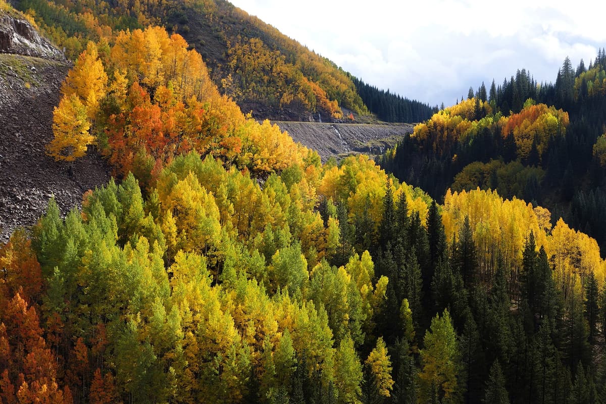
Camp Bird Road climbs the Canyon Creek drainage past the historic Camp Bird Mine, then forks and turns up into Yankee Boy Basin. The lower road is graded dirt. The upper road is a shelf-and-rock jeep route. Knowing where that transition happens is the whole game, so that's next.
Driving Camp Bird Road and Yankee Boy Basin
Here's the honest version, broken into the three stages your car will feel.
Stage one, US 550 to the Camp Bird area. The first several miles off the highway are graded dirt that a careful passenger car handles in dry weather. You'll pass the Camp Bird Mine and a shelf section that looks intimidating but is wider and smoother than its reputation. The road was regraded in the late 2010s, so a lot of older trip reports describe it as rougher than it is today. Take it slow, yield uphill, and you'll be fine through here.
Stage two, the fork into Yankee Boy Basin. Past the mine the road forks. The left branch climbs toward Governor Basin and gets rough fast; you want the right branch into Yankee Boy. This middle stretch turns rockier and looser. High-clearance two-wheel drive can usually pick its way up to the lower parking area, but a low sedan starts scraping and bottoming out here.
Stage three, the final push to the upper trailhead. The last climb to the 12,450-foot trailhead is the real four-wheeling: embedded rocks, a couple of steps that stop stock SUVs, and tight spots where a long wheelbase high-centers. This section wants high-clearance 4WD and an unhurried driver. Plenty of people with capable trucks still choose to park lower and walk it.
Trip reports disagree on exactly how far a given vehicle can go, partly because conditions change year to year and partly because "high clearance" means different things to different people. The safe read: dry graded road to the lower area for most cars, then a rough jeep road to the top for 4WD only.
Can You Make It in a Regular Car?
This is the question everyone asks in the comments, and the honest answer is "to the lower lot, probably, in dry weather, slowly." People do drive AWD crossovers and even careful sedans up to the lower parking area when the road is dry. You'll see them there. What a regular car won't do is the rocky final mile to the upper trailhead.
Here's how to think about it:
- High-clearance 4WD, short wheelbase: you can reach the upper trailhead at 12,450 feet. Go slow over the rock steps and pick your line.
- AWD crossover or SUV with decent clearance: usually fine to the lower area in dry conditions. Don't force it up the final rocky push.
- Low sedan or a car you care about: park at the lower area, or lower still if the road gets ugly, and walk from there.
If you park at the lower trailhead and hike the road to the basin, you're adding roughly three miles each way, which turns a short scramble into a full day of around eight miles round trip. That's a known, manageable trade. Getting high-centered on a rock at 12,000 feet in the dark is not. Match your parking spot to your vehicle instead of forcing it, the same rule that applies at most rough Colorado trailhead parking areas.
If you don't have the right rig at all, several Ouray-based jeep tour companies run trips up into Yankee Boy Basin through the summer. A guided ride up and a hike from the upper basin is a legitimate way to climb Sneffels without owning a trail-rated truck, and it's worth pricing out if the road is your only real obstacle.
The Two Trailheads: Lower and Upper
People talk about "the Sneffels trailhead" as if it's one place, but there are really two that matter, plus a scatter of pullouts in between.
The lower trailhead is the main parking area with the vault toilet. Sources put its elevation anywhere from about 10,700 to 11,400 feet depending on which pullout they're measuring, but the well-used lot with the restroom sits around 11,300 to 11,400 feet. This is where most two-wheel-drive and crossover drivers stop. It's also the busiest spot in the basin because it serves climbers, wildflower walkers, and sightseers all at once.
The upper trailhead sits at roughly 12,450 feet, as high as the road goes, and only high-clearance 4WD vehicles reach it. From here the standard South Slopes route to the summit is short, about 2.75 miles round trip. Starting from the lower area instead adds the road miles on both ends.
The gap between the two is what makes planning tricky. Your hiking distance, your start time, and how early you need to leave Ouray all depend on where your tires give up. Decide honestly before you drive, because turning a truck around on a narrow shelf with a line of jeeps behind you is nobody's idea of a good morning.
Parking, Crowds, and Wildflower Season
Yankee Boy Basin is one of the most famous wildflower spots in Colorado, and that changes the parking math in a way most 14er trailheads don't have to deal with. Through July, the basin fills with columbine, paintbrush, and dozens of other species, and the crowd that comes for the flowers is much bigger than the crowd climbing Sneffels. Tour jeeps, day-trippers, and photographers all compete for the same pullouts you want.
On a July weekend, the lower lot and the roadside pullouts fill early and the road gets loud with off-road traffic. If you're climbing the peak, the usual alpine start works in your favor here: be parked before sunrise and you'll beat both the flower crowd and the afternoon thunderstorms in one move. Roll in at 9 a.m. in mid-July and you may be parking well below where your vehicle could otherwise reach, then walking extra road just to get started.
One current note on parking off the road. In spring 2026, Ouray County decided against closing the upper section of the basin road to motorized traffic, and instead is working with the Forest Service and volunteers to keep drivers on the main road and off the tundra. The fragile alpine meadows above treeline recover slowly from tire tracks and trampling. Park in established pullouts, stay on the road and the trail, and don't create a new spot where there isn't one. The access stays open as long as people don't wreck the thing they came to see.
Do You Need a Permit or Reservation?
No. There's no permit, no timed-entry reservation, and no parking fee for the Mount Sneffels trailhead or the Yankee Boy Basin road. You show up, drive as far as your vehicle safely can, and park. It's first come, first served all the way up.
That's worth saying because Colorado has been adding paid systems at its busiest trailheads. Quandary Peak now runs a paid parking reservation and shuttle in summer, and Maroon Bells caps access. Sneffels and Yankee Boy Basin stay free and unregulated, which is great until the basin is jammed on a wildflower weekend. The trade-off for no reservation is no guaranteed spot, so arriving early does all the work.
Camping in the drainage is more restricted than parking. In the Canyon Creek corridor you drive up to reach the basin, camping has been limited to a small number of designated sites since the early 2000s, so you can't just pull off and pitch a tent anywhere. If you want to sleep near the mountain to acclimate, book a spot in Ouray or use one of the designated sites rather than improvising.
Facilities and Cell Service
There are vault toilets at the lower parking area and nothing higher up. No water, no trash service, no visitor center. Pack out everything, and carry all the water you'll need for the day, because there's none you can count on at the trailhead or on the route.
Cell service is nonexistent on the basin road and on the mountain, so download your maps before you leave Ouray and tell someone your plan. A paper San Juan Mountains trail map is cheap insurance when your phone won't load anything and the battery is dying in the cold. And because almost everyone starts in the dark to beat the weather, a hiking headlamp isn't optional here.
The Blue Lakes Alternative
Yankee Boy Basin is the short, popular way up Sneffels, but it's not the only one. The Blue Lakes trail approaches the mountain from the south, out of the Dallas Creek drainage near Ridgway, and climbs past a string of alpine lakes to Blue Lakes Pass before joining the upper terrain.
That route is longer and gains more total elevation, and the upper section is still loose Class 3. What you get for the extra effort is one of the prettiest backpacking approaches in the state and a trailhead that avoids the jeep traffic entirely. If the Yankee Boy Basin road is a dealbreaker for your vehicle, or you just want to slow down and camp at the lakes, read our Blue Lakes trail guide and plan it as an overnight. Either way, you're climbing the same summit from the same range.
When the Road Is Open
The Yankee Boy Basin road is a summer proposition. It's buried in snow through winter and spring and usually isn't drivable to the upper trailhead until late June, later after a heavy snow year. A rough rule of thumb from recent seasons has the upper road open from roughly late June into mid-October, but that shifts every year with snowpack and weather, so check current conditions before you commit.
The best single source for day-to-day road status is 14ers.com, where climbers post what they found on the drive, and the Ouray Ranger District at (970) 240-5300 for official closures. Even in July, snow can linger in the summit gully, so early-season climbers carry microspikes and know how to use an ice axe. Outside the summer window the trailhead doesn't vanish, it just gets harder to reach: you park where the plowing or the snowline stops and travel the road on foot, skis, or snowshoes, which turns Sneffels into a much bigger and more serious day.
Where People Go Wrong
The same handful of mistakes show up in trip report after trip report:
- Forcing a low car past the lower lot. The road to the upper trailhead is a jeep route. Sedans and soft crossovers scrape, dent, and sometimes get stuck. Park at the lower area and walk the road.
- Underestimating the drive. It's about six hours from Denver to Ouray, then up to 90 minutes on the basin road. People who treat Sneffels like a Front Range day trip arrive exhausted or too late.
- Parking on the tundra. Pull-offs above treeline look like fair game, but the alpine meadow doesn't recover. Use established pullouts only, and keep access open for everyone.
- Going too late in the day. Afternoon thunderstorms build over the San Juans, and the summit scramble is exposed. Be parked before dawn and off the top by midday.
- Bringing no water. There's none at the trailhead and none on the route. Fill up in Ouray.
- Underrating the altitude. The upper trailhead starts at 12,450 feet. Sleep near Ouray's elevation first and read up on altitude sickness before you go.
Get the drive and the parking sorted and Sneffels is one of the finest summits in the San Juans. For the climb itself, section by section, read our complete Mount Sneffels guide.
Frequently Asked Questions
Can you drive to the Mount Sneffels trailhead?
Partway in most vehicles, all the way only in high-clearance 4WD. A careful 2WD or AWD car can reach the lower parking area around 11,300 feet in dry conditions. The final rocky push to the upper trailhead at about 12,450 feet needs real clearance and four-wheel drive. Many people park lower and walk the road the rest of the way.
Do you need 4WD for Yankee Boy Basin?
For the lower parking area, no, a careful crossover or sedan makes it in dry weather. For the upper 4WD trailhead at roughly 12,450 feet, yes. That last stretch has embedded rocks and steps that stop stock SUVs, so it wants high-clearance 4WD and a short wheelbase. If you don't have that, park lower or book a jeep tour from Ouray.
How long is the Mount Sneffels hike from the lower trailhead?
From the upper 4WD trailhead the standard route runs about 2.75 miles round trip. Starting from the lower parking area adds roughly three miles of road each way, which makes it about eight miles round trip and a much longer day. Your mileage depends entirely on how far up the road you can safely drive.
Where do you park for Mount Sneffels?
The main lot is the lower parking area with the vault toilet, around 11,300 to 11,400 feet, where most non-4WD vehicles stop. Capable 4WD trucks continue to the upper trailhead at about 12,450 feet. On busy wildflower weekends in July, both fill early, so arrive before sunrise.
When does the Yankee Boy Basin road open?
The upper road is usually drivable from late June into mid-October, though the exact dates shift every year with snowpack. It's closed by snow the rest of the year. Check 14ers.com for recent road reports and call the Ouray Ranger District for official status before you drive.
Final Thoughts
The Mount Sneffels trailhead question is really a road question. The scramble is short and the summit is spectacular, but the Yankee Boy Basin road decides how your day goes. Know what your vehicle can handle, park where it's comfortable instead of forcing the rocky upper section, get there before the wildflower crowd and the afternoon storms, and stay on the road to protect the tundra that makes the place worth visiting.
Once you're parked, the mountain takes over. For the route up the South Slopes, the V-notch, and the gear you'll want, read our complete Mount Sneffels guide. And when you're back in town, an evening soak at the Ouray Hot Springs pool is the right way to end a San Juan summit day.
Get the Colorado 14er Packing Checklist (free PDF)
Plus a weekly note on the best Colorado trails, gear deals, and seasonal hike picks. No spam, unsubscribe anytime.
We respect your inbox. Unsubscribe anytime.