Guanella Pass, Colorado: Scenic Byway, Best Hikes, and Where to See Moose (2026)
Guanella Pass is a 22-mile paved scenic byway that climbs over the Continental Divide between Georgetown and Grant, topping out at 11,669 feet. It's one of the easiest ways in Colorado to drive from a mountain town straight up into open alpine tundra, and it packs a lot into a short trip: the trailhead for Mount Bierstadt, a cluster of alpine lakes, gold aspens in the fall, and willow flats near the summit where moose show up almost daily at dawn and dusk.
The pass sits about 50 minutes west of Denver, which makes it a rare high-country destination you can reach before the coffee wears off. You can drive the whole thing in a regular car, park at the top, and be standing above treeline in the time it takes most trailheads to even get started. Whether you want a 14er, a family-friendly lake walk, a moose photo, or just a drive with a lot of payoff per mile, Guanella Pass delivers.
This guide covers the drive itself, current road conditions, the best hikes off the pass, where to spot wildlife, when the aspens peak, camping options, and what winter looks like up here.
What you'll learn
- Quick facts for the byway and the pass
- Driving the Guanella Pass byway from Georgetown to Grant
- Is the road open, paved, and easy to drive?
- The best hikes off Guanella Pass
- Seeing moose and mountain goats
- Fall colors on the pass
- Camping near Guanella Pass
- Guanella Pass in winter
- What to bring
- FAQs
Quick facts {#quick-facts}
| Detail | Guanella Pass |
|---|---|
| Byway length | ~22 miles (Georgetown to Grant) |
| Pass summit elevation | 11,669 ft |
| Surface | Fully paved |
| Season | Open year-round (plowed in winter) |
| Nearest towns | Georgetown (north), Grant (south) |
| Drive time from Denver | ~50 minutes to Georgetown |
| Headline hike | Mount Bierstadt (14,060 ft) |
| Best for | 14ers, alpine lakes, moose, fall aspens |
| Restrooms | Vault toilets at the summit trailhead |
| Fees | None to drive; campgrounds cost |
The pass is named for Byron Guanella, a longtime Clear Creek County commissioner and road supervisor who pushed to keep the route open. The byway is a designated Colorado Scenic and Historic Byway, and it links two national forests, the Arapaho on the Georgetown side and the Pike on the Grant side.
Driving the Guanella Pass byway {#the-drive}
Most people start from Georgetown, an old mining town right off I-70 at exit 228. Roll through town, follow the Guanella Pass signs, and the road starts climbing almost immediately. The Georgetown side is the steeper, twistier half. It switchbacks up past Clear Lake and the Cabin Creek hydro reservoir, then works through spruce and fir before breaking out into the open near the top.
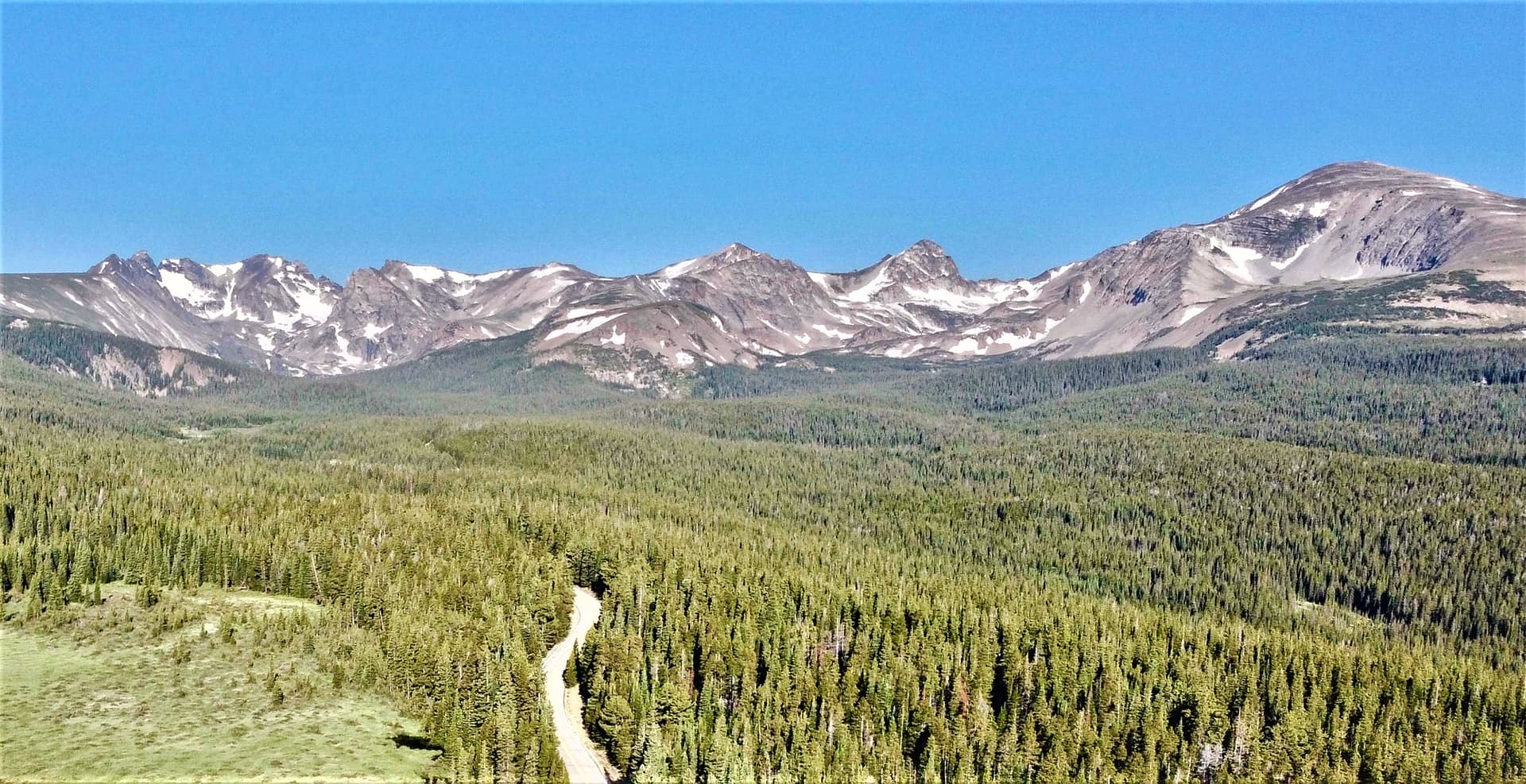
The summit is the star. At 11,669 feet you're well above treeline, with Mount Bierstadt and the jagged Sawtooth ridge filling the view to the east and Square Top Mountain rising to the west. There's a large trailhead parking lot here with vault toilets, and it doubles as the launch point for the pass's two most popular hikes.
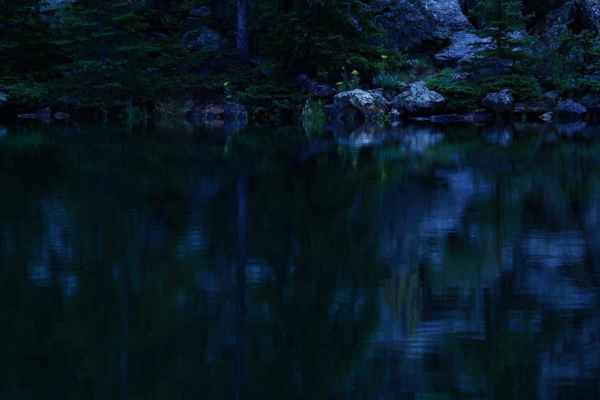
The south side, dropping toward Grant and US 285, is gentler and greener. It runs down through aspen groves and along Geneva Creek, past a few campgrounds, and it's the prettier half in late September when the leaves turn. Driving the full byway end to end takes about 45 minutes to an hour without stops, but nobody does it without stops. Give yourself two to three hours if you want to pull over for photos, walk to a lake, or sit and watch the willows for moose.
If you're not doing a full traverse, the out-and-back from Georgetown to the summit and back is the easy move. It's roughly 12 miles each way and gets you to the best scenery and the main trailheads.
Is the road open, paved, and easy to drive? {#road-conditions}
Good news on all three counts. The last gravel stretches were paved around 2015, so the entire byway is now blacktop. Any passenger car handles it fine in summer. The road is narrow and winding in spots, especially on the Georgetown side, so take the curves slow and use the pullouts to let faster traffic by.
The road stays open year-round. Clear Creek and Park counties plow it through the winter, which is unusual for a high Colorado pass and part of what makes Guanella such a reliable four-season destination. That said, winter driving is a different animal. Expect packed snow and ice above the trees, carry chains or run good snow tires, and check the forecast before you commit to the top.
One note on the spur roads. The byway itself is easy, but a couple of the side roads that branch off it are not. Naylor Lake Road, the short spur up to the Silver Dollar Lake trailhead, is a rough, potholed track that really wants high-clearance four-wheel-drive. Most cars should park at the pullout on the main road and walk it. Stick to the paved byway and you'll never have a problem.
The best hikes off Guanella Pass {#best-hikes}
The summit parking lot is one of the best trailhead hubs in the Front Range. From this single spot you can pick a 14er, a moderate lake hike, or a long wilderness slog, and there are more options a few miles down the road.
Mount Bierstadt (14,060 ft). This is the reason most hikers come. The West Slopes route starts right at the pass summit, runs about 7 miles round trip with roughly 2,850 feet of gain, and stays Class 2 the whole way. It's widely considered one of the friendliest first 14ers in Colorado, which also means it gets crowded on summer weekends. Start at or before dawn to grab parking and beat the afternoon storms. Our full Mount Bierstadt guide breaks down the route, the willow crossing at the start, and the notorious Bierstadt weather. If you're new to high peaks, read our Colorado 14ers guide first.
Square Top Lakes. Directly across the parking lot from the Bierstadt trail, a gentler path heads west toward two alpine lakes tucked below Square Top Mountain (13,794 feet). It's about 3.5 miles round trip to reach both lakes, with modest elevation gain, making it the mellower, family-friendlier option from the summit. Strong hikers use the lakes as a launch pad to scramble Square Top itself.
Silver Dollar and Murray Lakes. A few miles below the summit on the Georgetown side, these two lakes deliver a big alpine payoff for short mileage. The catch is the rough spur road to the upper trailhead. We cover the whole thing, including where to actually park, in our Silver Dollar Lake trail guide. It pairs nicely with our roundup of the best alpine lakes in Colorado.
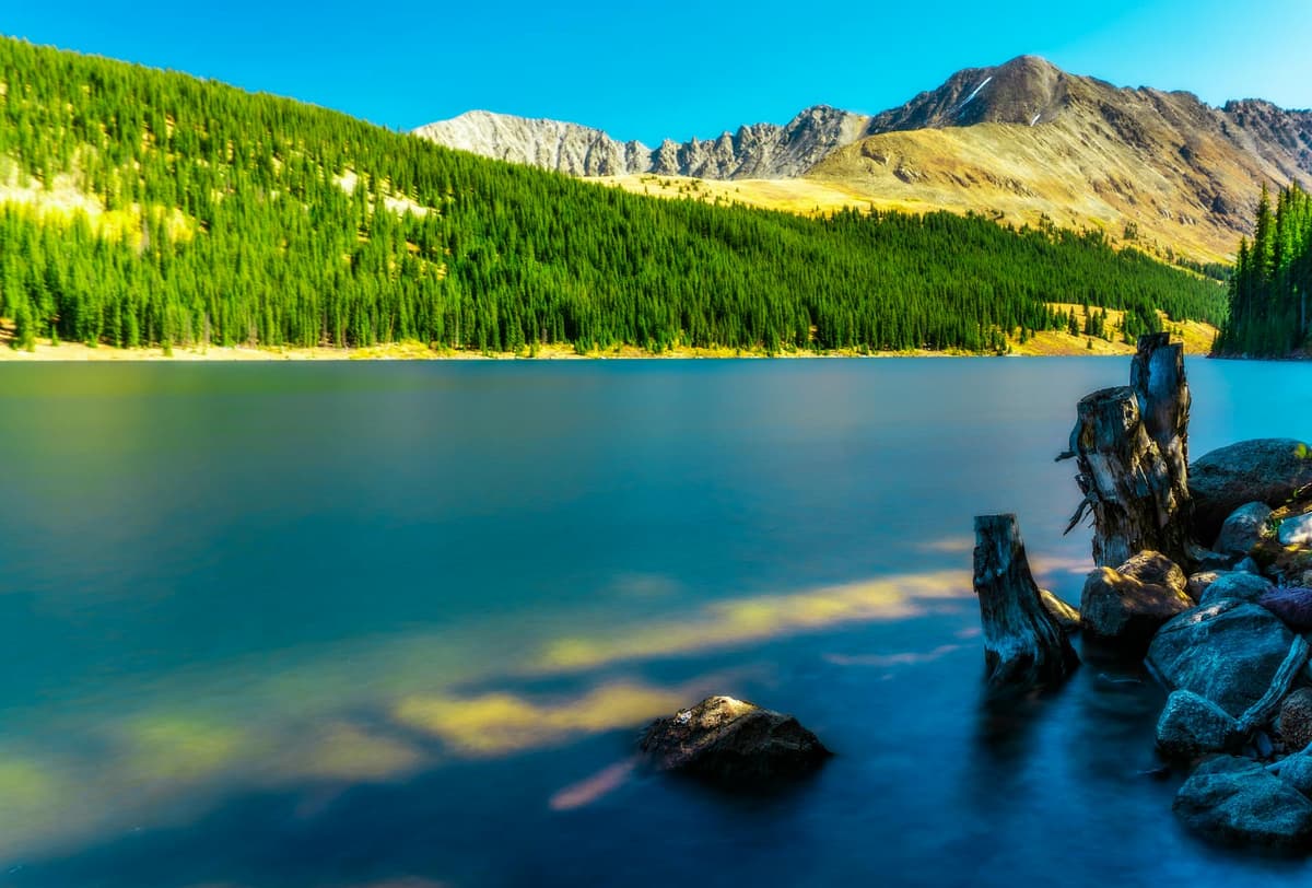
Abyss Lake. For a big day, the Abyss Lake Trail leaves the Grant side and pushes about 16 miles round trip deep into the Mount Blue Sky Wilderness, ending at a lake wedged between Bierstadt and Mount Blue Sky. It's long, strenuous, and far quieter than anything at the summit. Save it for when you're acclimatized and want solitude.
The Sawtooth. Experienced scramblers link Bierstadt to Mount Blue Sky (renamed from Mount Evans in 2023) across the Sawtooth, a Class 3 ridge that's the jagged skyline you see from the parking lot. It's a serious route with exposure and route-finding, not a casual add-on. If Mount Blue Sky is on your list, start with our Mount Evans and Mount Blue Sky guide.
Because so many trails start high here, altitude hits harder than the mileage suggests. If you're coming from sea level, give yourself a day or two up high first and know the warning signs from our altitude sickness guide.
Seeing moose and mountain goats {#wildlife}
Guanella Pass is one of the most dependable places in Colorado to see moose from your car. The willow flats near the summit, especially the marshy basin around the Bierstadt trailhead, are prime moose habitat. Early morning and the hour before sunset are your best windows. Drive slow, scan the willows, and you'll often spot one browsing within a couple hundred yards of the road.
Give moose a lot of room. They look calm, but they're large, fast, and more dangerous than most people expect, especially cows with calves in early summer and bulls during the fall rut. Stay in or near your vehicle, keep dogs leashed and quiet, and never try to close the distance for a photo. A pair of compact binoculars or a zoom lens is the right way to get a close look.
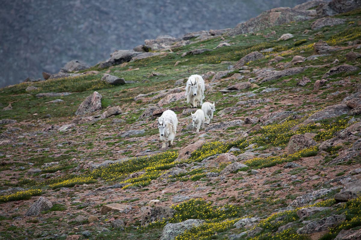
Higher up in the rocks, mountain goats and the occasional bighorn sheep pick their way across the tundra, particularly around Square Top and the Silver Dollar basin. Same rules apply: watch, don't feed, and keep your distance. You'll also hear marmots whistling and pikas squeaking from the talus all summer.
Fall colors on the pass {#fall-colors}
Late September turns Guanella Pass into one of the better leaf-peeping drives near Denver. The summit itself is above treeline, so the aspens live on the approaches: the lower Georgetown side and, even better, the Grant side dropping down along Geneva Creek. When the timing lines up, you get gold aspens in the valleys framed against the tundra and early snow up high.
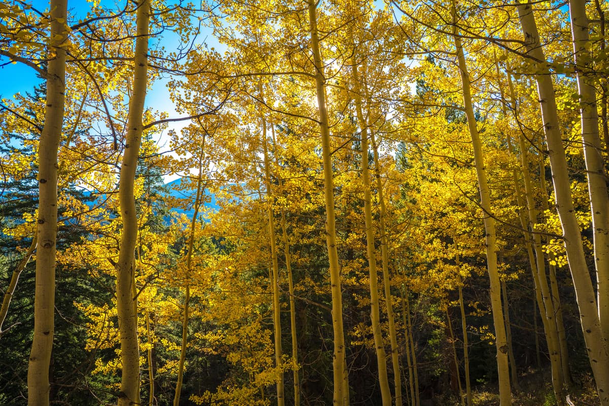
Peak color usually lands somewhere from mid to late September, though it shifts a week either way depending on the year. Weekends during peak get busy, so go early or go midweek if you can. The full byway drive is ideal in fall because the two sides peak at slightly different times, giving you a longer window to catch good color. For more of these, see our list of the best places to visit in Colorado in summer and fall.
Camping near Guanella Pass {#camping}
There are a few ways to spend the night up here. The Guanella Pass Campground sits near the top on the Grant side at around 10,900 feet, with a couple dozen sites that book up fast in summer and are worth reserving ahead on recreation.gov. Lower down on the Georgetown side, Clear Lake and a handful of other Forest Service campgrounds put you closer to town.
If you'd rather go free and quiet, dispersed camping is allowed in parts of the national forest along the byway, following the usual Leave No Trace rules and any posted restrictions. We cover how to do it right, including finding legal spots and fire regulations, in our Colorado dispersed camping guide. Camping at the pass also means you're at the Bierstadt trailhead for a true alpine start, which is a real advantage on busy summer weekends.
Guanella Pass in winter {#winter}
Because the road stays plowed, Guanella Pass is a genuine winter playground and not just a summer stop. Once the snow settles, the summit turns into a hub for snowshoeing, backcountry skiing, and even winter 14er attempts on Bierstadt for well-equipped mountaineers.
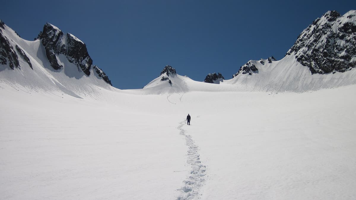
For most visitors, snowshoeing is the move. Silver Dollar Lake and the gentler terrain near the summit are popular beginner routes once conditions are stable. Just remember that plowed road access does not mean the slopes are safe. Avalanche terrain is real up here, so check the Colorado Avalanche Information Center forecast before you head out and stay on low-angle ground unless you know how to assess the risk. New to it? Start with our beginner snowshoeing guide and our roundup of the best snowshoes for Colorado. Winter driving to the top also demands snow tires or chains and a careful eye on the weather.
What to bring {#what-to-bring}
Guanella Pass puts you above 11,000 feet in a hurry, so pack for high-country conditions even on a short outing.
- Layers and a rain shell. Summer mornings start cold up here, and storms build fast most afternoons. A packable rain jacket is a must. Our what to wear hiking guide lays out the layering system.
- Sun protection. There's little shade above treeline. Sunscreen, sunglasses, and a brimmed hat matter here because the UV is intense at altitude.
- Trekking poles. They help on the steeper lake and peak climbs and save your knees coming down. See our trekking poles roundup or grab a basic set of collapsible trekking poles.
- Binoculars. For the moose and goats, a compact pair turns a distant speck into the highlight of the trip.
- Traction in shoulder season. Snow lingers into early summer and comes back early in fall. A set of hiking microspikes is smart insurance, covered in our microspikes guide.
- Water and snacks. There's no water or food at the summit, so bring plenty. Fuel up in Georgetown before you drive up.
FAQs {#faqs}
Is Guanella Pass Road open year-round? No. Both counties close the road over the summit from about the week after Thanksgiving until Memorial Day weekend, at the Naylor Lake gate on the Georgetown side and the Burning Bear gate on the Grant side; the lower stretches stay plowed. Is Guanella Pass paved?
Yes. The last gravel sections were paved around 2015, so the full 22-mile byway from Georgetown to Grant is now blacktop. A regular passenger car handles the drive fine in summer. The road is narrow and curvy in places, so take it slow.
Can you see moose at Guanella Pass?
Very often, yes. The willow flats near the summit are prime moose habitat, and dawn and dusk are the best times to spot them. Keep your distance, stay near your vehicle, and use binoculars or a zoom lens rather than approaching. Moose are large and can be dangerous.
How high is Guanella Pass?
The summit sits at 11,669 feet, well above treeline. Most of the trailheads at the top start above 11,000 feet, so the altitude affects your hike more than the mileage suggests. Acclimatize first if you're coming from lower elevation.
What is there to do at Guanella Pass?
Drive the scenic byway, hike Mount Bierstadt or the Square Top Lakes, walk to Silver Dollar Lake, watch for moose and mountain goats, catch fall aspen color in late September, and camp or snowshoe depending on the season. It's one of the most versatile high-country destinations near Denver.
Final word
Guanella Pass is about as much high country as you can reach for as little effort, a paved drive that dumps you above treeline with a 14er, alpine lakes, and moose all within a few minutes of the same parking lot. Come early for the crowds and the storms, respect the altitude and the wildlife, and pick the season that fits what you want, whether that's July wildflowers, September gold, or a quiet winter snowshoe. For more options close to the city, start with our best day hikes near Denver.
Get the Colorado 14er Packing Checklist (free PDF)
Plus a weekly note on the best Colorado trails, gear deals, and seasonal hike picks. No spam, unsubscribe anytime.
We respect your inbox. Unsubscribe anytime.