Mount Bierstadt: A Complete Guide to Colorado's Most Accessible 14er
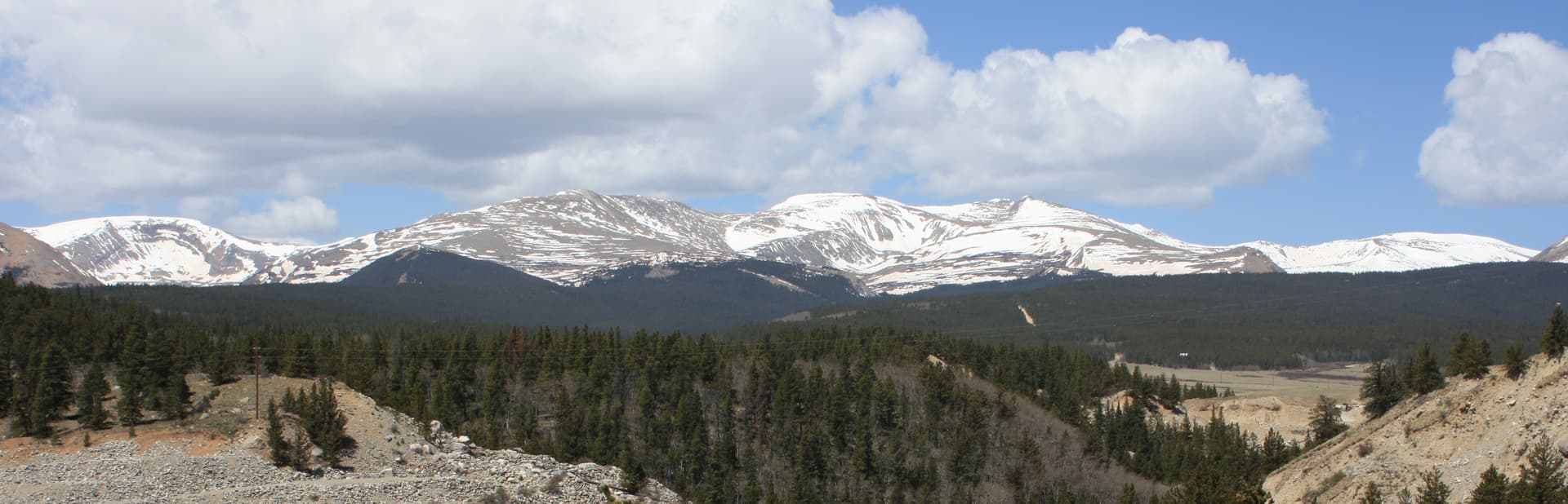
Mount Bierstadt is the most-climbed 14er in Colorado. Roughly 18,000 people summit it every year. It sits 14,060 feet above sea level, 90 minutes from Denver, with a trailhead at 11,669 feet. From the parking lot to the summit and back is 7 miles round trip with 2,850 feet of elevation gain. For a first 14er, it's the standard pick for good reason.
This isn't a hike to take lightly. It's still a 14er. People die on it. Lightning, falls, hypothermia, altitude sickness, and getting lost in afternoon weather are real risks. But with reasonable preparation and a 4 AM start, Mount Bierstadt is achievable for fit hikers without technical climbing experience.
This guide covers the route, the gear, the timing, and the decisions you'll need to make.
What You'll Learn
- Quick Stats: Mount Bierstadt at a glance
- Getting to the Trailhead
- The Route, Section by Section
- What to Pack
- Timing and Weather Strategy
- When to Climb Mount Bierstadt
- What to Expect at the Summit
- The Sawtooth Traverse Option
- Common Mistakes That Get People in Trouble
Quick Stats: Mount Bierstadt at a glance
- Elevation: 14,060 ft
- Trailhead: Guanella Pass, 11,669 ft
- Round Trip Distance: 7.0 miles
- Elevation Gain: 2,850 ft
- Class: Class 2 (no technical climbing, some hand use on summit boulders)
- Difficulty: Easy by 14er standards. Strenuous by hiking standards.
- Time: 5-8 hours typical
- Best Season: Mid-June through September
- Permit: None required for day hiking
- Crowds: Heavy on weekends from June through September
Getting to the Trailhead
The Guanella Pass trailhead sits on Guanella Pass Road between Georgetown (north) and Grant (south). From Denver, the standard approach is:
- I-70 west to Georgetown exit 228
- Through downtown Georgetown
- Guanella Pass Road south (paved the whole way)
- 11 miles to Guanella Pass summit
The drive from Denver takes 90 minutes in good conditions. Add 15 minutes for traffic on summer weekends. The road is paved and passable in any vehicle. In winter, the road is closed past the South Clear Creek Picnic Area, making the trail a 26+ mile commitment.
Parking: The summit pass parking lots fill by 6 AM on summer weekends. Arrive earlier or park at overflow lots and walk up. There's no permit fee; parking is first-come.
Restrooms: Pit toilets at the trailhead, no running water. Bring everything you need.
Cell service: Spotty at the trailhead, generally absent above treeline.
The Route, Section by Section
The Mount Bierstadt standard route is the West Slopes from Guanella Pass. It's well-defined and heavily traveled, so navigation is generally straightforward in good visibility.
Section 1: Trailhead to Willow Creek (Miles 0-1.0)
From the parking lot, the trail descends slightly through willow flats. This is the easiest section. The wooden plank boardwalks added in 2008 keep you out of the bog. Some hikers underestimate this section because it's downhill at the start; on the return, you'll be climbing 200 feet back to the parking lot when you're already tired.
Watch for moose in the willows, especially at dawn. Give them 50+ yards of distance. Moose are responsible for more injuries in Colorado than bears.
Section 2: Willow Creek Crossing (Mile 1.0)
The bridge over Willow Creek marks the transition from valley to climb. This is the last reliable water source on the route; you'll need to carry all the water you'll need for the climb (plan 2-3 liters minimum).
After the bridge, the trail begins climbing in earnest. The grade is moderate (10-15%) through grass and small pine.
Section 3: The Long Climb (Miles 1.0-3.0)
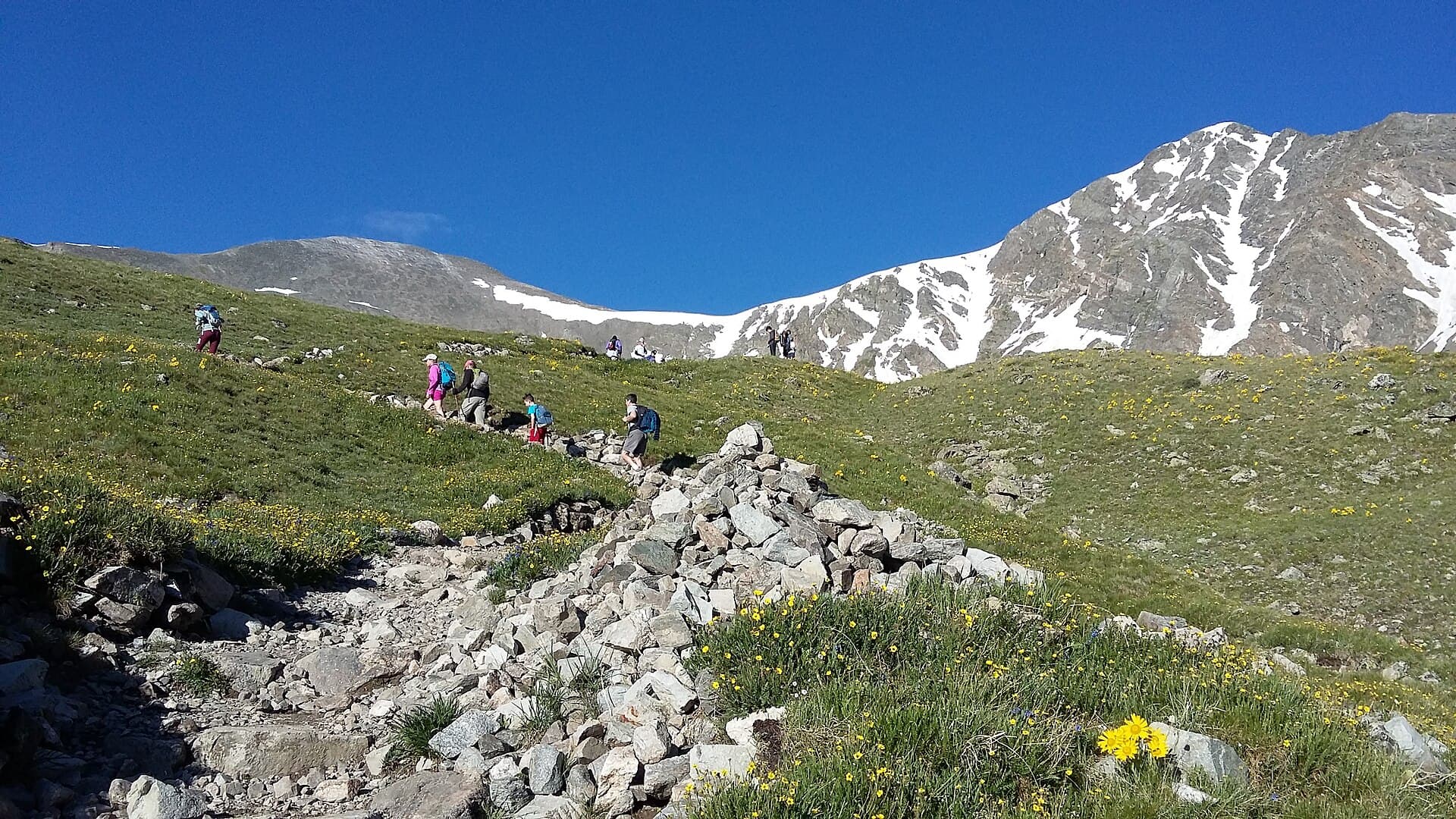
The bulk of the elevation gain happens here. You'll switchback up the west face of Bierstadt through grass, then talus, then larger rock. The trail is well-defined but exposed to wind from the west.
Pace yourself. This is where altitude hits people. Your heart rate will be higher than the same effort at sea level. If you feel dizzy or nauseous, stop, drink, eat a snack, and reassess. Acute mountain sickness will not improve by pushing harder.
Around 13,500 feet you'll cross into alpine talus. The trail becomes rockier but still well-marked with cairns.
Section 4: The Summit Ridge (Miles 3.0-3.5)
The last 500 feet to the summit transitions to Class 2 boulder hopping. You'll use hands occasionally for balance on large rocks. There's no technical climbing or exposure that would worry a comfortable scrambler. The route is well-cairned; follow the cairns rather than picking your own path.
Section 5: The Summit (Mile 3.5)
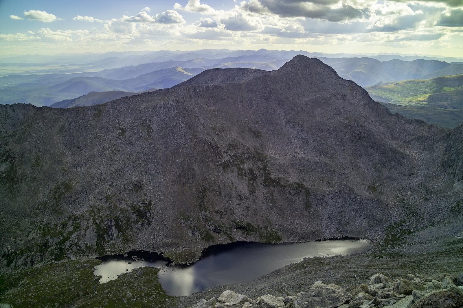
A small rock cairn marks the true summit. Views span Mount Evans (now called Mount Blue Sky) to the east, the Front Range to the north, and South Park to the south. On a clear day you can see the Sangre de Cristos to the south.
There's room for 10-15 people at the summit. On summer weekends, expect to share it.
Section 6: The Return (Miles 3.5-7.0)
Return on the same route. Descending feels easier on your lungs but harder on your knees. Trekking poles save knees on the talus sections. Don't let the descent lull you; people fall on the descent more than the ascent because they're tired and complacent.
Re-cross Willow Creek (still no usable water for filtering after a popular weekend). Climb back up to the parking lot.
What to Pack
The non-negotiables for Mount Bierstadt:
Water. 2.5-3 liters minimum. There's no usable water source after the Willow Creek crossing for the rest of the climb. An insulated water bottle (Hydro Flask 32oz or similar) keeps water from freezing if you're alpine starting in May or October.
Food. 800-1200 calories of trail food. Energy bars, trail mix, sandwiches, jerky. Eat regularly during the climb (every 45-60 minutes). Altitude reduces appetite; you need to eat anyway.
Layers. The temperature delta from trailhead to summit can be 30°F. Start with a base layer + light insulation. Add a wind shell + warm layer for the summit. See our base layers guide.
Rain shell. Waterproof rain jacket is required, not optional. Afternoon thunderstorms are a real threat.
Sun protection. UV at 14,000 feet is dramatically stronger than at sea level. Sunglasses (preferably wraparound), sunscreen on every exposed surface (including ears and the back of your neck), hat or visor.
Headlamp. For your alpine start. Petzl Actik Core or Black Diamond Spot 400.
Footwear. Sturdy hiking boots or trail runners. The talus section above 13,500 ft punishes thin shoes. See our hiking boots guide.
Map and offline GPS. Cell service is unreliable. Pre-download the route on Gaia GPS or AllTrails before leaving Denver.
First aid basics. Blister treatment, ibuprofen, electrolytes.
Trekking poles. Not required but save your knees on the descent.
Helmet. Optional for the standard route. Required if you're attempting the Sawtooth traverse to Mount Blue Sky.
Timing and Weather Strategy
The single most important rule for Mount Bierstadt: be off the summit by noon.
Colorado afternoon thunderstorms typically build between 11 AM and 2 PM in summer. Lightning strikes above treeline are the leading cause of weather-related deaths on 14ers. The trail is exposed for the entire upper half; there's no shelter from a storm.
Recommended timing:
- Trailhead: 5 AM (earlier in July/August monsoon season)
- Treeline (12,500 ft): 7 AM
- Summit: 9-10 AM
- Back below treeline: 11 AM
- Trailhead: 1 PM
For a 4 AM trailhead start, leave Denver by 2 AM. Most hikers find this brutal but worth it. Late starts are the most common reason people get caught in storms.
Check the forecast at forecast.weather.gov for the closest mountain weather forecast. The summit-area forecast for Mount Bierstadt is under "Idaho Springs / Georgetown" or similar. Look for:
- Storm probability above 30%: reconsider the day
- High temperature below 30°F at the summit: wear winter layers
- Wind speed above 30 mph: consider another day
When to Climb Mount Bierstadt
Best months: Late June through mid-September.
June: Snow still in upper sections through mid-June most years. Microspikes useful early in the month. By late June, dry conditions for most years.
July: Peak season. Monsoon season starts mid-July. Storms build earlier in the day; start by 4 AM.
August: Peak monsoon. Storms reliable by 11 AM most days. Strict noon-off-the-summit rule.
September: Best weather of the season. Cooler, drier. Some early snow possible after mid-September.
October: Increasingly snowy. Doable in early October with proper gear. By late October, winter conditions.
November-May: Winter mountaineering conditions. Snowshoes or skis required. Avalanche risk in spots. Not recommended for non-mountaineers.
What to Expect at the Summit
The summit is a small rocky plateau, big enough for 10-15 people comfortably. There's a benchmark marker (the small bronze disc) at the true summit. Take a picture, eat a snack, take in the view.
Temperatures at the summit are typically 25-35°F colder than the trailhead. Even on a 70°F day in Georgetown, summit temperatures with wind can be in the 30s. Bring the warm layer you packed.
Wind speed at the summit is reliably 10-30 mph. Anything above that and most people find the summit uncomfortable.
Photos: get the summit cairn shot, the directional sign (when present), and the panorama. Selfie sticks work but watch your footing.
Time at the summit: 15-30 minutes is typical. Don't linger if weather is building.
The Sawtooth Traverse Option
The "Sawtooth" is the connecting ridge between Mount Bierstadt and Mount Blue Sky (formerly Mount Evans). It's a Class 3 ridge traverse that lets fit, experienced scramblers bag two 14ers in one day.
Requirements:
- Helmet
- Experience with Class 3 scrambling
- Comfortable with 1,000-foot drop-offs on either side
- Good route-finding skills
Distance: Adds 2-3 hours to the round trip
Difficulty: Significantly harder than standard Bierstadt route
Risk: Real falling exposure in places
Most hikers don't need to attempt the Sawtooth on their first 14er. Save it for after you've climbed several Class 2 peaks and feel solid on rock.
Common Mistakes That Get People in Trouble
Starting too late. A 7 AM trailhead start puts you at the summit at noon, dangerously close to storm window.
Underestimating altitude. Bierstadt's trailhead is at 11,669 feet. If you've flown in from sea level the day before, plan to stay in Denver for at least one night before attempting. Two nights is better.
Not bringing enough water. People run out at the summit, get dehydrated on the descent, then struggle to walk out.
Wearing cotton. Cotton stays wet, drains heat, leads to hypothermia. Wool or synthetic only.
Skipping the rain jacket. A 15-minute storm at 13,500 feet without a shell can lead to hypothermia.
Pushing through altitude sickness. Nausea, dizziness, severe headache mean turn around. Pushing higher makes it worse, not better.
Ignoring the moose. Moose injuries are more common than bear injuries in Colorado. Give them space.
Letting kids go ahead unsupervised. Stay together on the route.
Other 14ers to Consider
If Mount Bierstadt is your first 14er and goes well, the natural next steps are:
- Grays Peak and Torreys Peak: Two 14ers in one day, 90 minutes from Denver. See our Grays Peak guide.
- Quandary Peak: Solo 14er from Breckenridge, comparable difficulty to Bierstadt. See our Quandary Peak guide.
- Mount Elbert: The highest 14er in Colorado, longer than Bierstadt but no technical climbing. See our Mount Elbert guide.
For the full list of 14ers ranked by difficulty for beginners, see our easiest 14ers guide.
Final Thoughts
Mount Bierstadt is achievable for fit hikers without technical climbing experience. It's also a real 14er with real risks. The combination of accessibility (90 minutes from Denver), low technical difficulty (no climbing), and clear route makes it the ideal first 14er for most people.
The keys to a successful climb: alpine start, watch the weather, pace yourself for altitude, and respect the descent. Get those right and Bierstadt is one of the most rewarding day hikes in Colorado.
For the full gear setup, see our guides to hiking boots, rain jackets, layering, and headlamps.
Get the Colorado 14er Packing Checklist (free PDF)
Plus a weekly note on the best Colorado trails, gear deals, and seasonal hike picks. No spam, unsubscribe anytime.
We respect your inbox. Unsubscribe anytime.