Mount Evans (Mount Blue Sky): Complete Guide to Colorado's Drive-Up 14er

Mount Evans is the only 14er in Colorado you can reach without hiking a step. A paved road climbs from Idaho Springs to a parking lot at 14,130 feet, and from there it's a quarter-mile walk to the 14,265-foot summit. That road, the Mount Blue Sky Scenic Byway, is the highest paved road in North America. It's the reason this peak sees more casual visitors than any other Colorado fourteener.
The mountain got a new official name in 2023. It's now Mount Blue Sky, though most maps, signs, and search results still say Mount Evans. Both names point to the same summit east of Idaho Springs, and this guide uses them interchangeably.
Whether you plan to drive up, hike from Summit Lake, or climb the full west ridge on foot, here's what you need to know before you go.
What You'll Learn
- Quick Stats: Mount Evans (Mount Blue Sky) at a Glance
- Why Mount Evans Is Now Called Mount Blue Sky
- Can You Drive to the Top? The Scenic Byway
- Do You Need a Reservation?
- Hiking to the Summit from the Top Parking Lot
- The Chicago Lakes Trail from Echo Lake
- Climbing It as a 14er: The West Ridge and Sawtooth
- Mount Goliath and the Ancient Bristlecone Pines
- Wildlife You'll See
- What to Pack
- When to Go and How the Altitude Hits
- Common Mistakes to Avoid
Quick Stats: Mount Evans (Mount Blue Sky) at a Glance
- Elevation: 14,265 ft
- Official name: Mount Blue Sky (renamed 2023; formerly Mount Evans)
- Location: Arapaho National Forest, east of Idaho Springs
- Top parking lot: 14,130 ft, about 130 vertical feet below the summit
- Summit walk from parking: roughly 0.25 mile one way, Class 2 rock
- Road: Colorado Highway 5, highest paved road in North America
- Drive from Denver: about 90 minutes to the summit lot in good conditions
- Season for the upper road: late May through early September, weather permitting
- Fee: yes, plus a timed-entry reservation in recent seasons (check current status)
- Best for: casual visitors, families, wildlife watching, and peak baggers who want a short summit day
Why Mount Evans Is Now Called Mount Blue Sky
In September 2023, the U.S. Board on Geographic Names changed the peak's official name from Mount Evans to Mount Blue Sky. The change came after years of work by the Cheyenne and Arapaho Tribes and other groups.
The old name honored John Evans, Colorado's second territorial governor. Evans was in office during the 1864 Sand Creek Massacre, when U.S. troops killed more than 150 Cheyenne and Arapaho people, most of them women, children, and elders. A state investigation later found Evans responsible for creating the conditions that led to the killings.
"Blue Sky" carries a different meaning. The Arapaho people are sometimes called the Blue Sky People, and the name ties to a Cheyenne ceremony. The Tribes proposed it as a name that honors the land's original stewards rather than a figure connected to their ancestors' deaths.
You'll still see "Mount Evans" almost everywhere, from trail signs to older maps to the name of the road most locals use. The transition takes years. Both names refer to the same mountain, so don't let the mismatch confuse you when you're planning.
Can You Drive to the Top? The Scenic Byway
Yes, and that's what makes this peak unusual. The Mount Blue Sky Scenic Byway (Colorado Highway 5) branches off Highway 103 at Echo Lake and climbs about 14 miles to the summit parking lot at 14,130 feet. No other paved road in North America goes higher.
From Denver, the drive is straightforward:
- I-70 west to Idaho Springs, exit 240
- Colorado Highway 103 south toward Echo Lake (about 13 miles, 10,600 ft)
- Turn onto Highway 5, the toll road, and climb to the summit lot
Plan on about 90 minutes from Denver to the top in good conditions, plus stops. The road is narrow, has no guardrails in places, and stacks switchback on switchback above treeline. Drive it in daylight, keep both hands on the wheel, and use low gear on the way down to save your brakes. If heights bother you, the passenger seat on the way up puts you on the inside.
The upper road is seasonal. It typically opens around Memorial Day weekend and closes after Labor Day, though the exact dates shift with snow every year. Even in summer, rangers close the top if a storm rolls in. Highway 103 to Echo Lake stays open longer into the fall and gives you the bristlecone pines and Echo Lake without the toll section.
Do You Need a Reservation?
In recent seasons, the Forest Service has run a timed-entry reservation system for the upper road (Highway 5 above Echo Lake) during the busy summer months. You book a window through recreation.gov, and there's a per-vehicle fee on top of the reservation.
The details change year to year, and the program has been adjusted more than once. Before you drive out, check the Clear Creek Ranger District page or recreation.gov for the current season's rules, the fee, and whether reservations are sold out for your date. Popular summer weekends fill early, so book ahead. An America the Beautiful federal pass may cover the entrance fee, but it does not replace the timed-entry reservation.
If you can't get a reservation, you still have options. Echo Lake, Mount Goliath, and the Chicago Lakes Trail all sit below the toll section and don't require one. More on those below.
Hiking to the Summit from the Top Parking Lot
If you drive up, reaching the true summit still takes a short walk. From the parking lot at 14,130 feet, a rough trail climbs about a quarter mile over boulders to the 14,265-foot high point. It's Class 2, meaning you'll use your hands on a few rocks but there's no real climbing or exposure.
Short as it is, this walk sits above 14,000 feet, where the air holds roughly 40 percent of the oxygen you get at sea level. People who feel fine in the car often get winded and lightheaded on this stretch. Go slow, and don't be surprised if a 15-minute walk feels like a hard effort.
Near the parking lot you'll see the stone ruins of the Crest House, a summit gift shop and restaurant that burned in 1979. Just below the true summit sits the Meyer-Womble Observatory, run by the University of Denver and one of the highest observatories in the world. Neither is open to walk through, but both are worth a look.
The Chicago Lakes Trail from Echo Lake
For hikers who'd rather earn the view, the Chicago Lakes Trail is the standout hike on the mountain. It starts at Echo Lake (10,600 ft), drops through the Idaho Springs Reservoir area, then climbs a glacial valley to two alpine lakes tucked under 1,000-foot cliffs.
- Distance: about 9.5 miles round trip to Upper Chicago Lake
- Elevation gain: roughly 1,800 ft, with a downhill start you'll climb on the way back
- Difficulty: strenuous, mostly for the distance and altitude
- Time: 5 to 7 hours
The trail doesn't summit the peak. It shows you the wild side of the mountain that road visitors never see: waterfalls, wildflower meadows, and the sheer headwall of the Chicago Lakes cirque. It's one of the better full-day hikes within an hour of Denver, and it doesn't require the toll road or a reservation.
Climbing It as a 14er: The West Ridge and Sawtooth
Peak baggers who want to hike Mount Blue Sky on foot, not drive it, have two common routes.
The West Ridge from Guanella Pass. This is the long, quiet way. From the Guanella Pass area you follow the ridge over rolling tundra for a Class 2 day that runs 10 or more miles round trip. It's a real 14er outing with real distance, and you'll have most of it to yourself.
The Sawtooth traverse from Mount Bierstadt. The Sawtooth is the jagged ridge connecting Bierstadt and Blue Sky. Fit, experienced scramblers use it to link both summits in one day. It's Class 3, with route-finding and drop-offs on both sides, so it calls for a helmet and comfort on exposed rock. If you're planning this link, read our Mount Bierstadt guide first, since most people climb Bierstadt on the way.
One quirk of this mountain: someone standing on the summit after a long foot climb may share it with families who drove up in sandals. That doesn't make the walk-up wrong, but it's worth knowing the summit is rarely quiet in summer. If solitude matters to you, the west ridge on a weekday is your best bet. For a broader look at how this peak stacks up against the rest, see our Colorado 14ers guide.
Mount Goliath and the Ancient Bristlecone Pines
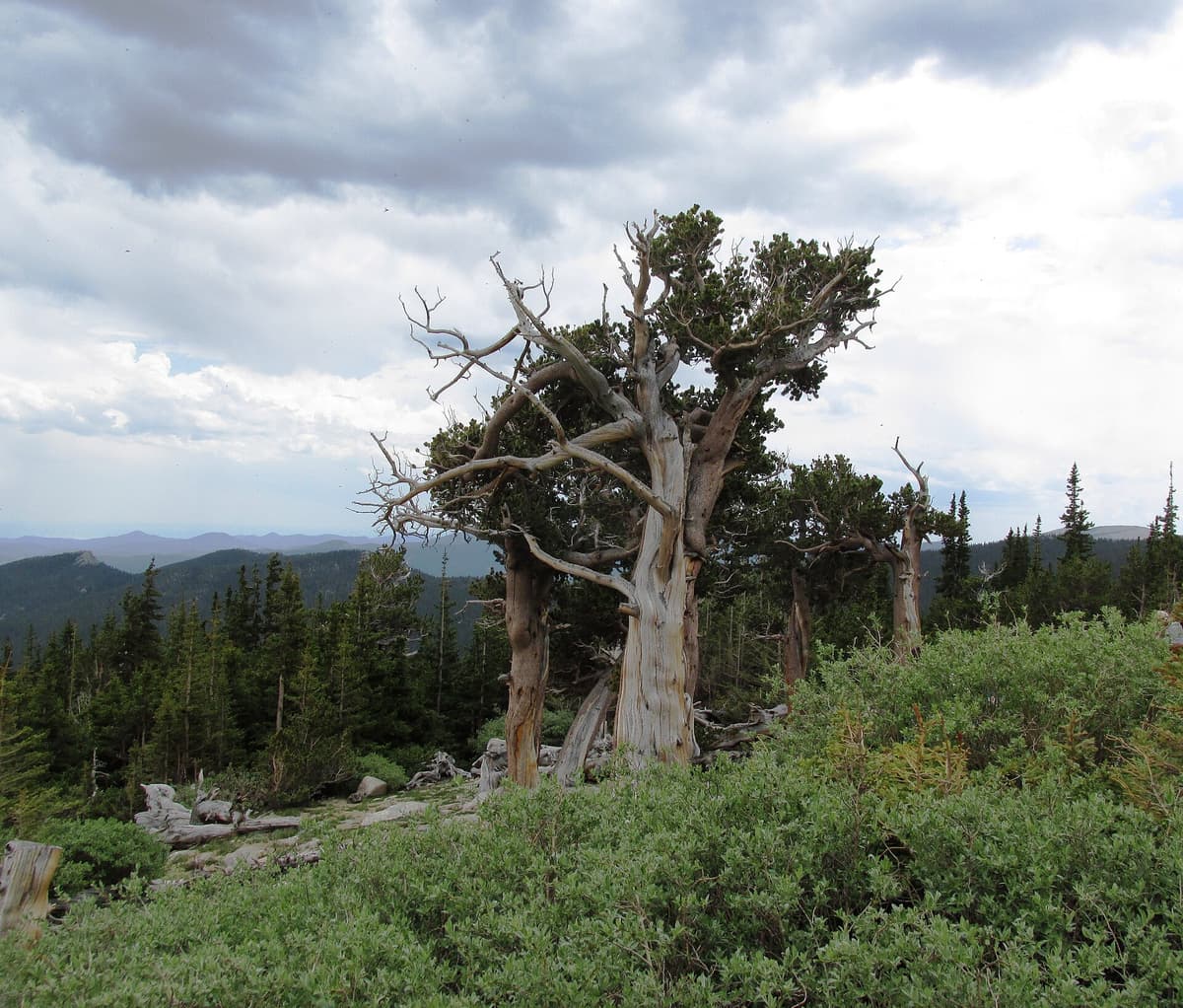
About halfway up the byway, Mount Goliath Natural Area protects a grove of Rocky Mountain bristlecone pines, some of them more than 1,600 years old. These are among the oldest living things in Colorado, twisted and polished by centuries of wind at treeline.
The Dos Chappell Nature Center anchors the area, and two short trails loop through the grove: the Alpine Garden Loop and the Pesman Trail, run in partnership with Denver Botanic Gardens. In July the alpine wildflowers here are some of the best on the mountain. It's a low-effort, high-reward stop, and it sits below the toll section, so you can visit even without a summit reservation.
Wildlife You'll See
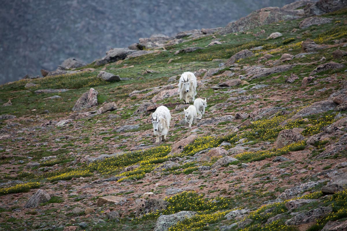
Mount Blue Sky is one of the most reliable places in Colorado to see high-country animals up close. Herds of mountain goats and bighorn sheep graze along the upper road and around Summit Lake, often within a few yards of parked cars. Yellow-bellied marmots sun on the rocks, and pikas dart through the talus with mouthfuls of grass.
Give them room. These are wild animals, not petting-zoo stock. Stay at least 25 yards back, never feed them, and don't box a goat against a cliff for a photo. Feeding wildlife teaches them to approach cars and roads, which gets them killed. Watch, take your picture with a zoom, and let them move on their own.
What to Pack
Even if you're driving, treat this like the high-alpine trip it is. The summit is 30 to 40 degrees colder than Denver, and mountain weather turns fast.
Warm layers. Pack a warm jacket and a hat even in July. A windproof insulated jacket makes the summit lot bearable when the wind is up.
Rain shell. Afternoon storms build most summer days. A waterproof rain jacket belongs in the car for everyone in your group.
Water. Bring more than you think. Altitude and dry air dehydrate you fast, and there's no water for sale at the top. An insulated water bottle keeps it from getting ice cold.
Sun protection. UV at 14,000 feet is punishing. Bring wraparound sunglasses, sunscreen, and a brimmed hat.
Sturdy shoes. The summit walk is loose rock. Skip the flip-flops and wear real hiking boots or trail shoes.
For the Chicago Lakes or west ridge hikes, add a headlamp, trail food, a map downloaded for offline use, and trekking poles for the descent.
When to Go and How the Altitude Hits
Season. The upper road runs roughly late May to early September. July and August bring the best weather and the biggest crowds. Early September, after Labor Day, the road usually closes but the lower stops stay open and the aspens start to turn.
Time of day. Go early. Colorado thunderstorms build between late morning and mid-afternoon in summer, and there's zero shelter above treeline. Aim to be at the summit by late morning and heading down before noon. Rangers will close the top gate when lightning threatens, and you don't want to be caught above the switchbacks in a storm.
Altitude. This is the part most first-timers underestimate. You can go from 5,280 feet in Denver to 14,265 feet in about two hours. That's fast, and headaches, nausea, and dizziness are common at the top. Drink water, skip the alcohol the night before, and if someone in your group feels genuinely sick, the fix is simple: drive back down, where the symptoms ease within a few thousand feet. Our altitude sickness guide covers the warning signs worth taking seriously.
Common Mistakes to Avoid
Dressing for Denver. People show up in shorts and T-shirts and freeze at the top. Pack layers regardless of the forecast in town.
Starting late. A midday arrival puts you in the storm window with no cover. Get up there in the morning.
Skipping the reservation. Driving 90 minutes only to get turned away at the Echo Lake gate is a bad day. Book ahead and confirm the current rules.
Feeding the goats. It's illegal, it's dangerous, and it ends badly for the animals. Keep your distance and your snacks.
Riding the brakes downhill. Long descents overheat brakes. Downshift and let the engine hold your speed.
Treating it like a scenic drive, not a mountain. The summit is real high-altitude terrain. Watch the weather, watch your body, and turn around if either one turns on you.
Frequently Asked Questions
How high is Mount Evans?
Mount Evans, now officially Mount Blue Sky, stands 14,265 feet above sea level. That makes it one of Colorado's 58 fourteeners and one of the highest points you can reach by car anywhere in North America, since a paved road climbs to a parking lot at 14,130 feet.
Can you drive to the top of Mount Evans?
Almost. The Mount Blue Sky Scenic Byway (Highway 5) ends at a parking lot 130 vertical feet below the summit. From there it's a short quarter-mile walk over rocks to the true high point. The upper road is open seasonally, usually late May through early September.
Do you need a reservation for the Mount Evans road?
In recent summers, yes. The Forest Service has required timed-entry reservations for the upper road during peak season, booked through recreation.gov, plus a per-vehicle fee. The rules change year to year, so check the current season before you go. The lower stops at Echo Lake and Mount Goliath don't require a reservation.
Why did Mount Evans change its name?
The U.S. Board on Geographic Names renamed it Mount Blue Sky in 2023 at the request of the Cheyenne and Arapaho Tribes. The former name honored territorial governor John Evans, who was tied to the 1864 Sand Creek Massacre. "Blue Sky" references the Arapaho people and a Cheyenne ceremony.
Is Mount Evans a hard 14er?
If you drive up, the summit walk is short but still hits you at 14,000 feet, so expect to get winded. On foot, the west ridge is a long Class 2 day and the Sawtooth traverse from Bierstadt is a serious Class 3 scramble. The difficulty depends entirely on how you approach it.
Final Thoughts
Mount Evans, or Mount Blue Sky, is the rare 14er that works for almost anyone. Families can drive up, watch mountain goats, and stand on a Colorado summit without a hard hike. Peak baggers can earn it on foot by the west ridge or link it with Bierstadt across the Sawtooth. Either way, respect the altitude, watch the afternoon sky, and confirm the road status and reservation before you leave home.
If this is on your list, pair it with a few of the best day hikes near Denver, or start with one of the easiest 14ers in Colorado for beginners to build your altitude legs first.
Get the Colorado 14er Packing Checklist (free PDF)
Plus a weekly note on the best Colorado trails, gear deals, and seasonal hike picks. No spam, unsubscribe anytime.
We respect your inbox. Unsubscribe anytime.