Boreas Pass, Colorado: Railroad-Grade Hikes, the Scenic Drive, and Fall Aspens Near Breckenridge
Boreas Pass is an 11,481-foot gap on the Continental Divide between Breckenridge and Como, and it's one of the easiest ways in Colorado to stand on the Divide without a hard climb. You can drive a regular car to the top on a dirt road that used to be a railroad, walk a nearly flat trail along the old grade, and be back in Breckenridge for lunch. That combination of high-country scenery and gentle terrain is rare, and it makes Boreas Pass a favorite for families, cyclists, leaf-peepers, and anyone still getting used to the altitude.
The road follows the bed of a narrow-gauge railroad that crossed here in the 1880s, so the grade almost never gets steep. That's the whole appeal. You gain views normally reserved for peak-baggers while walking a path a locomotive once climbed.
This guide covers the drive, the truth about whether your car can handle the road, the two best hikes, when the aspens turn, and what to pack for a spot that sits well above 11,000 feet.
What you'll learn
- Quick stats for the pass and the main trails
- The drive and how the road works
- Can a regular car make it?
- The railroad history and what's still standing up top
- The best hikes from the pass
- When to go and fall color timing
- Boreas Pass in winter
- What to pack
- Where to stay and nearby trails
- FAQs
Quick stats {#quick-stats}
| Detail | Info |
|---|---|
| Summit elevation | 11,481 ft (Continental Divide) |
| Location | Between Breckenridge (Summit County) and Como (Park County) |
| Road surface | Graded dirt, generally passenger-car friendly when dry |
| Drive from Breckenridge | ~10 miles to the summit, 30 to 45 minutes |
| Bakers Tank hike | ~6 miles round trip, gentle grade, easy |
| Black Powder Pass hike | ~3.5 to 4 miles round trip, ~700 ft gain, moderate |
| Season (road open) | Late May or June through the first heavy snow |
| Permits | None |
| Dogs | Allowed, leash recommended near the summit huts |
The drive and how the road works {#the-drive}
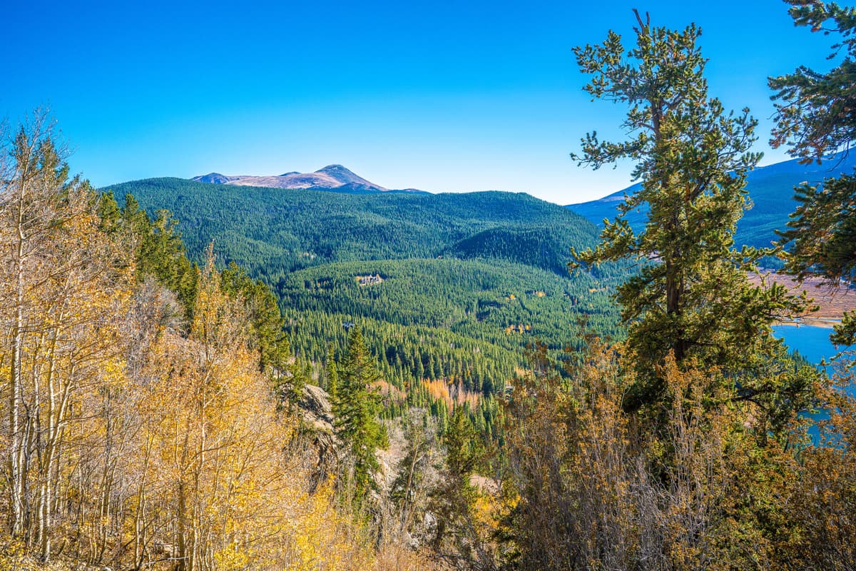
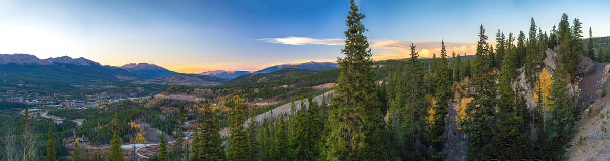
Boreas Pass Road leaves the south end of Breckenridge as a paved street and turns to dirt after a mile or so. From there it climbs about 10 miles to the summit, switchbacking gently above town before traversing open slopes with big views back toward the Tenmile Range and Quandary Peak.
Because the road sits on an old railroad grade, it holds a steady, forgiving pitch the whole way. There are a few narrow, shelf-like sections where two cars have to slow down and cooperate, but nothing white-knuckle. Give yourself 30 to 45 minutes to the top, more if you stop for photos, which you will.
At the summit you'll find a small parking area, the historic buildings, interpretive signs, and the county line. The road keeps going down the far side another 11 miles or so to Como, a tiny former railroad town near Fairplay. Driving the whole thing top to bottom is a scenic backway, not a shortcut, so plan on a leisurely afternoon rather than a quick connector.
Can a regular car make it? {#driving}
Mostly, yes. Boreas Pass Road is one of the more accessible high mountain roads in Colorado. When it's dry, a passenger sedan driven with a little patience handles it fine. The surface is graded dirt with some washboard and the occasional embedded rock, not the boulder-hopping you'd meet on a true four-wheel-drive route.
The caveats are weather and timing. After heavy rain the road gets slick and rutted, and low-clearance cars scrape more. Early season, snowdrifts can linger in shaded cuts until the county clears them. And the road closes for winter once the snow piles up, usually sometime in November, reopening in late spring. Check current conditions with the White River or Pike National Forest office before an early or late trip, and don't drive around a closure gate.
One more thing worth saying out loud: you're at 11,481 feet up top. That elevation hits some people even when they've just driven there. If you feel a pounding headache or nausea, head back down. Our altitude sickness guide explains what to watch for.
The railroad history up top {#history}
In 1882 the Denver, South Park and Pacific pushed a narrow-gauge line over this saddle, making Boreas one of the highest railroad crossings in North America. Trains hauled ore, timber, and passengers between the South Park mining camps and Breckenridge, fighting wind and snow that shut the line down for weeks at a time. The pass takes its name from Boreas, the Greek god of the north wind, and the crews who lived up here earned it.
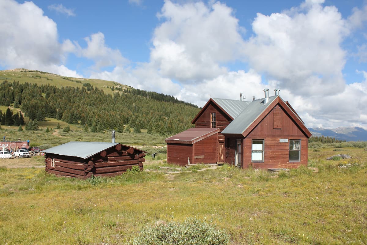
The stone-and-timber Section House still stands at the summit, built to house the workers who kept the tracks clear. Next to it sits a tiny pioneer-era log cabin, one of the oldest buildings in the county. The Summit Huts Association maintains both and rents them as backcountry huts in winter. In summer, volunteers sometimes open the Section House as a small museum on weekends.
About three miles down the Breckenridge side you'll pass Bakers Tank, a restored wooden water tank that once refilled the thirsty steam locomotives. The last train ran in 1937, the rails came up, and the grade slowly became the road and trail people use today.
The best hikes from the pass {#hikes}
You've got two standout options, and both use that gentle railroad grade to your advantage.
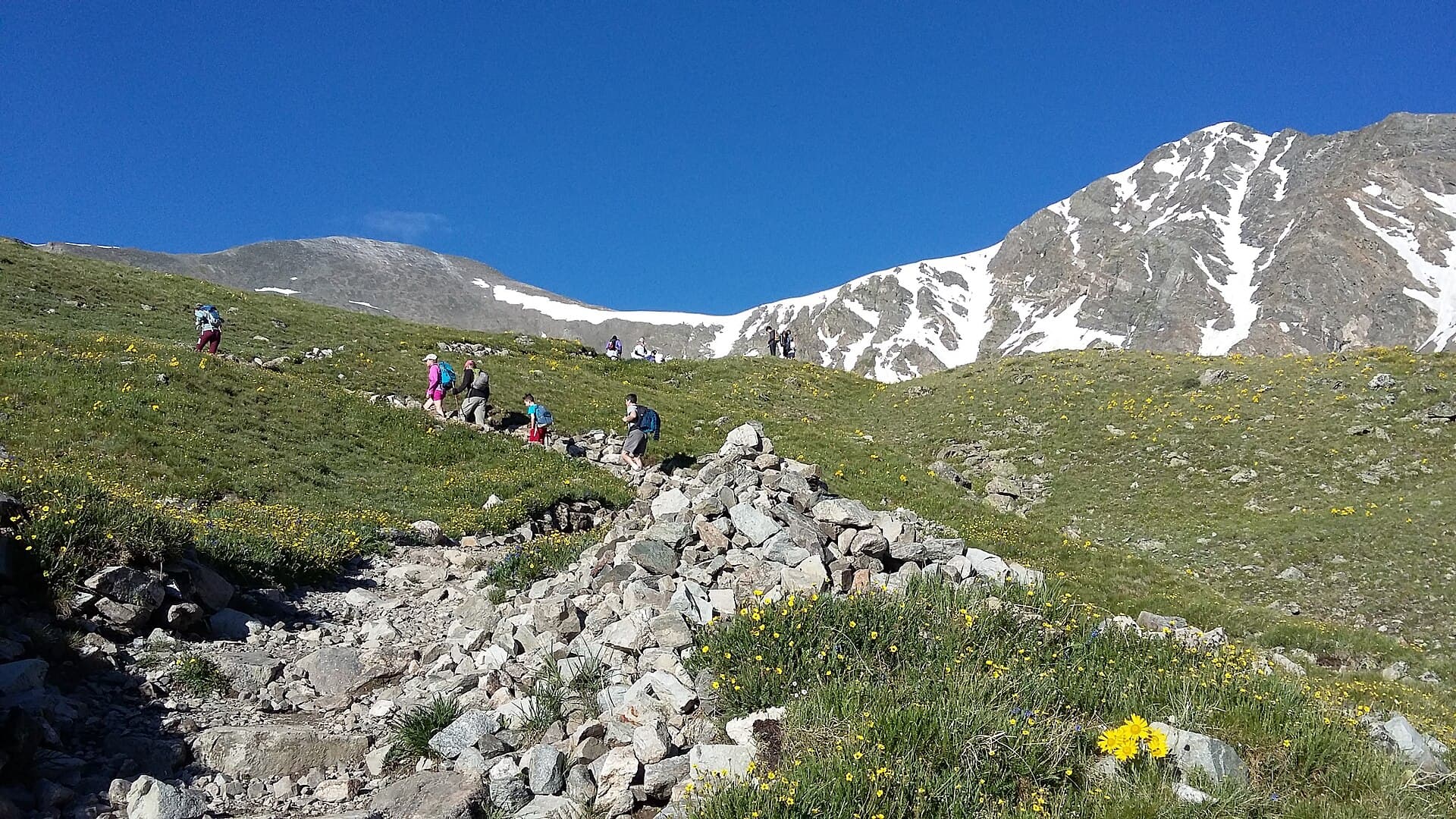
Bakers Tank (easy, ~6 miles round trip). This is the classic. From the trailhead where the plowed road ends on the Breckenridge side, follow the old grade as it curves along the hillside to the restored water tank. It climbs so gradually you'll barely notice, which makes it a great pick for kids, for a mellow trail run, or for a warm-up day while you acclimate. Mountain bikers love it for the same reason. Turn around at the tank or keep going toward the summit if you want more.
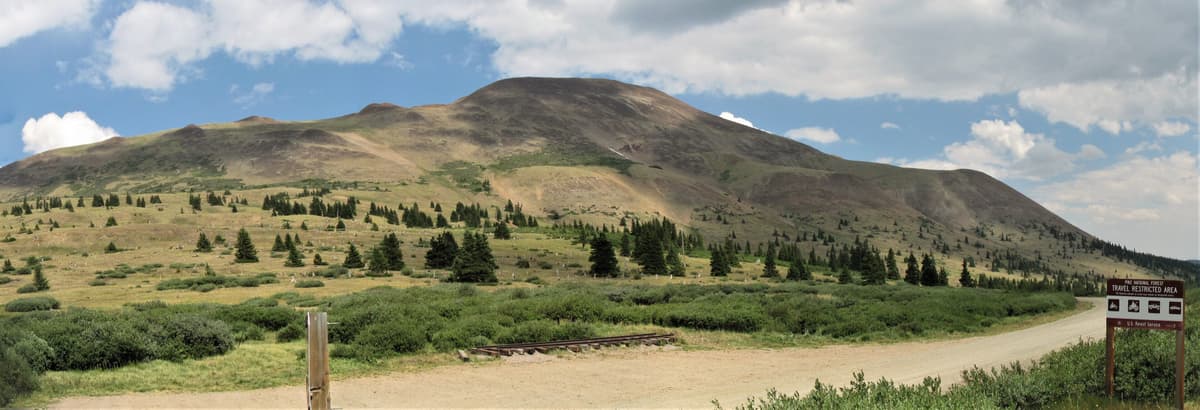
Black Powder Pass (moderate, ~3.5 to 4 miles round trip). Start right at the Boreas Pass summit and climb north on a real trail toward a 12,150-foot saddle tucked below Boreas Mountain. You gain about 700 feet, break above the last trees, and land in wide-open tundra with marmots whistling from the rocks. It's the better choice when you want a summit-style payoff without a summit-style effort.
Strong hikers sometimes push past the saddle toward the ridge and 13,082-foot Boreas Mountain, but that's off-trail tundra travel, so save it for a clear morning with good footing. Whichever you pick, watch the sky. Afternoon thunderstorms build fast up here in July and August, and there's no shelter above the trees.
When to go and fall color timing {#when-to-go}
June. The road usually opens late May or June once crews clear the drifts. Wildflowers start low and creep upward. Trails up high may still hold snow patches into early July.
July and August. Peak hiking season and peak wildflowers, with paintbrush and columbine in the meadows. Get your walking done in the morning to beat the storms. Weekends are busy but never Rocky Mountain National Park busy.
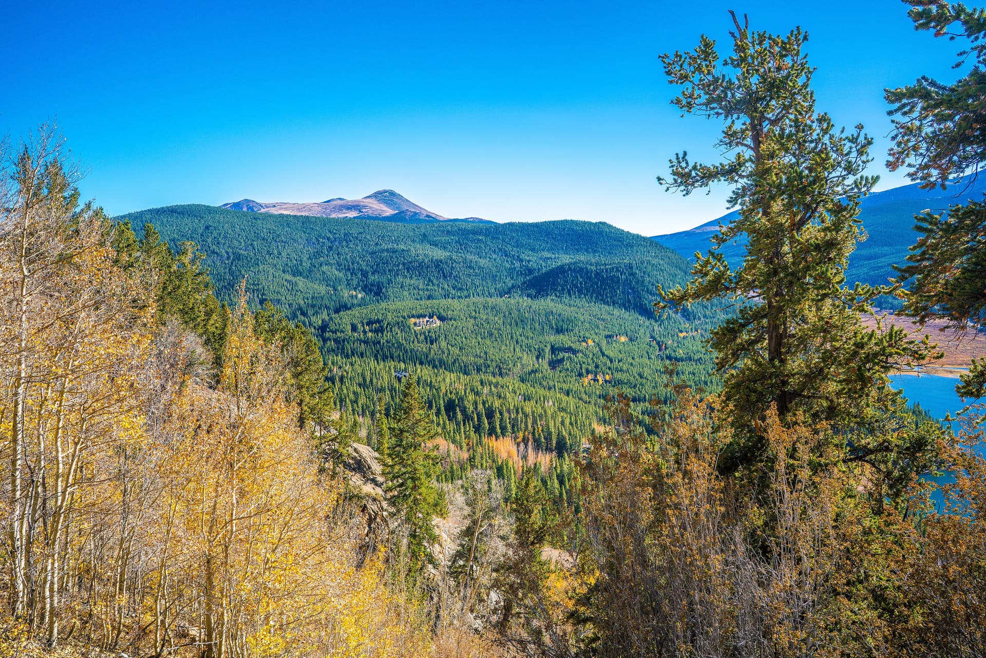
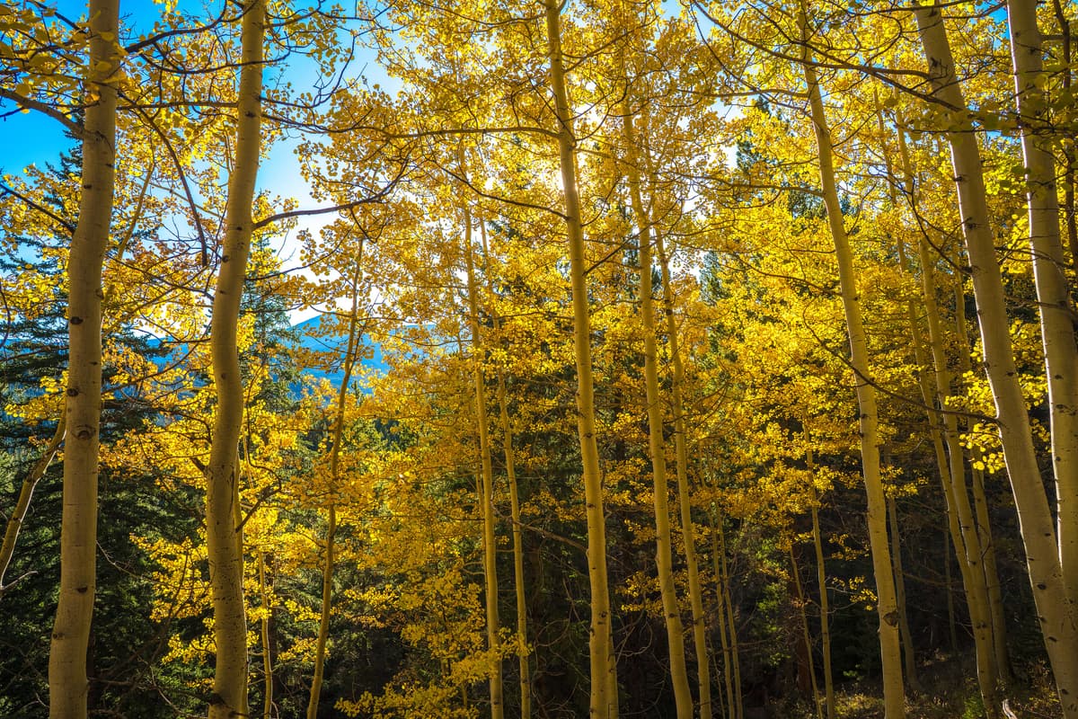
Mid to late September. This is the reason a lot of people know Boreas Pass. The aspen groves on the Breckenridge side light up gold, and because you can drive most of the way, it's one of the most accessible fall-color trips in Summit County. Peak usually lands somewhere between the third week of September and early October, weather depending. Go on a weekday if you can, because the leaf-peeping crowd finds this road too. For more autumn ideas, see our roundup of the best places to visit in Colorado once the season turns.
Late October onward. Snow starts sticking, the road closes for the season, and Boreas Pass becomes a winter destination instead.
Boreas Pass in winter {#winter}
Once the gate closes on the Breckenridge side, the road turns into one of the area's best low-angle winter routes. Cross-country skiers, snowshoers, and fat bikers all share the grade up toward Bakers Tank, following that same easy pitch under the snow. The lack of steep terrain keeps avalanche exposure low on the main grade, which is a big part of why it's so popular with beginners.
If you're new to travel on snow, the mellow grade here is a friendly place to learn. Start with our snowshoeing for beginners guide and the broader winter hiking guide for Colorado before you go, and never assume "low angle" means "no hazard" after a big storm. The Section House and the neighboring cabin can be booked as overnight huts through the Summit Huts Association, which turns a day route into a proper backcountry weekend.
What to pack {#what-to-bring}
Treat this like the high-altitude outing it is, even for the easy walks.
- Layers and a rain shell. Mornings start cold and afternoon storms are routine June through September. A packable rain jacket earns its space.
- Real footwear. Trail runners or hiking boots with grip beat sneakers on the loose grade. See our hiking boots for Colorado guide.
- Trekking poles. Nice on the Black Powder descent and steady the knees on any longer push. Picks in our trekking poles roundup.
- Traction for shoulder season. Snow lingers in the shaded cuts into July and returns early. A set of microspikes or traction cleats weighs nothing and saves a fall.
- Sun protection. You're above 11,000 feet with thin air and strong sun, so pack sunscreen, a wide-brim sun hat, and sunglasses.
- Water and snacks. Carry at least two liters. There's no water service at the summit.
- A headlamp if you're chasing the golden hour, since the road down is slow in the dark. Grab one from our headlamp guide.
Where to stay and nearby trails {#nearby}
Breckenridge is the obvious base, 10 minutes from the bottom of the road, with lodging, restaurants, and a walkable Main Street. From there you're close to a stack of Summit County trails. Tackle Quandary Peak if you want a beginner-friendly 14er, or hike up to the alpine lakes at the McCullough Gulch trailhead for a shorter, scenic day.
On the Como side, you're near Fairplay and Alma and the popular Kite Lake trailhead, the launch point for a cluster of accessible 14ers. If you'd rather sleep under the stars, the national forest around the pass has options covered in our dispersed camping in Colorado guide. Just remember that established sites near the pass fill up on summer weekends.
FAQs {#faqs}
Can you drive over Boreas Pass?
Yes, in summer. Boreas Pass Road runs about 10 miles from Breckenridge to the 11,481-foot summit and continues roughly 11 miles down to Como. It's graded dirt and generally fine for a passenger car when dry. The road closes in winter, usually from around November until late spring.
Do you need four-wheel drive for Boreas Pass Road?
No. When it's dry, most passenger cars handle the road with careful driving. High clearance helps on the washboard and after rain, and the shelf sections are narrow, but this isn't a rugged four-wheel-drive route. Avoid it right after storms if you're in a low-clearance car.
How long is the Bakers Tank hike?
Bakers Tank is about 6 miles round trip from the winter trailhead on the Breckenridge side, following the old railroad grade at an easy, steady pitch. It's a popular option for families, trail runners, and mountain bikers, and you can turn around at the tank or continue toward the summit.
When do the aspens change at Boreas Pass?
Fall color on the Breckenridge side usually peaks between the third week of September and early October, depending on the weather that year. Because you can drive most of the road, it's one of the easiest fall-aspen trips near Breckenridge. Weekdays are far less crowded than weekends during peak.
How high is Boreas Pass?
The summit sits at 11,481 feet on the Continental Divide, marking the line between Summit and Park counties. That's high enough that altitude can affect visitors, so acclimate for a day or two, drink plenty of water, and turn back if you feel sick.
Final word
Boreas Pass gives you Continental Divide scenery, real Colorado railroad history, and a couple of genuinely easy hikes, all from a road most cars can drive. Come in September for the aspens, come in July for the wildflowers, or come in winter on skis. Whenever you go, respect the altitude, watch the afternoon sky, and give yourself time to actually stop and look around. Next up, plan a full loop through the area with our best hikes near Breckenridge and Summit County picks.
Get the Colorado 14er Packing Checklist (free PDF)
Plus a weekly note on the best Colorado trails, gear deals, and seasonal hike picks. No spam, unsubscribe anytime.
We respect your inbox. Unsubscribe anytime.