McCullough Gulch Trailhead: Waterfalls, Alpine Lakes, and 2026 Parking
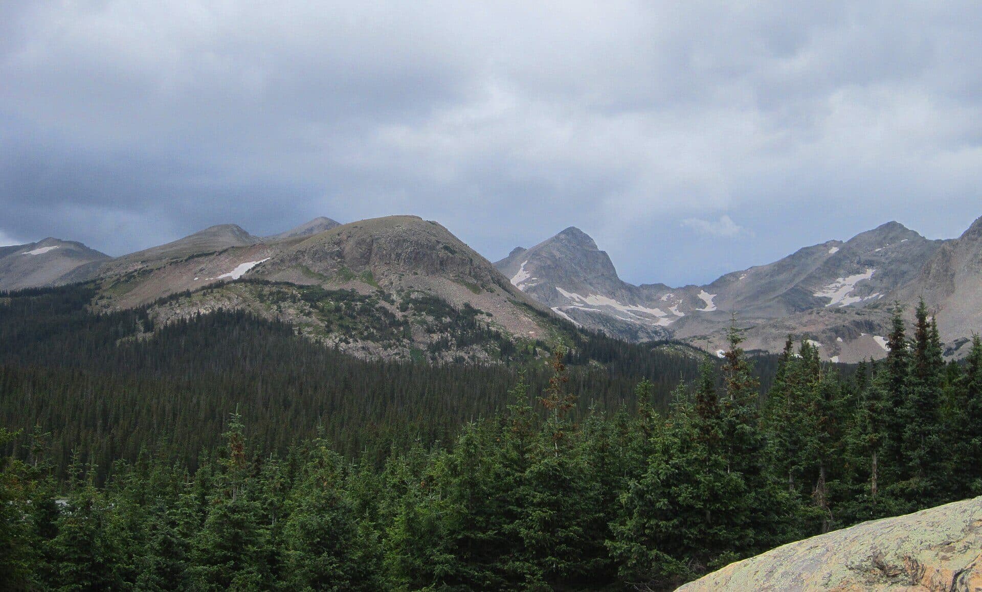
The McCullough Gulch Trailhead sits about 8 miles south of Breckenridge, on the north side of Quandary Peak, and it opens onto one of the best short payoffs in Summit County: a rushing waterfall at 1.7 miles, then a pair of alpine lakes tucked in a bowl below a 14,000-foot wall. You can turn this into a 3.4-mile round trip to the falls or push it to about 6.4 miles round trip if you want the upper lake. Either way, you're walking on a well-marked Class 1 trail the whole time.
Here's the part that trips people up. You can't just drive to the trailhead and park in summer anymore. Between mid-June and mid-September, McCullough Gulch runs on the same paid reservation and shuttle system as Quandary Peak next door, and the parking lot is tiny. Show up without a plan on a July Saturday and you'll get turned around at the bottom of the road.
This guide covers the 2026 parking rules first, since they decide your whole day, then walks the trail section by section, the gear that matters at this elevation, and when to go.
What You'll Learn
- Quick Stats
- The 2026 Parking Reservation and Shuttle
- Getting to the Trailhead
- The Hike, Section by Section
- What to Pack
- Best Time to Hike
- Wildlife and Trail Rules
- Common Mistakes
- Frequently Asked Questions
Quick Stats {#quick-stats}
To the waterfall (shorter option):
- Round trip distance: about 3.4 miles
- Elevation gain: about 800 ft
- Time: 2 to 3 hours
To the upper alpine lake (full hike):
- Round trip distance: about 6.4 miles
- Elevation gain: about 1,600 ft
- Time: 3 to 5 hours
- High point: about 12,400 ft
Trailhead elevation: about 11,100 ft
Class: 1 (walking the whole way)
Difficulty: moderate, mostly because of the altitude
Nearest town: Breckenridge, about 8 miles
Best season: late June through early October
Dogs: allowed on leash
Permit: parking reservation or shuttle required June 13 to September 13, 2026
The 2026 Parking Reservation and Shuttle {#parking-2026}
McCullough Gulch shares a trailhead corridor with Quandary Peak, and both got so popular that Summit County put them on a managed parking system. For 2026, you need either a paid parking reservation or a shuttle ticket to reach the trailhead between June 13 and September 13. Outside those dates, parking is first come, first served, but the lot holds only around two dozen cars and fills fast on weekends.
You have two ways in during the reservation window:
Reserve a parking spot. Book a spot at the Quandary Peak Trailhead through hikequandary.com. Reservations open two weeks ahead of your date, starting June 1, so a popular Saturday can book up quickly. From that lot, you'll catch a short on-site shuttle over to McCullough Gulch.
Take the shuttle from town. A shuttle runs seven days a week, 5 a.m. to 5 p.m., between the Breckenridge South Gondola Parking Structure and the Quandary Peak Trailhead. It's free for Summit County residents and about $7 round trip for visitors. For McCullough Gulch, you ride that shuttle to the Quandary lot, then hop the second on-site shuttle that runs to McCullough Gulch from 8 a.m. to 4 p.m.
The shuttle is honestly the easier call for most people. You skip the scramble for a reservation, you skip the rough drive up the last stretch of road, and you don't have to be at the trailhead at dawn to find a spot. Just plan your finish time around that 4 p.m. McCullough Gulch pickup so you're not stuck at the top.
This kind of managed access is spreading across Colorado's busiest trailheads. We break down how it works statewide in our guide to Colorado trailhead parking, which is worth a read before any popular summer hike.

Getting to the Trailhead {#getting-there}
If you're driving with a reservation, the trailhead sits off Highway 9 south of Breckenridge. From town, follow Highway 9 south about 8 miles toward Hoosier Pass, then turn right (west) onto Blue Lakes Road, also signed as County Road 850. Follow it a short way and bear right onto McCullough Gulch Road, Forest Road 851, which climbs to the trailhead.
That last road is dirt and gets rocky and washboarded as it climbs. A standard car can usually make it when the road is dry and you drive slowly, but low-clearance sedans will scrape in a few spots, and it turns greasy after rain. This is a big reason the shuttle exists: it saves your undercarriage and your nerves.
The trailhead itself has a small lot, a vault toilet, and a trail sign. There's no water, no store, and spotty cell service, so fill up and download your map in Breckenridge before you head up. Quandary Peak's standard route starts nearby, so don't confuse the two lots; the McCullough Gulch sign points you north into the gulch, away from Quandary's east ridge.
The Hike, Section by Section {#the-hike}
The trail starts in the trees and climbs steadily along McCullough Gulch Creek. You'll gain elevation from the first steps, and at 11,100 feet, most flatlanders feel it. Take it slow and let your lungs catch up.
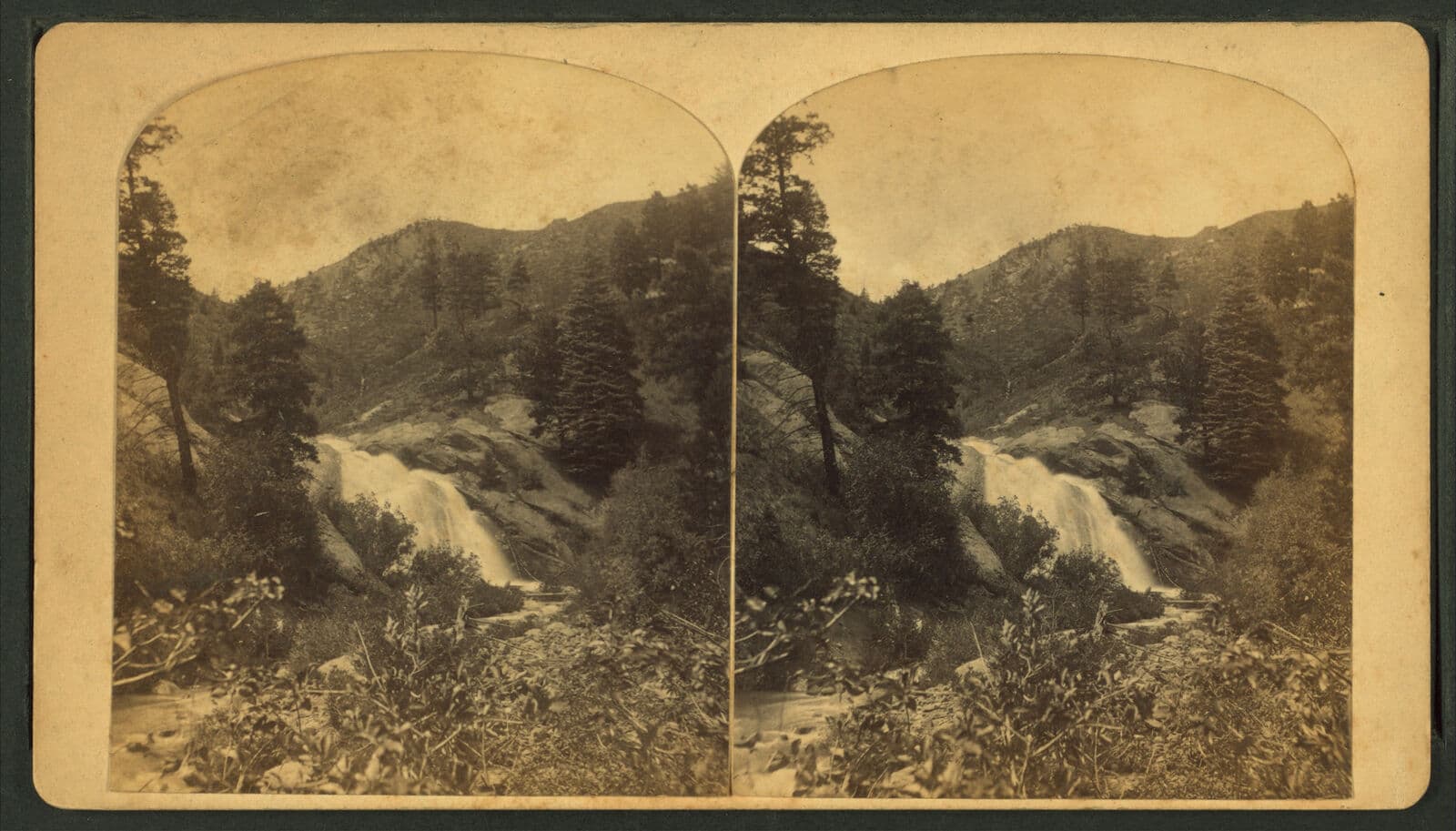
Trailhead to the waterfall (about 1.7 miles). The path works through spruce and fir, crosses a couple of sturdy footbridges, and passes rock gardens loaded with wildflowers in July. Around 1.7 miles you reach White Falls, where the creek pours down a granite slab in a wide, noisy cascade. This is the turnaround point for a lot of hikers, and it's a good one. The falls make a natural lunch spot, and the round trip from here runs about 3.4 miles.
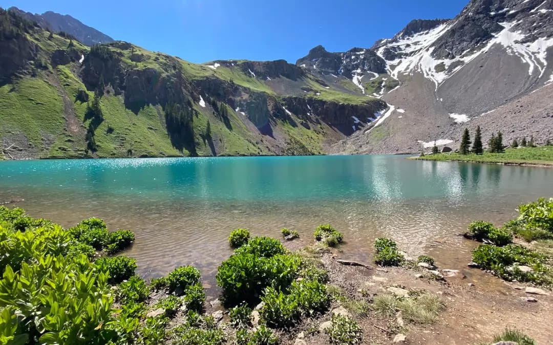
Waterfall to the lower lake (about 0.3 miles more). Push past the falls and the trees start to thin. In another third of a mile or so, you break out of the timber and the lower alpine lake sits in front of you, a cold sheet of water with talus slopes rising on either side. This is where the hike stops feeling like a forest walk and starts feeling like the high country.
Lower lake to the upper lake (about 1 mile more). The final stretch climbs through open tundra to the upper lake, sitting around 12,400 feet in a rocky bowl. Quandary Peak's north face and the ridgeline of the Tenmile Range wall off the horizon. This is the full 6.4-mile day, and the reward is a quiet alpine cirque that most of the waterfall crowd never sees.

None of it is technical. The trail is well-worn and easy to follow, though the upper section crosses loose rock and can hold snow into early July. If you love this style of hike, our roundup of the best alpine lakes in Colorado points you to more high basins like this one, and our Colorado waterfall hikes guide has other short walks to big cascades.
What to Pack {#what-to-pack}
McCullough Gulch is short, but it tops out above 12,000 feet, where weather turns fast and afternoon storms are the rule in summer. Pack like the mountain matters, even for a half-day.
Quick pick: A set of trekking poles is the single best add for this trail. The steady climb and the loose rock near the lakes are much kinder on your knees with poles in hand.
The rest of the short list:
- A hiking daypack big enough for layers, food, and 2 liters of water
- A layering system: a base layer, a warm midlayer, and a packable rain and wind shell, because it can be 40 degrees and blowing at the upper lake while it's 75 in town
- A water filter if you want to refill from the creek instead of hauling it all
- Sun protection: a brimmed hat, sunglasses, and sunscreen, since the tundra offers no shade
- Sturdy footwear with grip for wet granite near the falls
For our full picks on the pieces that matter most, see our guides to hiking boots for Colorado and trekking poles. Early season, a set of microspikes helps on the snow that lingers above the lower lake into July.
Best Time to Hike {#when-to-go}
Late June to early July: Snow is melting out, the creek runs high, and White Falls is at its loudest. Expect snow patches above the lower lake and mud lower down. Wildflowers start filling the gulch.
Mid-July to August: Peak season. The wildflowers go off, the trail is dry, and the water warms just enough to make a lakeside break comfortable. This is also when parking and the shuttle are busiest, so book early and start before 8 a.m. to beat the afternoon storms.
September to early October: The crowds thin, the willows and tundra turn gold, and mornings get crisp. The reservation window closes September 13, which makes late September a quieter time to visit if you catch a clear day. Watch for early snow up high.
Late October through May: The road closes with snow and the gulch becomes a snowshoe or ski objective for people with winter skills. That's a different trip. If you're building toward hikes like this, start with our beginner's guide to Colorado hiking.
Whenever you go, get an early start. Colorado's afternoon thunderstorms build fast over the Tenmile Range, and you don't want to be standing at an exposed alpine lake when the sky turns dark.

Wildlife and Trail Rules {#wildlife-rules}
The gulch and the slopes above it are prime mountain goat country, and you'll often spot them on the rocks near the lakes or picking along Quandary's north face. Keep your distance, at least 50 feet, and never feed them; a goat that learns to beg becomes a goat that gets aggressive. You may also see pika, marmots, and the occasional moose in the willows lower down.
A few ground rules keep this place worth visiting:
- Dogs are allowed but must be leashed, both for wildlife and for the goats
- Stay on the trail through the tundra; those alpine plants take decades to recover from a bootprint
- Pack out everything, including apple cores and orange peels
- Camp only where allowed, and check White River National Forest rules before you plan an overnight
Altitude is the real hazard here, not the terrain. At 12,400 feet, some people get headaches, nausea, or dizziness even on a short hike. If that's you, drink water, slow down, and head down if it gets worse. Our guide to altitude sickness in Colorado covers how to prevent it and when to turn around.
Common Mistakes {#common-mistakes}
Skipping the reservation. The number one way to ruin this hike is to drive up in July without a parking spot or shuttle ticket. Sort that out days ahead at hikequandary.com.
Underestimating the altitude. People treat a 6.4-mile hike as easy and forget it all happens above 11,000 feet. Sleep a night in the mountains first if you can, and don't rush the climb.
Starting too late. A noon start puts you at the upper lake right when storms fire. Be walking by 8 a.m., earlier on busy summer days.
Bringing the wrong shoes. The granite near the falls is slick, and the upper trail is loose. Trail runners or boots with real grip beat sneakers by a mile.
Confusing it with Quandary. They share a corridor, but McCullough Gulch is the gentler, family-friendly option. If you wanted the 14er and ended up at the lakes, you took the wrong sign. For that summit, read our Quandary Peak guide.
Frequently Asked Questions {#faqs}
Do you need a reservation for McCullough Gulch?
Yes, between June 13 and September 13, 2026, you need either a paid parking reservation or a shuttle ticket to reach the trailhead. Book at hikequandary.com, where reservations open two weeks before your date. Outside that window, parking is first come, first served in a small lot.
How long is the McCullough Gulch trail?
It's flexible. The waterfall is about 1.7 miles in, making a 3.4-mile round trip. Continuing to the lower and upper alpine lakes stretches it to roughly 6.4 miles round trip with about 1,600 feet of gain.
How hard is the McCullough Gulch hike?
Moderate. The trail is well-marked Class 1 with no scrambling, so the difficulty comes from the steady climb and the altitude rather than the terrain. Most fit hikers reach the waterfall in about an hour and the upper lake in two to three.
Is there a waterfall at McCullough Gulch?
Yes. White Falls sits about 1.7 miles up the trail, where the creek slides down a broad granite slab. It runs hardest in late June and early July with the snowmelt and makes a natural turnaround if you want a shorter day.
Are dogs allowed on the McCullough Gulch trail?
Dogs are welcome but must stay on a leash the entire hike. The gulch is mountain goat habitat, and a leashed dog protects both the wildlife and your pet from a bad encounter high on the slopes.
McCullough Gulch packs a waterfall, alpine lakes, and 14er views into a half-day, which is why it's worth the extra planning the parking system now takes. Book your spot or shuttle ticket, start early, and pack for cold wind up top. For more short trips like this, browse our best waterfall hikes in Colorado and our roundup of the best day hikes near Denver.
Get the Colorado 14er Packing Checklist (free PDF)
Plus a weekly note on the best Colorado trails, gear deals, and seasonal hike picks. No spam, unsubscribe anytime.
We respect your inbox. Unsubscribe anytime.