Mount Harvard: A Complete Guide to Colorado's Third-Highest Peak
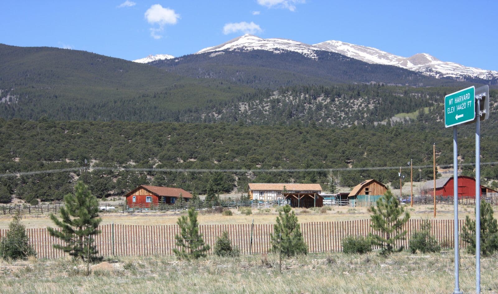
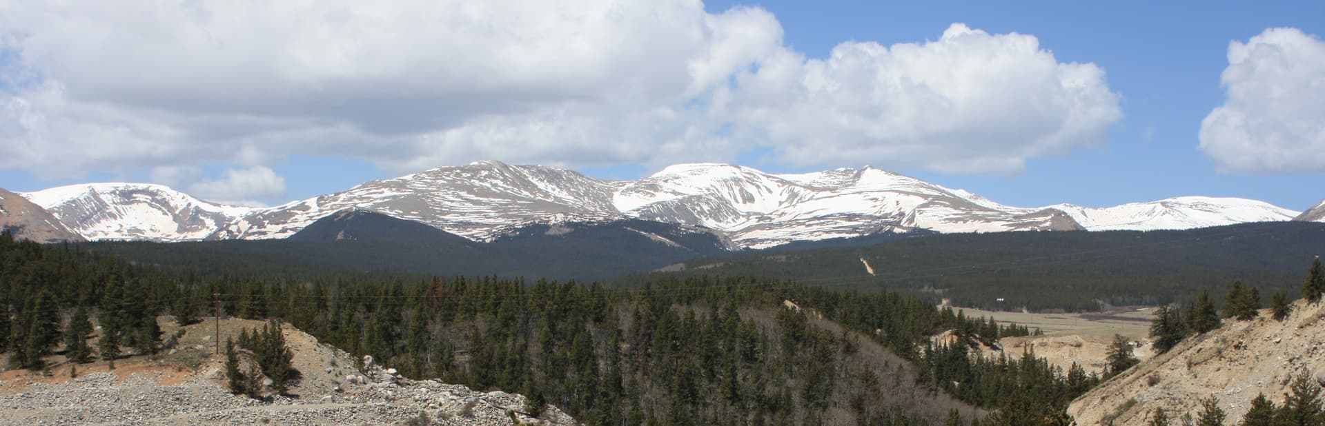
Mount Harvard sits at 14,421 feet, the third-highest peak in Colorado and the highest summit in the Collegiate Peaks Wilderness. Only Mount Elbert and Mount Massive stand taller, and both are in the same Sawatch Range a short distance north. Harvard's standard route from North Cottonwood Creek is a 14-mile round trip with about 4,600 feet of elevation gain. It's a serious day for fit hikers, longer than Elbert and much longer than the Front Range 14ers.
The trailhead is reached from Buena Vista, about 2.5 hours from Denver. The route stays Class 2 throughout, with a few short rocky sections near the summit that require careful foot placement but no actual scrambling. What sets Harvard apart is the long valley approach: roughly 4 miles of gradual climbing through forest and meadow before you even reach the alpine basin where the real work begins.
This guide covers the South Slopes standard route, the notorious traverse over to neighboring Mount Columbia, and the choices that make Harvard either a great long day or a long misery.
What You'll Learn
- Quick Stats
- Getting to the Trailhead
- The South Slopes Standard Route
- The Harvard-Columbia Traverse
- What to Pack
- Timing and Weather
- When to Climb
- What Makes Mount Harvard Different
- Common Mistakes
Quick Stats
South Slopes (standard route):
- Elevation: 14,421 ft (3rd highest in Colorado)
- Trailhead: North Cottonwood Creek, 9,880 ft
- Round Trip Distance: 14 miles
- Elevation Gain: 4,600 ft
- Class: 2 (a few rocky moves near summit, no exposure)
- Time: 9-12 hours typical
- Difficulty: Strenuous (long day, sustained gain, real distance)
Harvard-Columbia Traverse (variation):
- Round Trip Distance: 15 miles (loop)
- Elevation Gain: 5,500+ ft
- Class: 2+ with loose, ugly rock
- Time: 12-15 hours
- Difficulty: Significantly harder than standard route
Best Season: Late June through September
Permit: None required
Crowds: Moderate on summer weekends, less than Elbert or Bierstadt
Getting to the Trailhead
The North Cottonwood Creek Trailhead is reached from Buena Vista:
- Drive to Buena Vista (2.5 hours from Denver via Highway 285 + Highway 24)
- From the stoplight in Buena Vista, take Main Street west (it becomes County Road 350)
- After 0.4 miles, turn right onto County Road 361
- After another 0.9 miles, turn left onto County Road 365
- Follow CR 365 (rough dirt road) approximately 5 miles to the North Cottonwood Creek Trailhead
The first few miles of CR 365 are passable in any vehicle. The last mile gets rocky and rutted; high clearance is helpful but not strictly required in dry conditions. Most stock SUVs and crossovers make it. Sedans should plan to park at a wide pullout 0.5 miles before the trailhead and walk the rest.
From Denver, total drive time is about 2.5 hours. Many hikers stay in Buena Vista the night before. The town has motels, BNB options, and dispersed camping along CR 365 itself (free, no facilities, first-come).
Restrooms: Pit toilet at the trailhead.
Cell service: None at the trailhead, none on the route.
Parking: The trailhead lot holds about 25 vehicles. On summer weekends it fills by 5 AM. Overflow parking is along the road; do not block the turnaround.
The South Slopes Standard Route
The South Slopes route follows the North Cottonwood Creek trail up the valley, then climbs into Horn Fork Basin, then up Harvard's south face. Long but well-defined.
Section 1: Trailhead to Horn Fork Junction (Miles 0-1.5)
The trail starts in mixed evergreen forest along North Cottonwood Creek. Easy grade, gentle climbing, well-maintained tread. You'll cross the creek on a sturdy bridge in the first half mile.
At mile 1.5, the trail splits. Stay right at the Horn Fork Junction (signed). The left fork heads to Kroenke Lake and the Mount Yale area.
Use this opening stretch to warm up. You have a long way to go and the temptation to push the pace here will cost you later.
Section 2: Horn Fork Valley (Miles 1.5-3.5)
The trail climbs gradually through Horn Fork Valley, gaining about 1,200 feet over 2 miles. Sustained but moderate grade (8-10%). The forest opens periodically with views of Mount Columbia to the east and the upper basin ahead.
This section is where many hikers misjudge the day. It feels easy. It is easy. But you're burning time and calories on terrain that doesn't seem to demand much, and the real climb hasn't started yet.
Around mile 3.5, you'll break out of the trees near Bear Lake (a small, often-dry pond, not the spectacular alpine lake you might expect from the name). The basin opens.
Section 3: Upper Horn Fork Basin (Miles 3.5-5.5)
The trail climbs through the upper basin, an open alpine meadow surrounded by Mount Columbia, Mount Harvard, and a string of unnamed 13ers. The route is well-cairned but the trail braids in places; pick a line and follow the cairns.
You'll pass a wooden sign marking the Bear Lake camping area. Many backpackers stake camp here and summit the next morning; this is a legitimate option if you want to break the day into two halves.
The basin climbs steadily. At mile 5.5 you're around 12,500 ft, at the base of Harvard's south face.
Section 4: The Headwall Climb (Miles 5.5-6.7)
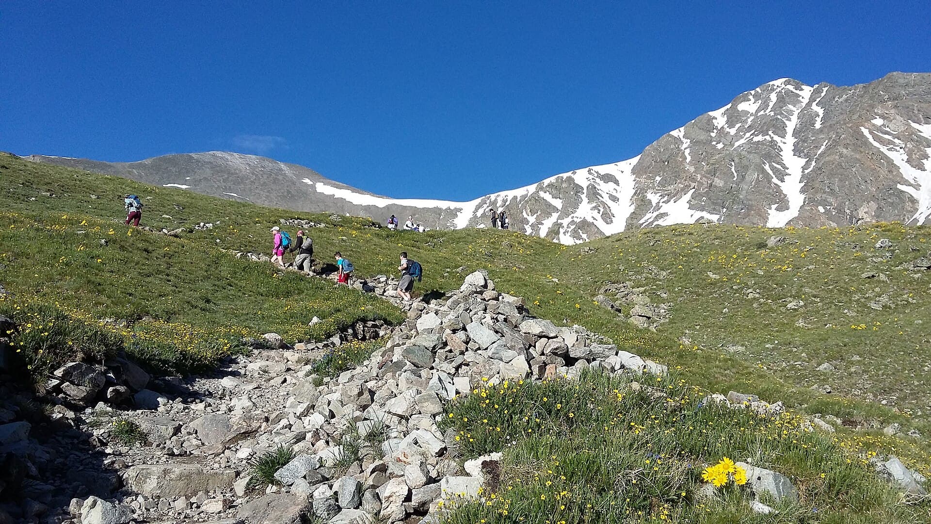
This is where Harvard earns its difficulty. The trail switchbacks up a steep grass and talus slope, gaining roughly 1,500 feet in just over a mile. Grade averages 18-22%. Sustained, exposed, and unrelenting.
The talus gets larger and looser as you climb. Trekking poles help on the lower section but become a hindrance on the upper rock; many hikers stow them for the last 500 vertical feet.
The altitude hits hard here. Above 13,500 ft, expect to stop every 50-75 steps to catch your breath. This is normal. Pace control is more important than speed.
Section 5: The Summit Block (Miles 6.7-7.0)
The final approach to the summit is a short, rocky scramble across large boulders. The route is not technical, but you'll use your hands for balance on three or four moves. No exposure of consequence; if you slip you'll bruise a knee, not fall off the mountain.
The cairned route works around the south side of the summit block, then up. Pay attention to the cairns; freelancing here puts you on harder terrain.
Section 6: The True Summit (Mile 7.0)
The summit of Mount Harvard is a relatively small, rocky platform. Room for maybe 15 people comfortably. A USGS benchmark and a small cairn mark the high point.
Views from the top:
- Mount Columbia (14,077 ft) directly to the south, the obvious massive peak across the saddle
- Mount Yale, Mount Princeton, and the rest of the Collegiate Peaks south
- Mount Elbert and Mount Massive to the north
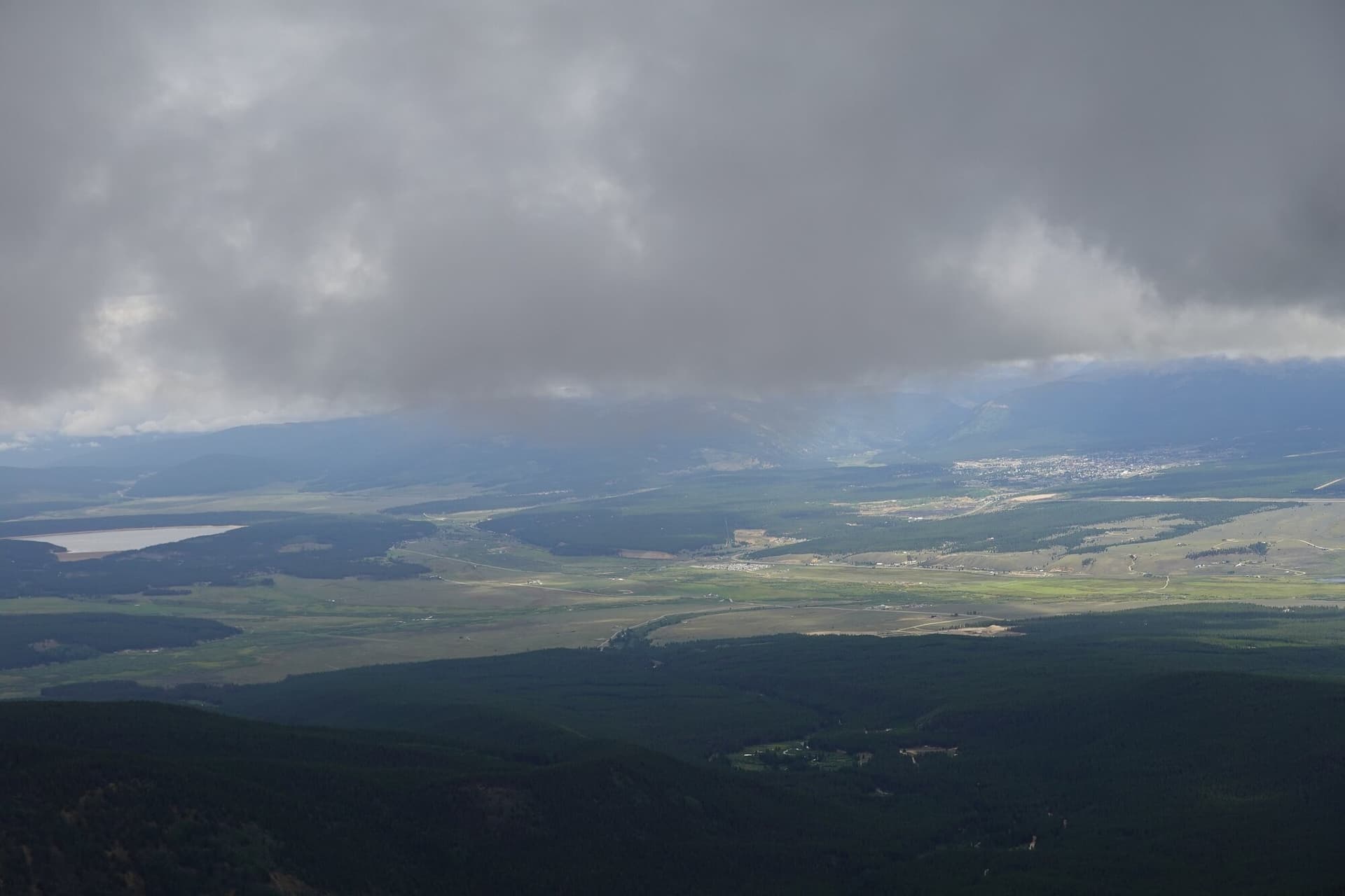
- The Arkansas River Valley far below to the east
- The Three Apostles and a sea of 13ers to the west
On a clear day, you can see well into the Sangre de Cristo range to the south and the Elk Range to the west.
Section 7: The Return (Miles 7.0-14.0)
Same route in reverse. The descent of the headwall is the hardest part of the return. Loose talus, steep grade, tired legs. Trekking poles save knees here.
Once you're back in the basin around mile 8.5, the trail eases. The valley walk back feels long because it is long. Many hikers find the final two miles through the forest psychologically tougher than they expect: you've done the climb, you're tired, and there's still real distance to cover.
Total descent time is typically 4-5 hours. Plan on being on the trail for 9-12 hours total.
The Harvard-Columbia Traverse
Mount Columbia sits 1.5 miles south of Harvard across a connecting ridge. On paper, bagging both in one day looks like the Grays-Torreys formula: two 14ers, one trailhead, modest extra effort. In practice, the Harvard-Columbia traverse is one of the most disliked routes in the Sawatch.
The problem is the ridge. The connecting ridge between Harvard and Columbia is a long, loose, miserable stretch of unstable talus. The route is Class 2+ but feels harder because the rock won't stay put. Every step risks shifting. Route-finding is poor; cairns are sparse and contradictory. The ridge has lost several hikers to twisted ankles and worse over the years.
Why most guides recommend against it:
- Loose rock the entire 1.5 miles between summits
- Route-finding is genuinely confusing
- Adds 4-5 hours to an already long day
- Forces you down Columbia's even-worse west slope to return
- Columbia's standard route by itself is also widely considered the worst standard 14er route in the Sawatch
- A retreat partway is hard; the ridge commits you
Who should consider it:
- Experienced 14er hikers who have done at least 10 peaks
- Hikers comfortable with loose, exposed Class 2+ terrain
- Hikers in good fitness who can handle a 15-mile, 12-15 hour day
- Hikers willing to start at 3 AM
What to expect if you go:
- From Harvard's summit, descend the rocky south ridge toward the saddle. The descent is steep and loose; pick lines carefully.
- The saddle (around 13,500 ft) is a respite but the ridge climb to Columbia begins immediately.
- The climb up Columbia involves more loose talus on a poorly-defined route.
- Columbia's summit (14,077 ft) is anticlimactic after Harvard.
- The descent off Columbia's standard west slope is widely considered the worst standard descent on any 14er: steep, loose, sandy, knee-destroying.
For most hikers, skip Columbia. Climb Harvard, return the way you came, and come back for Columbia from a different trailhead another day. There is no shame in this. Many experienced 14er hikers have done both peaks and would not repeat the traverse.
If you're set on Columbia anyway, climb it on its own day from the same trailhead. The standard route is still ugly but at least you're fresh.
What to Pack
Long-day kit. Quantities matter more than Bierstadt or Quandary because the day is 50% longer:
Water. 4 liters minimum. North Cottonwood Creek runs the length of the lower valley; many hikers carry a filter and refill on the descent. Plan to carry all your water for the ascent though; once you're in the upper basin there's no reliable source.
Food. 2,000-2,500 calories of trail food. This is a 9-12 hour day. Real food, not just bars. A sandwich or wrap eaten at Bear Lake on the way up makes a huge difference.
Layers. Base layer, insulation, wind shell, rain shell. The summit can be 30-40 degrees colder than the trailhead and the wind is reliably strong above the basin. See our base layers guide and rain jacket guide.
Sun protection. Sunglasses, sunscreen on every exposed surface, brimmed hat. You'll be above treeline for 6+ hours.
Headlamp. Mandatory. A 4-5 AM start means hiking in the dark for at least an hour, and a slow day means descending into dusk is a real possibility. See our headlamps guide.
Footwear. Real hiking boots with ankle support. The talus on the headwall and summit block punishes trail runners. See our hiking boots guide.
Map and offline GPS. The route is well-defined but the trail braids in the upper basin and the Horn Fork Junction can confuse tired hikers on the descent. Pre-download offline maps.
Trekking poles. Required. The descent of the headwall destroys knees without them.
First aid basics. Blister treatment (the long valley walk creates blisters), ibuprofen, electrolyte tablets.
Emergency layer. A light puffy jacket weighs almost nothing and saves lives if you twist an ankle and have to wait for help.
For altitude considerations, see our altitude sickness guide.
Timing and Weather
Same rule as every 14er: be off the summit by noon. Harvard's longer day means you need to start earlier.
Recommended timing:
- Trailhead: 4:00 AM (3:00 AM in monsoon season)
- Bear Lake: 6:30 AM
- Base of headwall: 7:30 AM
- Summit: 10:00-10:30 AM
- Below the headwall: 12:00 PM
- Bear Lake: 1:30 PM
- Trailhead: 3:30-4:30 PM
For a 4 AM trailhead start, leave Denver by 12:30 AM. This is genuinely not realistic for most hikers. Stay in Buena Vista the night before; the difference between a 2.5-hour pre-dawn drive and a 30-minute one is enormous for sleep, focus, and safety.
Check forecast.weather.gov for the Buena Vista / Collegiate Peaks mountain forecast. Same weather principles apply:
- Storm probability above 30%: reconsider
- Wind above 35 mph at altitude: it'll be unpleasant
- Snow falling in summer: turn around
The Collegiate Peaks sit slightly west of the typical monsoon track but storms still build by early afternoon in July and August. Do not gamble on weather here; the descent from the headwall in a thunderstorm is dangerous.
When to Climb
Best months: Late June through mid-September.
June: Snow lingers in the upper basin and on the headwall through mid-month most years. The headwall snow is steep enough to require microspikes or an ice axe in early season. Late June usually opens up the standard route in dry conditions.
July: Peak season. Monsoon storms start mid-month. Start by 3:30-4 AM.
August: Peak monsoon. Storm-ready by 11 AM most days. The longer day means timing matters more than on shorter peaks.
September: Best stable weather. Cooler temperatures. The aspen in the lower valley turn gold in late September; the descent through golden forest is one of the more memorable late-season experiences in the Collegiates. Some early snow possible after mid-month.
October-May: Winter conditions. CR 365 is not plowed; the road becomes impassable past the lower gates, adding miles to the approach. Avalanche risk on the headwall. Not recommended for non-mountaineers.
What Makes Mount Harvard Different
Mount Harvard vs the other major Sawatch 14ers:
Longer day. 14 miles vs 9.5 for Elbert, 13 for Massive. Harvard is the longest standard 14er day in the Sawatch.
More elevation gain. 4,600 ft vs 4,500 for Elbert. Comparable but spread over a longer distance.
Lower trailhead. 9,880 ft vs 10,040 for Elbert. Slightly more climbing, slightly more acclimatization room.
Better wilderness feel. The North Cottonwood Creek approach travels deep into the Collegiate Peaks Wilderness. The valley and basin feel remote and undeveloped in a way that Elbert's Halfmoon Creek approach does not.
Slightly less crowded. Harvard sees significant traffic but not Elbert-level traffic. The longer day deters casual hikers.
Harder summit block. Harvard's summit requires a brief rocky scramble; Elbert's does not. Class 2 vs Class 1.
Closer to Buena Vista. Buena Vista is a nicer, more lived-in town than Leadville and the drive from Denver is shorter.
Harvard is appropriate as a third or fourth 14er, after you've done Elbert or another long Class 1 or 2 peak. Hikers who go from Bierstadt straight to Harvard often have a rough day; the distance and sustained climbing are a step up.
Common Mistakes
Underestimating the distance. 14 miles is a real day. People who breezed up Elbert at 9.5 miles sometimes underestimate how much harder the extra 4.5 miles makes the day. The valley walk back is grueling on tired legs.
Not staying in Buena Vista the night before. Driving from Denver in the morning means starting at altitude with no acclimatization and very little sleep. The combination is a recipe for altitude sickness on the headwall.
Attempting the Columbia traverse on a first visit. Climb Harvard alone, see how you feel. The traverse adds 4-5 hours of loose, miserable terrain. Save it for a return trip if you decide you want it at all.
Starting too late. The longer day means you need an earlier alpine start than Bierstadt or Quandary. 4 AM at the latest; 3 AM in monsoon season.
Underestimating the headwall. The headwall is the hardest 1.2 miles you'll cover. It's steep, loose, and at altitude. Pace control is critical; pushing here costs you on the descent.
Wrong footwear. Trail runners can work for some hikers on the valley approach but get destroyed on the headwall talus. Boots with ankle support are the right choice here.
Not enough food. A 9-12 hour day burns 4,500-5,500 calories. Bars alone are not enough; carry real food, eat at Bear Lake, eat on the summit, eat on the descent.
Underestimating Buena Vista altitude. Buena Vista sits at 7,965 ft. It's a useful acclimatization stop but it's not Leadville-high; spending a night here helps less than spending a night in Leadville before Elbert.
Going alone without telling anyone. This route is remote. Cell service is nonexistent. Always file a trip plan with someone before the trailhead.
Other 14ers to Consider
After Mount Harvard:
- Mount Elbert: Colorado's highest, similar Sawatch experience. See our Mount Elbert guide.
- Mount Massive: Second-highest in Colorado, similar length day. See our Mount Massive guide.
- Grays Peak and Torreys Peak: The double 14er Front Range option. See our Grays Peak guide.
- Quandary Peak: Shorter and more accessible, near Breckenridge. See our Quandary Peak guide.
- Mount Bierstadt: The Front Range entry-level 14er. See our Mount Bierstadt guide.
- Pikes Peak by Barr Trail: An endurance peak. See our Pikes Peak guide.
For the full ranking of 14ers by difficulty, see our easiest 14ers guide.
Final Thoughts
Mount Harvard is the third-highest peak in Colorado, the highest in the Collegiate Peaks Wilderness, and one of the most rewarding long days in the Sawatch. The standard South Slopes route is Class 2 with a short rocky summit block; the limiting factors are distance, sustained elevation gain, and the headwall climb at altitude. Most hikers find it more strenuous than Elbert despite the similar gain, because the extra 4.5 miles wears you down.
The keys to success are simple: stay in Buena Vista the night before, alpine start by 4 AM, pace yourself through the long valley approach, save energy for the headwall, watch the weather, and respect the descent. Skip the Columbia traverse unless you've done your homework and you're set on it. There's no honor in turning a great day on Harvard into a miserable one on the ridge.
For the trail stats and map: Mount Harvard trail page. For the full gear kit, see our guides to hiking boots, rain jackets, base layers, and headlamps. For altitude, see our altitude sickness guide.
Get the Colorado 14er Packing Checklist (free PDF)
Plus a weekly note on the best Colorado trails, gear deals, and seasonal hike picks. No spam, unsubscribe anytime.
We respect your inbox. Unsubscribe anytime.