Mount Massive: A Complete Guide to Colorado's Second-Highest Peak
Willow Fire, 2026: the fire burned the forest west of Leadville in July and August 2026, and as of this writing Mount Massive, the Mount Massive Wilderness, and the Continental Divide Trail through the area are closed by Forest Service order through September 30, 2026 unless it is rescinded. Halfmoon Road and the Mount Elbert trail reopened on August 20; the Massive trailhead did not. Check the Pike-San Isabel National Forest alerts page for the current order before planning a climb, and expect burned slopes and hazard trees along the approach when it reopens.
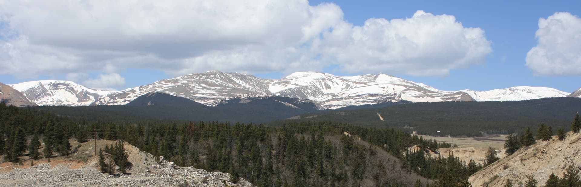
Mount Massive stands at 14,428 feet, the second-highest peak in Colorado and third-highest in the contiguous United States. It sits roughly four miles north of Mount Elbert in the Sawatch Range, separated by a single valley. The two peaks are within 12 vertical feet of each other, yet Mount Massive sees a fraction of the foot traffic. On a July Saturday when Elbert's parking lot is full by 5:30 AM, the Mount Massive Trailhead often has spaces past 7 AM.
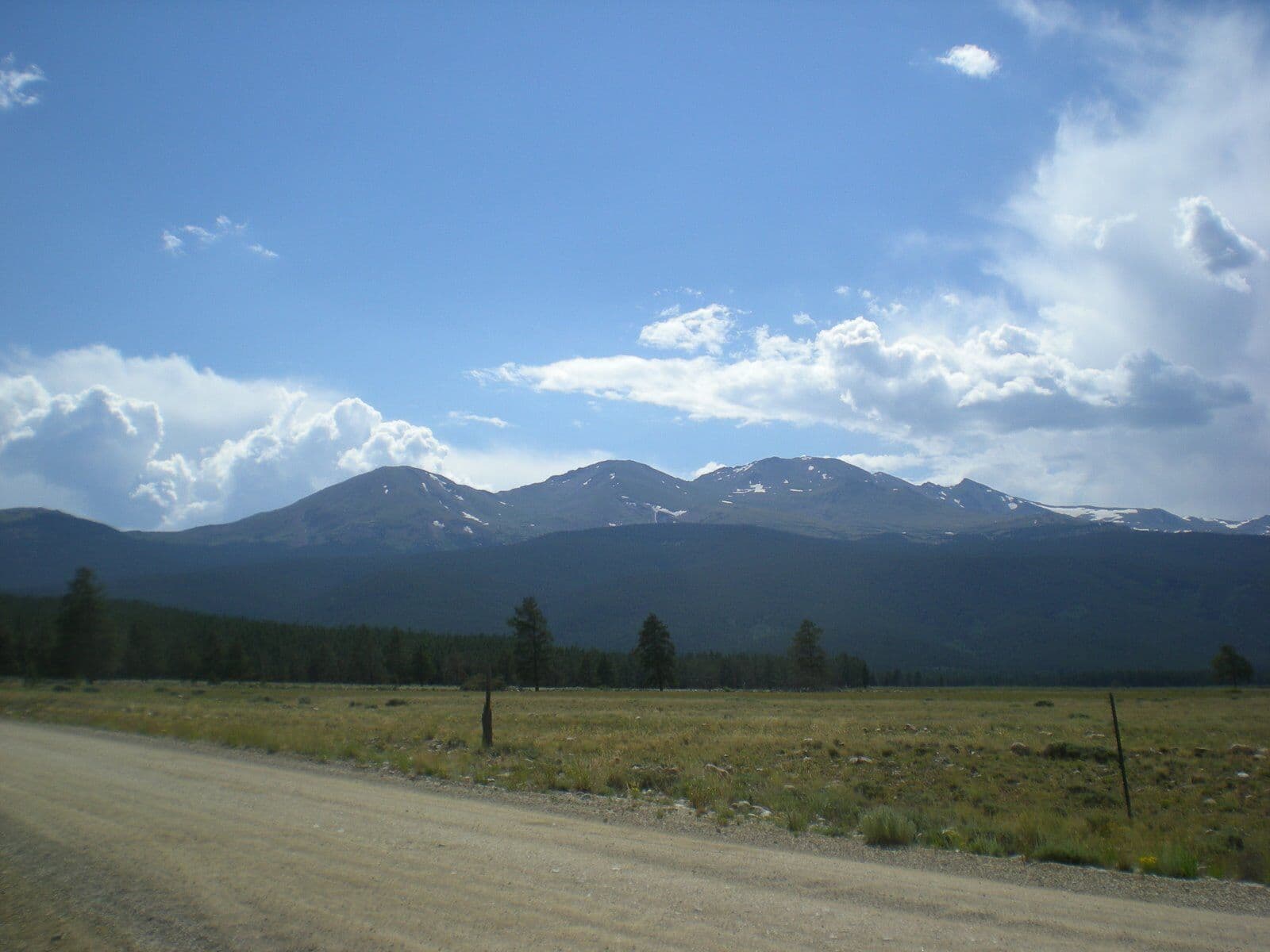
The "Massive" name is earned. The summit ridge runs more than three miles above 14,000 feet with five named sub-summits, the longest continuous high-altitude ridgeline in the Sawatch. Most hikers tag only the true summit, but the size of the mountain becomes obvious once you're on top: Elbert looks like a single point across the valley, while Massive feels like a wall.
The standard route is 13.6 miles round trip with 4,500 feet of elevation gain. This is a longer day than Elbert by four miles. For hikers who already have an Elbert or two Front Range 14ers under their belt, Mount Massive is the next step up. This guide covers the East Slopes (the standard route), the Mount Massive Trail vs Colorado Trail approach decision, and what to expect on a peak that punishes shortcuts.
What You'll Learn
- Quick Stats
- Getting to the Trailhead
- The East Slopes Route
- The Mount Massive Trail vs the Colorado Trail Approach
- What to Pack
- Timing and Weather
- When to Climb
- What Makes Mount Massive Different
- Common Mistakes
- Other 14ers to Consider
Quick Stats
East Slopes (standard route):
- Elevation: 14,428 ft (2nd highest in Colorado, 3rd highest in lower 48)
- Trailhead: Mount Massive Trailhead (Halfmoon Creek), 10,050 ft
- Round Trip Distance: 13.6 miles
- Elevation Gain: 4,500 ft
- Class: 2 (mostly Class 1; short Class 2 boulder section near the summit)
- Time: 8-11 hours typical
- Difficulty: Strenuous (long day, big elevation gain, real talus near the top)
Southwest Slopes via North Halfmoon Creek:
- Trailhead: North Halfmoon Creek, 10,250 ft
- Round Trip Distance: 8.0 miles
- Elevation Gain: 4,250 ft
- Class: 2
- Time: 7-10 hours
- Note: The road to this trailhead requires high-clearance 4WD
Best Season: Mid-June through September
Permit: None required
Crowds: Moderate on summer weekends, well below Elbert traffic
Getting to the Trailhead
The Mount Massive Trailhead is reached via the same Halfmoon Creek Road that serves Mount Elbert. The Massive lot sits about a mile past the Elbert lot.
- Drive to Leadville (3 hours from Denver via I-70 and Highway 24)
- From Leadville, take Highway 24 south for about 4 miles to County Road 24A (Halfmoon Drive)
- Turn right (west) onto Halfmoon Creek Road
- Follow the gravel road approximately 5 miles, past the Mount Elbert Trailhead, to the Mount Massive Trailhead parking area
The road is well-maintained gravel passable in any vehicle to the standard Mount Massive Trailhead. No 4WD required for the East Slopes standard route. The North Halfmoon Creek Trailhead (used for the Southwest Slopes variation) is another 3 miles up a rougher road that does require high-clearance.
Total drive from Denver: 3 hours. Most hikers stay in Leadville the night before. Cheap motels run $80-120 in summer, dispersed camping along Halfmoon Creek is free, and the elevation in town (10,150 ft) helps with acclimatization.
Restrooms: Pit toilets at the Mount Massive Trailhead.
Cell service: None at the trailhead, none on the route.
Parking: The Mount Massive lot holds about 25 vehicles. Overflow parks along the road shoulder. It fills later than the Elbert lot but still hits capacity by 6:30 AM on busy summer Saturdays.
The East Slopes Route
The East Slopes is the standard route on Mount Massive. It uses the Mount Massive Trail from the Halfmoon Creek trailhead. Long but, until the final push, straightforward.
Section 1: Trailhead to Colorado Trail Junction (Miles 0-3.0)
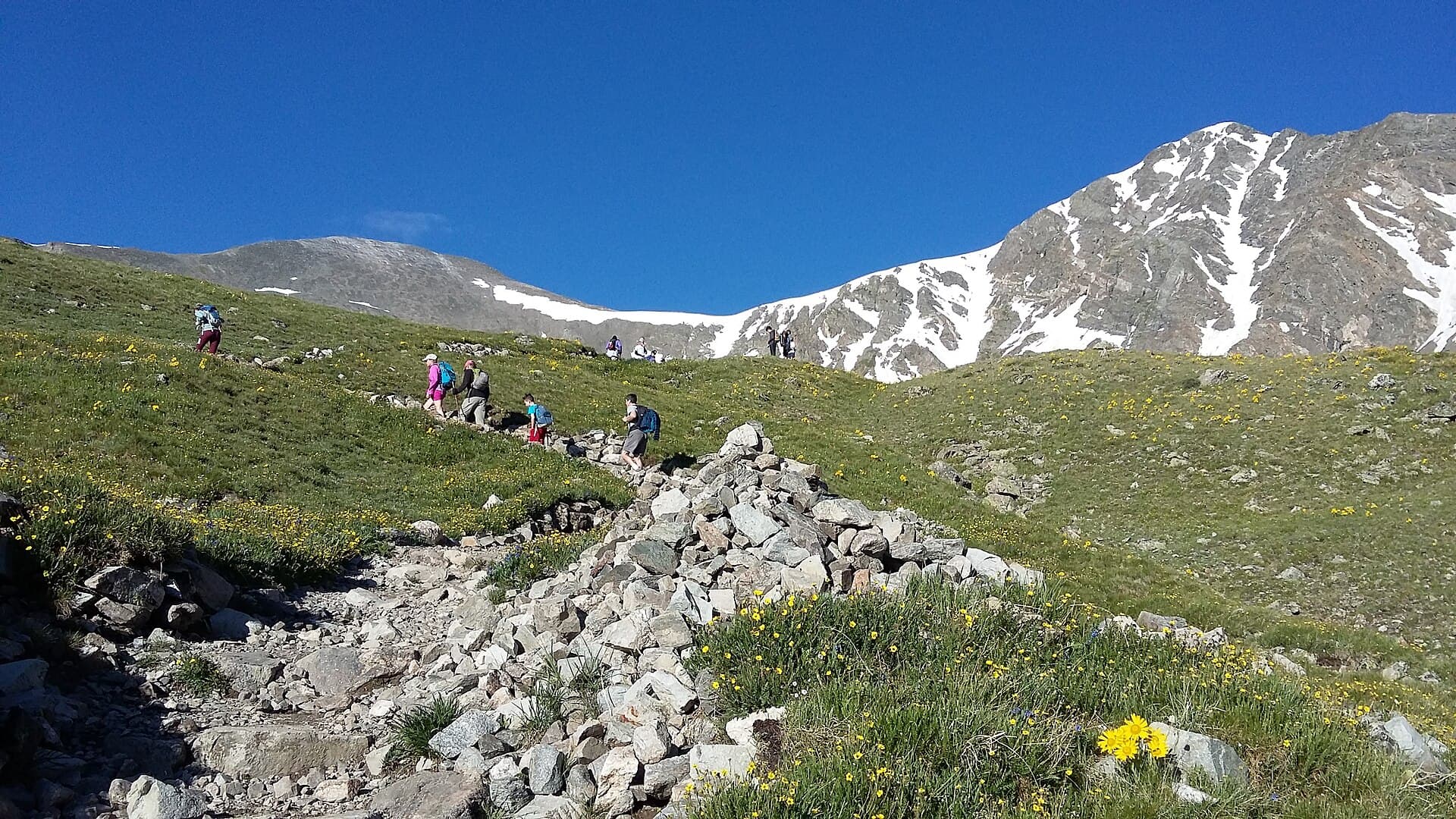
The trail starts in dense evergreen forest, climbing gradually for the first three miles. You're on the Colorado Trail / Continental Divide Trail for this stretch, sharing tread with thru-hikers. The grade is moderate (8-10%), the surface is good, and you cross several small streams.
This is the warm-up. The grade feels generous compared to what's coming. Resist the urge to push the pace; you have ten more miles to go.
Around mile 3.0, watch for the signed junction where the Mount Massive Trail splits off to the right (north). The Colorado Trail continues straight. Hikers who miss this junction add unnecessary miles before realizing the mistake.
Section 2: The Climb Through Trees (Miles 3.0-4.5)
After the junction, the Mount Massive Trail climbs harder. The grade jumps to 12-15% on long switchbacks through evergreen forest. You'll gain about 1,400 feet in this section.
Treeline arrives around 11,800 ft. The view opens dramatically: the east face of Massive rises in front of you, and Elbert appears across the valley to the south.
Section 3: The Lower Alpine Section (Miles 4.5-5.5)
Once above treeline, the trail crosses tundra on the lower flanks of the mountain. The grade is moderate here, a brief reprieve before the steep section. You'll pass small alpine lakes off to the right, and the trail is well-cairned where it crosses rocky stretches.
The true summit is still hidden behind the east shoulder. What you see ahead is the start of the long summit ridge, not the top.
Watch for marmots, pikas, and ptarmigan. This is also where you'll start to feel the altitude if you haven't acclimatized.
Section 4: The Steep Switchbacks (Miles 5.5-6.3)
This is the hard part. The trail steepens to sustained 15-20% grade up the east slope. Loose talus mixed with packed dirt. The switchbacks are long and exposed.
Pace breaks are not optional. Most hikers find they need to stop every 30-50 steps above 13,500 ft. This is normal and not a sign you're doing something wrong. The mountain is 14,428 feet tall and your blood is short on oxygen.
The wind picks up significantly on this section. The Sawatch funnels prevailing west winds across the summit ridge of Massive, and gusts over 30 mph are routine even on calm-feeling days in the valley.
Section 5: The Summit Ridge (Miles 6.3-6.7)
At about 14,000 ft, the trail gains the summit ridge. You're now on Mount Massive's defining feature: a three-mile high-altitude ridgeline. The true summit is 0.4 miles further along the ridge to the north.
The ridge involves Class 2 boulder hopping in several short sections. No exposure, no scrambling, but hand use for balance is common. Trekking poles get stowed or shortened here; you want hands free.
The route is cairned but route-finding requires attention. In a few spots the line wanders between boulder fields. Stay near the ridge crest; do not drop off the west face.
Section 6: The True Summit (Mile 6.8)
The true summit is marked by a small cairn and a USGS benchmark. The summit area is narrow compared to Elbert's broad plateau, but there's still room for 15-20 hikers to spread out.
Views from the top:
- Mount Elbert directly to the south, looking deceptively close
- The Collegiate Peaks (Harvard, Yale, Princeton, Columbia) further south
- The Holy Cross Wilderness to the north
- The Sawatch Range stretching in both directions along the Continental Divide
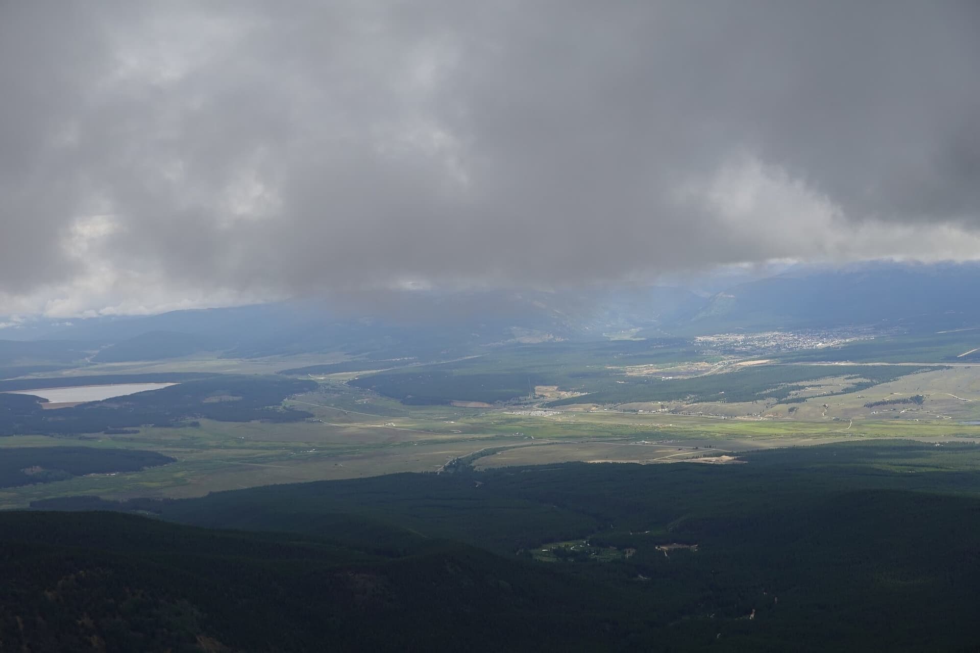
- The Arkansas River Valley and Leadville to the east
- The Mosquito Range east of the valley
The summit ridge continues north past the true summit to several sub-summits over 14,000 ft (North Massive, Massive Green, etc.). Tagging the sub-summits adds 1-3 miles and a lot of additional Class 2 work. Most hikers skip this on a first ascent.
Section 7: The Return (Miles 6.8-13.6)
Same route in reverse. The descent of the upper ridge requires the same care as the ascent; the boulders are no easier going down. Get back to the well-defined trail before relaxing.
The descent through the steep switchbacks is brutal on knees. Both trekking poles, shortened slightly for the downhill, save quads and ligaments.
The long lower section through the forest feels endless. Hikers psychologically struggle here because the summit is hours behind them and the trailhead still feels far. Snack often, drink, keep moving.
Total descent time: 4-5 hours, only marginally faster than the ascent. Plan for it.
The Mount Massive Trail vs the Colorado Trail Approach
Two practical approach options exist for the East Slopes:
Mount Massive Trail (standard). Start at the Mount Massive Trailhead on Halfmoon Creek Road. 13.6 miles round trip, 4,500 ft gain. The route described above.
Colorado Trail / Mount Massive Trail combo from Elbert lot. Start at the Mount Elbert Trailhead, follow the Colorado Trail north until it meets the Mount Massive Trail, then climb. Adds about 1 mile each way but gives you a backup parking option when the Mount Massive lot is full.
For most hikers, the Mount Massive Trailhead is the better choice when parking is available. The shorter total distance matters on an already-long day. The Colorado Trail approach is the backup plan if you arrive late and the Massive lot is packed.
A third option exists for serious hikers: the Southwest Slopes route via North Halfmoon Creek (mentioned in Quick Stats). Shorter total distance but a much rougher access road and a steeper, more demanding climb. It's also a less well-defined trail in the upper section. Only worth considering if you have a high-clearance 4WD and are comfortable with route-finding on talus.
What to Pack
The 14er kit, sized up for a longer day:
Water. 3-4 liters minimum. Halfmoon Creek and several smaller streams cross or parallel the lower route; some hikers refill with a filter on the descent. Plan to carry all your water for the ascent.
Food. 1500-2500 calories of trail food. This is an 8-11 hour day; bars alone won't cut it. Real sandwiches, jerky, trail mix, and a recovery snack for the descent.
Layers. Base layer plus insulation plus wind shell plus rain shell. The summit ridge runs 25-35°F colder than the trailhead and the wind is reliable. See our base layer guide and rain jacket guide.
Sun protection. Sunglasses with side shields, sunscreen on every exposed surface, brimmed hat or visor. Above treeline at 14,000 ft, UV exposure is brutal.
Headlamp. Required for the alpine start. See our headlamp guide.
Footwear. Real hiking boots. The summit ridge boulders chew up thin trail runners, and the long descent abuses ankles. See our hiking boots guide.
Map and offline GPS. The lower junction with the Colorado Trail and the cairned route across the upper ridge both reward pre-downloaded mapping. Don't rely on cell service.
Trekking poles. Both, not one. The descent is 4,500 ft over 6.8 miles. Your knees will thank you.
First aid basics. Blister treatment, ibuprofen, electrolytes. The long day produces blisters more often than shorter peaks.
Cash/credit card. For Leadville coffee, breakfast, and dinner on either end of the climb.
Optional: overnight kit. Some hikers split Mount Massive into two days, camping at one of the small lakes around 12,000 ft on the lower flanks. This eases the altitude load and turns the climb into a memorable backpack. If you go this route, see our guides to backpacking tents and sleeping pads.
Timing and Weather
Same rule as every 14er: be off the summit by noon.
Recommended timing for the East Slopes route:
- Trailhead: 4:00 AM (3:30 AM in monsoon season)
- Treeline (11,800 ft): 7:00 AM
- Summit ridge (14,000 ft): 9:30 AM
- True summit: 10:00-10:30 AM
- Below treeline on descent: 12:30 PM
- Trailhead: 2:30-3:30 PM
For a 4 AM trailhead start, you need to leave the trailhead parking by 3:50, which means staying in Leadville the night before. A 1 AM departure from Denver to make a 4 AM start is possible but punishing, and the lack of acclimatization makes altitude sickness much more likely. Read our altitude sickness guide before considering this.
Check forecast.weather.gov for the Leadville mountain forecast. The same weather decisions apply:
- Storm probability above 30%: reconsider the climb
- Sustained wind above 35 mph at altitude: it'll be miserable on the ridge
- Snow falling in non-winter season: turn around
- Cloud bases dropping toward 14,000 ft: the summit ridge becomes a navigation problem
Mount Massive's summit ridge is more exposed than Elbert's broad summit plateau. Lightning is a real threat. If you hear thunder while still on the ridge, descend immediately, even off the standard route if necessary, and re-find the trail at lower elevation.
When to Climb
Best months: Mid-June through mid-September.
June: Snow lingers on the upper ridge through mid-month most years. Microspikes useful early in the season. By late June, dry conditions for the standard route.
July: Peak season. Monsoon kicks in around mid-month. Start by 3:30-4 AM.
August: Peak monsoon. Storms build by 11 AM most days. The exposed ridge punishes hikers who linger.
September: Best stable weather of the year. Cooler temperatures, fewer storms. First snowfall possible after mid-month, especially on the ridge.
October-May: Winter conditions. Halfmoon Creek Road is not plowed past a point that varies year to year. Avalanche risk on the upper ridge. The route becomes a serious mountaineering objective requiring snowshoes or skis, ice axe, and avalanche education. Not recommended for non-mountaineers.
What Makes Mount Massive Different
Mount Massive vs Mount Elbert, the obvious comparison:
Longer day. 13.6 miles vs 9.5 miles. The extra four miles matters. Plan for 1-2 hours more total.
Same elevation gain. Both are about 4,500 ft, but Massive spreads the gain over a longer distance.
Same trailhead area, slightly different access. Both off Halfmoon Creek Road. Massive's lot is a mile further west.
Less crowded. Mount Massive sees roughly 60-70% of Elbert's traffic. On weekday mornings, the difference is dramatic; you may have whole sections of trail to yourself.
Longer summit ridge. Massive's three-mile ridge above 14,000 ft is unique among Colorado peaks. Elbert has a single summit point.
Slightly harder technical rating. Class 2 vs Class 1. The boulder section near Massive's summit requires more attention. Not technical climbing, but more than a pure walk.
More wind. Massive's long summit ridge catches prevailing wind harder than Elbert's broad summit. Bring the wind shell.
Slightly lower summit. 14,428 ft vs 14,440 ft. A 12-foot difference. Both feel the same on your lungs.
Worse bragging rights. "Second highest" doesn't carry the same weight as "highest." But the climb itself is arguably more interesting.
For hikers who've done Elbert and want a similar day with less foot traffic and a more dramatic summit experience, Massive is the better choice. For first-time 14er hikers, Elbert's shorter distance and Class 1 rating make it the safer starting point.
Common Mistakes
Underestimating the distance. 13.6 miles at altitude is a real day. Hikers who breezed through 9-mile Elbert sometimes struggle on Massive. The extra four miles compounds: more time on your feet, more chances for the weather to turn, more calories burned.
Not acclimatizing. Driving from Denver at low altitude in the morning is a recipe for altitude sickness, especially with a 4,500-ft gain and 8+ hours of exertion. Stay in Leadville (10,150 ft) at minimum the night before. Two nights at altitude before the climb is even better.
Insufficient food and water. An 8-11 hour day at altitude burns 4,500-5,500 calories for most hikers. Three liters of water is the minimum, four is better. Real food beats bars.
Starting too late. A 5 AM trailhead start leaves you summit-bound at 11 AM, which is too late in monsoon season. Get on the trail by 4 AM.
Wrong footwear. Trail runners work on the lower trail but suffer on the summit ridge boulders. Real hiking boots with ankle support are worth the extra weight.
Single trekking pole. Both poles, not one. The 4,500-ft descent over 6.8 miles will wreck your quads otherwise.
Missing the Mount Massive Trail junction. At mile 3.0, the trail splits from the Colorado Trail. Hikers staring at their feet have walked past this junction and added 1-2 miles. Look up.
Treating the summit ridge like a sidewalk. The Class 2 boulders are not Class 1. Watch your foot placement; don't try to talk and walk at the same time.
Trying Elbert and Massive on consecutive days. Both are 8-11 hour days at 14,000+ ft. Back-to-back is for very fit, well-acclimatized hikers. Most should rest a day between.
Skipping the wind shell. "It's calm in Leadville" doesn't mean it'll be calm on the ridge. Pack the shell every time.
Other 14ers to Consider
After Mount Massive:
- Mount Elbert: Right next door, slightly shorter, Class 1. The obvious pairing. See our Mount Elbert guide.
- Mount Bierstadt: Easier and much closer to Denver. Good "recovery" 14er. See our Mount Bierstadt guide.
- Grays Peak and Torreys Peak: Double 14er option in the Front Range. See our Grays Peak guide.
- Quandary Peak: Shorter, near Breckenridge, Class 1. See our Quandary Peak guide.
- Pikes Peak: Endurance test by Barr Trail, 26 miles round trip. See our Pikes Peak guide.
For the full ranking by difficulty, see our easiest 14ers guide.
Final Thoughts
Mount Massive is the second-highest peak in Colorado and one of the most rewarding 14ers in the Sawatch. The route is mostly Class 1 with a short Class 2 section near the summit, but the 13.6-mile distance and 4,500-ft gain make it more demanding than the shorter Front Range peaks. Most hikers find Massive harder than Elbert despite the similar elevation, simply because the day is longer.
The keys to a successful Massive climb: stay in Leadville the night before, alpine start by 4 AM, pace yourself for an 8-11 hour day, watch the weather, respect the summit ridge boulders, and use both trekking poles on the descent. The peak rewards preparation and punishes shortcuts.
If you've already done Elbert and want a peak that's similar in scale but quieter and arguably more interesting, Massive is the answer. If you're picking a first 14er, do Bierstadt or Quandary first, then Elbert, then come back for Massive.
For the trail stats and map: Mount Massive trail page. For the full gear kit, see our guides to hiking boots, rain jackets, base layers, and headlamps. For overnight options on Massive's lower flanks, see our backpacking tents and sleeping pads guides.
Get the Colorado 14er Packing Checklist (free PDF)
Plus a weekly note on the best Colorado trails, gear deals, and seasonal hike picks. No spam, unsubscribe anytime.
We respect your inbox. Unsubscribe anytime.