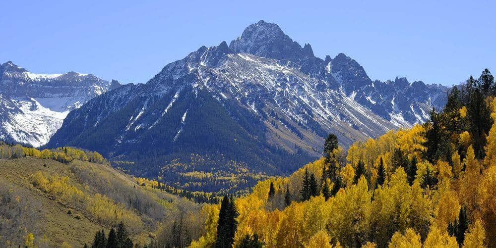
Mount Harvard (South Slopes)
Sawatch Range • Buena Vista, Colorado
Overview
Mount Harvard is the third-highest peak in Colorado and the highest of the Collegiate Peaks, and its South Slopes route through Horn Fork Basin is the longest of the Sawatch trade routes: 14 miles round trip with 4,600 feet of gain on a trail that stays Class 2 until a short scramble at the summit block. The basin is the best approach in the range, and Columbia stands across it for anyone planning a second day.
Trail Highlights
The Route
From the North Cottonwood Creek trailhead at 9,900 feet, the trail follows the creek through aspen for about 1.5 miles to the junction where the Kroenke Lake trail goes left. Stay right into Horn Fork Basin. The trail climbs gently for 3 miles through meadows and willow flats with the Columbia trail branching right, then past the Bear Lake junction into the upper basin at treeline.
Above the basin the trail steepens onto Harvard's south slopes, switchbacking up tundra and talus to a ridge and the final summit block, where a few moves of easy Class 2 scrambling on solid rock reach the top at 14,421 feet. The Harvard-Columbia traverse along the connecting ridge is Class 3 with a loose, slow section and is not the standard route for either peak. Return the same way.
Getting to the Trailhead
From Buena Vista, take County Road 350 (Crossman Avenue) west and County Road 365 north, about 10 miles in all with the last stretch gravel, to the North Cottonwood Creek trailhead; passenger cars manage it when dry. The lot fills by 5 AM on summer weekends and overflow lines the road. No fee or permit for day use. Toilet at the trailhead.
Best Time to Hike
Horn Fork Basin opens in June and the upper slopes are dry by early July; July through September is the window. The route is long enough that the July and August storm pattern sets a 4 AM start, with the summit before 10 and the basin by early afternoon. The willows in the basin turn gold in September, the best month. The aspen on the first 1.5 miles turn in the last week of September.
Good to Know
Dogs are allowed on leash in the Collegiate Peaks Wilderness; the summit block is easy enough for most. Not a kid hike. Carry three liters and a filter; Horn Fork Creek is the water. Backcountry campsites in the basin below treeline make Harvard and Columbia a comfortable two-night trip, with no fires above 11,000 feet. Buena Vista is 20 minutes from the trailhead. The Mount Harvard guide covers the climb in detail, and the Buena Vista hikes page lists Yale, Princeton, and the other Collegiates.
Sources
Figures and access details on this page were checked against these pages on 2026-09-04. Conditions change; confirm with the managing agency before you go.
Who to call
Conditions, closures, permits, and anything left behind on Mount Harvard (South Slopes).
- Managed by
- Salida Ranger District, Pike-San Isabel National Forests
(719) 539-3591 (Salida, Mon to Fri 8 to 4:30) · website - Lost and found, non-emergency
- Chaffee County Sheriff's Office
(719) 539-2596 · website - Emergency
- 911. Cell coverage is patchy on most of these trails; a text to 911 can get through where a call cannot.
Numbers checked 2026-10-04. Colorado United is an independent guide, not the land manager; wallets, keys, and dogs found on the trail go to the offices above.
What to Pack
Gear guides for this kind of hike:
Frequently Asked Questions
How long does the Mount Harvard (South Slopes) take?
Most hikers finish the 14-mile route in about 10 hours, plus stops. Allow extra time at altitude and for photos.
How hard is the Mount Harvard (South Slopes)?
It is rated hard, with 4,600 feet of gain over 14 miles and a high point of 14,421 feet. Come with conditioning and high-country experience.
Is the Mount Harvard (South Slopes) dog-friendly?
Yes, leashed dogs are allowed. Pack water for them and clean up after them.
When is the best time to hike the Mount Harvard (South Slopes)?
The best seasons are summer and fall. Start early to beat both the crowds and Colorado's afternoon thunderstorms.
Do I need a pass or permit for the Mount Harvard (South Slopes)?
No pass or permit is required to park, though popular lots still fill early on summer weekends.
Planning a Colorado trip? Get our packing checklist.
Free PDF + a weekly note on the best trails for the current season.
We respect your inbox. Unsubscribe anytime.
Read More About This Trail
Get additional insights, tips, and detailed information in our comprehensive guide.
Read Full Guide →Trail Information
Nearby Trails in Sawatch Range
Connected pages
- Mount Harvard full route guide
14,421 ft, Sawatch Range, Class 2
- Hikes near Buena Vista
All curated trails in the Buena Vista area.
- Hiking in the Sawatch Range
Regional trail guide.
Discover More Trails
Browse our complete directory of Colorado hiking trails with detailed guides and filters.
View All Trails