Grays Peak and Torreys Peak: A Complete Guide to the Double 14er Hike
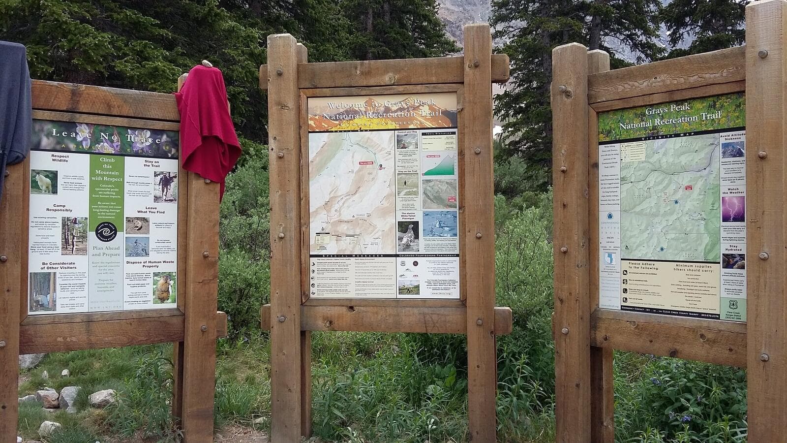
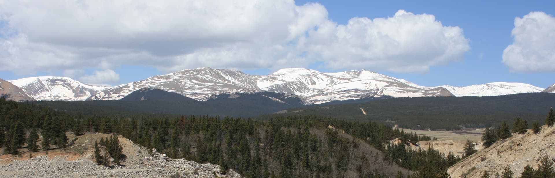
Grays Peak (14,275 ft) and Torreys Peak (14,267 ft) sit 0.6 miles apart on the Continental Divide. Most fit hikers climb both in a single day from the same trailhead, making this the most popular "double 14er" in Colorado. The combined hike is 8.5 miles round trip with 3,600 feet of elevation gain.
The trailhead is 75 minutes from Denver, 30 minutes from Georgetown. The route is well-defined and non-technical (Class 2 throughout). For hikers who want maximum 14er count per drive, Grays and Torreys is the best value in the Front Range.
This guide covers both peaks, the trailhead logistics, the route between them, and the decisions that separate a successful double summit from a stressful retreat.
What You'll Learn
- Quick Stats
- Getting to the Trailhead
- The Standard Route
- The Traverse to Torreys
- Single Peak vs Double Peak Strategy
- What to Pack
- Timing and Weather
- When to Climb
- What Makes This Different from Bierstadt
- Common Mistakes
Quick Stats
Grays Peak alone (out and back):
- Elevation: 14,275 ft (10th highest in Colorado, 1st on Continental Divide)
- Round Trip Distance: 8.0 miles
- Elevation Gain: 3,000 ft
- Class: 2 (no technical climbing, hand use on summit boulders)
- Time: 5-7 hours
Grays + Torreys (the double):
- Elevation: 14,275 ft (Torreys, 11th highest)
- Round Trip Distance: 8.5 miles
- Elevation Gain: 3,600 ft
- Class: 2 throughout
- Time: 6-9 hours
Trailhead: Stevens Gulch (Bakerville exit), 11,280 ft
Best Season: Mid-June through September
Permit: None required
Crowds: Heavy on summer weekends
Getting to the Trailhead
The Stevens Gulch trailhead is accessed from I-70 westbound at the Bakerville exit (exit 221), about 5 miles past Georgetown. From the exit:
- Turn left (south) onto Stevens Gulch Road (a.k.a. Bakerville Stevens Gulch Road)
- The first 3 miles are paved/maintained dirt
- The last 3 miles require high-clearance vehicles. 4WD recommended.
- Trailhead parking lot at the end (limited spaces)
The road catch: The last 3 miles of Stevens Gulch Road are not Subaru-friendly. Low-clearance cars can park at the lower lot 3 miles down and add 6 miles round trip to the hike. This is the difference between a 8.5-mile day and a 14.5-mile day. A 4Runner, Tacoma, Jeep, or similar handles the road; sedans and crossovers do not.
The upper parking lot has spaces for about 50 cars. On summer weekends, it fills by 5:30 AM. The lower lot has more space but adds significant distance.
Total drive from Denver: 75 minutes for the I-70 portion, plus 30-45 minutes on Stevens Gulch Road depending on vehicle.
Restrooms: Pit toilets at the upper trailhead. None at the lower lot.
Cell service: Limited at the trailhead, no service above treeline.
The Standard Route
The Grays Peak standard route is the Stevens Gulch Trail. From the upper parking lot:
Section 1: Trailhead to Grays Peak base (Miles 0-1.5)
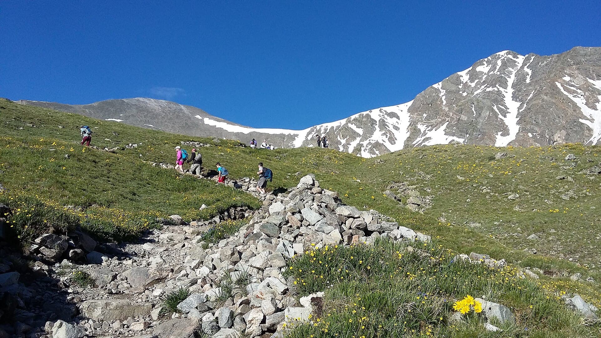
The trail begins in the willow-lined valley below both peaks. Gradual climb on a good trail through evergreen and willow. Cross Stevens Gulch on a wooden bridge around mile 0.5. Watch for moose in the willows, especially early morning.
The view of Grays Peak's northeast face dominates the entire approach. Torreys is hidden behind Grays from this angle until you climb higher.
Section 2: The Long Climb to Grays (Miles 1.5-3.5)
The trail switchbacks up the east slopes of Grays. The grade is sustained but not punishing (10-12% average). Most of the elevation gain happens here.
Around 12,500 ft you'll cross into alpine terrain. Watch for marmots, pikas, and white-tailed ptarmigan above treeline. The trail is well-cairned but exposed to wind from the north and west.
The upper section involves talus and larger rock. The route stays well-marked; follow the cairns.
Section 3: The Grays Peak Summit (Mile 4.0)
Grays Peak summit is a broad, relatively flat alpine plateau. Plenty of room for groups. Views span the Front Range to the east, the Continental Divide spreading north and south, and the Tenmile and Mosquito ranges to the west.
A USGS benchmark marker indicates the true summit.
This is the decision point. From the summit, you can see Torreys' summit clearly across the saddle. Now you decide whether to continue or descend.
The Traverse to Torreys
Section 4: Grays-Torreys Saddle (Miles 4.0-4.3)
From Grays' summit, the route descends 600 vertical feet to the saddle between the two peaks. This is the steepest, loosest section of the entire route. Rocks shift; trekking poles help.
The descent is rough but stays Class 2 (no scrambling required). Take it slow; this is where you can twist an ankle.
The saddle is at 13,710 ft. From here, Torreys' summit is 565 vertical feet up over 0.3 miles.
Section 5: Climb to Torreys (Miles 4.3-4.6)
The climb to Torreys is steep but short. The trail is well-defined. Some hikers find this section harder than the climb to Grays because they're already tired and the air is thinner.
The summit of Torreys is smaller than Grays', with room for 10-15 people. Views are slightly different than Grays: better view of the Loveland Ski Area to the north, slightly more impressive view of Kelso Ridge to the west.
A small cairn marks the summit.
Section 6: The Descent Decision
From Torreys, you have two options:
Option A: Return via Grays. Climb back up Grays' east slopes (565 ft), then descend the standard route. Adds 0.5 miles and 565 ft of climbing on tired legs.
Option B: Descend via the Kelso Ridge / Stevens Gulch shortcut. A less-defined trail descends the saddle between Grays and Torreys directly into Stevens Gulch. Saves climbing but adds challenging route-finding and loose terrain. Most hikers don't recommend this for newcomers.
For first-time double-baggers, Option A is the safer choice. Yes, you have to climb back up Grays, but the route is defined and the descent is manageable.
Section 7: The Return (Miles 4.6-8.5)
Descending Grays' east slopes on the standard route. Same descent considerations as Bierstadt: knees take a beating on the talus, trekking poles save them.
Re-cross Stevens Gulch, return to the trailhead.
Single Peak vs Double Peak Strategy
If you're not certain you can do both, plan to do Grays only. The single-peak option is a complete, satisfying 14er climb. You can decide at Grays' summit whether to push on.
Reasons to do Grays only:
- Weather building (storms in the forecast for afternoon)
- You're significantly tired at the summit
- You came up from sea level less than 24 hours ago
- You're hiking with people not committed to the second peak
Reasons to attempt the double:
- You feel strong at Grays' summit
- Weather is clear and stable
- It's before 10 AM
- You're acclimatized
A common pattern: tell yourself you'll do Grays + decide at the summit. Resist the "I have to do both because I drove this far" voice. Bagging Torreys later is a fine outcome.
What to Pack
Same base kit as Mount Bierstadt:
- 2.5-3 liters of water minimum (3+ for the double)
- 800-1500 calories of trail food (more for the double)
- Layering system: base + insulation + wind shell + rain shell
- Sun protection (sunglasses, sunscreen, hat)
- Headlamp for alpine start
- Sturdy hiking boots
- Map and offline GPS
- First aid basics
- Trekking poles (especially for the descent)
See our hiking boots guide, layering guide, and rain jacket guide for specific recommendations.
The double adds about 30 minutes to your day and requires extra calories. Carry an extra meal or large energy bar specifically for the saddle area.
Timing and Weather
Same rule as all Front Range 14ers: be off the summits by noon.
Recommended timing for the double:
- Trailhead: 4:30 AM
- Treeline (12,500 ft): 6:30 AM
- Grays summit: 8:30-9:00 AM
- Torreys summit: 9:30-10:00 AM
- Back to Grays summit: 10:30 AM
- Below treeline: 11:30 AM
- Trailhead: 1:30 PM
For Grays only:
- Trailhead: 5:00 AM
- Grays summit: 8:30 AM
- Trailhead: 12:00 PM
For a 4:30 AM trailhead start, leave Denver by 2:30 AM. Don't underestimate the Stevens Gulch Road drive time on the way up; the 4WD section is slow.
Check forecast.weather.gov for the Idaho Springs / Loveland Pass mountain forecast. The same weather principles apply as for Bierstadt:
- Storm probability above 30%: reconsider
- Wind speed at altitude above 35 mph: it'll be unpleasant
- Snow falling: turn around
When to Climb
Best months: Mid-June through mid-September.
June: Snow in upper sections through early-to-mid June most years. Microspikes useful early. By late June, dry conditions for the standard route.
July: Peak season. Monsoon starts mid-month. Start by 4 AM.
August: Peak monsoon. Storm-ready by 11 AM most days.
September: Best stable weather. Cooler. Some early snow after mid-month.
October-May: Winter conditions. Stevens Gulch Road typically closed past the lower lot. Snowshoes or mountaineering equipment required.
What Makes This Different from Bierstadt
Grays and Torreys vs Mount Bierstadt:
More elevation gain. 3,600 ft (double) vs 2,850 ft (Bierstadt).
More distance. 8.5 miles (double) vs 7 miles (Bierstadt).
Higher trailhead. 11,280 ft (Stevens Gulch) vs 11,669 ft (Guanella Pass). Actually a slight advantage to Bierstadt for altitude, but Stevens Gulch starts your day with more climbing.
Worse access road. Stevens Gulch requires 4WD; Guanella Pass is paved. This is a significant logistical difference.
Bigger summit views. Grays Peak is the highest point on the Continental Divide and offers more dramatic views than Bierstadt.
Two peaks for one drive. The double-summit option is unique to Grays/Torreys.
If you have a low-clearance car: do Bierstadt first. The Stevens Gulch Road might rule out Grays for you.
If you want to bag multiple 14ers efficiently: Grays/Torreys is the best Front Range double.
Common Mistakes
Underestimating the road. Sedans and crossovers can't make the upper trailhead. Plan to park at the lower lot if you don't have clearance.
Trying the double without acclimatization. The second peak (Torreys) feels dramatically harder if you're tired. Sleep at Front Range altitude for at least one night before.
Descending too fast on the Grays-Torreys saddle. This is the most common ankle-twist location. Slow down.
Not eating enough. The double burns 4,500+ calories for most people. Carry 2-3x your normal day-hike food load.
Going too fast on the ascent. Pace yourself for the entire day, not just the first peak.
Skipping the helmet for Kelso Ridge variant. If you opt for Kelso Ridge to Torreys instead of the standard route, you need a helmet. Loose rock falls.
Other 14ers to Consider
After Grays/Torreys:
- Mount Bierstadt: Easier, similar drive from Denver. See our Mount Bierstadt guide.
- Quandary Peak: Comparable difficulty, near Breckenridge. See our Quandary Peak guide.
- Mount Elbert: Colorado's highest. Longer but non-technical. See our Mount Elbert guide.
- Pikes Peak by Barr Trail: A serious endurance challenge. See our Pikes Peak guide.
For the full ranking of 14ers by difficulty, see our easiest 14ers guide.
Final Thoughts
Grays Peak alone is a clean, satisfying 14er. The double with Torreys is the best value in the Front Range for hikers who want to bag two peaks in one trip. The route is well-defined and non-technical; the limiting factors are altitude, weather, and access road logistics.
Plan around the road. If you can drive to the upper trailhead, the day is straightforward. If you have to park at the lower lot, plan extra time and extra calories.
Alpine start, watch the weather, pace yourself for both peaks, respect the descent. These rules don't change for Grays/Torreys.
For the full gear kit, see our guides to hiking boots, rain jackets, headlamps, and base layers.
Get the Colorado 14er Packing Checklist (free PDF)
Plus a weekly note on the best Colorado trails, gear deals, and seasonal hike picks. No spam, unsubscribe anytime.
We respect your inbox. Unsubscribe anytime.