South Mineral Campground: The Ice Lake Basin Basecamp Near Silverton

South Mineral Campground is a small first-come, first-served Forest Service campground at about 9,800 feet in the San Juan Mountains, roughly 7 miles west of Silverton, Colorado. It has 26 sites strung along South Mineral Creek, vault toilets, and no hookups or reliable drinking water. The reason people plan a trip around it, though, is what sits directly across the road: the Ice Lake Basin trailhead, gateway to one of the most photographed turquoise alpine lakes in the state. Camp here and you wake up a few steps from the trail, which means you skip the brutal early-morning parking scramble that the day-trip crowd deals with.
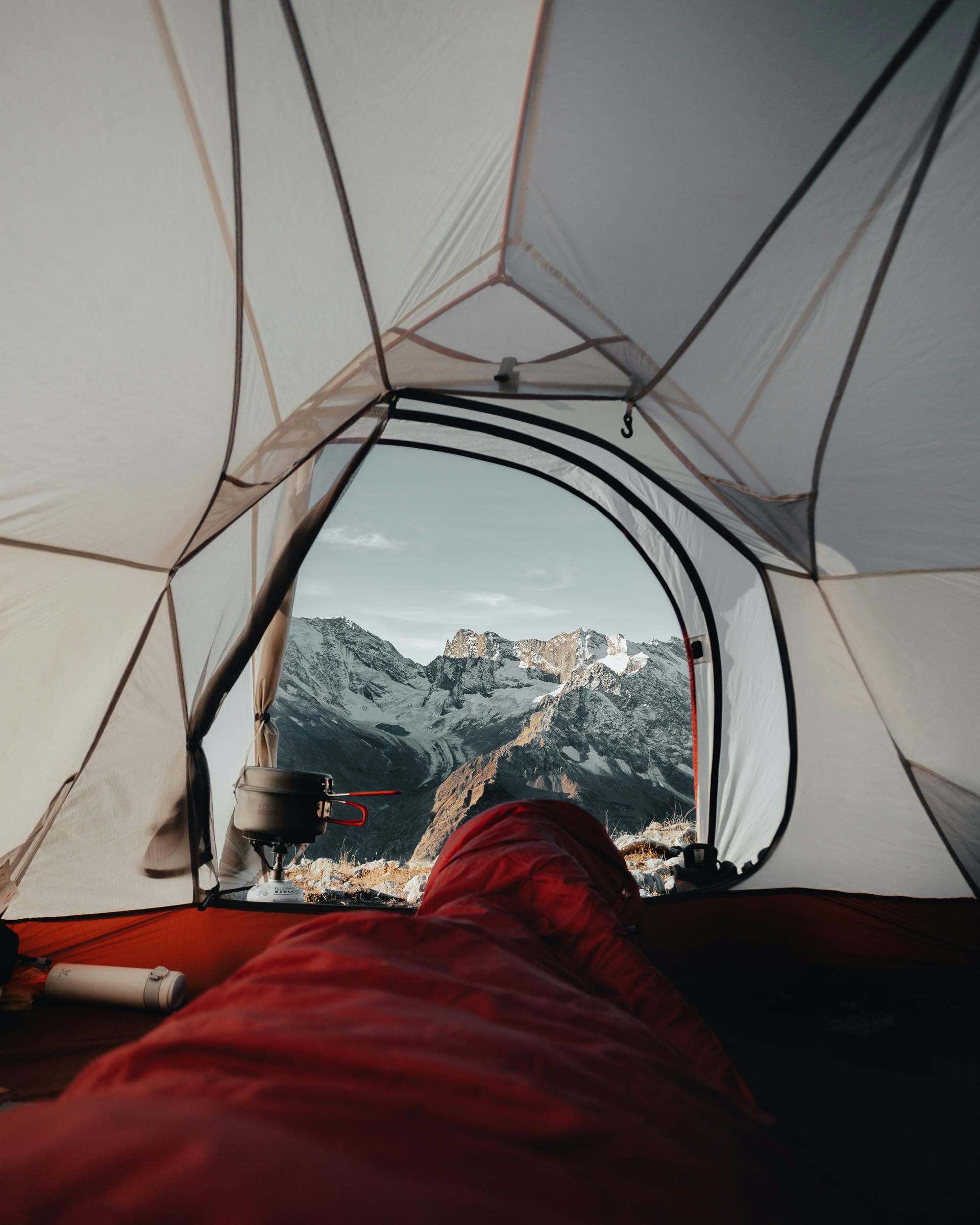
If you pack one thing right for this campground, make it a tent and sleeping setup rated for real cold. At 9,800 feet, nights dip into the 30s and 40s even in July, and an early-season or late-season trip can bring frost. A three-season backpacking tent plus a warm bag beats a summer car-camping tent by a wide margin up here. More on the full packing list below.
What You'll Learn
- Quick facts at a glance
- Where South Mineral Campground is
- How to get there
- The campground: sites, fees, and what to expect
- Dispersed camping along South Mineral Creek Road
- Hiking to Ice Lake Basin from your tent
- Clear Lake and other trips up the road
- Best time to camp here
- What to pack for a night at 9,800 feet
- Know before you go
- Frequently asked questions
Quick facts at a glance
| Detail | Info |
|---|---|
| Location | South Mineral Creek Road, about 7 miles west of Silverton, San Juan National Forest |
| Elevation | About 9,800 feet |
| Sites | 26 mostly level sites, tents and small RVs |
| Reservations | First-come, first-served only. No advance booking |
| Fee | A nightly fee applies; confirm the current rate with the San Juan National Forest before you go |
| Facilities | Vault toilets, picnic tables, fire rings. No hookups, no reliable potable water |
| The draw | Ice Lake Basin trailhead sits directly across the road |
| Access road | About 4 miles of maintained dirt off Highway 550, passable to most cars in summer |
| Season | Roughly late spring through early fall, snow depending |
| Cell service | Spotty to none. Download maps and directions first |
Where South Mineral Campground is
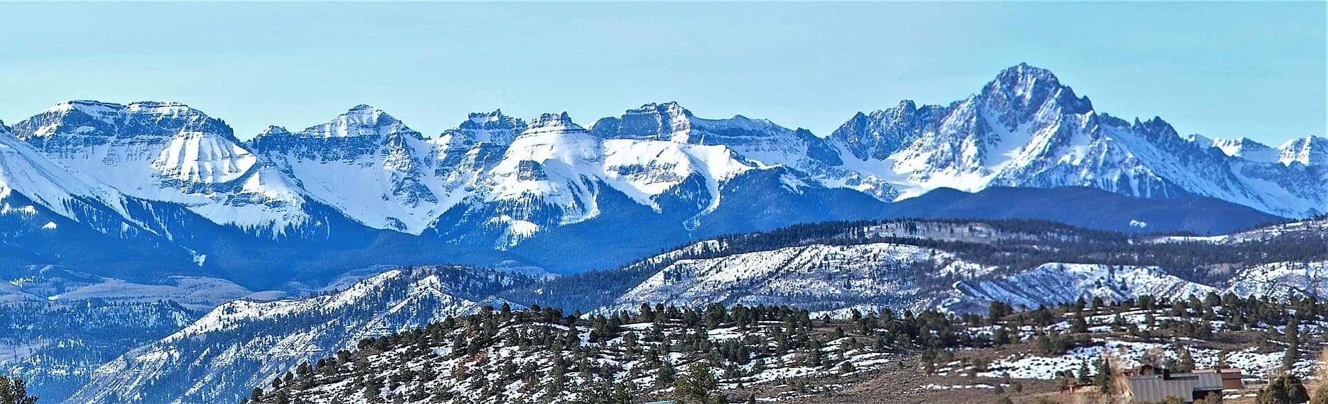
The campground sits in a high valley on South Mineral Creek, west of Silverton in the San Juan Mountains. Silverton itself is a former mining town at about 9,318 feet on U.S. 550, the stretch of road known as the Million Dollar Highway, roughly 50 miles north of Durango and 25 miles south of Ouray. From town, you drop down onto the highway briefly, then turn up South Mineral Creek Road and climb into a bowl ringed by 13,000-foot volcanic peaks.
This is classic San Juan country: steep, colorful, and higher than most people expect. The valley floor here already sits above where many Front Range 14er trailheads start. That elevation is the whole appeal and also the thing to respect, since the thin air affects sleep, appetite, and how hard the hikes feel. If you are new to the range, our San Juan Mountains guide covers the geology, the byways, and how the towns connect.
How to get there
From Silverton, follow U.S. 550 south and west out of town for a couple of miles, then turn onto South Mineral Creek Road (Forest Road 585), which is signed for the campground and Ice Lake. The turn is easy to miss, so watch your odometer and your map. From the highway, it's about 4 miles of maintained dirt and gravel to the campground, with the total distance from Silverton coming to roughly 7 miles.
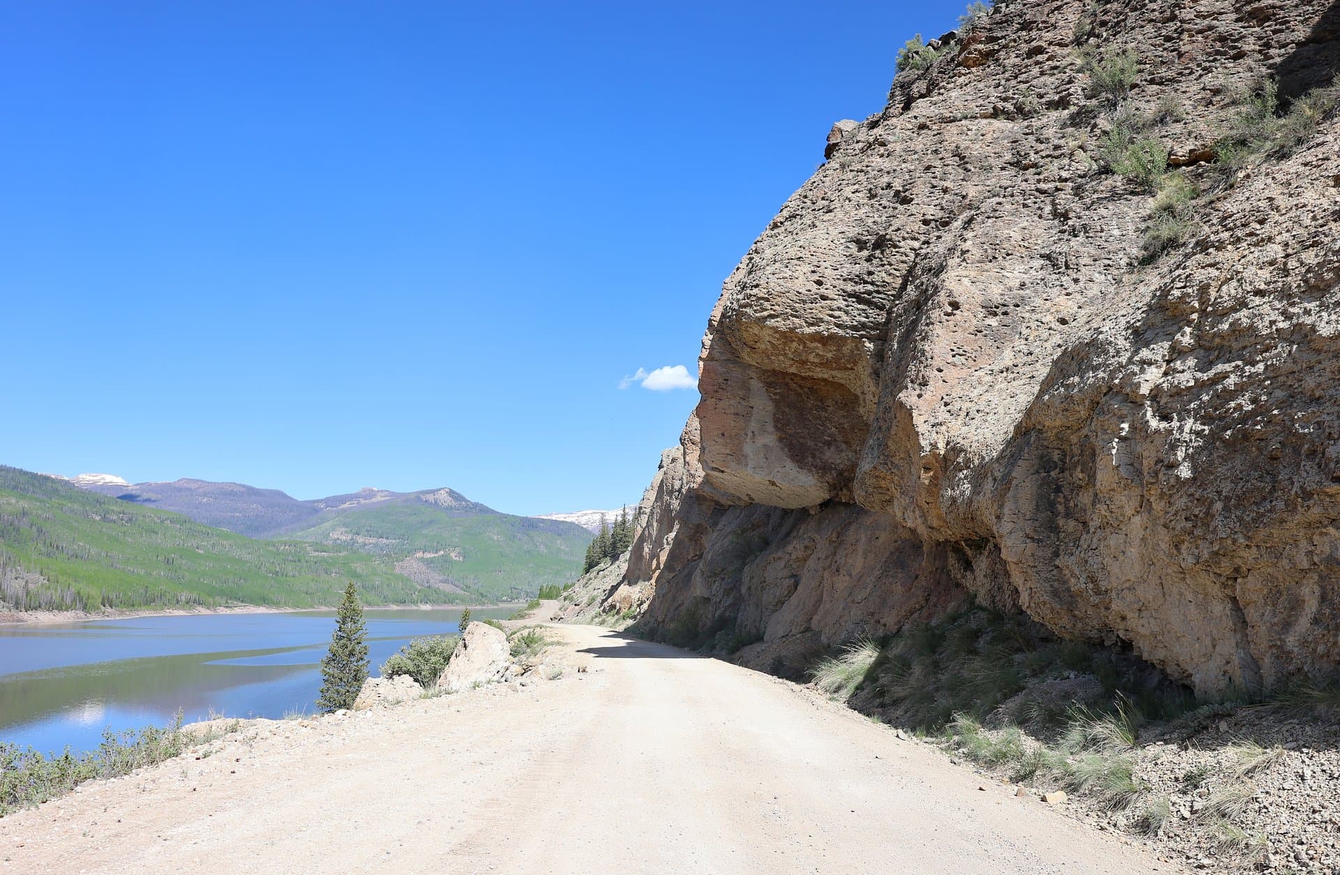
The road is graded and passable to most passenger cars in dry summer conditions, though it gets washboarded and dusty as the season wears on. Take it slow, especially on blind curves, because this is a busy road on summer weekends. After a heavy rain the surface can turn greasy, and early or late in the season you may hit lingering snowdrifts near the upper end. Beyond the campground the road deteriorates and turns into rougher four-wheel-drive terrain toward Clear Lake and the old mine sites, so don't assume your sedan can keep climbing past the campground.
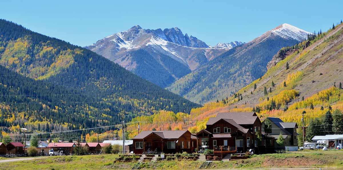
Silverton is your last real supply stop. It has gas, a grocery, restaurants, and outfitters, but hours can be short and the town is small, so fuel up and buy your food and water before you turn up the dirt. There's no store, no water spigot you can count on, and no cell signal once you're up the valley.
The campground: sites, fees, and what to expect
South Mineral Campground has 26 sites, most of them reasonably level, spread along the creek among spruce and fir. It runs first-come, first-served, with no reservation system, so your strategy is simple: arrive early. On summer weekends and through the wildflower peak in July, sites can fill by Friday morning or even Thursday. Midweek gives you far better odds, and rolling in before checkout time on a busy morning lets you grab a site as someone else pulls out.
Each site has a picnic table and a fire ring. There are vault toilets, and that's about the extent of the amenities. There are no hookups, no dump station, and no reliable drinking water, so you need to bring every drop you plan to use or filter from the creek. The sites suit tents and smaller RVs or trailers; big rigs will struggle with the dirt road and the tight, sloped sites, and there's no room to maneuver a long trailer.
A nightly camping fee applies. The Forest Service adjusts its rates, and payment at this campground is handled on-site rather than through advance booking, so check the current fee and payment method on the San Juan National Forest recreation pages before you drive out. Bring cash or be ready to pay by app, since signal is unreliable and you may need to sort payment before you lose service.
Dispersed camping along South Mineral Creek Road
If the campground is full, South Mineral Creek Road is lined with free dispersed sites, and a lot of people plan on those from the start. You'll see pullouts and established spots along the road below and around the campground, many with existing fire rings and creek access. These are free, but they fill even faster than the campground on a summer weekend, and the good ones near the trailhead go first.
Dispersed camping here follows standard national forest rules: camp in already-used sites to avoid trampling new ground, keep well back from the water, pack out everything including toilet waste where required, and follow any posted stay limits and fire restrictions. Because this corridor gets hammered with use, land managers watch it closely, and a bad fire year can bring restrictions or closures with little notice. Our Colorado dispersed camping guide walks through the distance rules, the 14-day limits, and how to read a motor vehicle use map so you know which pullouts are legal.
The trade-off is real: dispersed sites are free and let you camp right at the trailhead, but you get no toilet, no table, and no ranger presence, so you're fully on your own for waste and safety. If you value a vault toilet and a defined site, the campground fee buys you that.
Hiking to Ice Lake Basin from your tent
Here's why the campground is worth the effort. The Ice Lake Basin trail (Forest Trail 505) starts directly across the road, so campers walk to the trailhead instead of fighting for one of the few parking spots that vanish by 7 a.m. on a summer morning. That alone is a strong argument for spending the night up here.
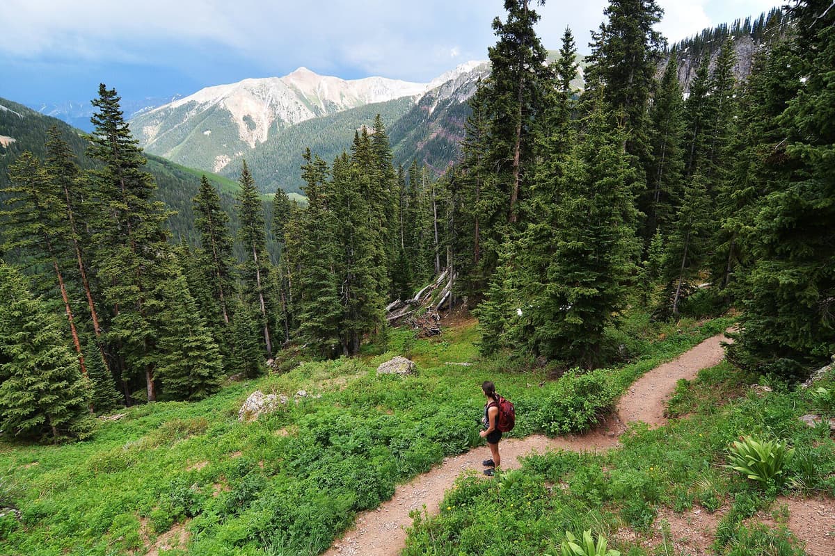
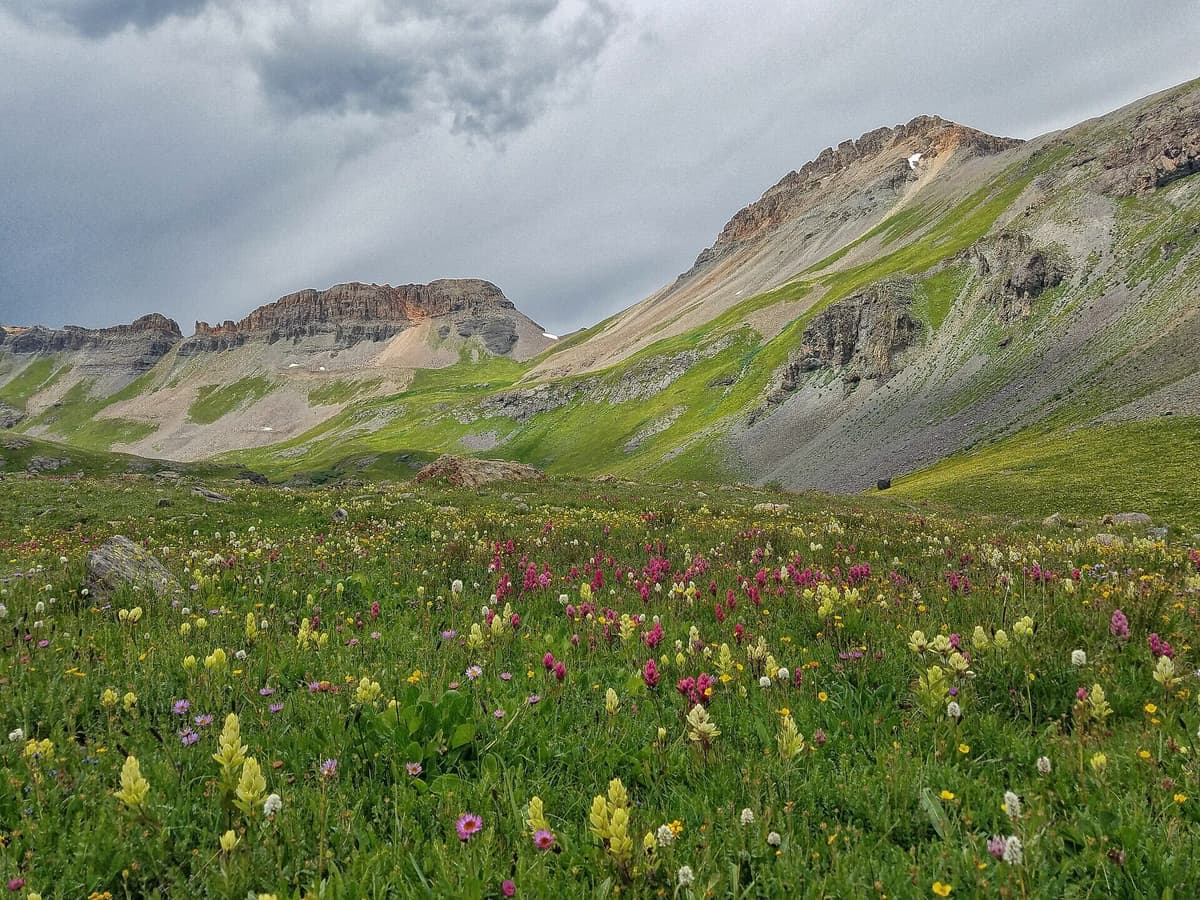
The trail climbs hard from the start. From the roughly 9,800-foot trailhead, you switchback up through forest into Lower Ice Lake Basin, a broad meadow around 11,400 feet laced with waterfalls and, in mid-summer, some of the best wildflowers in Colorado. Many people make the lower basin their turnaround, and it's a worthy hike on its own. To reach Upper Ice Lake, you keep climbing another steep pitch to the lake at roughly 12,200 feet. Round trip to the upper lake runs about 7.4 miles with somewhere in the range of 2,400 to 2,900 feet of gain, depending on how sources measure it. Either way, it's a strenuous day at high altitude, so treat it that way.
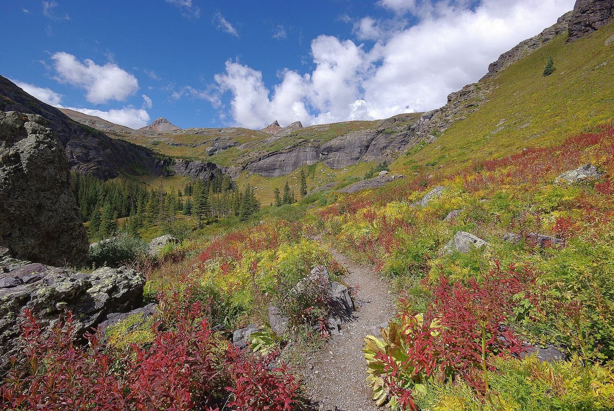
Upper Ice Lake is the payoff. The water glows an unreal turquoise, a color that comes from finely ground glacial rock flour and dissolved minerals suspended in the meltwater, catching the light. From the upper lake you can branch to Island Lake at roughly 12,400 feet, named for the small rock island in its equally vivid water, which adds about a mile round trip. Fuller Lake sits higher still, near 12,600 feet, and strong hikers link several of these together into one long day. The basin is ringed by jagged 13ers like Vermilion Peak, Golden Horn, and Pilot Knob, so the scenery keeps earning its reputation the whole way up.
Two cautions matter here. First, the 2020 Ice Fire burned part of the lower basin, and while the trail reopened in 2021, you may still see burn scar and standing dead trees, so check current conditions with the San Juan National Forest before you go. Second, this is exposed alpine terrain, and afternoon thunderstorms are the rule in July and August. Start at first light, aim to be off the high basin by early afternoon, and turn around if the sky builds. Our altitude sickness guide is worth a read before a hike that tops out above 12,000 feet, and camping at 9,800 feet the night before gives your body a real head start on acclimating.
Clear Lake and other trips up the road
Ice Lake gets the headlines, but South Mineral Creek Road is a hub for more than one trip. Clear Lake sits at about 12,000 feet in its own basin above the campground, and the draw is that you can drive nearly to the shore, if you have the right vehicle. The Clear Lake road is a rough, high-clearance four-wheel-drive route that switchbacks up the mountainside, not a passenger-car road, and it's not for nervous drivers. If you don't have the rig for it, you can hike or bike the road instead and still reach a stunning alpine lake with far fewer people than Ice Lake.
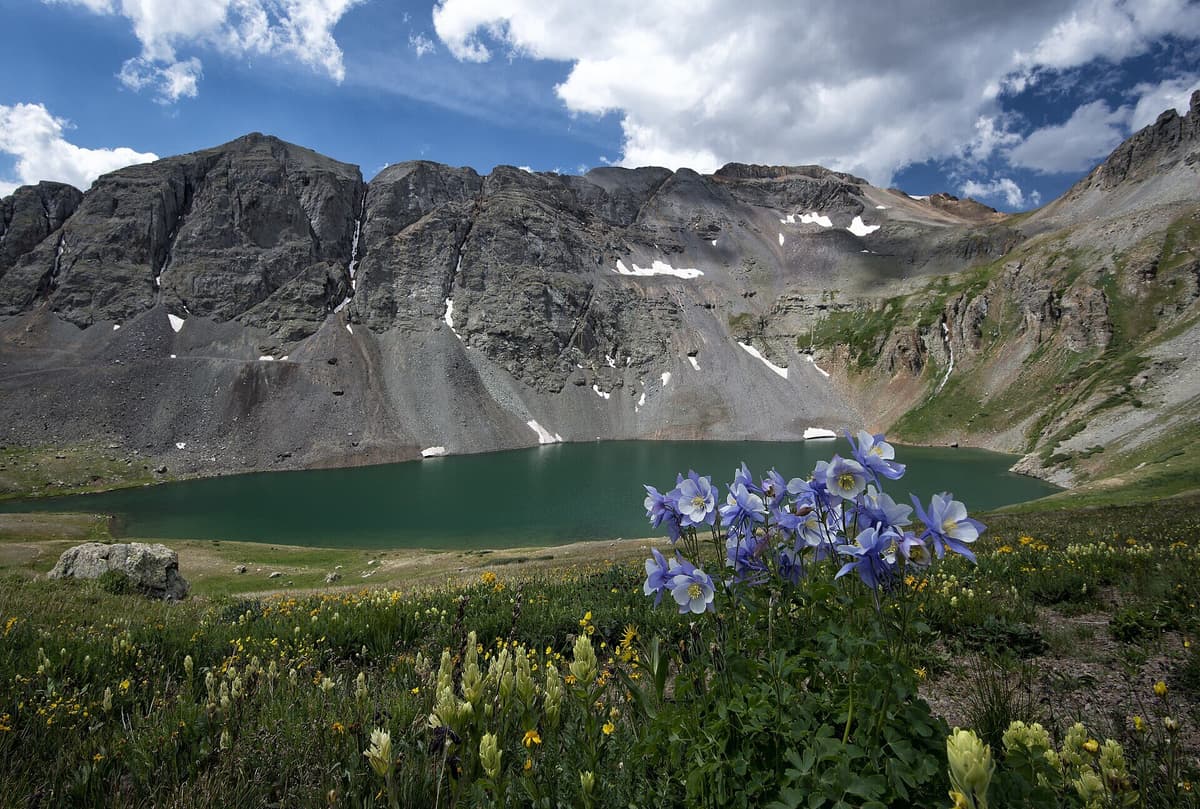
Around the valley you'll also find waterfalls tumbling off the walls, old mining relics like the Bandora Mine higher up the drainage, and connections deeper into the backcountry for people carrying overnight packs. The whole area is a launch point for exploring this corner of the range, and Silverton makes an easy resupply between trips. If you're building a longer road trip, our best hikes near Durango and best hikes near Telluride roundups cover the towns on either side of the San Juans.
Best time to camp here
The camping season up here is short. The road and campground typically open once the snow clears in late spring and stay usable into early fall, but exact dates shift year to year with the snowpack, so confirm before a shoulder-season trip. Mid-July through August is the reliable window, and it's also the busiest, so plan around crowds.
For wildflowers, aim for mid-to-late July, when the lower basin meadows go off. For fall color, late September brings gold to the aspens lower in the valley, though the high basin is above treeline and stays green rock and tundra. Whenever you come, the San Juans run wetter than much of Colorado thanks to the summer monsoon, so pack for afternoon rain and cold nights even in the middle of summer. If you're mapping out a whole trip, our guide to the best places to visit in Colorado in summer puts the San Juans in context with the rest of the state.
What to pack for a night at 9,800 feet
Camping this high changes your gear list. Nights get cold, weather turns fast, and there's no water tap, so plan for self-sufficiency:
- A warm sleep system. A bag rated colder than you think you need, since summer nights up here drop into the 30s and 40s. Pair it with an insulated sleeping pad with a solid R-value, because the ground pulls heat out of you fast at altitude.
- A capable tent. Wind and rain come through, so a sturdy backpacking or mountaineering tent beats a flimsy summer shelter. Our best backpacking tents for Colorado roundup breaks down the trade-offs.
- Water and a way to treat more. Bring your drinking water, and carry a backpacking water filter so you can safely refill from the creek. See our best water filters for hiking in Colorado for picks that handle silty alpine runoff.
- Layers for cold and rain. A warm midlayer, a rain shell, hat, and gloves, even in July. Our what to wear hiking guide covers the layering system for mountain weather.
- Trekking poles and traction. The climb to Ice Lake is steep, and trekking poles save your knees on the descent. Early or late season, snowfields linger high, so microspikes can be worth the space.
- A headlamp. For the pre-dawn start you'll want if you're serious about beating the storms. A reliable headlamp is cheap insurance.
Know before you go
A few things trip people up at South Mineral. There is no reliable drinking water, so never assume you can top off a jug at camp. Pack out all your trash and food scraps, and store food so it doesn't draw animals, since black bears and smaller critters work these campgrounds. Fire restrictions come and go with the summer, and a dry year can mean no campfires at all, so check the current stage before you plan on a fire. Keep dogs leashed and under control around the crowds and wildlife.
Altitude is the quiet risk. Sleeping at 9,800 feet and hiking above 12,000 is a lot for a body that flew in from sea level yesterday, so give yourself a day to adjust, drink more water than feels necessary, and back off if you get a pounding headache or nausea. Finally, this is a popular, heavily used area, so tread lightly. Camp on durable surfaces, stay on the trail through the fragile basin, and leave the wildflowers for the next person's photos. Parking at a trailhead this busy is its own challenge, which is one more reason camping across the road pays off.
Frequently asked questions
Can you reserve a site at South Mineral Campground?
No. South Mineral Campground is first-come, first-served with no advance reservations. Your best bet is to arrive early, especially midweek, or plan to use one of the free dispersed sites along South Mineral Creek Road if the campground is full.
How far is South Mineral Campground from the Ice Lake Basin trailhead?
Effectively zero. The Ice Lake Basin trailhead sits directly across the road from the campground, so campers walk to the trail instead of competing for the limited parking that fills by early morning in summer.
Can a regular car make it to South Mineral Campground?
Usually yes in dry summer conditions. The roughly 4-mile road off Highway 550 is maintained dirt and gravel and passable to most passenger cars, though it's washboarded and slick when wet. The rougher four-wheel-drive terrain starts past the campground on the way to Clear Lake.
Is there water at South Mineral Campground?
Not reliably. Plan to bring all your drinking water or filter from South Mineral Creek. There are vault toilets but no potable water spigot, hookups, or dump station, so come fully self-sufficient.
When is South Mineral Campground open?
Roughly late spring through early fall, depending entirely on snow. Mid-July through August is the dependable window and the busiest. Confirm current road and campground status with the San Juan National Forest before a shoulder-season trip.
South Mineral Campground is a lot of things at once: a legitimate high-country campground, a free-dispersed-camping corridor, and the closest bed to one of Colorado's most stunning alpine lakes. Get there early, pack for cold nights and afternoon storms, and let the short walk to the Ice Lake Basin trailhead do the rest. For more turquoise water to chase after this trip, see our guide to the best alpine lakes in Colorado.
Get the Colorado 14er Packing Checklist (free PDF)
Plus a weekly note on the best Colorado trails, gear deals, and seasonal hike picks. No spam, unsubscribe anytime.
We respect your inbox. Unsubscribe anytime.