10 Best Hikes Near Durango, Colorado (2026 Trail Guide)
Durango sits at 6,512 feet in southwestern Colorado's Animas River valley, surrounded by the San Juan Mountains. That means you've got everything from paved riverside strolls to lung-burning alpine climbs within a 30-minute drive. The town's been a basecamp for hikers, climbers, and train-chasers since the 1880s, and the trail network keeps getting better. Here are ten hikes that show off why Durango's one of Colorado's best hiking towns.
What You'll Learn
- Colorado Trail to Gudy's Rest
- Animas Mountain Trail
- Perins Peak Trail
- Hogsback Trail
- Animas River Trail
- Cascade Creek Trail
- Raider Ridge Overlook
- Junction Creek to Kennebec Pass
- La Plata Canyon
- Potato Lake (Spud Lake)
- What to Bring on Durango Hikes
- Frequently Asked Questions
Colorado Trail to Gudy's Rest
Distance: 7.2 miles round trip | Elevation Gain: 1,600 ft | Difficulty: Moderate
This is the hike everyone recommends first, and for good reason. The trail follows the first segment of the 486-mile Colorado Trail, climbing through aspen groves and mixed conifer forest before reaching Gudy's Rest, a rocky overlook named after Gudy Gaskill, the woman who championed the Colorado Trail's construction.
From the top, you'll look down at the Animas River valley with Durango spread out below and the La Plata Mountains stacking up to the west. It's the kind of view that makes you understand why people move here.
The trailhead sits at the Junction Creek parking area off 25th Street on Durango's west side. Parking fills fast on summer weekends, so aim to start before 8 AM. The trail is well-marked and maintained, though the first mile climbs steadily and can feel relentless if you're not acclimated to altitude.
Pro tip: Bring trekking poles for the descent. The rocky switchbacks are much kinder on your knees with poles taking some of the impact.
Spring through fall is the prime window. Snow can linger on the upper sections into May, and the trail gets icy by late November.
Animas Mountain Trail
Distance: 5.8 miles (loop) | Elevation Gain: 1,300 ft | Difficulty: Moderate
You can literally walk to this trailhead from downtown Durango, and that's half the appeal. Animas Mountain rises right out of the north end of town, and the loop trail circles its summit with views in every direction.
The east side of the loop climbs more aggressively, so most hikers go counterclockwise to get the steep part done early. You'll pass through scrub oak, ponderosa pine, and open meadows before reaching the ridge, where Durango, the Animas River, and the Needle Mountains fill the horizon.

Watch for rattlesnakes on the lower sections from May through September. They like the warm, rocky terrain on the east face. Keep dogs leashed (it's required here anyway) and stick to the trail through the switchbacks where erosion is a problem.
This trail gets hot and exposed in summer. Carry at least two liters of water and wear a sun hat with neck coverage. There's zero shade on the upper ridge.
Perins Peak Trail
Distance: 7.5 miles round trip | Elevation Gain: 2,100 ft | Difficulty: Hard
Perins Peak is Durango's big challenge hike. The trail climbs relentlessly from the trailhead off Leyden Street through Gambel oak thickets and ponderosa forest before breaking out onto the rocky summit ridge. The final push involves some scrambling over exposed rock, but nothing that requires technical gear.
The payoff is enormous. From the 8,889-foot summit, you get a full panorama: the La Plata range to the west, the Needle Mountains to the north, Nighthorse Reservoir glinting below, and the dusty expanse of the Southern Ute lands stretching south toward New Mexico.
Important: Perins Peak Wildlife Management Area closes seasonally (December 1 through April 15, typically) to protect wintering deer and elk. Check with Colorado Parks and Wildlife for current closure dates before you go.
Pack a water filter or purification tablets if you're topping off from streams on longer Durango hikes. Giardia is common in Colorado waterways.
Hogsback Trail
Distance: 3.2 miles round trip | Elevation Gain: 900 ft | Difficulty: Moderate
Hogsback is one of Durango's most popular after-work hikes, and you'll see why the first time you watch a sunset from the ridgeline. The trail climbs a narrow, hog-shaped ridge (hence the name) with steep drop-offs on both sides and views that feel way more dramatic than the modest distance suggests.
The trailhead is in the Overend Mountain Park area off East Animas Road. The first half mile is the steepest, and then the grade mellows as you walk the spine of the ridge. Wildflowers carpet the hillsides in June and July.
This is a great option if you're short on time but still want a real hike. Most people finish in 90 minutes. Pair it with a stop at one of Durango's breweries afterward, because that's basically a local tradition.
If you're new to Colorado hiking, check out our beginner's guide to hiking in Colorado for altitude tips, trail etiquette, and packing basics.
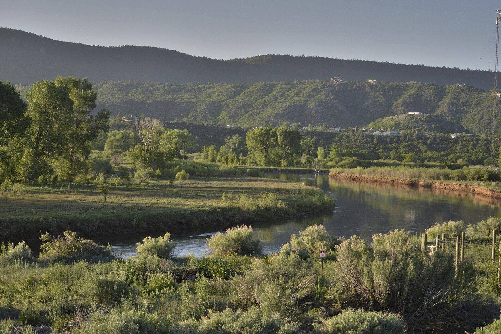
Animas River Trail
Distance: Up to 7 miles one way | Elevation Gain: Minimal | Difficulty: Easy
Not every hike needs to leave you gasping. The Animas River Trail is a paved, multi-use path that follows the Animas River through downtown Durango and beyond. It's perfect for families, casual walkers, joggers, and anyone who just wants a flat stroll with mountain views and river sounds.

The trail connects several parks, including Schneider Park, Rotary Park, and Santa Rita Park. You'll pass old railroad bridges, kayakers playing in the whitewater park, and the iconic Durango and Silverton Narrow Gauge Railroad if your timing is right.
It's also a solid option in shoulder seasons when higher trails are still snowy. The paved surface stays clear most of the winter, and the cottonwood trees along the river make fall walks here genuinely beautiful.
Bring a pair of comfortable trail running shoes for paved paths like this one. They're lighter than hiking boots and give you enough grip for any gravel side trails.
Cascade Creek Trail
Distance: 10.4 miles round trip | Elevation Gain: 1,800 ft | Difficulty: Moderate-Hard
If you want to get into real backcountry without driving hours from Durango, Cascade Creek delivers. The trailhead sits about 28 miles north of town along US-550 (the Million Dollar Highway), and the trail follows Cascade Creek through a narrow, forested valley toward the Weminuche Wilderness.
Old-growth spruce and fir line the creek, and the trail crosses the water several times (rock-hopping in low flow, wet feet in spring runoff). The deeper you go, the quieter it gets. By mile three, you're unlikely to see another person.
This trail is the gateway to longer backpacking routes into the Weminuche, Colorado's largest wilderness area. But as a day hike, an out-and-back to the five-mile mark puts you in some of the prettiest creek-side forest in the San Juans.
Gear note: Creek crossings mean waterproof hiking boots are worth their weight. Wet socks for five miles of rocky trail is nobody's idea of fun.
Raider Ridge Overlook
Distance: 1 mile round trip | Elevation Gain: 200 ft | Difficulty: Easy
Sometimes you just want a view without earning it. Raider Ridge is a quick, easy walk from the Fort Lewis College campus area that overlooks Durango and the surrounding valley. The entire hike takes about 30 minutes, and the vista punches well above its weight class.
Follow 8th Avenue off College Drive to 3rd Street, then go one block east to where the trailhead begins. The path is short but not entirely flat, with a gentle rise to the overlook. It's popular with college students, dog walkers, and anyone looking for a sunset spot that doesn't require a headlamp for the walk back.

This pairs well with a longer hike earlier in the day. Knock out Gudy's Rest in the morning, grab lunch downtown, then catch the sunset from Raider Ridge.
Junction Creek to Kennebec Pass
Distance: 21 miles round trip | Elevation Gain: 4,300 ft | Difficulty: Very Hard
This is the big one. The trail follows the Colorado Trail from Junction Creek up to Kennebec Pass at 11,600 feet, where you're standing on the spine of the La Plata Mountains looking down at both sides of the range. It's an all-day epic that most hikers start before dawn.
The route climbs through the same forest as Gudy's Rest but keeps going, pushing through alpine meadows and above treeline where weather changes fast. Afternoon thunderstorms are almost guaranteed from late June through August, so plan to reach the pass by noon and start heading down.
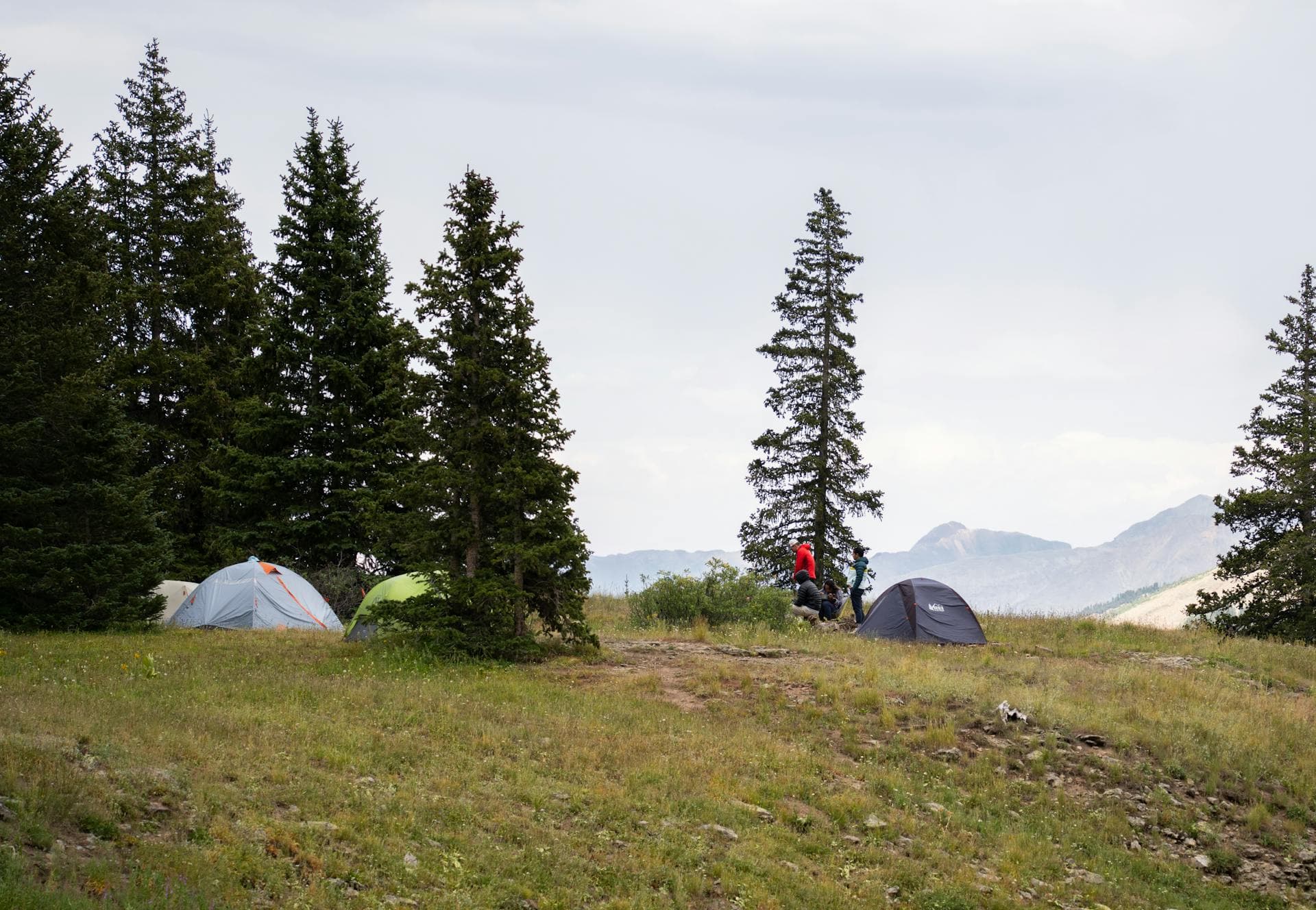
This isn't a casual outing. You'll want a full hiking daypack with rain cover, extra layers, food for 8+ hours, and the fitness to handle sustained climbing at altitude. Some hikers break it into an overnight trip, camping at one of the established sites along the creek.
For more on Colorado's longest and hardest trails, check our guide to Colorado 14ers.
La Plata Canyon
Distance: Varies (2 to 8 miles) | Elevation Gain: Varies | Difficulty: Easy to Moderate
La Plata Canyon is less a single trail and more a network of old mining roads and forest service routes that explore one of the prettiest canyons near Durango. Drive west on US-160 and turn north on La Plata Canyon Road (County Road 124) to access multiple trailheads.
The canyon bottom trails follow La Plata Creek through aspen-filled meadows and past crumbling mining ruins from the 1890s silver boom. Higher routes climb toward the ridgeline with views back down into the valley. You can make this as easy or hard as you want.
Fall colors here peak in late September and rival anything on the state's famous passes. The aspens turn gold and orange against dark spruce, and the canyon funnels the color into concentrated bursts.
If you're exploring off the main roads, a handheld GPS device or downloaded offline maps are smart insurance. Cell service disappears once you're a few miles into the canyon.
For more waterfall hikes in the state, check our guide to the best waterfall hikes in Colorado.
Potato Lake (Spud Lake)
Distance: 3.4 miles round trip | Elevation Gain: 700 ft | Difficulty: Easy-Moderate
Potato Lake (locals call it Spud Lake) sits at about 10,200 feet in a glacial cirque north of Durango, and it's one of the easiest alpine lakes to reach in the San Juans. The trailhead is about 30 minutes north of town off US-550, near the Purgatory Resort area.
The trail climbs steadily through spruce-fir forest with the occasional meadow opening before dropping slightly to the lakeshore. The lake sits in a bowl of rock and trees, and on calm mornings, the water reflects the surrounding peaks like glass. It's a great spot for a packed lunch and some quiet time.
Fishing is popular here (stocked with trout), so bring a rod if that's your thing. Even if it's not, the hike is worth it for the scenery alone.
For more alpine lake hikes across the state, check our roundup of the best alpine lakes in Colorado.
What to Bring on Durango Hikes
Durango's elevation and mountain weather mean you need to be more prepared than your average day hike. Here's the short list:
- Water: At least 2 liters per person. More for hikes above treeline or in summer heat.
- Layers: Mountain weather shifts fast. A lightweight packable rain jacket belongs in your pack even on blue-sky mornings.
- Sun protection: High altitude means stronger UV. Sunscreen, sunglasses, and a hat aren't optional.
- Snacks: Trail mix, bars, jerky. Anything calorie-dense that doesn't need refrigeration.
- Map/GPS: Cell service is spotty outside of town. Don't rely on your phone for navigation.
- First aid kit: Basic supplies plus moleskin for blisters. A compact hiking first aid kit covers the basics.
If you're looking for a full gear breakdown, our hiking headlamp guide and hiking food guide cover two categories most people underestimate.
Frequently Asked Questions
What's the best time of year to hike near Durango?
Late May through October is the prime hiking season. Lower trails like Animas Mountain and the River Trail open up by mid-April, but higher routes like Kennebec Pass and Potato Lake stay snow-covered until June. Fall (September to mid-October) brings perfect temperatures and golden aspens with fewer crowds than summer.
Are there easy hikes in Durango for families?
Yes. The Animas River Trail is flat, paved, and stroller-friendly. Raider Ridge Overlook is short enough for kids, and Potato Lake is a manageable distance with a big payoff. All three work well for families with young children.
Do I need a permit to hike near Durango?
Most trails near Durango don't require permits for day hiking. The Weminuche Wilderness doesn't have a permit system for day use. Some trailheads charge a parking fee or require a Colorado Parks and Wildlife pass. Check specific trailhead requirements before you go.
Is it safe to hike alone near Durango?
Solo hiking is common and generally safe on well-traveled trails like Gudy's Rest, Animas Mountain, and Hogsback. For remote trails like Cascade Creek or the Kennebec Pass route, tell someone your plan and expected return time. Black bears live in the area, so carry bear spray and know how to use it.
How do I deal with altitude in Durango?
Durango sits at 6,512 feet, and trailheads range from 7,000 to 10,000+ feet. If you're coming from sea level, spend a day or two acclimatizing before tackling anything strenuous. Drink extra water, skip alcohol the first day, and don't ignore headaches or nausea. Those are your body telling you to slow down.
Head to our trails directory for more Colorado hikes sorted by region and difficulty.
Get the Colorado 14er Packing Checklist (free PDF)
Plus a weekly note on the best Colorado trails, gear deals, and seasonal hike picks. No spam, unsubscribe anytime.
We respect your inbox. Unsubscribe anytime.