Best Hikes Near Lake City, Colorado
Lake City is a tiny mountain town at 8,661 feet on the western slope of the San Juans, providing the closest paved access to Handies Peak and the Alpine Loop.
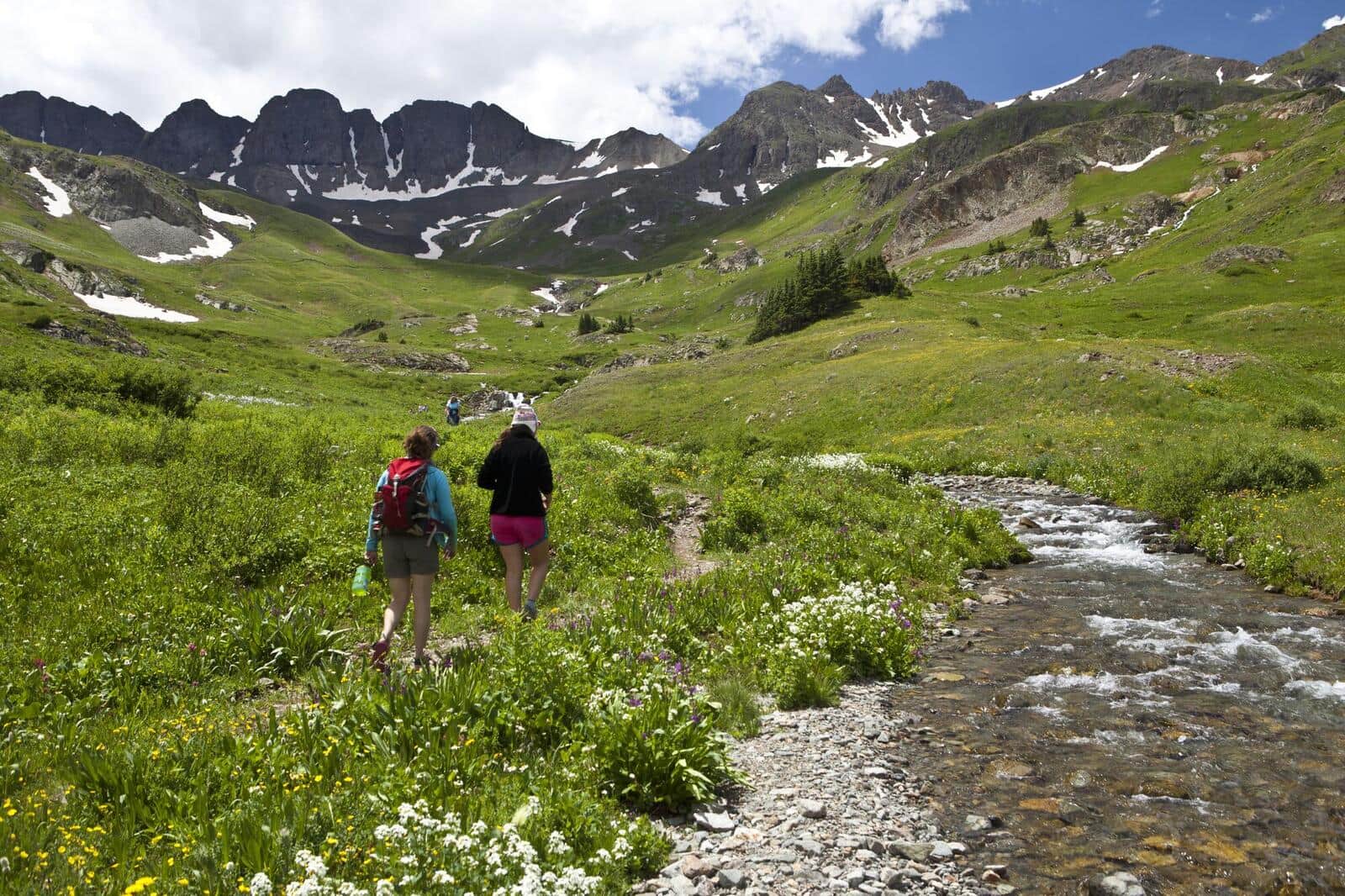
American Basin Trail
One of Colorado's most famous wildflower hikes. The basin explodes with color in mid-July through early August. Trailhead at the end of a rough 4WD road from Lake City. Also the standard start for Handies Peak (14er).
Cinnamon Pass Trail
Alpine pass between Lake City and Silverton, accessible as a 4WD route or a hike from the lower trailhead. The pass itself sits at 12,640 feet with views into both Animas Forks and Lake San Cristobal. Common access for Handies, Redcloud, and Sunshine 14ers.
Engineer Pass Trail
Alpine pass on the Alpine Loop Scenic Byway connecting Lake City and Ouray. Real hiking is possible from the lower trailhead; 4WD users can drive most of the way. Views span the entire upper San Juan headwaters.
Wetterhorn Basin Trail
Approach trail for Wetterhorn Peak (14er) from the Matterhorn Creek Trailhead. Long climb through a high basin with the iconic horn of Wetterhorn dominating views. Common as a 14er approach but worth doing as a basin hike alone.
Hiking in Lake City: what to know
Lake City has fewer than 500 year-round residents and one main street. The town sits on Henson Creek where it meets the Lake Fork of the Gunnison, with Lake San Cristobal (Colorado's second-largest natural lake) a few miles south. The hiking here is high, remote, and almost completely uncrowded compared to anywhere else in the state.
Handies Peak (14,058 feet) is the most accessible 14er from Lake City and one of the easiest 14ers in Colorado. The standard route from American Basin Trailhead is 5.5 miles round trip with 2,500 feet of gain. The trailhead requires a 4WD road approach via Cinnamon Pass; passenger cars can make it to the Grizzly Gulch parking area and add 2 miles each way.
American Basin in late July is one of the most spectacular wildflower destinations in Colorado: paintbrush, columbine, larkspur, and a dozen other species in full bloom under the peaks. Worth the trip even without summit ambitions.
The Alpine Loop is a 65-mile scenic byway loop connecting Lake City, Silverton, and Ouray through 12,000-foot passes (Cinnamon Pass and Engineer Pass). Some of the most accessible alpine driving in Colorado, with countless short hikes off the road.
Lake San Cristobal has a paved road around the south end with several trailheads. Williams Creek Trail and Mill Creek Trail both head south into the La Garita Wilderness from the lake.
Slumgullion Earthflow, 9 miles south of town on CO-149, is a massive active landslide with interpretive trails. Local oddity worth a quick stop.
For a real backcountry day, Sloan Lake (6 miles round trip from American Basin) accesses a high alpine lake under Handies Peak. The Redcloud and Sunshine Peaks (a 14er pair) are also accessible from American Basin via a long Class 2 traverse.
Lake City has minimal services. Cell coverage is unreliable; bring offline maps and a paper backup. The closest real grocery store is in Gunnison (an hour north) or Montrose (two hours).
Altitude is the unique factor here. The town sits at 8,661 feet and most hiking starts above 11,000 feet. Sleep at altitude for at least one night before climbing. Read our altitude sickness guide and our Colorado 14ers reference before planning.
14ers Near Lake City
5 Colorado 14ers (peaks over 14,000 ft) have their trailheads near Lake City.
Uncompahgre Peak
Beginner-friendlySan Juan Range
Wetterhorn Peak
San Juan Range
Sunshine Peak
San Juan Range
Redcloud Peak
San Juan Range
Handies Peak
Beginner-friendlySan Juan Range