Best Hikes Near Boulder, Colorado
Boulder is the most hiking-saturated city in Colorado, with 145 miles of trails inside Open Space and Mountain Parks (OSMP) alone.

Royal Arch Trail
A popular Boulder hike from the Chautauqua Park trailhead leading to a natural sandstone arch with stunning views of the city and Flatirons. The upper half involves stair-steps and short Class 2 scrambling, so older kids handle it well; younger kids may find it tough.
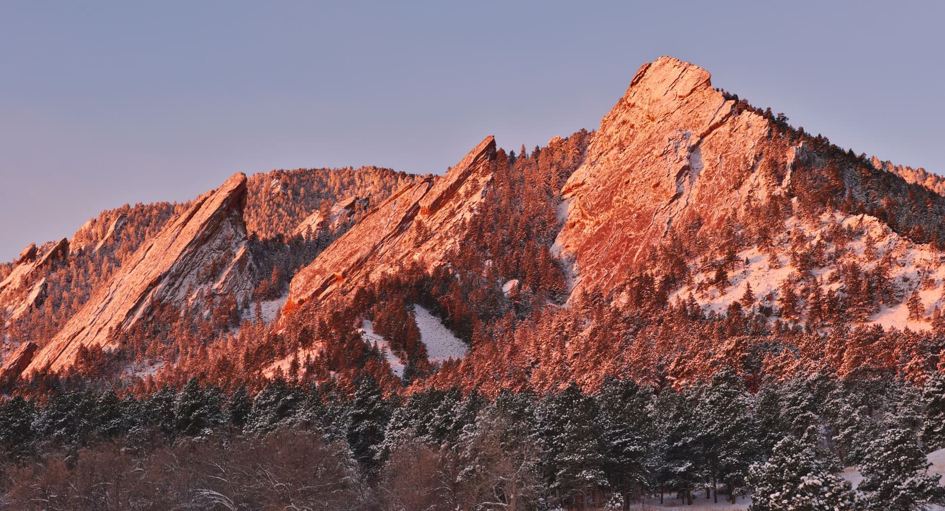
Flatirons Vista Trail
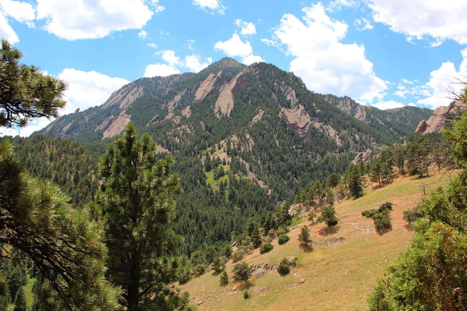
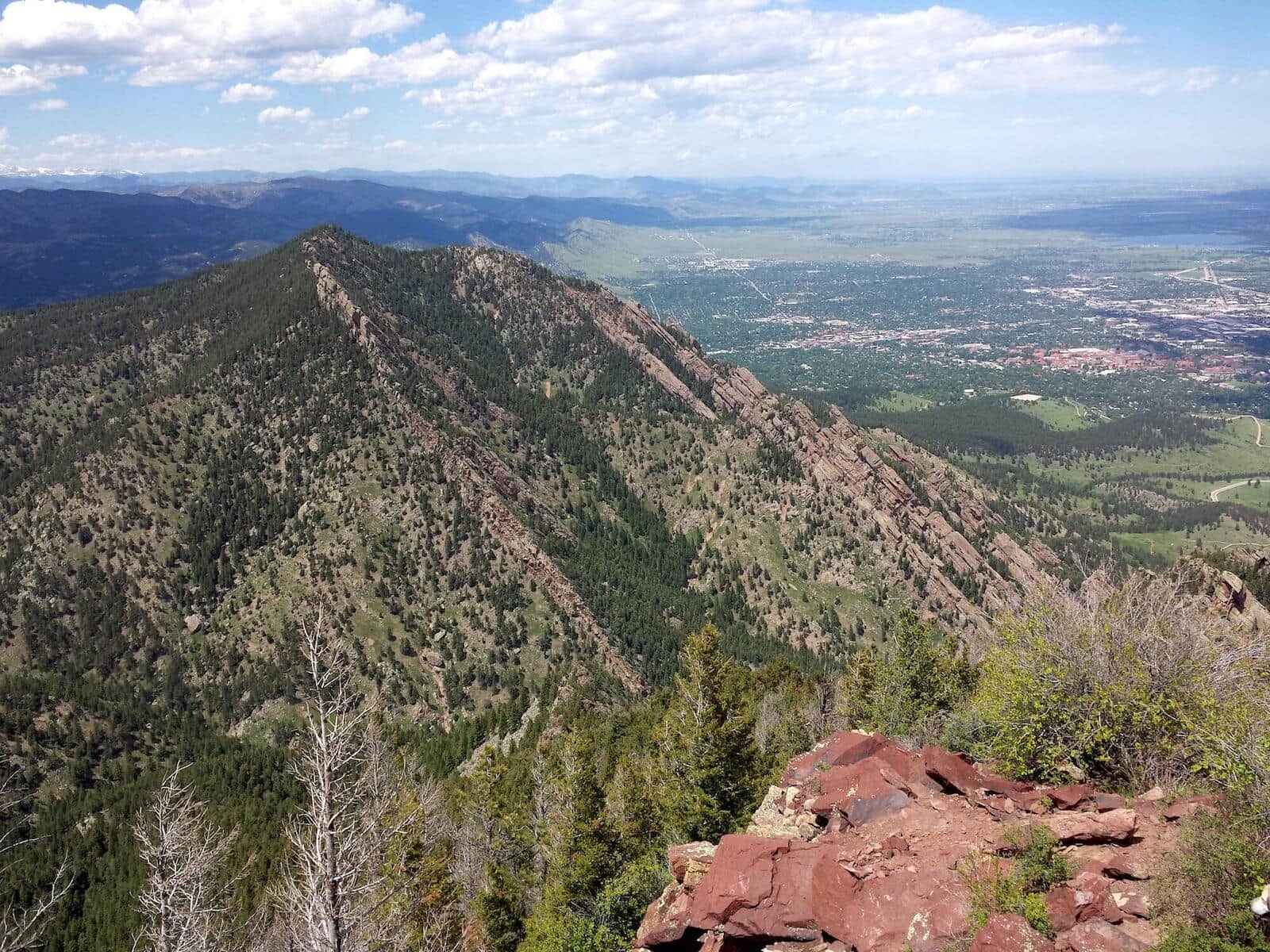
A gentle trail through grasslands and scrub oak with outstanding views of the iconic Flatirons rock formations and Boulder valley below.
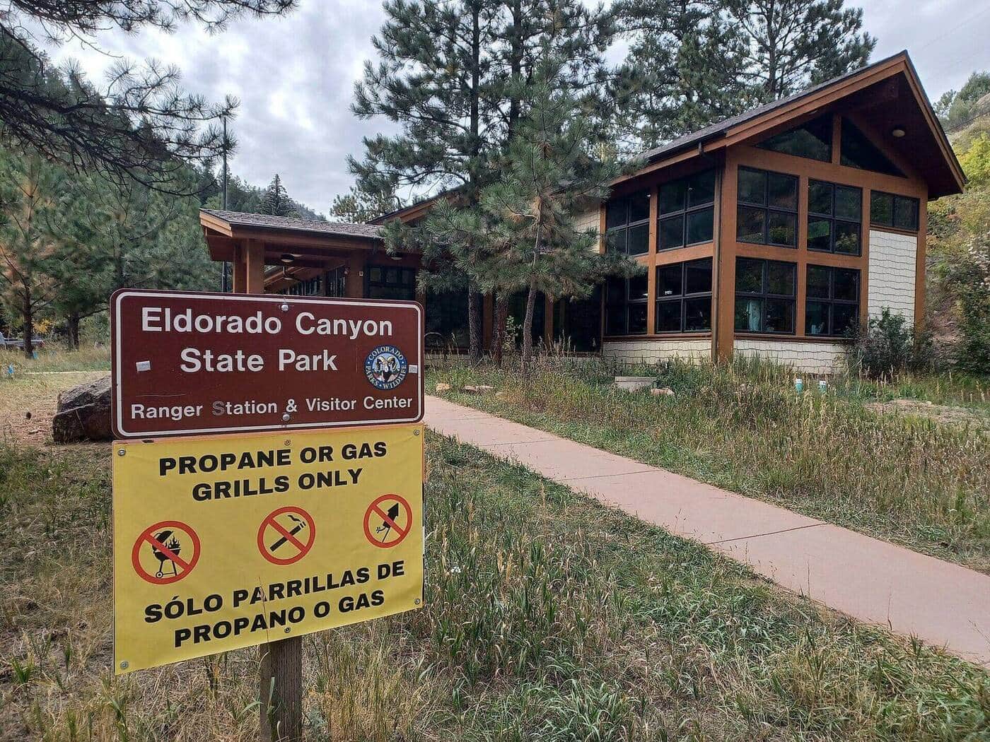
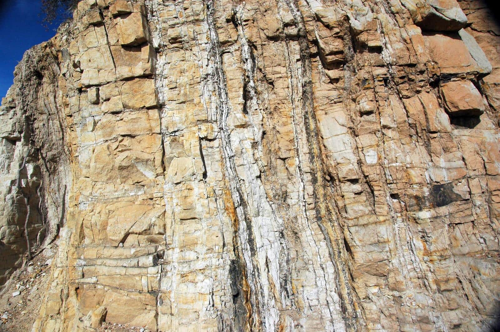
Eldorado Canyon Trail
A dramatic canyon hike through golden sandstone walls with South Boulder Creek flowing below. Popular for rock climbing access and scenic beauty.
Mount Sanitas Trail
The most popular Boulder trail. Steep climb up Mount Sanitas with city views the whole way, then a faster descent on the East Ridge Trail. Reliably crowded mornings and evenings.
Mesa Trail
The classic Boulder Open Space trail running along the base of the Flatirons. Can be done as a point-to-point with shuttle or sections out-and-back. Multiple side trails branch up to Bear Peak, Green Mountain, and Royal Arch.
Bear Peak Trail
Steep Boulder summit climb via Fern Canyon or West Ridge. Summit views span the entire Boulder Valley and out to the plains. Local conditioning hike for Front Range mountaineers.
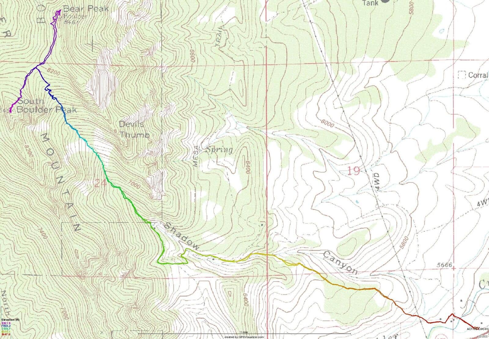
South Boulder Peak Trail
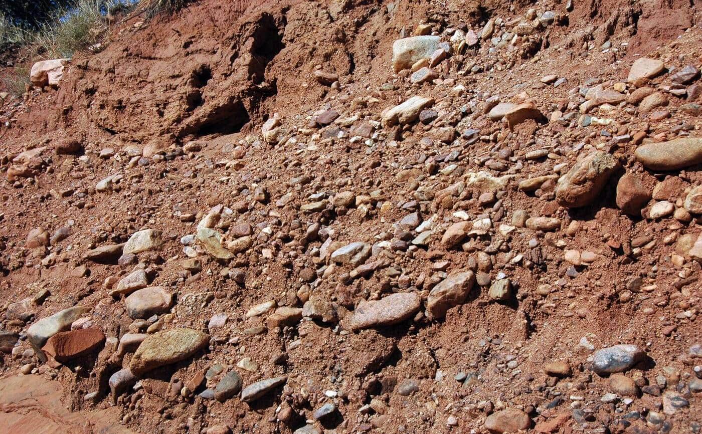
Boulder's highest summit at 8,549 feet. The Shadow Canyon route is the most direct but steep on loose talus. Often combined with Bear Peak for a two-summit day.
Green Mountain Trail (Boulder)
Steep summit hike from Gregory Canyon Trailhead to the top of Green Mountain. Multiple route options (Saddle Rock, Gregory Canyon, EM Greenman). Summit views over the Flatirons and Indian Peaks.
Walker Ranch Loop
Boulder Mountain Parks loop on a historic ranch property with views of Eldorado Canyon and the Flatirons from above. Mountain bikers share the trails (odd-day hikers, even-day bikes).
Heil Valley Ranch Loop
Boulder County Open Space loop in a quiet valley north of Lyons. Aspen groves and ponderosa pine, less crowded than the closer-in OSMP trails.
Hall Ranch Loop
Boulder County Open Space loop near Lyons with sandstone outcrops, ponderosa forest, and views to Longs Peak. Bighorn sheep are sometimes spotted in the western side of the property.
Picture Rock Trail
Connector trail between Heil Valley Ranch and Lyons. Open meadows, rolling terrain, mountain bike popular. Can be done as a point-to-point or shorter out-and-back.
Doudy Draw Trail
Easy Boulder OSMP trail through open meadows and ponderosa forest. Connects to the Spring Brook Loop and Community Ditch trails for longer days. Family-friendly with stroller access on lower sections.
Marshall Mesa Trail
Flat-to-rolling mesa loop on the south side of Boulder. Great for spring wildflowers, family hikes, or quick after-work miles. Coal mining history along the route.
Anne U. White Trail
Boulder County trail in Fourmile Canyon with the most reliable stream crossings of any Boulder-area trail. Named for an early conservation advocate. Multiple stream crossings on bridges make the hike kid-friendly even in spring runoff.
Lichen Loop
Short, kid-friendly loop near Boulder's Heil Valley Ranch. Stroller-accessible on the lower section. Perfect first-hike-with-toddlers option.
Hiking in Boulder: what to know
Boulder hiking divides into three categories: the iconic Flatirons trails right above the city (Royal Arch, Chautauqua Park, Mount Sanitas), the Boulder Open Space trails ten minutes from downtown (Mount Galbraith, Marshall Mesa, Eldorado Canyon), and the alpine destinations 45 minutes west in Indian Peaks Wilderness (Lake Isabelle, Arapaho Pass, Pawnee Pass).
For the Flatirons trails, weekday mornings are dramatically less crowded than weekends. Chautauqua Park parking fills by 8 AM on summer weekends; the free shuttle from CU Boulder is the better option. Royal Arch is the local favorite that's reliably busy because it deserves to be.
Indian Peaks Wilderness is the high-altitude option. From Brainard Lake Recreation Area you can reach Lake Isabelle (4 miles round trip, easy), Pawnee Pass (8 miles, harder), or do a longer day to Lake Dorothy. Brainard now requires a timed-entry reservation in summer ($12 through recreation.gov), which keeps the crowds manageable but requires planning a week or two ahead.
Boulder gets a lot of foothills snow in winter that lingers on north-facing trails into March. Mount Sanitas and the Foothills Trail dry out first; the higher Flatirons trails need traction in winter.
Dogs are central to Boulder hiking culture but specific OSMP trails have voice-and-sight regulations rather than leash requirements. Get the OSMP "Voice and Sight" tag at Open Space headquarters before letting your dog off-leash; rangers do check.
For visitors wanting one trail: Royal Arch is the right call. For locals: rotate through Sanitas, Bear Peak, and South Boulder Peak for the cardio days.