Mount Antero: A Complete Guide to Colorado's Gem 14er
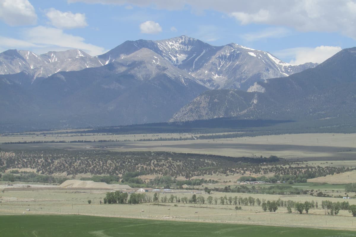
Mount Antero stands at 14,269 feet, the tenth-highest peak in Colorado and one of the most unusual 14ers in the state. It sits in the southern Sawatch Range above the town of Nathrop, between Buena Vista and Salida. The standard West Slopes route via Baldwin Gulch runs about 15 to 16 miles round trip with roughly 5,200 feet of gain if you walk the whole road, but Antero has a twist almost no other 14er offers: a rough 4WD road climbs nearly to the summit, so a capable vehicle can cut the day to a fraction of that.
What really sets Antero apart is what's underneath it. The mountain holds some of the highest gem deposits in North America. Aquamarine, the Colorado state gem, comes out of the rock near the summit and on neighboring Mount White, along with smoky quartz, phenakite, and topaz. People have been digging here since the 1880s, and on a summer weekend you'll share the upper slopes with rock hounds as much as peak baggers.
This guide covers the West Slopes standard route, the choice between driving and hiking the Baldwin Gulch road, the gem story, and what you need to climb Antero safely.
What You'll Learn
- Quick Stats
- Getting to the Trailhead
- The West Slopes Standard Route
- Driving vs Hiking the Baldwin Gulch Road
- Mount Antero's Gemstones
- What to Pack
- Timing and Weather
- When to Climb
- What Makes Mount Antero Different
- Common Mistakes
- Frequently Asked Questions
Quick Stats
West Slopes via Baldwin Gulch (standard route):
- Elevation: 14,269 ft (10th highest in Colorado)
- Trailhead: Baldwin Gulch, 9,420 ft (2WD parking)
- Round Trip Distance: 15-16 miles on foot from 2WD parking
- Elevation Gain: about 5,200 ft on foot
- Class: 2 (loose talus near the summit, no real exposure)
- Time: 9-12 hours on foot, far less with a 4WD vehicle
- Difficulty: Strenuous if hiked, moderate if you drive high
With a 4WD vehicle:
- Drive to 10,840 ft (3 miles up Baldwin Gulch Road) in a stock high-clearance 4WD
- Capable rigs continue much higher, toward 13,000 ft
- From a high parking spot the hike can drop to 6 miles or less round trip
Best Season: Late June through September
Permit: None required to climb
Crowds: Moderate, a mix of hikers, gem hunters, and off-road vehicles
Getting to the Trailhead
The Baldwin Gulch Trailhead is reached from Nathrop on US Highway 285, about 2.5 hours from Denver and 20 minutes south of Buena Vista.
- From US 285 at Nathrop, turn west onto Chaffee County Road 162 (Chalk Creek Road)
- Follow CR 162 about 12 miles. The road is paved for the first stretch, then dirt after roughly 10 miles
- You'll pass Mount Princeton Hot Springs and the Chalk Cliffs along the way
- Turn left (south) onto Baldwin Gulch Road, Forest Road 277
- The 2WD parking area sits right near this junction around 9,420 ft
CR 162 itself is fine for any car all the way to the Baldwin Gulch junction. The question is what you do after that. Baldwin Gulch Road is a genuine 4WD jeep road: rocky, rutted, with a creek crossing that runs high in early summer. Passenger cars and most crossovers should park at the lower area and either hike the road or arrange a ride.
From Denver, plan about 2.5 hours of driving. Many hikers stay in Buena Vista or camp along CR 162 the night before. There's dispersed camping (free, no facilities) on Forest Service land near the trailhead, which makes a dawn start much easier.
Restrooms: None at the lower trailhead. Use facilities in Nathrop or Buena Vista.
Cell service: Spotty to none past Mount Princeton Hot Springs.
Parking: The lower 2WD area is informal and fills on summer weekends. Don't block the road or the creek crossing.
The West Slopes Standard Route
The standard route follows Baldwin Gulch Road up the valley, then a series of mining switchbacks onto the high ridge, then a final talus climb to the summit. Whether you hike or drive the lower road, the upper mountain is the same.
Section 1: Lower Baldwin Gulch Road (9,420 to 10,840 ft)
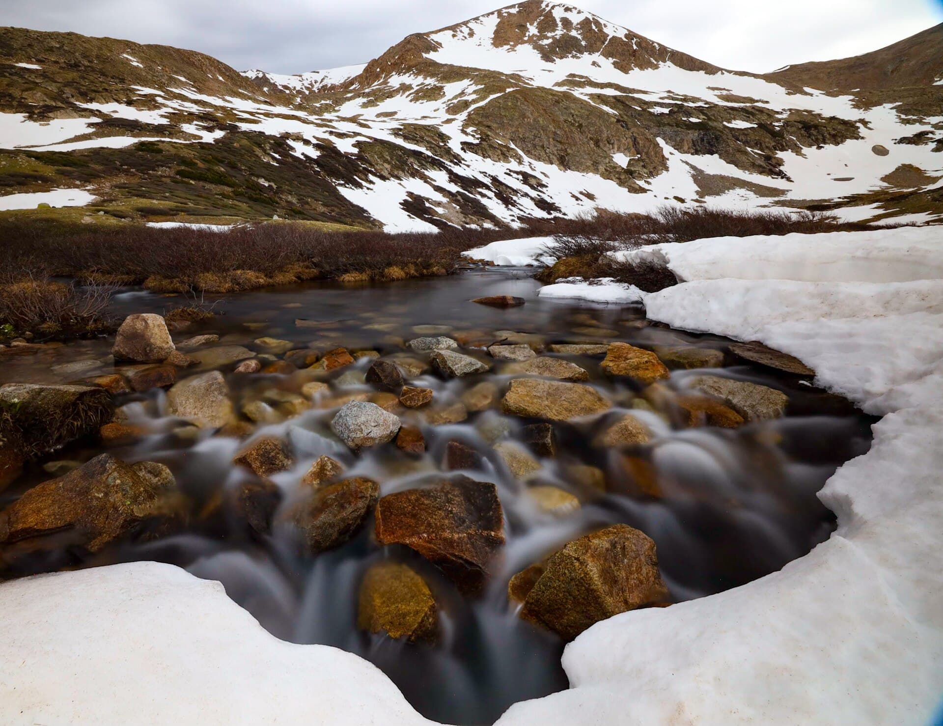
From the 2WD parking, the road climbs gradually through forest along Baldwin Creek. About a mile up there's a creek crossing that can run knee-deep during peak snowmelt in June and early July. By August it's usually an easy step across.
This stretch is gentle, a steady road grade with no real difficulty beyond the distance. If you're hiking the whole route, this is where you settle into a rhythm. If you drove, you'll start higher up and skip most of it.
Section 2: The Switchbacks to the High Ridge (10,840 to 13,000 ft)
Above the lower parking, the road climbs harder. It leaves the trees, switchbacks up open slopes, and gains the broad ridge between Antero and Mount White. The grade is moderate but sustained, and the altitude starts to bite above 12,000 ft.
This is the section that decides your day. A capable 4WD can drive much of it. On foot it's several miles of road walking with real elevation gain. Either way, the views open up fast: the Chalk Creek valley below, Mount Princeton to the north, and the Sawatch crest stretching in both directions.
Section 3: The Road's End and the Talus (13,000 to 13,800 ft)
The road eventually ends or becomes impassable around 13,000 to 13,500 ft, depending on the year and how aggressive a driver you are. From here everyone hikes. A trail and cairned route lead across the ridge toward Antero's summit pyramid.
The terrain turns to loose talus and scree. The grade steepens. This is Class 2: you'll use your hands for balance on a few rocky steps, but there's no exposure that will hurt you badly if you slip. Pace control matters here more than anything; above 13,500 ft, expect to stop and breathe every 50 to 75 steps.
Section 4: The Summit Block (13,800 to 14,269 ft)
The final climb works up Antero's northwest ridge over larger, blockier talus. The cairned route weaves through the rocks. Pay attention to the cairns; freelancing puts you on harder, looser terrain.
The summit is a rocky platform with room for a dozen people. Views from the top are some of the best in the Sawatch:
- Mount Princeton (14,197 ft) to the north
- Mount Shavano and Tabeguache Peak to the south
- The Arkansas River valley and the Sangre de Cristo range to the east
- Mount White and the gem fields just below to the northeast
On a clear morning you can see deep into the San Juans to the southwest.
Section 5: The Return
Same route in reverse. The talus descent is the hardest part on tired legs and loose rock, so trekking poles earn their weight here. If you drove up, your day ends quickly once you reach the vehicle. If you're walking the road back down, the final miles feel long, the way road walking always does at the end of a big day.
Driving vs Hiking the Baldwin Gulch Road
This is the central decision on Antero, and it changes the mountain completely.
If you drive a capable 4WD high: Antero becomes one of the easier 14er summits in Colorado, a short 6-mile or less round trip with a couple thousand feet of gain. This is why the peak is popular with off-roaders and gem hunters who treat it as a destination drive with a short walk on top.
If you hike the whole road: Antero is a long, strenuous 15 to 16 mile day with over 5,000 feet of gain, on par with the longest standard 14ers in the state. The road grade makes it feel gentler than a steep trail, but the distance is real.
A few honest notes:
- Baldwin Gulch Road is rough. It's rated for stock 4WD with high clearance, and the upper sections challenge even built rigs. Don't take a crossover or a rental SUV up it.
- The creek crossing can be impassable during high runoff in June. Check recent conditions.
- You'll share the road with ATVs, dirt bikes, and jeeps. It is not a quiet wilderness approach.
- Plenty of people split the difference: drive to a comfortable spot around 11,000 to 12,000 ft, park, and hike from there. This keeps the day reasonable without committing your vehicle to the worst sections.
If you don't own a serious off-road vehicle, the honest move is to either hike the full road or plan a high-clearance rental and turn around when the road exceeds your comfort. There's no shame in parking lower and walking; many strong hikers do the whole thing on foot.
Mount Antero's Gemstones
Antero is the most famous gem-producing mountain in Colorado, and one of the highest gem localities in North America. The pegmatite pockets near the summit and on Mount White hold aquamarine, the pale blue-green variety of beryl that became the official Colorado state gemstone in 1971. Collectors also pull smoky quartz, phenakite, topaz, and fluorite from the same zones, often above 13,000 feet.
A few things worth knowing before you start digging:
- Some areas are claimed. Active mining claims exist on parts of the mountain, and collecting on a valid claim without permission is off limits. Much of the surrounding Forest Service land is open to casual hand collecting, but the line isn't always marked. When in doubt, ask locally or stick to obviously open ground.
- It's hard work at altitude. The good pockets are high and the rock is stubborn. Most serious hunters carry a rock hammer and chisel set, eye protection, and gloves, and they dig over multiple trips.
- You're at 13,000-plus feet. Combining a full day of digging with thin air and afternoon storms is how people get into trouble. Treat a gem trip with the same caution as a summit climb.
- Casual hikers can still look. Even if you're not equipped to dig, the loose talus near the gem zones sometimes gives up small crystals on the surface. A good pair of eyes and a small bag is all you need to enjoy the hunt.
If gem hunting is your main goal rather than the summit, the area around Mount White and the upper Baldwin Gulch basin is where to focus. The actual high point of Antero is a bonus once you're already up there.
What to Pack
If you're hiking the full route, pack for a long, high day. If you're driving most of it, you still need full alpine gear for the summit push, because you'll be above 13,000 ft and exposed.
Water. 3 to 4 liters if hiking the road, 2 liters minimum if driving high. Baldwin Creek runs along the lower road; a filter lets you refill on the descent. See our water filter guide.
Food. Real food, not just bars, especially for the full hike. A 9 to 12 hour day burns 4,000-plus calories.
Layers. Base layer, insulation, wind shell, rain shell. The summit can be 30 to 40 degrees colder than Nathrop and the ridge wind is reliable. See our base layer guide and rain jacket guide.
Sun protection. Sunglasses, sunscreen, a brimmed hat. You'll be above treeline for hours.
Headlamp. Mandatory if you're hiking the road, smart even if you drive. An early start means dark hiking. See our headlamp guide.
Footwear. Boots with ankle support handle the summit talus better than trail runners. See our hiking boots guide.
Trekking poles. The loose talus descent punishes knees without them. See our trekking pole guide.
Map and offline GPS. The road braids and the upper route can confuse tired hikers. Pre-download offline maps before you lose signal at the hot springs.
Gem gear, if that's your plan. A rock pick and digging tools, safety glasses, and a sturdy bag for samples.
For altitude planning, see our altitude sickness guide.
Timing and Weather
The rule that governs every 14er applies here: be off the summit by noon. Afternoon thunderstorms build fast in July and August, and the high, open ridge on Antero is no place to be in lightning.
Recommended timing if you're hiking the full road:
- Trailhead: 4:00 AM (3:00 AM in monsoon season)
- High ridge: 8:00 AM
- Summit: 10:00-10:30 AM
- Back below treeline: by early afternoon
- Trailhead: 3:00-4:30 PM
If you drive high, you can start later, but don't let the short hike fool you into a lazy departure. You're still committing to a 14,000-foot summit with the same weather risk as any other.
Check the mountain forecast for the Buena Vista and Salida area at forecast.weather.gov before you go. The same principles apply everywhere in Colorado:
- Storm probability above 30 percent: reconsider
- Wind above 35 mph at altitude: it'll be miserable
- Snow falling in summer: turn around
The southern Sawatch gets the same afternoon monsoon pattern as the rest of the range. Storms can build by late morning in peak season.
When to Climb
Best months: Late June through mid-September.
June: Snow lingers on the upper road and the summit talus into early summer, and the Baldwin Gulch creek crossing runs high with snowmelt. Late June usually opens the route in dry years, but check conditions.
July: Peak season. The road is generally dry and passable. Monsoon storms start mid-month, so start early.
August: Peak monsoon and peak gem-hunting season. Plan to be off the summit by late morning. Weekends are busy with hikers and off-road traffic.
September: Often the best stable weather of the year, cooler temperatures, and thinner crowds. Some early snow possible after mid-month.
October-May: Winter conditions. The Baldwin Gulch road is not maintained and becomes impassable, adding miles and avalanche risk. Not recommended for non-mountaineers.
What Makes Mount Antero Different
Mount Antero compared with the other Sawatch 14ers:
The 4WD road. No other Colorado 14er lets a vehicle climb this high. It's the defining feature, for better and worse. It makes the summit accessible but fills the mountain with engine noise.
The gemstones. Antero is the gem mountain. Aquamarine, smoky quartz, and phenakite draw rock hounds from all over, and the gem fields are a destination in their own right.
Two completely different days. Almost no other 14er swings from a casual 6-mile outing to a 16-mile slog based purely on your vehicle. Your tires decide your difficulty.
Less of a wilderness feel. Because of the road and the mining history, Antero doesn't have the remote, undeveloped character of nearby peaks like Mount Harvard. If you want solitude, this isn't the one.
Great neighbors. Mount Princeton Hot Springs sits right at the base on CR 162, which makes Antero one of the few 14ers where you can soak tired legs in a hot spring within 20 minutes of the trailhead.
Antero works well as a second or third 14er. Strong hikers who walk the full road get a real workout; those who drive high get an accessible summit and a chance to hunt for gems.
Common Mistakes
Taking the wrong vehicle up Baldwin Gulch. This is a serious 4WD road, not a forest two-track. Crossovers, rental SUVs, and low-clearance trucks get stuck, damaged, or stranded. Know your rig and turn around when it gets too rough.
Underestimating the full hike. If you're walking the whole road, 15 to 16 miles with 5,000-plus feet of gain is a big day. People who hear "you can drive most of it" sometimes show up unprepared for the on-foot distance.
Letting the short drive-up version make you careless. A 6-mile summit is still a 14,000-foot summit. Bring full layers, watch the weather, and don't start at 9 AM.
The June creek crossing. Baldwin Creek can run dangerously high during peak runoff. Don't force a crossing that looks sketchy, on foot or in a vehicle.
Digging on claimed ground. Active mining claims exist on the mountain. Collecting on a valid claim without permission is illegal. When the boundaries aren't clear, stick to obviously open Forest Service land.
No acclimatization. Driving from Denver and going straight to a 14,000-foot summit invites altitude sickness. Spend a night in Buena Vista or camp along CR 162 first.
Skipping rain and wind layers. The summit ridge is fully exposed. The weather up top has nothing to do with the warm valley you left.
Frequently Asked Questions
How hard is it to climb Mount Antero?
It depends entirely on your vehicle. With a capable 4WD that drives high, the summit is a short Class 2 hike of about 6 miles, moderate difficulty. On foot the whole way, it's a strenuous 15 to 16 mile day with over 5,000 feet of gain. The terrain itself is never technical, just long and loose near the top.
Can you drive to the top of Mount Antero?
Not all the way. The Baldwin Gulch 4WD road climbs to roughly 13,000 to 13,500 feet, very high for a 14er, but the final 700 to 1,200 feet to the summit must be hiked over talus. The road requires a high-clearance 4WD vehicle and real off-road experience.
What gems can you find on Mount Antero?
Mount Antero is famous for aquamarine, the Colorado state gemstone, along with smoky quartz, phenakite, topaz, and fluorite. The deposits sit near the summit and on neighboring Mount White, among the highest gem localities in North America. Some areas are under active mining claims, so collect only on open ground.
How long does it take to hike Mount Antero?
On foot from the 2WD trailhead, plan 9 to 12 hours round trip. If you drive a 4WD high up the road, the hike from a high parking spot can take 4 to 6 hours. Either way, aim to be off the summit by noon to avoid afternoon storms.
Is Mount Antero a good 14er for beginners?
It can be, if you have the right vehicle. Driving high turns Antero into one of the more accessible summits, good for a second or third 14er. As a full hike, though, it's long and strenuous and better suited to fit hikers with some 14er experience. For true beginner peaks, see our easiest 14ers guide.
Other 14ers to Consider
Near Mount Antero and beyond:
- Mount Elbert: Colorado's highest, a long Class 1 hike farther north in the Sawatch. See our Mount Elbert guide.
- Mount Harvard: The Collegiate Peaks high point, a remote 14-mile day. See our Mount Harvard guide.
- Mount Massive: Second-highest in Colorado, a big day near Leadville. See our Mount Massive guide.
- Quandary Peak: Shorter and more accessible, near Breckenridge. See our Quandary Peak guide.
- Mount Bierstadt: The Front Range entry-level 14er. See our Mount Bierstadt guide.
For the full overview of Colorado's high peaks, see our 14ers guide.
Final Thoughts
Mount Antero is the tenth-highest peak in Colorado and unlike any other 14er in the state. The Baldwin Gulch road lets a capable 4WD climb past 13,000 feet, which means the mountain can be a short summit stroll or a 16-mile grind depending entirely on what you drive and how far you push it. The summit route stays Class 2 throughout, with loose talus the main obstacle near the top.
The gemstones are the other half of the story. Antero's aquamarine and smoky quartz pockets are some of the highest in North America, and on any summer weekend you'll find rock hounds working the high basins alongside the peak baggers. Whether you come for the summit, the gems, or both, the rules are the same: get an early start, watch the afternoon weather, bring full alpine layers even on the short version, and respect the loose rock on the descent.
For the rest of your kit, see our guides to hiking boots, rain jackets, base layers, and trekking poles. For altitude, read our altitude sickness guide before you go.
Get the Colorado 14er Packing Checklist (free PDF)
Plus a weekly note on the best Colorado trails, gear deals, and seasonal hike picks. No spam, unsubscribe anytime.
We respect your inbox. Unsubscribe anytime.