The DeCaLiBron Loop: Four 14er Summits in One Hike from Kite Lake
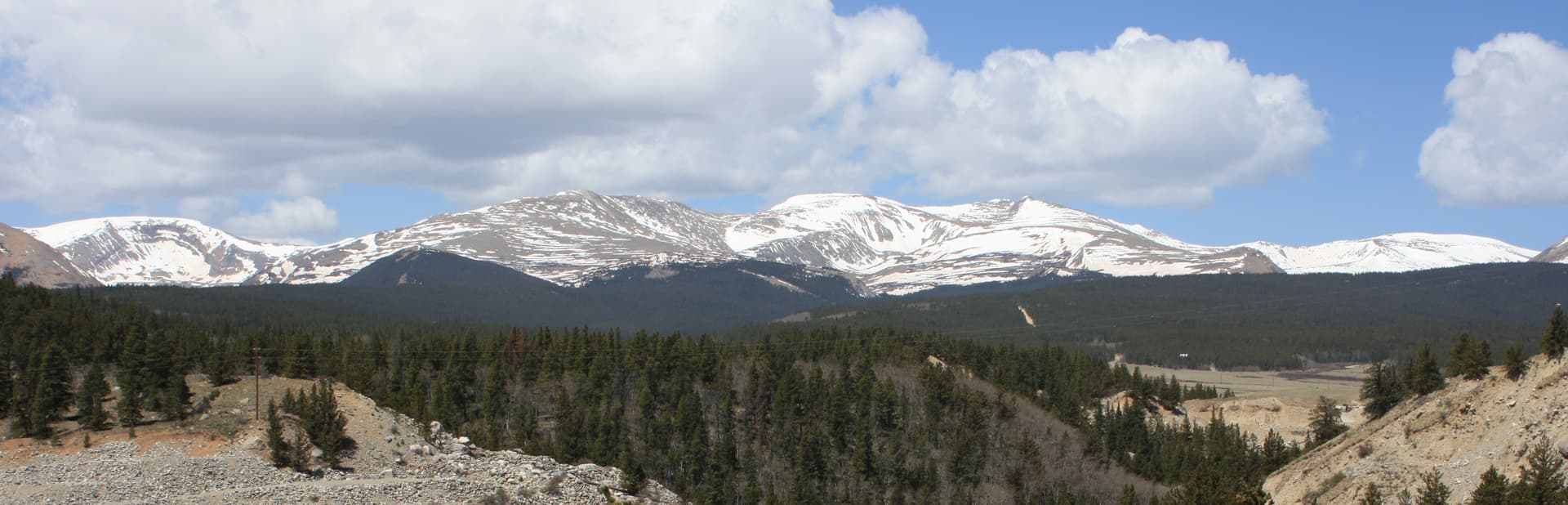
The DeCaLiBron loop links four summits (Mount Democrat, Mount Cameron, Mount Lincoln, and Mount Bross) on a single 7.25-mile loop from Kite Lake. Three of the four count as officially ranked 14ers; Cameron is a high point you walk over anyway. That makes DeCaLiBron the most summits-per-mile day in Colorado, and one of the fastest ways to add fourteeners to your list in a single morning.
The trailhead sits at about 12,000 feet near the town of Alma, roughly two hours from Denver. The loop climbs around 3,700 feet, stays Class 2 the whole way, and never drops below treeline once you leave the parking lot. That last part matters more than the mileage: you're exposed to weather from the first switchback to the last, so timing is everything.
This guide covers the name, the Cameron question, the drive to Kite Lake, the route peak by peak, which direction to hike, the Bross private-land situation, gear, and the mistakes that turn a fun four-summit day into a slog.
What You'll Learn
- Quick Stats
- What DeCaLiBron Means (and the Cameron Question)
- Getting to Kite Lake
- The Loop, Peak by Peak
- Which Direction to Hike
- The Bross Descent and Private Land
- What to Pack
- Timing and Weather
- When to Hike
- Altitude and Difficulty
- Common Mistakes
- Frequently Asked Questions
Quick Stats
- Peaks: Mount Democrat (14,155 ft), Mount Cameron (14,238 ft, unranked), Mount Lincoln (14,293 ft), Mount Bross (14,172 ft)
- Round Trip Distance: 7.25 miles (full loop)
- Elevation Gain: about 3,700 ft
- Class: 2 throughout (loose rock, no scrambling required on the standard loop)
- Time: 5 to 8 hours
- Trailhead: Kite Lake, about 12,000 ft
- Range: Mosquito Range, near Alma
- Best Season: Late June through September
- Permit: None to hike; day-use and camping fees apply at Kite Lake
- Crowds: Heavy on summer weekends
Mount Lincoln is the eighth-highest peak in Colorado, so even the "efficiency" version of this hike puts you on a serious summit. Cameron is the odd one out, which brings us to the name.
What DeCaLiBron Means (and the Cameron Question)
DeCaLiBron is a mashup of the four summits: DEmocrat, CAmeron, LIncoln, BROss. Hikers made up the word because saying "Democrat, Cameron, Lincoln, and Bross" every time gets old.
Here's the catch that trips up new peak-baggers. Mount Cameron doesn't count as a separate ranked 14er. To earn a rank on most Colorado lists, a summit needs at least 300 feet of prominence, meaning it has to rise 300 feet above the saddle connecting it to a higher neighbor. Cameron only rises about 138 feet above its saddle with Lincoln, so it's treated as a sub-peak of Lincoln rather than a standalone fourteener.
What that means in plain terms: you'll stand on four summits above 14,000 feet, but your official 14er count goes up by three (Democrat, Lincoln, Bross). Cameron is a bonus you cross without any extra effort, since the route runs right over it. Nobody skips Cameron; the debate is only about whether it "counts."
If you're chasing the ranked list of all 58 Colorado 14ers, DeCaLiBron knocks out three of them in one loop. For a full picture of how the list is organized, see our Colorado 14ers guide and our breakdown of 14ers by difficulty.
Getting to Kite Lake
Kite Lake is west of Alma, the highest incorporated town in North America at 10,578 feet. From Denver, take US-285 south to Fairplay, then CO-9 north to Alma (about 1 hour 45 minutes to 2 hours total).
In Alma, turn west onto Kite Lake Road (County Road 8, also called Buckskin Road) at the marked turn near the center of town. From there it's about 6 miles of dirt to the trailhead:
- The first few miles are graded dirt that most passenger cars handle fine in dry weather.
- The last mile gets rockier and rougher.
- In dry summer conditions, a careful driver in a normal car can usually reach the upper lot. Higher clearance makes the last stretch easier and less nerve-racking.
The parking reality: Kite Lake has a small day-use lot and a tiny campground (about 7 first-come sites) right at the trailhead. Both fill before sunrise on summer weekends. If the upper lot is full, you'll park lower on the road and add distance and vertical to your day. Getting there early solves this and also sets you up for the weather timing you need anyway.
There's a self-serve fee station for day use and camping. Pit toilets are at the trailhead. Cell service is spotty in Alma and gone above the lake, so download your maps before you leave pavement.
Camping at Kite Lake the night before is popular because it puts you at 12,000 feet for acclimatization and cuts the pre-dawn drive. It also means you're already parked when the lot fills. Just know that sleeping at 12,000 feet is rough if you're not adjusted to altitude yet.
The Loop, Peak by Peak
From Kite Lake, the trail climbs northwest toward the saddle between Democrat and Cameron. Here's how the four summits stack up in the recommended order.
Kite Lake to the Democrat Saddle
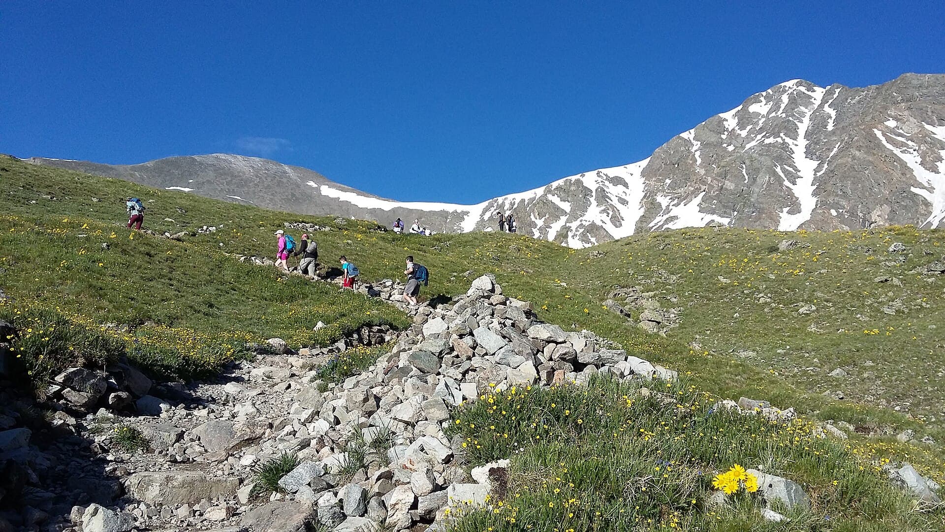
The trail leaves the lake and climbs steadily past old mining ruins toward the 13,400-foot saddle. This is a solid grind of switchbacks on rocky trail. You gain a big chunk of the day's elevation here, and you're above treeline the entire time, so keep an eye on the sky.
Mount Democrat (14,155 ft)
From the saddle, drop your momentum and turn left (northwest) for the out-and-back climb to Democrat. It's about 700 feet up over loose rock and talus. The trail is well-worn but steep in spots. From the top you get your first big view of the Mosquito Range and, on a clear morning, a line of peaks stretching toward the Sawatch. Return the same way to the saddle.
Mount Cameron (14,238 ft)
Back at the saddle, climb east onto the broad, flat plateau of Cameron. There's no dramatic summit here, just a wide alpine tableland with a rock pile marking the high point. This is the "half" peak, and it's the easiest 14,000-foot summit you'll ever walk across.
Mount Lincoln (14,293 ft)
From Cameron, a short ridge walk and a final rocky push lead to Lincoln, the high point of the loop and the eighth-highest peak in Colorado. The summit block is smaller and more defined than Cameron's. Watch for mountain goats; they're common on this ridge and used to people. Take your photos, then head back toward Cameron to pick up the traverse to Bross.
Mount Bross (14,172 ft)
From the Cameron area, the route swings southeast across a broad, gentle ridge toward Bross. The true summit of Bross sits on private mining claims (more on that below), and the maintained route keeps you just below the exact top. From here you begin the long descent back to Kite Lake.
Which Direction to Hike
Do Democrat first and Bross last. In other words, hike the loop so you climb Democrat's steep, loose slope on fresh legs and descend Bross's longer, gentler west slopes at the end.
The reason is simple. Democrat's face is steep and rocky, the kind of terrain that's slower and sketchier going down than up. Bross's western slopes are less steep and make for a more forgiving descent when your legs are tired and your knees are done. Going the other way (Bross first) means grinding up Bross early and then trying to pick your way down Democrat's loose rock at the end of a long day, which is how people twist ankles.
Most hikers you'll see on the loop go this same direction for the same reasons.
The Bross Descent and Private Land
Two things about Bross deserve extra attention.
First, the summit itself. Much of Mount Bross sits on patented mining claims, which are private property. For years the peak had access disputes, and the current arrangement asks hikers to stay on the designated route and off the exact private summit. The Colorado Fourteeners Initiative and local landowners worked out a reroute that keeps the loop open, so respect the signs and stick to the trail. This is why guidebooks describe Bross as a summit you reach "just below" the true top.
Second, the descent. The way down from the Bross area back to Kite Lake drops through steep, loose scree and gravel. It's the section where trekking poles earn their keep. Take it slow, plant your poles, and expect to slide a little. This descent is Class 2 but it's the part of the day most likely to bang up your knees or send you skidding. A good pair of trekking poles makes a real difference here, and our guide to the best trekking poles for Colorado breaks down what to look for.
What to Pack
Everything on this loop happens above 12,000 feet, so pack like the weather can turn on you, because it can.
- 2.5 to 3 liters of water
- 800 to 1,200 calories of trail food, plus a little extra for four summits
- Layering system: base layer, insulation, wind shell, and a rain shell
- Sun protection (sunglasses, sunscreen, brimmed hat); the sun is brutal above treeline
- A headlamp for the pre-dawn start
- Sturdy hiking boots with grip for loose rock
- Microspikes in early season, when snow lingers on Democrat's slope
- Map and an offline GPS track
- Trekking poles, especially for the Bross descent
- First aid basics
For deeper gear picks, see our guides to the best hiking boots for Colorado, rain jackets for Colorado hiking, and headlamps for hiking in Colorado.
Timing and Weather
The rule for every Colorado 14er applies double here: be off the summits by noon, and ideally start down well before that. Because the entire loop is exposed above treeline, you don't get the usual buffer of ducking into the trees when a storm builds. You're in the open from the first summit to the last.
A workable schedule for the loop:
- Trailhead: 4:30 to 5:00 AM
- Democrat summit: 7:00 to 7:30 AM
- Cameron and Lincoln: 8:00 to 9:00 AM
- Bross and starting the descent: 9:30 to 10:00 AM
- Back at Kite Lake: 11:30 AM to 1:00 PM
That early start isn't optional in July and August. Afternoon thunderstorms roll in most summer days, and lightning above treeline is the single biggest danger on this hike. If clouds are building fast and you're only on your second summit, it's smarter to cut the loop short than to chase all four.
Check the mountain forecast for the Alma and Fairplay area the night before and again in the morning. If storms are forecast before noon or winds at altitude are above 35 mph, adjust or reschedule.
When to Hike
Best months: Late June through mid-September.
June: Snow lingers on Democrat's north-facing slope and the shaded gullies into early-to-mid June most years. Microspikes and an ice axe may be useful early in the month.
July: Peak season and peak crowds. The monsoon pattern kicks in, so start by 4:30 AM and watch the sky.
August: Still busy, still stormy in the afternoons. Same early-start discipline.
September: Often the most stable weather of the year, with cooler temps and thinner crowds. Early-season snow can return after mid-month.
October through May: Winter conditions. Kite Lake Road closes to the upper trailhead, adding miles, and the loop becomes a mountaineering objective with avalanche considerations.
Altitude and Difficulty
DeCaLiBron is rated Class 2, which means no scrambling or exposure on the standard route, just steep and loose walking. The trail is easy to follow. So why do people underestimate it?
Altitude. You spend hours above 13,000 feet and touch four points above 14,000. That thin air makes every climb feel harder than the mileage suggests, and it's the main reason hikers turn around. Spend a night or two at Front Range or mountain-town elevation before you go, drink more water than feels necessary, and pace yourself from the first switchback. If you get a pounding headache, nausea, or dizziness that won't ease, turn around. Our guide to altitude sickness in Colorado covers the warning signs and how to respond.
Cumulative fatigue is the other factor. Four summits sounds efficient, but re-climbing after each saddle adds up. By the time you hit Bross, your legs are working on a full morning of climbing. That's fine if you paced yourself, and brutal if you sprinted Democrat.
If you're newer to 14ers, warm up on something like Mount Sherman, another Mosquito Range peak with an easier profile, or check our list of the easiest 14ers for beginners before taking on four at once.
Common Mistakes
Starting too late. The whole route is above treeline. A 7 AM start in July is asking to be caught in the open by afternoon storms.
Going Bross first. Descending Democrat's loose slope on tired legs is the setup for a fall. Save Democrat's steep part for the climb up.
Underestimating the altitude. Class 2 does not mean easy at 14,000 feet. Acclimatize first.
Skipping poles. The Bross descent is loose scree. Poles save your knees and keep you upright.
Chasing all four when the weather says no. Three summits and a safe walk down beats four summits and a lightning scare. The peaks will be there next time.
Standing on the private Bross summit. Respect the route and the signs. The loop stays open because hikers cooperate with the landowners.
Other 14ers to Consider
If DeCaLiBron leaves you wanting more Mosquito Range and nearby peaks:
- Mount Sherman: One of the easiest 14ers in the state, just south of the DeCaLiBron group. See our Mount Sherman guide.
- Quandary Peak: A popular non-technical peak near Breckenridge, great for a first summit. See our Quandary Peak guide.
- Grays and Torreys: The other classic multi-summit day, closer to Denver. See our Grays and Torreys guide.
For the trailhead details on the loop itself, our Kite Lake trailhead guide covers parking, camping, and the drive in more depth.
Frequently Asked Questions
How many 14ers is the DeCaLiBron loop?
You'll stand on four summits above 14,000 feet, but only three count as officially ranked 14ers: Democrat, Lincoln, and Bross. Mount Cameron is a high sub-peak of Lincoln without enough prominence to earn a separate rank, so most lists count the loop as three.
How long does the DeCaLiBron loop take?
Most hikers finish in 5 to 8 hours, covering 7.25 miles and about 3,700 feet of gain. Your pace at altitude matters more than the mileage. Plan for a pre-dawn start so you're off the summits before afternoon storms.
Is Mount Cameron a real 14er?
Cameron is a true 14,000-foot summit at 14,238 feet, but it isn't a ranked 14er. It only rises about 138 feet above its saddle with Mount Lincoln, short of the 300 feet of prominence most lists require, so it's treated as a sub-peak rather than a standalone peak.
Can you drive to Kite Lake?
Yes. Kite Lake Road runs about 6 miles west from Alma to the trailhead at 12,000 feet. Most of it is graded dirt that passenger cars handle in dry weather, though the last mile is rocky and easier with higher clearance. The small lot fills before sunrise on summer weekends.
Is Mount Bross closed?
The true summit of Bross sits on private mining claims, but the loop itself is open. Hikers follow a designated reroute that keeps them off the exact private summit. Stay on the marked route and respect the signs so the access agreement holds.
Final Thoughts
DeCaLiBron is the best value in Colorado 14er hiking: three ranked summits, a bonus fourth, and one 7.25-mile loop from a single trailhead. The route is non-technical and easy to follow. The real challenges are altitude, the loose Bross descent, and the weather that builds every summer afternoon over a route with no trees to hide in.
Get to Kite Lake early, climb Democrat first, keep an eye on the sky, and use your poles coming off Bross. Do those four things and you'll drive home with three new 14ers on your list before lunch.
Ready to plan the drive and parking? Start with our Kite Lake trailhead guide, then round out your kit with our picks for hiking boots and trekking poles.
Get the Colorado 14er Packing Checklist (free PDF)
Plus a weekly note on the best Colorado trails, gear deals, and seasonal hike picks. No spam, unsubscribe anytime.
We respect your inbox. Unsubscribe anytime.