Grays Peak Trailhead: Stevens Gulch Road, Parking, and Whether You Need 4WD
The Grays Peak Trailhead sits at 11,280 feet at the end of Stevens Gulch Road, and getting there is the part people underestimate. The trailhead itself is straightforward: it's the standard start for Grays Peak and its neighbor Torreys Peak, the most popular double 14er in Colorado. The catch is the road in. Stevens Gulch Road climbs about three miles of rocky, rutted dirt off I-70 at Bakerville, and it's rough enough that plenty of hikers park at the bottom and walk.
This page is about the logistics, not the climb: how to find the trailhead, what the drive is actually like, whether your car can make it, how early you need to arrive for a parking spot, and the permit and fee situation. If you want the route beta for the peaks themselves, that's in our complete Grays and Torreys guide. Here we're just getting you parked and on the trail.
What You'll Learn
- Quick Trailhead Facts
- Where Is the Grays Peak Trailhead?
- Driving Stevens Gulch Road
- Can You Make It in a Regular Car?
- Parking Reality: How Early to Arrive
- Where Not to Park
- Do You Need a Permit or Reservation?
- Facilities at the Trailhead
- From the Trailhead: Grays Alone or Both Peaks
- When the Road and Trail Are Open
- Where People Go Wrong
- Frequently Asked Questions
Quick Trailhead Facts
- Trailhead elevation: 11,280 ft (Grays Peak / Stevens Gulch Trailhead)
- Access road: Stevens Gulch Road, about 3 miles of rough dirt off I-70 exit 221 (Bakerville)
- Vehicle: high-clearance recommended; 4WD helps in wet or early-season conditions; low cars park at the bottom
- Upper lot capacity: roughly 50 vehicles, fills by 5:30 a.m. on summer weekends
- Lower parking: dirt area near I-70 at Bakerville, adds about 3 miles each way (6 miles round trip)
- Permit or fee: none; first come, first served
- Facilities: vault toilet at the trailhead, no water
- Cell service: none at the trailhead or on the route
- Peaks: Grays Peak (14,275 ft) and Torreys Peak (14,267 ft)
- Drive time: about 60 minutes from Denver, 30 minutes from Georgetown
- Season: road usually clear of snow late June into July; impassable in winter
Where Is the Grays Peak Trailhead?
The trailhead is off Interstate 70 at the Bakerville exit, which is exit 221, between Georgetown and the Eisenhower Tunnel. There's no town at Bakerville anymore, just the exit and a dirt lot, so don't expect gas, water, or a bathroom on the way up. Fill your tank and your water bottles in Georgetown, about 15 minutes east.
From the exit, you turn south onto Stevens Gulch Road and follow it up the drainage. The upper trailhead, sometimes called the Stevens Gulch Trailhead, is where the road ends at about 11,280 feet. That's roughly an hour from Denver in normal traffic, though I-70 westbound on a summer weekend morning can add time, which is one more reason people leave the city before dawn.
The road is signed as County Road 321 near the bottom and shows up as Stevens Gulch Road or Forest Road 189 on trail maps. They're the same road. Your GPS may call it different things, so the reliable landmark is the Bakerville exit off I-70.
Driving Stevens Gulch Road
Here's the honest version. Stevens Gulch Road is not maintained to passenger-car standard, and it gets rougher the higher you go. The lower stretch is packed dirt that most vehicles handle at a crawl. The upper mile or two is where it turns into a real mountain road: embedded rocks, water ruts that run a couple of feet deep in spots, washboard, and grades that hit around 13 percent. None of it is technical four-wheeling, but it will scrape a low bumper and rattle your fillings if you rush it.
Drive it slowly and pick your line around the worst rocks. In the dark, which is when most 14er hikers drive it, that's harder to do, so give yourself extra time and don't tailgate the truck ahead of you. After rain or during snowmelt the ruts hold water and the surface gets greasy, and that's when a two-wheel-drive car is most likely to get stuck or slide.
The road is closed by snow in winter and usually isn't drivable to the top until late June, sometimes into July after a heavy snow year. Early and late in the season you may be able to drive partway and then hit a snowbank, at which point you park and walk the rest.
Can You Make It in a Regular Car?
This is the question everyone asks, and the honest answer is "maybe, slowly, and at your own risk." People do drive sedans to the upper trailhead. You'll see them in the lot. But you'll also see hikers who scraped their oil pan or spent 40 white-knuckle minutes covering three miles and wished they'd parked at the bottom.
Here's how to think about it:
- High-clearance SUV or truck: you're fine in dry conditions. Take it slow over the rocky upper section and you'll reach the lot.
- All-wheel-drive crossover with decent clearance: usually makes it in dry weather if you're patient and careful with your line. Wet conditions raise the risk.
- Low sedan or a car you care about: park at the lower dirt lot near I-70 and walk. It adds about three miles each way, but it beats a tow bill and a ruined morning.
If you're not sure your car can handle it, park low. A six-mile round-trip road walk on top of the hike is a long day, but it's a known quantity. Getting high-centered on a rock in the dark is not. For an easier drive to a comparable peak, Mount Bierstadt's Guanella Pass trailhead is paved to the lot, which is worth knowing if the Stevens Gulch road is a dealbreaker for your vehicle.
Parking Reality: How Early to Arrive
The upper lot holds around 50 vehicles, and it fills early. On a summer weekend, plan to be parked by 5:30 a.m. or expect to miss out. Weekdays are easier, but Grays and Torreys are so popular that even a Tuesday in July can be tight by mid-morning.
This lines up with the alpine start you want anyway. Colorado's high peaks build afternoon thunderstorms, and the rule is to be off the summit by noon, so a 5 a.m. start on the trail is normal. Arriving early solves the parking and the weather in one move. Our Grays and Torreys guide covers the timing in detail, and the same before-dawn logic applies at most busy Front Range trailheads.
If the upper lot is full when you arrive, you can't just squeeze in along the road (more on that below). Your realistic option is to drive back down and park at the lower Bakerville lot, then walk up. That's why getting there early matters so much here: there's no overflow lot and no shuttle to bail you out, unlike the paid system at Quandary Peak.
Where Not to Park
Roadside parking on Stevens Gulch Road is not allowed, and it's enforced. Much of the lower road passes private property, roughly the first 1.4 miles leading up toward the trailhead, and parking there can get you a fine and a tow. The rangers and property owners have cracked down as the crowds have grown, so don't count on leaving your car "just for a few hours" on the shoulder.
The two legal places to park are the upper trailhead lot and the dirt lot down at Bakerville near the interstate. If both the upper lot is full and you don't want to walk from Bakerville, your day is basically over, so build your plan around getting a legal spot rather than improvising one. Blocking the road is also a genuine problem for other drivers and for emergency access, so the enforcement isn't arbitrary.
Do You Need a Permit or Reservation?
No. There's no permit, no timed-entry reservation, and no parking fee at the Grays Peak Trailhead. You show up, and if there's room, you park and hike. It's first come, first served all the way.
That's worth calling out because Colorado has been adding paid systems at its busiest trailheads. Quandary Peak now requires a paid parking reservation or a shuttle in summer, Maroon Bells caps access, and Brainard Lake charges a fee. Grays and Torreys stay free and unregulated, which is great until the lot fills. The trade-off for no reservation system is that there's no guaranteed spot and no backup, so the early arrival does all the work. Mount Elbert's trailheads work the same way: free, first come, and small.
Facilities at the Trailhead
There's a vault toilet at the upper trailhead, and that's the only facility. There's no water, no trash service, and no visitor center, so pack out everything you bring and carry all the water you'll need for the day. A double 14er is a long outing, and you'll want more water than you think at altitude.
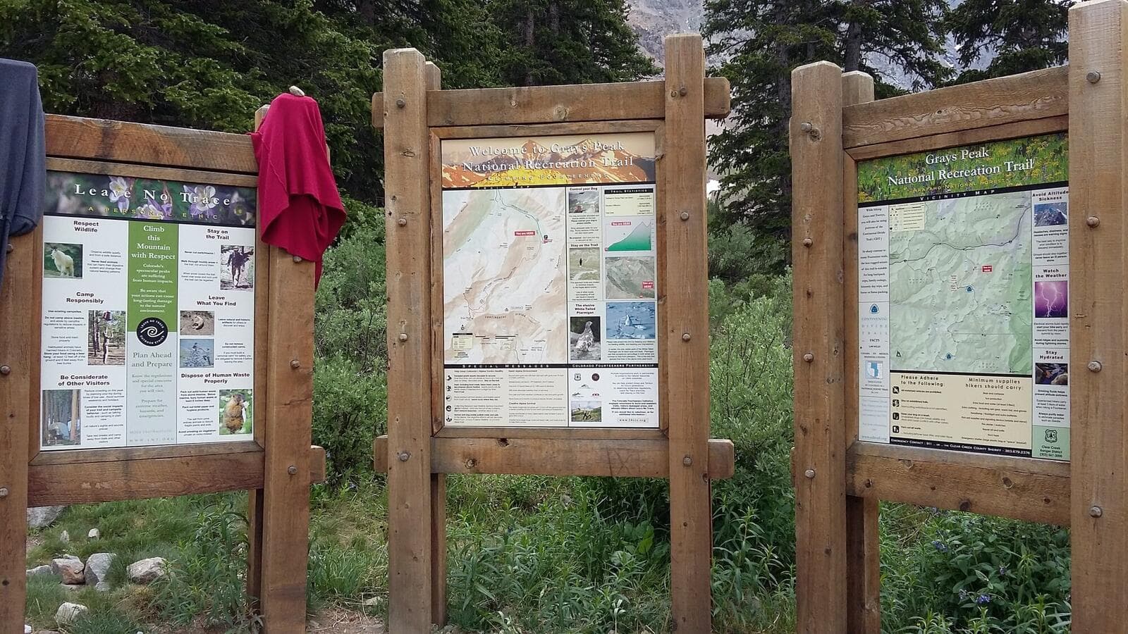
Cell service is unreliable to nonexistent at the trailhead and on the mountain, so download your maps offline before you leave pavement and tell someone your plan. A paper trail map is cheap insurance when your phone won't load anything and the battery is draining in the cold. And because almost everyone starts in the dark, a headlamp isn't optional here.
From the Trailhead: Grays Alone or Both Peaks
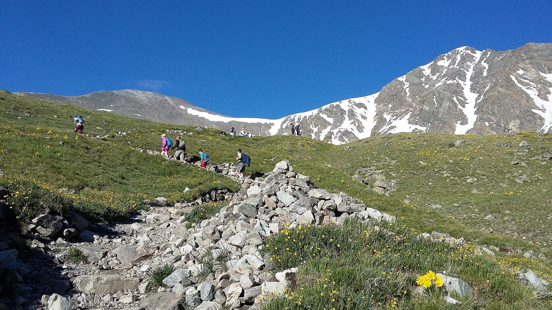
From the parking area you cross a bridge over Stevens Gulch creek and follow a wide, well-built trail up the valley below Kelso Mountain. Grays Peak alone is about 8 miles round trip with 3,000 feet of gain, and it's Class 1, meaning a walk-up with no scrambling. It's one of the friendliest 14ers in the state for a first summit, which is why it shows up on our list of the easiest 14ers for beginners.
Most people who drive all the way up here climb both peaks. Adding Torreys means dropping to the saddle between the two summits and climbing about 600 feet back up the other side, which brings the day to roughly 8.5 miles and 3,600 feet total. That side trip is Class 2 in a spot or two but still non-technical for most hikers. Whether you tag one or both, the start is the same trailhead and the same early alarm.
Starting at 11,280 feet, the altitude hits fast if you drove up from lower ground that morning. Sleeping high the night before helps, and so does knowing the warning signs. Our guide to altitude sickness in Colorado covers how to head off the headache and nausea that catch flatlanders on peaks this high.
When the Road and Trail Are Open
Stevens Gulch Road is a summer proposition. It's buried in snow through winter and spring and usually isn't drivable to the upper trailhead until late June, later in a big snow year. July through September is the reliable window. By October, early storms can close the top of the road again.
Outside that window the trailhead doesn't disappear, it just gets harder to reach. Winter and early-spring climbers park low and travel the snow-covered road on foot, skis, or snowshoes, which turns Grays into a much bigger day and a real avalanche-terrain decision. If you're new to 14ers, stick to the summer window when the road is open and the trail is mostly dry. For a broader view of what's climbable and when, see our Colorado 14ers guide.
Where People Go Wrong
The same handful of mistakes show up at this trailhead again and again:
- Trusting the drive to a low car. Sedans make it sometimes, but the rocky upper section and the deep ruts punish low clearance. If you're unsure, park at Bakerville and walk.
- Arriving too late. The upper lot fills by around 5:30 a.m. on summer weekends. Roll in at 7 and you're either driving back down to Bakerville or going home.
- Parking on the road. The lower road crosses private land and roadside parking gets ticketed and towed. Use the upper lot or the Bakerville lot, nothing in between.
- Bringing no water. There's none at the trailhead and none on the route. Fill up in Georgetown.
- Underestimating the altitude. Starting at 11,280 feet after sleeping at sea level is a recipe for a slow, sick day. Acclimatize if you can, and turn around if the symptoms get real.
Get the drive and the parking sorted and Grays and Torreys are a rewarding, non-technical day with two summits for one trailhead. For the climb itself, section by section, read our complete Grays and Torreys guide, and bring real hiking boots for the upper trail and the rocky saddle.
Frequently Asked Questions
Can you drive to the Grays Peak trailhead?
Yes, but the road matters. Stevens Gulch Road runs about three miles of rough dirt from the Bakerville exit on I-70 to the upper trailhead at 11,280 feet. High-clearance vehicles handle it fine in dry conditions. Low cars often park at the lower Bakerville lot and walk up, which adds about three miles each way.
Do you need 4WD to reach the Grays Peak trailhead?
Not strictly, but it helps. The road is rocky and rutted, and high-clearance is the real requirement more than four-wheel drive. In dry weather, careful AWD crossovers and SUVs make it. After rain or in early season, 4WD and good clearance matter more. If your car is low, park at Bakerville and hike the road.
How early do you need to get to the Grays Peak trailhead?
Aim to be parked by 5:30 a.m. on summer weekends. The upper lot holds about 50 vehicles and fills before sunrise. An early start also keeps you ahead of afternoon thunderstorms, so plan to be hiking by around 5 a.m. and off the summit by noon.
Do you need a permit to hike Grays Peak?
No. There's no permit, reservation, or parking fee at the Grays Peak Trailhead. It's first come, first served. The only real strategy is arriving early, since there's no overflow lot and no shuttle if the upper parking is full.
Is the Grays Peak trailhead open in winter?
The trailhead exists year round, but Stevens Gulch Road is impassable to vehicles in winter and typically not drivable to the top until late June or July. Winter climbers park at Bakerville and travel the snow-covered road on foot, which makes for a much longer and more serious day.
Final Thoughts
The Grays Peak Trailhead question is really a road question. The hike is friendly, the peaks are non-technical, and the only permit is your alarm clock. What trips people up is Stevens Gulch Road and the small lot at the top. Know your vehicle, get there before dawn, and park only in the two legal lots, and the rest of the day is the fun part.
Once you're parked, the mountains take over. For the route up both summits, step by step, see our complete Grays and Torreys guide, and if this is one of your first 14ers, our roundup of the easiest 14ers for beginners shows exactly where Grays fits.
Get the Colorado 14er Packing Checklist (free PDF)
Plus a weekly note on the best Colorado trails, gear deals, and seasonal hike picks. No spam, unsubscribe anytime.
We respect your inbox. Unsubscribe anytime.