Mount Sherman Trailhead: Fourmile Creek, Iowa Gulch, Parking, and Whether You Need 4WD
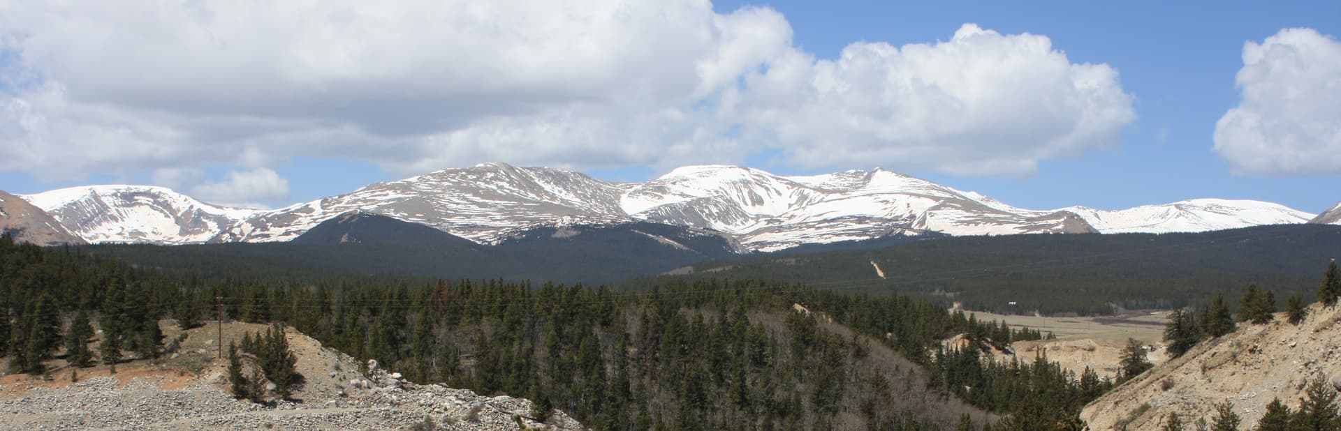
Mount Sherman has two trailheads, and both of them sit at the end of an old mining road that decides how long your day gets. The Fourmile Creek trailhead on the Fairplay side is the one most people use. The Iowa Gulch trailhead on the Leadville side is shorter but harder to find and just as rough. Neither needs a permit or a fee, and the hike itself is the easiest standard 14er in Colorado. The road in is the part that trips people up, along with a detail that's easy to miss: much of this mountain sits on private mining claims, not public land.
This page is about getting parked, not the climb. How to find each trailhead, what the drives are actually like, whether your car can reach the top, where the gates and the private-property signs are, and the handful of mistakes that turn a short day into a long one. If you want the route beta, that's in our complete Mount Sherman guide. Here we're just getting you to the start.
What You'll Learn
- Quick Trailhead Facts
- Two Trailheads: Fourmile Creek vs Iowa Gulch
- Driving Fourmile Creek Road (Fairplay Side)
- Driving Iowa Gulch (Leadville Side)
- Can You Make It in a Regular Car?
- The Private Land Problem
- Parking Reality and How Early to Arrive
- Do You Need a Permit or Reservation?
- Facilities and Cell Service
- When the Roads Are Open
- Where People Go Wrong
- Frequently Asked Questions
Quick Trailhead Facts
- Peak: Mount Sherman, 14,036 ft, Mosquito Range
- Fourmile Creek trailhead (Fairplay side): end of County Road 18, near the old Leavick townsite; a gate sits higher up around 12,000 ft
- Iowa Gulch trailhead (Leadville side): end of Lake County Road 2 then the dirt fork up Iowa Gulch, about 7 miles from US-24
- Vehicle: passenger cars reach a lower parking point on both roads; high-clearance and often 4WD get you higher
- Round trip: roughly 5 to 5.5 miles with about 2,100 ft of gain from the main trailhead; shorter if a capable vehicle reaches the upper road near 12,000 ft
- Permit or fee: none; first come, first served
- Land status: the route crosses private mining claims; stay on the trail and respect posted signs
- Facilities: none at either trailhead; no water, no toilet
- Cell service: unreliable to nonexistent
- Season: mid-June through September for easy driving; snow closes the upper roads the rest of the year
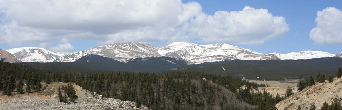
Two Trailheads: Fourmile Creek vs Iowa Gulch
Most 14ers have one standard trailhead. Sherman has two, because the mountain sits on a ridge with mining roads pushed up both sides from the old silver days.
The Fourmile Creek trailhead comes in from the east, out of Fairplay. It's the popular choice, it's the one in our route guide, and it's the easier of the two to find. You follow Fourmile Creek Road up toward the Leavick townsite and the Dauntless Mine, and the road quality decides where you stop.
The Iowa Gulch trailhead comes in from the west, out of Leadville. It's a hair shorter to the summit, but the trailhead is unmarked, the approach road is just as rough up high, and the start of the hike crosses a soggy meadow under a power line. The Forest Service's own Mount Sherman page actually describes this Iowa Gulch approach as the trailhead, so it isn't an obscure back door, just a quieter one.
Pick based on where you're coming from. Driving up from Denver or South Park, Fourmile Creek is the natural side. Staying in Leadville or coming over from the west, Iowa Gulch saves you the long loop around. Either way the summit is the same, and so is the early alarm.
Driving Fourmile Creek Road (Fairplay Side)
From US-285 just south of Fairplay, turn west onto County Road 18, which is Fourmile Creek Road. The lower stretch is graded dirt that most cars handle at a steady crawl. You'll pass ranch land, then climb into the trees, and after roughly 10 miles the valley opens up near the old Leavick townsite around 11,200 feet. Leavick is a scatter of mining ruins, not a town, so there's no gas, water, or bathroom out here.
Above Leavick the road changes character. It gets rockier, steeper, and narrower as it climbs the last mile and a half toward a gate near 12,000 feet, just below the Dauntless Mine. When conditions are good and the gate is open, high-clearance vehicles grind up to parking near the gate and shave the hike down to about 3 miles round trip with roughly 1,500 feet of gain. When the gate is shut, or when snow or mud blocks the upper road, you park lower and walk the road, which puts you back near that 5-plus-mile, 2,100-foot standard day.
The honest version: the upper mile is embedded rock and water ruts, not smooth dirt. It's not technical four-wheeling, but it will scrape a low bumper and rattle a tired driver in the dark. Recent trip reports also note landowners posting fresh No Parking signs along the road, so don't assume a pullout you used last year is still fair game.
Driving Iowa Gulch (Leadville Side)
From US-24 in Leadville, turn east onto Monroe Street, then right onto Lake County Road 2 (Toledo Street). The road is paved for about 3.8 miles. At a fork marked with a rough-road sign, bear left onto dirt and climb about 3 more miles up Iowa Gulch. The trailhead sits roughly 7 miles from US-24.
The catch here is twofold. First, the trailhead is unmarked. There's no sign and no built lot, just a pair of concrete blocks near where the road ends at the amphitheater, and the trail heads off toward the creek under a power line through soft, wet ground. Second, the sources disagree on how far an ordinary car can get. Some hikers report reaching close to 12,000 feet on a decent day; a common recommendation is that passenger cars stop at a pullout a couple of miles past the fork and let higher-clearance rigs continue. The road's condition swings with the season and recent weather, so treat the upper section as high-clearance terrain and check a recent report before you commit.
Dispersed camping is not allowed in Iowa Gulch, so plan to sleep in Leadville or at a nearby campground rather than car-camping at the trailhead.
Can You Make It in a Regular Car?
This is the question everyone asks, and on Sherman the answer depends on how far up you insist on driving.
- Passenger car, either side: you can reach a lower parking point and walk the rest. On the Fourmile side that's near Leavick; on the Iowa Gulch side it's a pullout below the roughest stretch. You add road miles, but you keep your oil pan.
- AWD crossover with decent clearance: usually gets higher in dry conditions if you're patient and pick your line. Wet or snowy road erases that advantage fast.
- High-clearance SUV or truck: reaches the upper parking near 12,000 feet when the road and gate allow, which is what turns Sherman into a genuinely short hike.
If you're unsure, park where your clearance runs out and walk. The extra road mileage is a known quantity. Getting high-centered on a rock in the dark, miles from cell service, is not. For a 14er with a far simpler drive, Mount Bierstadt's Guanella Pass is paved to the lot, which is worth knowing if the mining roads here are a dealbreaker for your vehicle.
The Private Land Problem
Here's the thing that makes Sherman different from most 14er trailheads, and it's easy to miss. Much of the mountain is privately owned mining claims, not national forest. The Forest Service's Mount Sherman page says it plainly: "this mountain is on a privately owned mining claim and is not on public land," and it adds a warning that matters for everyone who comes after you: "Misuse of this trail could lead to closure."
What that means in practice:
- Stay on the established route. The data we keep on this peak flags it directly: the standard line crosses private claims, so wandering off-trail, cutting switchbacks, or poking around the mine structures is both a safety hazard and a trespass risk.
- Respect posted signs. If a spot is marked No Parking or No Trespassing, believe it, even if an old guidebook says otherwise. Claim boundaries near the road have been changing.
- Skip the Sacramento Creek approach. Some older guides list a Sacramento Creek trailhead on the southeast side. It crosses private property and shouldn't be used. Stick to Fourmile Creek or Iowa Gulch.
None of this is hypothetical. Access to Colorado's 14ers that cross private land has gotten tighter in recent years, and a few peaks have seen real closures. Sherman stays open because hikers behave, so the low-effort move is to be a good guest.
Parking Reality and How Early to Arrive
Neither trailhead has a real parking lot. On the Fourmile side, the upper parking near the gate is small and the road itself becomes the overflow, with cars lining the shoulder wherever it's legal and wide enough. On the Iowa Gulch side, parking is informal space near the end of the road. Both fill on summer weekends because Sherman is the 14er handed to beginners, so it draws crowds out of proportion to its size.
Plan to arrive early, ideally parked before 6 a.m. on a summer weekend. That lines up with the start you want anyway. Sherman's entire route is above treeline, Colorado's afternoon thunderstorms build between late morning and early afternoon, and the rule is to be off the summit by noon. An early arrival solves the parking and the weather in one move. Our Mount Sherman weather and timing guide walks through the storm windows and the wind, which is the thing people remember most about this peak.
Do You Need a Permit or Reservation?
No. There's no permit, no timed-entry reservation, and no parking fee at either Mount Sherman trailhead. You show up, and if there's legal room, you park and hike.
That's worth saying because Colorado has been adding paid systems at its busiest trailheads. Quandary Peak now needs a paid parking reservation or a shuttle in summer, and places like Maroon Bells cap access entirely. Sherman stays free and first come, first served. The flip side is that there's no guaranteed spot and no backup if parking fills, so your alarm clock does all the work. It's the same deal as the free, unregulated lots at Grays Peak.
Facilities and Cell Service
There are no facilities at either trailhead. No toilet, no water, no trash service, no visitor center. Use the restroom and fill your water in Fairplay or Leadville before you drive up, and pack out everything you bring.
Cell service is unreliable at best and usually absent once you're on the road, let alone the mountain. Download your map offline before you leave town and tell someone your plan. A paper Trails Illustrated map is cheap insurance when your phone won't load and the cold is draining the battery. And because nearly everyone starts in the dark, a headlamp isn't optional here.
When the Roads Are Open
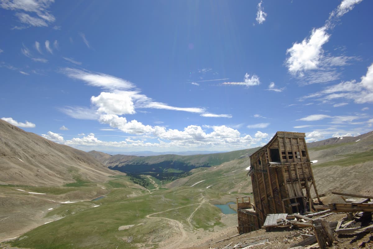
Both access roads are a summer proposition. Mid-June through September is the reliable window for driving high; by then the snow has usually cleared the upper roads, and the trail is mostly dry.
Outside that window the trailheads don't disappear, they just get farther away. On the Fourmile side, county plowing typically reaches only to about 11,000 feet, and the road above isn't maintained, so winter and early-spring climbers park low and travel the snow-covered road on foot, skis, or snowshoes. On the Iowa Gulch side, maintenance stops near the ASARCO Mine exit, and the upper road closes with snow. Either way, that turns the easiest 14er in summer into a long, serious outing with avalanche terrain on the slopes. If you're new to 14ers, stick to the summer window. For the bigger picture of what's climbable and when, see our Colorado 14ers guide.
Conditions change fast up here, especially the gate status and the upper road. Before you drive, check recent trip reports on 14ers.com and, if you want the official word, call the managing ranger district. The Fourmile side falls under the South Park Ranger District in Fairplay at (719) 836-2031; the Iowa Gulch side is the Leadville Ranger District at (719) 486-0749.
Where People Go Wrong
The same mistakes show up at both trailheads again and again:
- Driving a low car too far up. The upper mile on each road is rocky and rutted. Park where your clearance runs out and walk; a scraped oil pan or a stuck car in the dark is the worse option.
- Arriving too late. The small parking areas fill before sunrise on summer weekends, and a late start also puts you on an exposed ridge at thunderstorm time.
- Parking on private land. Claim boundaries near both roads are posted and the signs have been moving. Don't leave your car anywhere marked, even "just for a few hours."
- Treating the Iowa Gulch trailhead like it's signed. It isn't. Know the concrete-block landmark and the power-line start before you go, or you'll waste daylight hunting for the trail.
- Underestimating the altitude. Both trailheads start near or above 11,000 feet, and the hike tops out at 14,036. If you drove up from sea level that morning, the altitude hits hard. Read our altitude sickness guide first.
Get the drive and the parking sorted and Sherman lives up to its reputation as the friendliest big summit in the state. For where it ranks against the other gentle peaks, see our roundup of the easiest 14ers for beginners.
Frequently Asked Questions
Can you drive to the Mount Sherman trailhead?
Partway, yes. Both the Fourmile Creek road from Fairplay and the Iowa Gulch road from Leadville are drivable dirt roads, but the upper sections are rough. Passenger cars reach a lower parking point; high-clearance and often 4WD vehicles continue to parking near 12,000 feet when the road and gate allow, which shortens the hike considerably.
Do you need 4WD to reach the Mount Sherman trailhead?
Not to hike the peak, but it decides how far you drive. High-clearance is the real requirement on the upper roads, and 4WD helps in wet or early-season conditions. Low cars can reach a lower lot on either side and walk the rough stretch, adding road miles to the day.
Is Mount Sherman on private property?
Much of it is. The Forest Service notes the mountain sits on privately owned mining claims rather than public land, and warns that misuse of the trail could lead to closure. Stay on the established route, respect posted No Parking and No Trespassing signs, and don't enter the old mine structures.
Which trailhead is better, Fourmile Creek or Iowa Gulch?
Fourmile Creek, from Fairplay, is easier to find and the more popular choice. Iowa Gulch, from Leadville, is slightly shorter to the summit but unmarked and just as rough up high. Pick the side you're already closest to; the hike and the summit are the same.
Do you need a permit to hike Mount Sherman?
No. There's no permit, reservation, or parking fee at either trailhead. It's first come, first served. The only real strategy is arriving before sunrise, since the parking areas are small and fill fast on summer weekends.
Final Thoughts
The Mount Sherman trailhead question is really two road questions and one land question. The hike is short and non-technical, but the mining roads decide how much walking you add, and the private claims decide how carefully you tread. Know your vehicle, get there before dawn, park only where it's legal, and stay on the route across the claims. Do that and Sherman stays open, free, and exactly as easy as its reputation.
Once you're parked, the mountain takes over. For the route section by section, see our complete Mount Sherman guide, check the weather and timing before you commit, and bring real hiking boots for the loose rock on the summit ridge.
Get the Colorado 14er Packing Checklist (free PDF)
Plus a weekly note on the best Colorado trails, gear deals, and seasonal hike picks. No spam, unsubscribe anytime.
We respect your inbox. Unsubscribe anytime.