Longs Peak Hike: A Complete Guide to the Keyhole Route
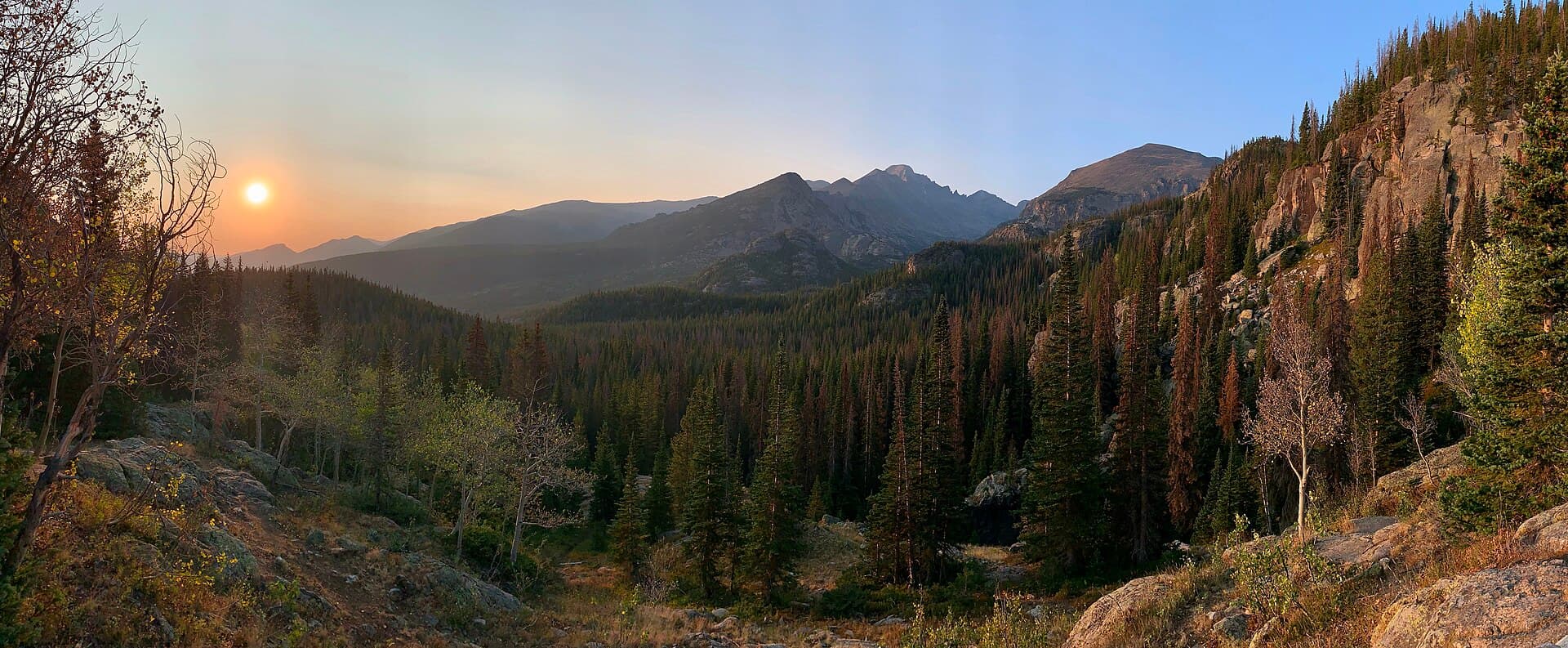
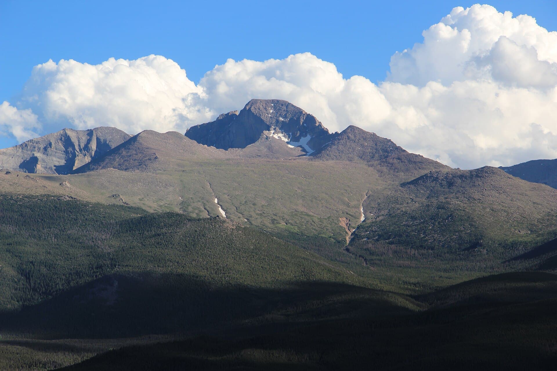
The Longs Peak hike is the hardest standard-route 14er most people will ever attempt. The summit sits at 14,259 feet, the only fourteener inside Rocky Mountain National Park, and the standard way up is the Keyhole Route: roughly 14.5 miles round trip with about 5,100 feet of elevation gain. Plan on 10 to 15 hours car to car. This is not a walk-up. It's Class 3 scrambling with real exposure, and it kills people most years.
That said, thousands of fit hikers without technical climbing experience summit Longs every summer. The route is doable in a long single push if you start in the dark, move efficiently, and turn around when the weather or your body tells you to. The trick is knowing what you're walking into before you leave the trailhead at 2 AM.
This guide covers the route section by section, the gear that matters on Class 3 terrain, the timing strategy, the permit situation, and the decisions that separate a good summit day from a rescue.
What You'll Learn
- Quick Stats: Longs Peak at a glance
- How Hard Is the Longs Peak Hike?
- Getting to the Trailhead
- The Keyhole Route, Section by Section
- What to Pack
- Timing and Weather Strategy
- When to Climb Longs Peak
- Permits and Camping
- Common Mistakes That Get People in Trouble
- Frequently Asked Questions
Quick Stats: Longs Peak at a glance
- Elevation: 14,259 ft
- Trailhead: Longs Peak Ranger Station, 9,405 ft
- Round Trip Distance: 14.5 miles
- Elevation Gain: ~5,100 ft
- Class: Class 3 (exposed scrambling, hands required, real fall potential)
- Difficulty: One of the hardest standard 14er routes in Colorado
- Time: 10-15 hours typical
- Best Season: Mid-July through early September (snow-free window)
- Permit: None for day hiking; no timed-entry reservation needed at this trailhead
- Crowds: Heavy in summer, but spread out across a very long day
How Hard Is the Longs Peak Hike?
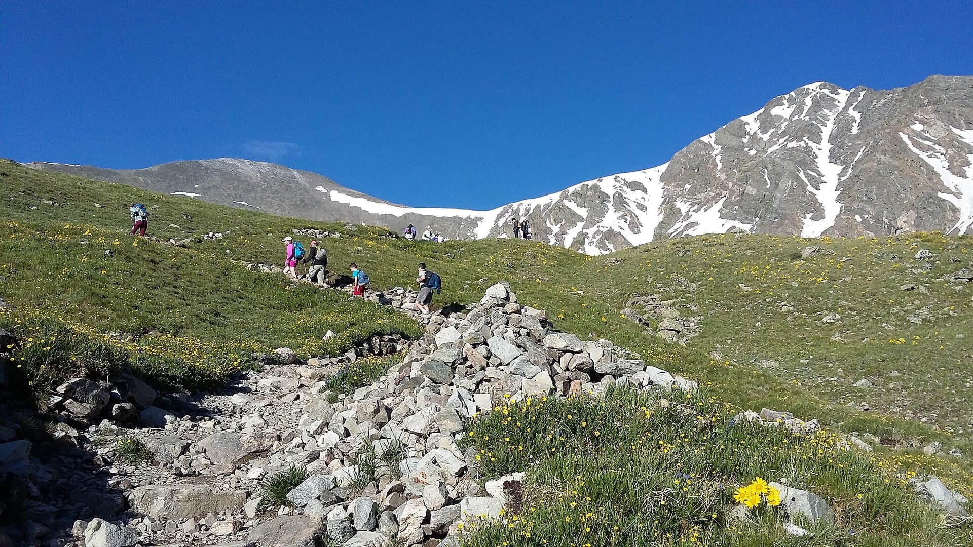
Hard. Harder than people expect, and the numbers undersell it. The first six miles to the Keyhole are a steady, runnable trail with big elevation gain. That part is just a long, high-altitude slog. Then the trail ends.
From the Keyhole on, you're scrambling across ledges, up a loose couloir, along a narrow exposed traverse, and up a slick slab to the summit. That final 1.5 miles takes most people two to three hours each way. There's no railing, no chain, and in a few spots a slip would be fatal. The route is marked with red-and-yellow painted bullseyes on the rock, but route-finding still matters in fog.
For comparison, Mount Bierstadt is a Class 2 trail you can finish in five hours. Longs Peak is a different animal. If you've never done Class 3 scrambling with exposure, Longs should not be your first 14er. Get a few Class 2 peaks under your belt first, and read our 14ers overview and easiest 14ers for beginners before you commit.
Summit success rates hover around 50 percent. Most people who turn back do so because of weather, time, or nerves on the exposed sections, not fitness.
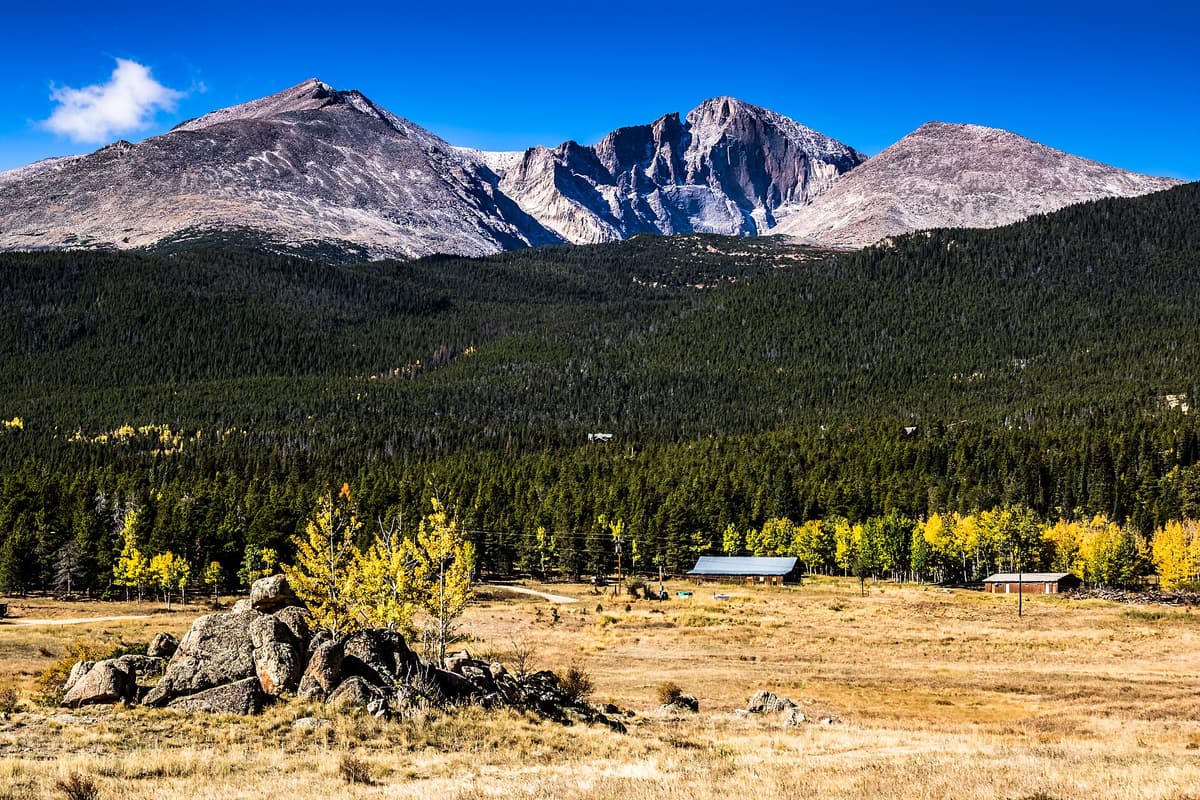
Getting to the Trailhead
The Longs Peak Trailhead is at the Longs Peak Ranger Station off Colorado Highway 7, the Peak to Peak Highway. It's about 10 miles south of Estes Park and a short drive north of Allenspark.
From the Front Range, the standard approach is:
- Get to Lyons on US-36
- Take CO-7 west and south toward Estes Park
- Turn at the signed Longs Peak Area road, about 9 miles south of Estes Park
- Follow it one mile to the ranger station and trailhead parking
Here's the key logistical detail: the Longs Peak Trailhead is reached directly from CO-7 and does not pass through a Rocky Mountain National Park entrance station. That means it sits outside the park's summer timed-entry reservation system. You don't need a timed-entry permit to hike Longs, which is part of why it stays busy. If you're building a longer trip in the area, our Rocky Mountain National Park guide and Estes Park hikes roundup cover the rest of the park where reservations do apply.
Parking: The lot is small and fills overnight. On summer weekends it's full by 2 to 3 AM. When it's full, people park along the access road. Plan to arrive in the dark regardless, because you should be hiking by then anyway.
Restrooms: Toilets at the trailhead. No reliable water once you start, so fill up before you go or plan to filter.
Cell service: Spotty at the trailhead, gone above treeline.
The Keyhole Route, Section by Section
The Keyhole Route breaks cleanly into two halves: a long trail to the Boulder Field, then the scramble.
Trailhead to Goblins Forest (Miles 0-1.2)
You start in dense subalpine forest, climbing steadily by headlamp. The trail is wide and obvious. This is your warm-up; settle into a sustainable pace, because you have a lot of climbing ahead.
Goblins Forest to Treeline (Miles 1.2-3.5)
The trail switchbacks up, crosses Alpine Brook, and breaks out of the trees around 11,000 feet. Once you clear treeline you lose all wind protection. This is usually where you'll catch your first big view of the peak and the sky, which tells you a lot about your weather odds for the day.
Treeline to the Boulder Field (Miles 3.5-6.0)
The trail passes the Chasm Lake junction (a worthwhile side trip on a different day) and climbs to Granite Pass, then traverses to the Boulder Field at about 12,760 feet. This is the last spot with a privy and the designated backcountry campsites. From here you can see the Keyhole, the notch in the ridge marked by the stone Agnes Vaille Shelter, a memorial to a climber who died descending in a 1925 winter storm.
This is your gear-up and gut-check point. If the weather looks unsettled, this is a reasonable place to call it. Beyond the Keyhole, retreat gets slower and more dangerous.
The Keyhole (Mile 6.0, 13,150 ft)
Scramble up the boulders to the Keyhole itself. Stepping through it is the moment the hike changes. On the far side you're on the west face, often colder and windier, looking at terrain that does not forgive mistakes. From here the painted bullseyes guide you.
The Ledges (13,150-13,300 ft)
A traverse across sloping rock ledges with exposure below. The holds are good but the consequences are real. Move deliberately, keep three points of contact, and don't rush.
The Trough (13,300-13,900 ft)
A long, loose gully that grinds you out at altitude. The footing is bad and other hikers can knock rocks down on you, which is exactly why a helmet earns its place in your pack here. The Trough tops out at a short Class 3 step that's the first place many people feel genuinely nervous.
The Narrows (13,900 ft)
A narrow ledge across the south face with a long drop on one side. It's shorter than it looks in photos, and the holds are solid, but it demands full attention. This is not the place to be hurried by weather or fatigue.
The Homestretch and Summit (13,900-14,259 ft)
The final pitch is a steep, smooth granite slab with cracks for hands and feet. When dry it's straightforward Class 3. When wet or iced it's treacherous. Top out and you're on a flat, surprisingly large summit with views across the entire park. Then remember: you're only halfway. Every exposed section has to be down-climbed, and most accidents happen on the descent.
What to Pack
Longs is a long day on serious terrain, so your kit matters more than on an easy 14er. The rockfall in the Trough and the exposure on the upper route change what you carry.
- Helmet. The single most overlooked piece. Rockfall in the Trough is constant when the route is busy. A climbing helmet is cheap insurance. Browse climbing helmets on Amazon.
- Grippy footwear. You want sticky rubber and a precise fit for the slabs and ledges, not soft trail runners. See our Colorado hiking boots guide, or shop approach shoes.
- Bright headlamp plus spare batteries. You'll start and possibly finish in the dark. Details in our headlamp guide, or shop headlamps.
- Hard shell rain jacket. Afternoon storms are the main thing that kills people up here. Our rain jacket picks cover it, or shop rain shells.
- Warm layers and gloves. It can be below freezing with wind on the west face even in July. Shop fleece and insulated layers.
- Water and a filter. Carry at least 3 liters and know where you can refill below the Boulder Field. Shop water filters.
- Calorie-dense food. A 12-hour day at altitude burns through you. Pack more than you think you'll eat.
Skip the cotton entirely. Wool or synthetic next to skin, always.
Timing and Weather Strategy
The whole route is built around one rule: be off the exposed summit blocks before the afternoon thunderstorms build. In a typical Colorado summer, storms fire up between 11 AM and 1 PM almost daily. Lightning above treeline is lethal, and you cannot outrun it on this terrain.
Work backward from that. If you want to be summiting by 8 AM and back below the Keyhole by 10, you need to leave the trailhead between 1 and 3 AM. That's the famous "alpine start," and on Longs it's not optional. A sunrise start gets you to the scramble exactly when the sky goes bad.
Check a mountain-specific forecast the night before, not a town forecast. If thunderstorms are predicted before noon, change your plans. The mountain will still be there next week. Turning around at the Keyhole with the summit in view is the experienced call, not the cowardly one.
When to Climb Longs Peak
The standard Keyhole Route is a Class 3 scramble only when it's dry and snow-free, which in most years means mid-July through early September. Outside that window it becomes a technical mountaineering objective that requires an ice axe, crampons, and the skills to use them on steep snow and ice.
- Mid-July to early September: Prime season. The route is "in," snow is mostly gone, and conditions are at their friendliest.
- June and late September: Lingering or early snow can turn the Trough, Narrows, and Homestretch into mountaineering terrain. Check conditions reports.
- October through May: A full winter mountaineering route. Far outside the scope of a day hike, and a different skill set entirely. If you're curious about cold-weather hiking generally, start with our winter hiking guide, not Longs.
Permits and Camping
Day hiking Longs Peak requires no permit, and because the trailhead sits outside the park's gated entrances, you don't need a timed-entry reservation either. You also won't pass an entrance station on the way in.
If you want to break the climb into two days, you can camp in the Boulder Field, which puts you within an hour or so of the Keyhole for an early summit push. Those backcountry sites require a wilderness camping permit from Rocky Mountain National Park, and they book out fast for summer weekends. Reserve well ahead. Camping high also means a night near 12,800 feet, so be honest about how you handle altitude before counting on it.
Acclimatization matters more on Longs than almost anywhere, because you're spending hours above 13,000 feet. If you've just flown in from sea level, spend a couple of nights at elevation first. Our guide to altitude sickness in Colorado covers the warning signs you can't ignore.
Common Mistakes That Get People in Trouble
Starting too late. A dawn trailhead start puts you on the exposed summit blocks right as storms build. Leave by 3 AM at the latest.
Treating it like a regular hike. The trail ends at the Keyhole. If you're not comfortable scrambling with exposure, the upper route will rattle you, and a rattled hiker on the Narrows is a dangerous hiker.
Going up in wet or snowy conditions. The Homestretch slab and the Trough are manageable dry and lethal slick. Conditions, not the calendar, decide whether the route is safe.
Skipping the helmet. The Trough funnels rockfall, and busy days mean other people's mistakes land on you.
Pushing past your turnaround time. Set a hard summit cutoff before you leave. If you're not on top by it, turn around. The descent is where most accidents happen, and a late summit means descending tired into bad weather.
Underestimating the descent. Down-climbing the Narrows and Homestretch on shaky legs is harder than going up. Save energy and focus for it.
Ignoring altitude symptoms. Severe headache, nausea, and confusion mean go down. Higher never makes it better.
Frequently Asked Questions
How hard is the Longs Peak hike?
It's one of the hardest standard-route 14ers in Colorado. The first six miles are a steep trail, then the route becomes Class 3 scrambling with real exposure across the Ledges, Trough, Narrows, and Homestretch. About half of those who attempt it summit.
How long does it take to hike Longs Peak?
Most hikers take 10 to 15 hours round trip for the 14.5-mile Keyhole Route. Strong, fast parties finish in 9 to 10 hours; many take longer. Starting between 1 and 3 AM is standard to beat afternoon storms.
Do you need a permit to hike Longs Peak?
No permit is required for a day hike, and the Longs Peak Trailhead sits outside Rocky Mountain National Park's timed-entry reservation system, so no reservation is needed either. Overnight camping in the Boulder Field does require a wilderness permit.
Can a beginner hike Longs Peak?
It's a poor choice for a first 14er. The exposed Class 3 scrambling demands comfort on rock with serious fall potential. Build up on Class 2 peaks like Mount Bierstadt or Quandary Peak first, then consider Longs once you're solid on exposure.
What is the best time of year to climb Longs Peak?
Mid-July through early September, when the Keyhole Route is dry and snow-free. Outside that window the upper route turns into technical mountaineering that requires an ice axe, crampons, and the training to use them.
Final Thoughts
Longs Peak rewards preparation and punishes shortcuts. The combination of distance, altitude, exposure, and afternoon weather makes it the most demanding 14er most hikers will ever stand on top of. Get the timing right, carry the right gear, scramble within your comfort zone, and respect your turnaround time, and the Keyhole Route is one of the great days in Colorado mountaineering.
If Longs feels like a stretch right now, work up to it. Start with our easiest 14ers guide, then come back when exposed scrambling feels routine. For the full kit, see our guides to hiking boots, rain jackets, and headlamps.
Get the Colorado 14er Packing Checklist (free PDF)
Plus a weekly note on the best Colorado trails, gear deals, and seasonal hike picks. No spam, unsubscribe anytime.
We respect your inbox. Unsubscribe anytime.