Spruce Creek Trailhead: Parking, the Road, and the Hike to Mohawk Lakes
The Spruce Creek Trail starts about 2.5 miles south of Breckenridge and does the work of four different hikes at once. It's the approach to Mohawk Lakes, the trail past Continental Falls, the walk to the old Mayflower Mine cabins, and the long day up Crystal Peak. On its own, it's a gentle 4.5-mile round trip through spruce forest to a meadow and a mine ruin, which makes it a good first hike at altitude. Push past that meadow and it turns into one of the best alpine days in Summit County.
Here's the catch that decides how your day goes: the trailhead sits at the end of a rough dirt road, and where you have to park depends entirely on what you're driving. A passenger car stops at the lower lot and adds a couple of miles. A high-clearance truck can grind up another mile of rock to the upper lot and cut the hike close to in half. Get to that lower lot after about 7 a.m. on a summer weekend and it's already full, with no legal parking along the road.
This guide covers the road and the parking first, since that's what trips people up, then walks the trail from the lower lot all the way to Upper Mohawk Lake, plus the gear and timing that matter at 12,000 feet.
What You'll Learn
- Quick Stats
- Getting to the Trailhead and the Road
- Where to Park
- The Hike, Section by Section
- What to Pack
- Best Time to Hike
- Wildlife, Ruins, and Trail Rules
- Common Mistakes
- Frequently Asked Questions
Quick Stats {#quick-stats}
From the lower trailhead:
- Round trip to Mayflower Lake and the mine cabins: about 4.5 miles
- Round trip to Continental Falls: about 5 miles
- Round trip to Lower Mohawk Lake: about 6 miles
- Round trip to Upper Mohawk Lake: about 7 miles, roughly 1,600 ft of gain
From the upper 4WD lot: knock about 2 miles and 400 feet off each of those.
Trailhead elevation: about 10,400 ft (lower lot)
High point: Upper Mohawk Lake, about 12,100 ft
Managing agency: White River National Forest, Dillon Ranger District
Nearest town: Breckenridge, about 10 minutes
Best season: July through September
Dogs: allowed, under voice control (a leash is smart near the lakes)
Fee or permit: none
Distances vary a little source to source depending on which lot they measure from and which lake they call the end, so treat these as close estimates. The Forest Service lists the trail as Spruce Creek (Mohawk Lakes) Trail #58.
Getting to the Trailhead and the Road {#getting-there}
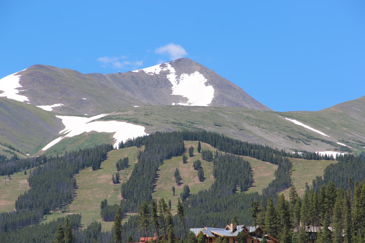
From Breckenridge, drive south on Colorado 9 about 2.5 miles toward Hoosier Pass. Watch for Spruce Creek Road, also signed as County Road 800, on the right just past the Crown subdivision. Turn there and the pavement gives way to dirt in a few hundred yards.
Spruce Creek Road climbs about 1.2 miles to the lower trailhead lot. When it's dry, a normal passenger car handles this stretch fine if you take the ruts and rocks slowly. After rain it gets greasy, and low-clearance cars will scrape in a couple of spots.
Above the lower lot, the road gets serious. The Forest Service recommends four-wheel drive for the next mile of rough, rocky road that ends near the Mohawk Lakes junction. High-clearance drivers who make it up there start the hike most of the way in. Everyone else parks below. Don't try the upper road in a low car to save your legs; you'll save nothing and risk your oil pan.
There's no toilet and no water at either lot, and cell service is spotty. Fill your bottles and download your map in Breckenridge, which is only about ten minutes back down the highway with every service you'd want.
Where to Park {#parking}
The lower lot holds around 30 cars, and on a July or August weekend it fills by about 7 a.m. Once it's full, you're stuck, because parking along Spruce Creek Road isn't allowed and the residents there do call it in. A full lot means you come back at a different hour or pick another day.
So the move is simple: start early. Being on the trail by 7 gets you a spot, beats the crowd at the falls, and puts you at the lakes before the afternoon storms build. This isn't a hike you show up to at 10 a.m. and expect to walk right onto.
Overnight parking at the trailhead is a different story. It's allowed only if you've booked Francie's Cabin, the 10th Mountain Division hut up the Crystal Lake road. If you're doing a day hike, plan to be back at your car the same day.
Spruce Creek doesn't run on the reservation-and-shuttle system that its neighbor McCullough Gulch now uses, so there's no ticket to buy here. But the parking crunch is the same problem in a different form. If you want the full picture on how Summit County is managing its busiest trailheads, our guide to Colorado trailhead parking is worth reading before any popular summer hike, and the nearby McCullough Gulch trailhead guide covers the paid system a few miles south.
The Hike, Section by Section {#the-hike}
From the lower lot at 10,400 feet, the trail heads southwest into spruce and fir, climbing steadily along the creek. The grade is friendly, never steep, but you're starting above 10,000 feet, so most people feel it in the first mile. Slow down and let your lungs catch up.
Lower lot to the Wheeler Trail (about 1.5 miles). The path stays in the trees and rolls uphill beside Spruce Creek. Around 1.5 miles the Wheeler Trail crosses it. Right heads toward McCullough Gulch; left climbs over the Tenmile Range to Copper Mountain. Keep going straight for Mohawk Lakes.
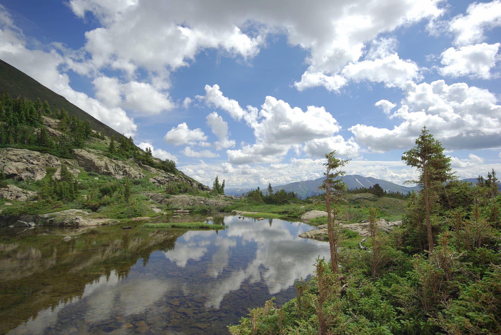
Wheeler Trail to Mayflower Lake (about 2 miles from the lot). The trail meets the upper 4WD road near a small diversion dam, follows it briefly, then reaches the Mohawk Lakes junction. Just beyond sits Mayflower Lake, a small pond in a meadow at roughly 11,400 feet, ringed by the collapsing log cabins and rusted machinery of the Mayflower Mine. This is the turnaround for the easy 4.5-mile version, and it's a fine one for families or a first day at altitude. The kids can poke around the meadow while everyone eats.
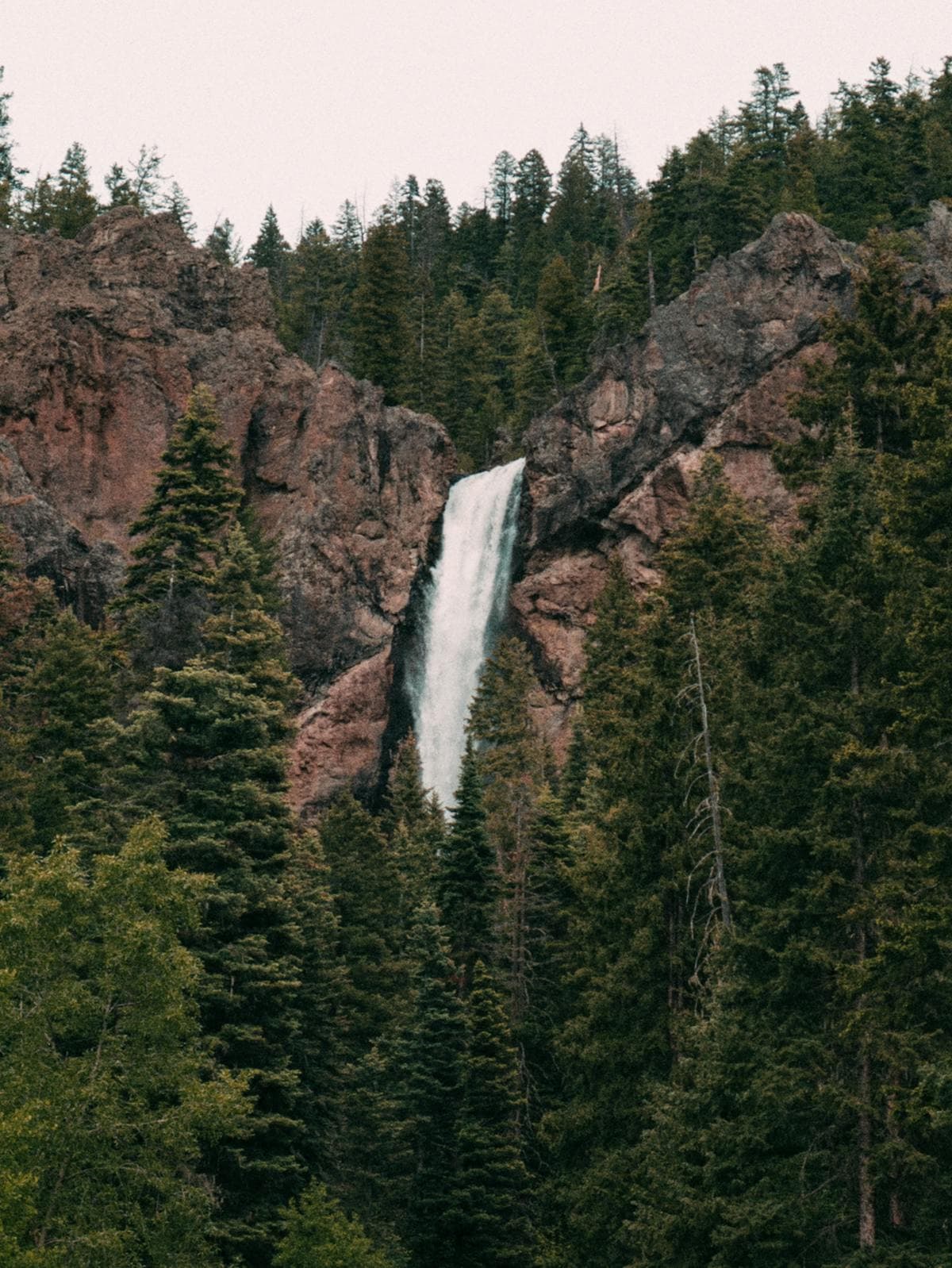
Mayflower Lake to Continental Falls and Lower Mohawk (about a mile more). From here the Mohawk Lakes trail turns uphill and steepens right away, climbing beside Continental Falls. The falls are a long, multi-tiered cascade pouring down granite, and the trail next to them is rocky with a couple of steps where you'll want your hands. Above the falls the trail passes an old wooden mill and cabin clinging to the slope, then levels out at Lower Mohawk Lake around 11,800 feet, sitting in a bowl of rock.
Lower to Upper Mohawk Lake (about half a mile more). The trail rounds the lower lake and climbs a final rocky pitch to Upper Mohawk Lake at about 12,100 feet, with Pacific Peak walling off the head of the basin and a smaller tarn beyond. This is the full day, and the upper lake is the payoff most of the waterfall crowd never bothers to reach.
None of it is technical, but the section beside the falls is steep and exposed enough that it's better for older kids than small ones. For the full trail detail, our Spruce Creek Trail guide and Mohawk Lakes trail page break down each junction, and if you love this kind of high basin, the roundup of the best alpine lakes in Colorado points you to more.
What to Pack {#what-to-pack}
Spruce Creek tops out above 12,000 feet, where the weather turns fast and afternoon storms are the summer rule. Even for a half-day, pack like the mountain matters.
Quick pick: A set of trekking poles earns its keep here. The steps beside Continental Falls and the loose rock up top are far kinder on your knees with poles in hand.
The rest of the short list:
- A hiking daypack with room for layers, food, and two liters of water
- A base layer, a warm midlayer, and a packable rain and wind shell; it can be 40 degrees and blowing at the upper lake while town bakes at 80
- A water filter if you'd rather refill from the creek than haul it all
- Sun protection, because the tundra above the falls has no shade
- Shoes with real grip for the wet granite near the cascade
For the pieces that matter most, see our picks for hiking boots for Colorado and trekking poles. Early in the season, a set of microspikes helps on the snow that hangs around the lakes into July.
Best Time to Hike {#when-to-go}
Late June to early July: The lower trail is usually clear, the creek runs high, and Continental Falls is at its loudest. Expect snow patches above Mayflower Lake and mud lower down. The upper lakes hold ice into July.
Mid-July to August: Peak season. The trail is dry, the wildflowers fill the meadow, and the lakes warm just enough for a comfortable break on the rocks. This is also when the lot fills earliest and the falls section backs up, so start before 7 a.m.
September to early October: Crowds thin, the aspen along Spruce Creek Road turn gold in the last week of September, and mornings get crisp. Catch a clear day and it's the quietest good window of the year. Watch for early snow up high.
Late October through May: The road closes to vehicles from about November 23 to May 20, or until it dries out, and the route becomes a snowshoe and backcountry ski approach. It's a popular one, but the bowls above the falls are avalanche terrain, so that's a trip for people with winter skills and avalanche gear, not a casual walk. If you're building toward hikes like this, start with our beginner's guide to Colorado hiking.
Whenever you go in summer, get an early start. Storms build over Pacific Peak and the Tenmile Range by early afternoon, and the lakes sit above treeline with nowhere to hide.
Wildlife, Ruins, and Trail Rules {#rules}
The lower forest is moose country in the willows along the creek, so give them a wide berth if you see one; a moose is more dangerous up close than a bear. Higher up, marmots and pika work the talus around the lakes. Keep your distance from all of it and never feed anything.
The Mayflower Mine ruins are the other thing people crowd around, and they're worth seeing. The log cabins, the wooden mill above the falls, and the scattered machinery date to the Mayflower Gold Mine of the late 1880s. They sit on Forest Service land and they're slowly falling apart, so photograph them from the trail and don't climb on or inside them. A collapsing 140-year-old cabin is not a jungle gym.
A few ground rules keep this place worth the drive:
- Dogs are allowed. The trail is outside any designated wilderness, so voice control is the legal standard, but the lakes get busy enough that a leash is the polite call.
- Stay on the trail through the tundra above the falls. Those alpine plants take decades to recover from a bootprint.
- Camp only at the seven designated dispersed sites past the lower lot, and pack out everything.
- Altitude is the real hazard here, not the terrain. At 12,100 feet, some people get headaches or nausea even on a short hike. Our guide to altitude sickness in Colorado covers how to prevent it and when to turn around.
Common Mistakes {#common-mistakes}
Showing up late. The lower lot fills by 7 a.m. on summer weekends, and there's no roadside overflow. A late start often means no start.
Driving the upper road in the wrong car. The mile above the lower lot is genuinely rough. If you don't have high clearance and four-wheel drive, park at the lower lot and walk. A high-centered sedan blocking that narrow road ruins several people's mornings, including yours.
Stopping at the falls and calling it Mohawk Lakes. Continental Falls is beautiful and a lot of people turn around there, thinking they've done the hike. The lakes are another mile and a half up, and they're the reason to come.
Underestimating the altitude. A 7-mile hike sounds easy until you remember it all happens above 10,000 feet. Sleep a night in the mountains first if you can, and take the first mile slow.
Confusing it with McCullough Gulch or Quandary. They're all clustered south of Breckenridge and it's easy to mix up the trailheads. Spruce Creek is the mine-and-lakes hike; the fourteener next door is covered in our Quandary Peak guide.
Frequently Asked Questions {#faqs}
Do you need a permit or reservation for the Spruce Creek Trail?
No. There's no fee, permit, or parking reservation for Spruce Creek, unlike neighboring McCullough Gulch and Quandary Peak. The only limit is the small lot, which fills early on summer weekends. Overnight parking is allowed only with a Francie's Cabin reservation.
How long is the hike to Mohawk Lakes from the Spruce Creek Trailhead?
From the lower lot, it's roughly 6 miles round trip to Lower Mohawk Lake and about 7 miles to Upper Mohawk Lake, with around 1,600 feet of gain to the top. Starting from the upper 4WD lot cuts about 2 miles and 400 feet off those numbers.
Can I drive to the upper Spruce Creek Trailhead?
Only with a high-clearance, four-wheel-drive vehicle. The mile of road above the lower lot is rough and rocky, and the Forest Service recommends 4WD for it. Passenger cars should stop at the lower lot and hike from there.
Is the Spruce Creek Trail dog friendly?
Yes. Dogs are allowed and the trail is outside designated wilderness, so voice control is the rule rather than a required leash. Because the falls section and the lakes draw crowds, a leash is the considerate choice, and it keeps your dog off the loose rock and away from wildlife.
When does the Spruce Creek Road close for winter?
The Forest Service closes the road to vehicles from about November 23 to May 20, or until it dries out in spring. In winter the road is plowed only to the residential section, and the trail becomes a snowshoe and ski route. The bowls above the falls are avalanche terrain, so save the upper lakes for people with winter travel skills.
Spruce Creek packs a waterfall, a chain of alpine lakes, and a genuine mining ruin into a single trail, with a family-friendly turnaround built in at Mayflower Lake. Sort out which lot your car can reach, start early, and pack for cold wind up top. For more high country like this, browse our best waterfall hikes in Colorado and the full list of trails on the Breckenridge hikes page.
Get the Colorado 14er Packing Checklist (free PDF)
Plus a weekly note on the best Colorado trails, gear deals, and seasonal hike picks. No spam, unsubscribe anytime.
We respect your inbox. Unsubscribe anytime.