Mount Princeton Weather: When to Climb the Collegiate Prow
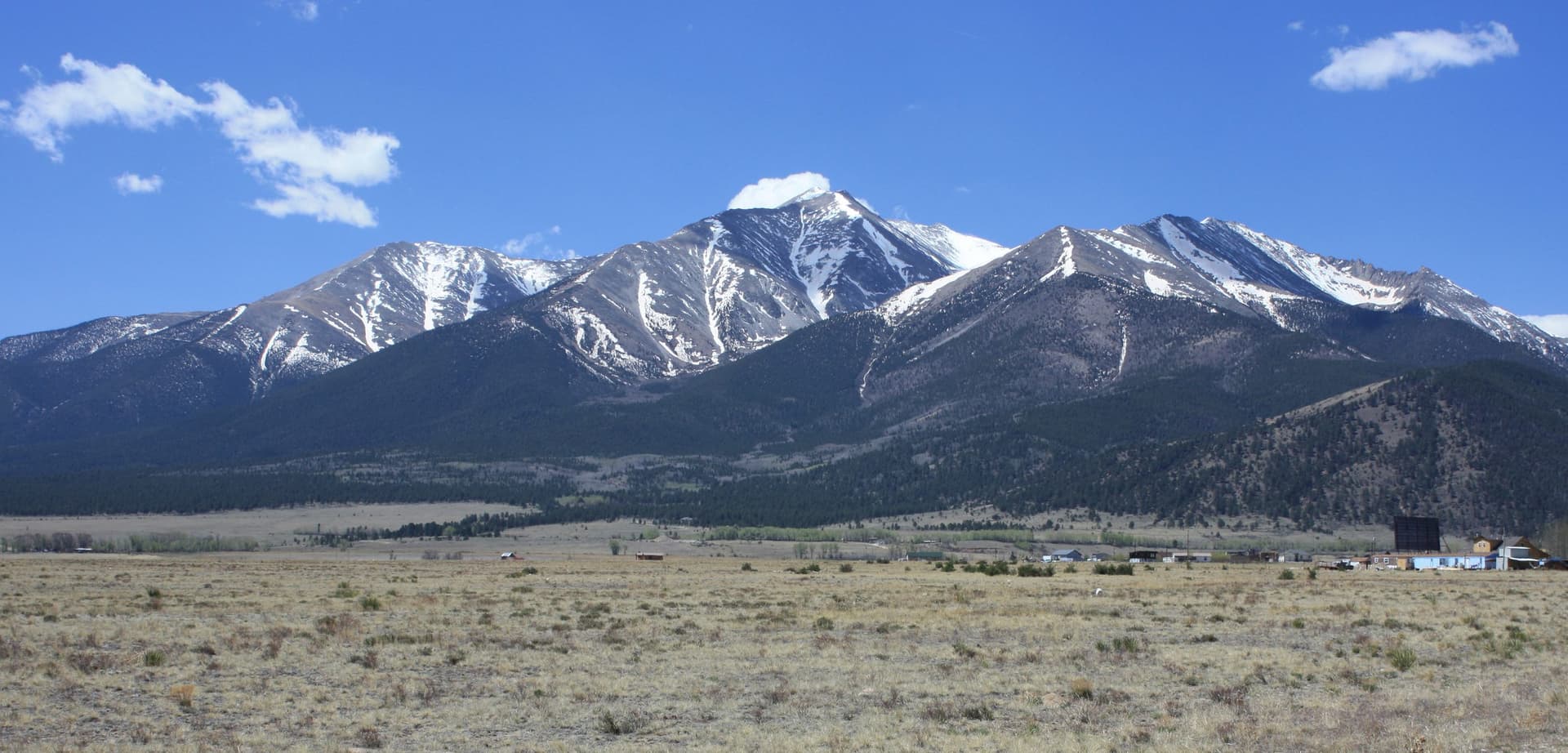
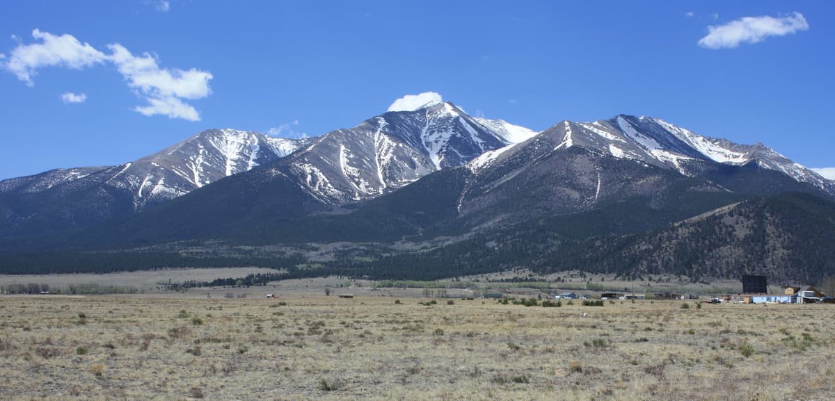
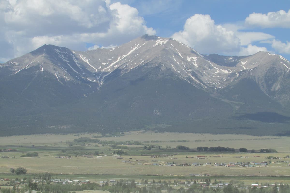
Mount Princeton weather catches people off guard more than most Sawatch peaks, and it's because of where the mountain sits. The summit is 14,197 feet, but the town of Buena Vista at its foot is barely 8,000, and the Mount Princeton Hot Springs at the base will have you soaking in warm water in shorts. That valley is sunny, mild, and lulling. The top of the peak is a different planet, 20 to 30°F colder and raked by wind, and the gap between the two is bigger than almost anywhere else on the Collegiate Peaks.
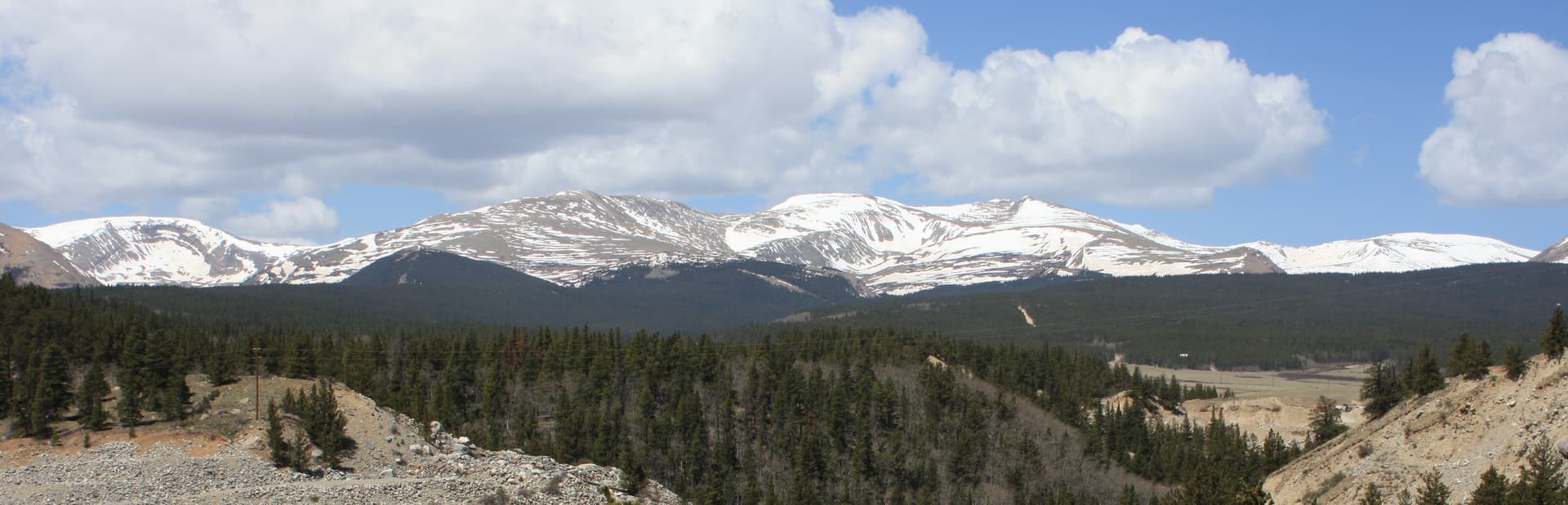
Princeton makes it worse by standing apart. Instead of hiding in the main crest of the range like Harvard or Columbia, it juts east toward the Arkansas River Valley, a bold prow of a mountain you can see for miles up and down Highway 285. That prominence is why the view from the top is so good, and it's also why the wind hits it from every side and the weather arrives with less warning. Add a long, rough access road that strands you on open slopes far from the car, and the timing of your climb matters as much here as the forecast itself.
This guide covers what to actually expect on Mount Princeton: summit temperatures, the month-by-month picture, the best window to climb, how the summer storms work on an exposed peak with a slow road out, and how to read a forecast built for 14,000 feet instead of the warm valley below.
What You'll Learn
- Quick Weather Facts
- How Cold Does It Get on Mount Princeton?
- Mount Princeton Weather by Month
- The Best Time to Climb Mount Princeton
- Summer Storms and the Long Way Back to the Car
- Why a Standalone Peak Catches More Weather
- The Road Is a Weather Problem Too
- Winter and Shoulder-Season Conditions
- What to Wear and Pack
- How to Check the Mount Princeton Forecast
- Frequently Asked Questions
Quick Weather Facts
- Summit elevation: 14,197 ft
- Radio towers (practical trailhead): about 10,800 ft
- Buena Vista valley floor: about 8,000 ft
- Summit vs. Buena Vista: typically 20 to 30°F colder
- Summer summit highs: mid-40s to low 50s°F on a good day (July-August)
- Summer summit lows: high 20s to mid-30s
- Winter summit highs: single digits to teens, with lows below zero
- Wind: commonly 20-40 mph up high, higher on the exposed east ridge and in storms
- Snow: possible any month; the upper slopes hold it into June and again by October
- Standard non-technical window: late June through mid-September
- Afternoon storm season: July and August (the monsoon)
- Most stable stretch: September, before winter shuts the road
How Cold Does It Get on Mount Princeton?
The number to plan around: the summit runs roughly 20 to 30°F colder than Buena Vista. The valley sits near 8,000 feet, the summit is 14,197, and air cools about 3 to 5°F for every 1,000 feet you climb. So when it's a pleasant 75°F afternoon in town, the top of the peak can be sitting in the 40s, and often cooler once the wind factors in.
In the standard climbing season, summit highs land in the mid-40s to low 50s on a calm, sunny day, and they fall fast when clouds or wind move in. Overnight lows up high run in the high 20s to mid-30s even in July. You'll usually leave the radio towers in the 40s at first light, warm up on the grind across the basin, then feel the cold come back the moment you stop moving on the exposed summit. The hot springs at the base can be running a comfortable soak while the top of the mountain is raw.
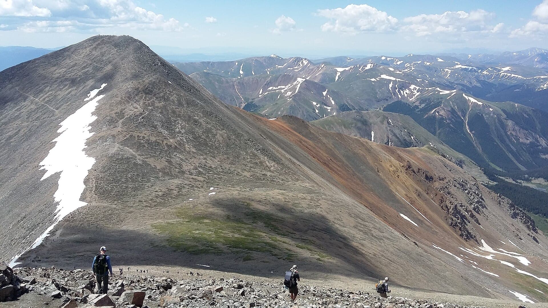
Wind is the part people underestimate on Princeton, and it's worse here than on peaks tucked into the range. The whole upper route runs above treeline across open east slopes and a long ridge, so there's nothing to slow the air down. A 45°F reading with a 25 mph wind feels closer to the low 30s on bare skin, and gusts over 40 mph are common on the summit and the ridge even on an otherwise clear day. Pack as if the top will be cold and windy no matter how warm it is at the car, because it usually is.
Mount Princeton Weather by Month
Here's the rough shape of the year up high. Treat these as typical patterns, not promises, because weather at 14,000 feet swings hard from one day to the next.
January-February. Deep winter. Summit highs in the single digits and teens, lows below zero, and steady wind that can top 60 mph in storms. The Mount Princeton Road is snowed in, so a climb means a long, cold approach on foot for experienced parties only.
March-April. Still full winter on the mountain. Snow is deep on the upper slopes, the road stays buried, and avalanche terrain is a real concern on the steeper pitches. The valley starts to thaw, but spring in Buena Vista means nothing at summit elevation.
May. The base begins to melt out, and the valley gets genuinely pleasant, which tempts people up too early. The upper slopes stay loaded and the road usually isn't passable to the towers. Wet spring snow on the loose talus is miserable and slick.
June. The transition month. Once the Mount Princeton Road dries out and melts clear to the radio towers, usually by mid-to-late June, the standard season begins. Early June still holds snow on the upper east slopes and icy patches in the talus, so bring traction if you go early.
July. Prime time for daylight and warm starts, and the start of the monsoon. Afternoon thunderstorms build almost daily, so the morning is your only reliable window. The road has dried out and the tundra on the traverse is green.
August. Warm, and the wettest month of the year up high. Storms fire most afternoons, and a passing cell can drop hail or graupel in the middle of summer that turns the loose east slopes slick. Early starts aren't optional.
September. The sweet spot for weather. The monsoon usually breaks, the air dries out, and conditions stabilize. Mornings are colder and the light fades sooner, and late in the month the aspen in the valley go gold. A late-month storm can leave fresh snow on the route with little warning.
October. Winter returns fast. Early snow ices the talus and the ridge, the upper road gets dicey and then closes, and the standard season effectively ends.
November-December. Full winter, with cold, heavy wind, short days, and a long snow approach once the road is buried.
The Best Time to Climb Mount Princeton
If you want the standard East Slopes route without technical snow gear, the window is roughly late June through mid-September. That's once the Mount Princeton Road has melted out enough to drive to the radio towers and the upper slopes have cleared enough to move on rock and tundra instead of snow. In that window the route is a Class 2 walk-up on loose talus, with no exposure of consequence.
Within that window, September gives you the most stable weather. The August monsoon has usually faded, the afternoon storms taper off, and high pressure brings drier, clearer days. The trade-offs are colder starts and less daylight, which matters when you're already factoring a slow drive up a rough road into each end of the day. July and August are warmer with the longest days, but you're climbing in peak thunderstorm season on a fully exposed mountain, so the early start matters even more.
Princeton draws steady summer traffic but rarely gets slammed the way the Front Range 14ers near Denver do. Weekdays are noticeably quieter, and even summer weekends here feel calmer than Grays or Bierstadt. If you're weighing whether this is the right peak and want the climb itself laid out section by section, our full Mount Princeton route guide walks the road tiers and the East Slopes, and the easiest 14ers for beginners guide puts Princeton in context next to the gentler walk-ups.
Summer Storms and the Long Way Back to the Car
Summer on Princeton comes with the same rule that governs the whole Colorado high country: be off the summit and headed down by noon, and earlier is better. Afternoon thunderstorms build almost daily in July and August. They form fast, throw lightning and hail, and drop the temperature hard, and the entire upper route is above treeline with nowhere to hide.
The daily pattern is predictable enough to plan around. Mornings start clear and calm. By late morning, clouds stack up over the Sawatch crest. By early afternoon, storms are going. Since the climb runs about 6 to 9 hours from the radio towers for most hikers, working backward from a noon deadline is exactly why the standard advice is a predawn start. Plenty of people aim to top out by 8:30 or 9 AM.
Princeton adds its own wrinkle: the long way back to the car. On a peak where you park at the summit, getting below treeline is quick. Here, even after you leave the top, you've still got the talus descent, the traverse across the basin, and the walk back down the road to the towers before you're anywhere near shelter, and then a slow crawl down the mountain road on top of that. That exposed stretch between the summit and the car is where an afternoon storm catches people. Build your turnaround time around getting off the open slopes, not just off the summit, and if the sky is already going at the top, don't linger to sign the register. The loose east slopes are slow enough without hurrying through a hailstorm. If you're feeling the altitude at all, read up on altitude sickness first, because a pounding headache at 14,000 feet dulls exactly the judgment a weather call needs.
Why a Standalone Peak Catches More Weather
The reason Princeton feels so much colder and windier than the valley comes down to elevation, exposure, and its shape. The summit is more than 6,000 feet above Buena Vista, which alone explains most of the temperature gap you feel when you stop climbing. Air cools as you rise, and there's a lot of rising on this peak.
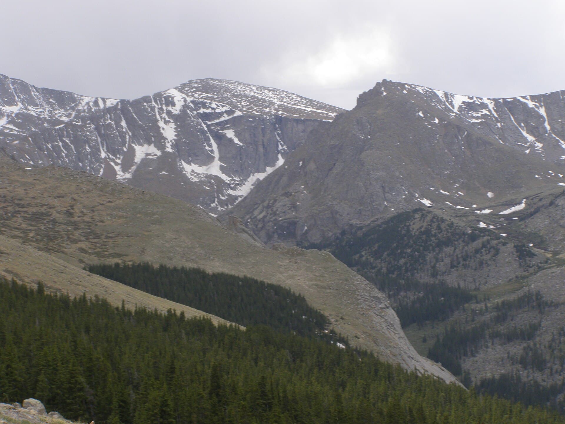
The bigger factor is that Princeton stands out ahead of the range. Most Sawatch 14ers sit shoulder to shoulder along the crest, partly sheltered by their neighbors. Princeton juts east toward the Arkansas Valley as a bold, isolated prow, so it meets wind and weather from the plains to the east and the range to the west with nothing in front of it. That prominence is what makes the summit view down to Buena Vista so dramatic, and it's the same reason the mountain gets worked over by wind that a more sheltered peak wouldn't feel.
There's a thermal twist too. The warm, sunny Arkansas Valley heats up fast on a summer afternoon, and that rising warm air feeds the convection that builds thunderstorms right over the peak that towers above it. A smooth, lens-shaped lenticular cloud parked over the summit is a classic sign that strong wind is already up there, and it's worth heeding even under otherwise blue sky. For a sense of how Princeton fits among the state's high peaks, our Colorado 14ers guide puts it in context, and the Mount Elbert weather guide covers a nearby Sawatch giant with the same afternoon rhythm an hour up the valley.
The Road Is a Weather Problem Too
On most peaks the forecast is about the summit. On Princeton it's also about the road, because the Mount Princeton Road is the thing that decides how long and exposed your day is, and weather controls the road.
In late spring and early summer, snowmelt and mud keep the upper road impassable well after the valley has dried out and warmed up. A sunny week in Buena Vista doesn't mean the road to the towers is clear; it often stays snowbound or greasy into mid or late June. In the fall, the first real storms ice the upper road and then close it for the season, which turns a 6.5-mile hike from the towers into a 13-mile day from lower down, in winter conditions.
Even in summer, an afternoon storm that catches you high means descending loose, wet talus and then driving down a narrow dirt road with steep drop-offs while rain or hail is still coming down. That's a worse combination than it sounds. Factor the road into your weather plan: check that it's melted out before an early-season attempt, and give yourself enough margin to be driving down, not just hiking down, before storms build.
Winter and Shoulder-Season Conditions
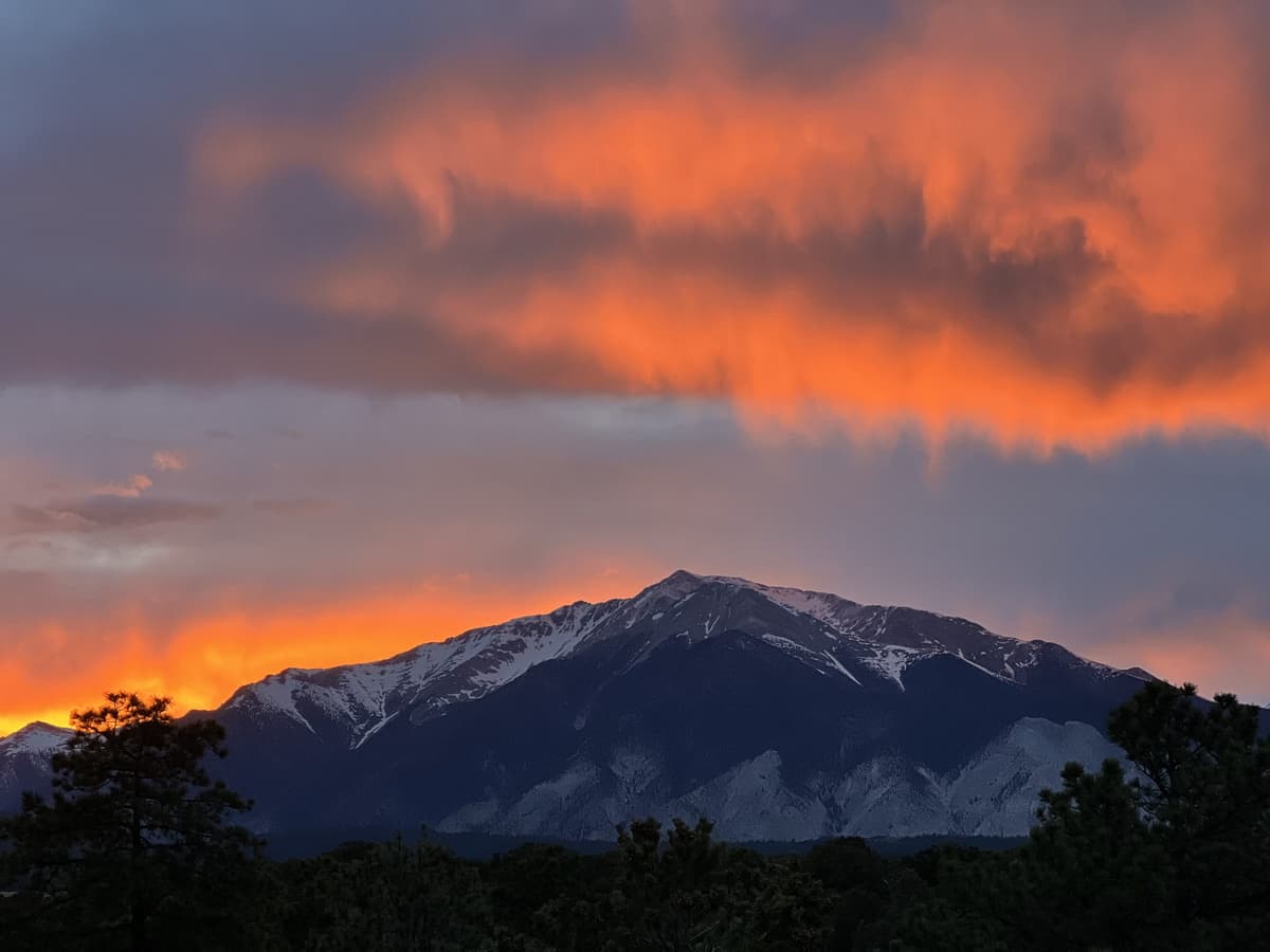
Outside the summer window, Princeton is a different objective. From roughly late October through May, the Mount Princeton Road is snowed in, so the climb starts far lower and the day gets much longer. Summit highs sit in the single digits and teens, lows fall below zero, and wind chills of -20°F or colder are normal in a storm on this exposed a peak. The steeper upper pitches hold avalanche terrain, and the standard summer line isn't automatically the safe winter line.
The shoulder seasons bite in their own way. A late-September or early-October attempt can start on bare tundra and finish on an icy, wind-scoured summit, and fresh snow can turn the braided talus trails slick and hard to follow with little warning. A warm May afternoon in the valley hides a loaded, wet upper mountain that's more dangerous, not less. The crowds thin out in these windows, which is pleasant, but the margin for error shrinks at the same time.
If you're set on a cold-season climb, treat it like the mountaineering trip it is: real traction, warm layers with backups, avalanche awareness, and a hard turnaround time. Our winter hiking guide for beginners covers the gear and the decision-making that keep cold trips from going sideways, and it's worth reading before you commit to Princeton in the snow.
What to Wear and Pack
The rule for Princeton is simple: dress for the summit, not the hot springs. You'll start cool in the dark, warm up fast on the road and the talus, and end cold and windy on exposed rock, so layers you can add and shed are the whole game. The east ridge is the windiest stretch of the day for most people, so have your shell handy before you get there.
A working summer kit looks like this:
- Insulating layer. A packable down jacket or synthetic puffy you can pull on at the summit and stuff away for the climb. See our down jacket picks.
- Wind and rain shell. A waterproof rain jacket blocks the ridge wind and any afternoon cell you get caught in on the open slopes. Our rain jacket roundup has options built for the alpine.
- Warm base and midlayer. A merino wool base layer holds heat even when you sweat on the way up. See our base layer guide.
- Hat and gloves. A warm beanie and lightweight gloves weigh almost nothing and save your hands on cold summit rock.
- Headlamp. You're leaving in the dark and walking the road to start, so a bright headlamp with fresh batteries isn't optional. See our headlamp guide.
- Sun protection. The high-altitude sun is brutal on open tundra. Bring high-SPF sunscreen and polarized sunglasses.
For an early-season climb in June or a late-season one in October, add traction. A pair of microspikes handles firm snow and ice on the talus, and our microspike guide explains where they help and where you need more. The loose east slopes also make a good argument for trekking poles in any season.
How to Check the Mount Princeton Forecast
Town forecasts lie about the summit, and on Princeton they lie harder than usual because the valley is so warm and sunny. An app pinned to Buena Vista or Nathrop shows you low-elevation conditions, which can be 20 to 30°F warmer and far calmer than 14,000 feet. Check a forecast built for the elevation instead, and pay attention to the storm timing specifically.
A few reliable sources:
- Mountain-forecast.com publishes a dedicated Mount Princeton forecast broken out by elevation band, including summit-level wind and temperature.
- The National Weather Service point forecast for the summit coordinates gives you a government read on temperature, wind, and thunderstorm probability by hour. Pin it to the peak, not the town.
- Road and trail conditions from the San Isabel National Forest (Salida Ranger District) and recent trip reports tell you whether the Mount Princeton Road is melted out and drivable, which matters most in June and again in October.
Check the forecast the night before and again the morning of. In summer, zero in on the afternoon thunderstorm timing so you can set a turnaround that gets you off the open slopes and down the road before storms fire. In the shoulder seasons, watch the wind and the chance of new snow. If the summit forecast looks ugly, central Colorado has plenty of lower, safer days out, and the Mount Princeton Hot Springs at the base are a fine consolation. For the drive and the road tiers themselves, the full route guide covers how high you can realistically get your vehicle.
Frequently Asked Questions
How cold is it on the summit of Mount Princeton?
The summit typically runs 20 to 30°F colder than Buena Vista in the valley below. In the summer climbing season, expect summit highs in the mid-40s to low 50s on a calm day and overnight lows in the high 20s to mid-30s. Wind makes it feel colder than the thermometer reads, especially on the exposed east ridge, so carry a warm layer even on a hot day in town.
What is the best time to climb Mount Princeton?
Late June through mid-September is the standard non-technical window, once the Mount Princeton Road melts out to the radio towers and the slopes clear of snow. September usually brings the most stable weather, with the monsoon faded and drier, clearer days. July and August are warmer with longer days but sit in peak thunderstorm season, so an earlier start matters more.
Does it snow on Mount Princeton in summer?
Yes. Snow can fall on Princeton in any month, including July and August. Summer snow usually comes as brief hail or graupel during an afternoon storm and rarely piles up, but it can make the loose east slopes slick and drop the temperature sharply within minutes, which is one more reason to be heading down by noon.
Why is Mount Princeton so windy?
Princeton juts east out ahead of the main Sawatch crest as an isolated prow instead of sitting sheltered among its neighbors. The whole upper route is above treeline with nothing to block the wind, so it catches air from both the valley and the range. Gusts over 40 mph on the summit and east ridge are common even on otherwise clear days.
Can you climb Mount Princeton in winter?
You can, but it's far harder than the summer walk-up. The Mount Princeton Road is snowed in, which adds long miles, and the upper pitches hold avalanche terrain. Summit temperatures drop below zero with heavy wind chill on an exposed peak. Treat a winter attempt as a real mountaineering day with traction, avalanche awareness, warm layers, and a firm turnaround time.
Final Thoughts
Mount Princeton rewards hikers who don't trust the warm valley at its foot. Climb in the late-June to mid-September window, start before dawn, watch the forecast at summit elevation rather than in town, and build your turnaround around getting off the open slopes and down the road, not just off the summit. The standalone prow that gives you that huge view over Buena Vista is the same thing that makes it cold and windy up top, so respect it.
Ready to plan the climb itself? Our full Mount Princeton route guide walks the road tiers and the East Slopes section by section, and the Mount Princeton Hot Springs guide covers the soak waiting at the bottom. For more Collegiate climbing, see Mount Yale, Mount Harvard, and Mount Antero.
Get the Colorado 14er Packing Checklist (free PDF)
Plus a weekly note on the best Colorado trails, gear deals, and seasonal hike picks. No spam, unsubscribe anytime.
We respect your inbox. Unsubscribe anytime.