Mount Sherman Weather: When to Climb and What to Expect
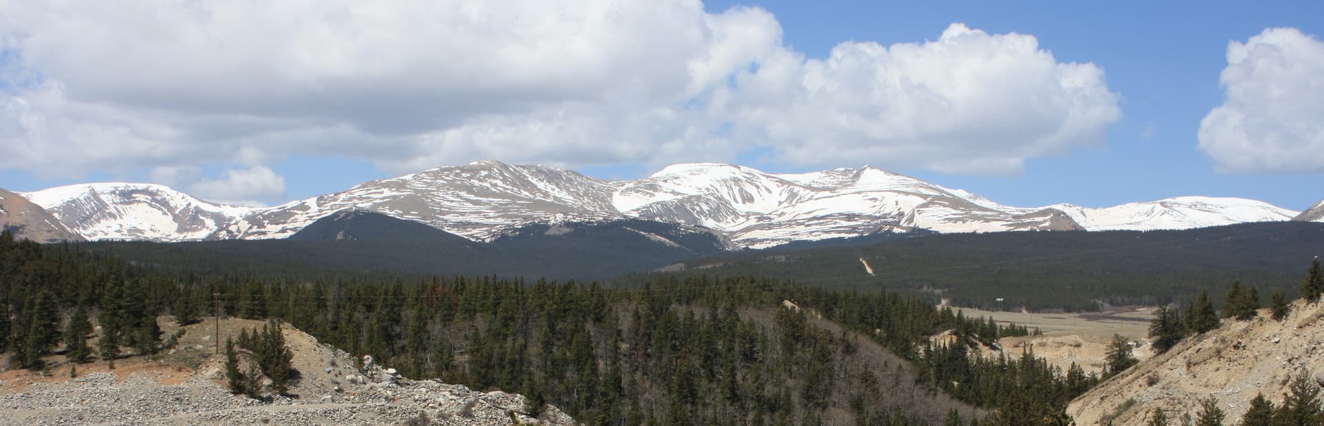
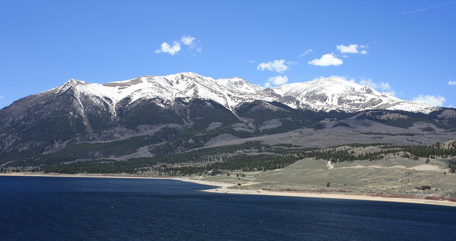
Mount Sherman weather is easy to underestimate, right up until the wind hits you at the saddle. The summit sits at 14,036 feet in the Mosquito Range between Fairplay and Leadville, and the trailhead already starts you near 12,000 feet. That high start is the peak's whole appeal, since it skips the long forest grind of bigger 14ers. It's also the catch. You're above treeline from the first step, with no shelter from wind, sun, or lightning anywhere on the route.
The good news is that Sherman's weather follows a schedule you can plan around. Mornings are usually calm and clear. The wind builds through the day and funnels hard through the saddle. In summer, thunderstorms fire in the afternoon almost on cue. Get up early, move steadily, and turn around on time, and you'll catch the mountain at its best. Linger, and you're the tallest thing on an open ridge when the sky turns.
This guide covers what to actually expect on Mount Sherman: temperatures, the month-by-month picture, why wind is the story here more than on most 14ers, how the summer storms work, and how to read a forecast built for the summit instead of the town.
What You'll Learn
- Quick Weather Facts
- How Cold Does It Get on Mount Sherman?
- Mount Sherman Weather by Month
- The Best Time to Climb Mount Sherman
- Wind: The Weather That Turns People Around
- Summer Storms and the Noon Rule
- Winter and Shoulder-Season Conditions
- Getting to the Trailhead in Different Seasons
- How to Check the Mount Sherman Forecast
- Frequently Asked Questions
Quick Weather Facts
- Summit elevation: 14,036 ft
- Trailhead elevation: near 12,000 ft (Fourmile Creek or Iowa Gulch)
- Summit vs. Fairplay: typically 25 to 35°F colder on a summer afternoon
- Summer summit highs: mid-40s to mid-50s°F (July-August)
- Summer summit lows: upper 20s to mid-30s
- Winter summit highs: single digits to low 20s, with lows well below zero
- Wind: commonly 20-40 mph up high, and the saddle funnels it stronger
- Snow: possible any month; the southwest slopes and the ridge hold it into mid-June
- Standard non-technical window: mid-June through late September
- Afternoon storm season: July and August (the monsoon)
- Most stable stretch: September, before winter returns
How Cold Does It Get on Mount Sherman?
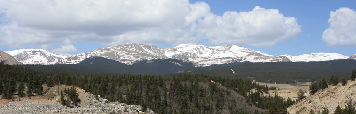
The number to plan around: the summit runs roughly 25 to 35°F colder than Fairplay and Alma on a summer afternoon, and the gap widens the more the valley heats up during the day. Fairplay itself sits near 9,950 feet, so it's no warm baseline to begin with. When town shows 70°F in July, the top of Sherman is often sitting in the upper 40s to low 50s at best, and that's before you factor in the wind.
In the standard climbing season, summit highs land in the mid-40s to mid-50s on a good day, with overnight lows in the upper 20s and 30s. You'll usually leave the trailhead in the 40s at first light, warm up on the climb toward the saddle, then feel the cold come straight back once you stop moving on the summit.
Wind is the part hikers underestimate most on Sherman. Because you're above treeline the whole way, there's nothing to slow it down, and the saddle between Mount Sheridan and Mount Sherman acts like a nozzle. A 48°F reading with a 30 mph wind feels closer to the low 30s on bare skin, and gusts past 40 mph are common on the ridge even on an otherwise pleasant day. Pack as if the top will be cold and windy no matter how warm the car was, because it usually is.
Mount Sherman Weather by Month
Here's the rough shape of the year up high. Treat these as typical patterns, not guarantees, because high-altitude weather swings hard from one day to the next.
January-February. Deep winter. Summit highs in the single digits and teens, lows below zero, and steady wind that can top 60 mph in a storm. The Fourmile Creek and Iowa Gulch roads aren't plowed to the trailhead, so the climb starts miles lower on snow.
March-April. Still full winter up high. Snow is deep on the southwest slopes and the summit ridge, days are short, and the approach roads stay snowed in. March is often one of the snowier months in the central mountains.
May. The base begins to thaw, but the upper mountain stays buried and the roads usually aren't drivable to the trailhead yet. Melting snow turns the lower road into a rutted, muddy mess.
June. The transition month. Once the roads dry out and open, usually by mid-June, the standard season begins. Early June still holds snow on the ridge, and a cornice can linger on the east side, so plan for microspikes and watch your footing. By late June the route is often a straightforward walk-up.
July. Prime time for daylight and warmth, and the start of the monsoon. Afternoon thunderstorms build almost daily, so mornings are your only reliable window. This is one of the busiest stretches on the mountain.
August. Warm, crowded, and the wettest month. Storms fire most afternoons, and a passing cell can drop hail or graupel in the middle of summer. Early starts aren't optional.
September. The sweet spot for weather. The monsoon usually breaks, the air dries out, and conditions settle. Mornings are colder and the light fades sooner, and a late-month storm can leave fresh snow on the route with little warning.
October. Winter returns fast. Early snow ices the ridge and the summit boulders, the roads get sketchy, and the standard season winds down.
November-December. Full winter, with cold, wind, short days, and a long snow approach once the roads are snowed in.
The Best Time to Climb Mount Sherman
If you want the standard route without technical snow gear, the window is roughly mid-June through late September. That's once the approach roads open and the southwest slopes have melted out enough to move on rock instead of snow. Sherman clears earlier than the harder, higher peaks because it's a short Class 2 walk-up with a high start.
Within that window, September usually gives you the most stable weather. The August monsoon has faded, afternoon storms taper off, and high pressure brings drier, clearer days. The trade-offs are colder starts and less daylight. July and August are warmer with the longest days, but you're climbing in peak thunderstorm season, so the early start matters even more.
Because Sherman is a go-to first 14er, it gets slammed on summer weekends. The small upper lots fill by 6 AM on a July or August Saturday, and an early arrival for parking lines up perfectly with the early start the weather demands. If you're weighing whether Sherman is the right pick for a first summit, our guide to the easiest 14ers in Colorado puts it next to the other beginner-friendly options, and the full Mount Sherman route guide walks the climb section by section.
Wind: The Weather That Turns People Around
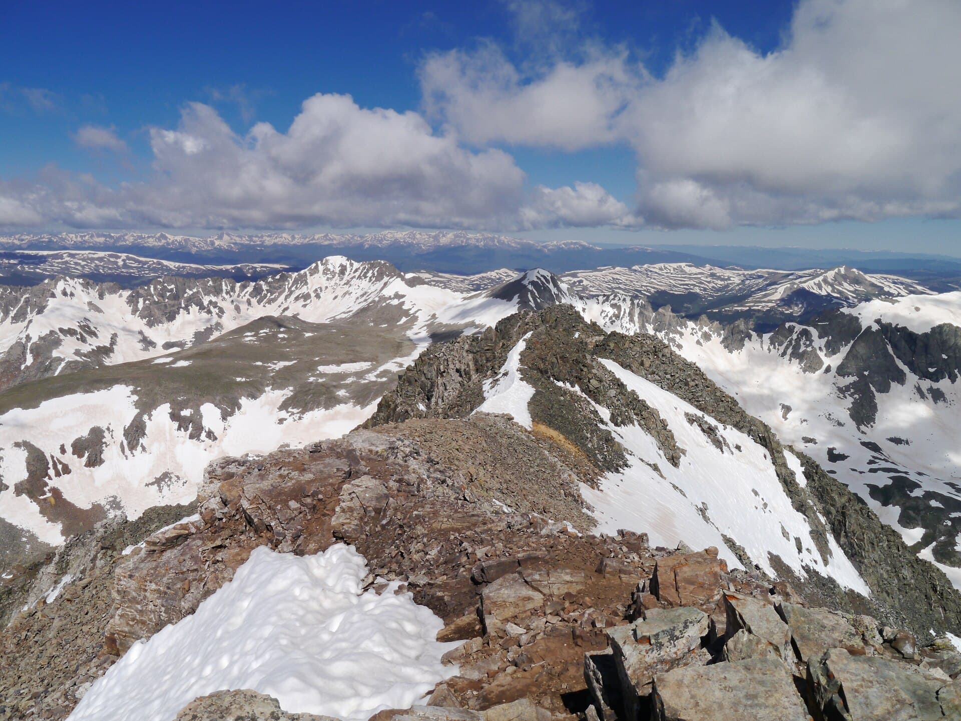
On many 14ers, thunderstorms are the deciding factor. On Sherman, it's often the wind. The reason is geometry. The standard route climbs to the saddle between Mount Sheridan and Mount Sherman, then follows the ridge north to the top, and both of those features channel and accelerate whatever the range is throwing at you. Hikers regularly describe a calm parking lot giving way to a 40 mph blast the moment they top out on the saddle.
Wind up here does two things. It strips heat off you fast, so a temperature that sounds fine on paper feels far colder on exposed skin. And it makes the loose, rocky summit ridge harder to move on, since a strong gust can push you off balance right where the footing is worst. Neither is dramatic on its own, but together they wear people down and send plenty of hikers back before the summit even though the sky looks clear.
Plan for it directly. Carry a real wind shell and gloves even when the forecast reads warm, keep a warm layer within reach for the ridge, and watch the summit wind number when you check the forecast, not just the storm chance. If steady winds over 30 to 35 mph are forecast up top, expect a miserable and slower day, and be honest with yourself about turning around at the saddle if it's worse than you can manage.
Summer Storms and the Noon Rule
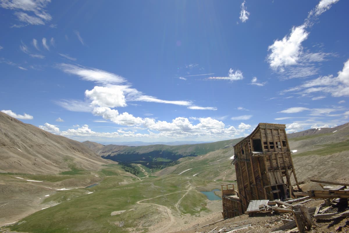
Summer on Sherman comes with the rule that governs the whole Colorado high country: be off the summit and headed down by noon, and earlier is better. Afternoon thunderstorms build almost daily in July and August. They form fast, throw lightning and hail, and drop the temperature hard, and above treeline there's nowhere to shelter.
The daily pattern is predictable enough to work backward from. Mornings start clear and calm. By late morning, clouds stack up over the range. By early afternoon, storms are going. Since the round trip runs about 3.5 to 6 hours for most hikers, a pre-dawn start is what keeps you off the ridge before the sky turns. A workable timeline in monsoon season looks like a 5 to 6 AM trailhead departure, the summit by 8 or 9 AM, and back below the saddle by 10 or 11.
What raises the stakes on Sherman is the exposure. On peaks that climb through forest, you get an hour or two of tree cover before you're out in the open. Here the trailhead already sits above treeline, so you're exposed to lightning almost from the car. If you hear thunder or watch clouds building while you're still climbing, the summit isn't worth it. Turn around. Altitude clouds your judgment right when you need it most, so if the elevation is hitting you, read up on altitude sickness in Colorado before you go.
Winter and Shoulder-Season Conditions
Outside the summer window, Mount Sherman is a different objective. From roughly late October through May, neither approach road is plowed to the trailhead, so the climb starts miles lower and turns into a long snow trek. Summit highs sit in the single digits and teens, lows fall below zero, and wind chills of -20°F or colder are normal in a storm.
Snow is the bigger complication. The southwest slopes and parts of the ridge sit on terrain that can slide, so a winter or early-spring Sherman is an avalanche-aware outing, not a casual snow walk. Add short daylight and a road walk that adds miles at both ends of the day, and it becomes a serious trip even though the summer version is a beginner's peak.
If you're set on a shoulder-season attempt in June or October, the middle ground is traction and timing. A pair of microspikes handles firm snow on the ridge, and our microspike guide covers where they help and where you need more. For a true winter climb, treat it like the mountaineering day it is, and read our winter hiking guide for beginners before you commit.
Getting to the Trailhead in Different Seasons
Sherman's weather starts before the trail, on the road in. There are two standard approaches, and both are weather-sensitive.
The Fourmile Creek trailhead on the Fairplay side is the popular one. Fourmile Creek Road (Park County Road 18) climbs about 12 miles toward the old Leavick townsite and gets rockier as it gains elevation. A two-wheel-drive car can usually reach a lower parking area, but the final rough stretch to the upper lot near 12,000 feet wants high clearance and ideally four-wheel drive. Park at the lower lot and you add roughly a mile each way plus a few hundred feet of gain. After a wet spell or an early-season melt, the ruts and mud can stop a low car well short of where it would in August.
The Iowa Gulch trailhead on the Leadville side is shorter still, but the access road is rougher and gated lower in many years. In winter, both roads are snowed in below the trailheads, which is what turns the climb into a long approach on skis or snowshoes. Check the road status before a shoulder-season trip, because whether you can drive to the trailhead often matters more than the summit forecast that day.
How to Check the Mount Sherman Forecast
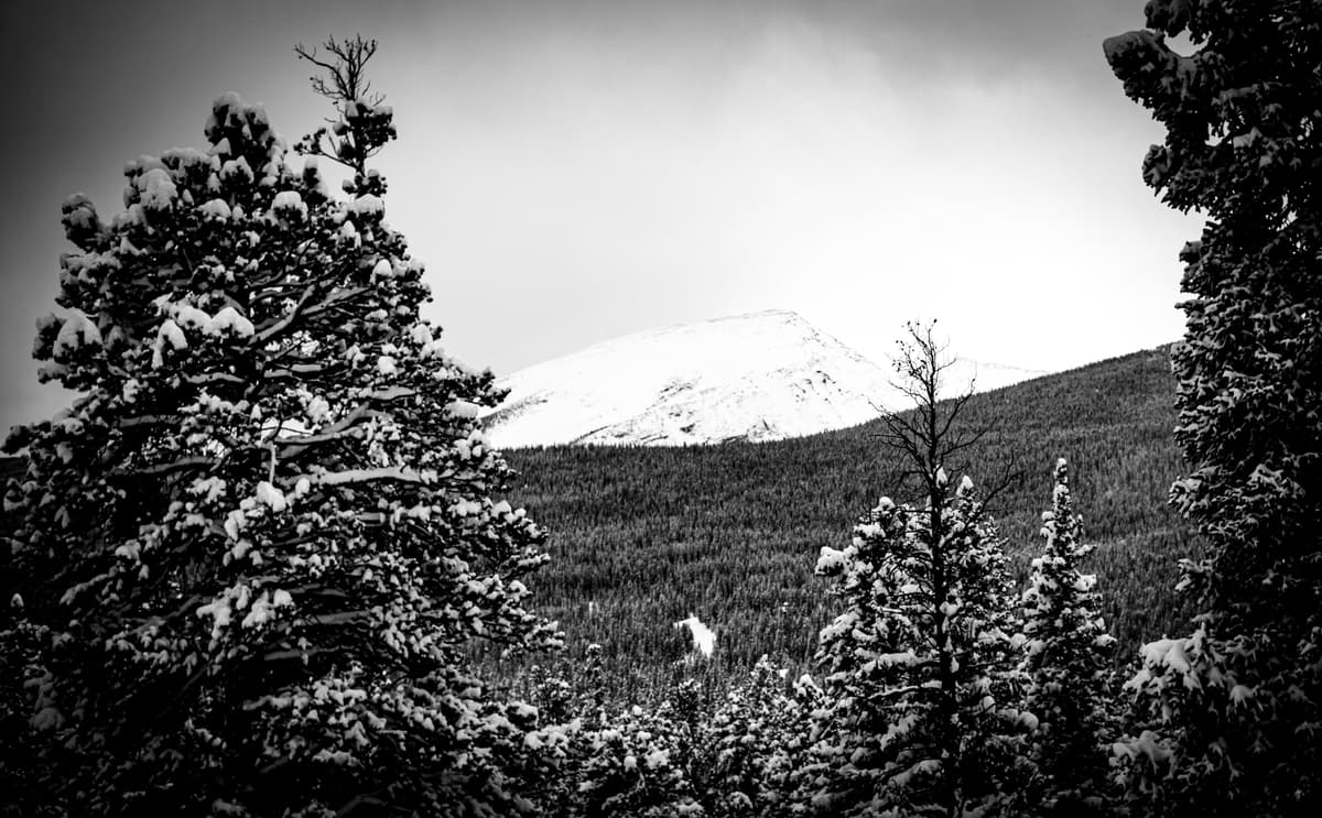
Town forecasts lie about the summit. An app pinned to Fairplay or Leadville shows you low-elevation conditions, which can be 25 to 35°F warmer and far calmer than 14,000 feet. Check a forecast built for the elevation instead, and pay attention to wind and storm timing specifically.
A few reliable sources:
- Mountain-forecast.com lists a dedicated Mount Sherman forecast broken out by elevation band, including summit-level wind and temperature.
- The National Weather Service point forecast (forecast.weather.gov) for the summit coordinates gives you a government read on temperature, wind, and thunderstorm probability by hour.
- The road status from Park County and the Pike-San Isabel National Forest tells you whether you can drive to the trailhead, which matters most in the shoulder seasons.
Check the forecast the night before and again the morning of. In summer, zero in on the afternoon thunderstorm timing and set a turnaround that gets you off the ridge before storms fire. In every season, look hard at the summit wind number, since that's what most often decides the day on this peak. If the summit forecast looks ugly, there are plenty of lower, safer options nearby, and our Colorado 14ers guide can help you pick a peak that fits the conditions.
Frequently Asked Questions
What is the best time of day to climb Mount Sherman?
Start before dawn, usually between 5 and 6 AM in summer. The goal is to reach the summit by mid-morning and be headed down by noon, because afternoon thunderstorms build almost daily in July and August. Since the route is above treeline the whole way, an early start is the single most useful safety decision on the mountain.
How windy is Mount Sherman?
Very. Winds of 20 to 40 mph are common on the upper mountain, and the saddle between Mount Sheridan and Mount Sherman funnels them stronger, with gusts past 40 mph even on clear days. Wind, more than storms, is what turns most hikers around here, so carry a wind shell and gloves regardless of the temperature.
How cold is it on the summit of Mount Sherman?
The summit typically runs 25 to 35°F colder than Fairplay on a summer afternoon. In the climbing season, expect summit highs in the mid-40s to mid-50s and overnight lows in the upper 20s to mid-30s. Wind makes it feel colder than the thermometer reads, so pack a warm layer even on a hot day at the trailhead.
Does it snow on Mount Sherman in summer?
Yes. Snow can fall on Mount Sherman in any month, including July and August. Summer snow usually arrives as brief hail or graupel during an afternoon storm and rarely piles up, but it can make the summit boulders slick and drop the temperature sharply within minutes.
When is Mount Sherman free of snow?
The standard route is usually melted out enough for a non-technical climb from mid-June through late September, though the southwest slopes and the ridge can hold snow into mid-June. A cornice sometimes lingers on the east side of the summit ridge in early season, so stay on the rock and off the snow lip.
Final Thoughts
Mount Sherman rewards hikers who respect the wind and the clock. Climb in the mid-June to late-September window, start before dawn, check the summit wind and storm timing rather than the town forecast, and set a hard turnaround that gets you off the exposed ridge before the afternoon builds. Do that and Sherman lives up to its billing as one of the friendliest 14ers in Colorado.
Ready to plan the climb itself? Our Mount Sherman route guide walks the Fourmile Creek route section by section, and the Mount Bierstadt weather guide covers a nearby beginner peak with the same afternoon-storm rhythm.
Get the Colorado 14er Packing Checklist (free PDF)
Plus a weekly note on the best Colorado trails, gear deals, and seasonal hike picks. No spam, unsubscribe anytime.
We respect your inbox. Unsubscribe anytime.