Grays Peak Weather: When to Climb Grays and Torreys
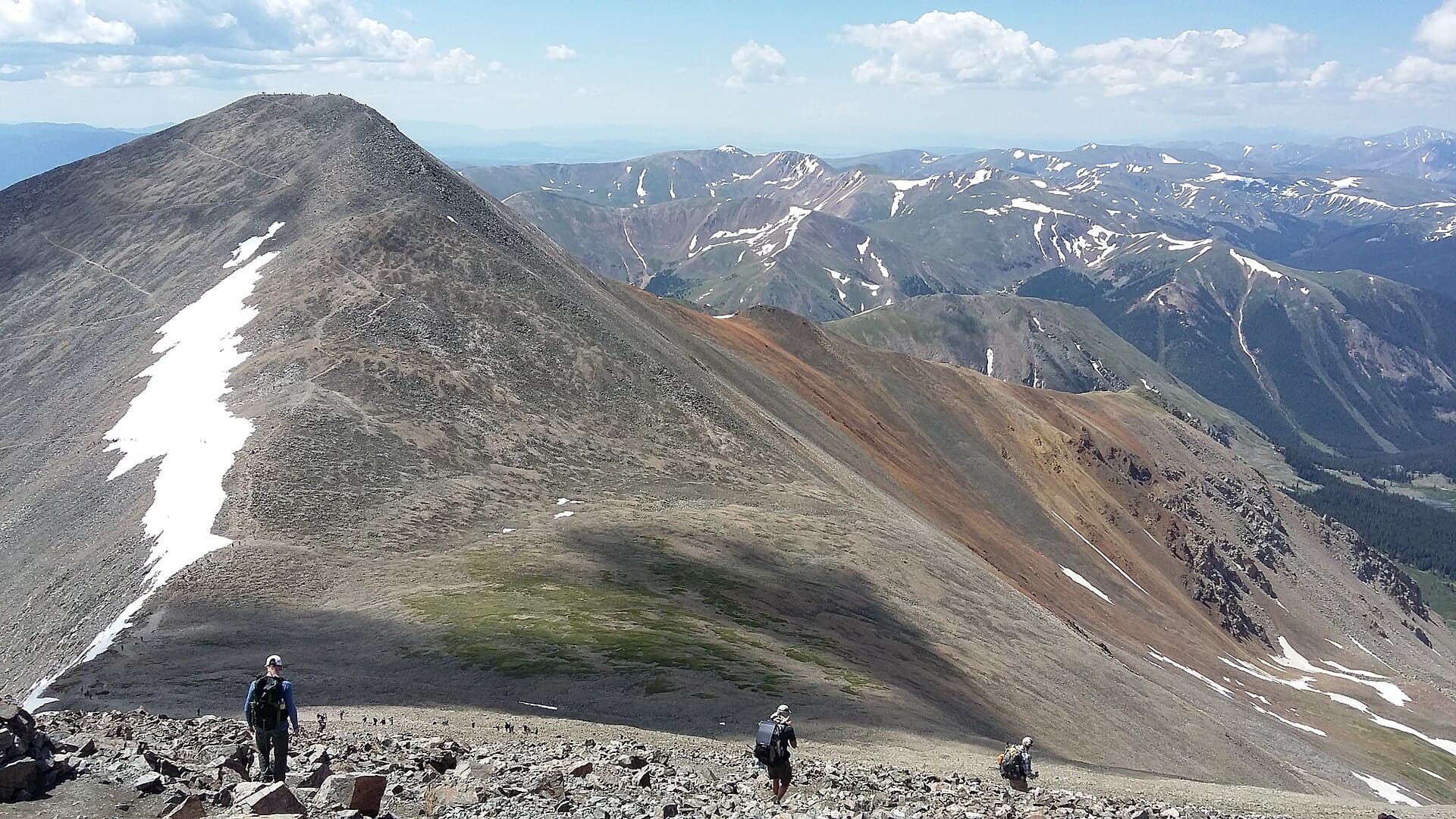
Grays Peak weather is the piece most people planning the state's favorite double 14er think about last, and it's the piece most likely to turn them around. The summit sits at 14,275 feet, the highest point on the Continental Divide in North America, and the Stevens Gulch trailhead already starts you at 11,280 feet. That's the catch. You're at or above treeline almost from the first step, and in summer the afternoon storms arrive on a schedule you can set your watch by.
Grays and its neighbor Torreys, at 14,267 feet, sit a little over half a mile apart on the Divide, and most fit hikers do both in one day from the same trailhead. That makes the weather a two-part question: not just whether you can reach Grays, but whether the sky lets you add Torreys. The good news is that the pattern here is predictable enough to plan around. Mornings are usually calm and clear. Storms build in the afternoon. Start early, move steadily, and keep an eye on the saddle between the peaks, and you'll have the Divide at its best.
This guide covers what to actually expect on Grays Peak: temperatures, the month-by-month picture, the best window to climb, how the summer storms work on the Divide, and how to read a forecast built for 14,000 feet instead of the valley below.
What You'll Learn
- Quick Weather Facts
- How Cold Does It Get on Grays Peak?
- Grays Peak Weather by Month
- The Best Time to Climb Grays and Torreys
- Summer Storms, the Noon Rule, and the Saddle Decision
- Winter and Shoulder-Season Conditions
- Why the Continental Divide Makes the Weather Its Own Thing
- What to Wear and Pack
- How to Check the Grays Peak Forecast
- Frequently Asked Questions
Quick Weather Facts
- Grays summit elevation: 14,275 ft
- Torreys summit elevation: 14,267 ft
- Saddle between the peaks: about 13,700 ft
- Trailhead elevation: 11,280 ft (Stevens Gulch)
- Summit vs. Denver: typically 30 to 35°F colder
- Summer summit highs: low to mid-40s°F on a good day (July-August)
- Summer summit lows: 20s to low 30s
- Winter summit highs: single digits to teens, with lows well below zero
- Wind: commonly 20-40 mph up high, stronger in the saddle and in storms
- Snow: possible any month; the upper slopes hold it into June and again by October
- Standard non-technical window: mid-June through late September
- Afternoon storm season: July and August (the monsoon)
- Most stable stretch: September, before winter moves back in
How Cold Does It Get on Grays Peak?
The number to plan around: the summit runs roughly 30 to 35°F colder than Denver. So when the city is showing 90°F on a July afternoon, the top of Grays is sitting in the low 50s at best, and often cooler once the wind picks up. Torreys, eight feet lower and a few hundred yards away across the saddle, feels the same.
In the standard climbing season, summit highs land in the low to mid-40s on a good day, and overnight lows drop into the 20s and low 30s. You'll usually leave Stevens Gulch in the 40s at first light, warm up fast on the switchbacks up the east slopes of Grays, then feel all of it come back the moment you stop moving on the summit. The valley at the trailhead can be pleasant while the top is raw.
Wind is the part hikers underestimate here, and the saddle is the worst of it. Because the whole route runs above treeline, there's nothing to slow the air down, and the gap between Grays and Torreys funnels and accelerates whatever is moving across the Divide. A 45°F reading with a 25 mph wind feels closer to the low 30s on bare skin, and gusts over 40 mph are common on the summits and in the saddle even on an otherwise clear day. Pack as if the top will be cold and windy no matter how warm it is at the car, because it usually is.
Grays Peak Weather by Month
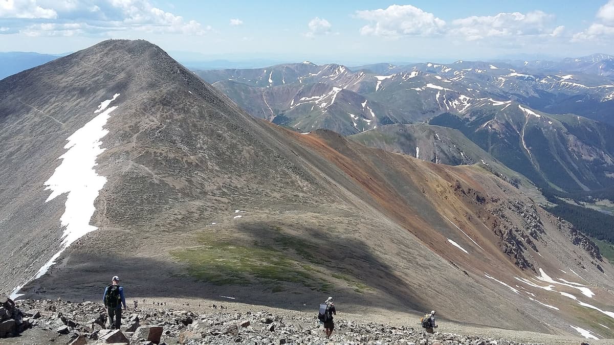
Here's the rough shape of the year up high. Treat these as typical patterns, not promises, because weather at 14,000 feet swings hard from one day to the next.
January-February. Deep winter. Summit highs in the single digits and teens, lows below zero, and steady wind that can top 60 mph in storms. Stevens Gulch Road is snowed in, which turns the climb into a long, cold approach on foot for experienced parties only.
March-April. Still full winter up high. Snow is deep in the basin and on the upper slopes, days are short, and the road stays buried. Spring in Denver means nothing at this elevation.
May. The base starts to thaw, but the upper mountain stays loaded and the road usually isn't passable to the top. Avalanche terrain on the north and east faces is a real concern well into the month.
June. The transition month. Once Stevens Gulch Road melts out enough to drive, usually by mid-June, the standard season begins. Early June still holds snow on the upper slopes and in the gully between the peaks, but by late June the route is often a straightforward walk on rock and tundra.
July. Prime time for daylight and warmth, and the start of the monsoon. Afternoon thunderstorms build almost daily, so mornings are your only reliable window. This is the busiest stretch of the year, and the small upper lot fills before dawn.
August. Warm, crowded, and the wettest month. Storms fire most afternoons, and a passing cell can drop hail or graupel in the middle of summer. Early starts aren't optional.
September. The sweet spot for weather. The monsoon usually breaks, the air dries out, and conditions stabilize. Mornings are colder and the light fades sooner, and a late-month storm can leave fresh snow on the route with little warning.
October. Winter returns fast. Early snow ices the switchbacks and the saddle, the road gets dicey, and the standard season effectively ends.
November-December. Full winter, with cold, heavy wind, short days, and a long snow approach once the road closes.
The Best Time to Climb Grays and Torreys
If you want the standard route without technical snow gear, the window is roughly mid-June through late September. That's once Stevens Gulch Road is drivable and the slopes have melted out enough to move on rock and tundra instead of snow. Both peaks are a Class 1 to Class 2 walk-up in that window, which is a big part of why they're the go-to first 14ers for so many people.
Within that window, September gives you the most stable weather. The August monsoon has usually faded, the afternoon storms taper off, and high pressure brings drier, clearer days. The trade-offs are colder starts and less daylight, which matters more when you're trying to fit two summits into the morning. July and August are warmer with the longest days, but you're climbing in peak thunderstorm season, so the early start matters even more.
Because Grays and Torreys are the most popular double 14er in the Front Range, and the trailhead is about an hour from Denver off I-70, the peaks get slammed on summer weekends. The small upper lot fills before dawn, and an early arrival for parking lines up exactly with the early start the weather demands. If you're weighing whether this is the right pair for your first summit, our guide to the easiest 14ers for beginners puts Grays next to the other walk-ups, and the full Grays and Torreys route guide walks the climb and the traverse section by section.
Summer Storms, the Noon Rule, and the Saddle Decision
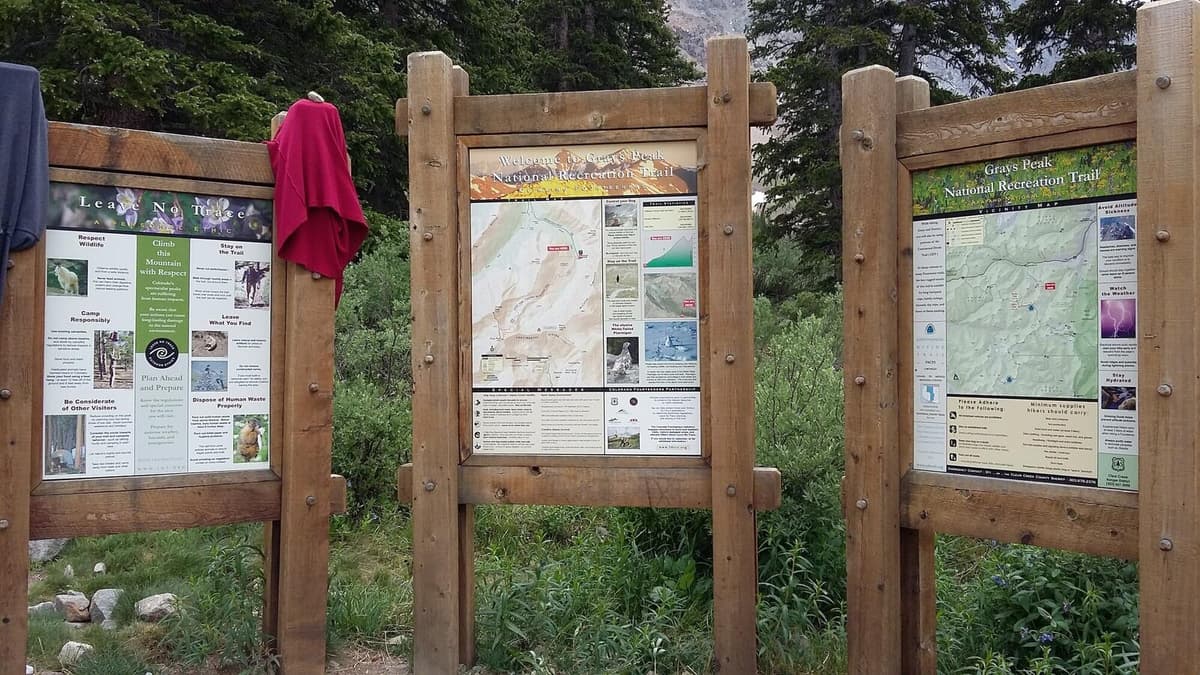
Summer on Grays comes with the same rule that governs the whole Colorado high country: be off the summit and headed down by noon, and earlier is better. Afternoon thunderstorms build almost daily in July and August. They form fast, throw lightning and hail, and drop the temperature hard, and above treeline there's nowhere to hide.
The daily pattern is predictable enough to plan around. Mornings start clear and calm. By late morning, clouds stack up over the Divide. By early afternoon, storms are going. Since the double runs about 6 to 9 hours for most hikers, working backward from a noon deadline is exactly why the standard advice is a pre-dawn start. Plenty of people aim to top out on Grays by 8 or 9 AM so they still have time and clear sky for Torreys.
That's where Grays and Torreys get their own wrinkle: the saddle between the peaks is your decision point. After you summit Grays, you drop a few hundred feet to the saddle at about 13,700 feet, then climb back up to Torreys. If clouds are building, the wind is rising, or you hear thunder while you're standing in that saddle, Torreys isn't worth it. Skip the second summit, turn down, and get below treeline. The mountain will be there next year. The hardest version of this call is when Grays goes smoothly and you're tempted to grab Torreys even as the sky turns, because the altitude dulls exactly the judgment you need. If you're feeling the elevation at all, read up on altitude sickness before you go, since a pounding headache at 14,000 feet makes a bad weather decision more likely.
Winter and Shoulder-Season Conditions
Outside the summer window, Grays and Torreys are a different objective. From roughly late October through May, Stevens Gulch Road is snowed in, so the climb starts lower and the day gets much longer. Summit highs sit in the single digits and teens, lows fall below zero, and wind chills of -20°F or colder are normal in a storm. The north and east faces hold avalanche terrain, and the standard summer line is not automatically the safe winter line.
Even the shoulder seasons bite. A late-September or early-October attempt can start on bare tundra and finish on an icy, wind-scoured summit, and fresh snow can turn the switchbacks and the saddle slick with little warning. The crowds thin out, which is pleasant, but the margin for error shrinks at the same time.
If you're set on a cold-season attempt, treat it like the mountaineering trip it is: real traction, warm layers with backups, avalanche awareness, and a hard turnaround time. Our winter hiking guide for beginners covers the gear and the decision-making that keep cold trips from going sideways, and it's worth reading before you commit to the Divide in the snow.
Why the Continental Divide Makes the Weather Its Own Thing
The reason Grays feels so much colder and windier than the trailhead comes down to elevation, exposure, and where it sits. Air cools as you climb, roughly 3 to 5°F for every 1,000 feet. The summit is about 3,000 feet above the trailhead and nearly 9,000 feet above Denver, which alone explains most of the temperature gap you feel when you stop moving up top.
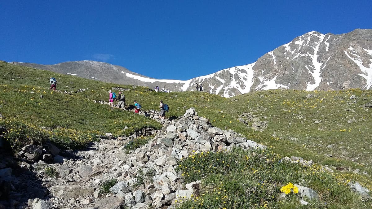
The bigger factor is that there's no shelter. The trailhead already sits near treeline, so you're exposed to wind and lightning almost from the start, with no forest to duck into on the way up. Whatever the range is throwing at you hits you directly. That's why a calm morning in the basin can turn into a stiff, cold wind on the ridge, and why the summit rocks feel arctic even when the valley is warm.
Sitting on the Continental Divide adds a twist the Front Range foothills peaks don't have. Weather here can come from either side. Storms often build on the western slope, out of sight from the trail, and spill over the Divide onto the summits with less warning than you'd get from a system rolling in from the plains. The smooth, lens-shaped lenticular cloud parked over Grays or Torreys is a classic sign that strong wind is already up there, and it's worth heeding even under otherwise blue sky. For a sense of how these two fit among the state's high peaks, our Colorado 14ers guide puts them in context, and the sibling Mount Bierstadt weather guide covers a nearby peak with the same afternoon-storm rhythm.
What to Wear and Pack
The rule for Grays is simple: dress for the summit, not the trailhead. You'll start cool in the dark, warm up fast on the switchbacks, and end cold and windy on exposed rock, so layers you can add and shed are the whole game. The saddle crossing to Torreys is the windiest stretch of the day for most people, so have your shell handy before you get there.
A working summer kit looks like this:
- Insulating layer. A packable down jacket or synthetic puffy you can pull on at the summit and stuff away for the climb. See our down jacket picks.
- Wind and rain shell. A waterproof rain jacket blocks the ridge and saddle wind and any afternoon cell you get caught in. Our rain jacket roundup has options built for the alpine.
- Warm base and midlayer. A merino wool base layer holds heat even when you sweat on the way up.
- Hat and gloves. A warm beanie and lightweight gloves weigh almost nothing and save your hands on cold summit rock.
- Headlamp. You're leaving in the dark, so a bright headlamp with fresh batteries isn't optional.
- Sun protection. The high-altitude sun is brutal on open tundra. Bring high-SPF sunscreen and polarized sunglasses.
For an early-season climb in June or a late-season one in October, add traction. A pair of microspikes handles firm snow on the switchbacks and in the gully between the peaks, and our microspike guide explains where they help and where you need more.
How to Check the Grays Peak Forecast
Town forecasts lie about the summit. An app pinned to Georgetown or Denver shows you low-elevation conditions, which can be 30 to 35°F warmer and far calmer than 14,000 feet. Check a forecast built for the elevation instead, and pay attention to the storm timing specifically.
A few reliable sources:
- Mountain-forecast.com publishes dedicated Grays Peak and Torreys Peak forecasts broken out by elevation band, including summit-level wind and temperature.
- The National Weather Service point forecast for the summit coordinates gives you a government read on temperature, wind, and thunderstorm probability by hour.
- The road and trail conditions from the Clear Creek Ranger District and recent trip reports tell you whether Stevens Gulch Road is drivable and how much snow is left on the route, which matters most in June and again in October.
Check the forecast the night before and again the morning of. In summer, zero in on the afternoon thunderstorm timing so you can set a turnaround that gets you, and your plan for Torreys, off the ridge before storms fire. In the shoulder seasons, watch the wind and the chance of new snow. If the summit forecast looks ugly, there are plenty of lower, safer days out nearby, and our best day hikes near Denver can point you somewhere the weather isn't the whole story. For the drive itself, the Grays Peak trailhead guide covers Stevens Gulch Road and whether your vehicle can make the upper lot.
Frequently Asked Questions
How cold is it on the summit of Grays Peak?
The summit typically runs 30 to 35°F colder than Denver. In the summer climbing season, expect summit highs in the low to mid-40s and overnight lows in the 20s to low 30s. Wind makes it feel colder than the thermometer reads, especially in the saddle over to Torreys, so carry a warm layer even on a hot day at the trailhead.
What is the best time of day to climb Grays and Torreys?
Start before dawn, usually between 4 and 6 AM in summer. The goal is to top out on Grays by mid-morning so you can decide on Torreys and still be headed down by noon, because afternoon thunderstorms build almost daily in July and August. Since the route is above treeline the whole way, an early start is the single most useful safety decision on the mountain.
Does it snow on Grays Peak in summer?
Yes. Snow can fall on Grays and Torreys in any month, including July and August. Summer snow usually comes as brief hail or graupel during an afternoon storm and rarely piles up, but it can make the summit boulders and the saddle slick and drop the temperature sharply within minutes.
Is the weather different on Torreys Peak than on Grays?
Not meaningfully. The two summits are about half a mile apart and only eight feet different in height, so they share the same temperatures, wind, and storms. The saddle between them is often the windiest spot of the day, and it's the natural place to decide whether to continue to the second peak if the sky is turning.
Can you climb Grays Peak in winter?
You can, but it's far harder than the summer walk-up. Stevens Gulch Road is snowed in, which adds miles, and the upper slopes hold avalanche terrain. Summit temperatures drop below zero with heavy wind chill. Treat a winter attempt as a real mountaineering day with traction, avalanche awareness, warm layers, and a firm turnaround time.
Final Thoughts
Grays and Torreys reward hikers who respect the clock and the sky. Climb in the mid-June to late-September window, start before dawn, watch the forecast at summit elevation, and treat the saddle between the peaks as your weather checkpoint for the second summit. Do that and the highest point on the Continental Divide gives you two 14ers in a morning, at their best.
Ready to plan the climb itself? Our Grays and Torreys route guide walks the Stevens Gulch trail, the traverse, and the double summit section by section.
Get the Colorado 14er Packing Checklist (free PDF)
Plus a weekly note on the best Colorado trails, gear deals, and seasonal hike picks. No spam, unsubscribe anytime.
We respect your inbox. Unsubscribe anytime.