La Plata Peak: A Complete Guide to Colorado's Fifth-Highest 14er
La Plata Peak stands at 14,336 feet, the fifth-highest summit in Colorado and one of the tall peaks of the Sawatch Range. It sits south of Twin Lakes along Highway 82, the road that climbs toward Independence Pass, close enough to Mount Elbert and Mount Massive that you can see both from the summit. Yet La Plata sees far fewer boots than its famous neighbors. On a July Saturday when the Elbert lot overflows before dawn, the La Plata Peak Trailhead often has open spaces at 6 AM.
The standard route is the Northwest Ridge: 9.25 miles round trip with 4,500 feet of elevation gain, rated Class 2. It's a step up from the beginner peaks. The climb onto the ridge is steep and relentless, and the upper mountain is a long stretch of talus that punishes anyone who showed up under-trained. This is not a first 14er. It's the peak you do after Bierstadt, Elbert, and a couple of other Class 1 or easy Class 2 summits.
La Plata also carries a second, much harder route: the Ellingwood Ridge, a two-mile Class 3 scramble that ranks among the classic ridge lines in Colorado. This guide focuses on the standard Northwest Ridge, covers the Ellingwood option briefly so you know what you're looking at from the summit, and lays out the trailhead logistics, gear, and timing that make the difference between a good day and a slog.
What You'll Learn
- Quick Stats
- Getting to the Trailhead
- The Northwest Ridge Route
- The Ellingwood Ridge Alternative
- What to Pack
- Timing and Weather
- When to Climb
- How La Plata Compares to Its Neighbors
- Common Mistakes
- Frequently Asked Questions
- Other 14ers to Consider
Quick Stats
Northwest Ridge (standard route):
- Elevation: 14,336 ft (5th highest in Colorado)
- Range: Sawatch
- Trailhead: La Plata Peak Trailhead, Highway 82, about 10,160 ft
- Round Trip Distance: 9.25 miles
- Elevation Gain: 4,500 ft
- Class: 2 (long talus, a few Class 2 rock steps near the summit)
- Time: 7-10 hours typical
- Difficulty: Strenuous (steep climb to the ridge, sustained talus up high)
Ellingwood Ridge (advanced route):
- Class: 3, roughly 5,900 ft of gain
- A two-mile ridge scramble with real exposure and route-finding
- Time: 12-14 hours; for experienced scramblers only
Best Season: Late June through September
Permit: None required
Nearest towns: Twin Lakes (tiny), Leadville and Buena Vista for lodging
Crowds: Light to moderate, well below Elbert and Massive traffic
Getting to the Trailhead
The La Plata Peak Trailhead is one of the easier Sawatch trailheads to reach. The parking lot is paved and sits right off Highway 82, so any passenger car makes it without trouble. No 4WD, no rough forest road, no clearance worries.
- Drive to Twin Lakes (about 2.5 hours from Denver via I-70, Highway 91 through Leadville, then Highway 24 and Highway 82)
- From Twin Lakes, continue west and south on Highway 82 toward Independence Pass for roughly 9 to 14 miles
- Watch for the signed La Plata Peak / La Plata Gulch trailhead and parking lot on the south side of the road
- The lot is paved with room for around 20 to 30 vehicles
Total drive from Denver runs about 2.5 to 3 hours depending on route and traffic through the mountains. Most hikers stay in Leadville (10,150 ft) or Buena Vista the night before. Leadville has the altitude advantage for acclimatization; a night at 10,000-plus feet does real work on your body before a 14,000-foot climb. Dispersed camping is available along parts of Highway 82 and nearby forest roads if you'd rather sleep at the trailhead elevation.
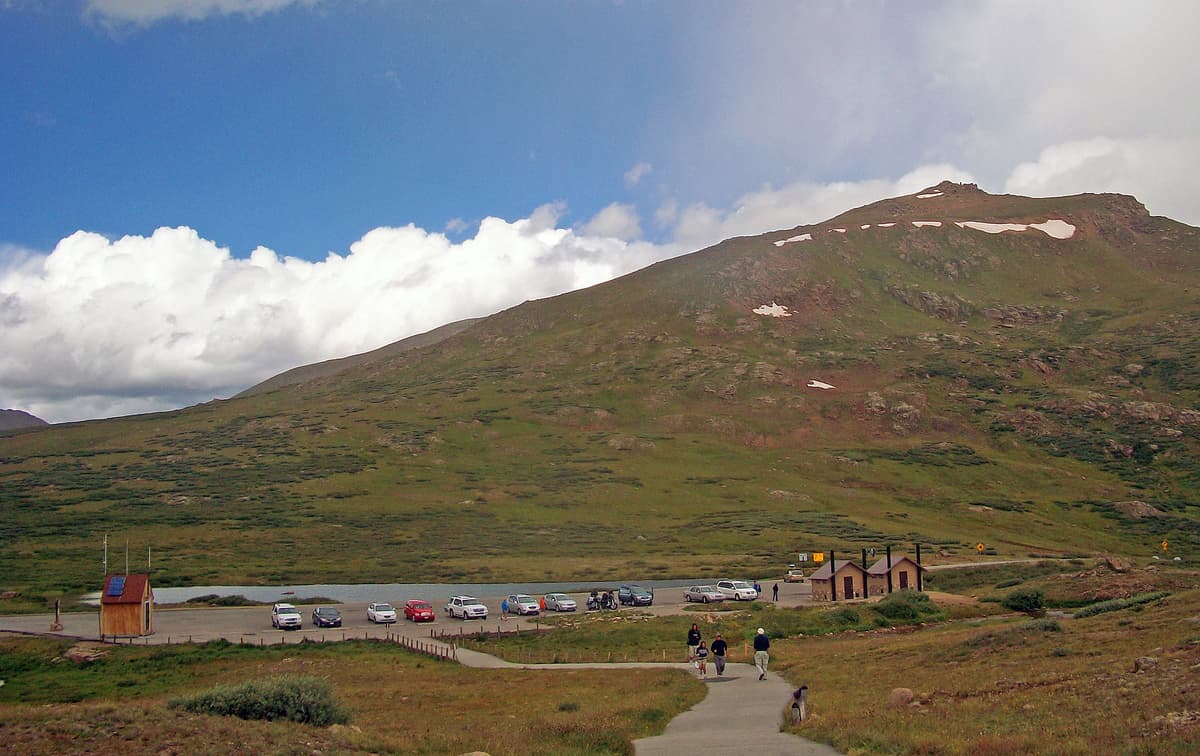
Restrooms: A vault toilet is usually available near the trailhead.
Cell service: Spotty to none at the trailhead, none on the route. Download your maps before you leave town.
Parking: The paved lot holds a couple dozen cars and fills later than Elbert's, but it still reaches capacity on peak summer Saturdays. Arrive early. Overflow parking along Highway 82 is limited and the shoulder is narrow in spots.
Winter note: Highway 82 over Independence Pass closes to vehicles from roughly early November to late May. The gate sits east of the trailhead near Twin Lakes, so once the pass closes you can't drive to the lot. Winter and early-spring hikers add several road miles on foot or skis just to reach the summer trailhead.
The Northwest Ridge Route
The Northwest Ridge is the standard line up La Plata. The trail is well built and easy to follow, so the challenge is physical rather than technical. You gain 4,500 feet, and a big chunk of that comes in one steep push.
Section 1: Trailhead to the Gulch (Miles 0 to 2.3)
The trail starts by crossing the South Fork of Lake Creek on a sturdy log bridge, then crosses the La Plata Gulch creek on a second bridge a short way in. These crossings are bridged in summer, so you keep dry feet. After the creeks, the trail turns south and climbs at a moderate grade through evergreen forest and willow thickets, following La Plata Gulch upstream.
This stretch is the warm-up. The grade is friendly, the tread is good, and the trees give shade for an early start. Enjoy it, because the mountain changes character soon.
Section 2: The Steep Climb to the Ridge (Miles 2.3 to 3.3)
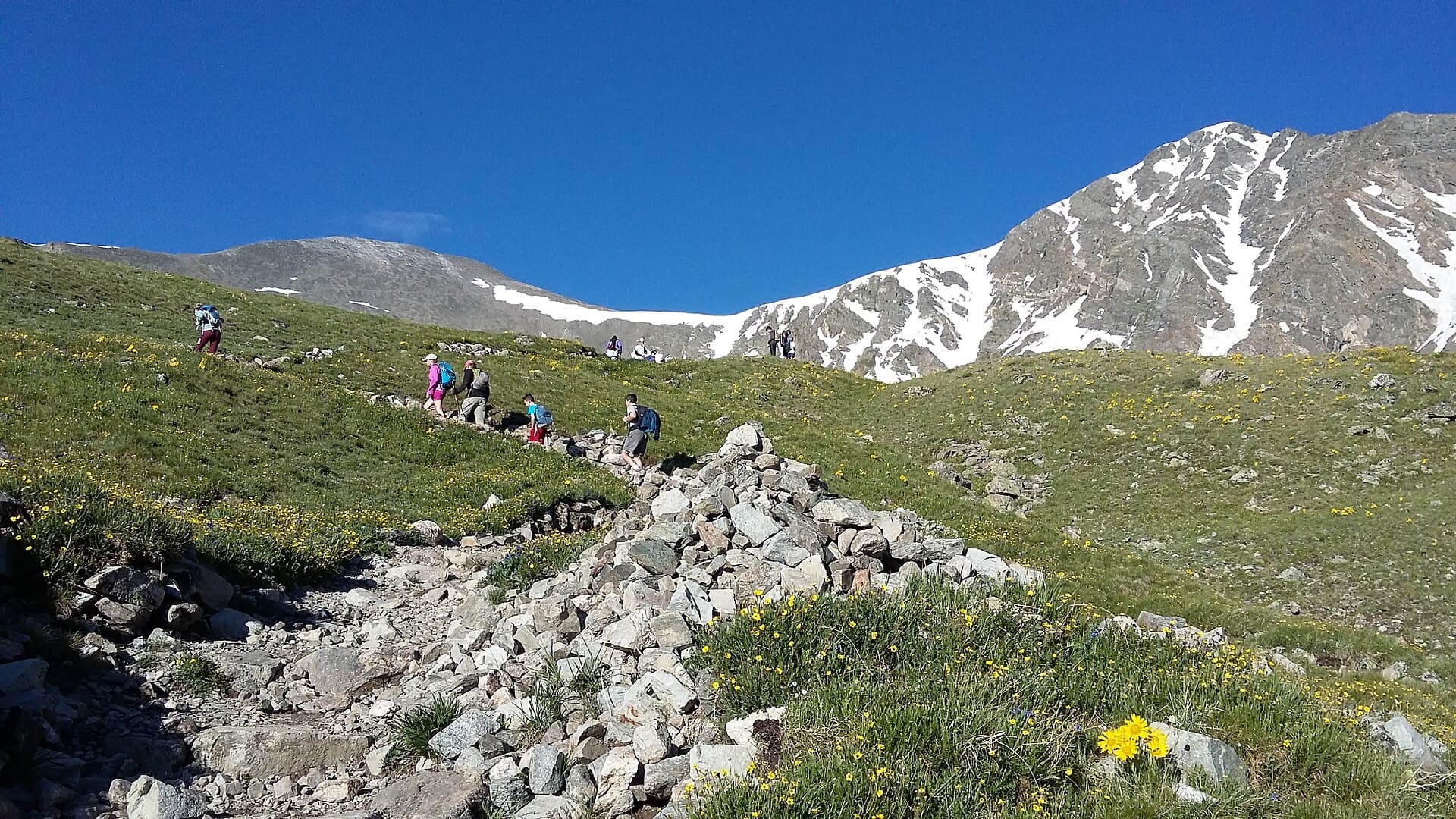
Around 11,200 feet, the trail leaves the gulch and turns to climb the northwest ridge directly. This is the hard part of the day. The switchbacks are tight and relentless, gaining roughly 1,500 feet in about a mile to reach the ridge crest near 12,300 feet.
Pace yourself here. Short, steady steps beat fast bursts followed by long stops. You'll pass treeline in this section, and the views open across the valley as the trees thin out. Trekking poles earn their weight on this climb, both going up and, later, coming down.
Section 3: The Northwest Ridge (Miles 3.3 to 4.4)
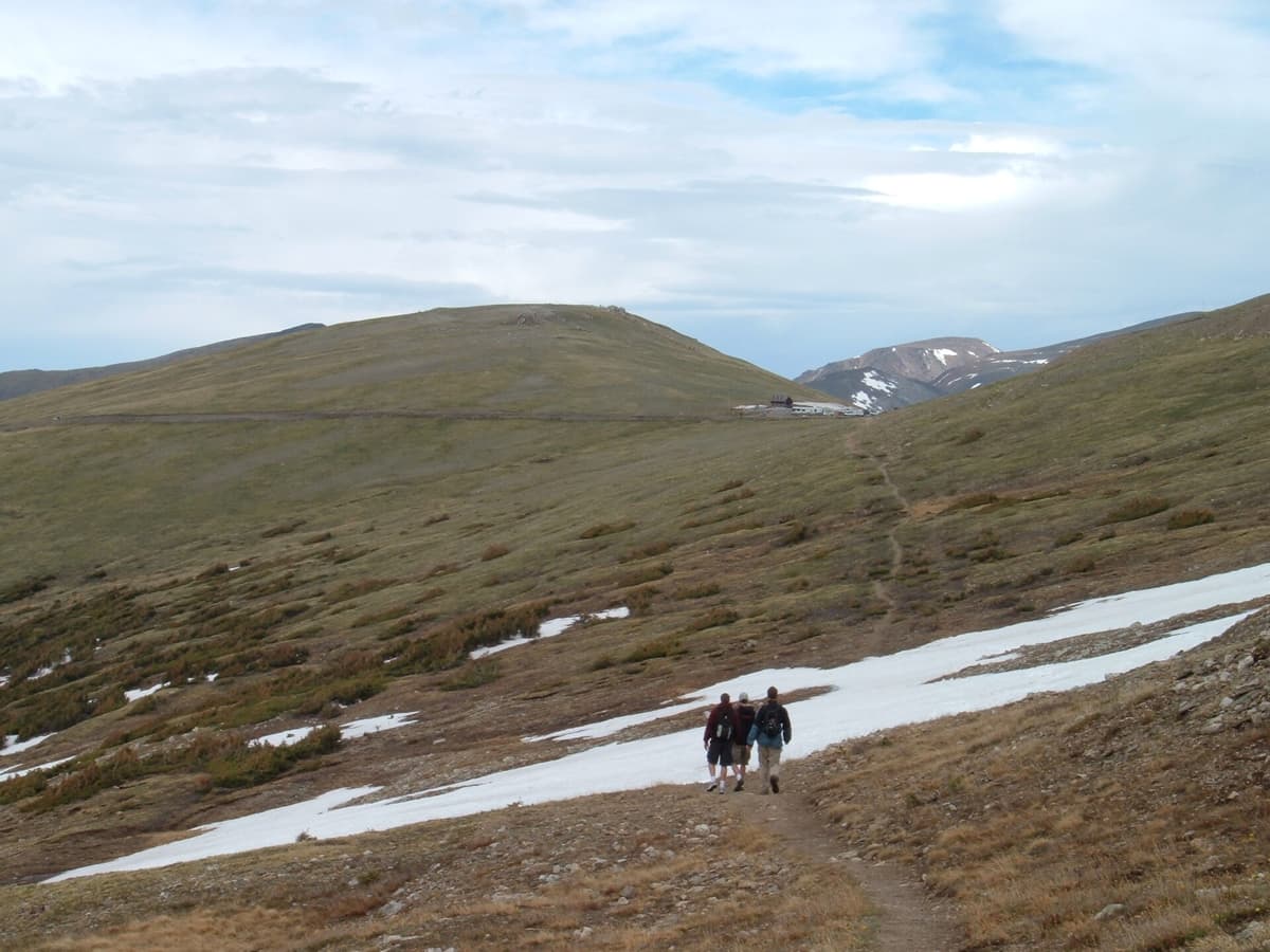
Once on the ridge, the angle eases at first. You walk up a broad shoulder of grass and scattered rock, then the surface shifts to talus as you climb higher. The upper ridge involves boulder hopping and a few short Class 2 rock steps where you'll use your hands for balance. Nothing here is exposed or technical, but the footing demands attention.
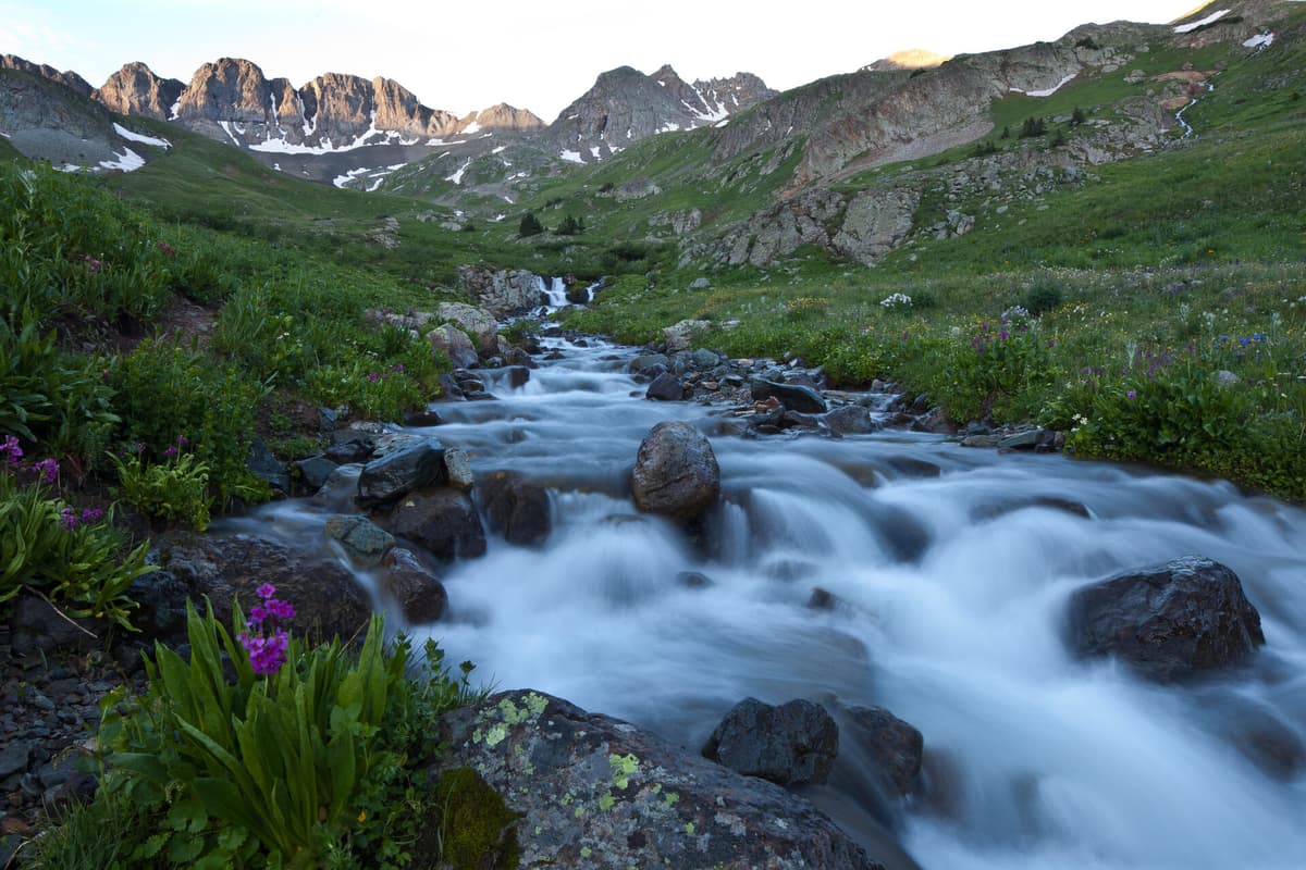
La Plata has a habit of showing false summits. Several high points along the ridge look like the top until you crest them and see more mountain ahead. Don't let it get in your head. The true summit is the obvious high point at the far end of the ridge, and the trail and cairns keep you on line.
Section 4: The Summit (Mile 4.6)
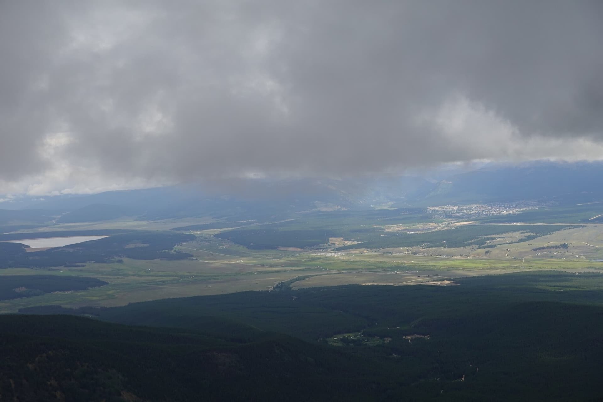
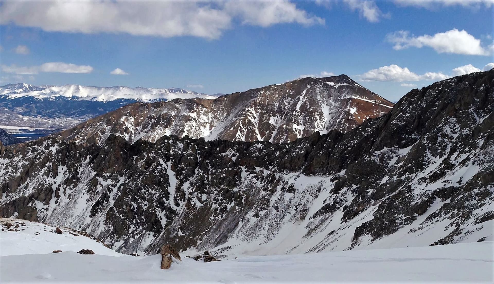
The summit is a rocky perch with room for a handful of hikers to spread out. The payoff is the view. Mount Elbert and Mount Massive rise to the north across the valley, the twin giants of the Sawatch. Twin Lakes shines to the northeast, and the jagged Ellingwood Ridge drops away to the east, showing exactly why that route earns its reputation. The Collegiate Peaks stretch south along the range.
Sign the summit register, eat something real, take your photos, and start watching the sky. On La Plata you want to be heading down well before the afternoon clouds build.
Section 5: The Return (Miles 4.6 to 9.25)
Same route in reverse. The talus is no easier going down, so keep your focus on the upper ridge until you're back on dirt trail. The steep switchbacks that hurt on the way up hurt your knees on the way down; shorten your poles slightly and take them slow. The lower forest stretch feels long after a big day, so snack, drink, and keep moving. Plan on 3 to 4 hours for the descent.
The Ellingwood Ridge Alternative
If you've stood on the summit and stared at the sawtooth ridge running east, you've seen the Ellingwood Ridge. It's a Class 3 route that traverses about two miles of jagged rock to reach La Plata's summit, and it's one of the more committing ridge scrambles in Colorado. Total gain climbs to roughly 5,900 feet, and parties routinely spend 12 to 14 hours on the full day.
The ridge is mostly Class 3 scrambling with sections of loose and rotten rock, real exposure in places, and constant route-finding around towers and notches. Guidebooks and trip reports say the same thing over and over: people underestimate how long it takes. This is a route for experienced scramblers who are comfortable with exposure, moving over loose rock, and making their own way when the "trail" disappears. If you're new to Class 3, do several easier scrambles first and go with someone who has done the ridge. For everyone else, the Northwest Ridge is the answer.
What to Pack
The standard 14er kit, tuned for a long day with real talus up high:
Water. 3 liters minimum. The creeks near the trailhead are an option for filtering on the way out, but plan to carry all your water for the climb. A good filter is worth the space if you want to top off low on the mountain. See our guide to the best water filters for hiking in Colorado.
Food. 1,500 to 2,500 calories. A 7 to 10 hour day at altitude burns through fuel fast. Bring real food, not just bars.
Layers. Base layer, insulation, wind shell, and rain shell. The summit runs 25 to 35 degrees colder than the trailhead, and the wind on the ridge is reliable. See our merino base layer guide and rain jacket guide.
Footwear. Real hiking boots with ankle support. The upper talus chews up thin trail runners, and the long descent is hard on ankles. See our hiking boots guide.
Trekking poles. Both, not one. The steep climb to the ridge and the 4,500-foot descent will wreck your quads and knees without them. See our trekking poles guide.
Headlamp. Required for the alpine start. See our headlamp guide.
Sun protection. Sunglasses, sunscreen on every exposed surface, and a brimmed hat. Above treeline the UV is brutal.
Microspikes. Useful in June and again after mid-September when snow lingers on the upper ridge. A pair of hiking microspikes on Amazon packs small and saves the day on an icy talus step.
Map and offline GPS. Download the route before you leave cell service. A paper backup like a Sawatch Range trail map is cheap insurance. The false summits and the cairned talus reward knowing where you are.
First aid basics. Blister care, ibuprofen, and electrolytes for the long day.
Timing and Weather
The 14er rule holds: be off the summit by noon.
Suggested timing for the Northwest Ridge:
- Trailhead: 4:30 AM (earlier in monsoon season)
- Treeline: 6:30 AM
- Ridge crest (12,300 ft): 7:30 AM
- Summit: 9:00 to 10:00 AM
- Below treeline on descent: 11:30 AM
- Trailhead: 1:30 to 2:30 PM
Colorado's summer monsoon builds afternoon thunderstorms most days from mid-July into August. Lightning is the real danger on a high, open ridge, and La Plata's upper mountain leaves you exposed for a long stretch. If you hear thunder or see storms building, turn around. The summit will still be there next week.
Check forecast.weather.gov for the Independence Pass or Leadville mountain forecast the night before and again in the morning. The usual decision points:
- Storm probability above 30 percent: reconsider or start earlier
- Sustained wind above 35 mph at altitude: the ridge will be miserable
- Snow falling outside winter: turn around
- Cloud bases dropping toward 14,000 ft: route-finding on the talus gets harder
Read our altitude sickness guide if you're driving up from low elevation, because the 4,500-foot gain and long day make altitude problems more likely without a night or two up high first.
When to Climb
Best months: Late June through September.
June: Snow lingers on the upper ridge into early or mid-month most years. Microspikes and an early start help. Creek crossings run high with snowmelt, though the bridges keep you dry.
July: Peak season and peak monsoon. Start by 4 AM and move with purpose.
August: Storms build early and often. The exposed ridge punishes anyone who lingers on top.
September: Often the best stable weather of the year. Cooler air, fewer storms, and thinner crowds. First snows can arrive after mid-month.
October through May: Winter conditions, and Highway 82 is gated at Twin Lakes, so you add road miles to even reach the trailhead. Avalanche terrain, short days, and deep cold turn La Plata into a mountaineering objective that needs winter skills, avalanche training, and the right gear. Not a casual outing.
How La Plata Compares to Its Neighbors
La Plata sits in a neighborhood of famous 14ers, so it's worth knowing where it lands.
Versus Mount Elbert. Elbert is taller (14,440 ft) but easier, a Class 1 walk-up on its standard route. La Plata's steep ridge climb and upper talus make it the harder day despite being 100 feet shorter. Do Elbert first. See our Mount Elbert guide.
Versus Mount Massive. Massive is a longer day at 13.6 miles, but its grade is gentler and its rating is a softer Class 2. La Plata packs its difficulty into a shorter, steeper package. See our Mount Massive guide.
Versus Huron Peak. Huron, a bit further south in the Sawatch, is a similar strenuous Class 2 with a rougher access road. La Plata's paved trailhead is the easier drive. See our Huron Peak guide.
For a beginner-friendly starting point instead, see our easiest 14ers guide and the full ranking in our 14ers by difficulty guide.
Common Mistakes
Treating it like a beginner peak. La Plata is harder than Bierstadt, Quandary, or Elbert. The steep ridge climb and long talus stretch surprise hikers who expected a walk-up. Build up to it.
Starting too late. A 6 AM trailhead start puts you summit-bound around 11 AM, which is too late in monsoon season. Get moving by 4 to 4:30 AM.
Blowing up on the steep section. The 1,500-foot climb to the ridge crest is where under-prepared hikers redline. Slow your pace before you feel wrecked, not after.
Chasing false summits. Several bumps on the upper ridge look like the top. Know that the true summit is the far high point and pace yourself accordingly, so you don't burn out mentally.
Skipping the wind shell. Calm in the valley does not mean calm on the ridge. La Plata's summit catches wind hard. Pack the shell every time.
One trekking pole, or none. The steep grade both directions demands two poles. Your knees will feel every skipped one on the descent.
Underestimating the Ellingwood Ridge. If you're eyeing that jagged ridge for a future trip, respect it. It's a full Class 3 day that has humbled strong hikers. Build the scrambling experience first.
Frequently Asked Questions
How hard is La Plata Peak?
La Plata is a strenuous Class 2 climb, harder than most beginner 14ers. The 9.25-mile round trip includes a steep 1,500-foot push to gain the ridge and a long stretch of talus near the summit. Fit hikers with a few easier 14ers behind them handle it well; it's not a good first 14er.
How long does it take to hike La Plata Peak?
Most hikers finish the Northwest Ridge in 7 to 10 hours round trip, including breaks and time on the summit. Faster, well-acclimatized hikers do it in 6. The Ellingwood Ridge route is a much longer 12 to 14 hour day.
Do you need 4WD to reach the La Plata Peak Trailhead?
No. The trailhead sits right off paved Highway 82 with a paved parking lot, so any passenger car reaches it in summer. That easy access is one reason La Plata makes a good day trip. Note that Highway 82 closes over Independence Pass in winter, gated near Twin Lakes.
What is the best time of year to climb La Plata Peak?
Late June through September, with September often offering the most stable weather and thinnest crowds. July and August bring reliable afternoon thunderstorms, so start early and be off the summit by noon. Winter climbs require mountaineering skills and added road miles.
Which route is the standard route up La Plata Peak?
The Northwest Ridge is the standard route: 9.25 miles round trip, 4,500 feet of gain, Class 2. The Ellingwood Ridge is a much harder Class 3 alternative for experienced scramblers, with about 5,900 feet of gain and serious exposure.
Other 14ers to Consider
If La Plata is on your list, these pair well with it:
- Mount Elbert: The state high point and a Class 1 walk-up, right across the valley. The best warm-up for La Plata. See our Mount Elbert guide.
- Mount Massive: A longer but gentler day next door. See our Mount Massive guide.
- Huron Peak: A scenic Sawatch Class 2 further south. See our Huron Peak guide.
- Quandary Peak: A shorter Class 1 near Breckenridge, good for building fitness. See our Quandary Peak guide.
For trail stats, elevation, and a route map, see the La Plata Peak page.
Final Thoughts
La Plata Peak is the fifth-highest mountain in Colorado, and it rewards hikers who show up ready. The Northwest Ridge is a well-built Class 2 route, but the steep climb to the ridge and the long upper talus make it more work than the 9.25-mile distance suggests. It's the right peak to tackle after a few easier 14ers, not as your first.
The keys to a good day: stay in Leadville or Buena Vista the night before, start by 4 to 4:30 AM, pace the steep section, watch the weather, and use both poles on the descent. Do that, and you get one of the finest summit views in the Sawatch, with Elbert and Massive close enough to feel like you could touch them.
For the peak's stats and map, see the La Plata Peak page. For the full gear kit, see our guides to hiking boots, trekking poles, rain jackets, and base layers.
Get the Colorado 14er Packing Checklist (free PDF)
Plus a weekly note on the best Colorado trails, gear deals, and seasonal hike picks. No spam, unsubscribe anytime.
We respect your inbox. Unsubscribe anytime.