Huron Peak: A Complete Guide to Hiking Colorado's Sawatch 14er
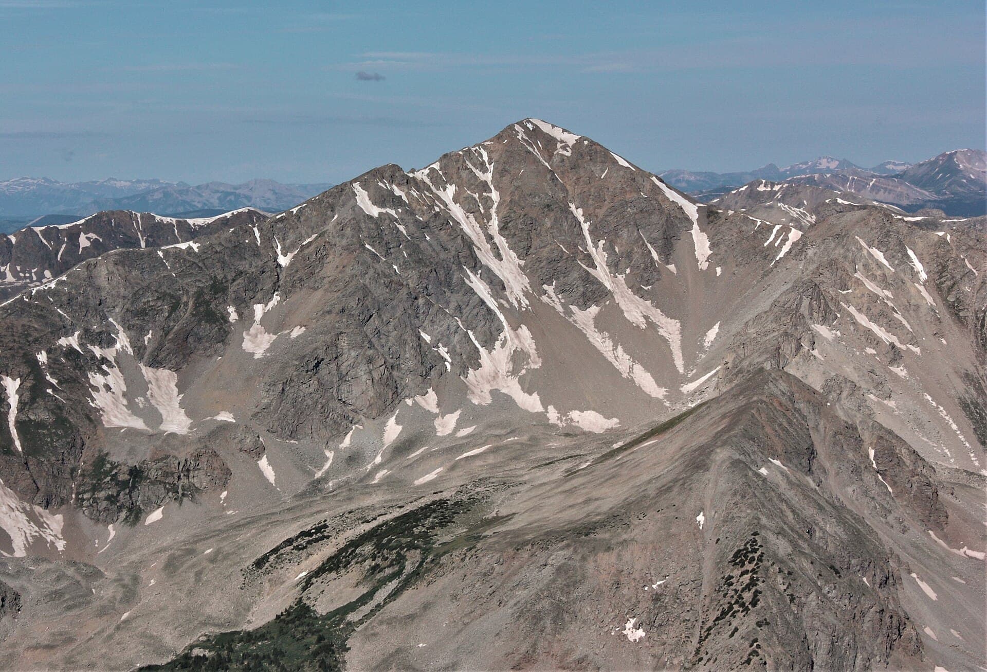
Huron Peak (14,010 ft) is the 14er a lot of people forget to climb until someone shows them a photo from the top. It sits deep in the Sawatch Range near the ghost town of Winfield, between Buena Vista and Leadville, and it pays back the drive with what plenty of Colorado hikers call the best summit view in the whole range: a straight-on look at the Three Apostles rising out of Apostle Basin.
The standard Northwest Slopes route runs about 6.5 miles round trip with roughly 3,500 feet of gain from the upper trailhead, and it stays Class 2 the entire way. That means you walk a real trail to the top with no scrambling and no exposure. The catch, like a lot of Sawatch peaks, is the rough road to the trailhead and the dawn start the weather demands.
This guide covers the route, the road that decides your whole day, the gear that matters at 14,000 feet, and how to fold Huron into a Collegiate Peaks trip.
What You'll Learn
- Quick Stats
- Getting to the Trailhead
- The Northwest Slopes Route
- The View from the Top
- What to Pack
- Timing and Weather
- When to Climb
- Camping and Nearby 14ers
- Common Mistakes
- Frequently Asked Questions
Quick Stats
From the upper 4WD trailhead (standard):
- Elevation: 14,010 ft (one of the lower Colorado 14ers by height)
- Round Trip Distance: about 6.5 miles
- Elevation Gain: about 3,500 ft
- Class: 2
- Time: 5 to 8 hours
- Trailhead: upper South Winfield, about 10,600 ft
From the lower 2WD trailhead:
- Round Trip Distance: closer to 10.5 miles
- Elevation Gain: about 3,800 ft
- Added time: 1.5 to 2 hours of walking the rough road each way
- Trailhead: South Winfield, about 10,260 ft
Range: Sawatch, Collegiate Peaks Wilderness
Nearest towns: Buena Vista and Leadville
Best Season: Late June through late September
Permit: None required
Crowds: Moderate on summer weekends, light midweek
Getting to the Trailhead
Huron sits at the end of Clear Creek Road (County Road 390), which leaves US 24 near Clear Creek Reservoir, about halfway between Leadville and Buena Vista. This road, not the hike, is what you plan your day around.
Turn west off US 24 onto CR 390 and follow it for roughly 12 miles of maintained dirt to the old mining town of Winfield. A passenger car can make this stretch in dry summer conditions; it's washboarded and dusty, but passable, and plenty of sedans do it every weekend.
Winfield is where the decision happens. The town was a silver camp in the 1880s and is now a preserved ghost town, with a handful of restored cabins, a schoolhouse, and a small cemetery. Just past the townsite, the road forks. The left fork (South Fork Clear Creek Road) climbs toward the upper Huron trailhead, and this is where the surface falls apart.
Here's how the last stretch breaks down:
- Winfield to the lower South Winfield trailhead: Any vehicle can reach the parking area right at the fork, around 10,260 ft. Many people just park here.
- The 2-mile spur to the upper trailhead: This narrow road needs real high-clearance 4WD. It's rocky, rutted, and has a couple of spots that stop stock SUVs. It ends at a small trailhead around 10,600 ft.
- If you're unsure, park lower. Walking the spur adds about 4 miles round trip and a little over 300 feet of gain, but it beats wrecking an oil pan or blocking the one-lane road.
Drive from Denver: Budget about 3 hours to the CR 390 turnoff, then 40 to 60 minutes on the dirt to Winfield depending on your pace. Huron is doable as a long Front Range day trip, but most people sleep near the trailhead to get the early start.
Restrooms: Vault toilets near Winfield and at the upper trailhead. None higher up.
Cell service: None at the trailheads and none on the mountain. Download your maps before you leave the pavement.
The Northwest Slopes Route
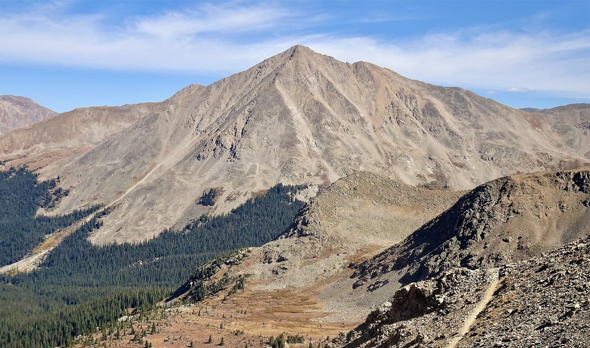
The Northwest Slopes are why Huron has a reputation as a friendly summit. The trail is well built, easy to follow, and never asks for anything harder than steady uphill walking. From the upper trailhead you'll cover about 6.5 miles round trip with roughly 3,500 feet of gain.
Section 1: Trees to Treeline (Miles 0 to 1.5)
From the upper trailhead at about 10,600 ft, the trail crosses a small creek in the first half mile, then settles into a series of switchbacks through spruce and fir. You gain most of your first 800 to 1,000 feet in this shaded stretch. The footing is good and the grade is honest without being brutal.
Around treeline the forest opens into a broad basin. This is a good spot to pull a layer, drink water, and get your first look at the slopes above.
Section 2: The Basin (Miles 1.5 to 2.5)
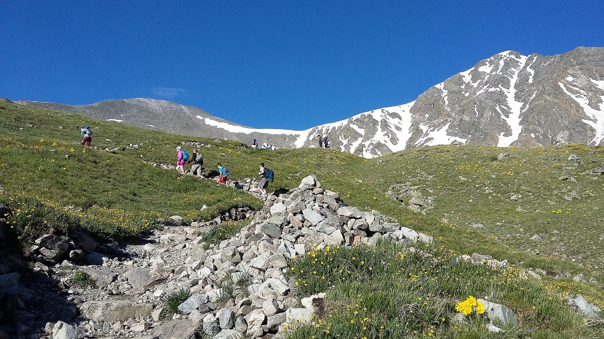
The trail bends south and climbs through a green basin thick with wildflowers in July. The grade eases here, giving your legs a break before the final push. Columbine, paintbrush, and alpine sunflowers fill this stretch in a good year, and the peak comes into view ahead.
Take your time through the basin. It's the prettiest walking on the mountain, and the more you slow down, the better you'll feel when the trail tilts up again.
Section 3: The Summit Switchbacks (Miles 2.5 to 3.25)
Above the basin, the trail climbs a set of well-graded switchbacks up Huron's northwest shoulder. This is where you feel the altitude. The grade steepens, the air thins, and the last few hundred feet are loose in spots, so slow your pace and let your breathing set the rhythm. The trail stays clear and Class 2 the whole way, meaning you might put a hand down once or twice but you're never scrambling.
You reach the summit sooner than the map suggests. Huron's top is a compact, rounded high point with room to sit, eat, and take in the view.
Section 4: The Descent
Return the way you came. The summit switchbacks are the section to respect on the way down, since loose rock and tired legs are how ankles roll. A set of trekking poles earns its keep here. Once you're back in the basin, it's an easy stroll to the car.
The View from the Top
Most 14ers reward you with a wide sweep of distant summits. Huron gives you that too, but it also gives you something specific and unforgettable: a direct line of sight to the Three Apostles.
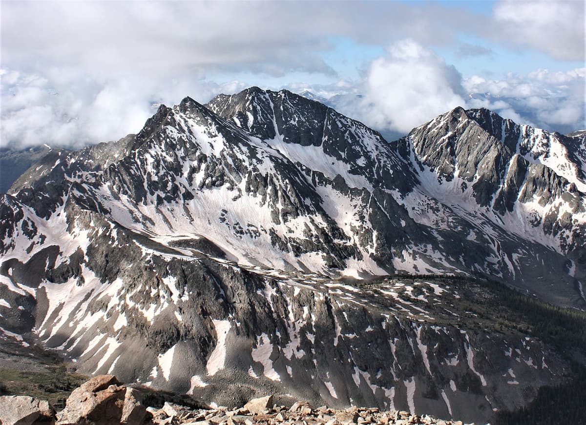
Look south from the summit and you'll see Ice Mountain in the center, flanked by North Apostle and West Apostle, rising in a jagged wall out of Apostle Basin. These are some of the most rugged, photogenic peaks in the Sawatch, and Huron puts them right in your lap. It's the reason a modest 14er with a short trail shows up on so many "best summit view" lists.
Turn the other directions and the payoff continues. La Plata Peak stands to the north, the Missouri Gulch trio (Missouri, Belford, and Oxford) fills the view to the east, and the rest of the Collegiate Peaks stretch out along the spine of the range. Sign the register, eat something, and give yourself time up here. On a calm morning it's one of the best seats in Colorado.
What to Pack
Huron is short by 14er standards, but it's still a 14er in a remote range with no cell service. Pack like the weather could turn, because it can.
Quick pick: A set of collapsible trekking poles does more for your knees on the summit switchbacks than any other single piece of gear. Best value upgrade for this hike.
Core kit for a summer summit:
- 2.5 to 3 liters of water, or a filter to refill at the creek low on the trail
- 800 to 1,200 calories of trail food
- A layering system: base layer, insulation, and a rain and wind shell
- Sun protection, since the basin and summit offer no shade
- A rechargeable headlamp for your pre-dawn start
- Sturdy boots with real tread
- Offline maps on your phone, plus a paper backup
- First aid basics
For our full picks on the pieces that matter most up high, see our guides to hiking boots for Colorado, rain jackets, and trekking poles. Early in the season, a set of microspikes helps on lingering snow in the upper switchbacks.
Timing and Weather
The rule for every Colorado 14er applies here: be off the summit by noon.
Afternoon thunderstorms build fast over the Sawatch in summer, and you do not want to be on an open ridge at 14,000 feet when lightning rolls in. Huron is short enough that an early start makes this easy to manage.
A reasonable schedule from the upper trailhead:
- Trailhead: 6:00 AM
- Treeline: 7:00 AM
- Summit: 8:30 to 9:00 AM
- Back at the car: 11:00 AM
That gives you a comfortable buffer before storms typically fire. If you're starting from the lower 2WD trailhead and walking the spur, back everything up by 45 minutes to an hour.
Check the mountain forecast for the Collegiate Peaks the night before, since you won't have signal at the trailhead. Watch for these red flags:
- Storm probability above 30 percent
- Wind above 35 mph at altitude
- Any snow in a summer forecast, which points to unstable air
Huron tops out just over 14,000 feet, so don't shrug off a headache or nausea. Read up on altitude sickness prevention before you go, and try to sleep at least one night near Buena Vista or Leadville elevation to start acclimating.
When to Climb
Best window: Late June through late September.
June: Snow lingers in the upper switchbacks and the basin well into the month, especially after a heavy winter. Carry microspikes and expect wet crossings. The road may still have drifts near the upper trailhead early on.
July: Wildflowers peak in the basin, usually mid-to-late month. This is the prettiest time to climb and the busiest. It's also peak monsoon season, so a dawn start is not optional.
August: Warm and green, with storms building early most afternoons. Start at first light and you'll be fine.
September: Often the most stable weather of the year, with cool mornings and thinning crowds. The road stays open and the aspens lower down start to turn. First snows can arrive after mid-month.
October through May: The high country locks up with snow, turning Huron into a long winter objective with a much harder approach. That's a different trip entirely. If winter hiking is new to you, start with our winter hiking guide for beginners before considering anything at this elevation.
Camping and Nearby 14ers
Since you're driving all the way to Winfield, it's worth turning Huron into a two- or three-peak weekend. This corner of the Sawatch is one of the best 14er clusters in the state.
Camping: Dispersed sites line CR 390 between the reservoir and Winfield, and there's more camping near the townsite and the lower trailhead. These fill up on summer weekends, so arrive Friday afternoon if you can. For the rules on where you can and can't set up, read our guide to dispersed camping in Colorado.
Nearby 14ers from the same road:
- Missouri, Belford, and Oxford share the Missouri Gulch trailhead a few miles back down CR 390. Strong hikers link all three in a long day.
- La Plata Peak stands just to the north and makes a natural second summit for a Collegiate trip.
Plenty of people build a base camp near Winfield and knock out Huron one morning and a Missouri Gulch peak the next. All of them are non-technical, all of them are remote, and all of them reward an early start.
New to high peaks in general? Start with our beginner's guide to Colorado hiking and our roundup of the easiest 14ers in Colorado. Once Huron has you hooked, our nearby Mount Yale and Mount Harvard guides cover two more Collegiate summits worth your time.
Common Mistakes
Underestimating the road. The hike is moderate; the last two miles of road are not. Know your vehicle's limits before you commit to the upper trailhead, and be ready to park lower and walk.
Starting late. "It's only 6.5 miles" lulls people into a 9 AM start, and then storms catch them on the open switchbacks. Treat this like any 14er and start at dawn.
Skipping acclimatization. Coming straight from sea level to a 14,010-foot summit is how people end up sick. Spend a night or two at elevation first.
Carrying no rain shell. Sawatch weather turns on a dime. A light shell weighs almost nothing and can save your day.
Trusting your phone to find the trail. There's no signal out here. Download offline maps and bring a paper backup.
Frequently Asked Questions
How hard is Huron Peak?
By 14er standards, Huron is on the easier side. The Northwest Slopes route is about 6.5 miles round trip with roughly 3,500 feet of gain from the upper trailhead, and it stays Class 2 the whole way on a clear trail. A fit, acclimated beginner can handle it. The hardest parts are the rough 4WD spur and the thin air near the top.
Can you drive a regular car to the Huron Peak trailhead?
You can drive a passenger car the 12 miles to Winfield and the lower South Winfield trailhead in dry summer conditions. The final 2-mile spur to the upper trailhead needs real high-clearance 4WD. If you park lower, add about 4 miles round trip and roughly 90 minutes to your day.
How long does it take to hike Huron Peak?
Most hikers finish the Northwest Slopes route in 5 to 8 hours round trip from the upper trailhead, including breaks. Starting from the lower 2WD trailhead adds 1.5 to 2 hours of walking the spur road each way.
What's the best time to climb Huron Peak?
Late June through late September. July brings peak wildflowers in the basin but also monsoon storms, so start at dawn. September usually offers the most stable weather and thinner crowds before the first snows and the seasonal freeze-up.
Is Huron Peak a good first 14er?
It can be. The trail is short, well built, and non-technical, which makes it beginner-friendly. The catch is the remote location, the rough access road, and the lack of cell service, so it's best as a first 14er for someone who already has a little Colorado hiking experience and a capable vehicle or a willingness to walk the road.
Final Thoughts
Huron Peak punches well above its modest height. The trail is short and clean, the July wildflowers in the basin are some of the best around, and the view of the Three Apostles from the summit is one you'll be showing people for years. The whole trip hinges on the road, so match your route to your vehicle and start early.
Plan the drive, sleep near Winfield or Buena Vista to acclimate, watch the weather, and give yourself a dawn start. Do that, and Huron is one of the most rewarding 14,000-foot summits in Colorado.
For more high-country routes, see our Colorado 14ers guide and, for another short and scenic summit, our Handies Peak guide.
Get the Colorado 14er Packing Checklist (free PDF)
Plus a weekly note on the best Colorado trails, gear deals, and seasonal hike picks. No spam, unsubscribe anytime.
We respect your inbox. Unsubscribe anytime.