Cottonwood Creek Trailhead: Gateway to Mount Harvard, Columbia, and Two Alpine Lakes
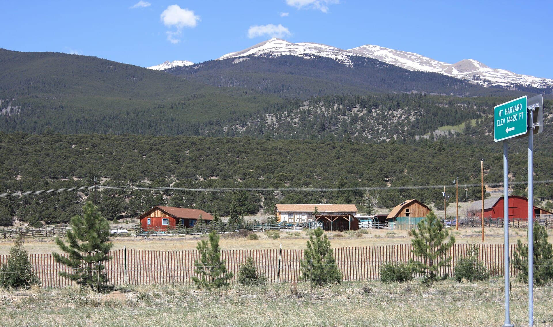
The Cottonwood Creek Trailhead, marked on most maps as the North Cottonwood Creek Trailhead, sits at about 9,880 feet at the end of a dirt road west of Buena Vista, and it's the main door into the highest corner of the Collegiate Peaks. From this one dusty lot you can climb Mount Harvard, the third-tallest mountain in Colorado, tackle its rugged neighbor Mount Columbia, or skip the summits entirely and walk to a quiet alpine lake in the basin below. No permit, no timed-entry reservation, no fee. Just a graded dirt road that most cars handle and a wide creek-side trail that fans out into four of the best hikes in Chaffee County.
That range of options is what makes this trailhead special. Peak baggers pull in before dawn for a 14-mile day on Harvard. Backpackers set off for Bear Lake or Kroenke Lake with lighter goals and heavier packs. This guide covers where the trailhead is, what the road is really like, every major hike from the lot, and how to pick the right day so the mountain weather doesn't pick it for you.
If you're heading up in June or early July, drop a pair of microspikes in your pack before anything else. Snow lingers in Horn Fork Basin and on the upper slopes of both 14ers well past the calendar start of summer, and a firm morning snow slope is the one thing that turns a strong hiker around short of the goal.
What You'll Learn
- Quick Stats
- Where Is the Cottonwood Creek Trailhead?
- Getting There: The Drive from Buena Vista
- Mount Harvard: The Main Event
- Mount Columbia and the Harvard-Columbia Traverse
- The Lakes: Bear Lake and Kroenke Lake
- The Colorado Trail Connection
- When to Hike
- What to Pack
- Where to Stay
- Frequently Asked Questions
Quick Stats
- Trailhead elevation: about 9,880 feet
- Distance from Buena Vista: roughly 12 miles, 30 to 40 minutes
- Road: paved for the first few miles, then graded dirt; passable to most passenger cars in dry weather
- Permit or fee: none to hike or park
- Wilderness: Collegiate Peaks Wilderness, San Isabel National Forest
- Peaks accessed: Mount Harvard (14,421 feet) and Mount Columbia (14,077 feet)
- Lakes accessed: Bear Lake (about 12,380 feet) and Kroenke Lake (about 11,500 feet)
- Season: roughly mid-June through October; the road isn't plowed in winter
- Dogs: allowed on leash
Where Is the Cottonwood Creek Trailhead?
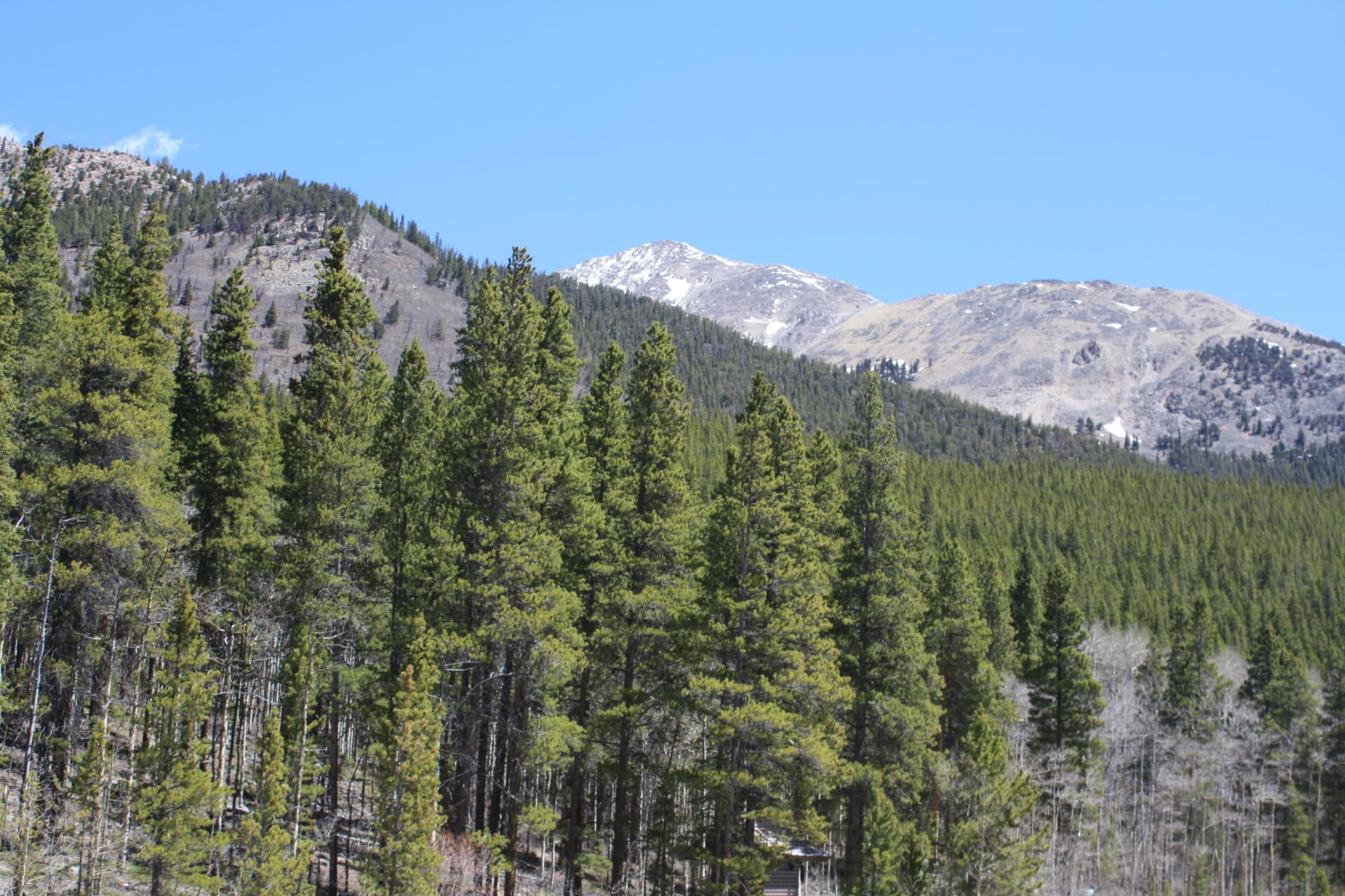
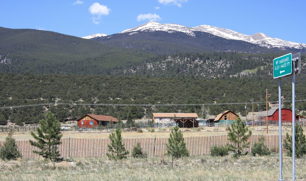
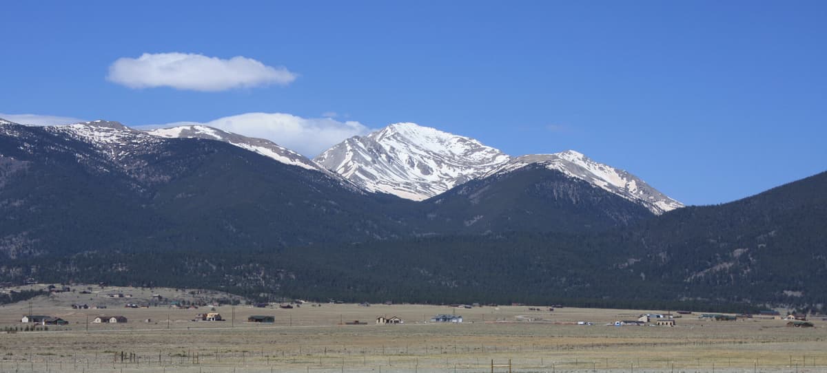
The trailhead sits in the central Sawatch Range, in the Collegiate Peaks Wilderness of Chaffee County, about 12 miles west of Buena Vista. It's tucked at the mouth of the North Cottonwood Creek drainage, with a wall of high summits rising to the west. Mount Yale stands to the south, Mount Columbia looms almost directly above, and Mount Harvard, the tallest of the Collegiate Peaks, crowns the head of the valley.
You'll see the spot written a few different ways. Signs and forest maps call it the North Cottonwood Trailhead or North Cottonwood Creek Trailhead, while a lot of hikers just say "the Harvard trailhead" because that's the peak most people are chasing. It's all the same dirt lot at the end of County Road 365. From here a single wide trail follows the creek upstream for about 1.7 miles before it splits, sending you either north into Horn Fork Basin toward Harvard, Columbia, and Bear Lake, or west up the valley toward Kroenke Lake. For the neighboring drainage and a paved-road option, see our guide to the Denny Creek Trailhead a few miles south.
Getting There: The Drive from Buena Vista
Here's the part that trips people up, because the turns aren't obvious in the dark. From the stoplight in Buena Vista, head west on County Road 306 (the road toward Cottonwood Pass) for about 2.5 miles. Turn right onto County Road 361 and follow it north for roughly 2.5 more miles. Watch for the sign for County Road 365, North Cottonwood, on the left. Turn there, and the road bends hard west toward the mountains. Stay on 365 for about 3.5 miles to where the Colorado Trail crosses, then keep going another 1.4 miles to the road's end at the trailhead.
The first stretch out of town is paved and quick. Once you're on County Road 365 it turns to graded dirt, and while it gets rutted and rough in spots near the end, most passenger cars handle it fine in dry weather if you take it slow. This is a real advantage over trailheads like the Lake Ann Trailhead at Winfield, where the upper road demands four-wheel drive. You don't need a rugged rig here, just patience and a little clearance. The road isn't plowed in winter, so the season is set by snow. For the bigger picture on leaving your car at Colorado trailheads, our notes on trailhead parking cover the etiquette and the busy-weekend reality.
The lot itself is a modest gravel clearing, and on summer weekends it fills before sunrise with 14er hikers. If you roll in at 6 a.m. on a July Saturday, expect to park along the road and add a short walk to your day.
Mount Harvard: The Main Event
Mount Harvard is why most people know this trailhead. At 14,421 feet it's the third-highest peak in Colorado, behind only Mount Elbert and Mount Massive, and it's the high point of the entire Collegiate Peaks Wilderness. The standard South Slopes route from here runs about 14 miles round trip with roughly 4,600 feet of gain, which makes it one of the longer 14er days in the state. It stays Class 2 the whole way, with only a few blocky moves near the summit, so the challenge is distance and altitude rather than technical climbing.
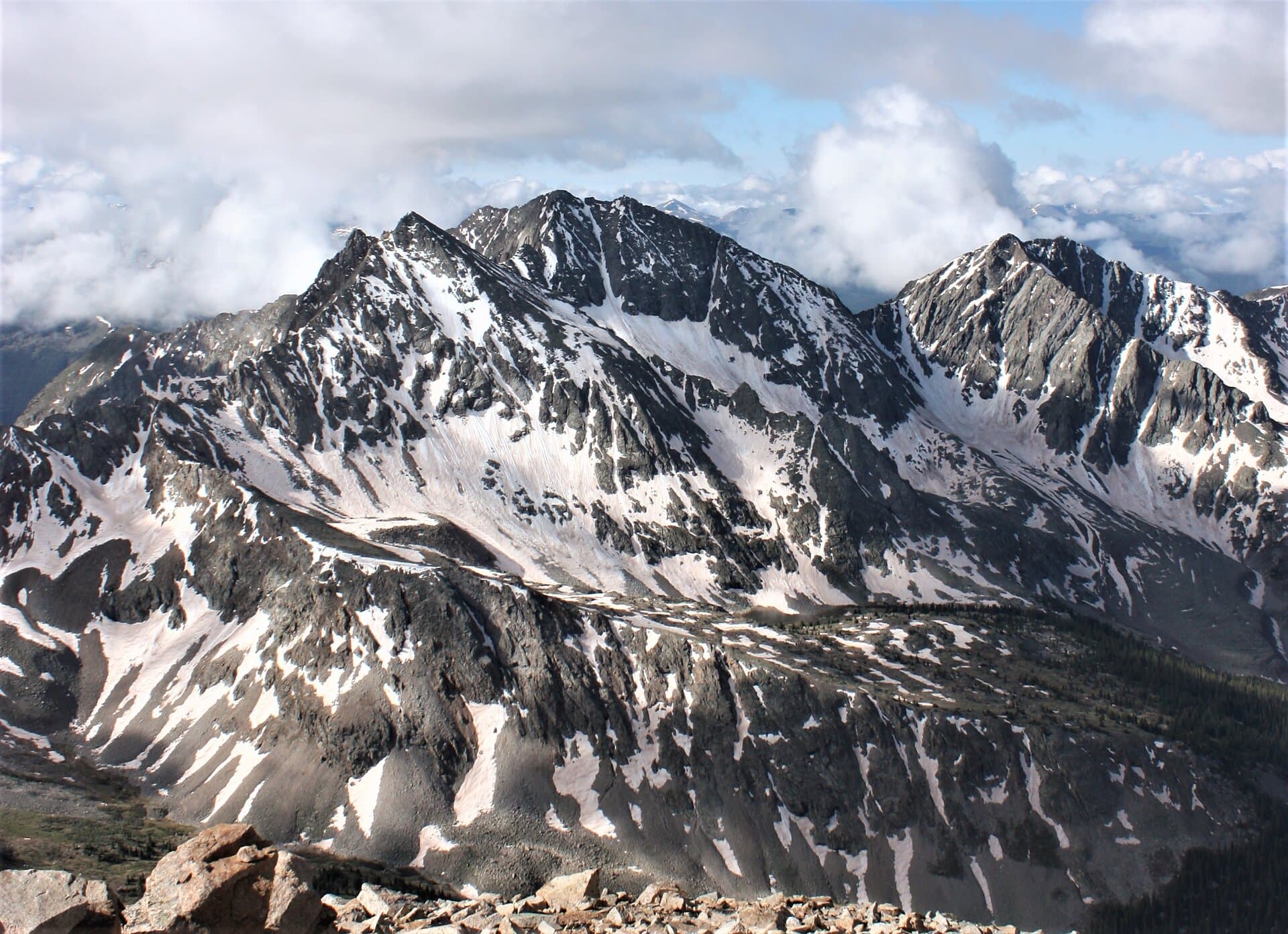
The route starts gently. You follow North Cottonwood Creek through forest for a couple of miles, pass the Kroenke Lake junction, and climb into Horn Fork Basin, a broad alpine bowl ringed by Harvard and Columbia. From the basin the trail bends north and grinds up grassy slopes and rock toward Harvard's summit block. Save some energy for the top, where a short scramble through granite blocks brings you to the true high point and a view that stretches across the whole Sawatch. For the full route breakdown, timing, and gear, read our complete guide to Mount Harvard. If it's your first big summit, start with our Colorado 14ers guide and our list of the easiest 14ers for beginners before you commit to a day this long.
Mount Columbia and the Harvard-Columbia Traverse
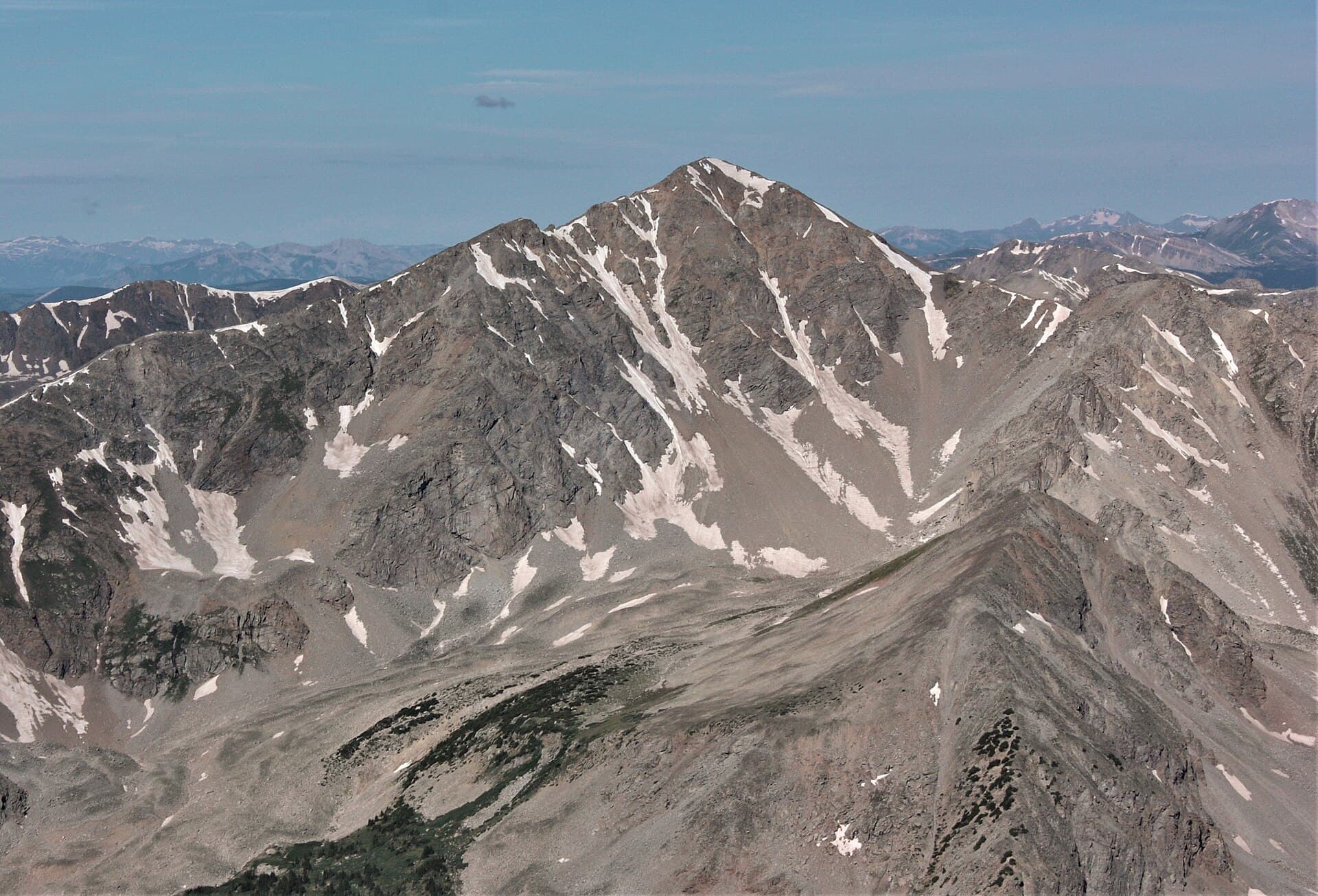
The other 14er from this lot is Mount Columbia, 14,077 feet, rising on the east side of Horn Fork Basin. Columbia has a reputation as one of the less-loved fourteeners, and the reason is the West Slopes route: a steep, loose grind up shifting scree that's about 11.5 miles round trip with roughly 4,200 feet of gain. It's honest work with a modest payoff, so a lot of hikers save Columbia for a specific reason, and that reason is usually the traverse.
The Harvard-Columbia traverse links both summits in one push, dropping off Harvard's south ridge and following about two miles of rugged, loose ridgeline over to Columbia before descending the west slopes back into the basin. It's a classic Sawatch outing and a genuinely big day, roughly 15 miles with well over 6,000 feet of gain, all above treeline. The rock is loose and route-finding matters, so this is a trip for hikers who already have several 14ers behind them. Most people are wise to take the two peaks on separate days rather than force the traverse when their legs are cooked.
The Lakes: Bear Lake and Kroenke Lake
You don't have to summit anything to make this trailhead worth the drive. Two alpine lakes sit within a day's reach, and both are gorgeous.
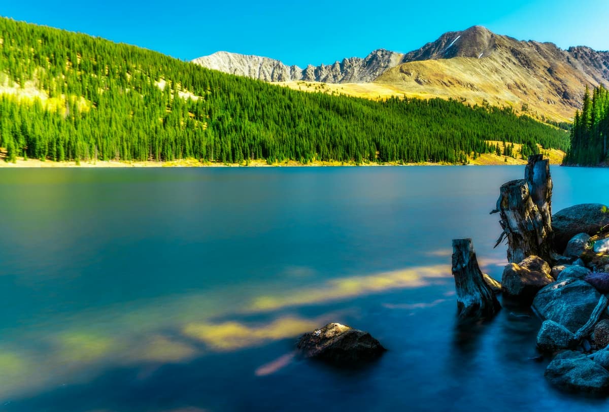
Bear Lake sits at about 12,380 feet at the head of Horn Fork Basin, cupped right below Harvard and Columbia. The hike is roughly 11 miles round trip with about 2,500 feet of gain, following the same trail the peak baggers use until the basin opens up, then branching to the lakeshore. It's a hard day by lake standards but far easier than a 14er, and the setting, a cold tarn under two of Colorado's highest summits, is hard to beat. Kroenke Lake is the gentler option. From the junction 1.7 miles in, you head west up the North Cottonwood valley to reach the lake at about 11,500 feet, a round trip near 8.5 miles with only about 1,700 feet of gain. The grade stays kind for a long time, which makes Kroenke a favorite for a first backpacking overnight or a strong day hike. Both lakes reward a slow lunch on the rocks. If quiet high water is your thing, our roundup of the best alpine lakes in Colorado points you toward more in the same style.
The Colorado Trail Connection
The trailhead also plugs straight into Colorado's long-distance network. The Colorado Trail crosses County Road 365 about 1.4 miles below the lot, and its Collegiate East route runs through this drainage, so you'll often share the lower miles with thru-hikers grinding out big daily distances. Past Kroenke Lake, the trail keeps climbing to Browns Pass on the Continental Divide, which ties this valley into the country above Denny Creek and Cottonwood Pass. That connection makes loops and point-to-point trips possible if you've got two cars or a shuttle. A good map earns its weight up here where trails braid and junctions come without cell service, so bring one; our picks for Colorado trail maps cover the paper and app options worth carrying.
When to Hike
The reliable window for a dry, snow-free trip runs roughly mid-June through October, and the sweet spot is July through September. June often still holds snow in Horn Fork Basin and on the upper slopes of both 14ers, so unless you're comfortable on steep snow with traction, give the melt time to finish. July brings wildflowers to the basin and the longest days of the year. August is warm and dependable. September thins the crowds and lights up the aspens along the lower road, though nights turn cold fast at these elevations.
Whatever month you pick, respect the mountain clock. Colorado's afternoon thunderstorms build fast over these high basins, and the upper trails and summits are wide open with nowhere to shelter from lightning. On a 14-mile Harvard day that means a pre-dawn start so you're off the summit and heading down by early afternoon. The same weather discipline that keeps you safe on a peak like Mount Bierstadt matters just as much on the lake hikes, where the upper basin is every bit as exposed.
What to Pack
This is high country with long approaches, so pack for distance and for weather that flips in an hour.
- Traction for early season. Snow hangs in the basin and on both peaks into July. A light set of microspikes turns a firm snow slope into a non-issue. Here are our microspike picks for Colorado.
- A rain shell and a warm layer. Above treeline it's windy, and storms roll in without much warning. Carry a packable rain jacket you can throw on in seconds.
- Trekking poles. Fourteen miles round trip is a lot easier on the knees with poles, especially descending Harvard's slopes at the end of a long day. See our trekking pole picks.
- Water and a filter. The creek runs alongside much of the lower trail, so a small water filter lets you carry less and refill as you climb. A comfortable daypack makes the miles friendlier.
- Sun protection. UV is fierce above 11,000 feet with little cover near the lakes and none on the peaks. Hat, sunglasses, and sunscreen, every time.
- A map, snacks, first-aid basics, and a headlamp for the alpine start you'll want on the 14ers.
Where to Stay
The simplest plan is to camp near the trailhead. There's free dispersed camping along County Road 365 as you approach the lot, with basic sites among the trees, first come first served and no fee. Sleeping high the night before genuinely helps on a hike that tops out over 14,000 feet, and it lets you hit the trail acclimatized. Bring everything you need, including water and a way to pack out every scrap of trash, because there are no services up here.
Prefer a bed? Buena Vista is the closest town, about 30 to 40 minutes back down the road, with motels, restaurants, and gear shops, plus the hot springs and river scene that make it a fun basecamp. Leadville and Salida are both reasonable drives too. However you sleep, altitude is the real hazard on these long days; our guide to altitude sickness in Colorado explains what to watch for and how to give your body a fighting chance. If you're backpacking to one of the lakes, dial in your shelter with our picks for the best backpacking tents for Colorado.
Frequently Asked Questions
Do you need a 4WD to reach the Cottonwood Creek Trailhead?
No. County Road 365 is graded dirt, and most passenger cars reach the trailhead fine in dry weather if you drive slowly over the rutted sections near the end. High clearance helps but isn't required. The bigger limit is season: the road isn't plowed, so deep snow closes access in winter and early spring.
Which peaks can you climb from the North Cottonwood Trailhead?
Two fourteeners start here: Mount Harvard at 14,421 feet, the third-highest peak in Colorado, and Mount Columbia at 14,077 feet. Strong, experienced hikers sometimes link both in one day on the Harvard-Columbia traverse, a roughly 15-mile outing with over 6,000 feet of gain along a loose, exposed ridge.
How far is the hike to Mount Harvard from the trailhead?
The standard South Slopes route to Mount Harvard is about 14 miles round trip with roughly 4,600 feet of elevation gain. It stays Class 2 the whole way, with a short blocky scramble near the summit. Plan on a pre-dawn start and a full day, and turn around by early afternoon to beat the storms.
What lakes can you hike to from the Cottonwood Creek Trailhead?
Two. Bear Lake sits at about 12,380 feet in Horn Fork Basin below Harvard and Columbia, roughly 11 miles round trip. Kroenke Lake is gentler, about 11,500 feet and near 8.5 miles round trip up the North Cottonwood valley. Both make good backpacking destinations or long day hikes.
Is there a fee or permit to hike here?
No. The trailhead sits in the Collegiate Peaks Wilderness of San Isabel National Forest, and there's no entrance fee, no parking fee, and no timed-entry reservation to hike or park. Dispersed camping along the access road is free as well, which is a refreshing change from the reservation systems at places like Rocky Mountain National Park.
The Bottom Line
The Cottonwood Creek Trailhead gives you a rare spread of options from one easy-to-reach dirt lot: two of Colorado's highest summits, a classic ridge traverse, and two alpine lakes, all with no permit and no fee. Come for Mount Harvard if you're chasing the state's high peaks, or aim for Kroenke Lake if you'd rather trade the summit push for a gentle walk to cold water under the Collegiate giants. Ready to pick your line? Start with our full guide to Mount Harvard, the tallest of the bunch, waiting at the head of the valley.
Get the Colorado 14er Packing Checklist (free PDF)
Plus a weekly note on the best Colorado trails, gear deals, and seasonal hike picks. No spam, unsubscribe anytime.
We respect your inbox. Unsubscribe anytime.