The Continental Divide in Colorado: Where It Is and How to Reach It
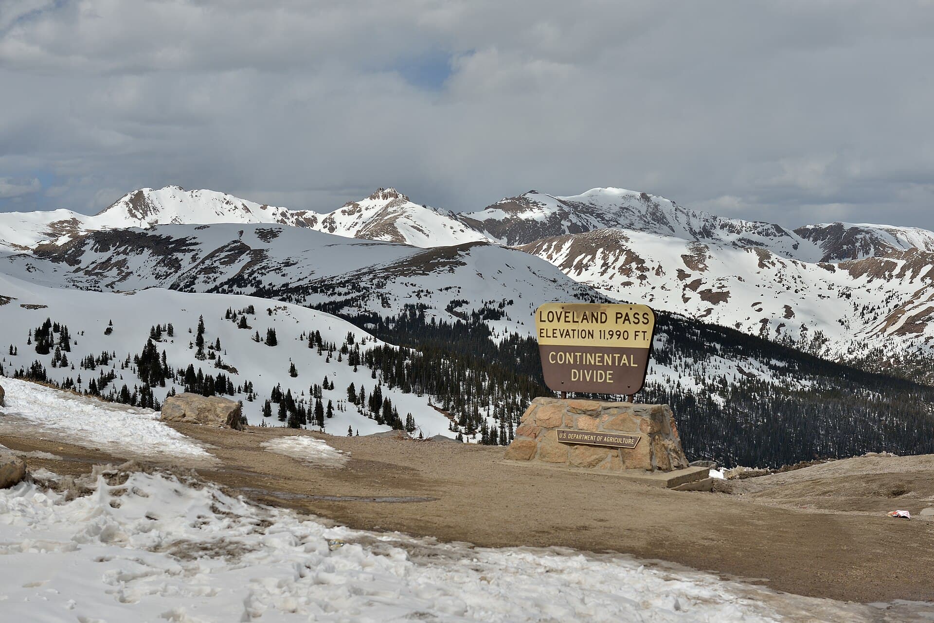
The Continental Divide is the ridgeline that decides where rain and snowmelt end up. Water that lands on the east side drains toward the Atlantic; water on the west side drains toward the Pacific. In Colorado, that line runs roughly north to south for about 750 miles, riding the crest of the highest mountains in the state. It's the reason the Colorado River starts here, and it's close enough to reach that you can drive over it in an afternoon or stand on it after a short hike.
Most people picture the divide as a single trail or a sign at a mountain pass. It's really a continuous high boundary that weaves through Rocky Mountain National Park, over famous passes like Loveland and Independence, across a couple of the state's tallest fourteeners, and down into the San Juans near the New Mexico border. Here's where it goes, how to get to it, and the best spots to stand with one foot draining to each ocean.
What You'll Learn
- What Is the Continental Divide?
- Where Does the Continental Divide Run Through Colorado?
- Which Way Does the Water Flow?
- The Highest Point on the Continental Divide
- Mountain Passes You Can Drive Across the Divide
- The Continental Divide Trail in Colorado
- Best Day Hikes to Stand on the Divide
- What to Pack
- Weather and Altitude on the Divide
- Frequently Asked Questions
What Is the Continental Divide?
The Continental Divide of the Americas is the drainage split that runs the length of North and South America. In the United States it follows the spine of the Rocky Mountains from the Canadian border down to Mexico. On one side, every creek, river, and drop of snowmelt heads toward the Pacific Ocean. On the other side, it heads toward the Atlantic by way of the Gulf of Mexico.
Colorado holds the highest stretch of the entire divide. Because the state sits at the top of the Rockies, the line here rarely drops below 10,000 feet and often runs well above treeline. That high ground is what makes Colorado a headwaters state: rivers that feed a big chunk of the American West, including the Colorado River, begin as snow piled up along this ridge.
The divide isn't a wall or a fence. It's a topographic boundary you'd only notice if you watched which way a raindrop rolled. Stand on it in the right spot and rain falling a few feet to your left could reach San Diego while rain to your right heads for the Mississippi.
Where Does the Continental Divide Run Through Colorado?
The divide enters Colorado from Wyoming in the north and exits into New Mexico in the south. Tracing it from top to bottom, it passes through some names you'll recognize:
- Rocky Mountain National Park, where Trail Ridge Road crosses the divide at Milner Pass near Poudre Lake
- Berthoud Pass on US 40, above Winter Park
- Loveland Pass on US 6, between Georgetown and the ski areas
- Grays and Torreys Peaks, the two fourteeners the divide climbs right over
- Fremont Pass and Tennessee Pass near Leadville and Copper Mountain
- Independence Pass on Colorado 82, between Twin Lakes and Aspen
- Monarch Pass on US 50, west of Salida
- The San Juan Mountains and Wolf Creek Pass on US 160 in the south
From there it slips into New Mexico. Along the way it separates the eastern plains rivers from the western slope, and it forms the backbone that most of Colorado's tallest peaks hang off of.
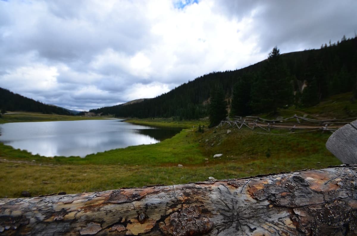
If you want to see the divide inside a national park, Rocky Mountain National Park is the easiest introduction. Trail Ridge Road tops out above 12,000 feet and crosses the actual divide at Milner Pass, where a sign marks the split and short trails lead off into the tundra.
Which Way Does the Water Flow?
This is the part that makes the divide worth caring about. On the east side of the line, water flows into the South Platte, the Arkansas, and the Rio Grande, all of which eventually reach the Atlantic Ocean through the Gulf of Mexico. On the west side, water collects into the Colorado River system and heads for the Pacific.
That split has real consequences. Cities on the Front Range, including Denver, pull a lot of their water from the western slope through tunnels bored under the divide, because most of the snow piles up on the Pacific side. The mountains you're hiking are, in a real sense, the water tower for a large part of the Southwest.
For hikers, the practical version is simpler. When you reach a divide sign at a pass or a summit, you're standing on the exact hinge point. Pour out your water bottle and half of it is theoretically headed for two different oceans.
The Highest Point on the Continental Divide
The single highest point on the Continental Divide anywhere in North America sits in Colorado. That's Grays Peak, at 14,275 feet, just west of Denver near the I-70 corridor. Its twin, Torreys Peak, stands right next to it at 14,267 feet, and the divide runs across both summits.
That makes Grays a popular target for two reasons. It's a fairly straightforward fourteener with a good trail, and it lets you say you climbed the highest bump on the entire divide. The Continental Divide Trail routes right over the top, so through-hikers walking from Mexico to Canada pass across the same summit day hikers reach on a Saturday morning.
If a summit like this is on your list, our Grays Peak complete guide covers the standard route, the trailhead, and how to pair it with Torreys in one day. It's a solid pick for anyone building toward the rest of the state's 14ers.
Mountain Passes You Can Drive Across the Divide
You don't have to hike to cross the divide. Several paved highways climb right over it, and each pass usually has a sign and a pullout where you can stop for a photo. From north to south, the drivable crossings include:
- Milner Pass (10,758 ft) on Trail Ridge Road in Rocky Mountain National Park
- Berthoud Pass (11,307 ft) on US 40, a common backcountry ski spot in winter
- Loveland Pass (11,990 ft) on US 6, one of the highest paved through-roads in the country
- Fremont Pass (11,318 ft) on Colorado 91 near Copper Mountain
- Tennessee Pass (10,424 ft) on US 24 near Leadville
- Independence Pass (12,095 ft) on Colorado 82, closed in winter
- Monarch Pass (11,312 ft) on US 50 west of Salida
- Wolf Creek Pass (10,857 ft) on US 160 in the San Juans
Loveland Pass is the crossing most Front Range drivers know, partly because the Eisenhower Tunnel on I-70 bores straight through the divide a few miles away. Trucks carrying hazardous loads still have to take the pass over the top instead of the tunnel. The pullout at the summit sits at nearly 12,000 feet, and short ridge walks head off in both directions if you want to add a little hiking to the drive.
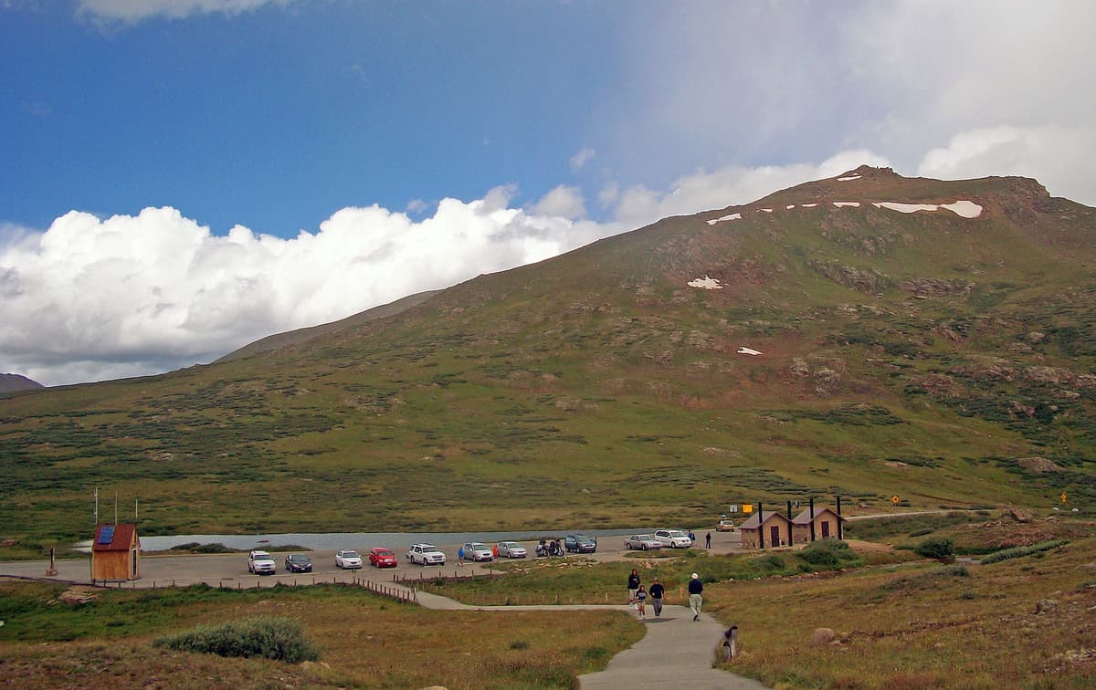
Independence Pass is the high drama option. At 12,095 feet, it's the highest paved crossing of the divide in the state, and the road is narrow, winding, and closed from roughly November into late May. Time your drive for a clear summer morning and you get tundra, old mining history, and long views in both directions.
The Continental Divide Trail in Colorado
The Continental Divide Trail, or CDT, is one of the country's three long national scenic trails, running about 3,100 miles from Mexico to Canada. Colorado holds roughly 750 miles of it, and many hikers consider the Colorado section the most scenic and the most demanding, because so much of it stays above treeline.
You don't need a through-hiker's schedule to enjoy it. The CDT is broken into segments that make good day hikes and weekend backpacking trips. Some of the best stretches run through the San Juan Mountains in the south, where the trail holds high alpine terrain for miles at a time. Others cross ground you can reach in under an hour from Denver.
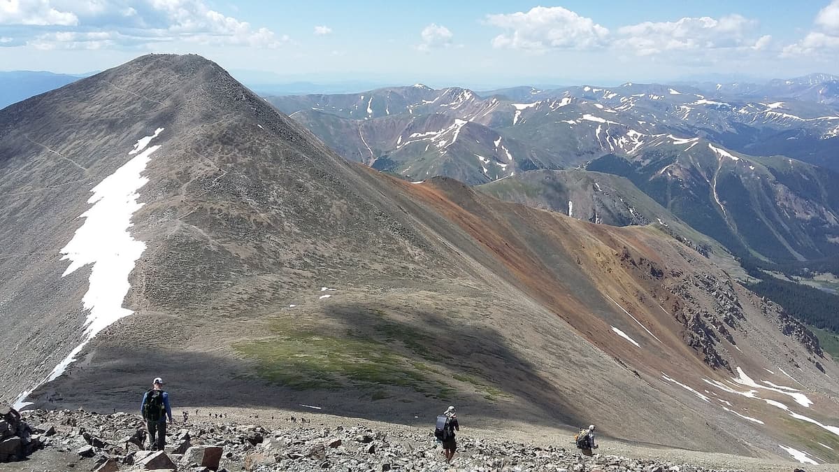
You don't need a permit to hike the CDT in Colorado, but the usual backcountry rules apply. Camp on durable ground, pack out everything, and treat your water. If you're heading up for a day, plan to be off the high ridges by early afternoon, which brings us to the two things the divide will test the most: your gear and your lungs.
Best Day Hikes to Stand on the Divide
You can reach the Continental Divide on foot without a big expedition. A few reliable options:
- Grays and Torreys Peaks. The classic. You cross the divide on the summit ridge and bag the highest point on it anywhere in North America.
- Berthoud Pass to Colorado Mines Peak. Start at the pass, which already sits on the divide, and follow the CDT route up to about 12,500 feet for big views without a long day.
- Loveland Pass ridge walk. Park at the summit pullout and walk the ridge in either direction. You gain altitude fast, so go slow.
- Mount Ida from Milner Pass. In Rocky Mountain National Park, this trail follows the divide itself through open tundra to a high overlook.
- Herman Gulch to Herman Lake. The lake sits in a basin right below the divide off I-70, and it's one of the better wildflower hikes near the interstate. Our Herman Gulch trail guide has the details.
Any of these puts you on or beside the divide within a few hours. If you're newer to hiking at altitude, start with a pass walk or Herman Gulch before committing to a fourteener.
What to Pack
The divide is high, exposed, and open to weather that changes fast. Even on a warm July morning, the wind at 12,000 feet can feel 20 degrees colder than the trailhead. A few things earn their spot in the pack:
- A wind and rain shell, because storms build quickly above treeline
- An insulating layer for wind on exposed ridges
- Sun protection: a brimmed hat and high SPF sunscreen, since UV is stronger up high
- A downloaded GPS map or navigation app, because trail junctions on the CDT can be subtle
- At least two liters of water and a way to treat more from streams
For a fuller rundown of layering for exposed Colorado terrain, see our guide on what to wear hiking. A good shell matters most; if you only upgrade one thing, make it your rain jacket.
Weather and Altitude on the Divide
Two things sink more divide hikes than difficulty: afternoon thunderstorms and altitude. From about mid-June through August, Colorado's high country builds storms almost daily, usually in the early afternoon. Lightning above treeline is a real danger, so the standard rule is to summit by noon and be heading down before the clouds pile up.
Altitude is the other factor. The divide sits high enough that shortness of breath, headaches, and nausea are common if you drive up from lower elevation and start hiking the same day. Give yourself a night at altitude if you can, drink more water than feels necessary, and turn around if symptoms get worse. Our guide to altitude sickness in Colorado covers the warning signs and how to prevent them.
If you're planning a cold-season trip, several divide passes stay open and become backcountry ski terrain, but the avalanche and exposure risk climbs sharply. Read up on winter hiking in Colorado before you head up in the snow.
Frequently Asked Questions
What is the Continental Divide in simple terms?
It's the ridgeline that splits which ocean water flows toward. Rain and snowmelt on the east side drain toward the Atlantic through the Gulf of Mexico, and water on the west side drains toward the Pacific. In the U.S. it follows the crest of the Rocky Mountains.
Where is the Continental Divide in Colorado?
It runs north to south through the center of the state for about 750 miles. It crosses Rocky Mountain National Park at Milner Pass, continues over Berthoud and Loveland Passes, climbs Grays and Torreys Peaks, and heads through the San Juan Mountains toward New Mexico.
Can you drive across the Continental Divide in Colorado?
Yes. Paved highways cross it at several passes, including Loveland Pass, Berthoud Pass, Independence Pass, Monarch Pass, and Wolf Creek Pass. Trail Ridge Road also crosses it at Milner Pass inside Rocky Mountain National Park. Most crossings have a sign and a pullout.
What is the highest point on the Continental Divide?
Grays Peak, at 14,275 feet in Colorado, is the highest point on the Continental Divide anywhere in North America. The divide runs directly over its summit and its neighbor, Torreys Peak, at 14,267 feet.
How long is the Continental Divide Trail in Colorado?
The full Continental Divide Trail runs about 3,100 miles from Mexico to Canada. Roughly 750 of those miles are in Colorado, much of it above treeline, which makes the Colorado section one of the highest and most scenic stretches of the whole trail.
Standing on the Line
The Continental Divide is one of the few landmarks you can reach a dozen different ways, from a paved pullout at a mountain pass to a fourteener summit to a week on the CDT. Pick the effort that fits your day. If you're ready to stand on the highest point of the whole divide, start with our Grays Peak complete guide and pick a clear morning to go.
Get the Colorado 14er Packing Checklist (free PDF)
Plus a weekly note on the best Colorado trails, gear deals, and seasonal hike picks. No spam, unsubscribe anytime.
We respect your inbox. Unsubscribe anytime.


