10 Best Hikes Near Boulder, Colorado (2026 Trail Guide)
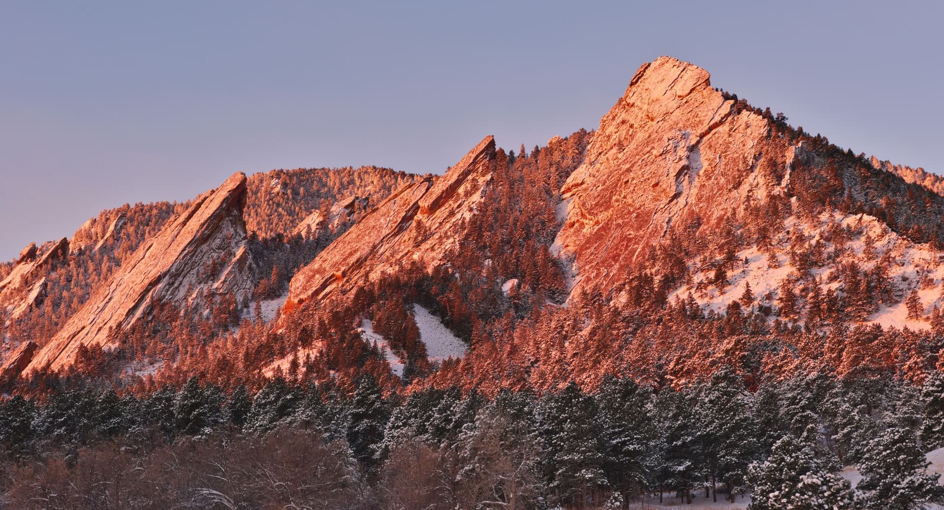
Boulder might have the best in-town hiking of any city in the country. The Flatirons rise straight out of the western edge of town, and the city's Open Space and Mountain Parks system protects more than 45,000 acres laced with over 150 miles of trail. You can summit a peak before work, scramble to a natural stone arch, or walk a rolling foothills traverse, all within ten minutes of downtown. The trade-off is crowds and limited parking at the marquee trailheads, so timing matters. Here are the 10 best hikes near Boulder, what to expect on each, and how to actually pull them off.
What You'll Learn
- Royal Arch Trail
- Mount Sanitas Loop
- First and Second Flatiron Trail
- Bear Peak via Fern Canyon
- Green Mountain via Gregory Canyon
- Mesa Trail
- Walker Ranch Loop
- Betasso Preserve Canyon Loop
- Rattlesnake Gulch Trail
- Red Rocks Trail and Settlers Park
- What to Bring on Boulder Hikes
- Frequently Asked Questions
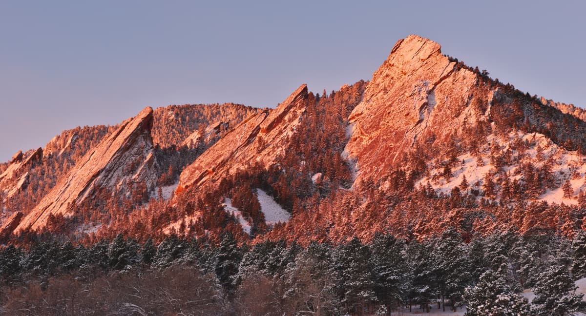
Royal Arch Trail
Distance: 3.4 miles round trip | Elevation Gain: 1,400 ft | Difficulty: Hard
If you do one hike in Boulder, make it Royal Arch. The trail climbs out of Chautauqua Park, tucks behind the First and Second Flatirons, and finishes at a 20-foot sandstone arch that frames the city and the plains below. It's short, but don't let the mileage fool you. The last half mile gains elevation in a hurry, with rocky steps and a steep pitch up to Sentinel Pass before the final drop down to the arch.
Start at the Chautauqua trailhead. Parking here fills before 8 AM on summer weekends, and from late May through early September the city runs the free Park-to-Park shuttle from the bus station downtown. Take it if you can. The trail is well signed, but the footing gets technical, so a pair of trail shoes with real grip makes the descent a lot kinder on your knees.
Mount Sanitas Loop
Distance: 3.3 miles round trip | Elevation Gain: 1,250 ft | Difficulty: Moderate-Hard
Mount Sanitas is Boulder's fitness-test hike, the one locals use to gauge how out of shape the winter left them. The classic loop climbs the rocky east ridge to the 6,843-foot summit, then drops down the Sanitas Valley Trail for an easy return. Going up the ridge first is the right call. It's a relentless staircase of stone and root, but the views of the city open up the whole way.
The summit is a jumble of tilted sandstone slabs that make a perfect lunch perch. From up top you can see the Continental Divide to the west and the high plains stretching east. The trailhead sits just past Mapleton Avenue on the west edge of town, with a small free lot that fills fast. Bring more water than you think you need, since the ridge is exposed and bakes in the afternoon sun.
First and Second Flatiron Trail
Distance: 2.6 miles round trip | Elevation Gain: 1,500 ft | Difficulty: Moderate-Hard
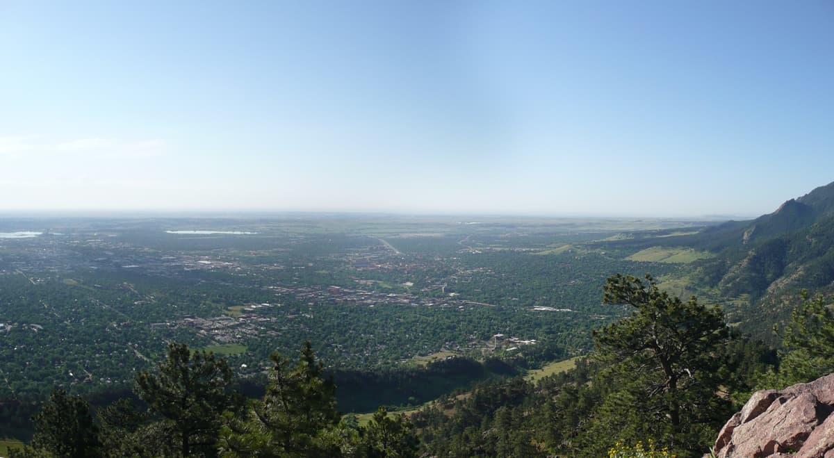
This is the hike that puts you right up against the iconic slabs. The trail leaves Chautauqua, climbs through ponderosa pine, and switchbacks up into the saddle between the First and Second Flatirons. You're not climbing the rock faces themselves, those are technical routes for climbers with ropes, but the hiking trail gets you close enough to crane your neck at the climbers above you.
The grade is steep and steady, and the upper section has loose dirt and rock that demands attention on the way down. Most hikers turn around at the high point of the maintained trail, where a short scramble to a flat rock gives you a clean view back over Boulder. It pairs well with Royal Arch if you want a bigger day, since both share the lower Chautauqua trail network. New to hiking at this elevation? Read our Colorado hiking beginners guide before you go.
Bear Peak via Fern Canyon
Distance: 8.5 miles round trip | Elevation Gain: 2,900 ft | Difficulty: Hard
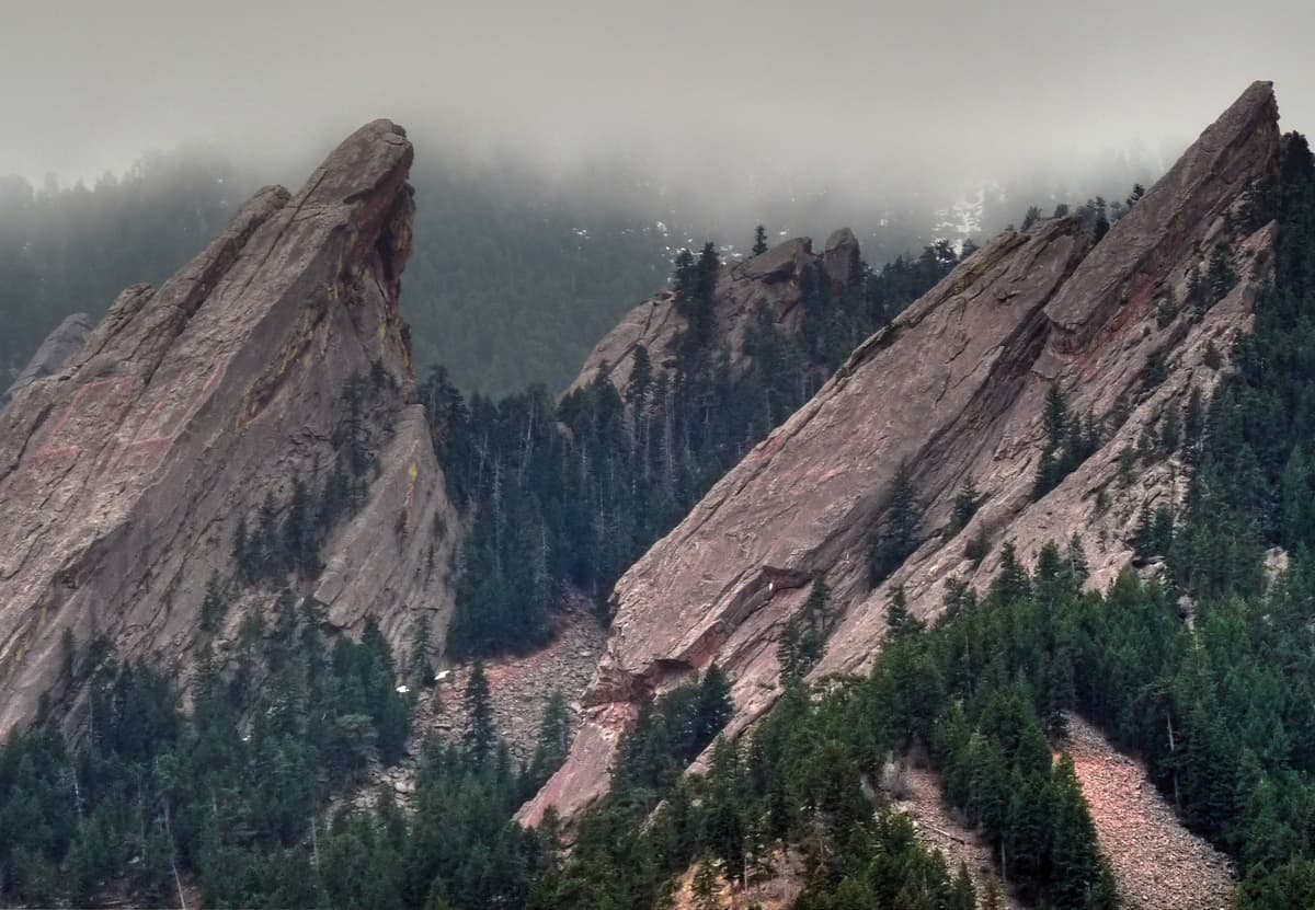
Bear Peak is the big one. At 8,461 feet, it's one of the highest summits in Boulder's foothills, and the Fern Canyon approach is the most direct and most brutal way up. The route climbs the Mesa Trail to the mouth of Fern Canyon, then grinds straight up a steep, rocky drainage to the summit ridge. The final scramble to the true summit involves using your hands.
This is a serious half-day hike with real exposure near the top, so save it for a clear morning and turn back if storms build. The payoff is a 360-degree view that takes in Longs Peak, the Indian Peaks, and the entire Front Range urban corridor. Many hikers link Bear Peak with neighboring South Boulder Peak for a longer loop. Either way, pack plenty of food and a way to treat water, since there's nothing reliable on the route. A set of trekking poles earns its keep on the steep, loose descent.
Green Mountain via Gregory Canyon
Distance: 5.5 miles round trip | Elevation Gain: 2,400 ft | Difficulty: Hard
Green Mountain sits between Bear Peak and the Flatirons, and the Gregory Canyon loop is the most scenic way to tag its 8,144-foot summit. The standard route climbs the Gregory Canyon Trail, connects to the Ranger Trail through shady forest, and finishes with a short rocky scramble to the top. Coming down the Saddle Rock and Amphitheater trails closes a satisfying loop.
There's a stone summit marker at the top with a metal pointer that names every peak on the Continental Divide horizon. Take a minute to find Longs Peak and Mount Audubon. The Gregory Canyon trailhead charges a $5 daily fee for vehicles not registered in Boulder County, and the small lot fills early. Parking at Chautauqua and walking over is a common workaround. If you're chasing more high country after this, our guide to the Indian Peaks Wilderness covers the alpine terrain just to the west.
Mesa Trail
Distance: 6.7 miles one way | Elevation Gain: 1,200 ft | Difficulty: Moderate
The Mesa Trail is the spine that connects almost every hike on Boulder's south side. It runs from Chautauqua south to Eldorado Springs, rolling along the base of the Flatirons through meadow, forest, and open foothills. You can hike it end to end as a point-to-point with a car shuttle, or use it to access dozens of side trails like Fern Canyon, Shadow Canyon, and Bear Canyon.
Because it stays low and never tackles a summit, the Mesa Trail is the rare Boulder hike that families and trail runners both love. The grades are gentle, the footing is mostly smooth, and you get nonstop views of the slabs above. It also stays clear earlier in spring and later in fall than the high peaks, making it a reliable shoulder-season pick. Bring a comfortable daypack with water and snacks, since the full traverse takes most people three to four hours.
Walker Ranch Loop
Distance: 7.6 miles round trip | Elevation Gain: 1,500 ft | Difficulty: Moderate-Hard
Walker Ranch is a change of scenery from the Flatirons crowds. This loop sits up Flagstaff Road southwest of town in cooler, higher pine and aspen forest, and it drops down to South Boulder Creek before climbing back out. There's a steep rock staircase section near the creek that you'll either hike up or down depending on your direction. Going clockwise puts that climb in the middle of the loop.
Mountain bikers share this trail, so stay alert on the descents and step aside on blind corners. The creek crossing is a great lunch spot, especially in early summer when the water is running high with snowmelt. At over 7,000 feet, Walker Ranch stays comfortable on hot July days when the lower foothills are sweltering. The trailhead parking lots off Flagstaff Road and Gross Dam Road are free and rarely full.
Betasso Preserve Canyon Loop
Distance: 3.3 miles round trip | Elevation Gain: 700 ft | Difficulty: Moderate
Betasso Preserve is a quiet Boulder County open space tucked up Boulder Canyon, and the Canyon Loop trail is a mellow option when the Flatirons feel like a parade. The trail winds through ponderosa pine and meadow with peekaboo views down into the canyon. It's the kind of place where you'll see more deer and wild turkeys than people on a weekday morning.
Note that the Canyon Loop is open to mountain bikes most days but closes to bikes on Wednesdays and Saturdays, which makes those the best days for a peaceful hike. The preserve sits at around 6,500 feet, so it stays a touch cooler than town. The drive up Boulder Canyon is short and scenic. This is a solid choice if you want a real foothills hike without the steep grind, and it works well for older kids and dogs.
Rattlesnake Gulch Trail
Distance: 3.6 miles round trip | Elevation Gain: 900 ft | Difficulty: Moderate
Just south of Boulder in Eldorado Canyon State Park, the Rattlesnake Gulch Trail climbs to the ruins of the old Crags Hotel, a luxury resort that burned down in 1913. The trail switchbacks up through the canyon with constant views of the sandstone walls where rock climbers cling to the cliffs. Above the hotel ruins, a continuing loop reaches an overlook of the Continental Divide and the railroad trestle that arcs across the canyon.
This one requires a state parks pass or day-use fee, and Eldorado Canyon's entrance reservation system fills up on summer weekends, so book ahead online. The canyon is one of the most beautiful spots in the whole Front Range. For the full rundown on the park, including the climbing scene and the swimming hole, see our guide to Eldorado Canyon State Park.
Red Rocks Trail and Settlers Park
Distance: 1.0 miles round trip | Elevation Gain: 250 ft | Difficulty: Easy
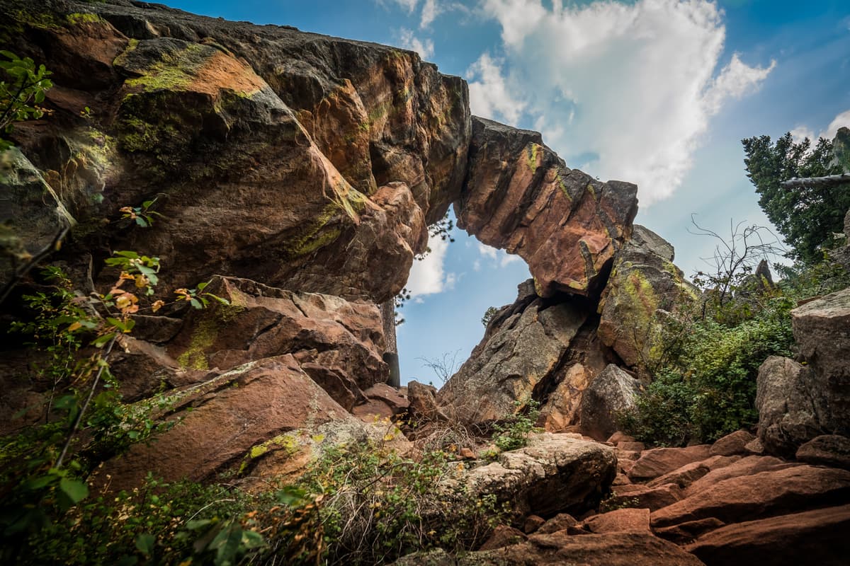
When you want a quick hit of red rock and a view without a big commitment, Settlers Park delivers. This short loop starts at the mouth of Boulder Canyon, climbs a few minutes up to a cluster of tilted red sandstone fins, and gives you a clean overlook of downtown Boulder and the foothills. It's a favorite for sunset, and it's gentle enough for young kids and casual visitors.
The trail connects to the larger Red Rocks and Mount Sanitas networks if you want to extend the day, but on its own it's a perfect leg-stretcher after a long drive into town. Parking is at the small Settlers Park lot at the west end of Pearl Street, and it's free. Bring a hat and sun protection, because the red rocks reflect a surprising amount of heat on a bright afternoon.
What to Bring on Boulder Hikes
Boulder's trailheads start around 5,400 feet and the high summits push past 8,400 feet, so the air is thinner than most visitors expect. If you're coming from sea level, take it slow your first day or two and drink more water than feels normal. Our piece on altitude sickness prevention covers the warning signs worth knowing.
Afternoon thunderstorms are a near-daily event from June through August, and the exposed ridges of Mount Sanitas, Bear Peak, and Green Mountain are dangerous places to be when lightning rolls in. Start early, aim to be off the high points by noon, and always pack a rain layer. A liter or two of water per person, sun protection, snacks, and sturdy footwear cover most day hikes here. If your dog is coming along, know that Boulder's Open Space requires either a leash or a Voice and Sight tag, which you register through the city, on most trails.
Frequently Asked Questions
What is the most popular hike in Boulder?
The Royal Arch Trail from Chautauqua Park is the most popular hike in Boulder. It's a 3.4-mile round trip that climbs behind the Flatirons to a natural sandstone arch overlooking the city. The First and Second Flatiron trail and Mount Sanitas loop are close runners-up.
Do you need a permit to hike near Boulder?
Most Boulder Open Space and Mountain Parks trails are free and require no permit. The Gregory Canyon trailhead charges a $5 daily parking fee for out-of-county vehicles, and Eldorado Canyon State Park requires a pass plus a timed entry reservation on busy days. Everything else is open access.
What is the hardest hike in Boulder?
Bear Peak via Fern Canyon is widely considered the hardest standard hike in Boulder. It gains roughly 2,900 feet over 8.5 miles round trip, with a steep rocky drainage and a hands-on scramble to the 8,461-foot summit. Linking it with South Boulder Peak makes it tougher still.
Where can I hike in Boulder with my dog?
Most Boulder Open Space trails allow dogs, but you must use a leash or register your dog in the city's Voice and Sight tag program. Mount Sanitas, the Mesa Trail, and Betasso Preserve are popular dog-friendly options. Eldorado Canyon State Park requires dogs to be leashed at all times.
When is the best time to hike near Boulder?
The lower foothills trails like the Mesa Trail and Settlers Park are hikeable year-round. The high summits are best from late May through October once the snow clears. September offers the most stable weather, with cool mornings, dry afternoons, and fewer crowds than midsummer.
Final Thoughts
Few cities let you walk from a coffee shop to a mountain summit, but Boulder does. Whether you've got an hour for the Settlers Park loop or a full morning for Bear Peak, the trails here reward early starts and a little planning around parking and weather. Grab a shuttle to Chautauqua, get on the trail before the lot fills, and you'll understand why locals never want to leave.
For more Front Range trail ideas, check out our guides to the best day hikes near Denver and the best hikes near Fort Collins.
Get the Colorado 14er Packing Checklist (free PDF)
Plus a weekly note on the best Colorado trails, gear deals, and seasonal hike picks. No spam, unsubscribe anytime.
We respect your inbox. Unsubscribe anytime.