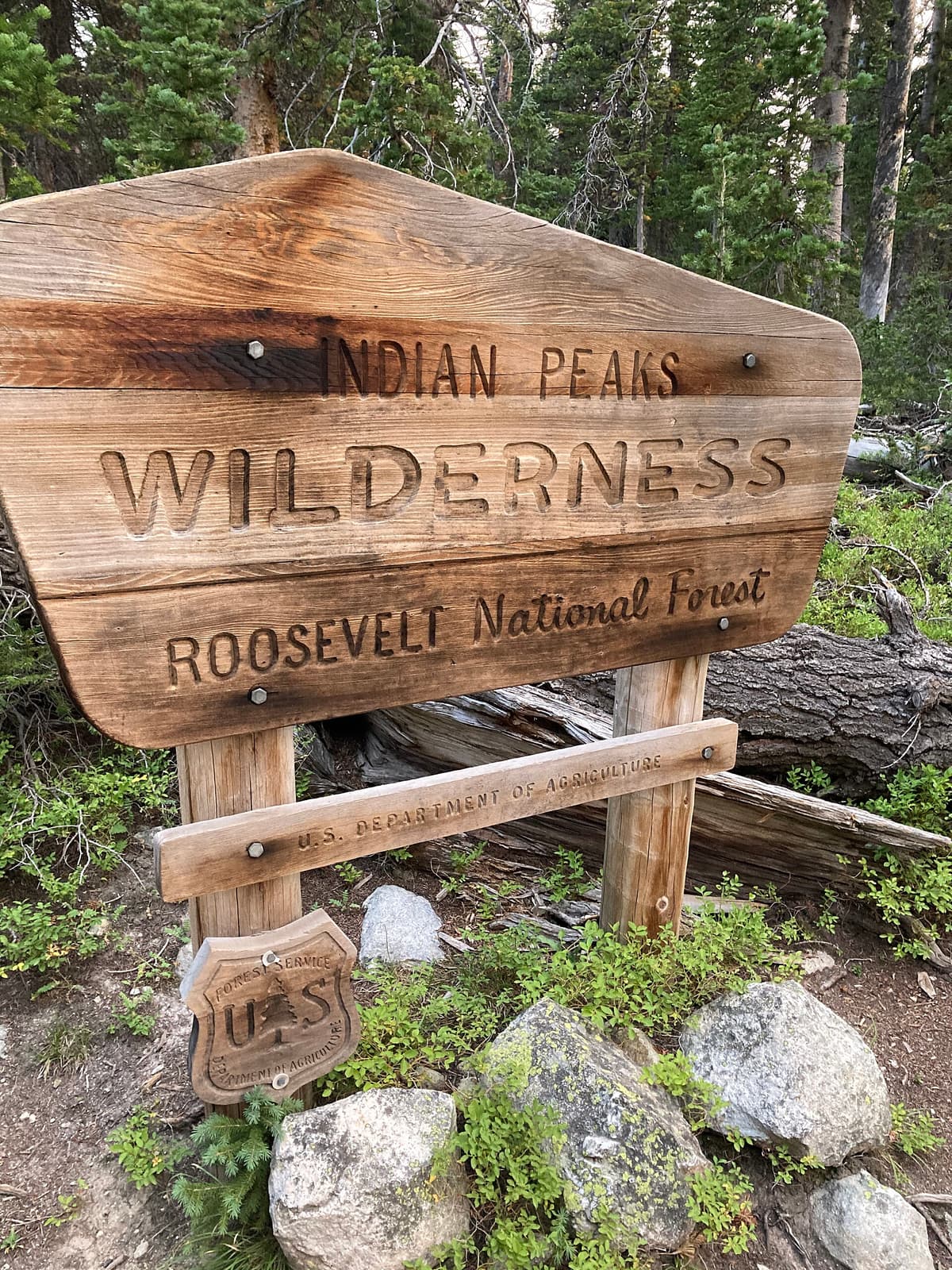
Fourth of July Trailhead: A Guide to Colorado's Indian Peaks Gateway
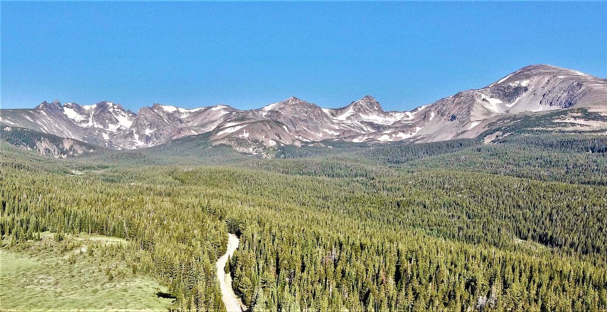
The Fourth of July Trailhead sits at about 10,150 feet on the eastern edge of the Indian Peaks Wilderness, and it's one of the best single starting points for hiking in all of Colorado. From this one dirt parking lot you can reach a Continental Divide pass, the highest lake in the wilderness, a famous wildflower basin, and a 13,000-foot summit. It's roughly an hour and a half from Denver and about 45 minutes past Nederland, up a rough mountain road that scares off some of the crowds.
If you want alpine scenery without driving to the far corners of the state, this is your spot. Here's how to get there, what it costs, and which hikes are worth your legs.
What You'll Learn
- Fourth of July Trailhead Quick Facts
- How to Get to the Fourth of July Trailhead
- Do You Need a Permit or Pay a Fee?
- The 5 Best Hikes from the Fourth of July Trailhead
- When Are the Wildflowers Best?
- What to Bring
- Hiking with Dogs
- Frequently Asked Questions
Fourth of July Trailhead Quick Facts
Here's the short version before you start planning:
- Location: Indian Peaks Wilderness, west of Eldora and Nederland, Boulder County
- Trailhead elevation: ~10,150 feet
- Managed by: Roosevelt National Forest, Boulder Ranger District
- Access road: ~5 miles of rough dirt past the town of Eldora
- Fee: None to park or day hike
- Permit: Required only for overnight backcountry camping (May through October)
- Dogs: Allowed on leash
- Facilities: A vault toilet at the trailhead, no water
- Best season: Mid-July through September
The parking lot is small, and it fills up fast. On a summer Saturday it's often full by 7:30 or 8 AM. Weekday mornings are much calmer, and they're your best shot at a spot near the trail.
How to Get to the Fourth of July Trailhead
The drive is half the adventure here, and it deserves a heads-up.
From Nederland, head south on Highway 119 for about half a mile, then turn west onto County Road 130 toward the Eldora area. Follow it past the turnoff for the ski resort and into the small town of Eldora. This is a residential mountain town, so drive slow and watch for kids and dogs. Once you pass the last houses, the pavement ends and the real road begins.
From there it's roughly 5 miles of dirt up Fourth of July Road to the trailhead. The road is rocky, narrow in spots, and washboarded in others. It climbs steadily, and the last mile or two is the roughest part.
A few things to know about the drive:
- A high-clearance vehicle is the safe choice. SUVs, trucks, and crossovers handle it fine in dry conditions.
- A regular car can make it slowly in summer, but you'll be picking your line around rocks and ruts. Go carefully and give yourself extra time.
- Avoid it after heavy rain or before mid-June. Snow lingers up top, and mud makes the ruts worse.
- It's a two-way road that feels like one lane in places. Use the pullouts and be ready to back up.
Plan on 30 to 45 minutes just for those 5 dirt miles. If you're nervous about your car, parking lower and hiking the road adds distance but saves your suspension. For more general advice on finding and using Colorado trailheads, our guide to Colorado trailhead parking covers the etiquette and the permit systems you'll run into.
Do You Need a Permit or Pay a Fee?
Good news for day hikers: there's no fee to park at the Fourth of July Trailhead and no permit needed to hike for the day. You just show up, find a spot, and go.
Overnight is different. The Indian Peaks Wilderness requires a backcountry permit for camping between May 1 and October 31, and popular zones fill up. If you're planning to backpack in and camp near Diamond Lake or the Arapaho Pass area, reserve a permit through the Forest Service ahead of time. Dispersed camping rules are strict here to protect the fragile alpine terrain, so read the zone requirements before you go.
Because this is designated wilderness, a few rules apply everywhere past the trailhead sign: no bikes, no motorized equipment, no drones, and dogs on leash. Groups are capped at 12 people and pack animals combined.
The 5 Best Hikes from the Fourth of July Trailhead
Almost everything starts on the Arapaho Pass Trail, which leaves the west end of the lot and climbs through spruce and fir before breaking into open basins. Here are the five trips worth building a day around, from easiest to hardest.
1. Fourth of July Mine (~4 miles round trip)
The old Fourth of July Mine site sits about 2 miles up the Arapaho Pass Trail at roughly 11,250 feet. It's a steady but reasonable climb, and it makes a great turnaround for hikers who want big views without a full summit day. You'll pass rusting mining relics and get wide-open looks at the surrounding peaks. This is the most family-friendly option from the trailhead.
2. Diamond Lake (~5 miles round trip)
Diamond Lake is the wildflower showstopper. About 1.2 miles up the Arapaho Pass Trail, a signed junction sends you left and down toward the lake, crossing a creek and dropping into a basin that fills with color in mid-summer. The lake sits around 10,900 feet with peaks reflected on calm mornings. It's one of the better wildflower hikes on the Front Range, and the moderate distance makes it doable for most fit hikers.
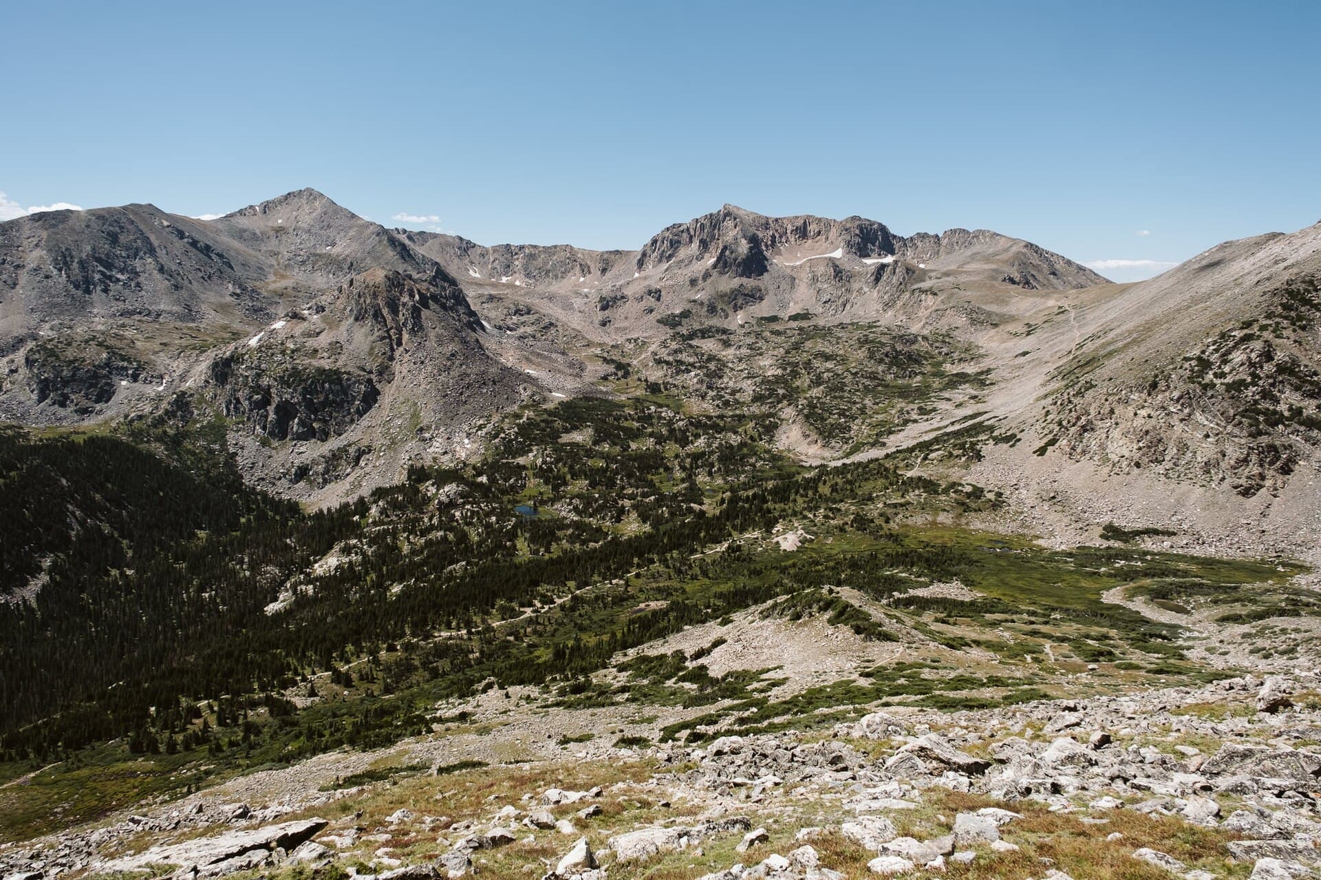
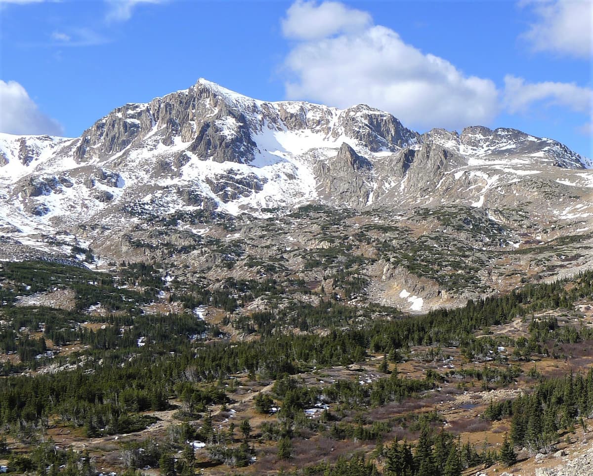
3. Arapaho Pass and Lake Dorothy (~7 miles round trip)
Stay on the main trail and you'll top out at Arapaho Pass around 11,900 feet, standing on the Continental Divide with views west into the wilderness. From the pass, a short spur climbs to Lake Dorothy, which sits at about 12,061 feet and holds the title of highest named lake in the Indian Peaks. Snow often rings the shore into July. This is a full alpine day, and the payoff is huge.
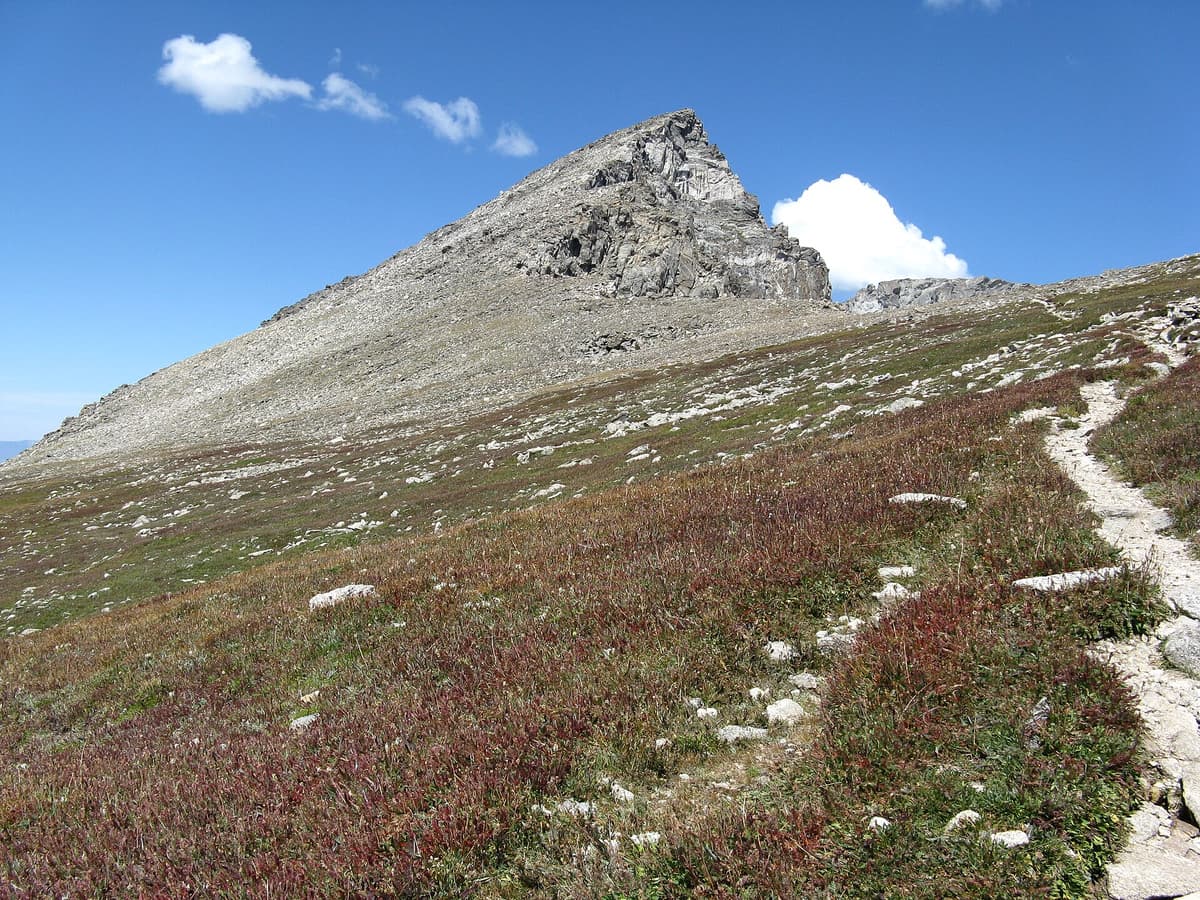
4. South Arapaho Peak (~8 miles round trip)
For a summit, South Arapaho Peak tops out at 13,397 feet. You'll branch off toward the Arapaho Glacier Trail and climb a rocky Class 2 route to the top, gaining close to 2,800 feet along the way. The views from the summit stretch across the glacier and deep into the divide. Strong hikers sometimes eye the traverse over to North Arapaho Peak, but that ridge is a serious Class 4 scramble with real exposure and fatal-fall potential. Don't wander onto it casually. If you're new to high peaks, read up on altitude sickness before you commit to a 13er.
5. Mount Neva (~8 miles round trip)
Mount Neva rises to 12,814 feet just south of Arapaho Pass and gives experienced hikers a quieter summit than its neighbors. The standard approach goes over the pass, then follows the divide toward the peak on Class 2 and 3 terrain. Route-finding matters here, and it's best saved for people comfortable off well-worn trails.
Want more options in the same range? Our roundup of the best hikes in the Indian Peaks Wilderness covers trailheads on both sides of the divide.
When Are the Wildflowers Best?
The Fourth of July area is one of Colorado's premier wildflower destinations, and timing is everything. Peak bloom in the Diamond Lake basin usually lands in mid-to-late July, though a heavy snow year can push it into early August.
Here's how the seasons play out:
Summer (July through early September) is prime time. By mid-July the road is clear, the trails are mostly snow-free, and columbine, paintbrush, and dozens of other species fill the meadows. Just watch the sky. Afternoon thunderstorms build fast above treeline, so start early and aim to be heading down by noon.
Fall (mid-September through October) brings cooler air, thinner crowds, and golden willows in the basins. Snow can arrive any time, and the access road gets dicey once it does.
Late spring and early summer (May through June) is a gamble. The upper road and passes hold snow well into June most years, and the higher lakes stay frozen. If you go early, expect to turn around at snow.
Winter effectively closes the road to normal vehicles, though skiers and snowshoers do reach the area from lower down. For most people, plan around the summer window. If you're chasing peak color across the state, our list of summer hikes in Colorado points to more high-country blooms.
What to Bring
You're starting above 10,000 feet and climbing from there, so pack like the weather can turn on you, because it can.
Water and a way to treat more. Bring at least 2 liters per person. Creeks and lakes are common up here, so a water filter lets you refill on longer days without hauling everything from the car.
Layers, including rain protection. Mornings can start near freezing even in July, and afternoon storms bring wind, rain, and hail. A packable rain jacket is non-negotiable no matter how blue the sky looks at the trailhead.
Sun protection. The UV is intense at this elevation. Sunscreen, sunglasses, and a sun hat will save you from a rough afternoon.
Trekking poles. The rocky descents from the pass and the peaks are hard on knees. A pair of trekking poles helps a lot, and our guide to the best trekking poles for Colorado breaks down the options.
The rest of the basics. Downloaded maps, a headlamp, a first aid kit, snacks, and extra food round out a smart day pack. Cell service is spotty to nonexistent past Nederland, so don't count on your phone to find the way.
Hiking with Dogs
Dogs are welcome at the Fourth of July Trailhead and throughout the Indian Peaks Wilderness, but they have to stay on leash the entire time. Rangers do enforce it, and the rule protects wildlife, other hikers, and your dog from a bad encounter with a moose or a marmot burrow.
A few things to keep in mind:
- Your dog feels the altitude too. Watch for heavy panting and fatigue, especially above the pass, and turn around if they're struggling.
- Bring water for them. There's plenty of creek access on most routes, but not everywhere.
- Rocky summit terrain is tough on paws. For South Arapaho Peak or Mount Neva, consider booties or skip the top.
- Pack out waste. Bags in, bags out. It doesn't belong in the alpine.
Make a Day (or Weekend) of It
Nederland is your last stop for coffee, food, and a bathroom before the dirt road, so fuel up there on the way in. After a big day, the town's breweries and cafes make an easy post-hike stop.
If you're building a bigger trip, the Front Range foothills nearby are loaded with options. Our guides to the best hikes near Boulder and the best day hikes near Denver cover shorter trails for rest days. And if you're trying to decide where to spend a multi-day trip, this comparison of Rocky Mountain National Park versus the Indian Peaks Wilderness will help you pick.
Frequently Asked Questions
How rough is the road to the Fourth of July Trailhead?
It's about 5 miles of rocky, washboarded dirt past the town of Eldora, climbing steadily to 10,150 feet. A high-clearance vehicle handles it comfortably. A regular car can make it slowly in dry summer conditions, but you'll be dodging rocks and ruts, and the last mile or two is the roughest. Budget 30 to 45 minutes for the drive up.
How long is the hike to Arapaho Pass?
Arapaho Pass is about 3 miles one way from the trailhead, or roughly 7 miles round trip if you add the short spur to Lake Dorothy. You'll climb from 10,150 feet to about 11,900 feet at the pass. Most hikers take 4 to 6 hours for the full round trip, depending on pace and how long they linger at the lake.
Where are the best wildflowers?
The Diamond Lake basin is the standout, usually peaking in mid-to-late July. The meadows along the lower Arapaho Pass Trail and around the Fourth of July Mine also bloom well. Go in the morning for the best light and the calmest weather, and stay on the trail to protect the fragile plants.
Do you need a permit to hike from the Fourth of July Trailhead?
No permit is needed for day hiking, and parking is free. You only need a backcountry permit if you plan to camp overnight in the Indian Peaks Wilderness between May 1 and October 31. Reserve those through the Forest Service in advance, since popular zones sell out.
Are dogs allowed?
Yes, dogs are allowed but must be on leash at all times in the Indian Peaks Wilderness. Bring water for them, watch for altitude fatigue, and pack out all waste. On rocky summit routes, consider protecting their paws or turning around before the roughest terrain.
The Fourth of July Trailhead gives you more alpine payoff per mile of driving than almost anywhere else this close to the Front Range. Beat the crowds with an early start, respect the weather, and pick the hike that matches your day. Then go see why this little dirt lot is worth the bumpy road.
Get the Colorado 14er Packing Checklist (free PDF)
Plus a weekly note on the best Colorado trails, gear deals, and seasonal hike picks. No spam, unsubscribe anytime.
We respect your inbox. Unsubscribe anytime.