Best Hikes Near Westcliffe, Colorado
Westcliffe is a tiny ranching town in the Wet Mountain Valley at 7,888 feet, with the Sangre de Cristo Range rising 6,000 feet directly out the west side of town.
Broken Hand Pass Trail
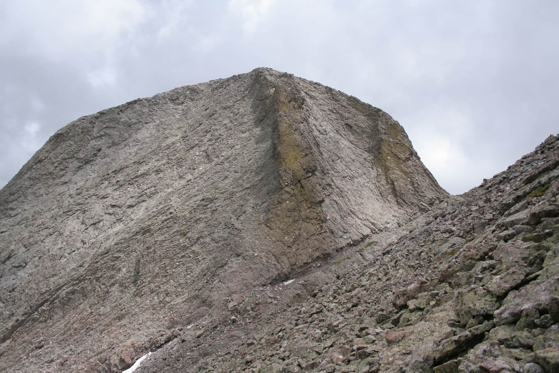
Steep climb from Cottonwood Lake to Broken Hand Pass at 12,940 feet. The pass is the gateway to Crestone Needle's standard route and the eastern approach to Crestone Peak's South Face. Wildflower meadows in mid-July, scree near the top.
Hot Springs Trail
Long approach to a remote backcountry hot spring in the Sangre de Cristo Wilderness. Climbs through aspen and conifer forest before reaching the springs in a high meadow. Best done as an overnight backpack.
Crestone Peak (South Face)
One of Colorado's toughest 14ers. Class 3 South Face route from South Colony Lakes. Solid conglomerate rock, real exposure, and a long approach. Helmet required.
Crestone Needle (South Face)
Famous Class 3 line up the south face from Broken Hand Pass. Tight gully route requires solid scrambling skill and helmet. Pair with Crestone Peak for the classic traverse.
Humboldt Peak (West Ridge)
Easiest 14er in the Sangres at Class 2. Standard route from South Colony Lakes basin, with stunning views of the Crestones across the cirque. Solid first 14er in the range.
Kit Carson Peak and Challenger Point
Two 14ers in one long day via the West Ridge from Willow Lake. Challenger Point first, then a tricky route-finding section called the Avenue to reach Kit Carson. Class 3.
Mount Lindsey (Northwest Gully)
Class 2+ standard route up a loose gully on the northwest face. Note: trailhead access has been intermittent due to private-land issues. Check current status before driving down.
Music Pass and Sand Creek Lakes
Non-14er option in the Sangres. Music Pass leads to Lower and Upper Sand Creek Lakes, two pristine alpine lakes in the wilderness south of the Crestones. Quiet and scenic.
Hiking in Westcliffe: what to know
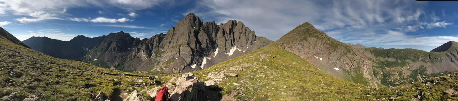
Westcliffe is the closest town to the Crestones (Crestone Peak, Crestone Needle, Humboldt Peak, Kit Carson Peak) and the South Colony Lakes basin, which together form one of the most technical 14er clusters in Colorado. This is not a beginner's hiking town. Most of what gets attempted here involves Class 3 or Class 4 scrambling, exposure, and route-finding above 13,000 feet.
The South Colony Lakes Trailhead is the main entry point. Getting there is half the adventure: from Westcliffe you drive 5 miles south to the Colony Lakes Road, then bounce up a notorious 4WD road for 5 more miles. Most passenger cars stop at the 2WD lot and walk an extra 2.5 miles each way. High-clearance 4WD is genuinely required for the upper lot, not a suggestion.
Humboldt Peak (14,070 feet) is the most reasonable 14er from South Colony Lakes: 11 miles round trip with 4,200 feet of gain if you start at the lower lot, Class 2 with no exposure. Crestone Peak and Crestone Needle from the same basin are Class 3 and Class 4 respectively, and both have killed experienced climbers. Read our Colorado 14ers guide before considering either.
For non-technical hiking, the Rainbow Trail runs 100 miles along the eastern base of the Sangres. Local sections from the Lake Creek and Hermit Lake trailheads make good day hikes through aspen and into alpine basins.
Hermit Lake (5 miles round trip, 1,400 feet of gain) is the friendliest local alpine destination. The trail follows Hermit Creek to a glacial lake under Hermit Peak.
Music Pass and the Sand Creek Lakes (Upper and Lower) are the harder day-hike options, accessing a quiet basin on the west side of the range. The trailhead is 45 minutes south of Westcliffe on dirt road.
Westcliffe has minimal services. Bring everything you need from Pueblo or Salida; the closest real grocery is over an hour away. Sleep at altitude here for at least one night before any 14er attempt and read our altitude sickness guide.
14ers Near Westcliffe
3 Colorado 14ers (peaks over 14,000 ft) have their trailheads near Westcliffe.
Crestone Peak
Sangre de Cristo Range
Crestone Needle
Sangre de Cristo Range
Humboldt Peak
Sangre de Cristo Range