Hiking in the San Juan Mountains
30 trails in this Colorado region — with elevation, distance, and seasonal recommendations.

Blue Lakes Trail
Three stunning alpine lakes nestled in the Mount Sneffels Wilderness beneath 14er Mount Sneffels and neighboring 13ers Dallas Peak and Gilpin Peak. One of Colorado's most scenic high-alpine destinations.
Bridal Veil Falls
Colorado's tallest free-falling waterfall drops 365 feet from a hanging valley. The trail follows a historic mining road with spectacular mountain views.
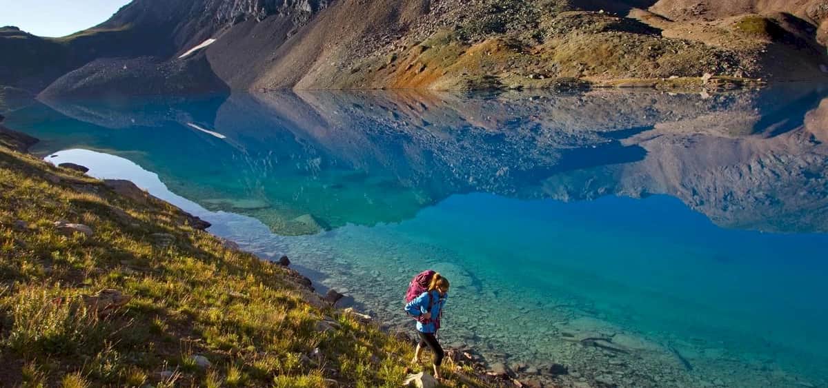
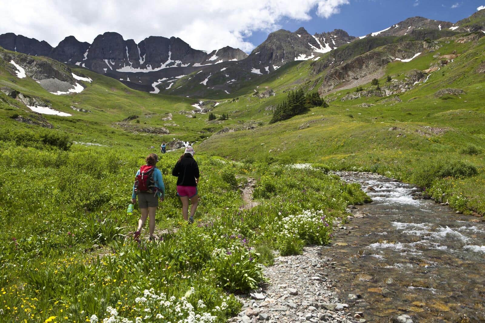
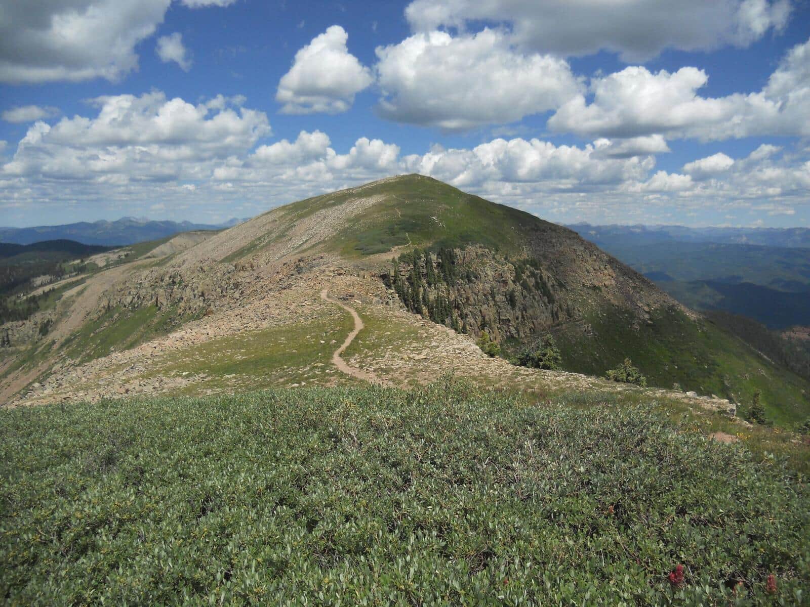
Ice Lake Basin
A spectacular hike to a pristine turquoise alpine lake surrounded by colorful peaks and abundant wildflowers. One of Colorado's most beautiful destinations.
Highland Mary Lakes
A scenic hike through historic mining territory to a series of alpine lakes with dramatic views of the surrounding San Juan peaks.
Fourmile Falls
A moderate hike through aspen and spruce forest to a dramatic 300-foot waterfall in the San Juan National Forest north of Pagosa Springs. The trail follows Fourmile Creek through wildflower meadows before the final approach to the falls.
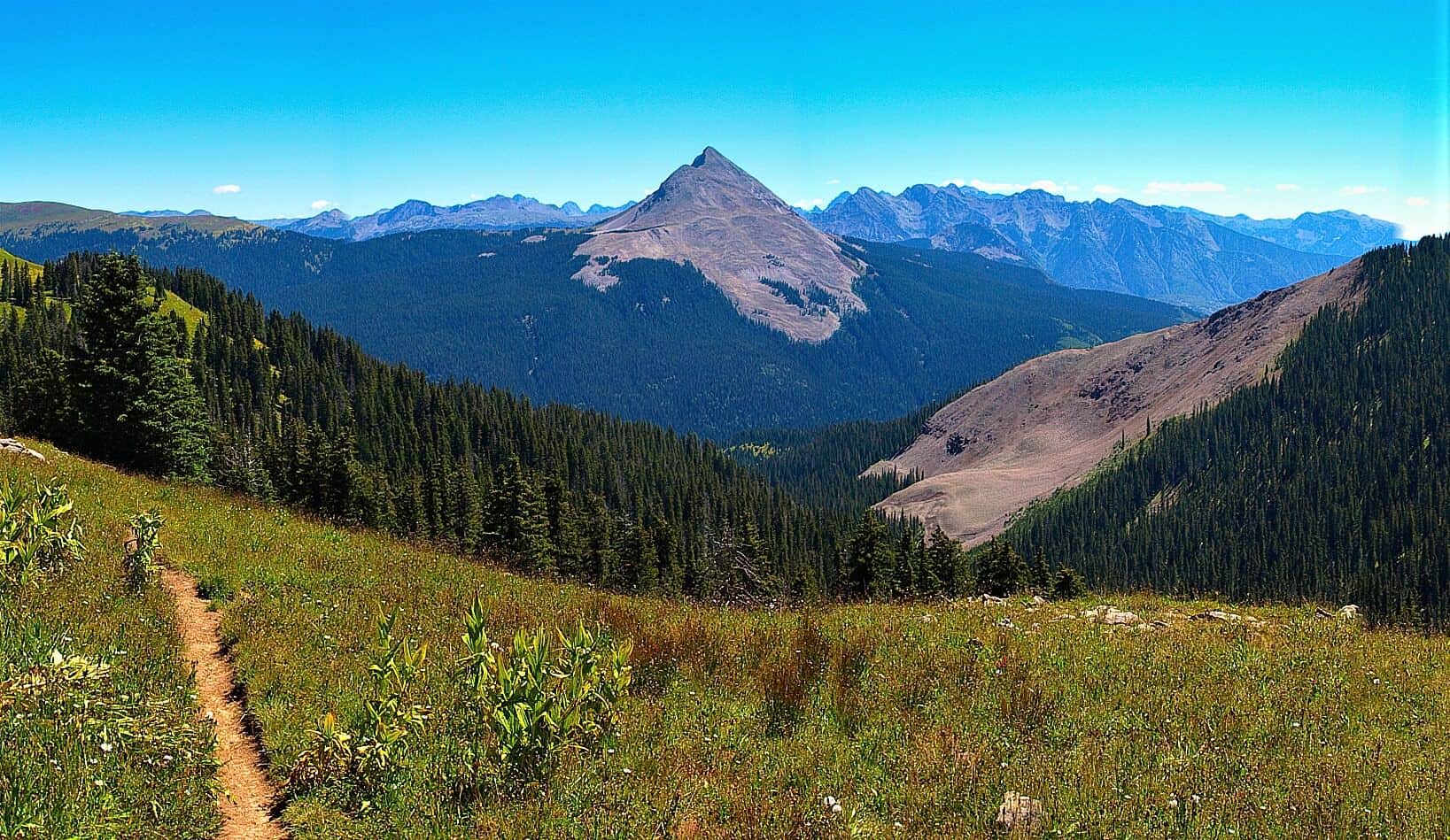
Engineer Mountain Trail
Steep climb from Coal Bank Pass on Highway 550 to the summit of Engineer Mountain. Wildflowers in July, distinctive layered rock formations near the top, and full San Juan panorama from the summit.
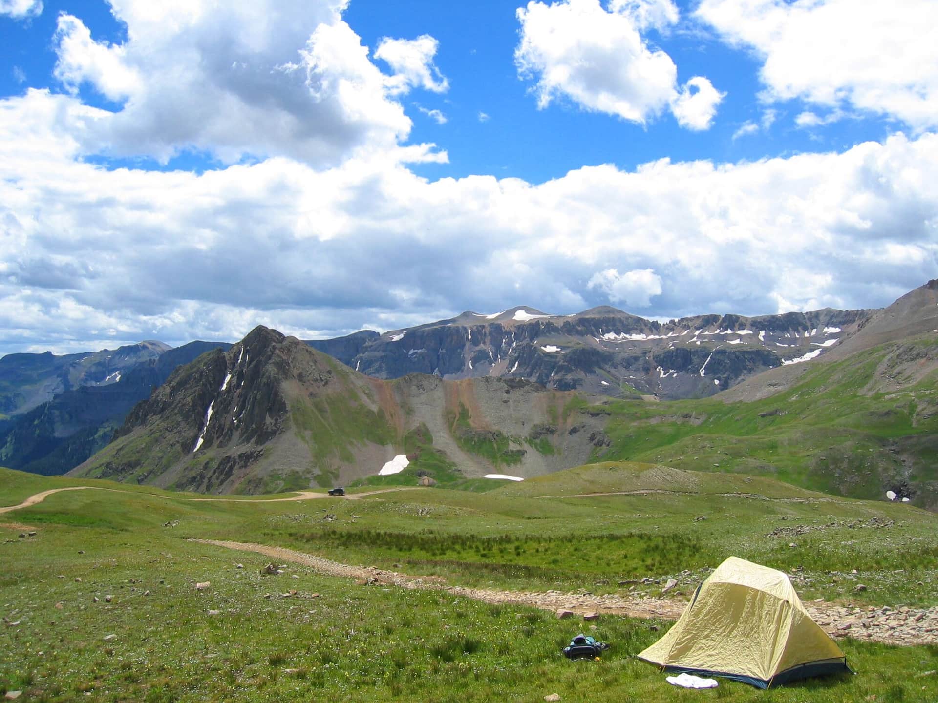
American Basin Trail
One of Colorado's most famous wildflower hikes. The basin explodes with color in mid-July through early August. Trailhead at the end of a rough 4WD road from Lake City. Also the standard start for Handies Peak (14er).
Yankee Boy Basin Trail
Short hike from the Yankee Boy Basin parking area through one of Colorado's premier wildflower basins. Also the standard approach for Mount Sneffels (14er). Best in mid-July when wildflowers peak.
Imogene Pass Trail
Famous Imogene Pass connects Ouray and Telluride at 13,114 feet. Most use it as a 4WD road, but hikers and runners do it as a brutal mountain pass crossing. The Imogene Pass Run is held here every September.
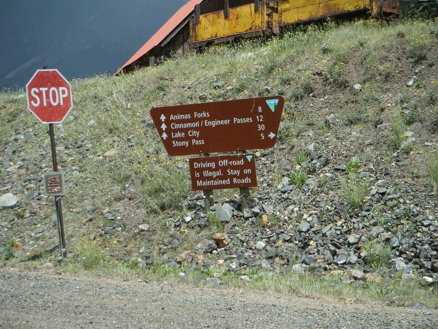
Cinnamon Pass Trail
Alpine pass between Lake City and Silverton, accessible as a 4WD route or a hike from the lower trailhead. The pass itself sits at 12,640 feet with views into both Animas Forks and Lake San Cristobal. Common access for Handies, Redcloud, and Sunshine 14ers.
Engineer Pass Trail
Alpine pass on the Alpine Loop Scenic Byway connecting Lake City and Ouray. Real hiking is possible from the lower trailhead; 4WD users can drive most of the way. Views span the entire upper San Juan headwaters.
Cascade Falls Trail
Short trail to a dramatic waterfall in Ouray's box canyon. The town's most accessible waterfall hike. Best in spring and early summer when snowmelt drives the flow.
Box Canyon Falls Park Trail
Walk into a slot canyon to view Box Canyon Falls dropping into a narrow gorge. Paid entry to the park ($5). The High Bridge Trail extends above the falls for a longer day.
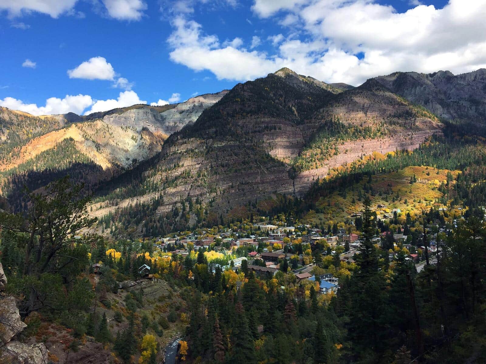
Ouray Perimeter Trail
Loop around the town of Ouray with views down to the streets and out to the surrounding peaks. Passes Cascade Falls, Box Canyon, and a series of viewpoints. The classic Ouray locals' hike.
Sneffels Highline Trail
Spectacular high ridge walk along the spine of the Sneffels Range. The route crosses Mears Pass, traverses high alpine ridges with continuous views of the Sneffels group, and descends into a glacial cirque. A classic San Juan backcountry day.
Spud Lake Trail
Short, family-friendly hike to a small alpine lake near Coal Bank Pass. Aspen forest in fall, wildflower meadows in summer. Excellent introduction to San Juan alpine hiking.
Crater Lake Trail (Weminuche)
Long approach into the Weminuche Wilderness via the Andrews Lake Trail and Continental Divide Trail to a remote alpine lake beneath Vestal and Arrow peaks. Backpack-worthy destination.
Pine River Trail
Long Weminuche Wilderness valley trail starting at Vallecito Reservoir. Day-hikable to about mile 4 or used as a backpack approach for the upper Pine River basin. Excellent fall colors.
Vallecito Creek Trail
Day-hike or backpack approach into the southern Weminuche Wilderness following Vallecito Creek. Less crowded than the Pine River. Excellent for shorter day-hikes from the Vallecito Reservoir area.
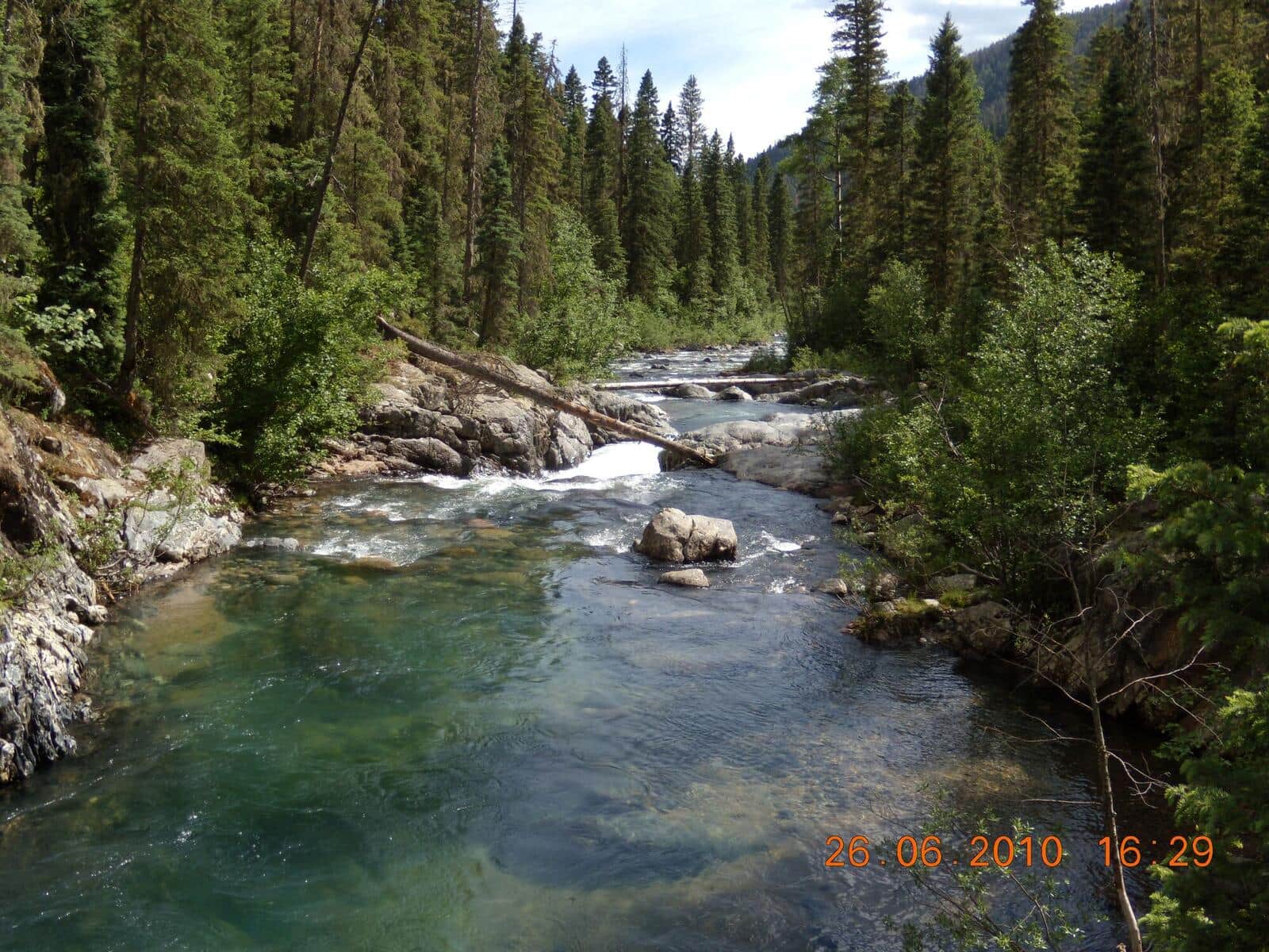
Cascade Creek Trail (Durango)
Wide aspen-and-meadow trail north of Durango along Cascade Creek. Excellent mountain biking and hiking shared use. September aspens are the highlight.
Lime Creek Trail
Easy hike from Old Lime Creek Road through the historic Lime Creek Burn area. Aspen regrowth in the burn zone, with bright fall colors. Lower difficulty than typical Silverton-area trails.
Stony Pass Trail
Alpine pass on the Continental Divide above Silverton. Access via 4WD road from Silverton or by hiking the lower section. The pass marks the divide between Rio Grande and Animas drainages.
Black Bear Pass Trail
Famous (and infamous) high alpine route between Red Mountain Pass and Telluride. Used mostly by experienced 4WD drivers; hikers do the upper section as a day climb to the pass. The descent into Telluride involves extreme exposure.
Endlich Mesa Trail
Long Weminuche Wilderness mesa traverse from Vallecito Reservoir. Very quiet backcountry, excellent for backpacking. Aspen forest below treeline, alpine meadows above.
Wetterhorn Basin Trail
Approach trail for Wetterhorn Peak (14er) from the Matterhorn Creek Trailhead. Long climb through a high basin with the iconic horn of Wetterhorn dominating views. Common as a 14er approach but worth doing as a basin hike alone.
Andrews Lake Trail
Short roadside loop around an alpine lake just off Highway 550 (the Million Dollar Highway) at Molas Pass. Excellent reflections of the surrounding peaks on calm mornings. Connects to the longer Crater Lake Trail for hikers wanting more.
Animas River Trail
Paved riverside trail running 7 miles through downtown Durango. Used by locals for commuting, dog walks, and casual jogs. Connects multiple parks and the historic train depot. The Durango Tour de Force runs on this trail.
Animas Overlook Trail
Short paved loop above Durango with sweeping views of the Animas River valley, downtown Durango, and the San Juan Mountains. Wheelchair accessible. Interpretive signs along the route.
Animas Mountain Trail
Loop up the mountain that frames Durango on the north side. Views down into the Animas Valley, west to Mesa Verde, and east toward the Weminuche Wilderness. The local after-work classic.
Hermosa Creek Trail
Long valley trail through the Hermosa Creek Wilderness, popular as a backpack or a mountain-bike shuttle. Hikers usually do a 6-10 mile out-and-back from either trailhead. Aspens turn early September.