Imogene Pass Trail
San Juan Mountains • Ouray, Colorado
Overview
Imogene Pass is the 13,114-foot road crossing between Ouray and Telluride, the second-highest vehicle pass in Colorado, and the course of the Imogene Pass Run every September. Most people cross it in a jeep. Hiking it is a 17-mile point-to-point day with about 5,300 feet of climbing on the Ouray side and a long descent past the Tomboy mine ruins into Telluride, and it is on this site because a steady stream of runners and hikers ask about it.
Trail Highlights
The Route
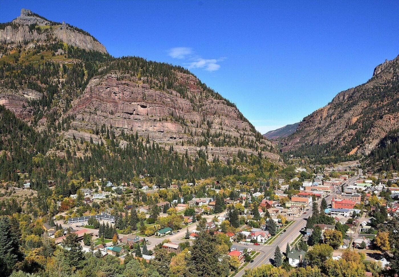
From Ouray, the route follows Camp Bird Road up Canyon Creek past the Camp Bird Mine, then turns onto the Imogene Pass road, which climbs through Imogene Basin in steep, rocky switchbacks. The grade is unrelenting above the mine, and the last mile to the pass is loose shelf road with the Sneffels massif filling the view west. The pass itself has the remains of a stone shelter; Fort Peabody, a 1904 guard post from the mining strikes, sits on the ridge above it at 13,365 feet and is a short scramble.
The Telluride side drops through Savage Basin past the Tomboy Mine, once a town of 900 people, with cabins, boilers, and mill foundations spread across the basin. The Tomboy Road then descends the north wall of the Telluride valley in long switchbacks, with the town and the box canyon below, and ends on Oak Street at the top of Telluride. Runners cover the whole thing in 3 to 6 hours; hikers should plan on 8 to 10.
Getting to the Trailhead
Camp Bird Road (County Road 361) leaves US 550 just south of Ouray. Passenger cars can drive the first 5 miles to the Camp Bird Mine area, which cuts the hike to about 12 miles; beyond that the road is real 4WD. Park at the wide spots near the mine, not in front of gates. The Telluride end is the top of Oak Street at the Tomboy Road, in a residential area with no parking; the hike needs a second car or a driver, since the road between the towns is 50 minutes around by Colorado 62 and US 550. No fee or permit.
Best Time to Hike
The road opens once the county plows the drifts near the pass, usually early July, and closes with the first big snow in October. July and August bring jeep traffic all day and storms by early afternoon; the pass and the basins on both sides are miles above treeline, so start from Ouray at dawn. Early September, after the monsoon eases, is the best window, and the run is held on the second Saturday of the month. Snow lingers on the north-facing Telluride side into July.
Good to Know
Dogs are allowed; the jeep traffic is the hazard. This is not a kid hike. The route climbs from 7,800 feet in Ouray to over 13,000, so altitude, not distance, is what stops people. Water is available from creeks in both basins with a filter; there is none on the pass. The Tomboy ruins are on private and Forest Service land and are unstable; look, do not enter. The shorter version, Telluride to Tomboy and back, is about 9 miles with 2,000 feet of gain and is the day most visitors actually want. Ouray and Telluride both have every service, and the Ouray hikes page has the Perimeter Trail and Yankee Boy Basin.
Sources
Figures and access details on this page were checked against these pages on 2026-09-04. Conditions change; confirm with the managing agency before you go.
Who to call
Conditions, closures, permits, and anything left behind on Imogene Pass Trail.
- Managed by
- Ouray Ranger District, Grand Mesa, Uncompahgre and Gunnison National Forests
(970) 240-5300 (Montrose, Mon to Fri 9 to 4, closed noon to 1) · website - Lost and found, non-emergency
- Ouray County Sheriff's Office
(970) 249-9110 · websiteNon-emergency calls go to WestCO dispatch in Montrose. Office (970) 325-7272, Mon to Thu 9 to 4. - Emergency
- 911. Cell coverage is patchy on most of these trails; a text to 911 can get through where a call cannot.
Numbers checked 2026-10-04. Colorado United is an independent guide, not the land manager; wallets, keys, and dogs found on the trail go to the offices above.
What to Pack
Gear guides for this kind of hike:
Frequently Asked Questions
How long does the Imogene Pass Trail take?
Most hikers finish the 17-mile route in about 10 hours, plus stops. Allow extra time at altitude and for photos.
How hard is the Imogene Pass Trail?
It is rated expert, with 5,300 feet of gain over 17 miles and a high point of 13,114 feet. Come with conditioning and high-country experience.
Is the Imogene Pass Trail dog-friendly?
Yes, leashed dogs are allowed. Pack water for them and clean up after them.
When is the best time to hike the Imogene Pass Trail?
The best seasons are summer and fall. Start early to beat both the crowds and Colorado's afternoon thunderstorms.
Do I need a pass or permit for the Imogene Pass Trail?
No pass or permit is required to park, though popular lots still fill early on summer weekends.
Planning a Colorado trip? Get our packing checklist.
Free PDF + a weekly note on the best trails for the current season.
We respect your inbox. Unsubscribe anytime.
Trail Information
Nearby Trails in San Juan Mountains
Connected pages
- Hikes near Ouray
All curated trails in the Ouray area.
- Hiking in the San Juan Mountains
Regional trail guide.
Discover More Trails
Browse our complete directory of Colorado hiking trails with detailed guides and filters.
View All Trails