Mount Yale: A Complete Guide to Climbing Colorado's Collegiate Peak
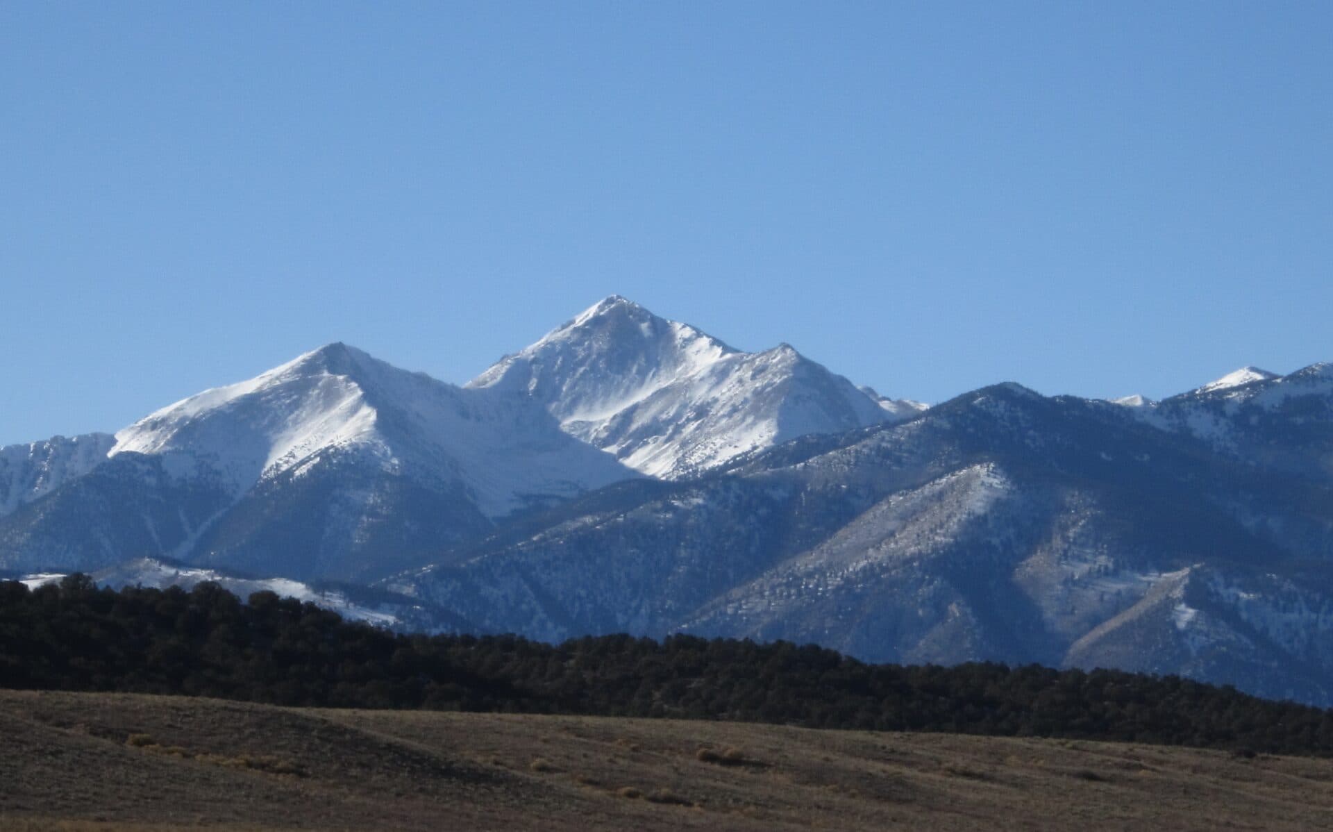
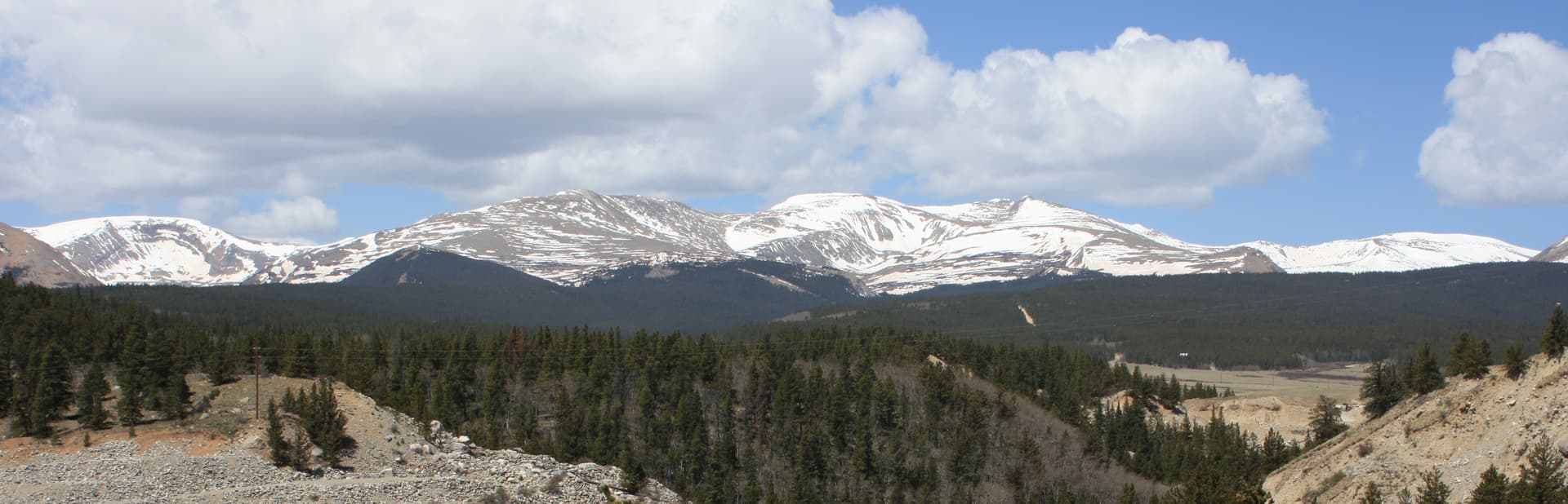
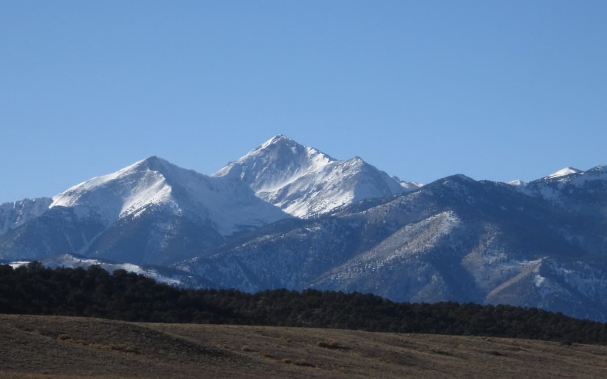
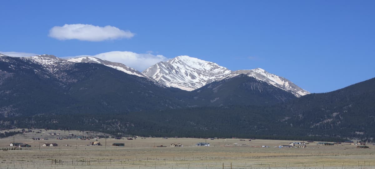
Mount Yale stands at 14,196 feet in the Sawatch Range, the 21st-highest peak in Colorado and one of the five Collegiate Peaks west of Buena Vista. The standard Southwest Slopes route from the Denny Creek Trailhead is a 9.5-mile round trip with about 4,300 feet of elevation gain. It stays Class 2 the whole way, with a talus-covered final ridge that asks for careful footing but no real scrambling.
What makes Mount Yale a favorite among Colorado 14ers is access. The Denny Creek Trailhead sits right off Cottonwood Pass Road, a paved highway about 12 miles west of Buena Vista. No four-wheel drive, no rutted approach road, no pre-dawn crawl up a jeep track. You park a sedan in the lot and start walking. That ease, combined with a fun ridge and big Collegiate views, makes Yale a popular second or third 14er for hikers stepping up from the Front Range peaks.
This guide covers the standard route section by section, the gear that matters at altitude, the timing that keeps you safe from afternoon storms, and how Yale stacks up against its Collegiate neighbors.
What You'll Learn
- Quick Stats
- Getting to the Denny Creek Trailhead
- The Southwest Slopes Standard Route
- What to Pack
- Timing and Weather
- When to Climb
- How Mount Yale Compares
- Common Mistakes
- Frequently Asked Questions
Quick Stats
Southwest Slopes (standard route):
- Elevation: 14,196 ft (21st highest in Colorado)
- Trailhead: Denny Creek, 9,900 ft
- Round Trip Distance: 9.5 miles
- Elevation Gain: 4,300 ft
- Class: 2 (talus and rock on the upper ridge, no exposure of consequence)
- Time: 7-10 hours typical
- Difficulty: Strenuous (sustained climb, real talus near the top)
Best Season: Late June through September
Permit: None required
Crowds: Busy on summer weekends, lighter midweek
Road: Paved to the trailhead; any vehicle makes it
Mount Yale was named for Yale University by Josiah Whitney during an 1869 survey expedition. The whole cluster carries college names: Harvard, Columbia, Princeton, Oxford, and Yale. They sit shoulder to shoulder in the Collegiate Peaks Wilderness, and from Yale's summit you can see most of them.
Getting to the Denny Creek Trailhead
The Denny Creek Trailhead is one of the easiest 14er trailheads to reach in the state:
- Drive to Buena Vista (about 2.5 hours from Denver via Highway 285 and Highway 24)
- From the stoplight in Buena Vista, take Main Street west; it becomes County Road 306, the Cottonwood Pass Road
- Follow CR 306 west for about 12 miles
- The Denny Creek Trailhead is on the right (north) side of the road, signed, with a paved pullout and dirt lot
The Cottonwood Pass Road is fully paved now, so you don't need high clearance or four-wheel drive to reach the trailhead. That's a big part of Yale's appeal. Most 14ers in the Sawatch make you earn the trailhead on a rough dirt road; this one you reach in a rental car.
From Denver, total drive time is about 2.5 hours. Buena Vista is the obvious place to stay the night before. It's a real town with motels, vacation rentals, restaurants, and an excellent main street. There's also dispersed camping along several side roads off CR 306, plus developed Forest Service campgrounds in the area.
Restrooms: Vault toilet at the trailhead.
Cell service: Spotty to none at the trailhead and nothing on the route. Download your maps before you leave town.
Parking: The lot holds roughly 30 to 40 vehicles between the main lot and the roadside pullouts. On summer weekends it fills by 6 AM. The trailhead also serves Hartenstein Lake, Browns Pass, and Kroenke Lake, so it draws backpackers and day hikers beyond just the Yale crowd. Arrive early.
The Southwest Slopes Standard Route
The Southwest Slopes route climbs through forest in the Delaney Gulch drainage, breaks treeline into an open basin, gains the southwest ridge, and follows that ridge over talus to the summit. It's well-defined and well-traveled, but the upper half is a real climb.
Section 1: Trailhead to the Yale Junction (Miles 0 to 0.8)
From the parking area, the trail heads north into the forest along Denny Creek. The grade is gentle and the tread is wide and well-maintained. Within the first mile you'll reach a signed junction. The Browns Pass and Hartenstein Lake trails branch left; stay right and uphill toward Mount Yale and Delaney Gulch.
Use this opening stretch to warm up and settle into a rhythm. The trail gets steeper soon, and starting easy pays off later.
Section 2: Delaney Gulch to Treeline (Miles 0.8 to 2.5)
This is where the work starts. The trail climbs steadily up the west side of the Delaney Gulch drainage through thick evergreen forest. The grade is sustained, often 12 to 15 percent, with switchbacks that gain elevation fast. You'll cross small streams and pass through a few open meadows.
The forest gives you shade in the morning, which is welcome, but it also hides the summit and most of the views. Just keep climbing. Around 11,800 feet the trees start to thin and the basin opens up ahead. This is a good place for a snack and a layer check before you commit to the open ridge.
Section 3: The Basin and the Saddle (Miles 2.5 to 3.7)
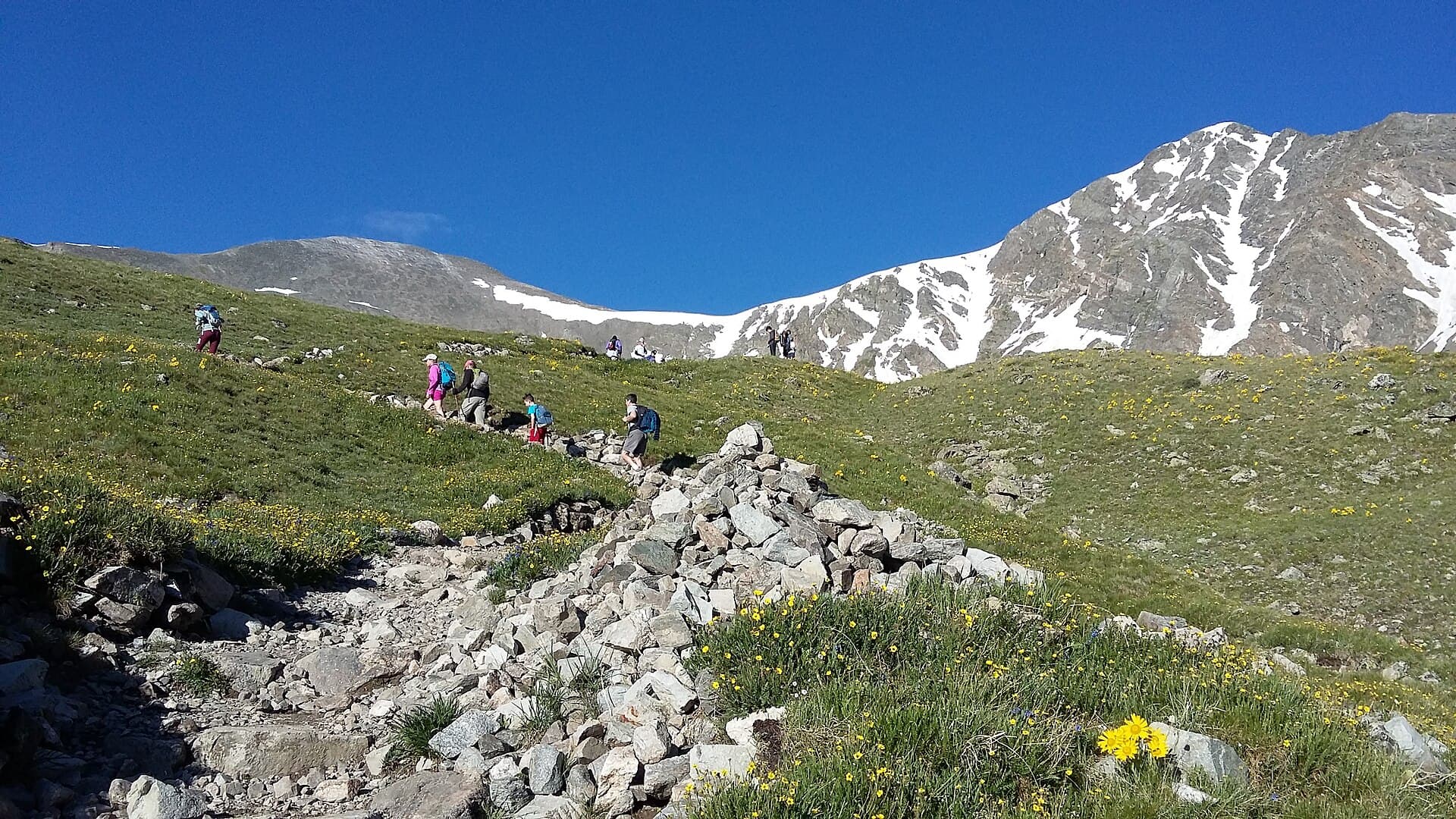
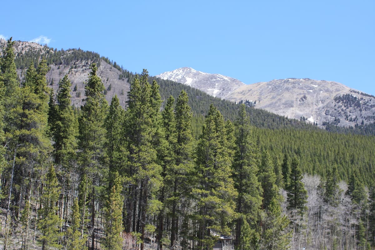
Above treeline the trail climbs through an alpine basin of grass, low willow, and scattered rock. The southwest ridge rises ahead and to your right. The trail angles up toward a saddle on the ridge at roughly 13,000 to 13,400 feet.
This section is steeper than it looks from below and the footing turns rockier as you climb. Cairns mark the way where the trail braids. Take your time; the altitude is real now, and pacing matters more than speed above 12,500 feet.
From the saddle you get your first clear look at the summit ridge and the rocky pyramid of Yale's high point to the northeast.
Section 4: The Southwest Ridge to the Summit (Miles 3.7 to 4.75)
The final push follows the southwest ridge over increasingly large talus. This is the crux of the day, though "crux" overstates it: the route stays Class 2, meaning you'll use your hands for balance on a few rocky steps but there's no exposure that would hurt you badly if you slipped.
The talus gets bigger and looser as you climb. Many hikers stow their trekking poles here and use their hands on the rock. The cairned route weaves through the boulders; pay attention and follow the established line rather than freelancing across loose rock. The last few hundred feet feel slow because the altitude is hammering you and every boulder demands a deliberate step.
Then the slope eases and you're standing on the summit.
Section 5: The Summit (Mile 4.75)
The top of Mount Yale is a rocky perch with room for a dozen or so people to spread out. The views are the payoff for the climb:
- Mount Harvard and Mount Columbia to the north, the tallest of the Collegiate group
- Mount Princeton and Mount Antero to the south
- The Three Apostles and a wall of 13ers to the west
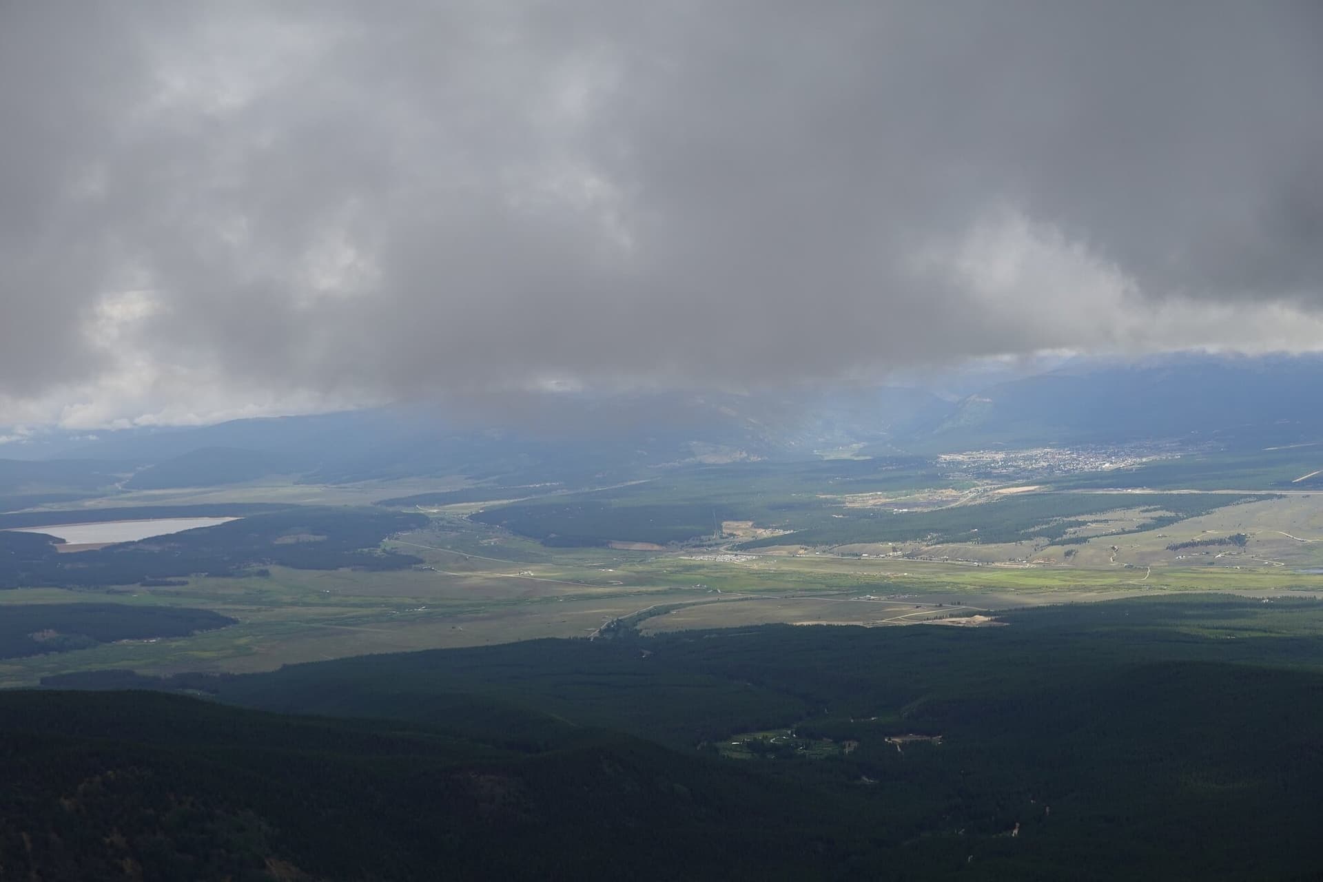
- The Arkansas River Valley and the Mosquito Range far to the east
- The Sangre de Cristo Range on the southern horizon on a clear day
It's one of the better summit panoramas in the Sawatch because Yale sits central to the whole Collegiate cluster. Sign the register, eat real food, and watch the sky. If clouds are building, head down.
Section 6: The Return (Miles 4.75 to 9.5)
Same route in reverse. The descent of the talus ridge is the part that punishes tired legs and knees, so take it slow and keep your poles handy once you're below the worst of the rock. The forest section near the bottom feels long because it is, but the shade is welcome on a hot afternoon.
Total descent time is usually 3 to 4 hours. Plan on 7 to 10 hours on the trail round trip, depending on your fitness and how long you linger up top.
What to Pack
Standard alpine 14er kit. The day is shorter than Harvard or Elbert but the altitude and talus demand the same gear:
Water. 3 liters minimum. Denny Creek runs along the lower trail, so a filter lets you refill on the way down, but carry everything you need for the climb itself. There's no reliable water above treeline. A hiking water filter is worth the few ounces if you want to top off.
Food. 1,500 to 2,000 calories of trail food. Real food beats bars alone on a climb this long. Eat at treeline and again on the summit.
Layers. Base layer, insulation, wind shell, and rain shell. The summit can run 25 to 35 degrees colder than the trailhead, and the wind on the ridge is reliably strong. See our base layers guide and rain jacket guide.
Sun protection. Sunglasses, sunscreen, and a brimmed hat. You'll be exposed above treeline for hours, and UV at 14,000 feet is brutal.
Headlamp. Mandatory. An early start means hiking in the dark, and a slow day can push your descent into dusk. See our headlamps guide.
Footwear. Sturdy hiking boots with ankle support handle the upper talus far better than worn-out trail runners. Our hiking boots guide breaks down the options.
Trekking poles. A big help on the steep forest climb and a knee-saver on the descent. A pair of trekking poles is one of the cheapest upgrades to a long day; see our trekking poles guide.
Map and offline GPS. The route is well-defined, but the upper basin braids and tired hikers miss the junction on the way down. Pre-download offline maps.
First aid basics. Blister care, ibuprofen, and electrolyte tablets cover the common problems.
For altitude considerations, read our altitude sickness guide before you go. Yale's 9,900-foot trailhead and 14,196-foot summit mean you gain a lot of altitude fast.
Timing and Weather
The rule on every Colorado 14er: be off the summit by noon. Afternoon thunderstorms build fast in summer and the open ridge is no place to be when lightning starts.
A reasonable timeline for a summer climb:
- Trailhead: 5:00 AM (4:00 AM in peak monsoon season)
- Treeline: 7:00 AM
- Saddle on the ridge: 8:00 AM
- Summit: 9:30 to 10:00 AM
- Below treeline: 12:00 PM
- Trailhead: 1:30 to 2:30 PM
For a 5 AM trailhead start, you'd leave Denver around 2:30 AM, which is rough. Stay in Buena Vista the night before. A short pre-dawn drive instead of a 2.5-hour one means better sleep, better focus, and a little acclimatization at the town's 7,965-foot elevation.
Check the mountain forecast at forecast.weather.gov for the Buena Vista and Collegiate Peaks area. The same principles apply on Yale as on any 14er:
- Storm probability above 30 percent: reconsider or start earlier
- Wind above 35 mph at altitude: expect a miserable ridge
- Snow falling in summer: turn around
The Collegiate Peaks sit a little west of the heaviest monsoon track, but storms still build by early afternoon in July and August. Don't gamble on the weather here.
When to Climb
Best months: Late June through mid-September.
June: Snow lingers in the upper basin and on the ridge through mid-month most years. Early-season snow on the talus can require microspikes or an ice axe. Late June usually opens the standard route in dry conditions.
July: Peak season. Wildflowers fill the lower basin and the trailhead lot overflows on weekends. Monsoon storms start mid-month, so plan an early start.
August: Peak monsoon. Be summit-ready and watching the sky by 10 or 11 AM. Weekday climbs are noticeably quieter than weekends.
September: The best stable weather of the year and cooler temperatures. The aspen in the valley below turn gold late in the month. Some early snow is possible after mid-September.
October through May: Winter conditions. The Cottonwood Pass Road is gated and not plowed past a certain point in winter, adding miles to the approach, and the ridge holds avalanche risk. This is mountaineering season, not a casual hike.
How Mount Yale Compares
Where Yale fits among the Collegiate Peaks and other popular 14ers:
Easier access than its neighbors. The paved Cottonwood Pass Road to a 2WD trailhead is the big draw. Mount Harvard and Mount Antero both require rough dirt roads; Yale does not.
Shorter than Harvard, longer than the Front Range peaks. At 9.5 miles, Yale sits between the long Sawatch days like Harvard (14 miles) and the quick Front Range climbs like Bierstadt. It's a solid step up in distance and sustained climbing from a beginner peak.
Harder summit than Elbert. Yale's talus ridge is true Class 2 with rocky steps near the top, where Mount Elbert stays Class 1 walking. The climbing is more engaging on Yale.
A good second or third 14er. Most hikers tackle Yale after they've done an easier Class 1 peak and want a step up without committing to a 14-mile day. It's appropriate after Bierstadt, Quandary, or Elbert.
Great basecamp town. Buena Vista is friendly, walkable, and full of good food and hot springs. After your climb, soak tired legs at the nearby Mount Princeton Hot Springs, about 20 minutes south near Nathrop.
For the full ranking of 14ers by difficulty, see our easiest 14ers guide and the broader Colorado 14ers guide.
Common Mistakes
Underestimating the climb because the road is easy. The paved access lulls people into thinking Yale is a beginner peak. The 4,300-foot gain and the talus ridge are no joke; this is a strenuous day.
Not staying in Buena Vista the night before. Driving from Denver in the predawn hours means starting at altitude with no acclimatization and little sleep. That combination invites altitude sickness on the upper ridge.
Starting too late. A 5 AM trailhead start gives you margin against afternoon storms. Sleeping in and starting at 7 puts you on the exposed ridge right when storms build.
Wrong footwear. Worn trail runners get chewed up on the upper talus. Boots with ankle support and decent tread are the better call for the rocky ridge.
Missing the junction on the descent. Tired hikers coming down sometimes blow past the turn back toward Denny Creek. Watch for it, and trust your downloaded map over your memory.
Not enough food and water. A 7-to-10-hour day at altitude burns through both faster than people expect. Carry more than you think you need.
Ignoring the weather. The southwest ridge is fully exposed. If storms are building, turn around. The summit will still be there next weekend.
Frequently Asked Questions
How hard is Mount Yale?
Mount Yale is a strenuous Class 2 hike, harder than beginner 14ers like Mount Bierstadt but not technical. The 9.5-mile round trip gains about 4,300 feet, and the final ridge crosses large talus that requires careful footing and occasional use of your hands for balance. Most fit hikers manage it as a second or third 14er.
How long does it take to hike Mount Yale?
Plan on 7 to 10 hours round trip, depending on your fitness and how long you spend on the summit. A typical pace puts you on top in about 4.5 to 5 hours and back at the trailhead 3 to 4 hours after that. Start by 5 AM to beat afternoon storms.
Do you need 4WD for the Denny Creek Trailhead?
No. The Cottonwood Pass Road (County Road 306) is paved all the way to the Denny Creek Trailhead, about 12 miles west of Buena Vista. Any passenger car makes it in summer. That easy access is one of the main reasons Mount Yale is so popular.
How tall is Mount Yale?
Mount Yale is 14,196 feet, making it the 21st-highest peak in Colorado and one of the five Collegiate Peaks in the Sawatch Range west of Buena Vista. It was named for Yale University during an 1869 survey expedition.
Is Mount Yale a good first 14er?
It's better as a second or third 14er. The sustained climb, the talus ridge, and the 4,300-foot gain make it tougher than entry-level peaks. If it's your first 14er, do an easier Class 1 climb like Mount Bierstadt or Quandary Peak first, then step up to Yale.
Final Thoughts
Mount Yale is one of the most approachable big 14ers in Colorado. The paved road to the Denny Creek Trailhead removes the usual Sawatch headache, the Southwest Slopes route is well-marked and stays Class 2, and the summit gives you a front-row seat to the entire Collegiate Peaks group. The catch is the climb itself: 4,300 feet of gain and a talus ridge that asks for respect at altitude.
Do the simple things right and you'll have a great day. Stay in Buena Vista the night before, start by 5 AM, pace yourself through the forest climb, watch the weather on the exposed ridge, and save energy for the descent. Then drive 20 minutes south and soak in the hot springs.
For more Collegiate climbing, see our guides to Mount Harvard, Mount Antero, and the Colorado 14ers guide. For the full gear kit, read up on hiking boots, trekking poles, base layers, and the altitude sickness guide.
Get the Colorado 14er Packing Checklist (free PDF)
Plus a weekly note on the best Colorado trails, gear deals, and seasonal hike picks. No spam, unsubscribe anytime.
We respect your inbox. Unsubscribe anytime.