A Weekend in Telluride: The Hiking Itinerary (2026)
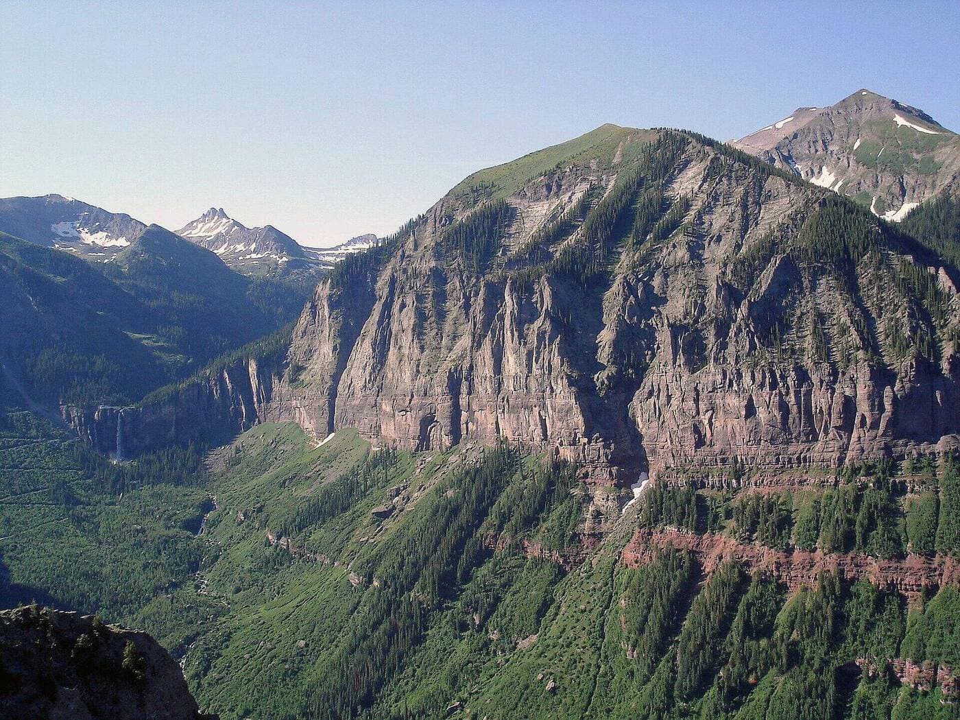
Telluride is uniquely set up for hiking weekends: the town sits in a box canyon at 8,750 feet, with 13,000-foot peaks rising directly above on three sides. Many of the best hikes start from within walking distance of downtown. You can do real backcountry hiking and still be eating dinner in town by 7 PM.
The catch is altitude. Telluride is high enough that sea-level visitors feel it. The first 24 hours determine whether your weekend goes well or you spend day two with a headache. This itinerary is built around that. Easier hikes day 1, the bigger day on day 2.
Friday (Arrival): Acclimatize
Arrive Friday afternoon. Telluride Regional Airport (TEX) gets in midday; most visitors drive from Montrose Airport (1 hour) or fly in via Aspen connections.
What to do:
- Check in
- Walk Telluride Main Street (it's only about 8 blocks long)
- Pick up groceries for trail snacks (City Market on West Colorado)
- Eat a carb-heavy dinner
- Drink 2-3 liters of water
- Skip alcohol
- In bed by 10 PM
Easy walk if you want one: the Telluride Town Park Loop is 1 mile, flat, with views of Bridal Veil Falls in the distance. The gondola from town to Mountain Village runs free until midnight if you want a longer walk back down on the Telluride Trail.
Saturday: Bear Creek Falls + Bridal Veil Falls
The two iconic Telluride waterfalls in one day. Both are accessible from downtown. Spread them out: Bear Creek in the morning when it's cooler, Bridal Veil in the afternoon when the light is best for photos.
Morning: Bear Creek Falls
Distance: 5 miles round trip
Elevation gain: 1,000 feet
Difficulty: Moderate
Trailhead: South end of Pine Street (walking distance from downtown)
Bear Creek Falls is the easier, shorter falls hike. The trail follows Bear Creek through wildflower meadows with the falls at the upper end. Best in June and July when wildflowers peak and snowmelt drives the cascades.
What to bring: Water bottle, sunscreen, light layers. Trekking poles aren't necessary; this is a well-graded trail.
Time it'll take: 2-3 hours total, including time at the falls for photos.
Lunch: Back in town
Quick lunch on Main Street. Brown Dog Pizza is a Telluride classic. Honga's Lotus Petal does great Asian fusion. Avoid the high-end places for lunch. Save those for dinner.
Afternoon: Bridal Veil Falls
Distance: 3.6 miles round trip
Elevation gain: 1,200 feet
Difficulty: Moderate
Trailhead: End of East Colorado Avenue (parking is limited; walk from town if possible)
Bridal Veil Falls is Colorado's tallest free-falling waterfall at 365 feet. The trail follows a historic mining road up through aspens to the falls and the restored hydroelectric powerhouse at the top. You can hike to the falls (1.8 miles in) or continue past to the powerhouse for the full 3.6-mile round trip.
What to bring: Solid hiking boots (the road is rocky), water, snacks, rain jacket if afternoon storms are building.
Photo tip: The falls flow heaviest in June after snowmelt peaks. By August the flow is much lower. The afternoon light catches the cascade for the best photos.
Saturday Dinner
Plan an early dinner. You've already done two hikes. Telluride's restaurants book up Friday and Saturday nights; reserve by Wednesday at the latest. Recommendations:
- 221 South Oak: Telluride's best fine dining
- Brown Dog Pizza: Casual, reliable
- The Butcher & The Baker: Good for breakfast/lunch, decent dinner
- Chair Mountain Ranch: Steakhouse experience
Sunday: One San Juan Classic
Sunday is your "real" hiking day with the most ambitious option. Pick based on conditions and energy:
Option A: Sneffels Highline Trail (full day, 13 miles)
The biggest San Juan day hike accessible from Telluride. A 13-mile loop along the spine of the Sneffels Range with continuous high-alpine views. Real backcountry day requiring acclimatization, fitness, and an early start (6 AM at the latest).
For: Fit hikers, day 3 of acclimatization, July through September.
Skip if: First day at altitude, afternoon thunderstorms in the forecast.
Option B: Wilson Peak Lower Trails (moderate, 6-8 miles)
The "Wilson Peak" you see on the Coors beer can. Full summit is technical class 3 climbing (saved for serious mountaineers), but the lower trails from the Rock of Ages Trailhead provide excellent hiking. Plan 6-8 miles of approach hiking with views of Wilson Peak, Mount Wilson, and El Diente.
For: Most weekend hikers, good acclimatization.
Option C: Black Bear Pass Trail Up (moderate, 7 miles)
The famous (or infamous) 4WD route up from Telluride, hiked as a one-way climb to the pass at 12,840 feet. Most hikers turn around at the pass; some continue down to Ouray for a one-way shuttle option. The views overlooking Bridal Veil Falls are among the best in the San Juans.
For: Strong hikers, dry conditions only.
Option D: Hope Lake / Lost Lake (moderate, 4 miles)
The "easier and quieter" Sunday option. Hope Lake is a 4-mile round trip alpine lake hike accessible from the Lizard Head Pass area. Far less crowded than the Bear Creek / Bridal Veil corridor. Perfect for slower-paced groups or anyone feeling the altitude.
For: Slower pace, kids, recovery day.
Sunday Dinner / Trip Wrap-Up
If you're driving back to Denver Sunday night, eat early and leave by 4 PM (it's a 6.5-hour drive). If you're flying out Monday, you have more flexibility.
For the wrap-up dinner:
- The View Restaurant (San Sophia Inn): Sunset views over town
- La Marmotte: French bistro with a long wine list
- Telluride Brewing Company: Casual craft beer
Logistics Summary
Getting there: Telluride Regional Airport (TEX) has direct flights from Denver, Phoenix, and a few other hubs in summer. Most visitors fly to Montrose (MTJ, 1 hour drive) or Denver (DEN, 6.5 hours).
Where to stay:
- Downtown Telluride: Walking access to trails and restaurants. Most expensive.
- Mountain Village: Gondola connects to town. Mid-range pricing.
- Lawson Hill / Riverbend: 10 minutes west of town. More budget-friendly.
Parking:
- Town parking is hard. The free Galloping Goose shuttle covers downtown.
- Bear Creek and Bridal Veil trailheads are at the south end of town; walk if you can.
- Wilson Peak / Sneffels area: drive 30-45 minutes; high-clearance vehicle helpful.
Permits: No permits required for any of these trails. The Wilson area is on USFS land.
Cell service: Sketchy in town (better in Mountain Village), patchy on trails. Download maps before you go.
Altitude: Telluride at 8,750 feet, Mountain Village at 9,545 feet. Trailheads are 9,000-10,500 feet. Sleep in town for at least one night before pushing into high-alpine routes.
Weather: Same monsoon pattern as the rest of Colorado. Afternoon thunderstorms reliable July through mid-September. Be off summits by noon.
Fall colors: Telluride is famous for fall colors, peaking around the third week of September. The aspen groves around Bear Creek and the surrounding mountains are spectacular. Book lodging early.
When to do this trip
Best months: Mid-July through mid-September. The Bear Creek and Bridal Veil flows are best in July; fall colors peak mid-to-late September.
When to avoid: Mud season (April-May), when most high-elevation trails are still snowy and lower trails are muddy. Winter (November-April) shifts the experience to ski-area hiking, snowshoeing, and ice climbing.
For more Telluride-area trail picks see our hikes near Telluride guide. The San Juan 14ers in the area (Mount Wilson, El Diente, Wilson Peak, Sneffels) are covered in the Colorado 14ers hub.
Get the Colorado 14er Packing Checklist (free PDF)
Plus a weekly note on the best Colorado trails, gear deals, and seasonal hike picks. No spam, unsubscribe anytime.
We respect your inbox. Unsubscribe anytime.