Best Hikes Near Ouray, Colorado
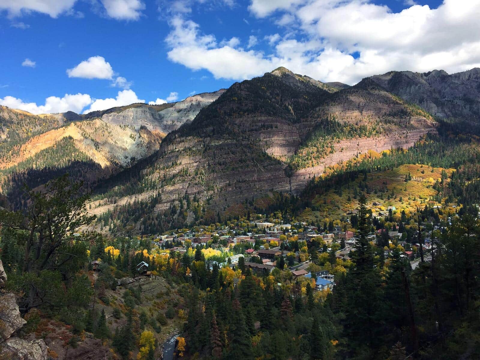
Ouray is a former mining town wedged into a box canyon at 7,792 feet, surrounded on three sides by 13,000-foot San Juan peaks.

Blue Lakes Trail
Three stunning alpine lakes nestled in the Mount Sneffels Wilderness beneath 14er Mount Sneffels and neighboring 13ers Dallas Peak and Gilpin Peak. One of Colorado's most scenic high-alpine destinations.
Yankee Boy Basin Trail
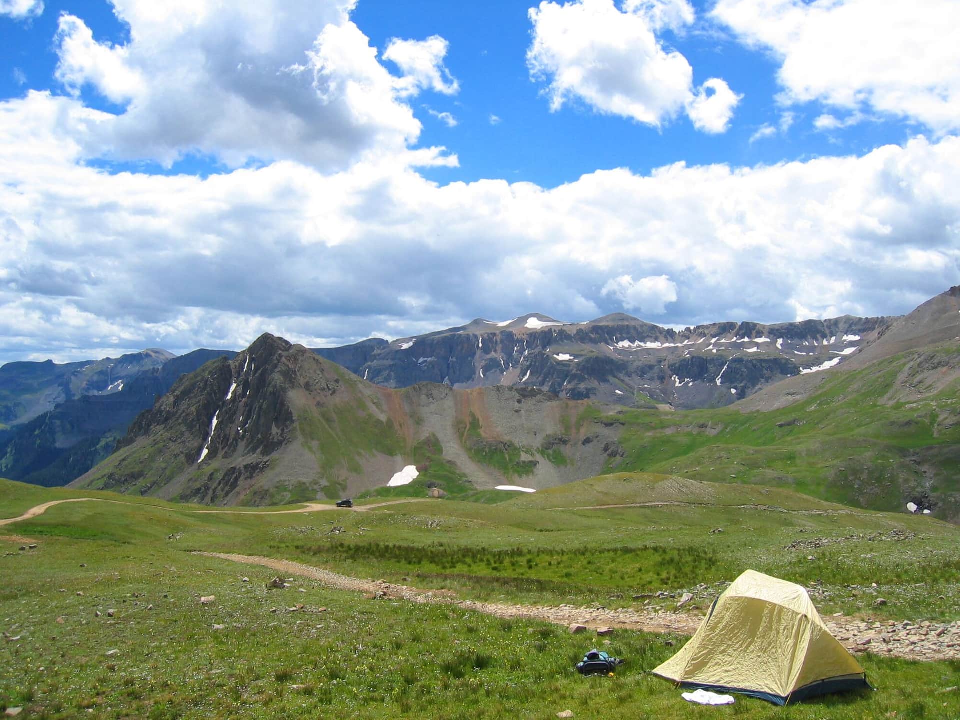
Short hike from the Yankee Boy Basin parking area through one of Colorado's premier wildflower basins. Also the standard approach for Mount Sneffels (14er). Best in mid-July when wildflowers peak.
Imogene Pass Trail
Famous Imogene Pass connects Ouray and Telluride at 13,114 feet. Most use it as a 4WD road, but hikers and runners do it as a brutal mountain pass crossing. The Imogene Pass Run is held here every September.
Cascade Falls Trail
Short trail to a dramatic waterfall in Ouray's box canyon. The town's most accessible waterfall hike. Best in spring and early summer when snowmelt drives the flow.
Box Canyon Falls Park Trail
Walk into a slot canyon to view Box Canyon Falls dropping into a narrow gorge. Paid entry to the park ($5). The High Bridge Trail extends above the falls for a longer day.
Ouray Perimeter Trail
Loop around the town of Ouray with views down to the streets and out to the surrounding peaks. Passes Cascade Falls, Box Canyon, and a series of viewpoints. The classic Ouray locals' hike.
Hiking in Ouray: what to know
Ouray calls itself the Switzerland of America and the comparison holds up. The town sits in an amphitheater of vertical walls, with hot springs at the bottom and ice climbing routes hanging off the cliffs in winter. Hiking here means going up, almost always steeply, on trails that were originally mining roads.
The Perimeter Trail is the iconic in-town loop: 6.2 miles around the rim of the box canyon, with about 1,500 feet of accumulated gain. The route passes Cascade Falls, Box Canyon Falls (a paid attraction at the bottom, free pass-through on the trail), and a series of viewpoints over town. Most locals do sections rather than the full loop. The full loop takes most hikers 4-5 hours.
Bear Creek National Recreation Trail is the harder local classic: 5.2 miles round trip and 2,400 feet of gain on an old miner's pack trail blasted into the canyon wall. The exposure on the lower sections makes some people uncomfortable. The trail ends at the historic Grizzly Bear Mine site. Trailhead is at a small pullout on US 550, 2 miles south of town. Park early; only 8-10 spots.
Box Canyon Falls is technically inside a paid park (currently $5), with a 500-foot walk to the base of a 285-foot waterfall hidden inside the canyon. Worth the small fee.
For higher destinations, the Blue Lakes Trailhead at the end of Dallas Creek Road accesses Mount Sneffels (14,158 feet) and the Lower and Upper Blue Lakes. The basin is one of the most photographed in Colorado. Lower Blue Lake is 6.4 miles round trip with 1,900 feet of gain. Mount Sneffels via the Lavender Col route is Class 3 and reachable from the same trailhead with a high-clearance 4WD shuttle to Yankee Boy Basin.
Yankee Boy Basin, accessed by a notorious 4WD road from Ouray, is the area's wildflower headline destination. Mid-July through early August is peak bloom.
Ouray weather mirrors the rest of the San Juans: reliable afternoon thunderstorms July-September. Start by 6 AM for anything above treeline. In winter the box canyon walls become the Ouray Ice Park, one of the largest ice-climbing venues in the world.