Denny Creek Trailhead: Gateway to Mount Yale, Hartenstein Lake, and Browns Pass
The Denny Creek Trailhead sits at about 9,900 feet on Cottonwood Pass Road, roughly 11 miles west of Buena Vista, and it's one of the busiest jumping-off points in the Collegiate Peaks Wilderness. From this single dirt lot you can climb a 14er, walk to a quiet alpine lake, or top out on the Continental Divide. The road in is paved the whole way, so any car makes it, which is a big reason the lot fills before sunrise on summer weekends.
Three hikes share the first mile of trail here: Mount Yale by its Southwest Slopes route, Hartenstein Lake at 11,472 feet, and Browns Pass at 12,020 feet on the Divide. They branch apart quickly, so it helps to know which fork you want before you're standing at the junction with a headlamp on.
This guide breaks down all three routes from the Denny Creek Trailhead, plus the driving directions, parking reality, gear that matters at this elevation, and the timing that keeps you ahead of afternoon storms.
What You'll Learn
- Quick Stats
- Getting to the Denny Creek Trailhead
- Parking and Facilities
- Hike 1: Denny Creek to Hartenstein Lake
- Hike 2: Browns Pass and the Continental Divide
- Hike 3: Mount Yale via the Southwest Slopes
- What to Pack
- When to Go
- Tips for Beating the Crowds
- Frequently Asked Questions
Quick Stats
Denny Creek Trailhead:
- Elevation: about 9,900 ft
- Location: Cottonwood Pass Road (CR 306), ~11 miles west of Buena Vista
- Land: Collegiate Peaks Wilderness, San Isabel National Forest
- Road: Paved to the lot; any vehicle makes it
- Facilities: Vault toilet, no potable water
- Permit: None required; sign the wilderness register
The three main hikes:
- Hartenstein Lake: 5.8 miles round trip, about 1,720 ft gain, strenuous
- Browns Pass: about 6.4 miles round trip, roughly 2,150 ft gain, strenuous
- Mount Yale (Southwest Slopes): 9.5 miles round trip, about 4,300 ft gain, Class 2
Best Season: Late June through September
The trailhead earns its crowds. It's paved-road access to genuine high country, and the three destinations cover a wide range of effort, from a half-day lake walk to a full 14er summit day. If you're new to the area, the lake is the friendliest introduction.

Getting to the Denny Creek Trailhead
The drive is about as easy as Colorado backcountry access gets:
- Get to Buena Vista, roughly 2.5 hours from Denver via Highway 285 and Highway 24
- From the stoplight in town, take Main Street west; it becomes County Road 306, the Cottonwood Pass Road
- Follow CR 306 west for about 11 miles
- The Denny Creek Trailhead is signed on the right (north) side of the road, with a dirt lot and roadside pullouts
Cottonwood Pass Road is fully paved to the trailhead and well past it, so you don't need high clearance or four-wheel drive. That sets Denny Creek apart from a lot of Sawatch trailheads, where the last few miles are a slow grind up a rutted jeep road. Here you just drive to the lot and start walking.
Buena Vista is the obvious base. It's a real town with motels, vacation rentals, restaurants, and a good main street for a pre-hike breakfast or a post-hike burger. If you'd rather camp, there's dispersed camping along several side roads off CR 306, plus developed Forest Service campgrounds in the Cottonwood Creek drainage.

Parking and Facilities
The lot holds roughly 30 to 40 vehicles counting the main area and the roadside pullouts. On a July or August Saturday it fills by 6 AM, and cars start lining the shoulder soon after. Because three popular hikes share this trailhead, it draws Yale climbers, lake day-hikers, and backpackers heading to Kroenke Lake all at once. Arrive early or come midweek.
There's a vault toilet at the trailhead and no potable water, so fill your bottles in town. Cell service is spotty to nonexistent here and gone entirely once you're on the trail, so download your maps before you leave Buena Vista.
This is designated wilderness, so sign the register at the trailhead before you head in. Overnight camping isn't allowed at the trailhead itself; backpackers need to walk in and camp on durable ground well off the trail and away from water. For a broader primer on lot etiquette and timing across the state, our guide to Colorado trailhead parking covers the patterns that keep you from circling a full lot at dawn.
Hike 1: Denny Creek to Hartenstein Lake
This is the trailhead's most approachable payoff. Hartenstein Lake is a 5.8-mile round trip with about 1,720 feet of gain, rated strenuous mostly for the elevation rather than any technical difficulty. Most hikers take three to four hours round trip.
The trail leaves the lot and climbs northwest through pine and aspen on rocky, well-marked singletrack. Around mile 0.9 you cross Denny Creek on a log bridge, a good spot to catch your breath. At roughly mile 1.2 the Mount Yale Trail (#1451) splits off to the right; stay straight for the lake. At about mile 2.0 the trail forks again, and here you go left for Hartenstein Lake.
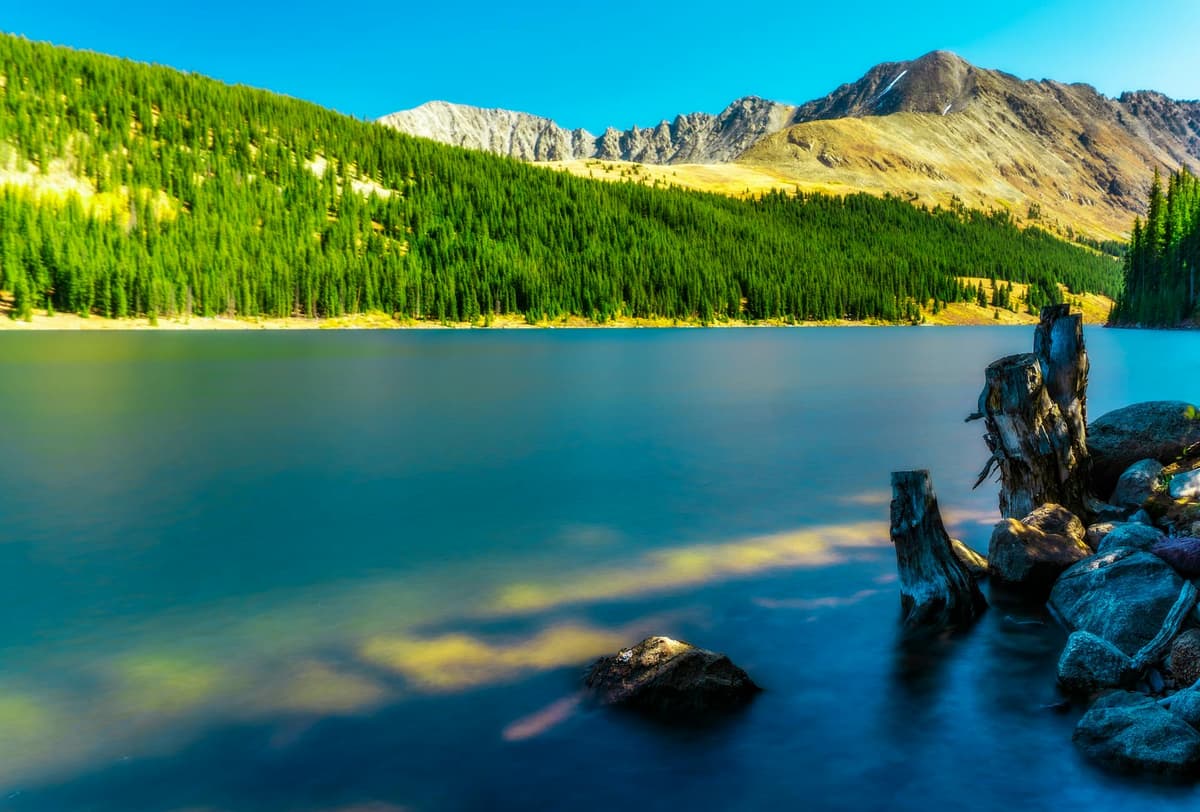
The lake sits at 11,472 feet in a basin ringed by talus and stunted spruce. Watch the slopes above the water for mountain goats, which work these high benches through the summer. It's a fine turnaround for a half-day outing, a solid conditioning hike before a bigger summit, or a first overnight for new backpackers. If alpine lakes are your thing, pair this with the picks in our roundup of the best alpine lakes in Colorado.
Hike 2: Browns Pass and the Continental Divide
Want to stand on the Continental Divide without climbing a 14er? Browns Pass is your hike. From the Denny Creek Trailhead it's about 6.4 miles round trip with roughly 2,150 feet of gain, which makes it a step up from the lake but still a reasonable half-day for a fit hiker.
Follow the same trail past the log bridge and the Mount Yale junction. At the mile 2.0 fork, go right (the left branch is the Hartenstein Lake spur). The trail keeps climbing through thinning forest and open meadow to Browns Pass at 12,020 feet on the Divide. From the top you get long views west toward the Cottonwood Pass country and east back over the drainage you climbed.
Browns Pass is also a connector. From the pass you can drop toward Kroenke Lake, link into the Colorado Trail, or set up a longer backpacking loop through the Collegiate Peaks. Wildflowers peak in these upper meadows in July, so time a summer trip for the color if you can. The exposure above treeline is real, so keep an eye on the sky; more on that in the timing section below.
Hike 3: Mount Yale via the Southwest Slopes
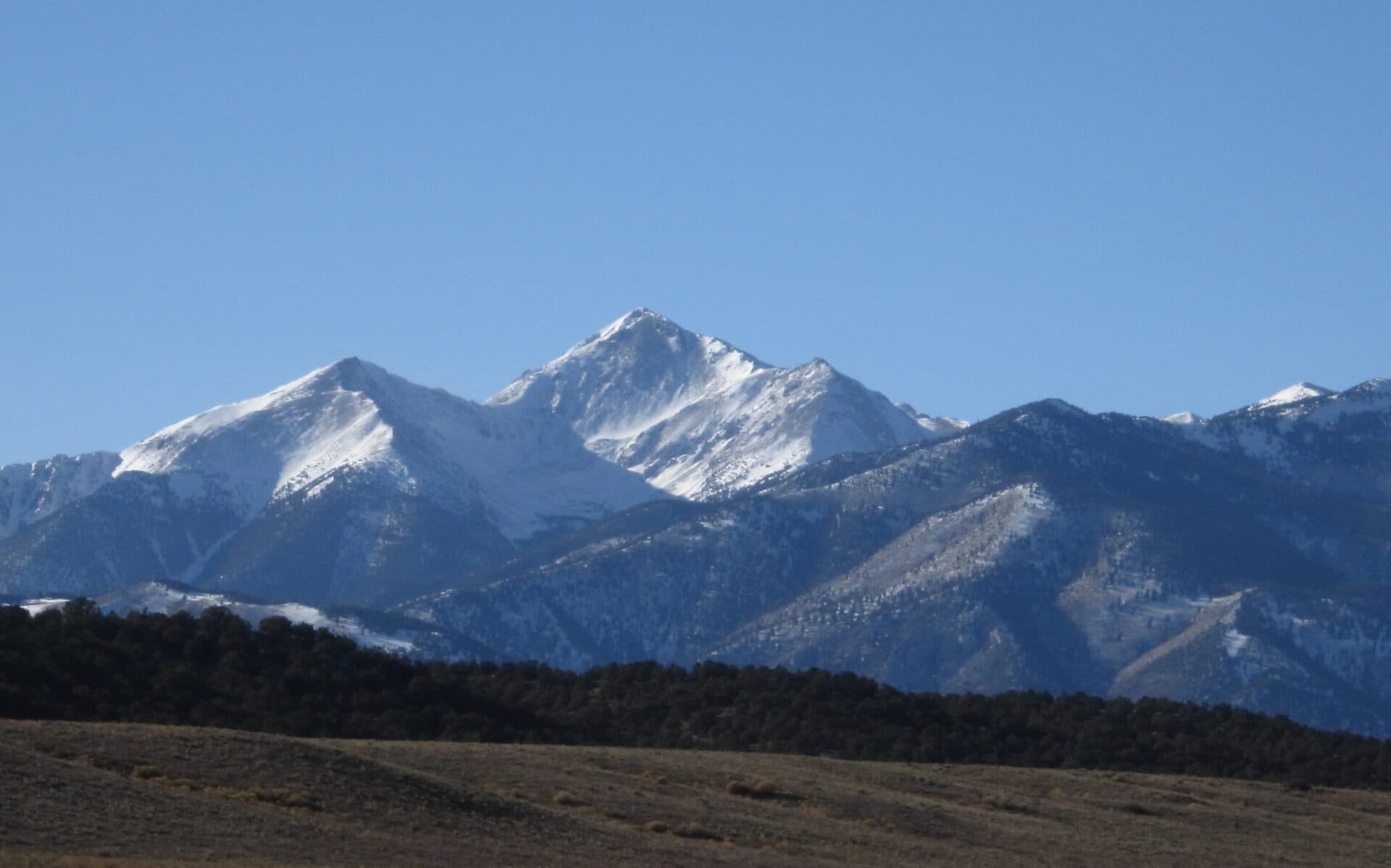
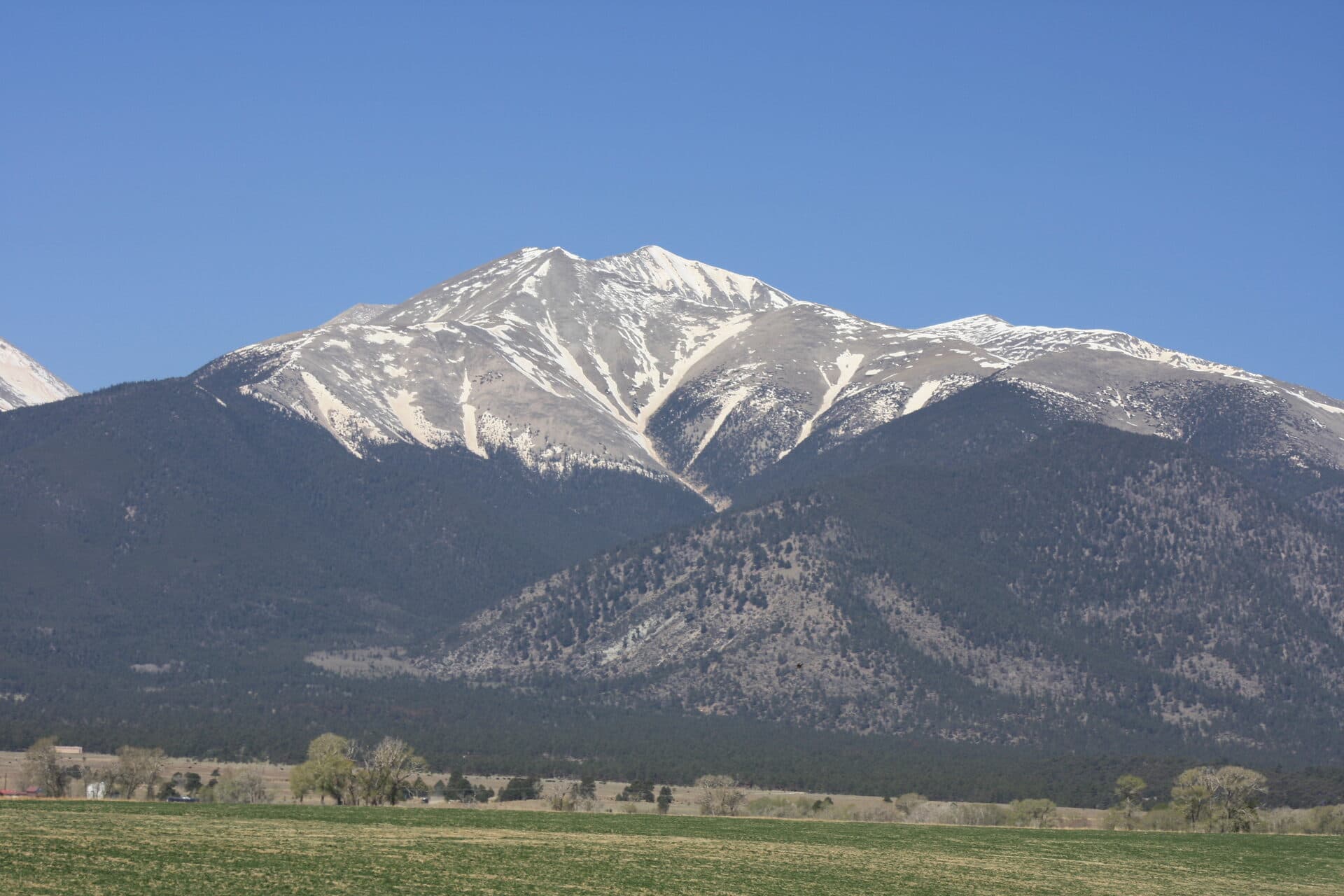
The big one. Mount Yale tops out at 14,196 feet, the 21st-highest peak in Colorado, and the Denny Creek Trailhead is the start of its standard Southwest Slopes route. Plan on a 9.5-mile round trip with about 4,300 feet of gain, all of it Class 2. There's no exposed scrambling, but the upper ridge is loose talus that asks for patience and good footing.
You share the first stretch of trail with the lake and pass hikers, then split right onto the Mount Yale Trail (#1451) at about mile 1.2. From there the route climbs steadily through the Delaney Gulch drainage, breaks out of the trees, and gains the southwest ridge for the final talus push to the summit. Most parties take seven to ten hours car to car.
Yale is a popular choice for a second or third 14er because the trailhead is so easy to reach and the route, while long, is straightforward. If you're building toward it, start with our list of the easiest 14ers in Colorado for beginners, then read the full route breakdown in our Mount Yale complete guide. For where Yale fits among the state's high peaks, the Colorado 14ers guide puts it in context.

What to Pack
Every hike from this trailhead starts above 9,900 feet and climbs from there, so pack for high country even on the shorter routes. A well-fitted daypack with room for layers, food, and at least two liters of water is the base.
Bring these no matter which fork you take:
- Layers. A warm mid-layer and a packable rain jacket stay in the pack even on a bluebird morning. Weather turns fast up here.
- Sun protection. Sunglasses, brimmed hat, and sunscreen. The thin air at this elevation burns you quicker than you'd expect.
- Water and a filter. Denny Creek and the lakes let you top off, so a lightweight water filter saves you from hauling every liter. Our take on the best water filters for hiking in Colorado covers the trade-offs.
- Trekking poles. Handy on the rocky descent from the lake and genuinely useful on Yale's talus. A pair of trekking poles saves your knees on the way down.
- Headlamp. If you're climbing Yale, you're starting in the dark. A headlamp with fresh batteries is non-negotiable for a pre-dawn start.
When to Go
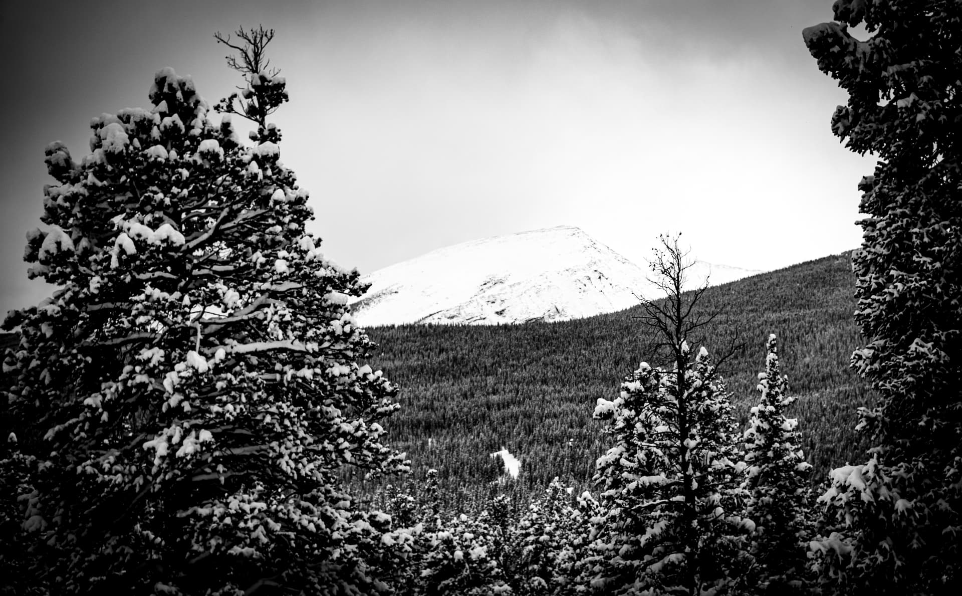
The trail is snow-free and comfortable from late June through September. July and August bring the best wildflowers and the warmest temperatures, but they also bring the reliable Colorado afternoon thunderstorm and the biggest crowds. Early season, expect lingering snow in the upper basin and on shaded pitches into early July.
Whatever the destination, get an early start and plan to be off exposed ground by noon. Lightning above treeline is the real hazard here, and Browns Pass and Yale's ridge are both fully exposed. For the summit day on Yale, a 5 to 6 AM trailhead start is standard so you're back below the ridge before storms build.
Altitude is the other thing to respect. You're starting near 9,900 feet, and Yale finishes above 14,000. If you're coming from lower elevation, give yourself a day or two in the mountains first. Our guide to altitude sickness prevention and treatment walks through the warning signs and how to head them off.
Tips for Beating the Crowds
- Arrive by 5:30 to 6 AM on summer weekends. The lot fills fast, and a full lot means a longer roadside walk before you even start.
- Go midweek if you can. Tuesday through Thursday sees a fraction of the weekend traffic.
- Aim for the lake or the pass over Yale for solitude. Most of the crowd is here for the 14er. Hartenstein Lake and Browns Pass stay noticeably quieter.
- Shoulder season helps. Late September, after Labor Day, brings golden aspen, cooler air, and thinner crowds. Just watch for early snow.
Frequently Asked Questions
How long is the Denny Creek to Hartenstein Lake hike?
Hartenstein Lake is a 5.8-mile round trip from the Denny Creek Trailhead, with about 1,720 feet of elevation gain. Most hikers finish it in three to four hours. It's rated strenuous mostly because of the altitude, not the terrain.
Where is the Denny Creek Trailhead in Colorado?
It's on Cottonwood Pass Road (County Road 306), about 11 miles west of Buena Vista in the Collegiate Peaks Wilderness. From the Buena Vista stoplight, drive west on Main Street, which becomes CR 306, and watch for the signed trailhead on the right.
Can you drive a regular car to the Denny Creek Trailhead?
Yes. Cottonwood Pass Road is paved all the way to the trailhead, so any car makes it. You don't need high clearance or four-wheel drive, which is a big part of why this trailhead is so popular.
Do you need a permit to hike from Denny Creek?
No permit is required for day hiking or backpacking. Because it's designated wilderness, you should sign the trail register at the trailhead. Overnight camping isn't allowed at the trailhead itself, so backpackers need to walk in before setting up.
What peaks and destinations can you reach from the Denny Creek Trailhead?
The trailhead accesses Mount Yale (14,196 feet) by its Southwest Slopes route, Hartenstein Lake at 11,472 feet, and Browns Pass at 12,020 feet on the Continental Divide. From Browns Pass you can continue to Kroenke Lake and connect into the Colorado Trail.
The Denny Creek Trailhead packs three very different days into one paved-road pullout, from a mellow lake walk to a full 14er. Pick the fork that fits your legs and the forecast, start early, and you'll see why this lot fills before the sun's up. Next, map out the summit day with our Mount Yale complete guide.
Get the Colorado 14er Packing Checklist (free PDF)
Plus a weekly note on the best Colorado trails, gear deals, and seasonal hike picks. No spam, unsubscribe anytime.
We respect your inbox. Unsubscribe anytime.