Lake Ann Trailhead: A Ghost-Town Path to a High Colorado Lake
The Lake Ann Trailhead sits at the end of a long dirt road in a Colorado ghost town, and it's one of the best trailheads in the Sawatch Range that most people drive right past on their way to a 14er. From the old mining camp of Winfield you can walk to Lake Ann, an alpine lake at 11,805 feet tucked under the jagged Three Apostles, on a moderate out-and-back that stays gentle for miles before it climbs. No permit, no timed-entry reservation, no fee. Just a washboard road, a preserved ghost town, and a basin most visitors never see.
That's the pitch. The same parking area also launches Huron Peak, a friendly 14er, and Lake Ann Pass, a high crossing on the Colorado Trail that thru-hikers talk about for its lingering cornice. This guide covers where the trailhead is, what the road to Winfield is really like, the hike to the lake step by step, the peaks that ring the basin, and how to pick the right day for your group.
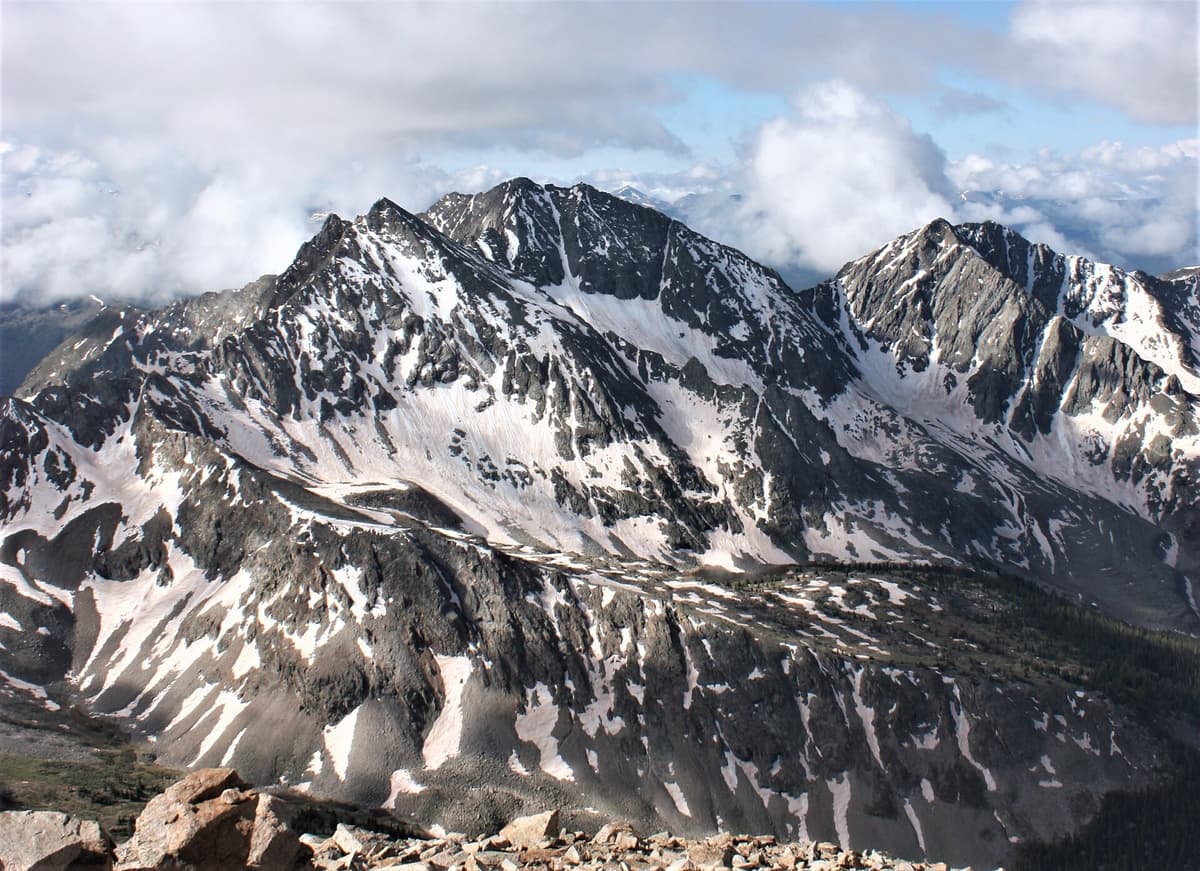
If you're hiking in June or early July, toss a pair of microspikes in your pack before you worry about anything else. Snow hangs in this basin and on Lake Ann Pass into the first week of July most years, and a firm morning snow patch on a steep slope is the one thing that stops casual hikers short of the lake.
What You'll Learn
- Quick Stats
- Where Is the Lake Ann Trailhead?
- Getting There: The Road to Winfield
- The Winfield Ghost Town
- The Hike to Lake Ann
- The Three Apostles and Lake Ann Pass
- Bonus: Huron Peak From the Same Lot
- When to Hike
- What to Pack
- Where to Stay
- Frequently Asked Questions
Quick Stats
- Trailhead elevation: 10,575 feet at the South Winfield (2WD) trailhead
- Lake Ann elevation: 11,805 feet
- Distance to the lake: about 11 miles round trip from the 2WD lot, roughly 7 miles if you drive the 4WD road to the upper trailhead
- Elevation gain: about 1,600 feet, most of it in the final stretch
- Difficulty: moderate, no scrambling to reach the lake
- Permit or fee: none to hike or park
- Wilderness: Collegiate Peaks Wilderness, San Isabel National Forest
- Season: roughly July through September for a dry, snow-free walk
- Dogs: allowed on leash
Where Is the Lake Ann Trailhead?
Lake Ann is deep in the Collegiate Peaks Wilderness, in the central Sawatch Range of Chaffee County. The trailhead sits at the old townsite of Winfield, at the very end of Clear Creek Road, west of U.S. Highway 24 between Buena Vista and Leadville. You're in Colorado's Collegiate Peaks here, surrounded by a wall of high summits. Huron Peak rises just to the north, the Three Apostles guard the head of the valley to the south, and the Continental Divide runs along the western skyline.
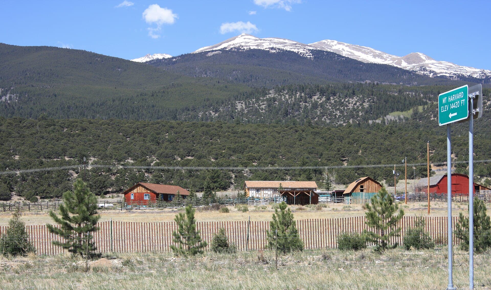
The full name you'll see on maps and on 14ers.com is the South Winfield Trailhead, or the South Clear Creek Trailhead. It's the same place. From here a single trail heads up the South Fork of Clear Creek toward Lake Ann, and it doubles as a stretch of the Colorado Trail's Collegiate West route, so you'll share the first miles with backpackers carrying big loads. For a sense of the neighborhood, the nearest big-name summit is Mount Harvard, the tallest of the Collegiate Peaks, a couple of drainages to the east.
Getting There: The Road to Winfield
Here's the part that trips people up. From U.S. 24, you turn west onto Chaffee County Road 390. The turn is about 14.5 miles north of Buena Vista, or roughly 20 miles south of Leadville, near the hamlet of Granite. From the highway it's about 11 to 12 miles of dirt road to Winfield.
That first long stretch of County Road 390 is a decent graded dirt road, and most cars handle it fine in dry weather. The catch is washboard. This road sees heavy use all summer, and it corrugates badly, so you'll be rattling along at 15 miles an hour in places whether you like it or not. Give yourself 30 to 40 minutes from the pavement, and air down your tires a touch if you know how; it smooths the ride.
At Winfield the road forks. The 2WD parking area sits about a tenth of a mile past the townsite, and that's where most passenger cars should stop. Beyond that, the road toward the upper Lake Ann trailhead turns rough and narrow, with rocks and ruts that call for a high-clearance four-wheel-drive vehicle. That upper trailhead is about 2.1 miles further along, and reaching it cuts roughly 4 miles off your round trip to the lake. If your car isn't built for it, don't force the issue; park at the 2WD lot and enjoy the extra walking through the basin. For the wider picture on where to leave your car at Colorado trailheads, see our notes on trailhead parking.
The Winfield Ghost Town
Winfield is worth a slow look before you start walking. It was a silver mining camp that boomed in the 1880s, and at its peak it held something like 1,500 people, with saloons, stores, two mills, and its own school. The silver crash of 1893 gutted the town, the way it gutted so many Colorado high-country camps, and the people drifted away.
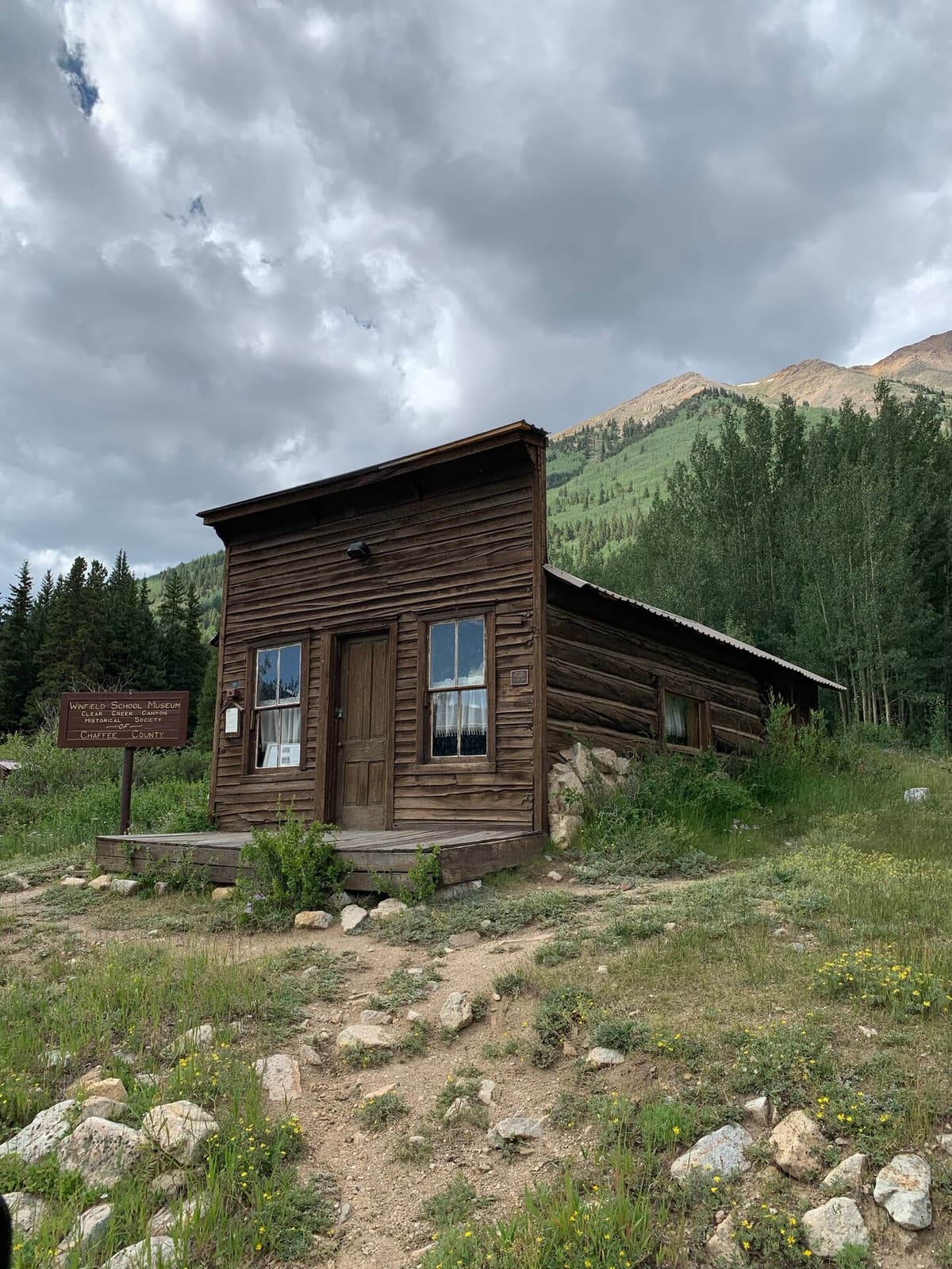
What's left today is a small cluster of restored buildings kept up by the Clear Creek Canyon Historical Society of Chaffee County. The old schoolhouse now is a little museum, and a few cabins still stand along the creek. Poke around, read the interpretive signs, and picture a working town at 10,500 feet with winters that ran eight months long. It's a quiet, honest kind of history, and it costs nothing to walk through. Just treat the buildings with respect; they survive because people leave them alone.
The Hike to Lake Ann
From the South Winfield 2WD lot, the walk to Lake Ann is about 11 miles round trip with roughly 1,600 feet of gain, which sounds bigger than it feels because the climbing is so spread out. The first two miles simply follow the rough four-wheel-drive road up the valley to the upper trailhead. It's not scenic road walking exactly, but the grade is easy and the Three Apostles start showing themselves ahead, so the miles go quickly.
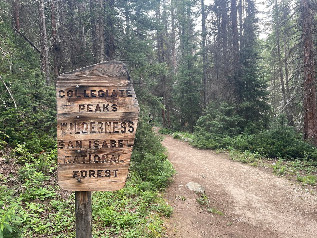
At the upper trailhead the real trail begins, and it soon passes the carved sign marking the boundary of the Collegiate Peaks Wilderness. From here you follow the South Fork of Clear Creek up a broad, gentle basin. This middle section is the prettiest easy hiking in the drainage: open meadows, the creek burbling alongside, wildflowers through July, and the Apostles rising higher and more dramatic with every bend. Keep an eye out for moose in the willows and marmots on the rocks.
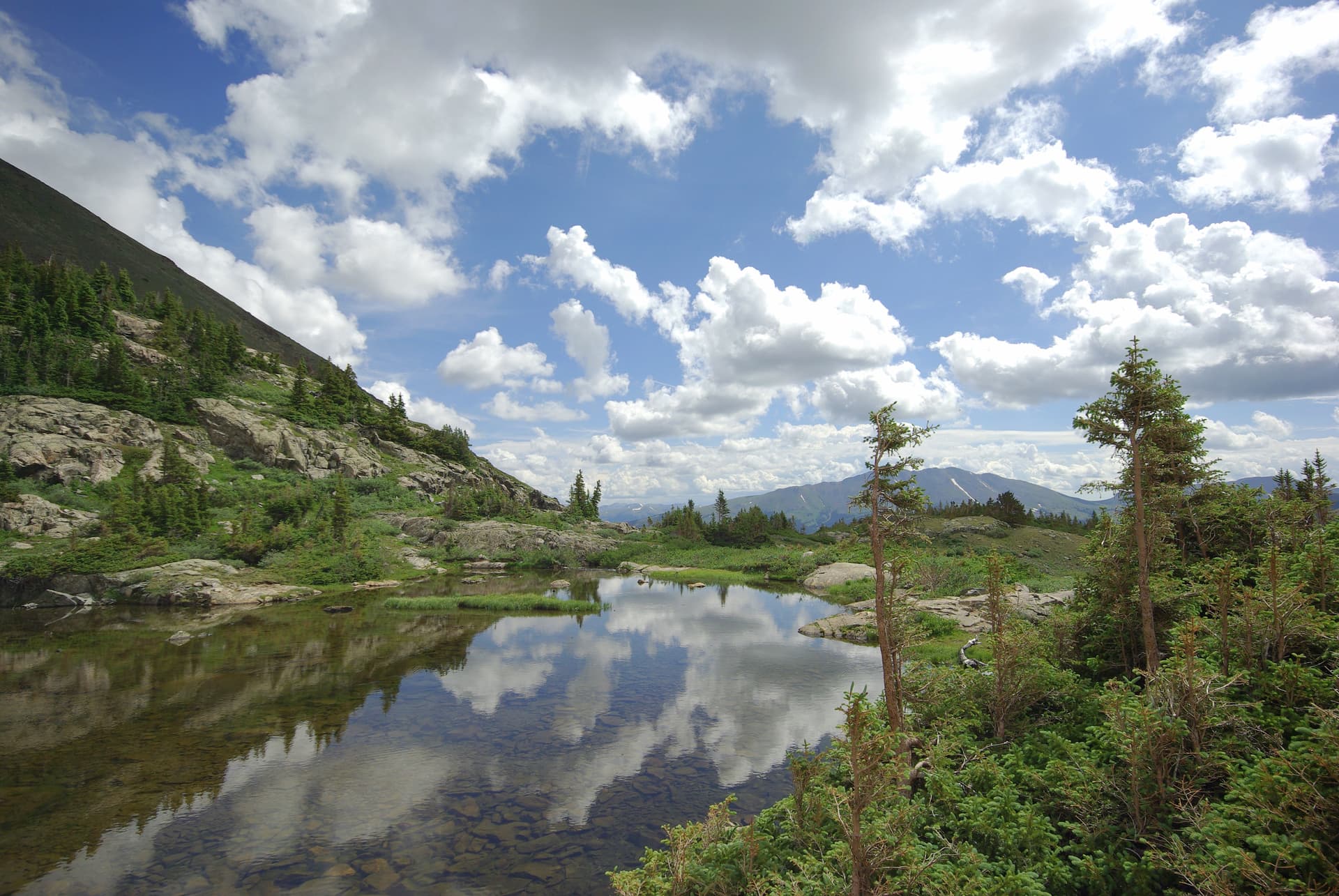
The trail splits at a signed junction where the Colorado Trail and the Lake Ann spur part ways. Stay on the path toward Lake Ann, and the grade finally tips upward for the last push. You climb through the last of the trees, the basin narrows, and Lake Ann appears at 11,805 feet, a cold alpine tarn cupped beneath a headwall with the Three Apostles filling the sky above it. It's a genuine high-country lake with no crowds and no development, the reward for a long, quiet approach. Pack a lunch and plan to linger. If lakes like this are your thing, our roundup of the best alpine lakes in Colorado has more in the same vein, and the Long Lake Trailhead near Boulder offers a shorter option in the Indian Peaks.
The Three Apostles and Lake Ann Pass
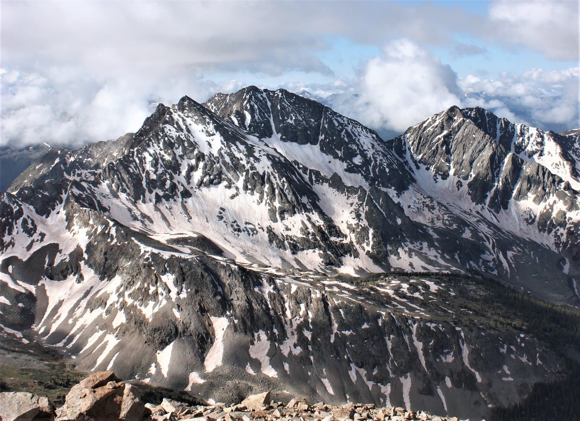
The three rugged peaks looming over the lake are the Three Apostles, some of the steepest, most photogenic summits in a range better known for gentle walk-up 14ers. Ice Mountain is the centerpiece at 13,951 feet, a Centennial 13er famous for the Refrigerator Couloir, a classic snow line that splits its north face. North Apostle stands at 13,860 feet just left of it, and West Apostle rounds out the trio at 13,568 feet. These are serious mountaineering objectives, not hiker peaks, so most people are happy to admire them from the lakeshore.
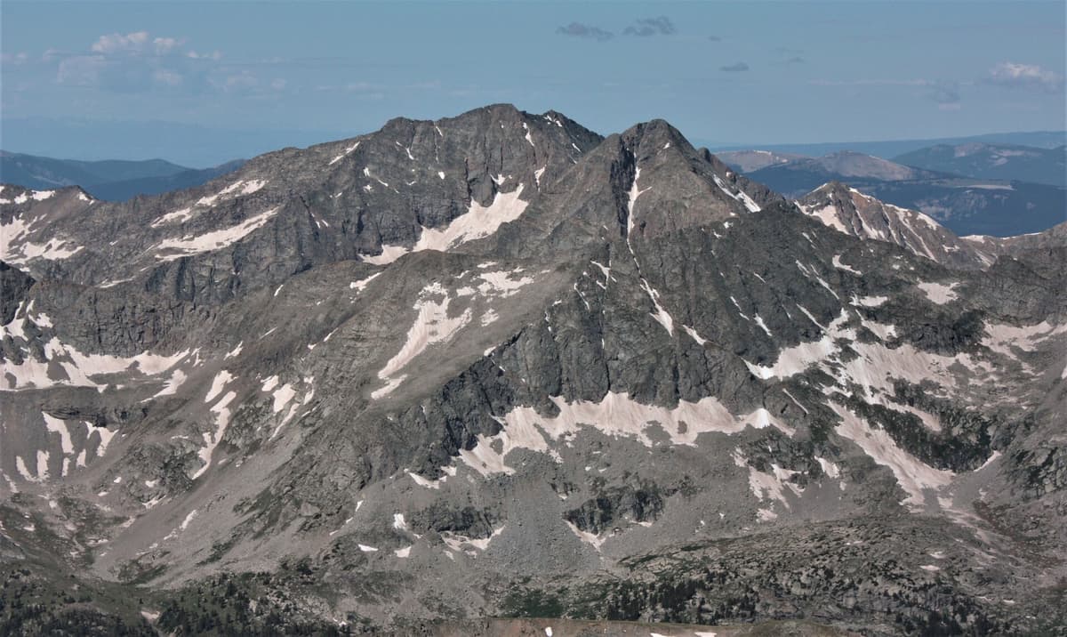
Above and west of the lake sits Lake Ann Pass, at about 12,588 feet on the Continental Divide. This is a highlight of the Colorado Trail's Collegiate West line and the Continental Divide Trail, and thru-hikers remember it for one reason: the cornice. A lip of snow builds on the pass over winter and often clings to the top well into July, forcing early-season hikers to pick a careful line around it. By mid-summer it usually melts back and the crossing is straightforward. If you're planning to backpack over the pass rather than just day-hike to the lake, a good map matters up here; see our picks for Colorado trail maps. Most day hikers turn around at the lake, which is plenty of reward on its own.
Bonus: Huron Peak From the Same Lot
Here's the other reason the Winfield trailhead stays busy. Huron Peak, a 14,010-foot summit, starts from this same parking area, which is why so many cars in the lot belong to peak baggers rather than lake hikers. Huron is one of the more approachable 14ers in the Sawatch, a Class 2 walk-up with no scrambling and one of the finest summit panoramas in the state, looking straight down onto the Three Apostles and the Apostle basin.
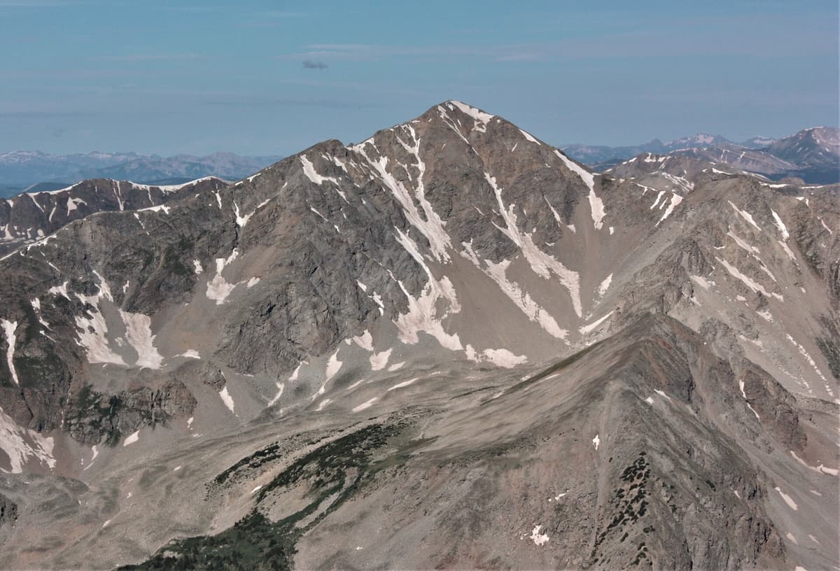
The standard North Huron Trail runs about 3.5 miles one way with roughly 3,400 feet of gain from the upper four-wheel-drive trailhead, or longer if you start from the 2WD lot. It heads up the North Fork of Clear Creek, the opposite direction from Lake Ann, so the two hikes share only the parking lot. If you've got a strong group and a very early start, some people bag Huron in the morning and wander toward Lake Ann in the afternoon, though that's a big day at altitude. New to Colorado summits? Start with our 14ers guide and our list of the easiest 14ers for beginners before you commit to a long approach like this one.
When to Hike
The window for a dry, snow-free trip to Lake Ann runs roughly July through September. June usually still holds snow in the upper basin and a stubborn cornice on the pass, so unless you're comfortable on steep snow with traction, wait for the melt. July brings wildflowers and long days; August is warm and reliable; September cools off and thins the crowds as the aspens along the lower road start to turn.
Whatever the month, respect the mountain clock. Colorado's afternoon thunderstorms build fast over these high basins, and the upper trail and the pass are exposed with nowhere to hide from lightning. Start early enough that you're heading down from the lake by early afternoon. The same weather discipline that keeps you safe on a peak like Mount Bierstadt applies on this hike, even though you're not summiting anything.
What to Pack
This is a long day at high elevation, so pack for distance and for fast-changing mountain weather.
- Traction for early season. Snow lingers in the basin and on Lake Ann Pass into July. A light set of microspikes turns a firm snow patch into a non-issue. Here are our microspike picks for Colorado.
- A rain shell. Above the trees it's windy, and storms roll in without much warning. Carry a warm layer and a packable rain jacket you can throw on in seconds.
- Trekking poles. Eleven miles round trip is easier on the knees with poles, especially on the descent. See our trekking pole picks.
- Water and a filter. The creek runs alongside much of the trail, so a small water filter lets you carry less and refill as you go. A comfortable daypack makes the long day nicer.
- Sun protection. UV is intense above 11,000 feet with little tree cover near the lake. Hat, sunglasses, and sunscreen, every time.
- The usual map, snacks, and first-aid basics, plus a headlamp if you're getting an alpine start.
Where to Stay
The easiest option is to camp right at the trailhead. There's a Forest Service dispersed camping area around Winfield with basic sites along the creek, first come first served and free, which lets you sleep near 10,500 feet and start acclimatized. Bring everything you need, including water and a way to pack out trash, because there are no services up here.
If you'd rather have a bed, Buena Vista is the closest real town, about 30 to 40 minutes back down the road and then south on U.S. 24, with motels, food, and gear shops. Leadville to the north is a similar drive. Sleeping high the night before genuinely helps on a hike that tops out near 12,000 feet; our guide to altitude sickness in Colorado explains why, and what to watch for. If you're carrying overnight gear over the pass, dial in your kit with our picks for the best backpacking tents for Colorado.
Frequently Asked Questions
How long is the hike to Lake Ann?
From the South Winfield 2WD trailhead it's about 11 miles round trip with roughly 1,600 feet of elevation gain. If you have a high-clearance four-wheel-drive vehicle and drive the rough road to the upper trailhead, you cut it to about 7 miles round trip. Either way, the grade stays gentle until the final climb to the lake.
Do you need a 4WD to reach the Lake Ann Trailhead?
Not to reach the 2WD lot. County Road 390 is graded dirt that most cars handle to Winfield, though it's badly washboarded. Beyond the townsite, the road to the upper trailhead is rough and narrow and does require high-clearance four-wheel drive. Passenger cars should park at the 2WD lot and walk the extra couple of miles.
Is there a fee or permit for Lake Ann?
No. Lake Ann sits in the Collegiate Peaks Wilderness, and there's no entrance fee, no parking fee, and no timed-entry reservation to hike or park here. That makes it a refreshing change from Rocky Mountain National Park or Brainard Lake, where you need a reservation in summer.
How high is Lake Ann?
Lake Ann sits at 11,805 feet, well above treeline, beneath the Three Apostles. The trailhead at Winfield is 10,575 feet, so you gain a little over 1,200 feet to the lake itself, spread across a long, mostly gentle approach.
Can you see the Three Apostles from Lake Ann?
Yes, and that's the main draw. The Three Apostles (Ice Mountain at 13,951 feet, North Apostle, and West Apostle) rise directly above the lake in a steep, jagged wall. They're some of the most rugged peaks in the Sawatch Range, and the view of them from the lakeshore is the payoff for the long walk in.
The Bottom Line
Lake Ann Trailhead gives you a lot for the price of a bumpy drive: a genuine ghost town to explore, a long and peaceful walk up a wild basin, and an alpine lake framed by three of Colorado's fiercest 13ers, all with no permit and no fee. Come for the lake, tack on Huron Peak if your legs are willing, and treat Winfield's old buildings gently on your way through. Ready for more high country from the same range? Read our guide to Mount Harvard, the tallest of the Collegiate Peaks just next door.
Get the Colorado 14er Packing Checklist (free PDF)
Plus a weekly note on the best Colorado trails, gear deals, and seasonal hike picks. No spam, unsubscribe anytime.
We respect your inbox. Unsubscribe anytime.