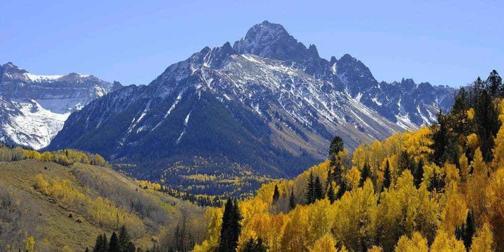
Missouri Mountain is the most shapely of the three fourteeners above Missouri Gulch, with a long northwest ridge that gives the standard route a short Class 2+ crux and a real summit feel. It is usually climbed on its own day from the same trailhead as Belford and Oxford.
Standard Route
From the Missouri Gulch trailhead at 9,650 feet, climb the switchbacks past the old cabin into the open gulch. At the split near 11,600 feet, stay left toward Elkhead Pass. At about 12,600 feet, the Missouri trail leaves the pass trail to the right and switchbacks west up the headwall to a notch on the northwest ridge near 13,700 feet. Follow the ridge south for about 0.7 mile to the summit at 14,074 feet. Total: 10.5 miles round trip, 4,500 feet of gain.
What to Expect
The ridge is easy walking except for one spot below the summit, where the trail drops off the crest onto a short, loose, exposed traverse across the west face before regaining the ridge. It is Class 2+ and only a few moves, but it is the place where people freeze up, and it holds snow into July. The ridge above the notch is exposed to wind. Combining Missouri with Belford by way of Elkhead Pass is possible for strong hikers but makes a 14-mile day with more than 6,000 feet of gain.
Access & Logistics
Missouri Gulch trailhead is 7.5 miles up Chaffee County Road 390 from US 24 at Clear Creek Reservoir; the gravel road suits passenger cars in dry weather. Parking overflows by 6 AM on summer weekends. No fee or permit.
When to Climb
The gulch opens in June, but the headwall switchbacks and the crux traverse hold snow later than Belford's ridge, so Missouri is best from mid-July through September. In early season the crux can be a snow slope that needs an ice axe. The northwest ridge is exposed to weather; be off the summit before noon in the thunderstorm months.
Camping, Permits, and Nearby
Dispersed camping runs the length of County Road 390, and Missouri Gulch has backcountry sites in the basin below the Elkhead Pass trail under Collegiate Peaks Wilderness rules. Leadville and Buena Vista are each about 25 minutes from the trailhead. The three Missouri Gulch peaks are commonly done over a weekend from a camp at the trailhead: Belford and Oxford one day, Missouri the next.
Gear Notes
Microspikes through early July for the crux, poles for the descent, and a wind shell for the ridge. Carry three liters; the gulch creek is the last water.
Related Reading
Planning a Missouri Mountain climb? Get the prep checklist.
Free PDF — pre-climb fitness, gear, weather decision tree. Plus weekly Colorado trail picks.
We respect your inbox. Unsubscribe anytime.