Vallecito Creek Trail: Trailhead, Parking, the Ford at Mile 7, and Where It Goes
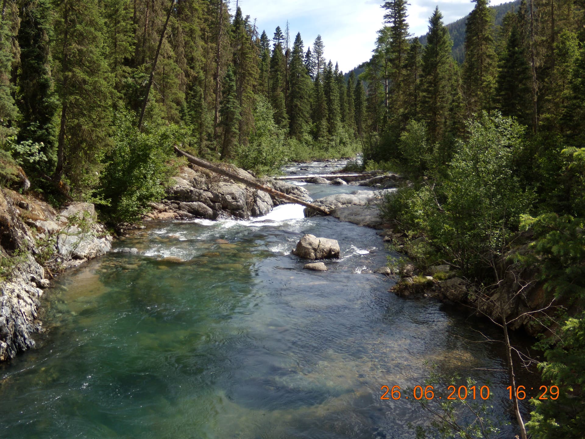
The Vallecito Creek Trail is the long valley door into the east side of the Weminuche Wilderness, starting at a trailhead by Vallecito Campground at the north end of Vallecito Reservoir, about an hour northeast of Durango. The Forest Service calls it the Vallecito Trail, #529, and it runs 19.5 miles north up the creek to Hunchback Pass on the Continental Divide. Almost nobody walks the whole thing in a day. What most people want to know before they drive out is simpler: where the trailhead is, whether a car can reach it, and how far up the creek they can get before the trail asks something hard of them.
That hard thing has a mile marker. Around 7 miles in, a bridge that washed out years ago was never replaced, and the route fords Vallecito Creek, which runs cold, fast, and genuinely dangerous during spring runoff. Below the ford the trail is a mellow, bridge-crossed creek walk good for a strong day hike. Above it, you're committing to a wilderness crossing and a multi-day backpack. This page covers the trailhead, the parking, the bridges and the ford, the Johnson Creek junction that backpackers use to reach Chicago Basin, and the mistakes that get people in trouble on this creek.
What You'll Learn
- Quick Trailhead Facts
- Where Is the Vallecito Creek Trailhead?
- Parking Reality
- The Trail, Mile by Mile
- The Ford at Mile 7
- Day Hike Options
- Johnson Creek and the Back Way to Chicago Basin
- Permits, Fees, Dogs, and Rules
- When to Go
- Where People Go Wrong
- Frequently Asked Questions
Quick Trailhead Facts
- Trailhead elevation: about 7,900 feet
- Trail: Vallecito Trail, Forest Service trail #529 (searched as "Vallecito Creek Trail")
- Full length: 19.5 miles one way to Hunchback Pass at 12,490 feet, where it meets the Continental Divide Trail (#813)
- Wilderness boundary: about 0.6 miles in; the first stretch is flat and easy along the campground
- Johnson Creek Trail (#821) junction: about 9 miles in, heading west toward Columbine Pass
- Distance from Durango: about 29 miles, roughly an hour, the last stretch on county roads
- Access road: paved and graded county roads to the campground entrance; any passenger car makes it
- Permit or fee: none to park or hike the trail
- Use: non-motorized only; no bikes, no drones over the wilderness
- Dogs: allowed, under control
- Managing office: Columbine Ranger District, San Juan National Forest, Bayfield, (970) 884-2512
Where Is the Vallecito Creek Trailhead?
The trailhead sits at the far north end of Vallecito Reservoir, past the lake and the summer cabins, where the pavement gives out near Vallecito Campground. From Durango the simplest way is to take Florida Road (County Road 240) northeast for about 17 miles, turn left onto County Road 501, and follow it about 9.5 miles up the east side of the reservoir through the little community of Vallecito. Then turn left onto County Road 500 and go about 3 miles to the campground entrance. Trailhead parking is on the left.
If you're coming from Bayfield instead, you can stay on County Road 501 the whole way, about 20 miles up to the County Road 500 turn, then the same 3 miles to the campground. Either way the roads are paved or well-graded, so this is not one of those San Juan trailheads that demands four-wheel drive and a high clearance. A regular car gets you there. Don't confuse this with the Vallecito Reservoir boat ramps and day-use areas lower down the lake; you want the trailhead at the top, by the campground, where the creek comes in.
Parking Reality
The trailhead has a real lot with room for a fair number of cars and horse trailers, since this is a popular stock and backpacking access point. That said, it fills on summer and fall weekends, and the campground next door means there's already traffic in the area. On a July Saturday morning you can find the lot full, with cars lining the road shoulder. Backpackers heading out for several days sometimes arrive the evening before to grab a spot and get an early start.
Leave nothing valuable in the car. This is an unattended trailhead, and a visible pack or wallet is an easy target. There's no self-pay station for the trail itself, so parking is free; just find a legal spot and don't block the campground or horse-trailer turnaround. If you're bringing stock, the extra space at the trailhead is one reason horse packers favor this entrance into the Weminuche.
The Trail, Mile by Mile
From the lot the trail starts flat and friendly, following the creek north past the edge of the campground. You cross into the Weminuche Wilderness at about 0.6 miles, and for the first few miles the walking stays gentle, with the creek on one side and steep forested canyon walls climbing away on the other. You cross Taylor Creek early. At around 3 miles you reach the first bridge over Vallecito Creek, a solid span and a natural turnaround or lunch spot.
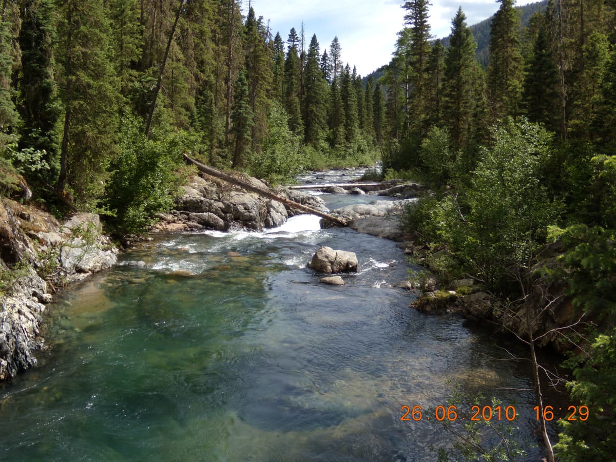
Past the first bridge the canyon tightens and the scenery gets better: granite walls, pocket meadows, and the creek dropping through rock gardens. Around 5.5 miles there's a second bridge (older maps and signs sometimes call it the twin bridges). This whole lower section is the Vallecito most day hikers and first-time visitors experience, and it's a good one: a clear mountain creek, big trees, and enough distance to feel like real wilderness without a single hard obstacle.
Then the trail reaches the spot that changes its character. Bridges in this canyon have a hard life. A bridge roughly 5.5 miles up was lost in an October 2025 flood, and the crossing at mile 7 has been a ford since an avalanche took out its bridge back in the winter of 2004 to 2005. Because the Forest Service doesn't always replace these quickly, the bridge situation here genuinely changes from year to year. Call the Columbine Ranger District at (970) 884-2512 before you count on any particular crossing, and read the trailhead sign, which usually posts current conditions.
The Ford at Mile 7
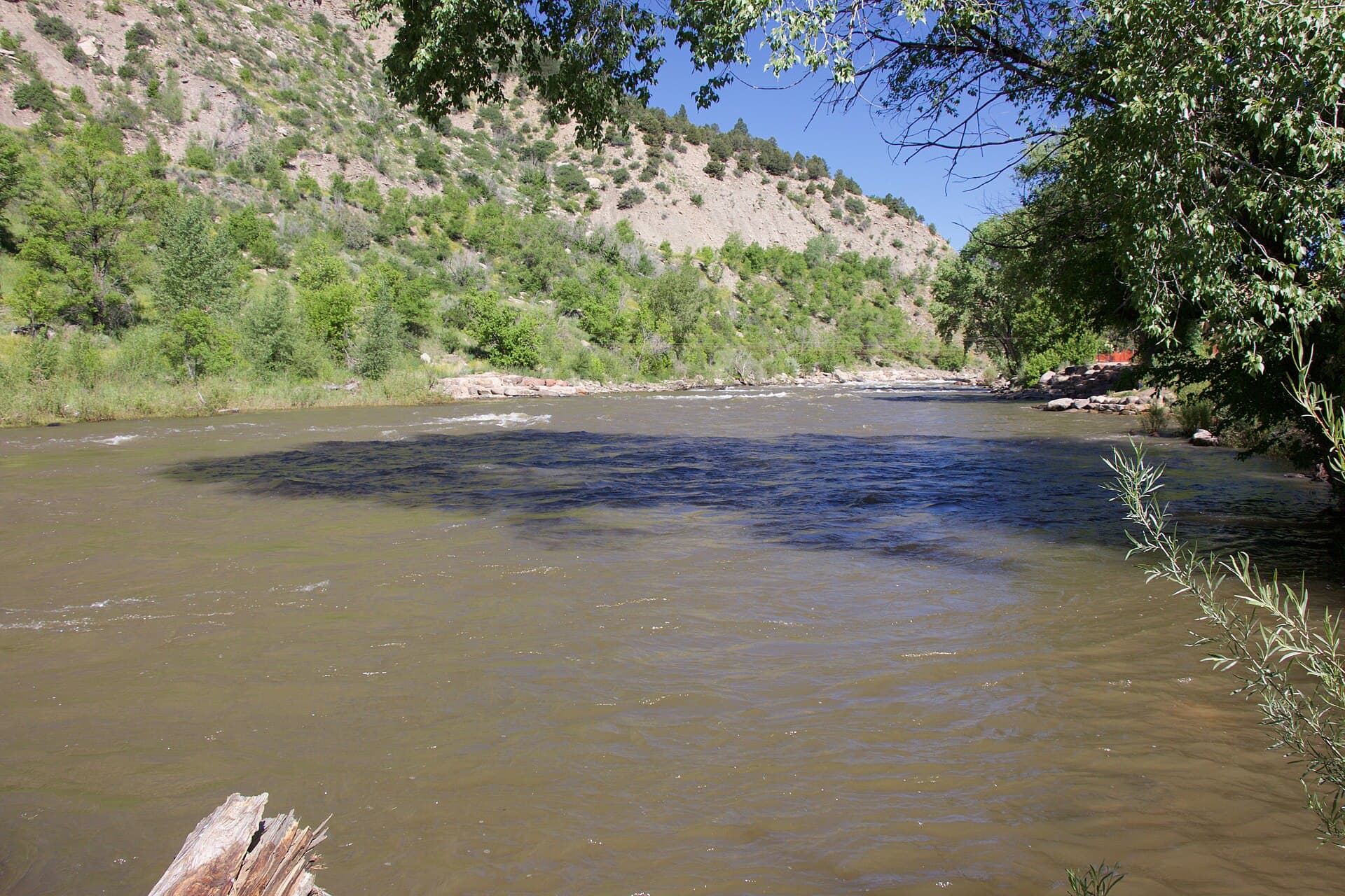
Here's the obstacle that defines this trail. At about 7 miles the route crosses Vallecito Creek with no bridge, and you have to wade. The Forest Service describes this ford as challenging and especially dangerous during spring runoff, which here runs from about mid-May to mid-June. During that window the creek is high, cold, and pushy, fed by snowmelt off the high Weminuche, and it has turned people around and worse. This is not a hop-across; it's a real stream crossing.
If you're heading past mile 7, time your trip for after the runoff drops, usually from July on, and treat the crossing with respect even then. Unbuckle your pack's hip belt before you step in so you can shed it if you go down, face upstream, move one foot at a time, and use trekking poles or a stout stick for a third and fourth point of contact. A pair of water shoes saves your boots and gives better footing than bare feet on slick rock. If the water is above your thighs and shoving hard, don't force it. Make the lower canyon your day and come back when the creek is lower. No summit or campsite is worth a swim in a snowmelt torrent.
Day Hike Options
You don't have to commit to the ford or a multi-day trip to get a lot out of this trail. The lower canyon gives you several honest turnarounds:
- First bridge and back: about 6 miles round trip on gentle grade, a good half-day with the creek as company the whole way.
- Second bridge and back: roughly 11 miles round trip, a full but non-technical day for a fit hiker, with the best of the granite canyon scenery.
- A shorter creek stroll: even a mile or two in and back is pleasant, flat, and dog-friendly, which makes it a decent family walk from the campground.
All of these stay below the mile-7 ford, so you get wilderness creek walking without a dangerous crossing. Carry a way to treat water on any of them. Vallecito Creek runs clear but you should still filter or purify it rather than drink straight from the source; a squeeze or pump water filter is plenty for a day hike. For more on treatment, see our guide to the best water filters for Colorado hiking.
Johnson Creek and the Back Way to Chicago Basin
Here's why serious backpackers know this trailhead. About 9 miles up Vallecito Creek, the Johnson Creek Trail (#821) branches west and climbs hard toward Columbine Pass. Over that pass sits Chicago Basin, the high bowl that holds the approach to three Weminuche fourteeners: Mount Eolus, Windom Peak, and Sunlight Peak. Most people reach Chicago Basin by riding the Durango and Silverton train to the Needleton stop and walking up Needle Creek. The Vallecito-to-Johnson Creek route is the long foot alternative, coming at the basin from the east.
It is not a shortcut. You hike roughly 9 miles up the valley, then grind up Johnson Creek to a high pass, so it's a committing multi-day trip with the mile-7 ford built into the approach. People choose it to bring a dog, to avoid the train schedule and cost, or to build a loop: in over Columbine Pass from Vallecito and out down Needle Creek to the train, or the reverse. If the basin is your goal, read our full Chicago Basin guide for the train-versus-hike tradeoff, the mountain goats, and food storage. Bring a bear canister; the basin's goats and marmots are notorious for raiding loose food and salty gear. This corridor is also one of the main gateways into the larger San Juan Mountains and the biggest wilderness area in the state, and you don't have to climb a fourteener to make the walk worth it.
Permits, Fees, Dogs, and Rules
No permit and no fee are needed to park at the trailhead or to hike the trail, including for overnight trips into the Weminuche. The usual wilderness rules apply, and the Forest Service does enforce them here: the trail is non-motorized, so no dirt bikes, no ATVs, and no mountain bikes, and drones are not allowed to fly over the wilderness. Group size is capped at 15 people, and the combined total of people and stock can't exceed 25.
Dogs are allowed and must be under control, which is a real draw over the train route to Chicago Basin, since the Durango and Silverton railroad won't carry pets. Keep a dog close around horses and other hikers, and carry water for it. For camping, don't pitch a tent within 100 feet of the creek or any other water source, keep campfires attended and dead out, and pack out everything you bring in. Practice Leave No Trace. The managing office is the Columbine Ranger District in Bayfield, (970) 884-2512, which is the number to call for current trail and bridge conditions.
When to Go
The trailhead sits at about 7,900 feet, low enough that the lower canyon opens by late spring, but the trail climbs to alpine country, so the full route is a summer and early-fall trip. The timing that matters most is the runoff. From about mid-May to mid-June the creek runs high and the mile-7 ford is at its most dangerous, so that window is for the lower canyon only. July and August are prime for going deep, with the standard San Juan catch: afternoon thunderstorms build most days, so start early and be off high, exposed ground by early afternoon.
Late September is the quiet reward. The crowds thin after Labor Day, the aspens in the lower canyon turn, and the creek has dropped to its friendliest level, which makes the ford and the upper valley far more reasonable. Winter shuts the high country down and turns the lower trail into a snowshoe route, with avalanche terrain on the slopes above, so that's for people who know how to read the forecast. Whenever you go, the elevation gain is real; our notes on altitude sickness prevention are worth a read before a big day or an overnight up here.
Where People Go Wrong
A few mistakes repeat on this trail often enough to name:
- Pushing past the ford in June. The mile-7 crossing during spring runoff is the single biggest hazard on the trail. If the water is high and strong, make the lower canyon your day and come back in late summer.
- Assuming the bridges are all there. Spans in this canyon wash out and don't always get replaced on schedule. Don't plan a route around a bridge you haven't confirmed with the ranger district.
- Treating the Chicago Basin approach as a quick way in. By way of Johnson Creek and Columbine Pass it's a long, climbing, multi-day trip, not a shortcut off the train.
- Arriving late on a summer weekend. The lot fills and the shoulder parking is limited. Come early.
- Drinking untreated creek water. Vallecito Creek looks clean and isn't guaranteed safe. Filter it.
Get those right and the Vallecito Creek Trail is one of the better creek walks in southwest Colorado, as happy with a half-day stroll to the first bridge as it is with a loaded pack bound for the high Weminuche. For a shorter, dog-friendly door into the same wilderness, compare it with the Upper Purgatory (Purgatory Flats) trailhead north of Durango. For other options nearby, see our roundup of the best hikes near Durango, and plan the rest of your kit with our Colorado backpacking checklist.
Frequently Asked Questions
How long is the Vallecito Creek Trail?
The full Vallecito Trail (#529) runs 19.5 miles one way from the trailhead near Vallecito Campground to Hunchback Pass at 12,490 feet on the Continental Divide. Most hikers do far less: the first bridge at about 3 miles makes a roughly 6-mile round trip, and the second bridge near 5.5 miles makes an 11-mile day, both below the mile-7 ford.
Do you have to ford Vallecito Creek?
Only if you go past about mile 7. A bridge there was lost to an avalanche in the winter of 2004 to 2005 and was never replaced, so the trail crosses the creek on foot. It's challenging and especially dangerous during spring runoff from mid-May to mid-June. Below that point the lower canyon has bridges, though those can wash out too, so check current conditions with the ranger district.
Can you hike to Chicago Basin from Vallecito?
Yes. About 9 miles up Vallecito Creek, the Johnson Creek Trail (#821) climbs west over Columbine Pass into Chicago Basin. It's a long, committing multi-day route rather than a shortcut, and it includes the mile-7 ford. People use it to bring a dog, skip the Durango and Silverton train, or build a loop that comes out at the Needleton train stop.
Are dogs allowed on the Vallecito Creek Trail?
Yes, dogs are allowed throughout the trail and the Weminuche Wilderness as long as they're under control. Because the Durango and Silverton train won't carry pets, this corridor and the nearby Purgatory Flats trail are the usual choices for hikers bringing a dog toward Chicago Basin. Carry water for your dog and keep it close around horses.
Is there a fee or permit for the Vallecito Creek trailhead?
No. Parking at the trailhead and hiking the trail are free, and no permit is required, including for overnight backpacking into the Weminuche. The lot fills on summer weekends, so arrive early. Note that the adjacent Vallecito Campground charges to camp, but that's separate from day-use trailhead parking.
The Vallecito Creek Trail rewards matching your plan to the creek: an easy bridge-crossed day hike below mile 7, or a serious wilderness backpack above it once the runoff drops. Decide which trip you're taking before you leave the car, and the only hard part left is wanting to turn around. When you're ready to go deeper, our Chicago Basin guide picks up where Johnson Creek climbs out of the valley.
Get the Colorado 14er Packing Checklist (free PDF)
Plus a weekly note on the best Colorado trails, gear deals, and seasonal hike picks. No spam, unsubscribe anytime.
We respect your inbox. Unsubscribe anytime.